|
Helvellyn to Dollwagon Pike from Swirls |
 |
 |
4th January 2020 |
 |
|
A weak weather system continues to domminate the New Year which is quite disappointing knowing that this time last year I had climbed Bowfell with a severe frost underfoot and glorious Winter skies above making that particular walk my favourite of the year. Well I guess there's no point looking back because you never know, we may have some good climbing weather just around the corner.
It was mentioned just before New Year about climbing Helvellyn from Swirls, this is a route that we normally do this time of year and given that it's now becoming the norm we weren't going to let a wet forecast put us off even though a Plan B was mentioned I'm sure I can speak for David and Rod when I say I'm pleased we never carried it out.
Yesterday (Friday) had been a glorious mountain day on Helvellyn but this is Winter in Lakeland and weather conditions can change at the click of a finger which is exactly what we got today with horizontal rain, high winds and low cloud almost from the off but we weren't going to let a bit of rain get in the way of tradition. |
|
| Wainwright Guide Book One |
 |
| The Eastern Fells |
| For Helvellyn is the great magnet that draws the crowds to Nethermost Pike: the latter is climbed accidently, almost unknowingly, only because it is an obstacle in the route to its bigger neighbour. |
 |
|
|
|
| |
|
Overview |
|
|
| Ascent: |
3,050 Feet - 930 Metres |
| Wainwrights: |
3, Helvellyn - Nethermost Pike - Dollywaggon Pike |
| Visiting: |
Browncove Crags - High Crag |
| Weather: |
A Dry Start With Drizzle & Rain Arriving Soon After, Windy With Low Cloud Throughout. A Damp Day! Highs of 7°C Lows of 7°C Feels Like -10°C |
| Parking: |
Using x2 Cars Layby, A591, Swirls - Roadside Parking Top of Dunmail Raise |
| Area: |
Eastern |
| Miles: |
6.8 |
| Walking With: |
David Hall & Rod Hepplewhite |
| Ordnance Survey: |
OL5 |
| Time Taken: |
4 Hours 45 Minutes |
| Route: |
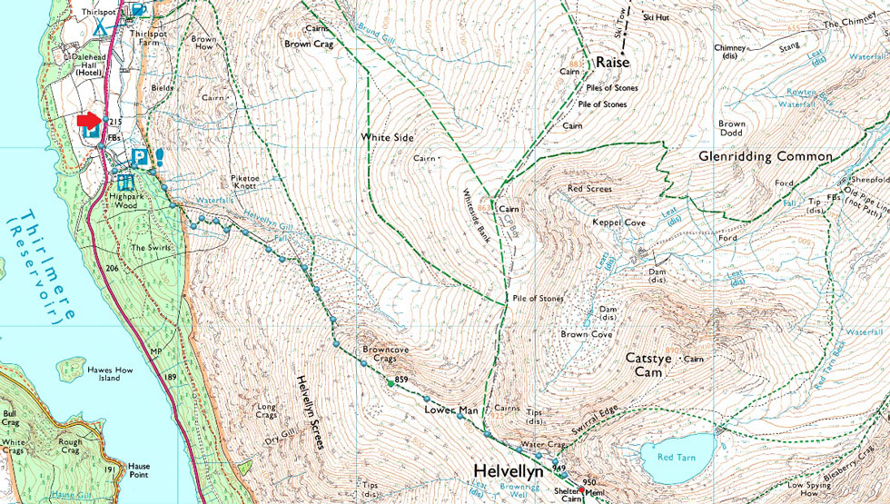
Swirls - Browncove Crags - Helvellyn - Nethermost Pike - High Crag - Dollywaggon Pike - Grisedale Tarn - Grisedale Hause - Raise Beck - Top of Dunmail Raise |
|
| |
|
Parking Details and Map - Swirls |
|
|
| Nearest Post Code: |
CA12 4TW |
| Grid Reference: |
NY 316 416 |
| Notes: |
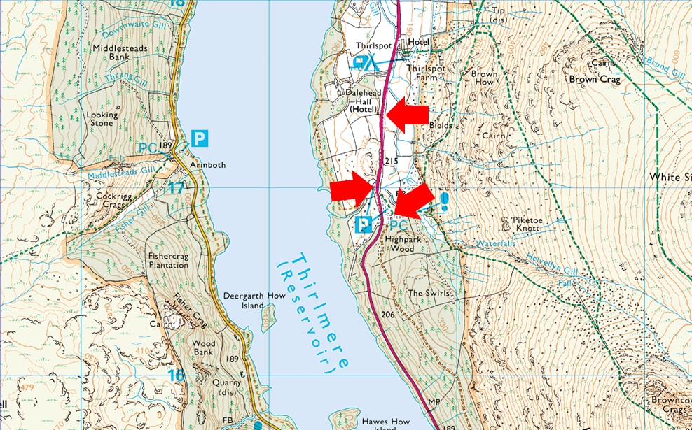
The car park at Swirls is a very popular car park all year around and is owned by United Utilities. There is a toilet block on the car park with easy access onto Helvellyn via Browncove Crags. On the opposite side of the A591 a smaller car park can be found overlooking Thirlmere Reservoir. Parking charges apply at both car parks, however a short distance north (upper arrow) a lay-by can be found where it is free to park. |
|
| |
|
Parking Details and Map - Top of Dunmail Raise |
|
|
| Nearest Post Code: |
LA22 9RS |
| Grid Reference: |
NY 327 211 |
| Notes: |
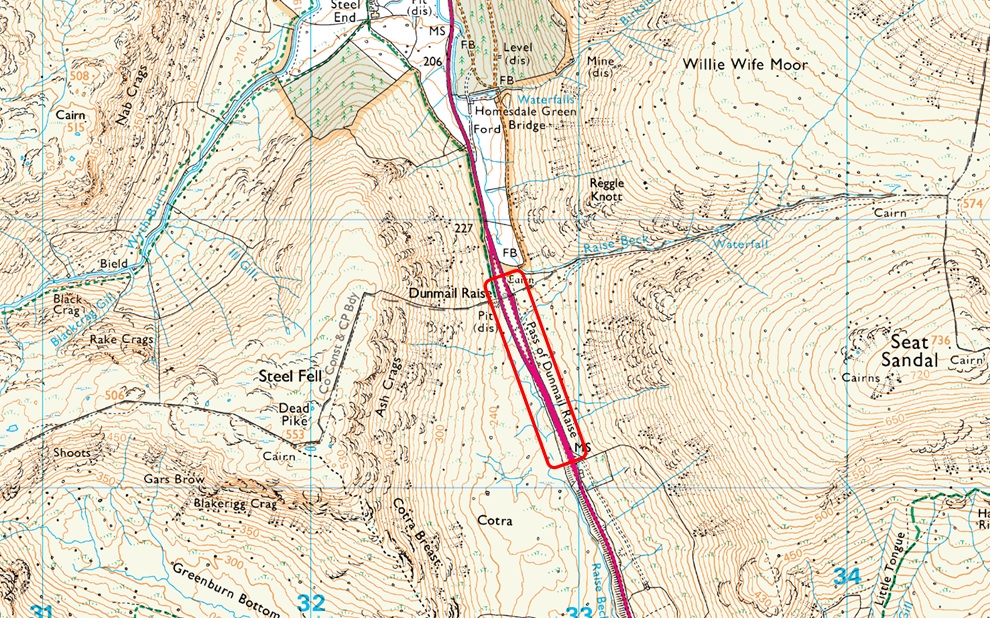
The A591 splits into two carriageway's across the top of Dunmail Raise where roadside parking can be found on both sides of the carriageway. However, parking is more limited on the left (if travelling from Grasmere) than the roadside parking found on the right, The top of Dunmail Raise offers excellent access onto the Helvellyn and Wythburn Fells which means that despite the ample parking spaces can fill up quite quickly especially during the Summer months. Parking is free. |
|
| |
|
Map and Photo Gallery |
|
|
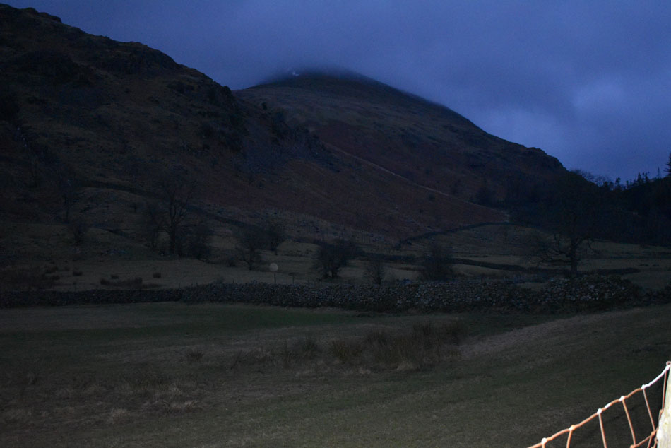 |
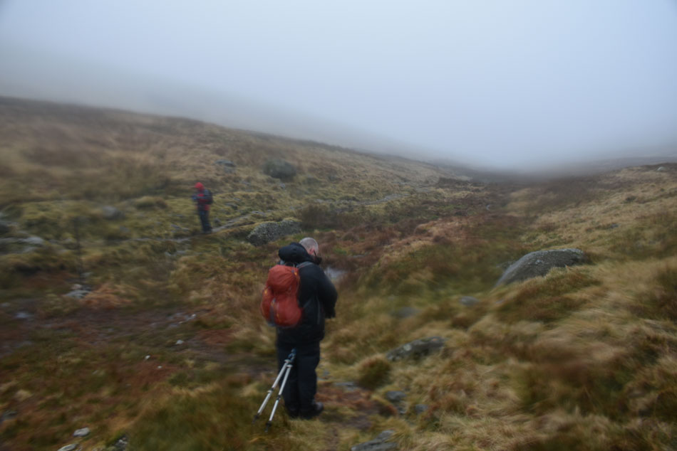
| Browncove Crags taken from the layby north of Swirls 08:20am |
| We planned our route by using two cars leaving Rod's car at the top of Dunmail Raise where I met Rod then drove past Thirlmere to meet David at the lay by just north of Swirls. We had arranged to meet David around 08:15am and we arrived a few minutes early before David drew up behind us. It was still dark with sunrise still a good twenty minutes away and we all commented that it wasn't just dark, but "dark dark" We kitted up in the lay-by where it was relatively mild but we could hear the wind rustling through the trees and right then we knew we were in for one of those adverse conditions walk because besides the strong gusts, rain and snow was also forecast across the higher summits. With the cars locked we walked back towards Swirls and passed through the carpark finding three cars already parked up while on the lower reaches of Browncove Crags two walkers are making an ascent. |
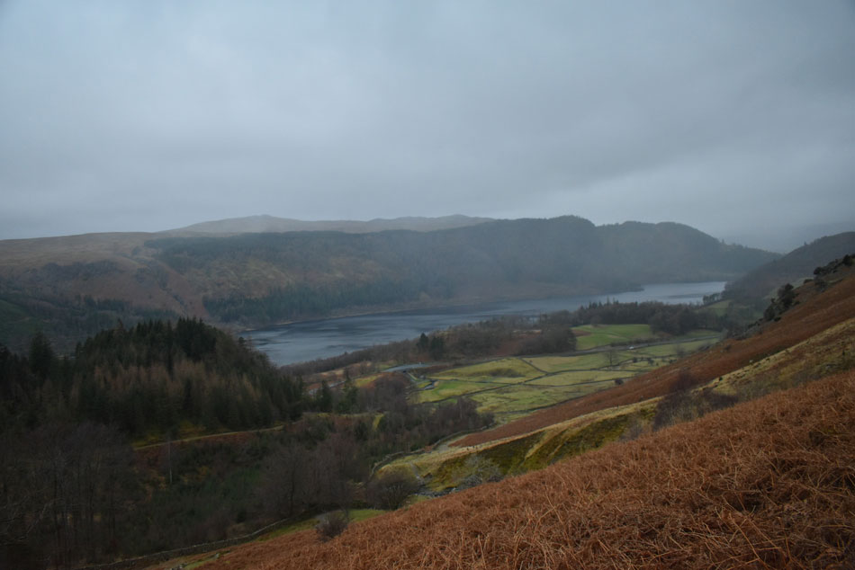 |
| Looking back on Thirlmere towards Fisher Crag, High Seat, High Tove and Raven Crag. |
| Dark soon became light once we had passed through the car park at Swirls where the steep climb on Browncove Crags began, there's no point rushing this ascent as it will only tire one out so we take our time taking time to put the world to rights while stopping to admire the views... |
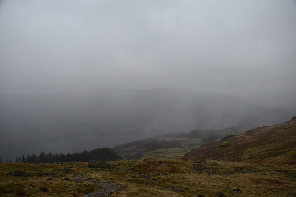 |
| What views... |
I guess this was the point when the weather changed for us, there had been drizzle in the air all morning and from our elevation we could see showers passing through but they never really caught us out until now, not only had it started to rain but we were also about to ascend into the cloud line.
Being seasoned walkers you do tend to extract everything from a walk like this, yes we had no views and we were about to get mighty wet but you know what, we don't mind that either. It's a huge mix of inner emotions whilst your senses are triggered with everything that's happening around you, you don't get to sense this with perfect weather walks which is why we enjoy conditions like this every now and again. |
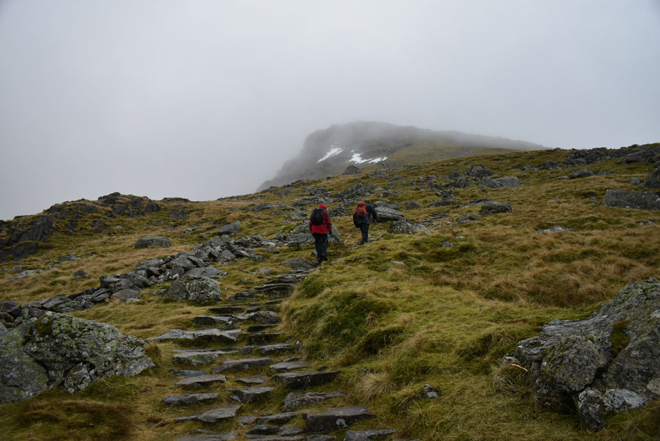 |
| David and Rod ascending Browncove Crags. |
It was time to get into the ascent and if that meant just looking at your boots while putting one foot in front of the other then so be it at a point when the wind and rain was starting to kill conversation anyway.
Hey ho lets go. |
 |
| Rod inspects the climbers gully at the top of Browncove Crags. |
Remarkably we seemed to have reached Browncove Crags in good time not before I reminded the guys about 'crampon rock' which is a sheltered craggy outcrop of rock just below Browncove Crags summit where we'd usually attach our crampons, no need for those today though, just a steady pair of legs as the wind was starting to whip up a right hooley.
Only the top of the gully had a good patch of old snow at its head. |
 |
| Looking back towards Helvellyn Lower Man over the head of Brown Cove. |
| We had intended to include Helvellyn Lower Man but for one reason or another we missed it possibly due to conversation on what would we gain by including Lower Man with visibility reduced to around 30 yards in places, sometimes much less. |
 |
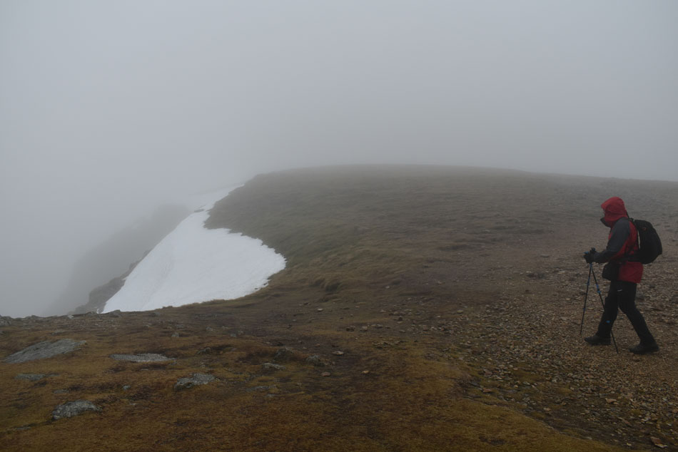
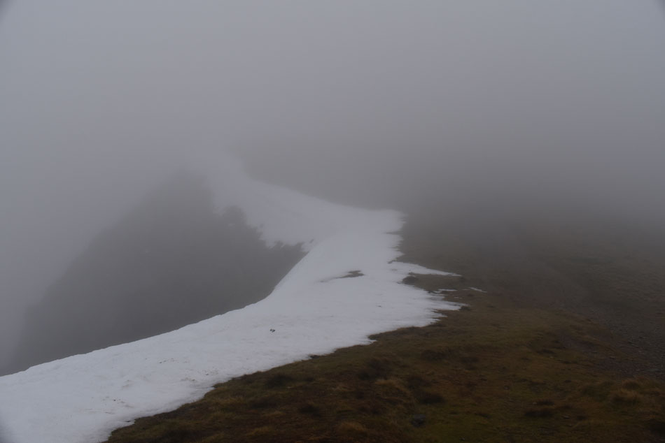
| Looking down on Swirral Edge from the exit ramp. |
| I'd been reading about this patch of snow on Weatherline's Mountain Forecast all week and was intrigued by the alerts surrounding it. Weatherline were absolutely correct to bring it to detail as this patch of snow was still hard and littered with footprints old and new, after standing here to take this photo from which I can confirm I would not pass this section no matter how small without wearing crampons or at least spikes it really did feel that hazardous especially to the unsuspecting and curious. |
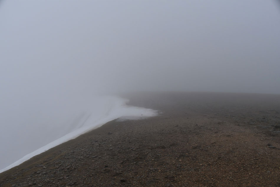 |
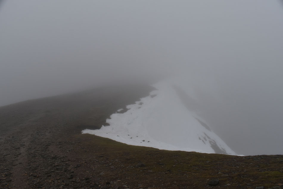
| Helvellyn summit plateau. |
| We left the top of Swirral Edge with our wits about us. With the wind blowing in from the west it was practically pushing us towards the edge and with that we gave it an extra wide berth, still though, there's something poetical about such trying conditions even though none of us spoke of it I'm sure we were all feeling it. |
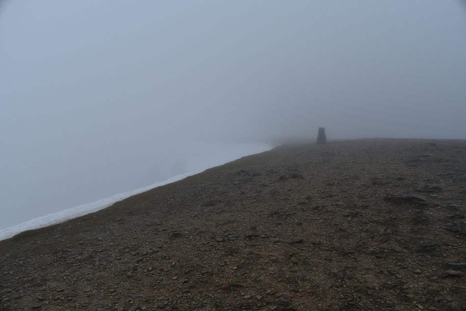 |
| Approaching Helvellyn trig point. |
| The summit plateau as you can see is all but free of snow with the exception of the cornice that had built up on the head wall which looked incredibly unstable. We could see that a few walkers had thrown rocks onto the cornice to destabilise it but thankfully no 'test' footprints were sighted. |
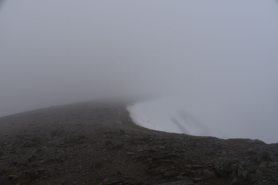 |
| Looking back along the summit plateau from Helvellyn summit cairn. |
| With winds increasing and visibilty reducing we had passed along the summit plateau only stopping to take the odd photo, other than that Helvellyn's summit was no place to hang around so we dropped down towards the shelter as Rod wanted to change his normal gloves into his full winter gloves. |
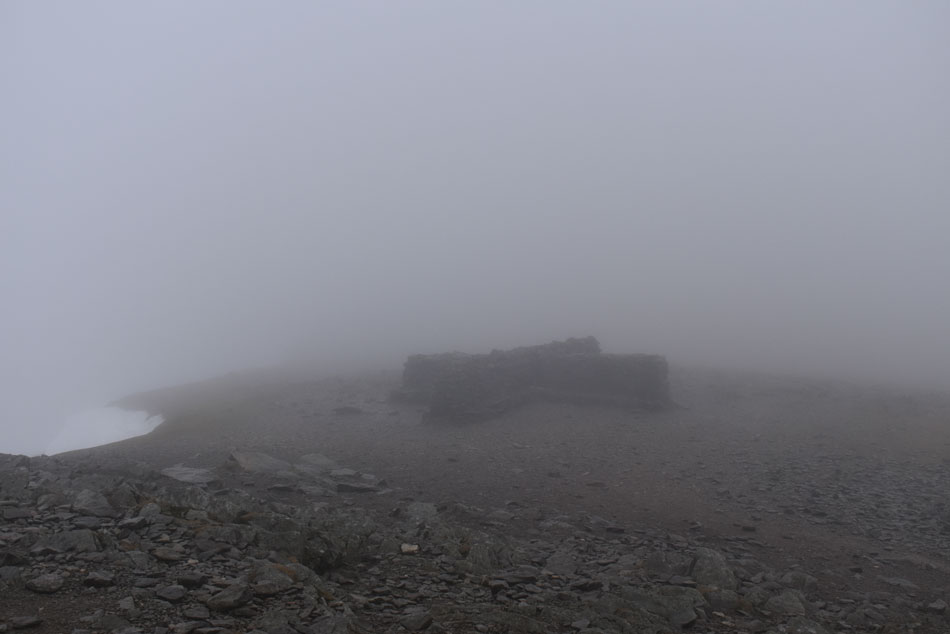 |
| Helvellyn summit shelter. |
| We sheltered for a few minutes while Rod changed his gloves, I at this point was still happy with my Extremities Windstopper gloves but saying that, the tips of my thumbs were starting to feel slightly numb but I thought I could cope with that as long as they didn't get any worse. David sat down while I kneeled down taking full protecting from the summit walls, soon we are joined by a solo walker just half kitted for todays conditions but he was friendly enough and non of us remarked on how protective his tracksuit bottoms were in this wind and rain, not very much we suspected. |
 |
| Ascent on Nethermost Pike. |
| We left Helvellyn summit shelter and tracked south towards Nethermost Pike where we were subjected to the strongest winds we'd had all morning, it felt bloody brutal and much colder than anything Rod and I had experienced on St Sunday Crag a couple of weekends ago. My hands were the first to feel the severe windchill and inside I was kicking myself for not changing into full Winter gloves as Rod had back at the shelter "guys you go on, I need to change my gloves I'll see you on Nethermost" Rod looked puzzled... "no way we'll wait for you mate" and with that I carried out the quickest glove change in history whilst David stopped my rain cover from becoming a sail - the only thing slowing me down was my little fingers just wouldn't locate inside the gloves but after a few 'star shapes' they slotted in just nicely and soon we were back on our way at which point we were overtaken by the guy we'd left at the shelter. |
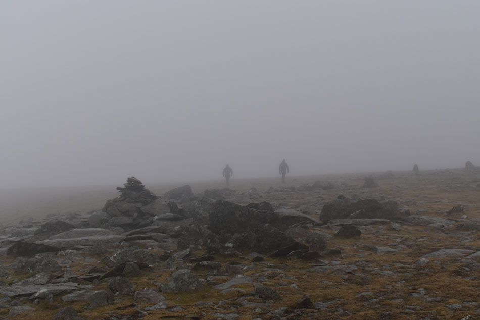 |
| Nethermost Pike summit. |
| We were pleased to have the wind on our backs during the short ascent onto Nethermost Pike where visibility was reduced once again. We arrived at the summit and took our photos before two figures emerged from the distance, as it turned out the two looked more than happy to see us instantly asking "which was the way down" or words to that effect. They were geared up correctly but were clearly lost, they went onto explain they had ascended Swirral Edge from Glenridding and were looking for Keppel Cove...I guess inside we all took that long breath, someone back at the summit had told them about the safer route down Keppel Cove which is indeed correct, what we don't know is did that same someone direct them in the wrong direction or had the lads simply got it wrong themselves, this wasn't the time for questions so I gave them clear instructions to return to Helvellyn, pass over the summit and onto Lower Man then descend steeply, ascend White Side then look out for the path forking right into Kepple Cove. The question remains to be asked however, why did the two attempt such a route given the conditions with no map or how to use one? It's becoming all too common and is the sole reason accidents happen. |
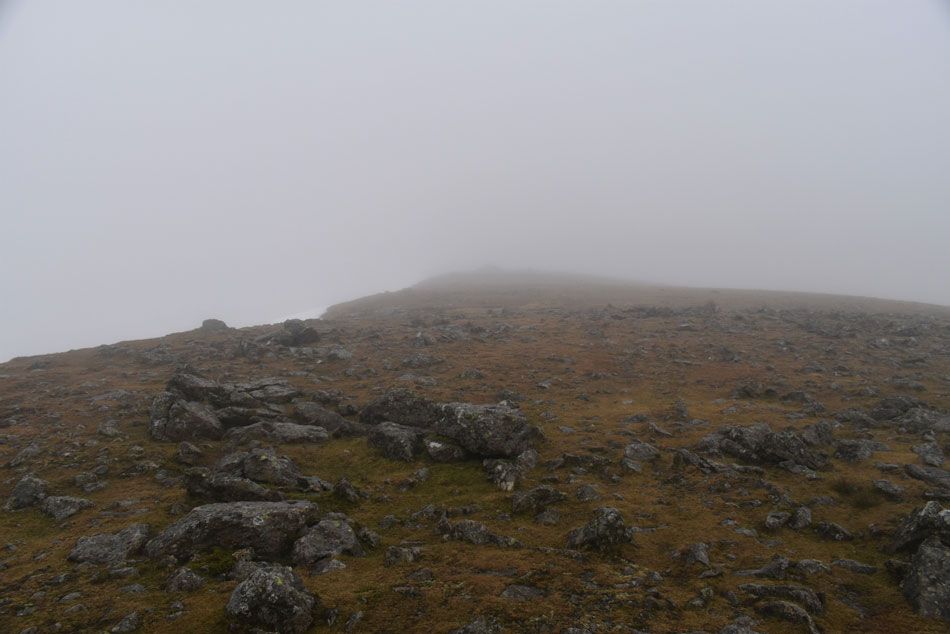 |
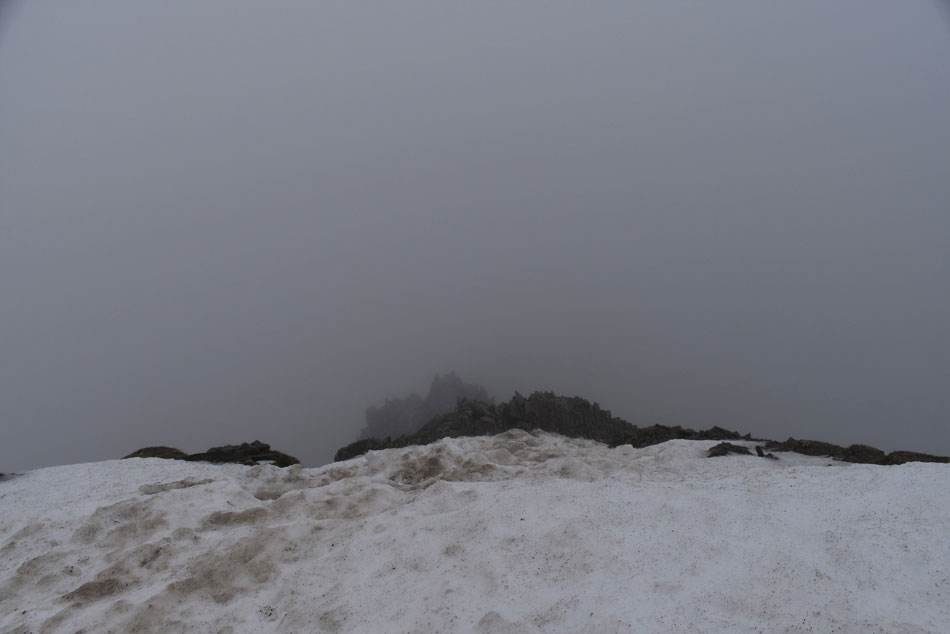
| High Crag summit. |
| We could see how anyone without knowledge of the area would get lost on Nethermost Pike, it was just a sea of cloud out there and we too had to pull ourselves back in line after wondering off the path. Grisedale's High Crag was next by which time the wind and rain hadn't let up and seemed to be getting heavier and stronger with each foot forward. As you can probably imagine taking pictures was difficult as I didn't want to expose my camera to the elements for too long which meant a simple shot on arrival at each summit or landmark. |
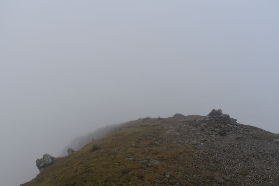 |
| Dollywaggon Pike summit. |
| We descended the rough path from High Crag and passed the top of Ruthwaite Cove where on a clear day we would have been presented with some of the grandest of mountain scenery the Lake District has to offer but sadly we couldn't see anything but the cloud in front of our faces. Unknowingly this quickened up our pace and after the short but steep pull we arrived at Dollywaggon Pike summit under thick gloomy cloud while the wind and rain pelted at us from all angles. Again we spent little time exposed and as quick as we had arrived we were making our descent towards the familiar old post at the southern tip of the summit. |
 |
| David and Rod and the top of Raise Beck. |
| Spotting the iron gate post through the cloud we made the slight descent from the summit then descended steeply, for anyone who has descended Dollywaggon Pike from the iron post will know just how steep this descent is, for those who haven't it's the kind of descent which just falls away in front of you so steep in places you are presented with 'false' summits but once past these soon give way for gentler incline once the bottom is neared. Grisedale Tarn was lost in cloud but we could just about make out two figures walking along the north shoreline. By now my camera was fogging up and so was Rod's so we took time to wipe our lenses with anything that wasn't wet which was difficult to find. From here we have slow descent via Raise Beck back to the top of Dunmail Raise where we hoped to be out of the cloud soon. |
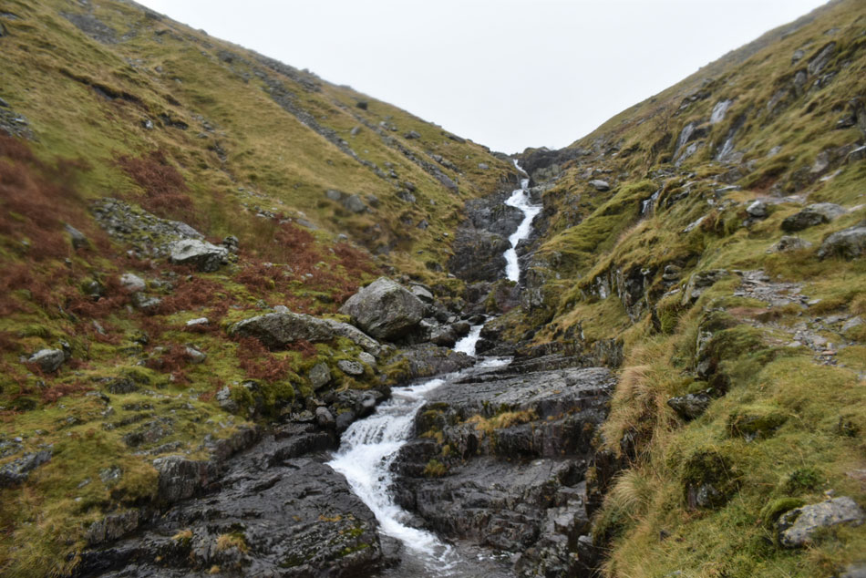 |
| Raise Beck falls. |
With more descent behind us the steep flanks of Steel Fell appeared through the cloud and further down we were even passed by more walkers some of whom were not properly equipped for conditions but after general "Hi's and ok's" we only got the same back but murmured they were in for a big surprise once higher. There was nothing we could have done to make the descent of Raise Beck any quicker, it's a steep descent in places with the best of a singular track to follow while navigating a descent over wet and slippery rock with the odd little scramble thrown in.
I reckon if tonights winning lottery ticket was waiting for us at the bottom we wouldn't have got to it any quicker. |
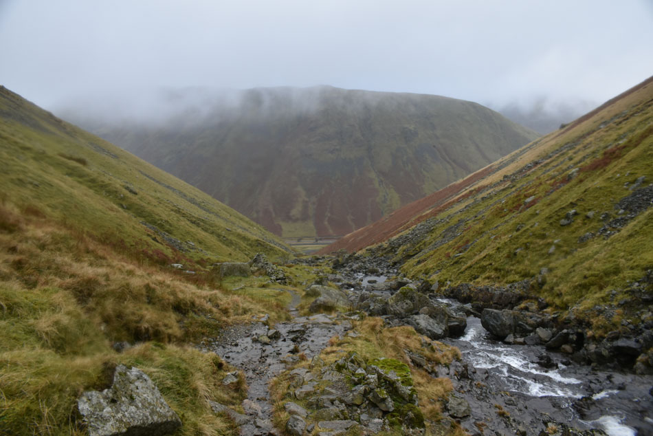 |
| Steel Fell from Raise Beck. |
At this point I was getting a tad worried for my camera after the viewing lens started to fog up so after taking this last photo I gave it another wipe down as best I could and packed it away. Our descent continued and we were passed once again by a young solo girl again, ill-equipped for conditions but after asking "Hi you ok" she just smiled back and got on with it. Our mood lightened and conversation returned sometimes stopping to watch Raise Beck tumble by or to adjust gear and clothing. The sound of traffic travelling over the top of Dunmail Raise brought our ears back to reality and for once the sound of the wind and rain pelting at our hoods was confined a couple of hundred feet above our heads. Rod's car was parked about two hundred yards south where after passing over a very slippery wood sty we walked alongside the traffic awaiting lunch which we had agreed to eat back at the car.
If anyone saw a Nissan Qashqai parked up on Dunmail Raise with all its windows steamed up there was no funny business going on inside, it was just us eating lunch. |
|
| |
| Back to top |
 |
|