Walking the Birketts, Lingmoor and Side Pike

18th May 2019

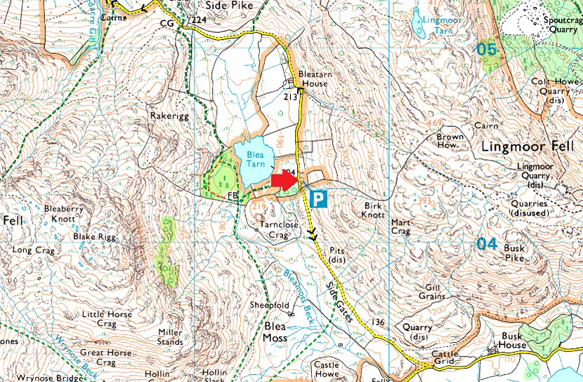
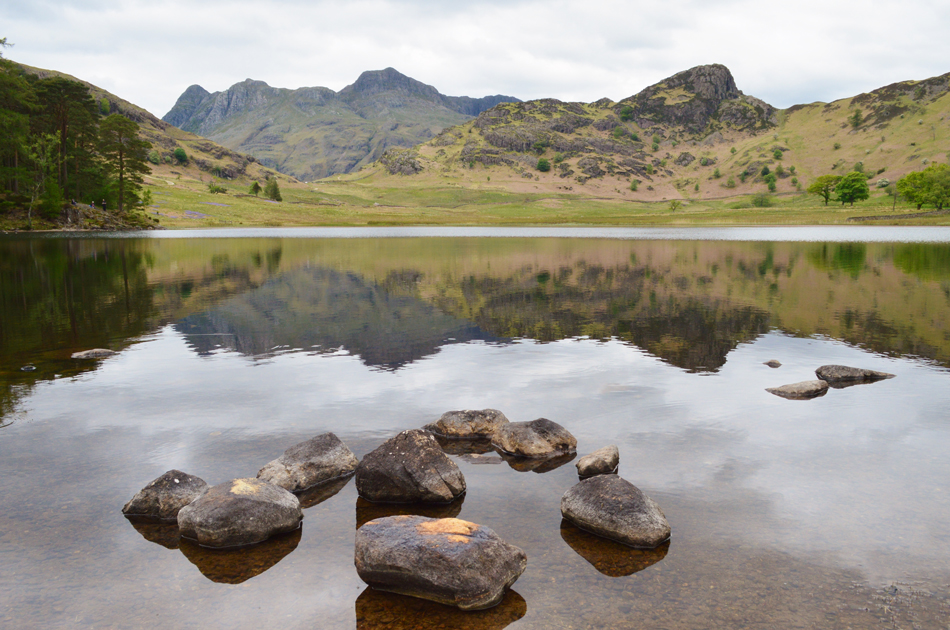
The forecasters had predicted rain for Saturday so I emailed David asking did he still fancy getting out his reply was "we can always stay low" which was just what I wanted to hear. I started looking through Birketts walks and Lingmoor Fell instantly appealed to me which is probably due to the lack time I've spent there which kinda nailed the walk for me. I'd been keeping a eye on the Lakeland weather which at the last minute changed from light rain to low level cloud but I packed to take a soaking anyway, this, after another glorious week of sunshine while the nation is at work but hey ho there's now't we can do to change the weather. A quick phone call about 8pm the Friday evening confirmed the meeting time and parking which was at the National Trust car park at Blea Tarn which is somewhere I haven't been since May 2010.

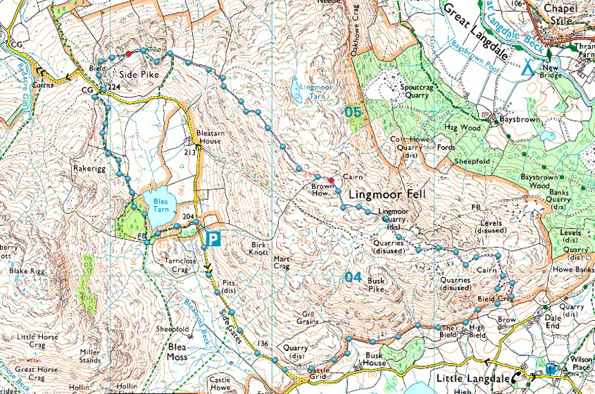
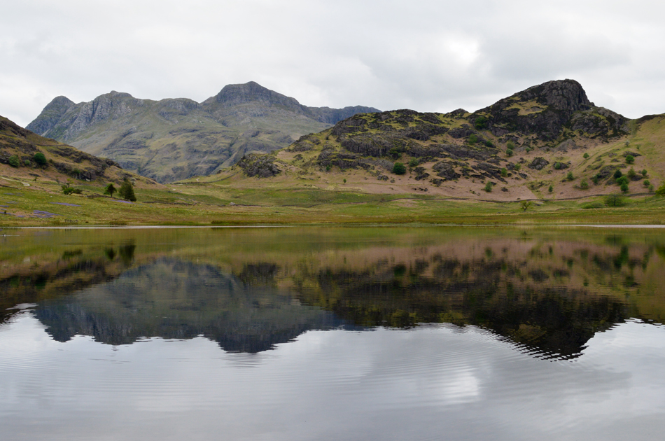
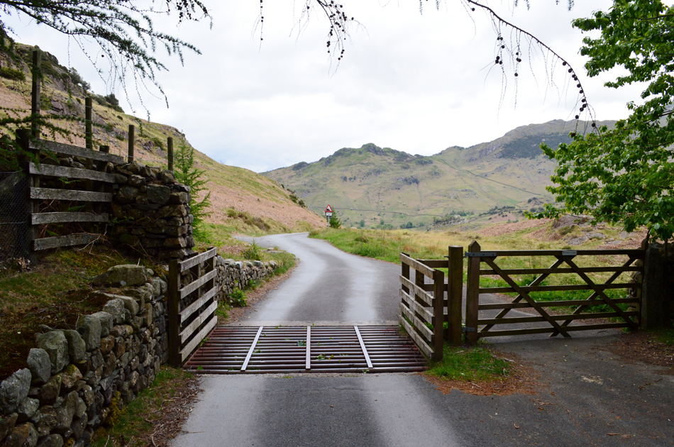
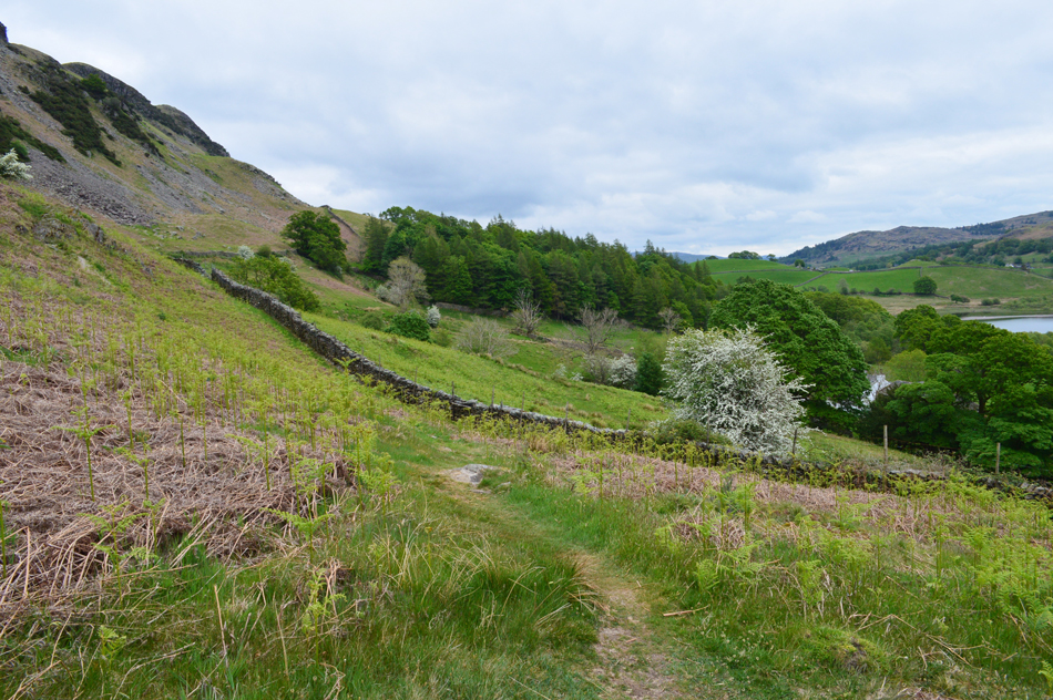
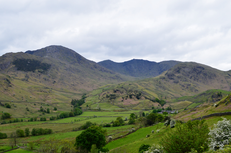
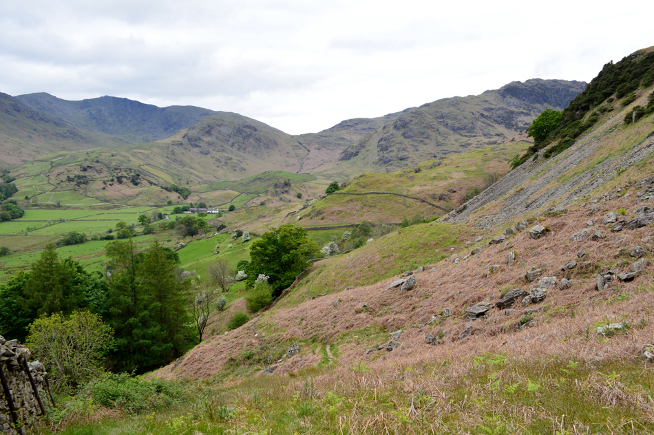
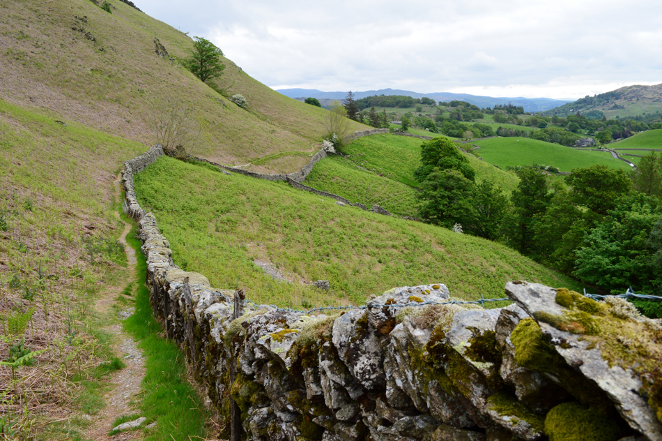
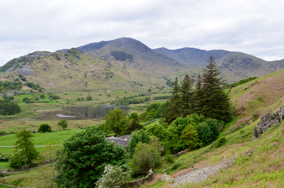
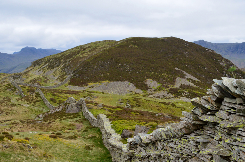
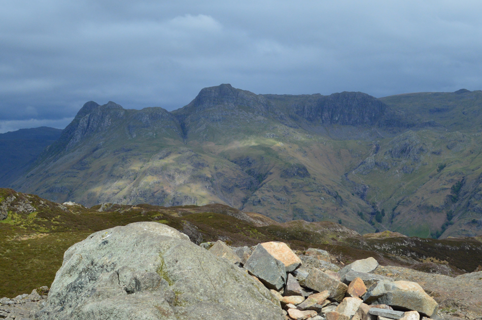
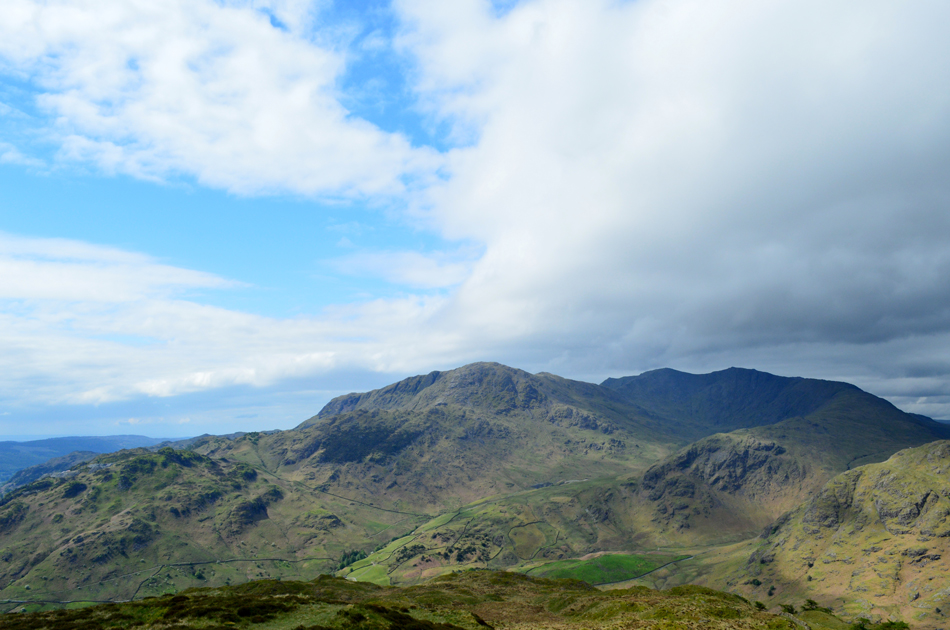
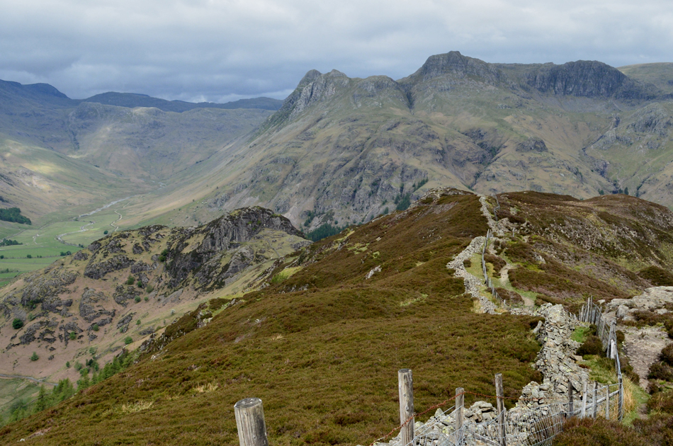
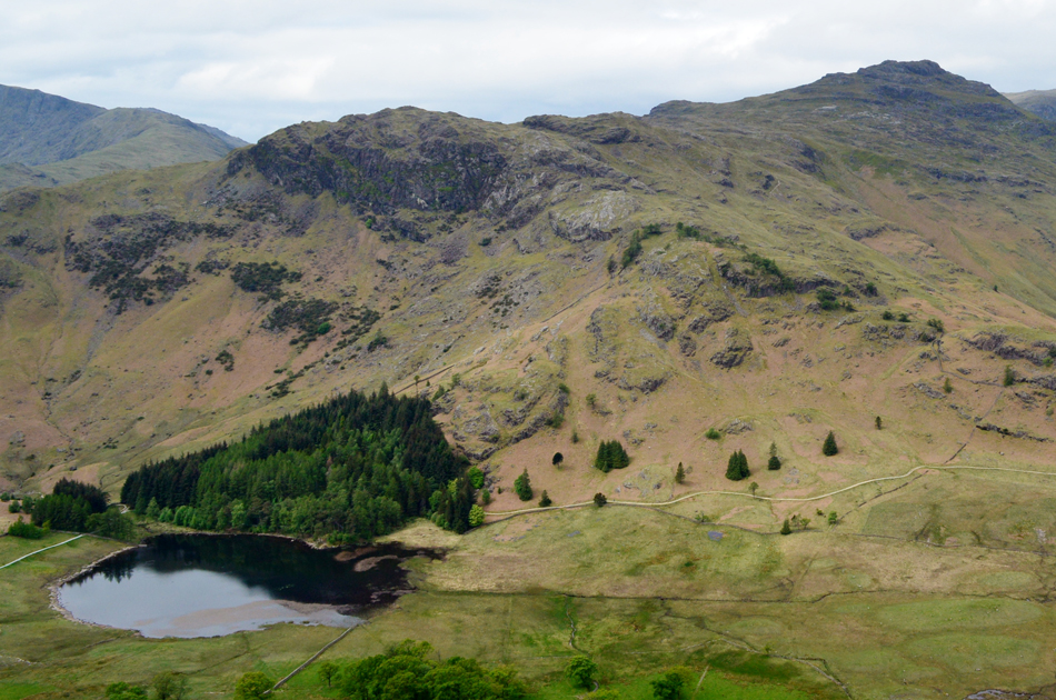
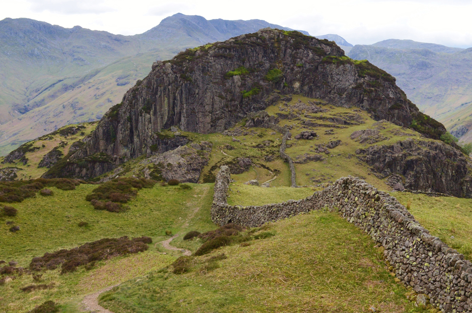
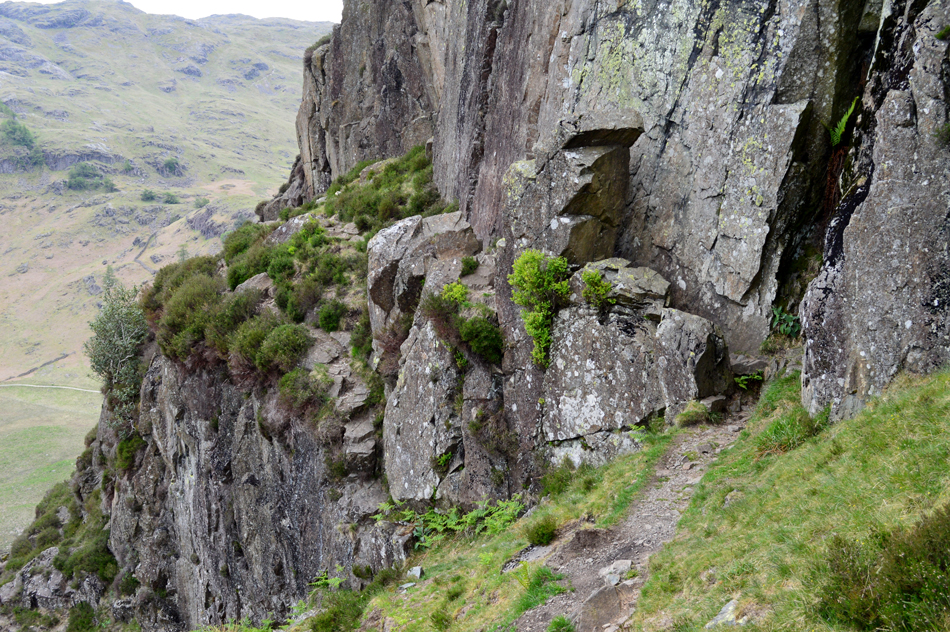
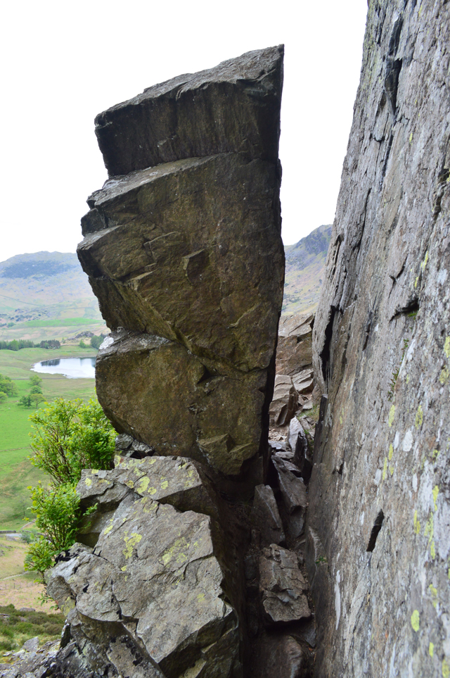
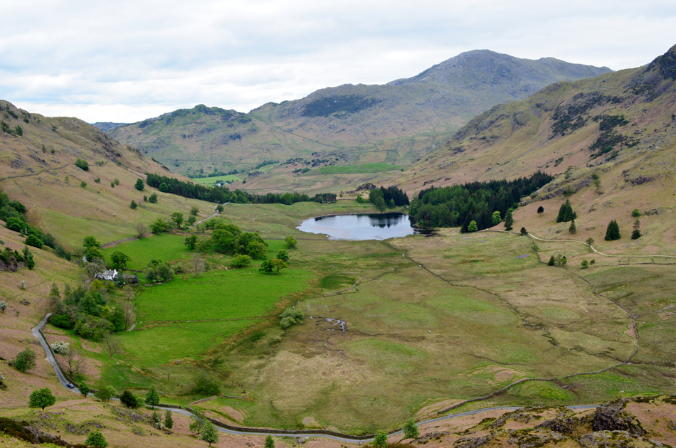
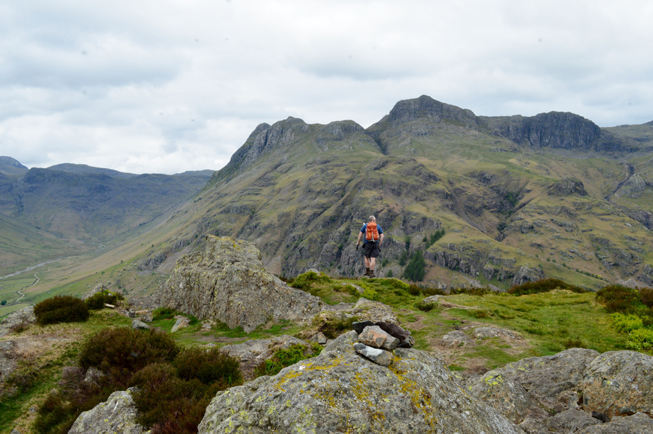
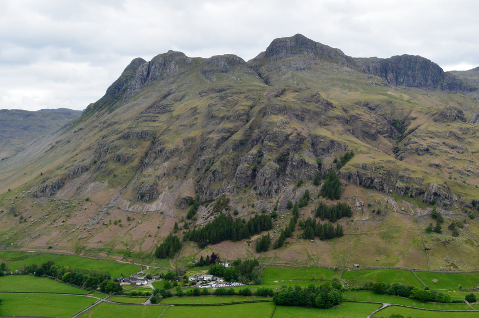
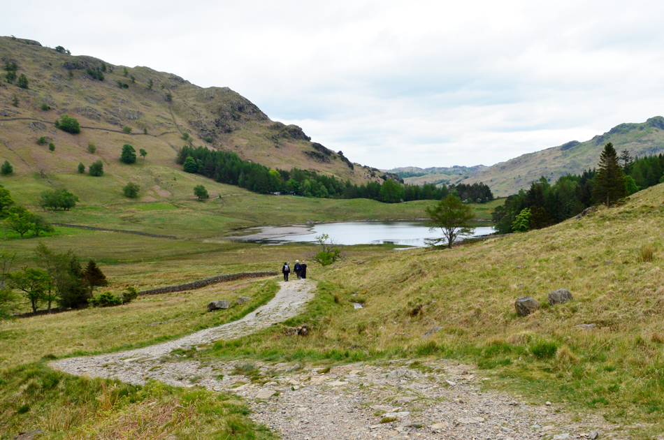
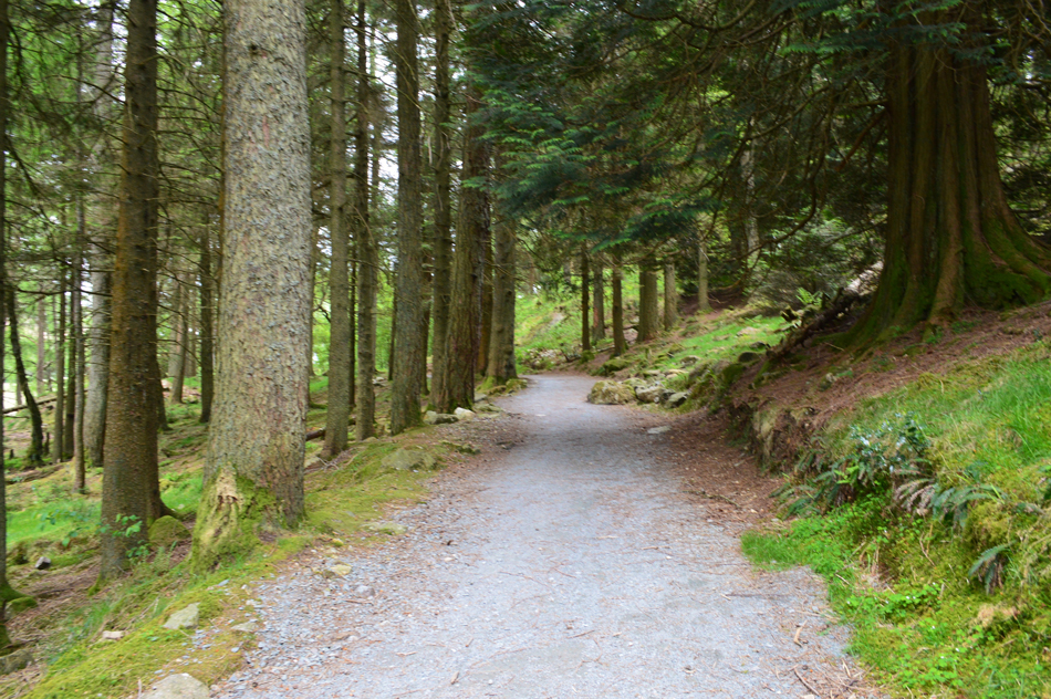
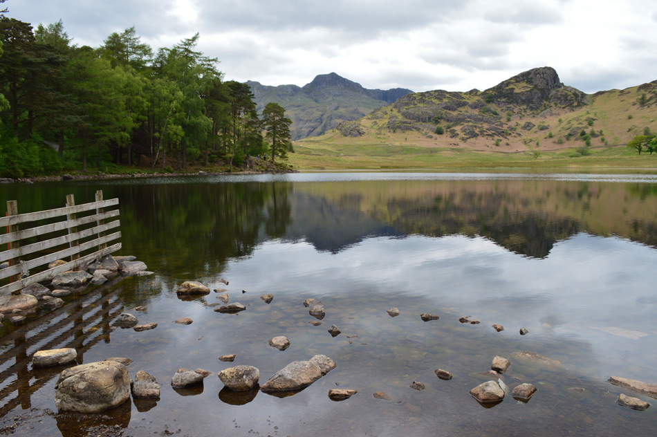
We started our walk at the National Trust car park, Blea Tarn before descending into Little Langdale from where we gained the footpath on the south flank of Lingmoor Fell. This path is undulating with quite a few little ascents and descents thrown in but the views over Little Langdale more than make up for it. After passing below Busk Pike and Bield Crag we gain the quarry path and follow the familiar stone wall which straddles the spine of the fell. After summating Lingmoor we start our descent which by no means can be underestimated with the odd scramble thrown in should you choose the craggy option. By now Side Pike is in full view which is gained easily after passing through 'the squeeze' below the craggy summit. After a short, but steep ascent we stopped to eat a early lunch with views over Blea Tarn and Blea Tarn House before descending back to the familiar cattle grid ending the walk with a circuit of Blea Tarn.

 
The Complete Lakeland Fells
By Bill Birkett

- Side Pike

Only Blea Tarn - over which the view to the Langdale Pikes is one of the all - time greats - and the plucky isolation of Side Pike hint at what lies abobe.


Overview
Ascent: 1,469 Feet - 448 Metres
Birketts: 2, Lingmoor Fell (Brown How) - Side Pike
Weather: Feeling Very Mild With Some Sunny Spells But Overcast For The Duration. Highs of 15°C Lows of 10°C
Parking: Blea Tarn
Area - Group: Southern - W/BOW
Miles: 5.3
Walking With: David Hall
Ordnance Survey: OL6
Time Taken: 4 Hours 10 Minutes
Route: Blea Tarn - Blea Moss - Little Langdale - Path Below Busk Pike - High Bield - Quarry Path - Lingmoor Fell (Brown How) - Side Pike - Blea Tarn
 

Parking Details and Map
Nearest Post Code: LA22 9NZ
Grid Reference: NY 295 043
Notes: Owned by the National Trust Blea Tarn car park is found nestled just a short stroll away from Blea Tarn between the valleys of Great Langdale and Little Langdale. A small to medium sized car park which through peak seasons would fill up quite quickly, arrive early to avoid disappointment. Charges Apply however for National Trust members displaying a current badge parking is free.


Map and Photo Gallery


The Langdale Pikes and Side Pike from Blea Tarn 08:25 12°C

We agreed to leave meet just outside Clappersgate where we left David's car and traveled to Blea Tarn in mine and by 08:20am we were parked up at the National Trust car park after emptying £6.50 into the parking machine, this gave us four hours fell time which should be plenty. Well the great news is it isn't raining but it was cloudy but we can put up with that. Its feeling mild too which David reflected by wearing shorts while my legs are still in Winter and Spring mode. We agreed before we started the walk to take a stroll over to Blea Tarn if only to capture the wonderful reflections of the Langdale Pikes, a image you will never tire of whatever the skies.

We're hoping to be back here in 4 hours so despite the fantastic views we best get a shifty on.


Leaving the National Trust car park.
Before we start the steady descent into Little Langdale.

Baysbrown Wood on the southern flank of Lingmoor Fell.
We started our descent into Little Langdale then left the road at a old wooden barrier on the left hand side and started the first of many ascents onto open fell side. This particular path is new to us both and despite its little humps and bumps we were looking forward to exploring its many nooks and crannies.

The view over Little Langdale towards Birk Fell, Wetherlam, Swirl How, Great Carrs and Wet Side Edge.

Also known as the Greenburn Horseshoe.

In this image the top of Wrynose Pass comes into view along with Blake Rigg and Pike O'Blisco over on the right.
We continued to follow the path passing below Busk Pike and the spoil heaps from a disused quarry above, the path continues to rise, sometimes steep in places seen here as we head towards High Bield.

The path wasn't always steep.
Seen here on a lovely level section while taking in views over towards Black Crag.

The view over Little Langdale Tarn towards Blake Rigg, Wetherlam, Swirl How, Great Carrs and Wet Side Edge.
It was around this point both David and I are reminded of a walk we did back during my Walking the Wainwrights in 30 Walks project where we linked Loughrigg Fell, Black Crag, Holme Fell and Lingmoor Fell together covering a distance of around 15 miles on a hot and very humid June day back in 2016, it was so humid Loughrigg Fell might as well of been the Matterhorn as our bodies struggled to cope with the stifling humidity and two days later we were still suffering from headaches. Today might not be as bright and sunny but it is still very humid and we can't help but laugh about the day we climbed Little Langdale's Matterhorn.

Loughrigg Fell summit is just ahead.
Having linked up with the quarry path we continued our ascent passing through the disused quarry before arriving at the summit shoulder from where its a simple case of following the stone wall all the way to the summit.

The Langdale Pikes, Pavey Ark and Sergeant Man from Lingmoor Fell summit
We were blessed in brief sunshine as we arrived at the summit most of which hadn't quite reached over into Great Langdale leaving the Langdale Pikes looking very moody indeed.

Further south however...
Wetherlam, Swirl How, Great Carrs and Wet Side Edge are enjoying the brief spell of sunshine.

Could it be clearing up?
On a day the forecasters predicted rain? nah ! This brief spell of sunshine was most welcome and going forward it did look like it could improve for the duration of the day but it wasn't to last, but nice while it did.

After a few minutes at the summit we started our descent as Side Pike comes into view.
Well the sun might of gone back in but just look at that for a view to descend by.

Our view over Blea Tarn towards Blake Rigg and Pike O'Blisco.
 

Side Pike.
Having descended the shoulder of Lingmoor Fell all that was left was the final descent onto the col which divides Lingmoor Fell from Side Pike, here you have two choices, if you descend left (as we did) you are presented with a scramble that required hands on rock, descend towards the right and you'll find a path less the scrambley bits.

'The Squeeze', Side Pike.
Some people call this the squeeze others 'fat mans agony' whatever you want to call it you'll have to remove your pack before passing through.

Time to remove our packs.
Not forgetting to pack camera's and poles away.

Views over Great Intake, Birk Fell, Wetherlam, Blea Tarn House and Blea Tarn taken shortly after passing through 'The Squeeze'
I went first not before removing my pack and camera before David passed me the packs over and quickly we are through. On't other side of the squeeze we are joined by a solo walker who only had to wait for a moment or so for us to gear up before starting the final ascent on Side Pike summit.

The Langdale Pikes, Pavey Ark and Pike Howe from Side Pike summit.

It was by now late morning and we figured we earned ourselves the two pieces of cake each I'd been carrying all morning so we dropped down slightly and found the perfect spot over looking Blea Tarn and tucked into a early lunch noting that the cake was eaten before lunch was.

It's the rule.


Its fair to say that the Langdale Pikes domminated the view seen here with Old Dungeon Ghyll below.

After lunch accompanied by thousands of midges we packed up and took a walk over to the Great Landgdale side of the summit and looked down on the many tents occupying the campsites below, further into the valley we can see that the farmer has opened up a field on which dozens of cars are lined up no doubt their owners taking advantage of the Lakeland Fells and activities.

Great Langdale is one of those peak destinations and parking can be tricky during Summer which is why local farmers open their fields to accommodate Great Langdales many visitors but as David quite rightly put it with a slight sigh in his tone "it never used to be this busy" Its a double sided sword if you ask me knowing tourist bring income for local businesses but I know which side of the sword I prefer.

Moving on...


Heading towards Blea Tarn.
Having descended Side Pike by its many rock steps we arrived at the familiar cattle grid below which over looked a very sorry looking Wall End Farm before we joined the footpath for Blea Tarn which we found was busy, but not as busy as you'd expect for a Saturday afternoon.

We pass through the woods next to Blea Tarn.
Where in days gone by I wild camped here with my son Owen.

Side Pike reflections.
 

The Langdale Pikes and Side Pike from Blea Tarn.

We knew that we'd be late back to the car but only by around ten minutes so we decided to crab a few more moments capturing one of Lakelands most iconic views.

We arrived back at a half full car park while going over the highlights of the walk which for me had to be Side Pike closely followed by the time we spent watching the fish rise at a serene Blea Tarn. The ground underfoot is dry and dusty and even though the clouds are a brooding grey we've got away without so much as getting the caps of our boots wet.


Back to top