|
Broad Crag, Ill Crag, Great End and Lambfoot Dub |
 |
 |
2nd November 2018 |
 |
|
I must admit I'd been quite lucky with todays forecast after booking the day off a couple of weeks ago which back then it was hit and miss if I'd walk at all. Due to work commitments and an evening out tomorrow I thought I'd book the day off and if it turned out I had a good forecast I'd hit the hill. Even earlier in the week Friday had always looked the better day with both Saturday and Sunday confirmed as washouts, blimey I thow't, I had been lucky, then came where to walk and after figuring I'd earned myself a break from my Birkett project two very similar walks sprang to mind both visiting Broad Crag, III Crag and Great End, the only thing was I was undecided about was these two routes: Great End via The Band, or an alternative descent from Great End to the Corridor Route via Lambfoot Dub.
For those unaware Lambfoot Dub is a tarn ledged 800ft below Great End's summit and access can only be gained from Great End or from the Corridor Route below, the easier route being the latter. Both routes involve incredibly steep ground and should only be attempted by the experienced in good conditions. Todays main aim was to summit Broad Crag, Scafell Pike's parent peak which I'm hugely fond of given that Broad Crag will always be the underdog to its bigger brother.
I've always been a fan of the underdog. |
|
| Wainwright Guide Book Four |
 |
| The Southern Fells |
-Great End This is the true Lakeland of the fell walker, the sort of terrain that calls him back time after time, the sort of memory that haunts his long winter exile. |
 |
|
|
|
| |
|
Overview |
|
|
| Ascent: |
3,232 Feet - 985 Metres |
| Wainwrights: |
Great End |
| Visiting: |
Broad Crag - III Crag |
| Weather: |
A Bright Start Leading To Bright Spells. Some Low Level Cloud. Highs of 8°C Lows of 4°C |
| Parking: |
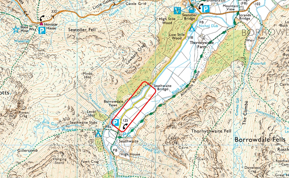
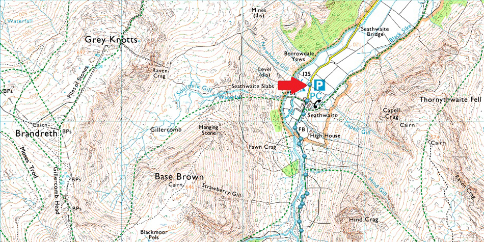
Roadside Parking, Seathwaite, Borrowdale |
| Area: |
Southern |
| Miles: |
9.2 |
| Walking With: |
On My Own |
| Ordnance Survey: |
OL6 |
| Time Taken: |
5 Hours 40 Minutes |
| Route: |
Seathwaite - Stockley Bridge - Grains Gill - Ruddy Gill - Esk Hause - Calf Cove - Broad Crag - III Crag - Great End - Lambfoot Dub - Corridor Route - Sty Head - Styhead Tarn - Stockley Bridge - Seathwaite |
|
| |
|
Parking Details and Map |
|
|
| Nearest Post Code: |
CA12 5XJ |
| Grid Reference: |
NY 235 712 |
| Notes: |
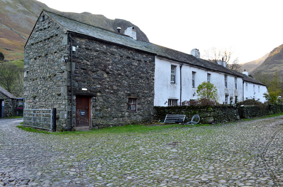
I guess it's fair to say that Seathwaite is to Lakeland what Times Square is to New York. Set within the heart of Borrowdale in the heart of the Lake District Seathwaite is the walkers hub of Lakeland. Seathwaite is the starting point for many a walker heading for the highest ground in England when during the Summer hundreds of 'Three Peakers' visit Scafell Pike. There is room for ample parking yet it's quite difficult to put a figure on how many cars and mini buses park in the valley at any one time but it is recommended to arrive early if you want to secure a parking space. During peak seasons such as Summer the farmer has known to allow parking on both sides of the valley with a small charge close to Seathwaite Farm. Please park courteously and do not block any gates, remember Seathwaite Farm is a working farm meaning the land owner will require access to any gates by any means, you have been warned! Parking is free. |
|
| |
|
Map and Photo Gallery |
|
|
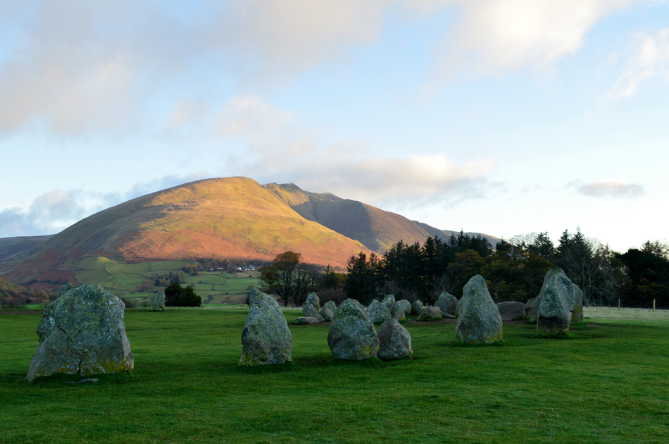 |
| Blencathra from Castlerigg Stone Circle. |
| There was time for a quick stop at Castlerigg Stone Circle before I passed through Keswick were just like last weekend there was plenty of photographers witnessing this mornings sunrise. |
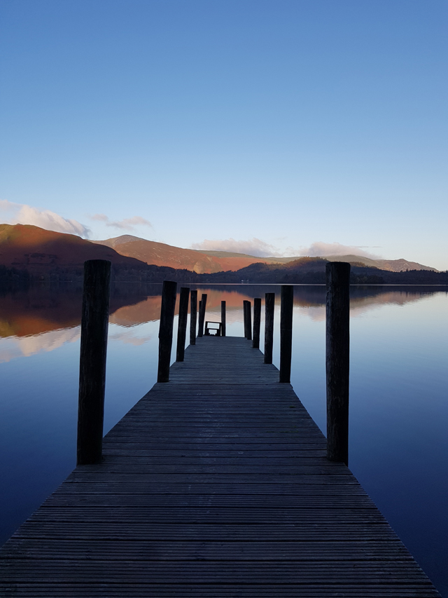 |
| Skelggill Bank (Catbells) Barrow and Grisedale Pike from Ashness Jetty. |
| Likewise after passing through Keswick I stopped off at Ashness Jetty to capture this stunning view over Derwent Water. This image was taken from my mobile phone. |
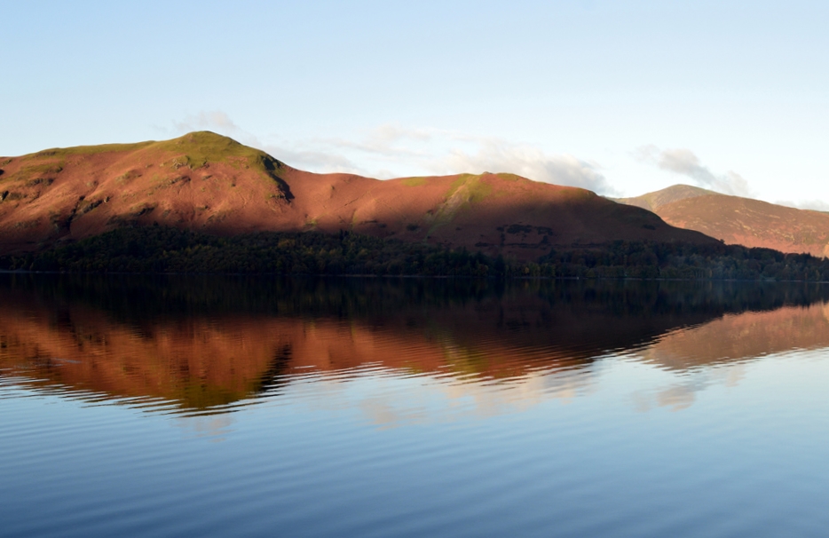 |
| Catbells reflections. |
| Here's another shot taken from by mobile phone. |
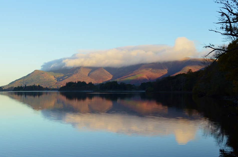 |
| Cloud topped Skiddaw from Ashness Jetty. |
| Okay, time to head through to Seathwaite now. |
 |
| Seathwaite Farm 08:20am 4°C |
| After around fifteen minutes of leaving Ashness Jetty I arrived in Seathwaite and parked with ease close to the farm, there's a few cars parked up but no sign of the owners. The sound of the falls from Sourmilk Gill fill my ears and indeed the valley as I kit up behind my car. The forecast was for a dry, bright but cold start but if anything it feels mild so I ditch my beanie in favour of my baseball cap, my gloves, remarkably remain in my pack in stark contrast to last weekends excursion in Newlands where the tips of my fingers had frozen. With my car locked I walked down the lane towards the farm just as the farmer heads into a nearby field where 'mornings' are shared. |
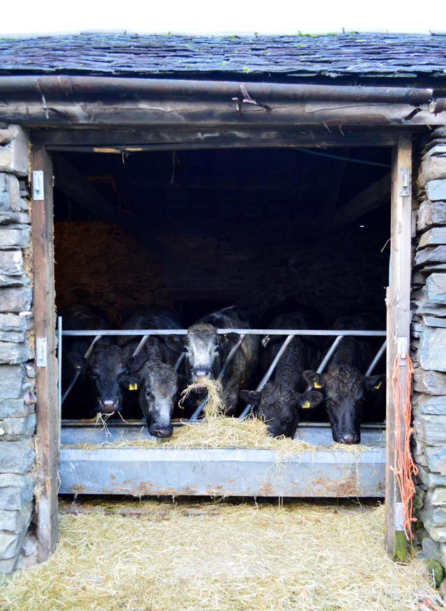 |
| Morning girls. |
| I don't want to disturb their breakfast so I keep moooving...sorry, I couldn't resist. |
 |
| Stockley Bridge in front of Seathwaite Fell. |
With Seathwaite Farm behind me I followed the track towards Stockley Bridge, gone was the sound of Sourmilk Gill now replaced by a much gentler flowing Grains Gill. Despite the odd dozen cars parked up back in Seathwaite I couldn't see anyone up ahead or behind me, after scouring the footpath on the flank of Seathwaite Fell it appeared I had the valley to myself, not even a wet boot print on the ground, Bliss.
After crossing Stockley Bridge I keep left alongside the stone wall until the path breaks away gaining steady ground towards the top of Ruddy Gill. |
 |
| The view back towards Seathwaite and a sunlit Seatoller Fell. |
| |
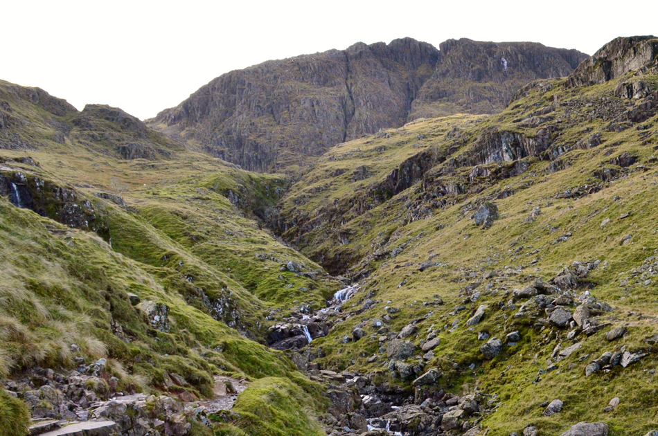 |
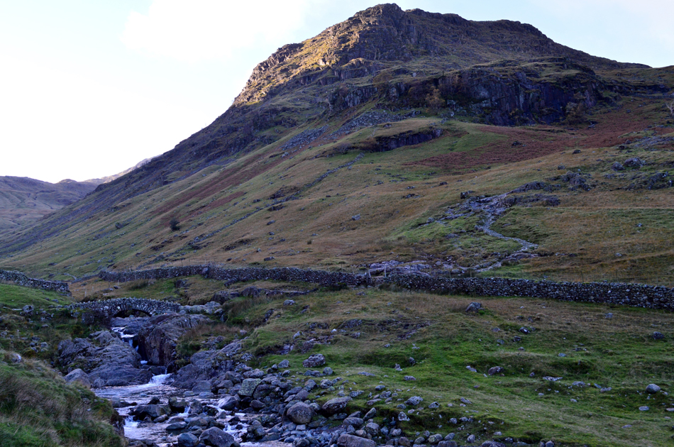
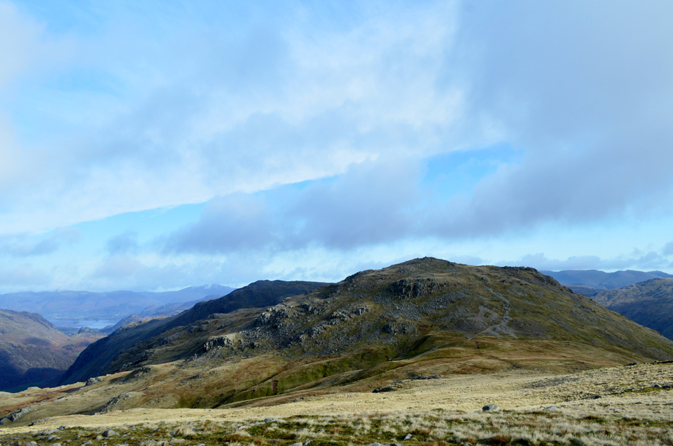
| Great End comes into view. |
| At the point where Ruddy Gill flows into Grains Gill. |
 |
| Looking back on Ruddy Gill with flank of Seathwaite Fell to the left and Glaramara to the right. |
| Almost at the top of Ruddy Gill now and from out of nowhere a fell runner is gaining ground on me. |
 |
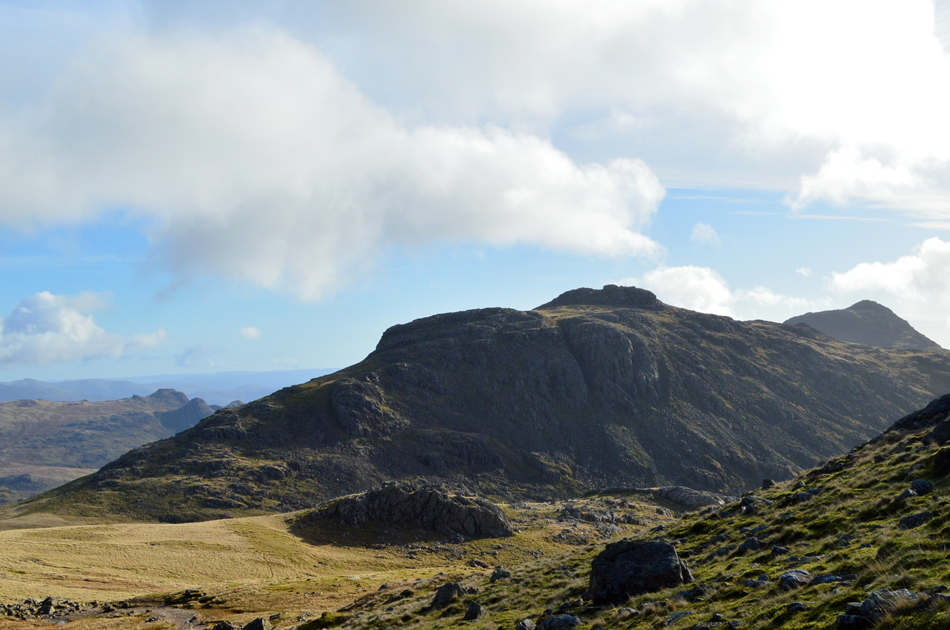
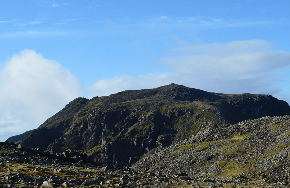
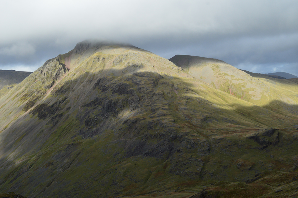
| The Great End seen with Central Gully. |
| I am no match for the fell runner who quickly caught me up and we shared a polite morning together with a few words over how mild it felt, there was no talk of each others routes but we did manage to cross paths again later in the day at Styhead Tarn. |
 |
| Looking back over the top of Ruddy Gill towards Seathwaite Fell, Sprinkling Tarn, Great Gable, Green Gable and Base Brown. |
| The fell runner took off towards Esk Hause and I quickly lost site of her, meanwhile it started to cloud over as I reached the top of Ruddy Gill the sun however, soon broke through again below Esk Hause. |
 |
| Allen Crags and Glaramara from Esk Hause. |
| Esk Hause is a significant crossroads in Lakeland where paths converge from Great Langdale, Eskdale and Borrowdale, you'd be hard pressed to find the place to yourself even on a week day but today I had just that, bloody marvellous. |
 |
| Looking back over Esk Hause towards Esk Pike. |
| |
 |
| Meanwhile in the other direction, Ill Crag. |
| With Cockley Pike seen lower left. |
 |
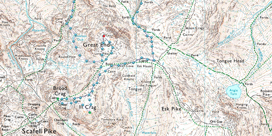
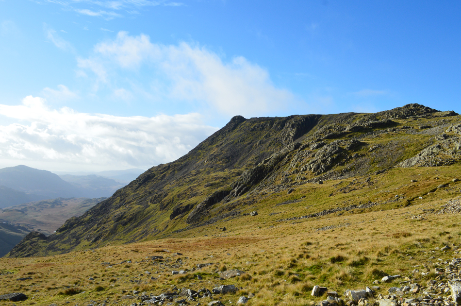
| Approaching Calf Cove. |
The fell runner had made a direct ascent on Great End via the rough scree thus avoiding Calf Cove altogether all the while I contemplate whether I summit Great End first or leave it until last?
Despite Great End being in close proximity it made sense to leave the summit until last from where I'll be able to make my descent to Lambfoot Dub thereafter. |
 |
| The Langdale Pikes, Esk Pike and Bowfell from my ascent on Calf Cove. |
| The sun was now blazing on my back and with little to no wind I made the easy ascent on Calf Cove in what felt like Spring conditions, up ahead I spot the fell runner as she crosses the grassy col where I suspect she's bound for Scafell Pike next. |
 |
| Impressive views over Wasdale Head towards Lingmell, Great Gable, Kirk Fell, Pillar, Scoat Fell and Red Pike (Wasdale) |
| Incidently, the grassy area to the right is the ground I'll start the steep descent towards Lambfoot Dub from later, I intentionally avoided a recce which I'll do on my return before summiting Great End. |
 |
| The view over the top of Calf Cove towards Great End. |
| |
 |
| Scafell Pike and Broad Crag. |
With more height gained the air had turned much cooler but I resisted adding my gloves. From the top of Calf Cove I continued to follow the path and crossed the boulder field with care feeling the odd slip here and there due to the rock being covered in ice while in other places I found the boulders wet and greasy.
It has become apparent since changing my walking boots during the Summer that I do not have the same confidence that I had with my Meindl's as I do with my new Scarpa Delta's, trust underfoot has become an issue I could do without! |
 |
| Scafell Pike seen over Broad Crag and Little Narrowcove. |
| |
 |
| Scafell Pike now seen with Broad Crag. |
| Having passed III Crag to the south I started my descent into the Col which divides III Crag from Broad Crag. A solo walker stands on Scafell Pike summit who then disappears from view as I look back on Great End, Sty Head and the Gables. |
 |
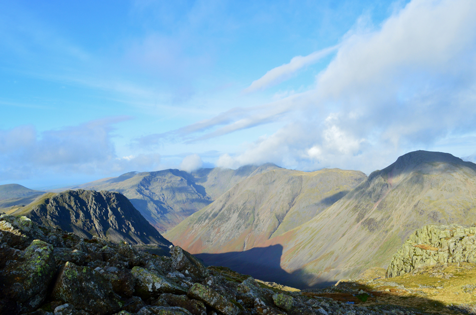
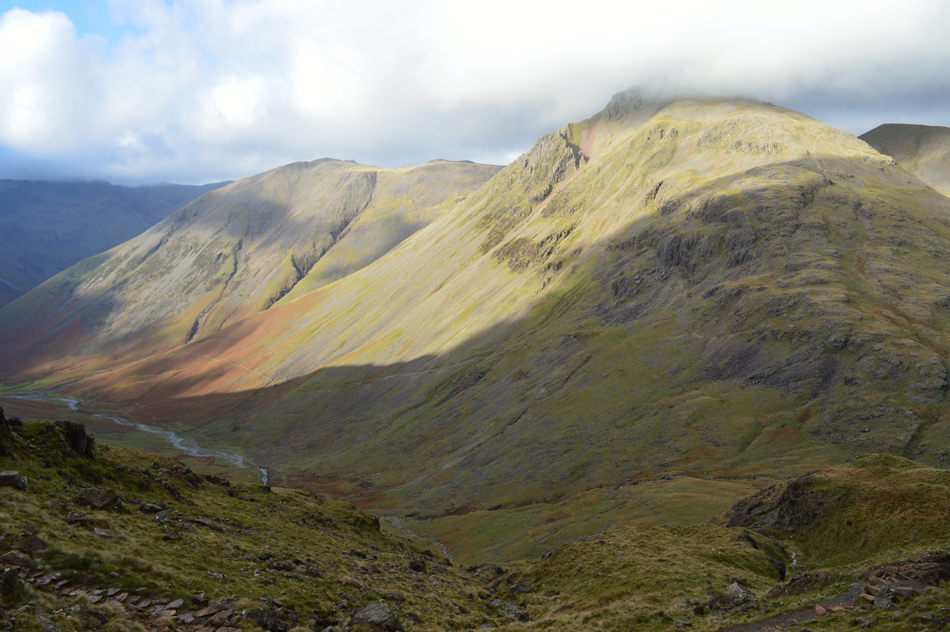
| The view back towards Great End, Great Gable and Green Gable. |
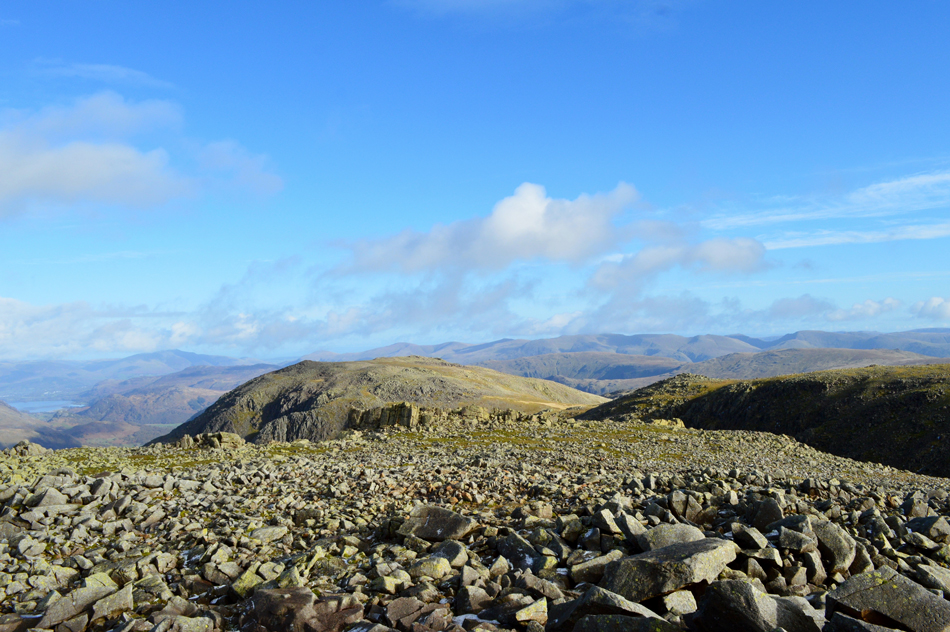
From the Col I am able to get a perspective of the ground which will need to be descended in order to reach Lambfoot Dub which can be seen as the small pool in the centre of the photograph. The top of the grassy Col from where I'll begin my descent can be seen in shadow alongside a dark cleft over on the right. From here the descent doesn't look as steep as the contours my map suggests! |
 |
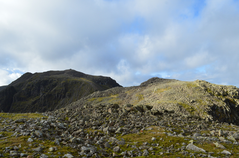
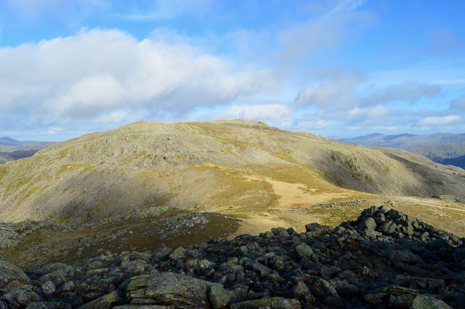
| The view back towards Ill Crag from Broad Crag summit plateau. |
| From the Col I followed a familiar path first over boulder where once again care had to be taken due to the ice covered rock. Once the shoulder was gained I found more ice underfoot mixed with frozen hail which slowed my pace almost to a crawl. |
 |
| The view back along Broad Crag's boulder strewn summit towards Great End. |
| |
 |
| Scafell Pike from Broad Crag summit. |
| With care I picked my way towards the summit and perched myself upon the summit rock taking in the full view of Scafell Pike, below the summit two walkers emerge quite a distance apart from Broad Crag Col but don't let the distance between them kill conversation. Voices who could not see me together with the odd crack of boot over rock was the only sounds that disturbed the silence but I wasn't complaining. |
 |
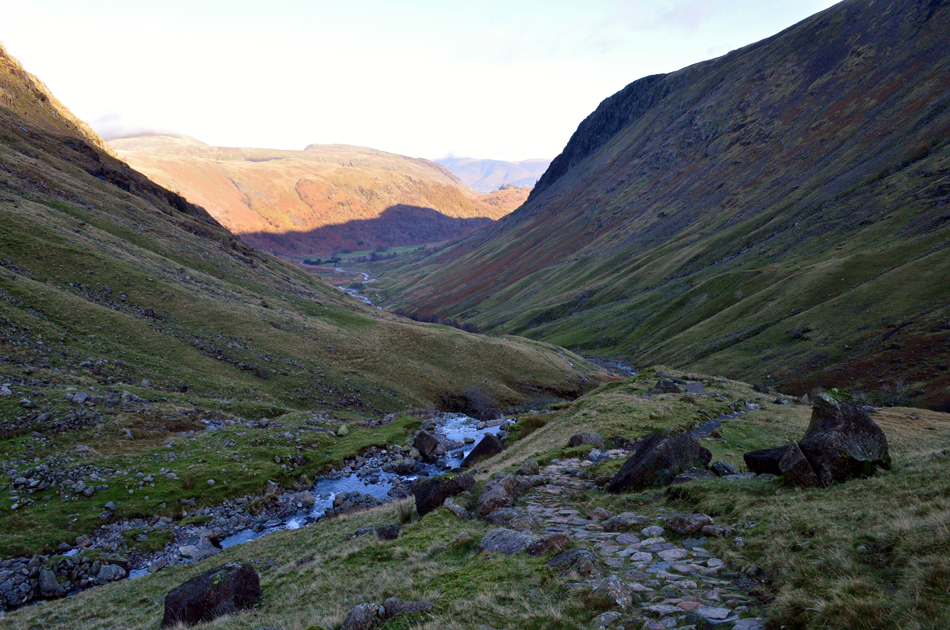
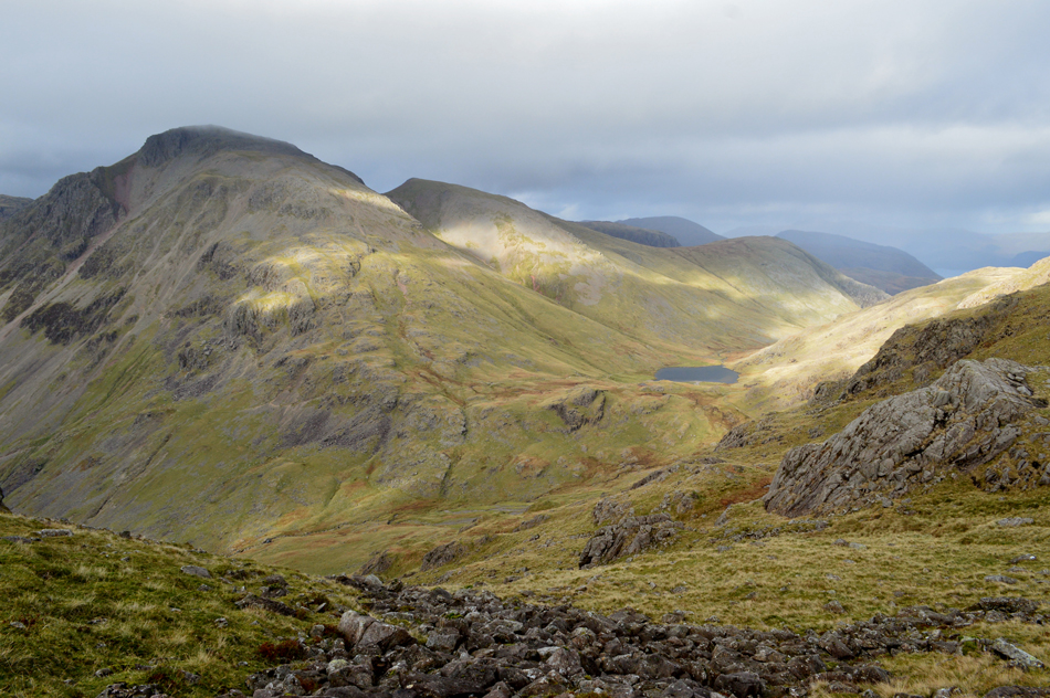
| Looking back towards Great End with Round How and Lambfoot Dub seen below. |
| That's Styhead Tarn in the distance but you didn't need me to tell you that. |
 |
| III Crag from Broad Crag with the silhouette of Wetherlam, Swirl How and Coniston Old Man in the distance. |
| High cloud approached from the north and with it went any warmth the sun was providing, it didn't last long but long enough to make me think I needed to keep warm and that meant leaving the summit. I picked my way down from the summit rock and took in the view over Broad Crag Col before doubling back again while taking care underfoot. Due to the slippery rock I didn't want to risk using the same ascent route in descent so I picked up a narrow path lesser in gradient before finding myself back at the Col between III Crag and Broad Crag. |
 |
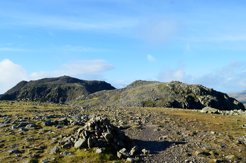
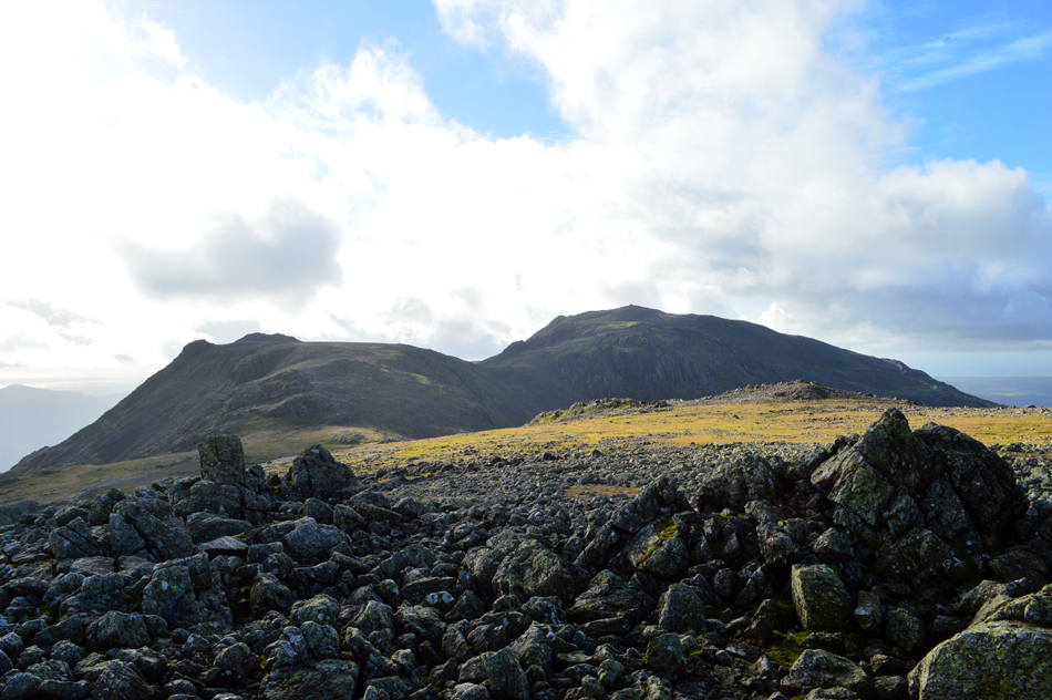
| Two Lakeland giants in one view. |
| From the Col I easily gained the rocky plateau of III Crag before making my way towards the summit rocks encountering the same slippery rock as I had on Broad Crag, with this in mind I knew the clamber onto III Crag's summit rocks was going to be a tricky one. |
 |
| Views over Little Narrowcove towards Scafell Pike and Rough Crag with Sca Fell in the distance. |
| I was right, the summit rock was covered in black ice making purchase incredibly difficult so much so I almost gave up until I spotted a grass ledge which lead to the north cairn. This mix of rock and grass was also used in descent. |
 |
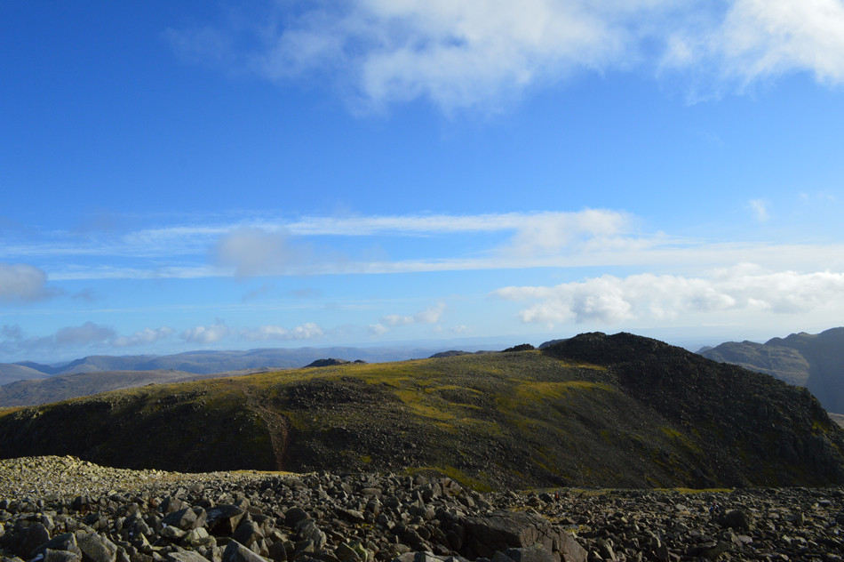
| A spectacular view down the Cockley Pike ridge with extended views over Great Moss and the River Esk. |
| That's Pen over on the right. |
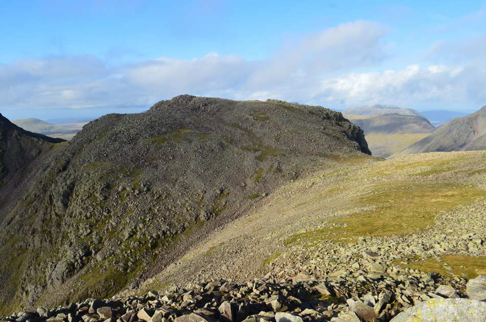 |
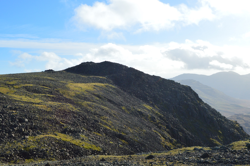
| Broad Crag and Broad Crag Col taken during the descent of III Crag. |
| |
 |
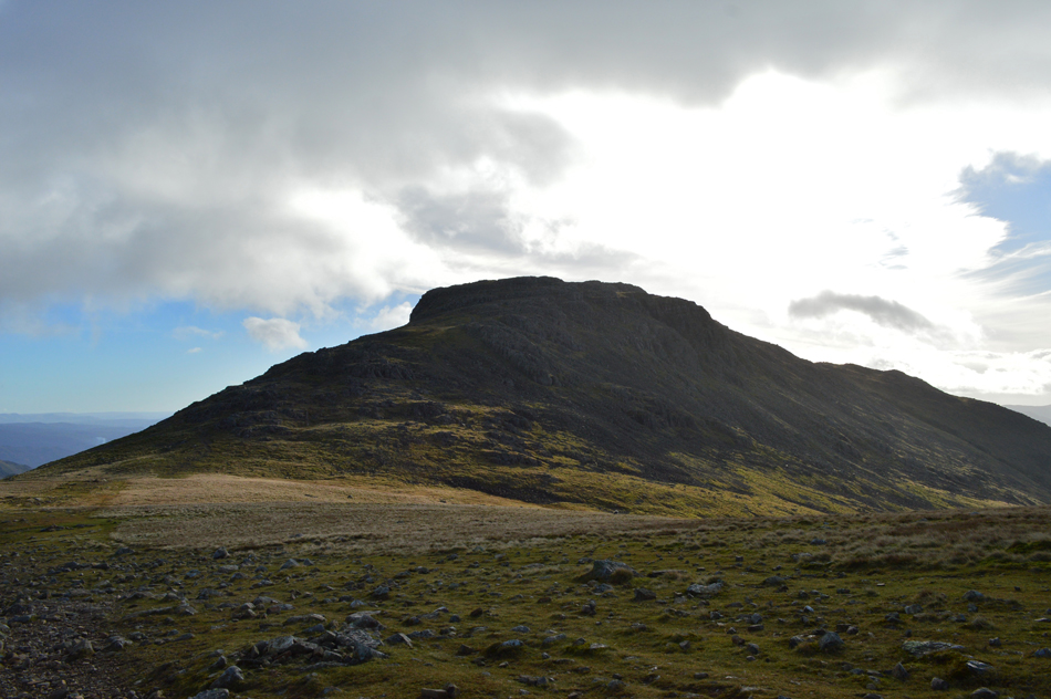
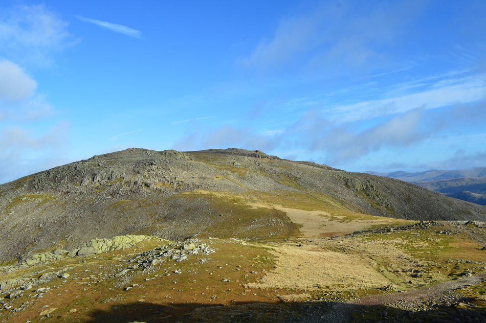
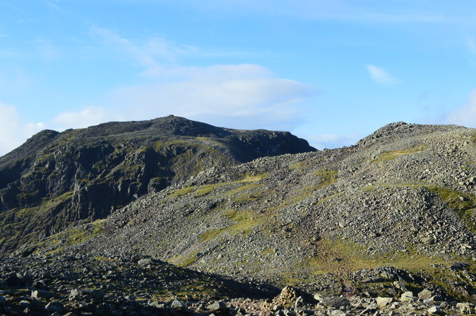
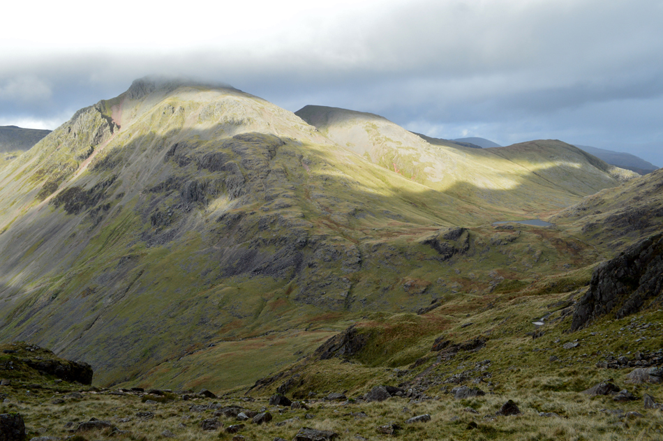
| Returning to Great End seen over the top of Calf Cove. |
With both Broad Crag and III Crag behind me it was time to return to the top of Calf Cove during which time I pass a young man who had just left the path on route towards III Crag summit "are you heading towards III Crag I asked?" He looked puzzled but agreed "just be careful I explained, the rock is extremely slippery" and with that he smiled and thanked me. I crossed the boulders once again and before I dropped onto the grass col below I pass a trio of walkers all of whom smiled a Hi in passing.
I drift to the left of the Col where I try to do a recce but it's impossible, the ground falls steeply away a sure indication of the steep gradient, at this point I saw no point in descending only having to re-ascend after my recce was complete, so I decide to summit Great End then return to the grass Col afterwards. |
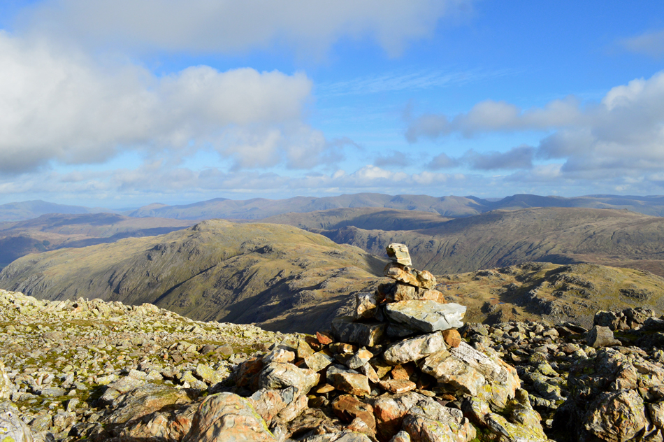 |
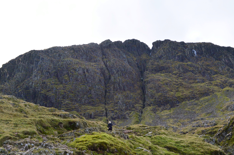
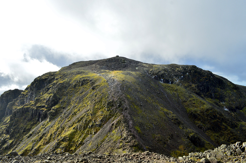
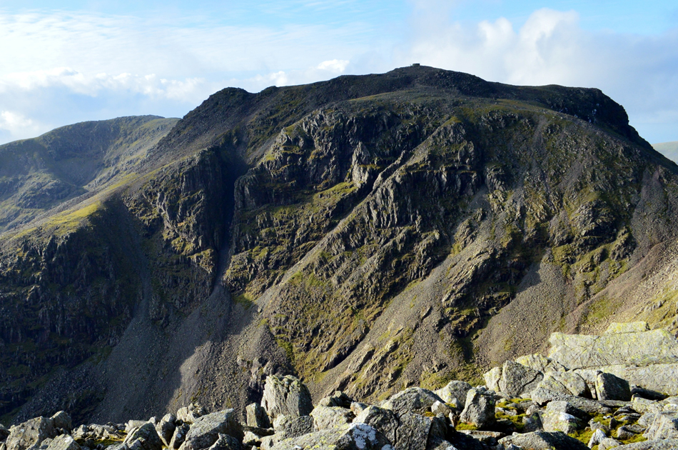
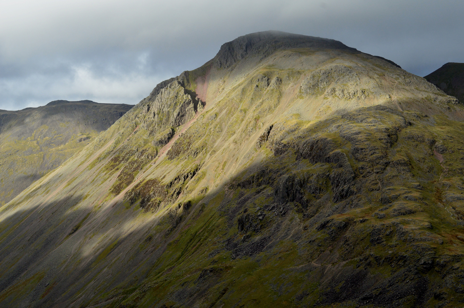
| Allen Crags and Glaramara from Great End summit |
| In good spirit I marched towards Great End summit not stopping until the summit cairn was reached where I found I had the summit to myself, ordinarily I would have found time to do some exploring especially from the top of Central Gully but Lambfoot Dub and my subsequent descent was playing on my mind, I needed to return to the grass Col at the top of Calf Cove. |
 |
| III Crag and Scafell Pike from Great End. |
| |
 |
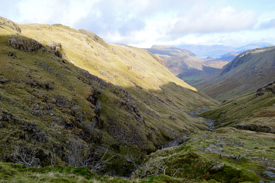
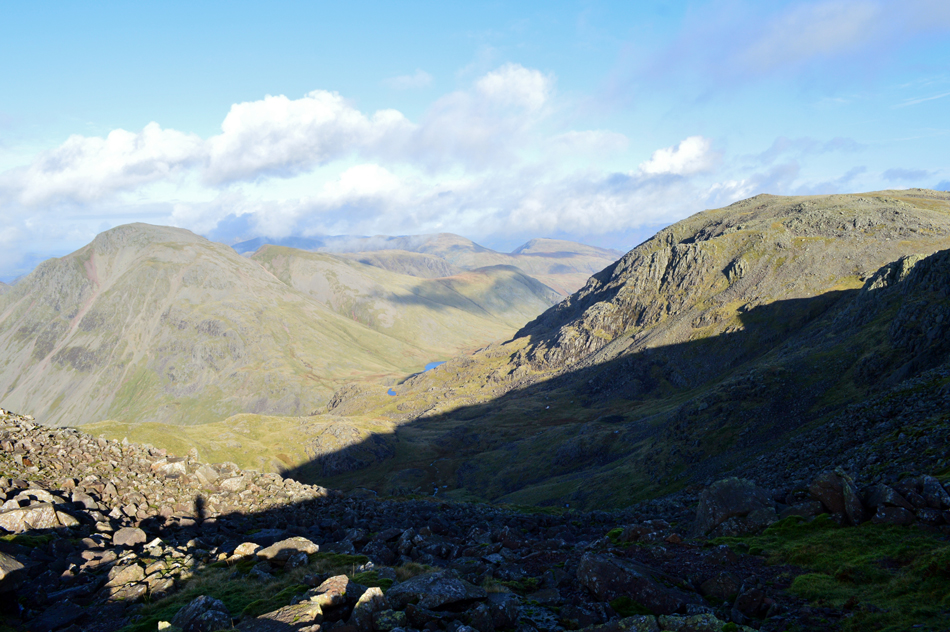
| The view down from the grass Col taking in Lingmell, Kirk Fell, Pillar, Scoat Fell and Red Pike (Wasdale) |
| After taking a look at this view you might understand why I didn't descend to carry out my recce, this is a known route, nevertheless I still need to feast my eyes on the ground to make sure I'm good with the descent. |
 |
| That view though !!! |
| |
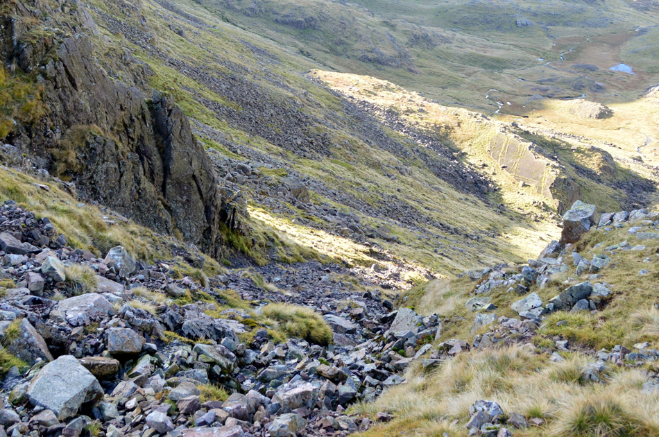 |
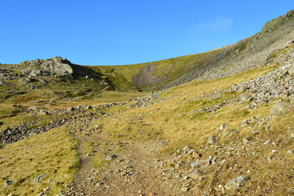
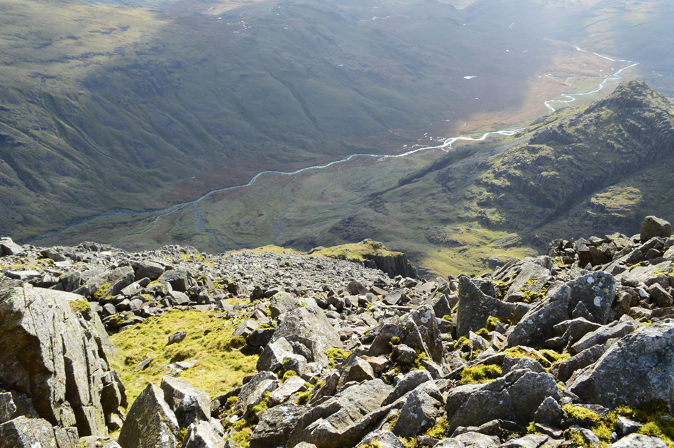
| Descending the rough scree/stream bed. |
| After peering down the scree I found a narrow path to the left of the scree/steam bed and I slowly zigzagged my way down, the stream below the scree is a contributor to Greta Gill some 600ft below. I carefully descend the scree revealing that earthy smell you only find once undisturbed soil has been disturbed. My mind tells me to sway right but this will only land me on the rock slabs to the west of Great End's summit, I continue all the way down the scree which naturally curves towards the right as I approached its base. |
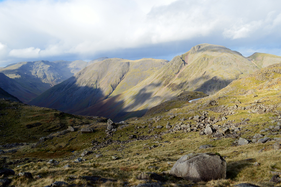 |
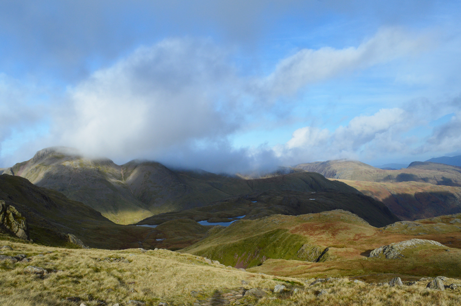
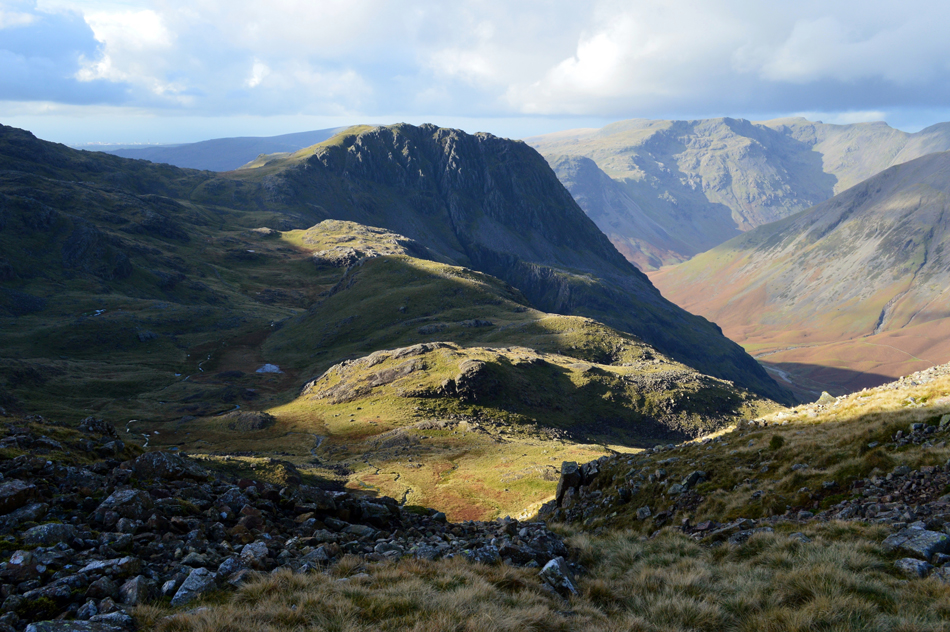
| Great Gable. Green Gable and Kirk Fell seen as I Lambfoot Dub comes into view. |
Despite the overall popularity of some of the highest and most popular ground in England just 500ft above my head the feeling of isolation down here is over whelming. |
 |
| Looking back on my route dominated by the summit of Long Pike overhead. |
| |
 |
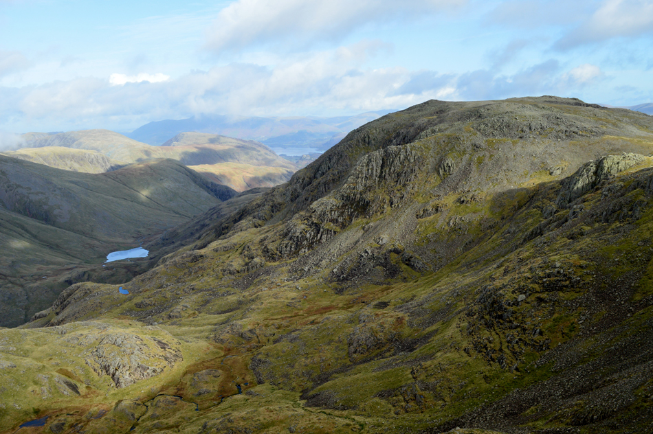
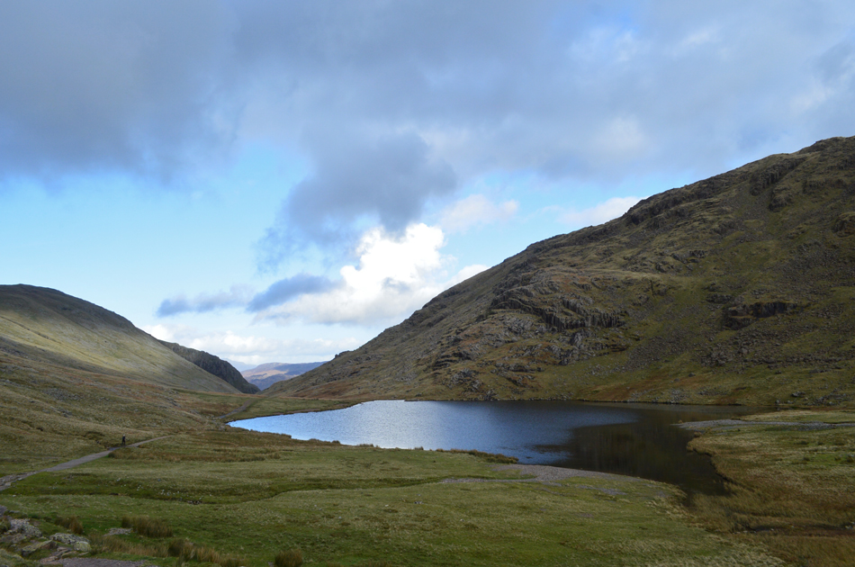
| The Gables seen from Lambfoot Dub. |
By the time I arrived at lambfoot Dub it had clouded over once again which only added to the eeriness which can only be attached to something so isolated.
Dare I say after all these years wanting to visit Lambfoot Dub my inner emotions take over, what a place. |
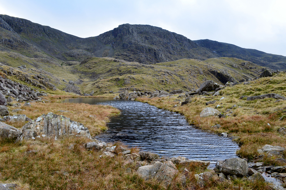 |
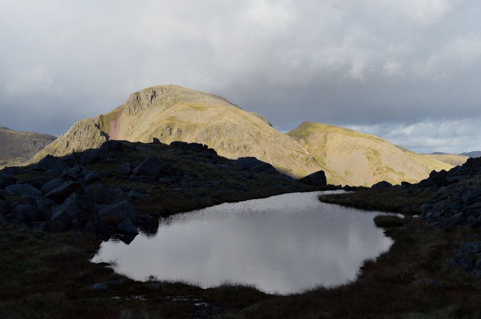
| Round How, Broad Crag and Scafell Pike from Lambfoot Dub. |
I found myself a rock to perch upon and began to soak in the atmosphere witnessing the different light whilst a cold wind descended bringing with it a wind chill that I hadn't felt all day. Everytime I went to leave I couldn't pick myself up, and when I did, I returned.
Spiritual. |
 |
| Great Gable, Green Gable, Base Brown seen over Sty Head and Styhead Tarn taken during descent from Lambfoot Dub. |
| After tearing myself away from Lambfoot Dub I descended a grassy trod finding just the odd rock scree to navigate around, incredibly the Corridor Route was by now just 200ft below and can clearly be seen during most of the descent. |
 |
| A close up of Great Gable, Great Napes and Kern Knotts. |
| Where it appears cloud is about to descend onto Gable's summit. |
 |
| The wider view. |
| As the Corridor Route also comes into view below. |
 |
| The Gables from the Corridor Route. |
| |
 |
| Kirk Fell, Great Gable and Green Gable from the Corridor Route. |
| With Lingmell Beck below. |
 |
| Styhead Tarn from Sty Head. |
Having reached the Corridor Route I kicked my feet into the back of my boots and began the walk back to Sty Head passing Skew Gill where I left the path and ascended for a better view into the Gill which never materialised as the light began to fade. I rejoined the path again and made my way through the boggy area around Spout Head before emerging at Sty Head. I hadn't eaten anything other than the two bananas I had for breakfast this morning and figuring I'd earned myself my lunch I de-shouldered my pack and took out the cheese salad wrap that I'd made the night earlier.
On re-shouldering my pack I noticed movement on the Corridor Route then realised it looked like the woman fell runner who passed me this morning; Cheese wrap in hand I walked the path besides Styhead Tarn before the fell runner caught up with me who then shared me her route, it turns not only had she summited Great End but Scafell Pike and Lingmell too completing with an hour to spare ready to do the school run.
Occasionally l look back at Great End and Broad Crag whose summits are by now below cloud. The view was gloomy but befitting to an otherwise perfect walk along England's highest ground. |
|
| |
| Back to top |
 |
|