|
Walking the Birketts, Over Seat Sandal to Fairfield |
 |
 |
14th October 2018 |
 |
|
With the tail end of Storm Callum behind us here in the North West of England we are left licking our wounds no more so than Cumbria which experienced wide scale flooding closing roads and railways, thankfully however, flood defences held and so the clean up began. Storm Callum had spread eastwards all day Saturday and Sunday's forecast after a wet start looked decent enough for a walk, so after holding out until the last minute checking various conflicting forecasts in the end Rod and I emailed each other confirming we'd still be walking based on the fact that we'd already packed our packs.
Saturday evening came and through various social sites I was able to see first hand the flooding that had been left behind by the storm which left a number of roads closed one of which was the A591 at Grasmere. This of course would have had an impact on todays walk as we planned to meet a mile or so north of the village at Mill Bridge from where this walk officially starts. So after a lengthy detour to Penrith I dropped in on the A591 via the outskirts of Keswick, this after encountering a second road closure at the Stanah side of the B5322 where a flood damaged car had come to rest in the middle of the road. It was here I flagged down Rod before we drove south towards Grasmere coming to a stop at Mill Bridge around twenty minutes later than planned. |
|
| The Complete Lakeland Fells |
 |
| By Bill Birkett |
A strong mountain atmosphere pervades the tops of this delightful round high above Grasmere. |
|
|
|
| |
|
Overview |
|
|
| Ascent: |
2,862 Feet - 873 Metres |
| Birketts: |
4, Seat Sandal - Fairfield - Great Rigg - Stone Arthur |
| Weather: |
Overcast Throughout Turning Brighter PM, Feeling Mild, Light Winds Over The Summits. Highs of 11°C Lows of 10°C Feels Like 3°C |
| Parking: |
Parking Spaces, Mill Bridge A591 |
| Area - Group: |
Eastern - C-FAR |
| Miles: |
6.25 |
| Walking With: |
Rod Hepplewhite |
| Ordnance Survey: |
OL5 |
| Time Taken: |
4 Hours 5 Minutes |
| Route: |
Mill Bridge - Tongue Gill - Seat Sandal South Ridge - Seat Sandal - Grisedale Hause - Fairfield - Great Rigg - Stone Arthur - Brackenwife Knotts - Tongue Gill - Mill Bridge |
|
| |
|
Parking Details and Map, Parking Spaces, Mill Bridge A591 |
|
|
| Nearest Post Code: |
LA22 9RR |
| Grid Reference: |
NY 336 091 |
| Notes: |
Parking is strictly limted just to just two cars, taking care not to block accses to a farmers gate and the entrance to Mouray Cottage. Parking is free. |
|
| |
|
Map and Photo Gallery |
|
|
  |
| |
| |
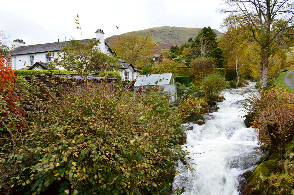 |
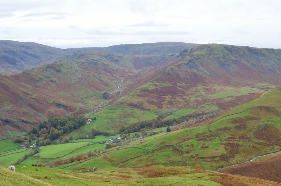
| Tongue Gill, Mill Bridge, Grasmere 12°C 8:50am |
Parking is strict at Mill Bridge allowing only two cars besides the Mouray Cottage, we were lucky finding the spaces empty. I'm not sure about Rod but I was happy to get out my car after detouring twice and after the usual greeting with a handshake I let out a mammoth stretch at the rear of my car, without haste we both started to boot up noting that traffic was travelling north along the A591 which left me wondering was the road now open which conflicted with the matrix signs on the M6 which stated that the A591 was closed, either way it was all forgot about rather quickly.
With our cars locked we crossed the road and found ourselves looking down on Tongue Gill which was pretty deafening to say the least but her banks held firmly to the comfort of Tongue Gill cottage just feet away. We're at the official starting point to todays walk where we will collect four Birkett summits starting first with Seat Sandal via its steep south ridge, from the summit we descend steeply crossing Grisedale Hause onto Fairfield before going on to summit Great Rigg from where a simple descent will lead us on to Stone Arthur, the twist in todays walk lies with the descent back to Tongue Gill via Brackenwife Knotts which I was really looking forward to. |
 |
| The Coast to Coast plaque. |
| We left the rapids of Tongue Gill which slowly faded into the distance along with the noise of the traffic passing half a dozen cottages as we headed towards Tongue Gill, the last cottage boasted this plaque just above the second floor window, I had seen the plaque before but I've also walked passed here a few times forgetting it was there and I wondered how many others have. |
 |
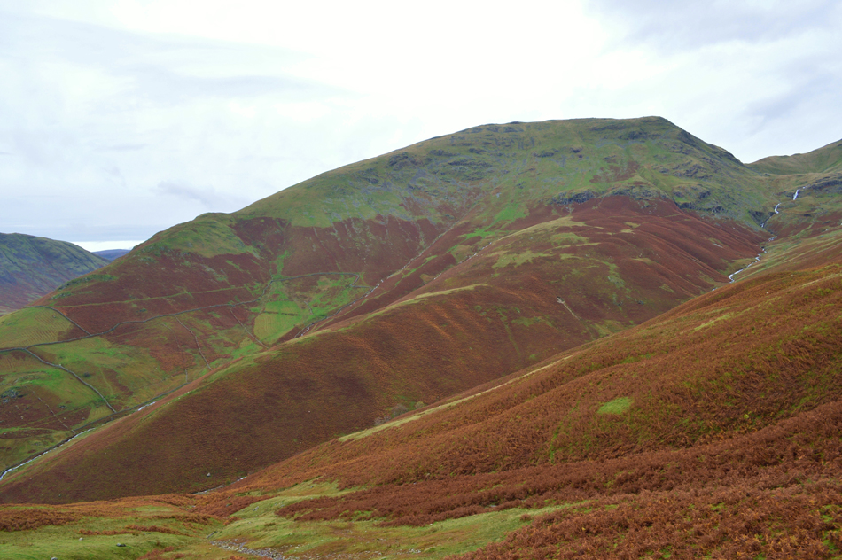
| Seat Sandal South Ridge and Seat Sandal from Tongue Gill. |
We followed the footpath which started to rise steadily as Tongue Gill fell steeply to our flank below, no matter the distance we were away from the rapids they were never far from earshot sighting the white squall through the tree branches from fifty feet above. Continuing we rise further along the stone track until a second gate is reached, the first only allowing access onto a private field. After passing through the gate we looked steeply up the nose of the south ridge "that doesn't look so steep"
Said no one ever. |
 |
| Looking back on Grasmere from Seat Sandal South Ridge. |
| Despite its prominent position over looking Dunmail Raise and Grasmere Seat Sandal is steep sided on all flanks where you will not find an ascent that doesn't get the calfs going and the lungs pumping, the south ridge is no different but we knew this and though sometimes panted breath we keep up conversation stopping once on the shoulder of the fell to look back down the ridge. |
 |
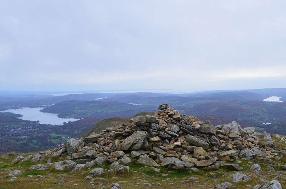
| St Sunday Crag, Cofa Pike and Fairfield from Seat Sandal summit cairn. |
| On reaching the shoulder of the summit we had gained the ridge in relative comfort where we stopped again to look over the cloud which was forming on Willie Wife Moor which had been rising from the shores of Thirlmere for the past ten minutes or so. With the shoulder now behind us three summit cairns appeared with the furthest away being the highest while close by, a somewhat disheveled summit shelter. By now we could feel the affects of the windchill which nipped at exposed skin so before we start the steep descent to Grisedale Hause it's best we deshoulder packs at the summit and add extra layers. |
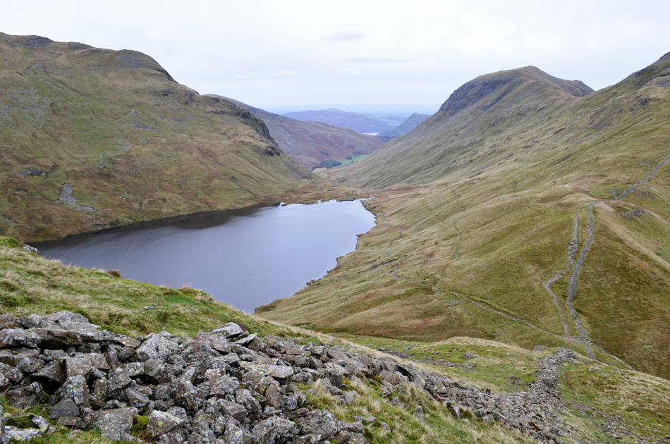 |
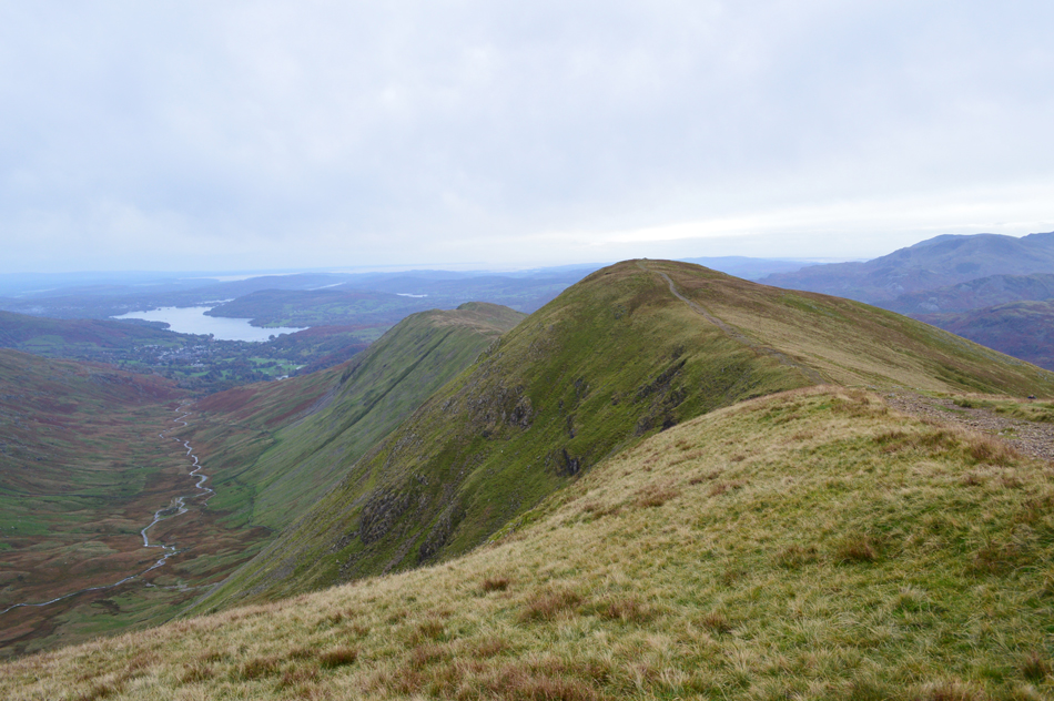
| Descending Seat Sandal with views over Grisdale Tarn towards Dollywagon Pike, the Grisedale Valley, St Sunday Crag and Fairfield. |
| Here the path is steep where despite there being a well trodden path to follow the descent is heavily eroded and care should be exercised. |
 |
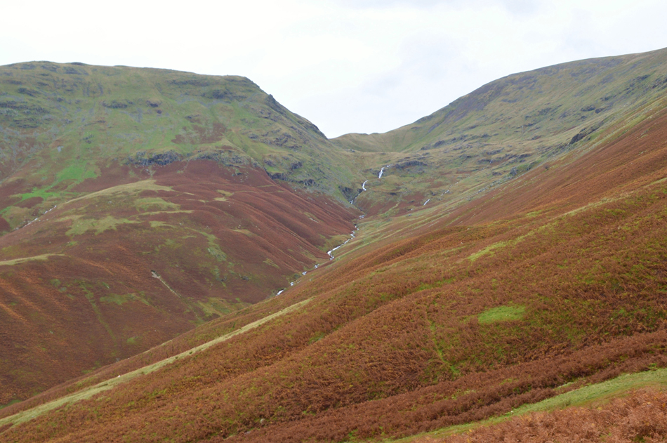
| St Sunday Crag and Fairfield seen over Grisedale Hause. |
We hadn't seen anyone except for the walker we spied standing on the summit of Dollywagon Pike but we were soon joined by groups of fell runners making their ascent on Seat Sandal from Grisedale Hause one of whom had a dog with them as I glance over at Rod
"Paul, the dog is not lost" I'm never gonna hear the end of that am I !! |
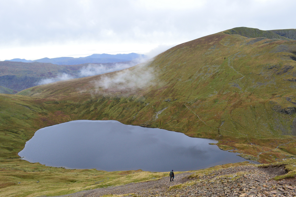 |
| Views down on Grisedale Tarn with Dollywagon Pike behind. |
| Having crossed Grisedale Hause we started our ascent on Fairfield by following the steep steps which rose into zigzags around the waist of the fell. We had been protected by the chill but with the summit shoulder almost reached those sudden burst of cold air were now upon us. |
 |
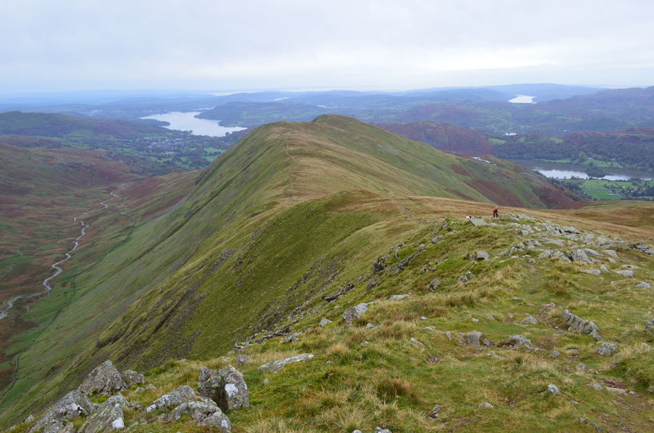
| Looking back on Seat Sandal from the ascent of Fairfield. |
| We'd made good time during our ascent only stopping the odd once to look back on the cloud we'd seen earlier which had almost risen to the summit of Dollywagon Pike before breaking southwards across the slopes of Seat Sandal. |
 |
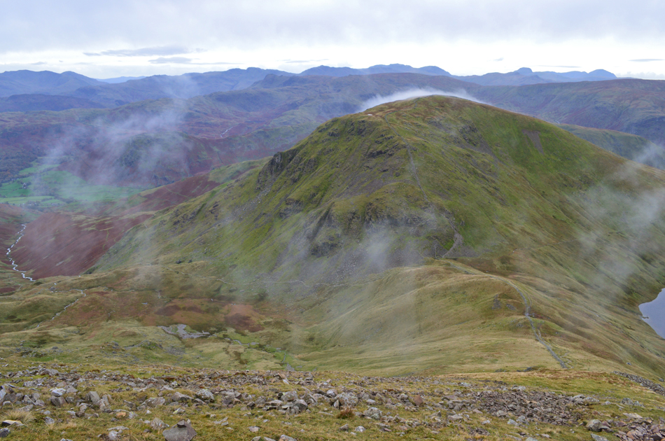
| Great Rigg from the ascent of Fairfield. |
| "Why is that Herdie looking at you Rod" "because it thinks I'm George Clooney" sigh...thats one long standing joke to many! moving on... |
 |
| The view over the Grisedale Valley towards Dollywagon Pike, High Crag, Nethermost Pike and Helvellyn. |
| That's Falcon Crag in the foreground with The Tongue descending from Dollywagon Pike summit, behind is the infamous Nethermost Pike east ridge with Striding Edge in the distance. |
 |
| Deserted Fairfield summit. |
| Having reached the shoulder of Fairfield via the steep zigzags we continued over eroded ground towards the summit which we found to be deserted, of all the summits over 2,000ft Fairfield at times, despite its popularity can feel as lonely as some of the western summits of equal height and today, for just a few moments before two fell runners arrived we had the summit to ourselves along with a chilled wind. |
 |
| Fairfield summit shelter. |
| Here looking towards the western, and north western fells while beyond, a cloudless sky on the horizon which was forecast to push eastwards into the afternoon. |
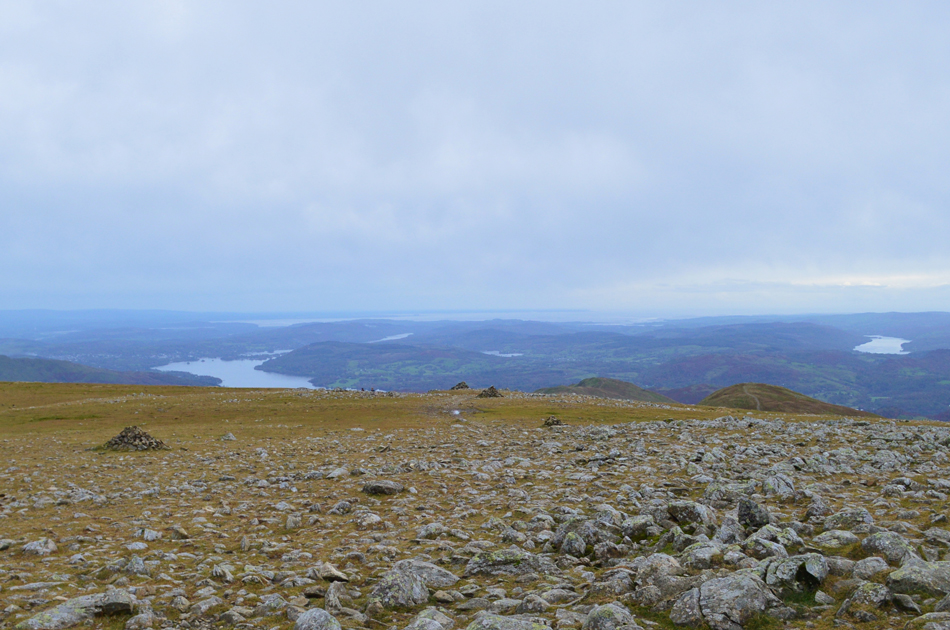 |
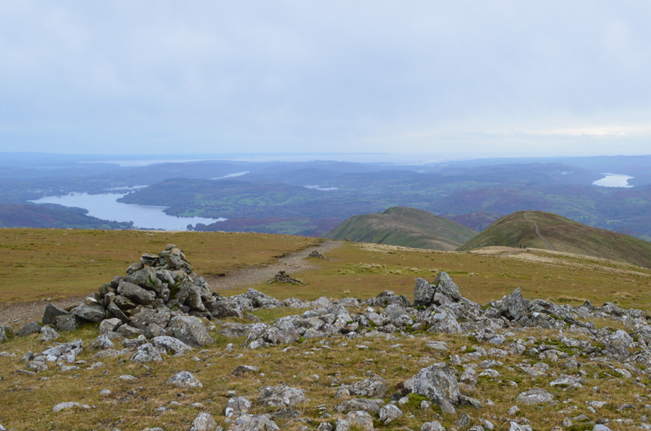
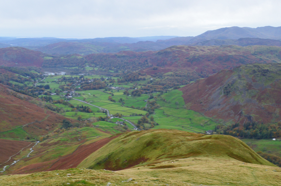
| Long distant views over Morecambe Bay, Windermere, Esthwaite Water and Coniston from Fairfield. |
| The two peaks seen over on the right are Great Rigg and Heron Pike which form the western side of the popular Fairfield Horseshoe. |
 |
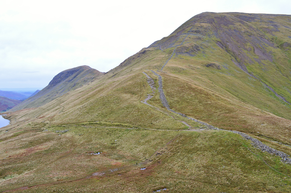
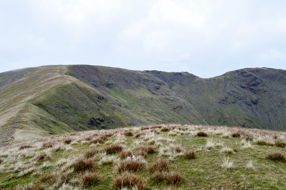
| Great Rigg seen over Calf Cove. |
| With the Rydal Valley below. |
 |
| The view back over Fairfield towards Dollywagon Pike. |
| Where is everyone? |
 |
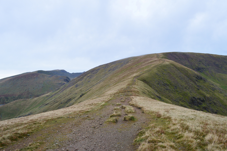
| Here we peer over Calf Cove towards Fairfield, Link Hause and Hart Crag. |
| It was here memories came flooding back of the ascent David and I made on Link Hause from the Rydal Valley, the ascent from here looks pretty steep but looking back it wasn't any steeper than lets say todays ascent on Seat Sandal, we press on towards Great Rigg. |
 |
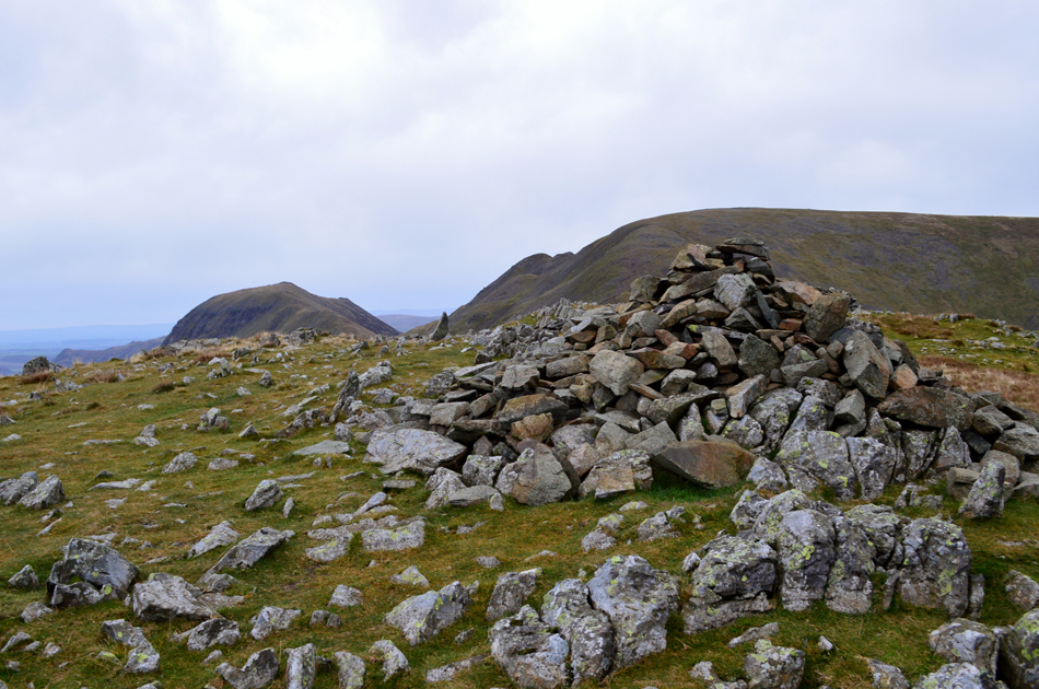
| Great Rigg summit. |
| After an easy pull we arrived at Great Rigg summit cairn, the wind had eased slightly but not enough to start removing the extra layers just yet. After passing four walkers heading for Fairfield we began the short descent south along the shoulder of the summit while taking in the view of Windermere and Morecambe Bay beyond. |
 |
| Heron Pike and Erne Crag from the descent of Great Rigg. |
| With Grasmere coming into view over on the right. |
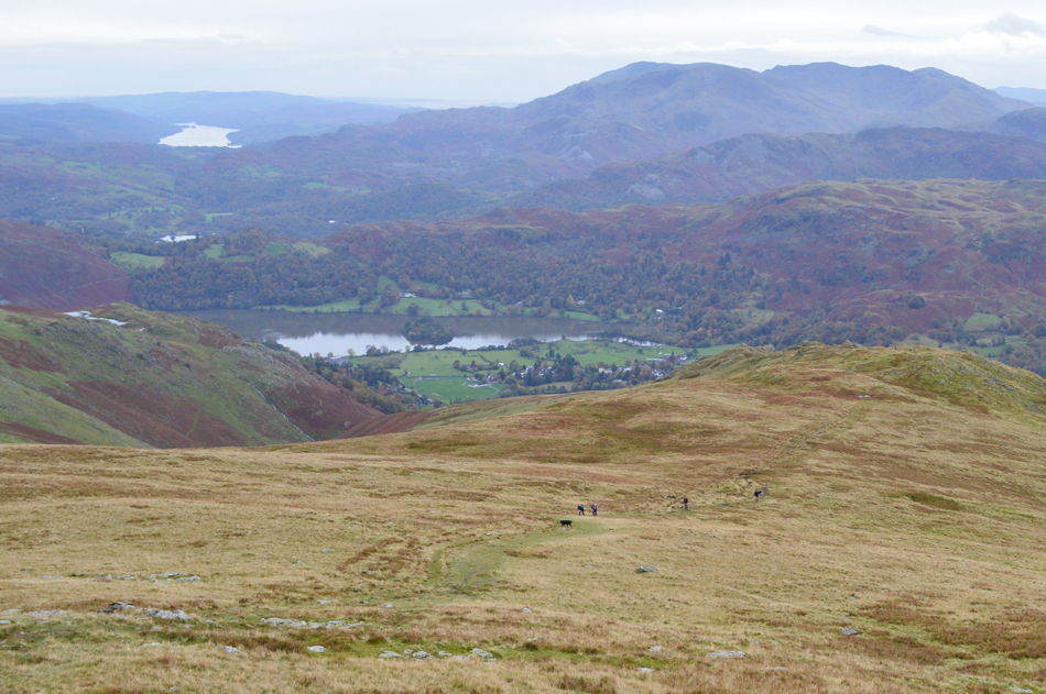 |
| Leaving the ridge we continue to descend towards Stone Arthur. |
| By now the majority of people we had seen all morning were fell runners and we're about to pass four more heading for Great Rigg from Stone Arthur, to our right flank two women fell runners who descend a pathless route into Tongue Gill which looked steep and difficult underfoot, our route was quite the opposite with soft and sometimes boggy grass to descend by with just the odd scurry over rock thrown in. |
 |
| The view over Grasmere from Stone Arthur summit. |
| Not forgetting the previous days floods which were evident in the fields below. |
 |
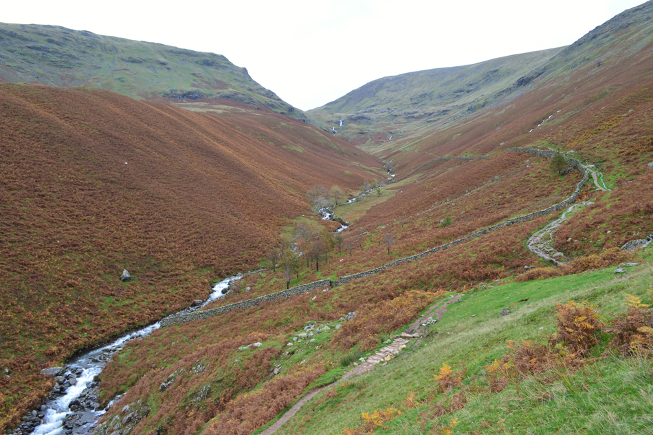
| Descending via Brackenwife Knotts with views into Greenburn and Greenup Edge beyond. |
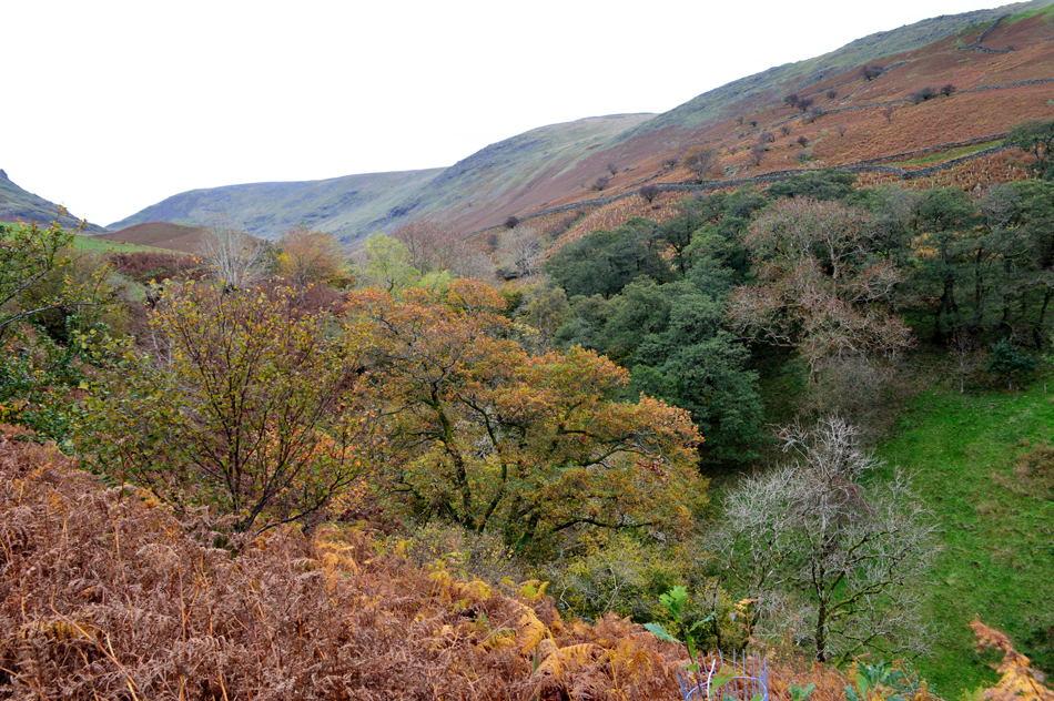
I'd been looking forward to this last section of the walk which took us back to Tongue Gill from the top of Brackenwife Knotts. It's not a popular route making it a steep pathless descent all the while the view is captured by the dominance of Steel Fell, Seat Sandal and the Greenburn valley.
From Brackenwife Knotts the ridge is not so apparent so we descend grassy shoulder over grassy shoulder until we spotted the wall seen in the lower left of this picture, spotting the wall meant we were in line with the ridge which we had surveyed from the lower slopes of Seat Sandal earlier, however the line of descent we had decided on required us to sway right towards a second wall seen lower right, this would drop us almost on top of the footbridge over Tongue Gill seen close to the Ford seen on the 1:25 000 map |
 |
| Views over The Tongue Gill towards Great Tongue and the mass of Seat Sandal. |
| No sign of the two off peak fell runners who would have to have descended through the bracken seen over on the right. |
 |
| A close up of Hause Gap. |
| With Seat Sandal seen left and Fairfield, right, incidently the hollow below Hause Gap is known as Hause Moss. |
 |
| The view through Tongue Gill. |
| At times we had managed to follow the odd sheep trod before passing through a large section of bracken ourselves where a path had been worn through over time, soon we found ourselves at the corner of the wall looking down on the ruins of the old Iron mine below. |
 |
| Tongue Gill. |
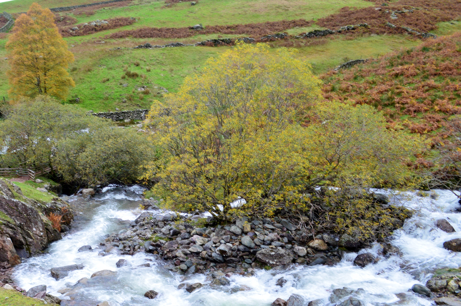
| With the descent behind us we followed the valley footpath towards the footbridge seen left where the beck steeply falls into Tongue Gill, around half a mile later Tongue Gill flows below the A591 from where I took the picture at the begining of my report. Seeing water for me in such spate is awe inspiring such the power and noise the rapids create before being managed by man down further down stream where a Hydro Dam has just been completed. |
 |
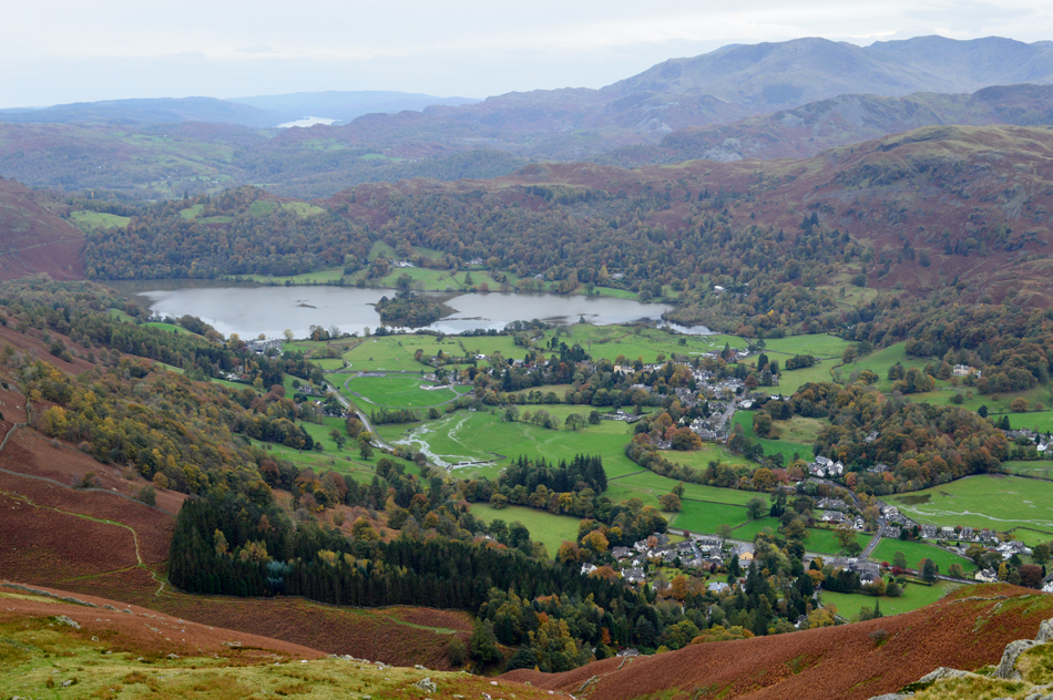
| Autumn in Tongue Gill (ravine) |
| With views extending as far as Fairfield and Great Rigg. |
 |
| Almost back at the cars now. |
Having peered down at the falls from the footbridge over Tongue Gill all that was left was to cross the Ford which too, was in spate, taking no chances we used the footbridge then followed the stone footpath as Tongue Gill fell steeply, this time to our left flank as Grasmere slowly sank below the tree line then out of sight. The traffic from the A591 brought us back to reality which before crossing we took a second look from the road bridge from which we had stood at just over four hours earlier.
Crossing the road took minutes rather than seconds as we waited for the traffic to pass soon arriving at our cars where we took off our packs and removed our muddied boots.
... happen I'll chance it through Grasmere on my way home. |
|
| |
| Back to top |
 |
|