|
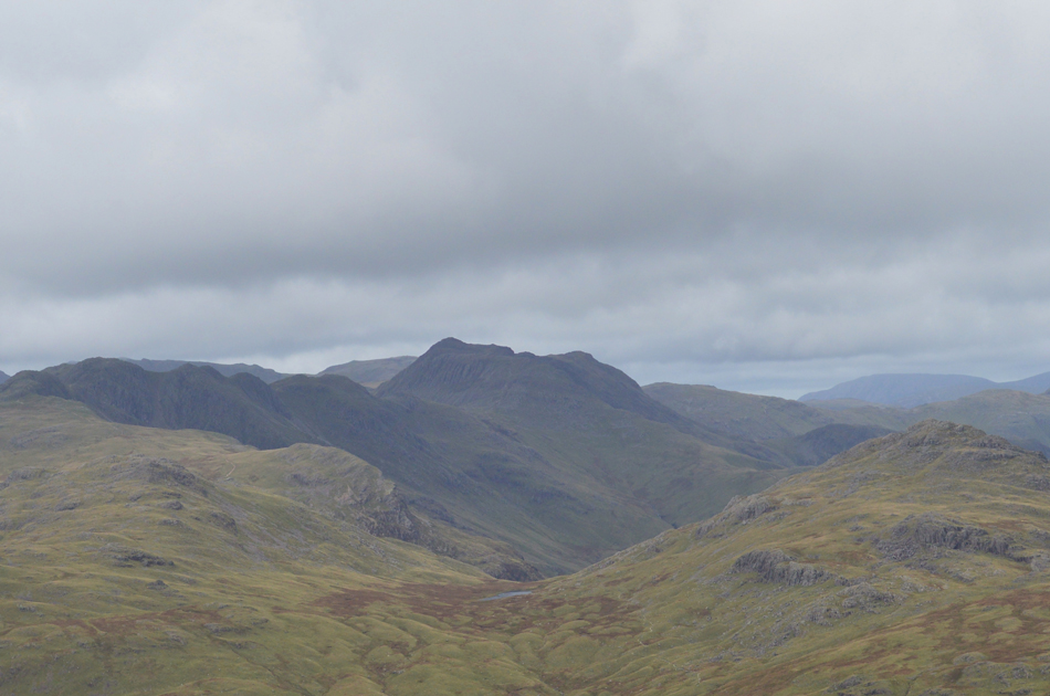
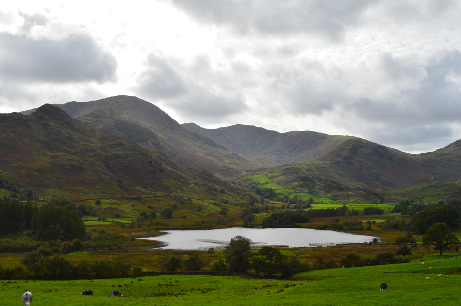
Broad Slack and Wetherlam from Elterwater |
 |
 |
22nd September 2018 |
 |
|
Well the trio are finally back together after a staggering two month break which can be put down to holidays and work, it happens I guess. Storm Ali had battered the Lake District during the mid week leaving felled trees in its wake and not to mention some very unsettled weather which even had the forecasters guessing what will happen next.
As it turns out today Saturday had remained dry with even some sun forecast throughout the day so we turned our attention to a walk that David had previously walked alone and simply wanted to repeat again so he asked myself and Rod would we join him and of course we jumped at the chance.
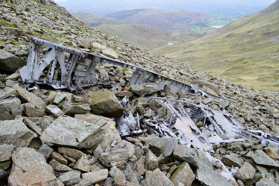
The main aim in todays walk was not Wetherlam but to visit the Bomber wreckage which had been pushed into Broad Slack after crashing during bad weather on Great Carrs back in October 1944. A memorial still stands at the crash site alongside part of the landing gear but we wanted to explore, and of course share what remains of the wreckage located below in Broad Slack. |
|
| Wainwright Guide Book Four |
 |
| The Southern Fells |
| -Swirl Hawse Swirl Hawse is a true mountain pass, a neat and narrow defile with a small summit marked by a big cairn. |
 |
|
|
|
| |
|
Overview |
|
|
| Ascent: |
3,276 Feet - 999 Metres |
| Wainwrights: |
Wetherlam |
| Weather: |
Dry But Overcast, Some Sunny Spells. Feeling Brisk Over The Summits. Highs of 15°C Lows of 10°C |
| Parking: |
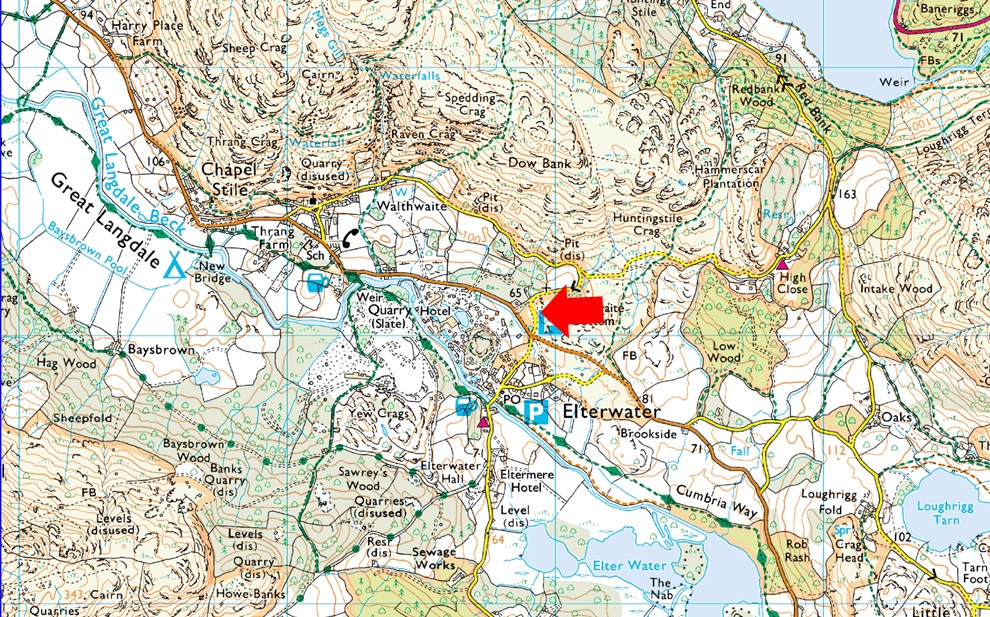
Car Park, Walthwaite Bottom, Elterwater |
| Area: |
Southern |
| Miles: |
10 |
| Walking With: |
David Hall & Rod Hepplewhite |
| Ordnance Survey: |
OL6 |
| Time Taken: |
7 Hours 10 Minutes |
| Route: |
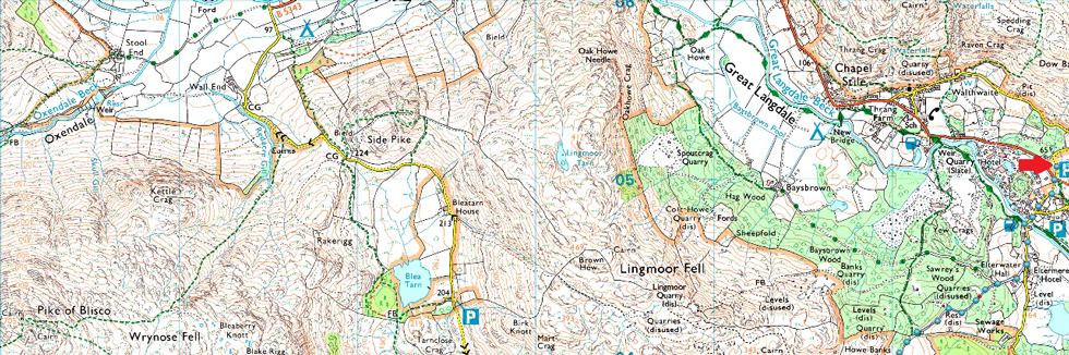
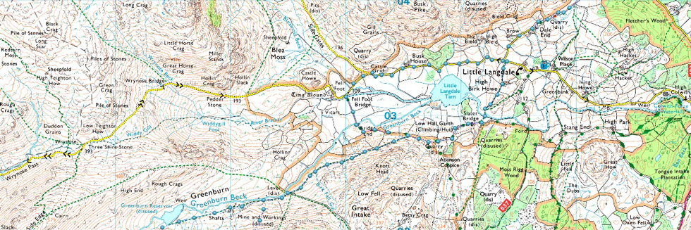
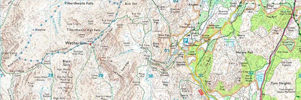
Elterwater - Elterwater Hall - Dale End - Little Langdale - Slater Bridge - Greenburn - Greenburn Reservoir - Broad Slack - Swirl Hawse - Wetherlam - Wetherlam Edge - Slater Bridge - Little Langdale - Dale End - Elterwater Hall - Elterwater |
|
| |
|
Parking Details and Map |
|
|
| Nearest Post Code: |
LA22 9QZ |
| Grid Reference: |
NY 329 705 |
| Notes: |
A small car park just outside the village of Elterwater Walthbottom provides access to the fells around Great Langdale, Little Langdale and of course Elterwater. Parking is free. |
|
| |
|
Map and Photo Gallery |
|
|
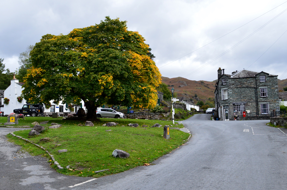 |
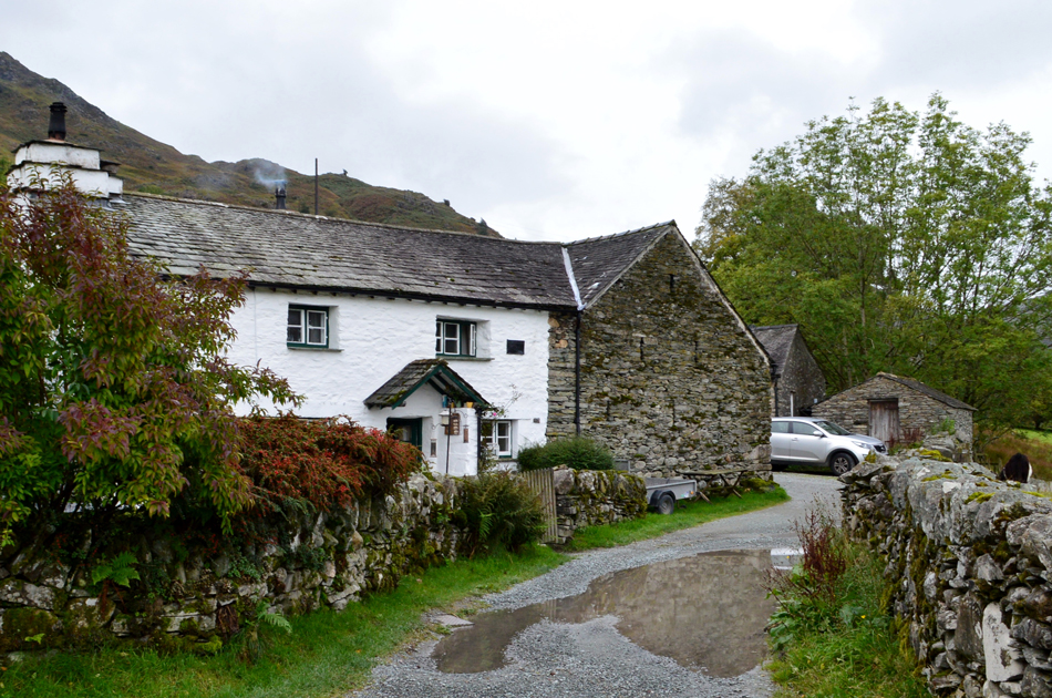
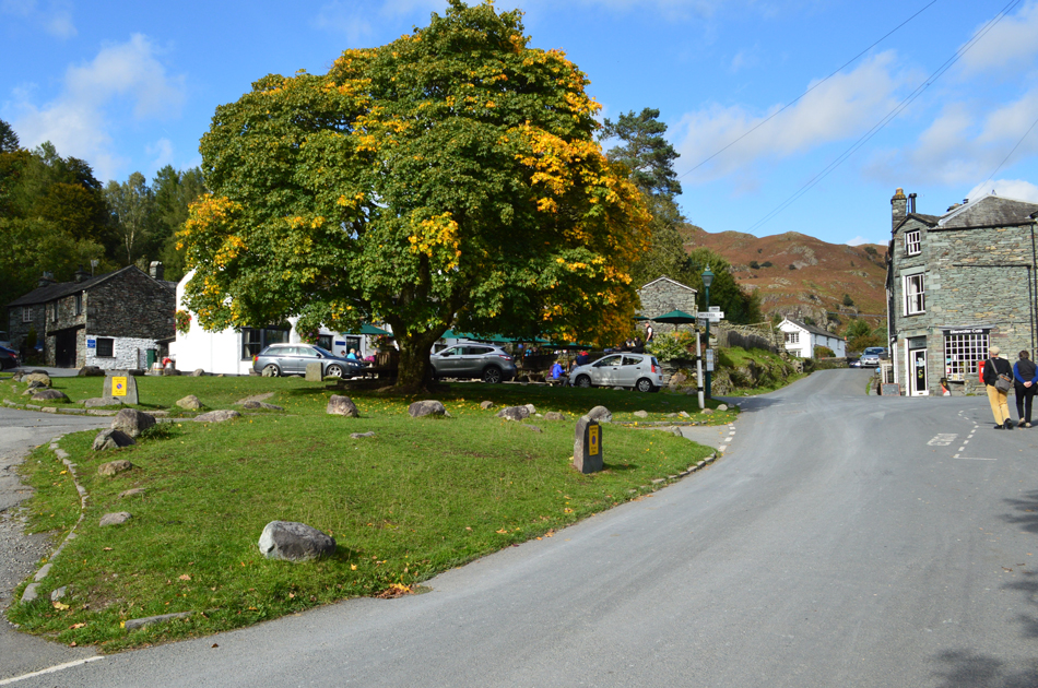
| The Maple Tree outside the Britannia Inn, Elterwater 08:30am 10°C |
We had agreed to meet at 08:30am just outside Elterwater at the parking spaces at Walthwaite Bottom and arrived simultaneously at around 08:20am...thats three blokes arriving from three corners of the country within five seconds of one another as David so aptly put it! As it turned out Rod had followed me in from Ambleside and we both so happened to arrive at the same time as David. There were plenty of spaces so we parked side by side and greeted with the usual handshakes, behind us, the owner of a camper van is cooking bacon which smelled positively delicious "gan ask can he cook three more" David laughed.
It's a brisk morning with the morning temperature just into double figures but it feels cooler than of late and unlike our last walk we'd ditched the shorts for long trousers. Kitted up we locked the cars and headed into the hamlet of Elterwater passing the Britannia Inn and the familiar Maple tree which is just starting to show its autumn colours. We continued and crossed the bridge over Great Langdale Beck before turning right on the outskirts of the village at a sign posted Coniston. |
 |
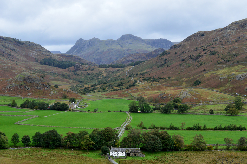
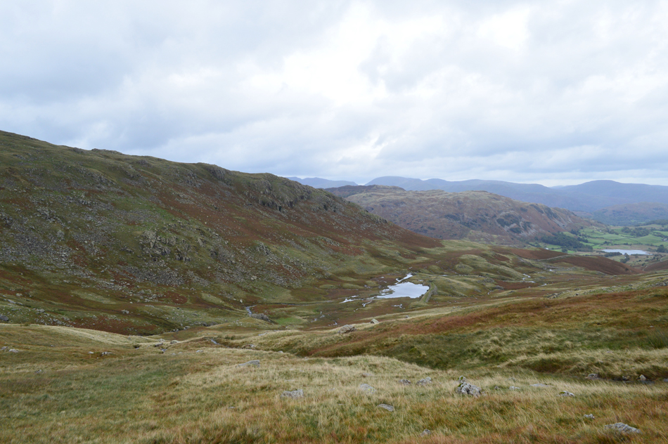
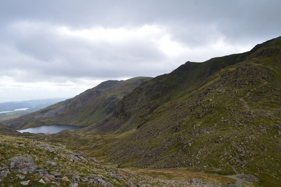
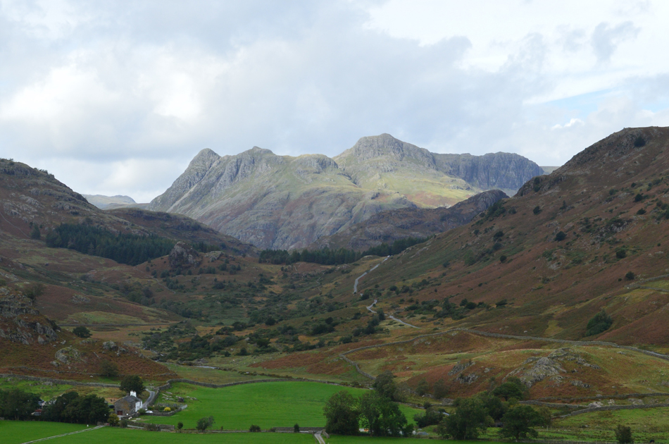
| Views over Dale End Farm towards the Greenburn Valley. |
The tarmac road came to an end as we entered Sawrey's Woods and under rough track we made our way towards Dale End where we were treated to our first view into the Greenburn Valley.
Just in case you were wondering that's Wetherlam over on the left with Swirl How and Great Carrs in the distance, Broad Slack can be seen at the head of the valley between Swirl How and Great Carrs. |
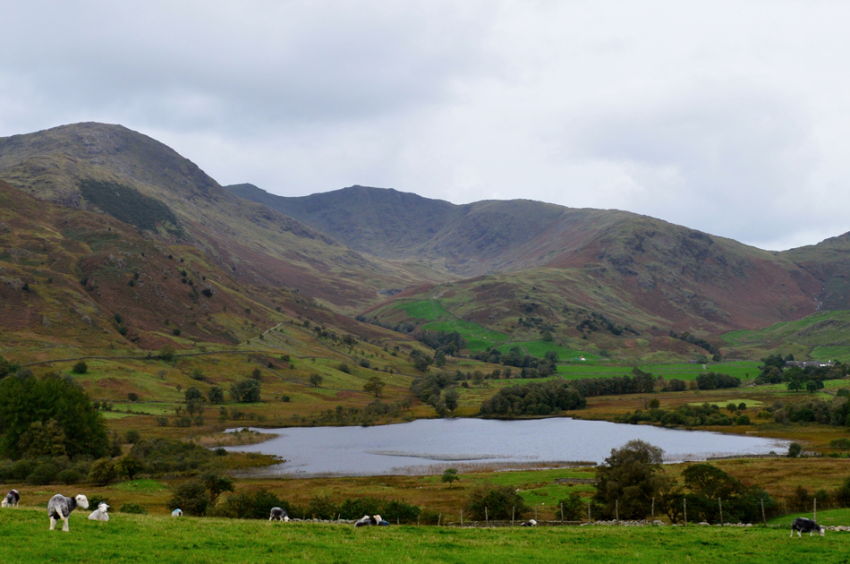 |
| The Greenburn Valley from Little Langdale Tarn. |
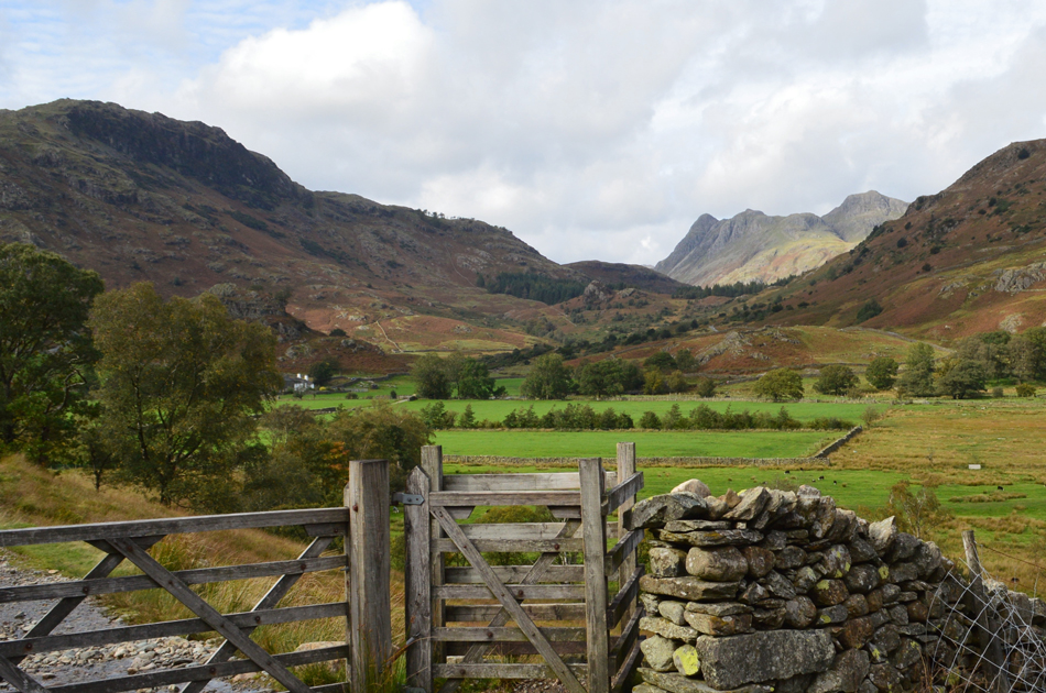
| Having left Dale End behind we crossed into Little Langdale then followed the track descending slightly towards Slater Bridge. |
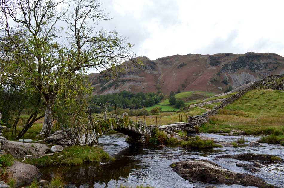 |
| Lingmoor Fell from Slater Bridge. |
| Perhaps, the most photographed bridge in Lakeland. |
 |
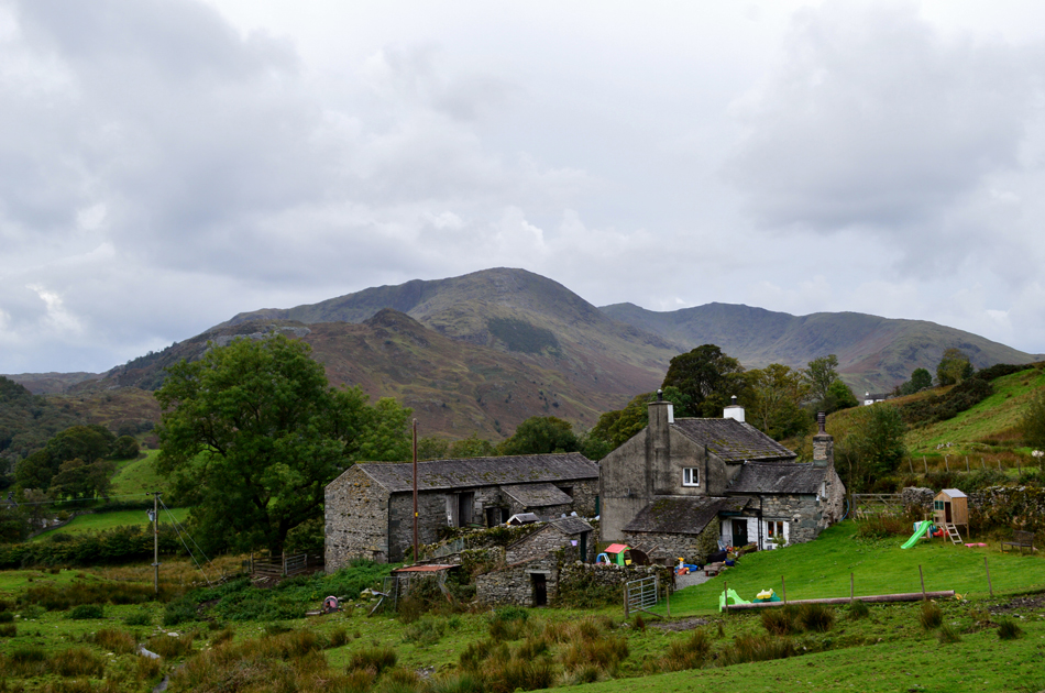
| Passing Low Hall Garth. |
| Back at Slater Bridge there was the distinct smell of wood burn in the air and it was here at Low Hall Garth where it was coming from, you do get used to the seasonal smells of Lakeland and wood being burned in a wood burner is certainly one of them, you kind'a miss it during the Summer months. |
 |
| The view over Little Langdale towards the Langdale Pikes. |
| It's still a little gloomy at the moment but it's forecast to pick up later in the day. Incidentley that's Bridge End Farm in the foreground which we'll be passing during our walk back through Little Langdale later. |
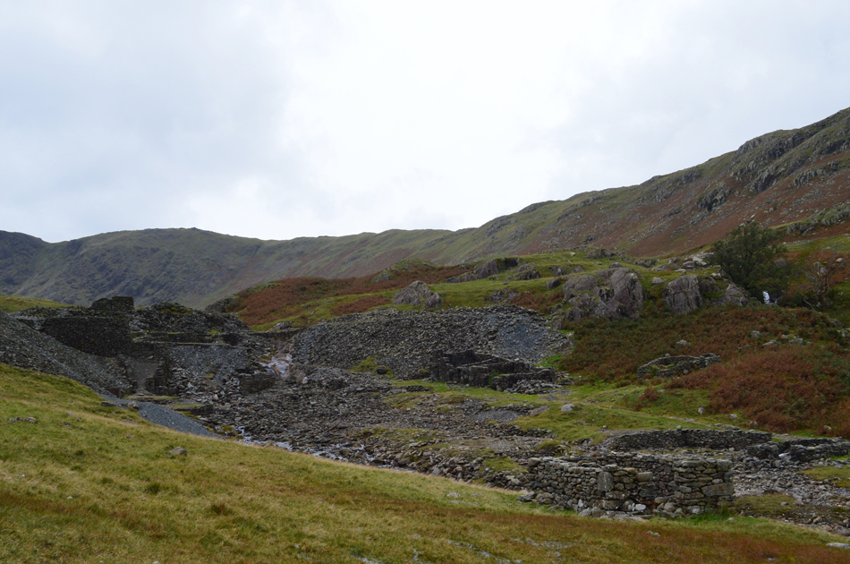 |
| Greenburn Copper Mine. |
| The Coppermine was a hub of activity here in Little Langdale from the 1600's right through to the 1940's |
 |
| The site of the waterwheel shaft at the head of the mine. |
| One can only imagine how industrious Greenburn would have looked during the middle of the 19th Century when output was at its greatest, it's taken us the best part of half an hour to reach the mine mainly over level ground but in Winter this valley along with working conditions would have made life difficult for the miners who worked not just here, but all over Lakeland. |
 |
| Looking back on Wetside Edge seen over Greenburn Reservoir as we head further into the valley. |
| Having left the mine our path teetered into nothing and soon we found ourselves walking over pathless, steep boggy ground. The head of the valley seemed to be made up of two steep shelfs, here we stop and look back from the first, and also the wettest. |
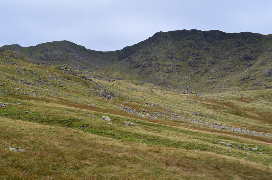 |
| Swirl How, Great Slack and Great Carrs comes into view. |
| Having passed the first shelf we maintain height by keeping to the left while heading below the craggy outcrop you see up ahead, having an eye for the lay of the land is vital and reduces wasting energy which I'm sure will be needed before we climb into Broad Slack. |
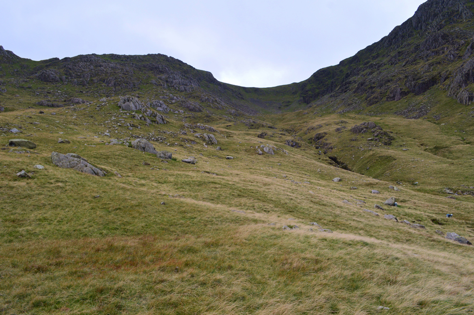 |
| Broad Slack. |
Having reached the head of the second shelf Broad Slack was presented before us, but, in order to reach its base we would need to navigate around a bowl of boggy ground, here we keep left while maintaining height before starting the climb on Broad Slack.
From the base of Broad Slack we still couldn't see the wreckage and although myself and Rod never spoke of it I wondered what size of wreckage was I expecting to find. |
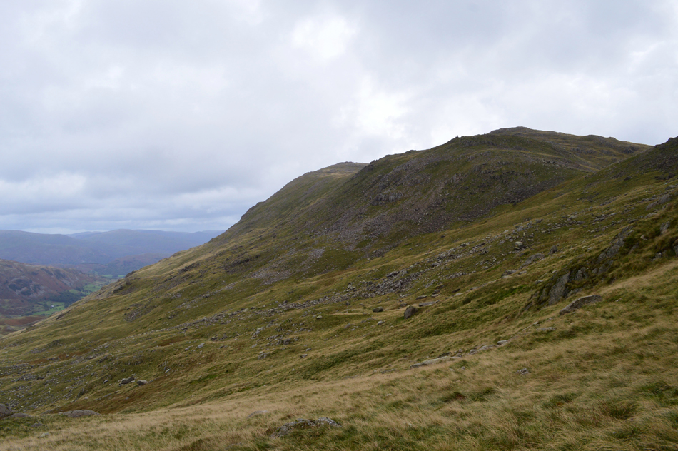 |
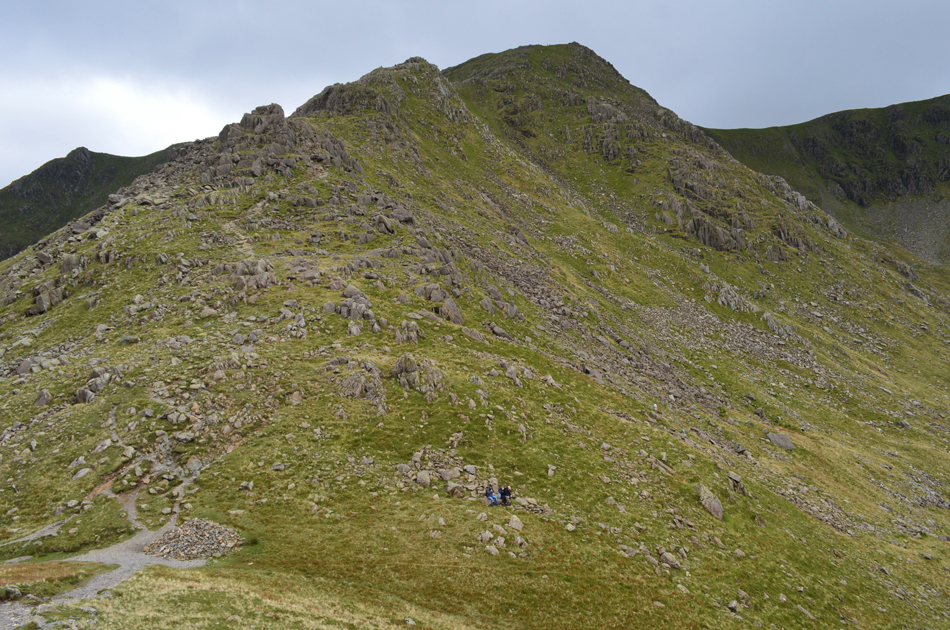
| Looking back on Black Sails and Wetherlam from Broad Slack. |
| It was here we found the going incredibly steep not helped by the boggy grassy hussocks along with hidden holes dotted about, it was a time to tread carefully. |
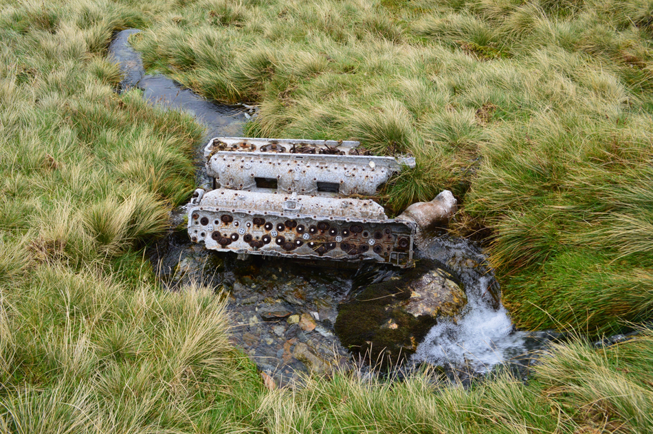 |
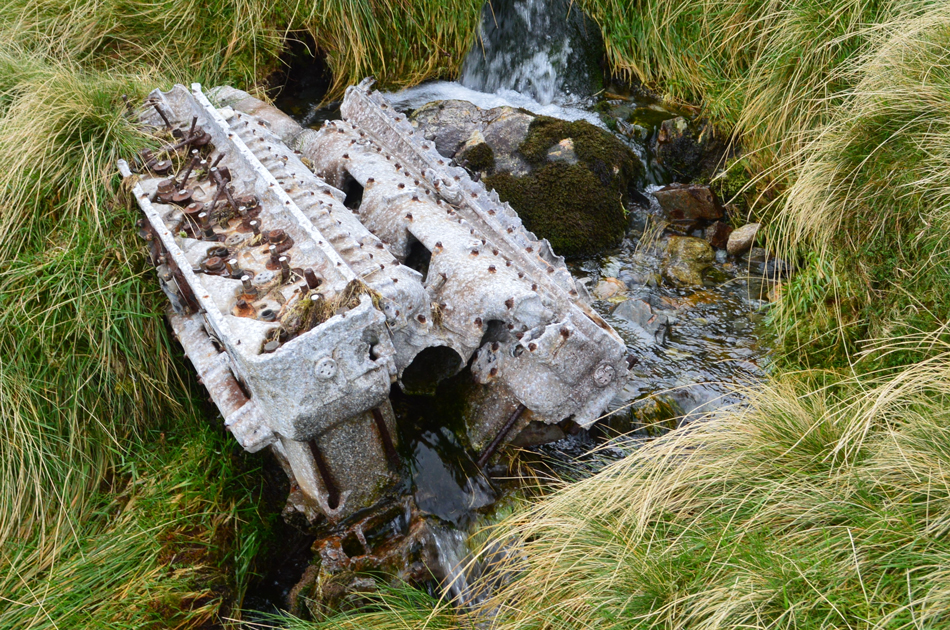
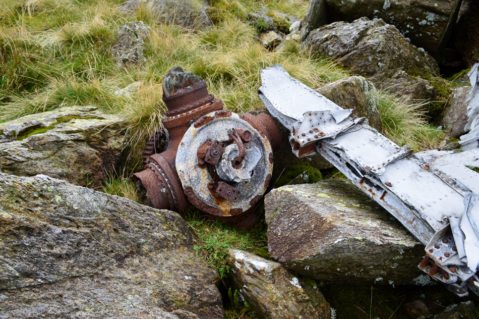
| Rolls Royce Merlin engine, Broad Slack. |
| We soon started to spot twisted aluminium debris mostly alongside the beck before continuing with our ascent then we spotted this, a Rolls Royce V12 Merlin engine just lying there in the beck, to say I had a wow moment would have been an understatement. |
 |
| But how did it get here? |
This engine at some point weighed in at 730kg and that is of course beyond the weight of what any human could carry. On any other crash site the RAF clean up crew would have hauled the wreckage away using trucks but due to the mountainous location of this site the wreckage was pushed from the summit of Great Carrs (not far from the original site of the crash) down into Broad Slack.
What is puzzling is directly below Great Carrs where more of the wreckage can be found lies a natural corrie so how did this engine (one of four prop engines) find its way a further 150 metres down the mountain? After carrying out some research it is though than on impact, parts of the Bomber 'carried on over the edge' and it is reputed that this engine was one of those parts. |
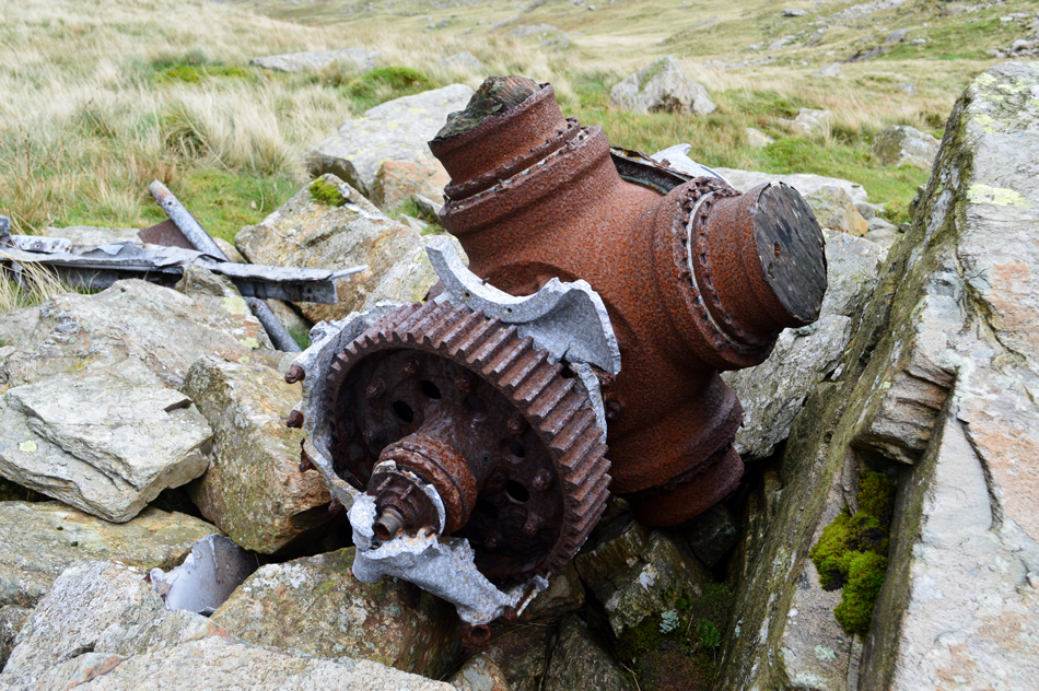 |
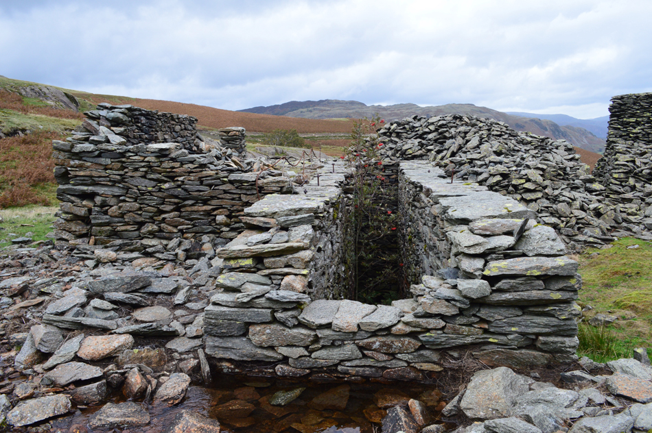
| One of two propeller bosses and gears found in Broad Slack. |
| The propeller boss is what the propellers would have been attached to with the large gear being attached to the engine at the rear. If you look closely you can still see the base of each four original wooden propellers. |
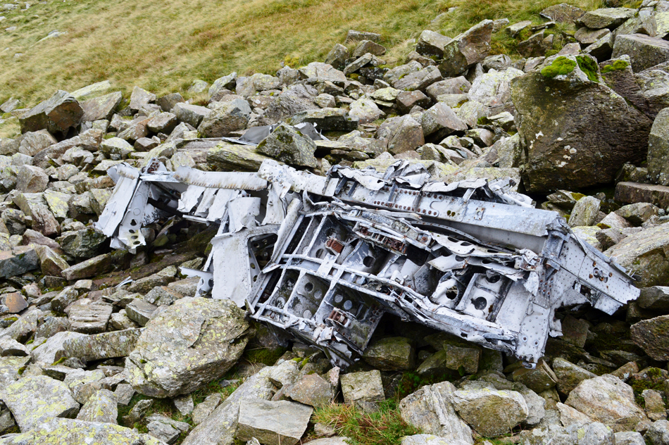 |
| We think this maybe a section of the rear under carriage. |
| Sorry I am no expert so please don't quote me. |
 |
| The second propeller boss and gear. |
| Found with what appears to be sections of a wing. |
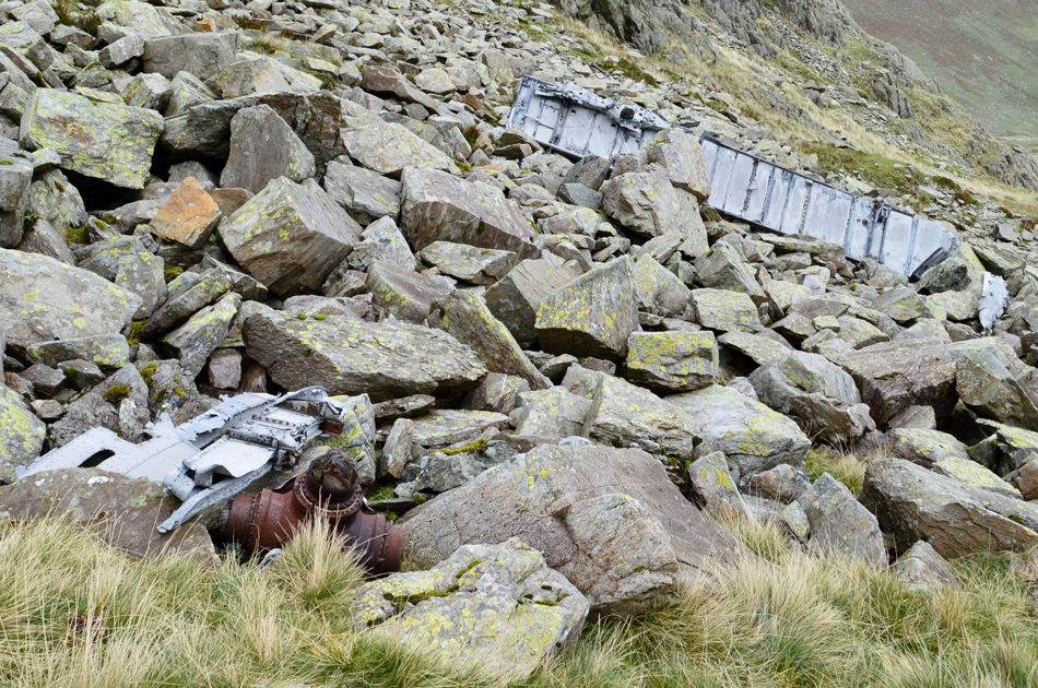 |
| This image shows the distance between the rear undercarrige in relation to the second propeller boss. |
| Experts believe that the wreckage is moving slowly down the mountain due to the scree the wreck was pushed into. |
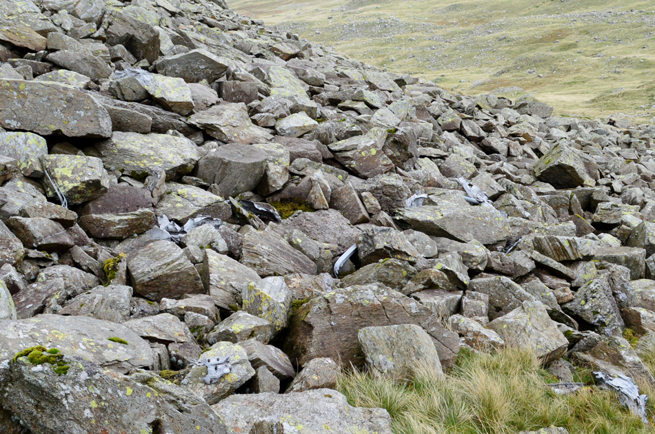 |
| Fragments of twisted aluminium wreckage aren't difficult to find. |
| Most are above the scree although more can be seen wedged within the rock and scree. |
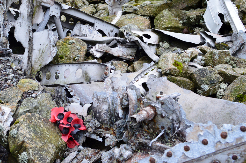 |
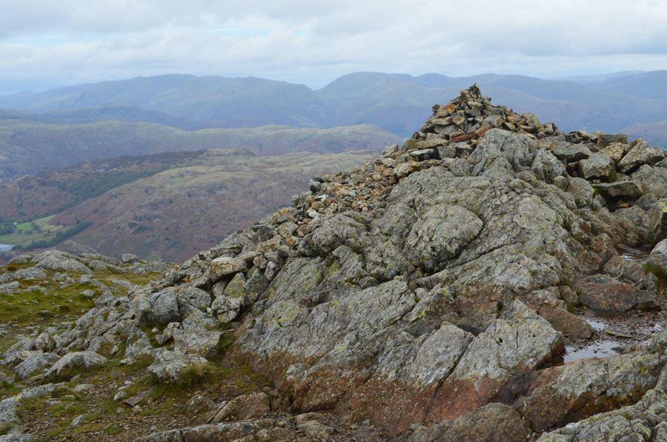
| Memorial, centre undercarriage. |
Having left RAF Topcliffe in Yorkshire on a night of training exercise the crew which consisted of seven Canadians and one Scot found themselves in thick cloud whilst over the north west of England where they became lost, having made contact with Topcliffe the crew were given a bearing for the base but after a half an hour nothing had been heard so a Mosquito was dispatched from Church Fenton Airfield with an aim to guide the Bomber back to base which was equipped with the latest night-fighting direction finding equipment.
The crew of the Mosquito were successful and homed in on the Halifax Bomber only to have located it then witness the moment it crashed into the west side of Great Carrs sadly killing all eight crew members. It is thought that instead of following instructions to orbit high ground at 4,000ft the crew descended to get a visual fix but by this stage the crew were too low and sadly it was too late. |
 |
| Centre undercarriage. |
| Not far from the undercarriage a large area of scorched ground was found where it is thought a fire broke out after the Bomber had been pushed from the summit where we found evidence of melted aluminium. |
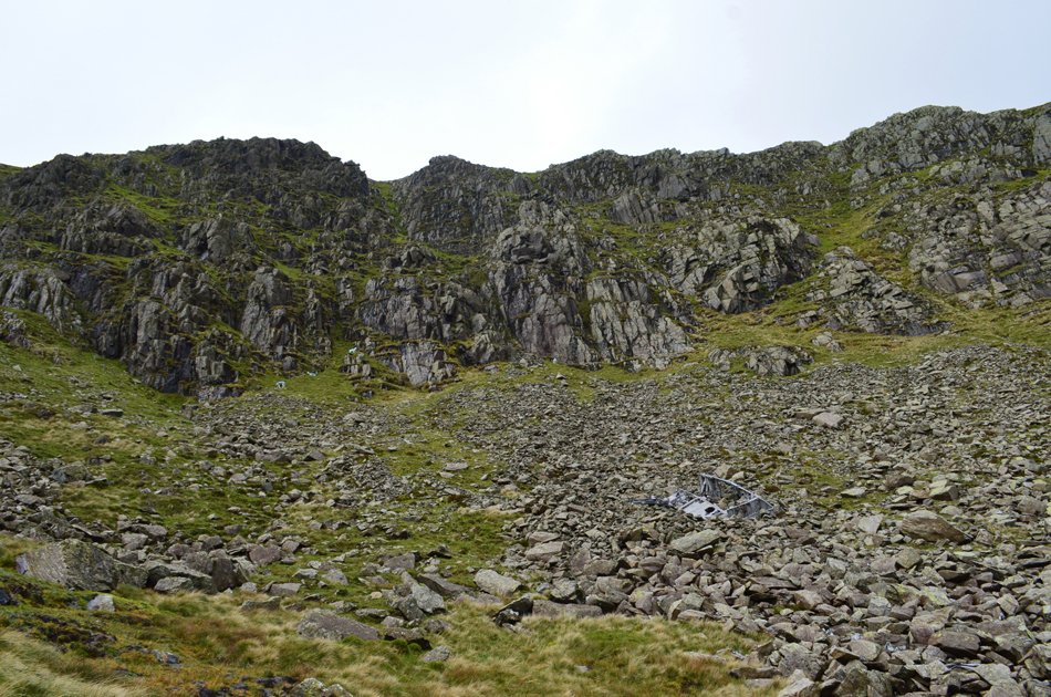 |
| The wreckage site directly below Great Carrs. |
| I'm not sure why but I had assumed that the wreckage had been pushed from the Top of Broad Slack rather than the summit of Great Carrs, the site of the wreckage of course proved me wrong. |
 |
| Black Sails and Wetherlam from Broad Slack. |
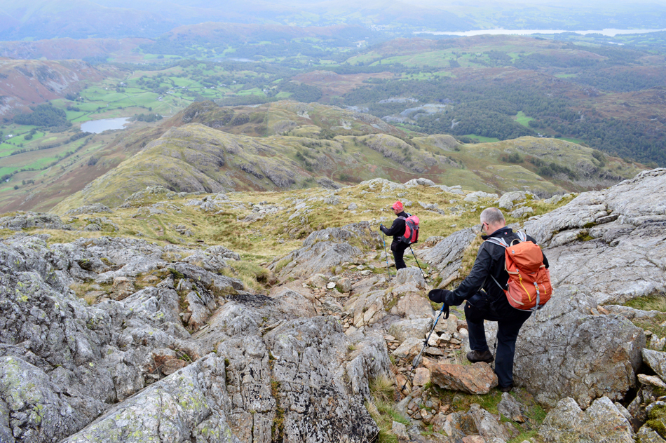
| David had previously mentioned the little effort required in order to reach Swirl Hawse where we maintained a level route in line with the Hawse which was out of site for much of the traverse. |
 |
| Looking down into Greenburn as we pass below Prison Band. |
| |
 |
| Looking back over Swirl Hawse towards Prison Band and Swirl How as we begin the ascent on Wetherlam. |
If you look towards the right below Prison Band your traverse started between the craggy outcrops in the distance then below the crags you see on the left which pretty much kept us in line with Swirl Hawse.
Please be advised to only attempt in clear conditions. |
 |
| The view over Swirl Hawse towards Great How Crags, Brim Fell Raven Tor and Coniston Old Man. |
| Not forgetting Levers Water below. |
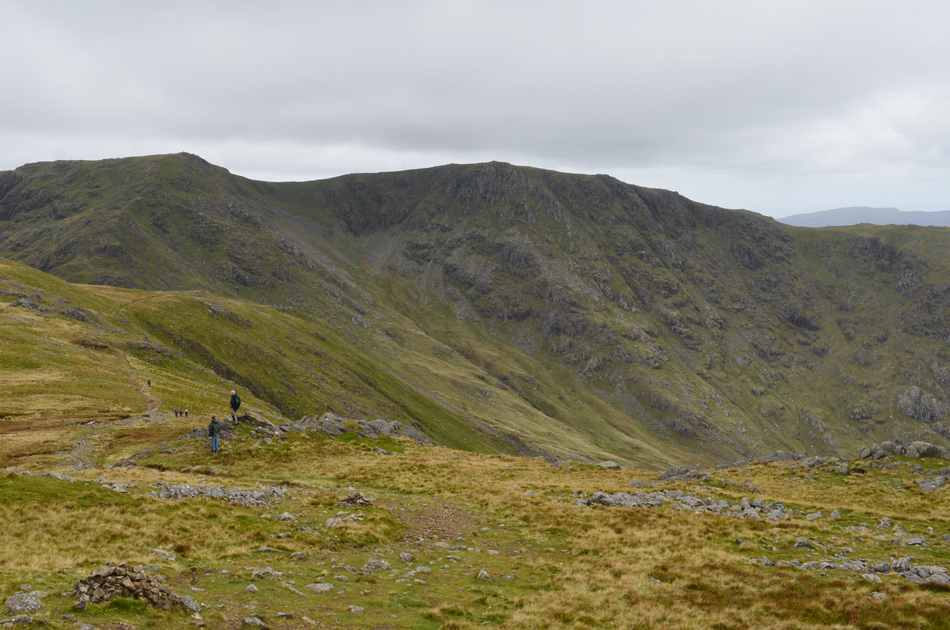 |
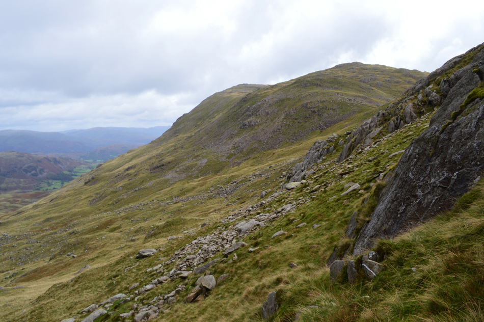
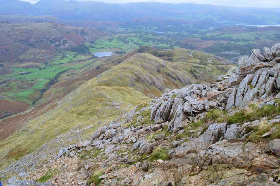
| Here looking back on Prison Band, Swirl How, the Top of Broad Slack, Broad Slack and Great Carrs. |
| It's only from a distance do you get to see how steep Broad Slack actually is which will explain why my lungs still haven't recovered! |
 |
| The Helvellyn and Fairfeild groups from Wetherlam summit. |
| We were surprised to see how busy the path was between Wetherlam and Swirl Hawse most of whom were walking from Wetherlam having already summated, it was here we were threatened by rain which thankfully didn't amount to much although the wind by now was brisk enough to add gloves. |
 |
| Mirky, but atmospheric views towards Pike O'Blisco, Cold Pike, Great Knott, Crinkle Crags and Bowfell. |
| With Red Tarn below. |
 |
| Descending Wetherlam via Wetherlam Edge. |
| Without realising it we found it was close to lunch time and with no shelter at the summit we decided to descend a little, find a spot out of the wind and break out lunch. |
 |
| Birk Fell from Wetherlam Edge. |
Having secured a lunch spot close to the path we de-shouldered and had lunch, soon after a couple and their two dogs pass who stopped for a quick chat, the dogs, however, were more interested in our lunch than conversation!
With lunch packed away we re-shouldered and began our descent down Wetherlam Edge, the edge itself isn't exposed but it can be tricky underfoot with lots of twists where in some cases four point contact is required, or five point contact if you want to include your backside! We're descending towards the flat area below known as Birk Fell Hawse from where we'll descend further into the Greenburn valley via a faint grassy footpath. |
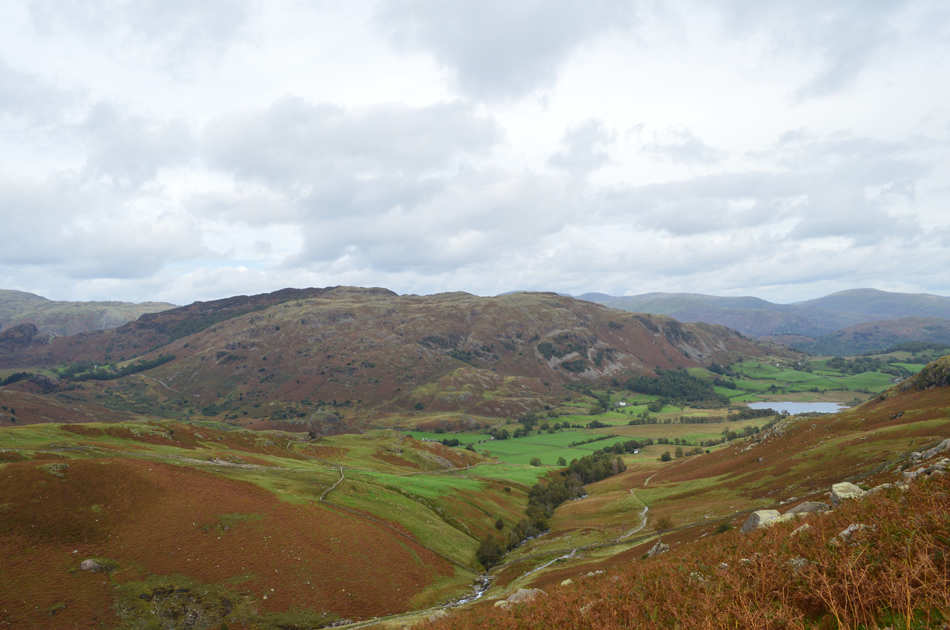 |
| Lingmoor Fell and Little Langdale Tarn from the descent of Wetherlam. |
| Having reached Birk Fell Hawse we picked up the grassy path as it started to descend steadily before arriving at a large patch of Juniper bushes which were a no-go area as far as we were concerned. Below the bracken is starting to retreat and through it we can pick out faint trods, this descent was slow and care had to be taken to avoid a tumble. |
 |
| The Langdale Pikes seen over Little Langdale. |
| |
 |
| Blake Rigg and the Langdale Pikes seen as we head towards Bridge End. |
| With the descent of Wetherlam behind us we descended back into Greenburn close to the impressive intake stone wall which ascends over to Tilberthwaite, the old miners path underfoot still runs with water but at least it was starting to brighten up. With Bridge End approaching David asked should we alternate the walk back and include Bridge End then a road walk through the heart of the Little Langdale valley. |
 |
| The Langdale Pikes from Bridge End. |
| |
 |
| Blake Rigg and the Langdale Pikes from Bridge End. |
| |
 |
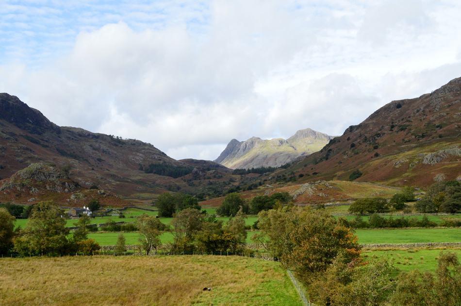
| The Greenburn Valley from Little Langdale Tarn. |
| Having passed through Bridge End we picked up the tarmac road and headed east passing the junction for Blea Tarn and Great Langdale, it was as busy as you would expect to see it with cars coming to stops and various passing places and I for one was glad I was on foot, the theme continued as the road ascended slightly sometimes having to stand in the hedgerows to let the traffic pass, it was no hardship it was turning into a lovely Autumn afternoon. |
 |
| Back at the Britannia Inn, Elterwater. |
With one last look into the Greenburn valley we left the main road through Little Langdale and headed for Dale End once again, I hadn't noticed the slight incline in the road this morning but my legs had picked it up on the way back. Under the mass of Lingmoor Fell we entered Sawery's Woods passing many a walker and mountain biker, Elterwater was close and both David and I were eagerly awaiting the moment we'd take off our boots.
We left the rough track behind and entered the village under a warming sun and passed the Britannia Inn whose benches were packed with folk eating and drinking outside still wearing jackets to keep the nip out. A few minutes later we found ourselves back at the car which I unlocked to take out my trusty stool, I untied my boot laces and eased my right boot off first soon followed by my left, I'd half expected to see flames shooting from my aching feet but all I got was sweaty socks. |
|
| |
| Back to top |
 |
|