|
Walking the Birketts, Scafell Pike via Pen, Scafell via Deep Gill SCA 2A |
 |
 |
27th May 2018 |
 |
|
Rod had asked me a couple of weeks ago about walking one of Bill Birketts supplementary Scafell walks this Bank Holiday which original route included gaining Scafell via the difficult scramble of Broad Stand, now it only took a few seconds to figure out that despite enjoying the odd scramble we are not rock climbers and we didn't want to put ourselves under any pressure just so we could cover a particular walk, not when just two Fridays ago one climber fell from Broad Stand badly injuring both legs, this didn't mean we couldn't carry out the walk, it just meant we had to chop and change things a little...in came Deep Gill.
Okay, I'm the first to admit that I'm a stickler for sticking to the route, especially as my Birkett project involves doing just that so myself and Rod came up with this route, it follows the same original route, and includes sections of the supplementary route too, it's kind of a hybrid walk. With the warm weather continuing we set a date for the Bank Holiday Sunday, yes we knew that we'd be amongst the masses but only for a little while and that we could cope with. |
|
| The Complete Lakeland Fells |
 |
| By Bill Birkett |
-Pen Located amongst impressive rock scenery, its position is remote and the going rough and difficult, this is not a place for the unwary. |
|
|
|
| |
|
Overview |
|
|
| Ascent: |
3,904 Feet - 1,191 Metres |
| Birketts: |
4, Pen - Scafell Pike - Scafell - Slight Side |
| Weather: |
Warm Dry & Sunny, Strong Gust Over The Summits. Highs of 24°C Lows of 16°C |
| Parking: |
Parking Spaces, Jubilee Bridge, Eskdale |
| Area - Group: |
Southern - SCA 2A |
| Miles: |
10.7 |
| Walking With: |
Rod Hepplewhite |
| Ordnance Survey: |
OL6 |
| Time Taken: |
8 Hours 5 Minutes |
| Route: |
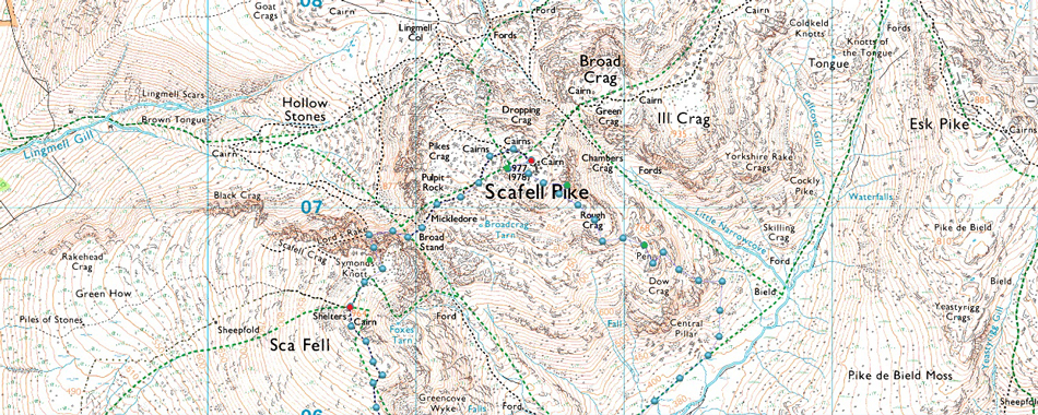
Jubilee Bridge - Brotherilkeld - Great Moss - Little Narrowcove - Pen - Eskdale Cairn - Rough Crag - Scafell Pike - Mickeldore - Rakes Progress - Lord's Rake - West Wall Tarverse - Deep Gill - Symonds Knott - Scafell - Long Green - Slight Side - Top of Cat Gill - Taw House Farm - Brotherilkeld - Jubiliee Bridge |
|
| |
|
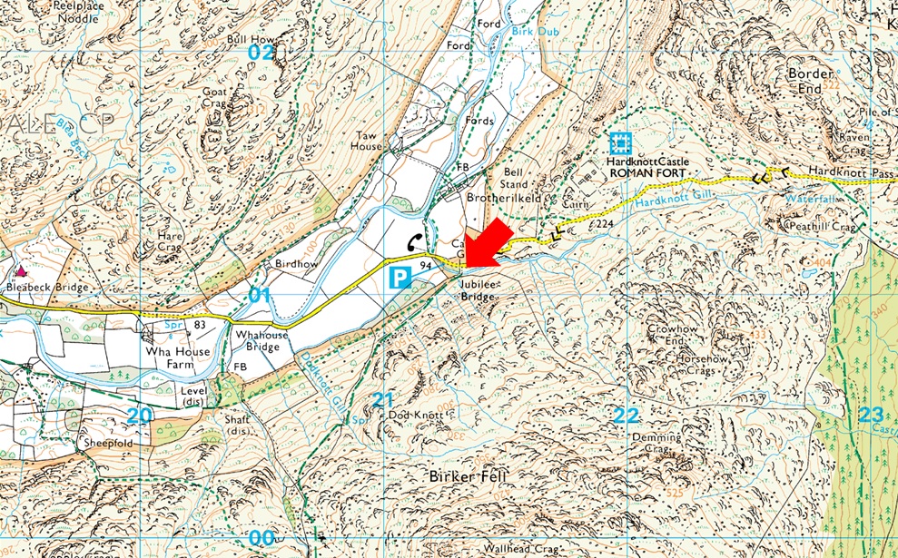
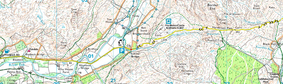
Parking Details and Map |
|
|
| Nearest Post code: |
CA19 1TH |
| Grid Reference: |
NY 212 801 |
| Notes: |
There is room for around eight well parked cars at Jubilee Bridge with further off road spaces found between Jubilee Bridge and Whahouse Bridge. The parking spaces are perfectly positioned to get into upper and lower Eskdale whether you aim for a walk up Harter Fell, Bowfell or the Scafells these spaces during summer are at a premium and my advice is to arrive early should you want to secure a parking place. Look out for the cattle grid at the bottom of Hardknott Pass (Jubilee Bridge itself cannot be seen from the road) parking can be found on the left if approaching from the top of the Hardknott Pass or just after the cattle grid on the right if approaching from Eskdale. Parking is free. |
|
| |
|
Map and Photo Gallery |
|
|
 |
| Jubilee Bridge, Eskdale 07:50am 16°C |
Eskdale is a fair trek from the north east for Rod so we agreed to meet up at Jubilee Bridge at the slightly later time of 08:30am. For some reason the previous night I hadn't slept well and was already awake by the time my alarm clock went off at 05:10am, having checked the forecast again I was soon travelling north by 05:50am putting my arrival time to 07:40 (ish) time to take my foot of the gas I think. I arrived around 07:45am and backed my car into one of three remaining parking spaces, with my engine switched off I caught a few moments shut eye and even spent few minutes at Jubilee Bridge from where I spotted Rod's car arriving. I went back to meet Rod and shook hands with a 'morning' The forecast couldn't have been better with morning temperatures here in the valley already at 16°C, however, the forecast had predicted winds with gusts of up to 45mph across the tops, we were soon to find out those gust weren't confined to just the summits.
We kit up in standard summer attire although given the predicted winds we wore long, not short sleeve base layers. I'd treated myself to some new Sorbothane gel insoles for my boots which should help with my Plantar Faciiltis in my right foot, so out came the old gel pads in went the new insoles. If I could have predicted what was about to happen I'd of left the damn things at home. |
 |
| Views towards Slight Side and Heron Crag (left) Bowfell (centre) and Hard Knott (right) |
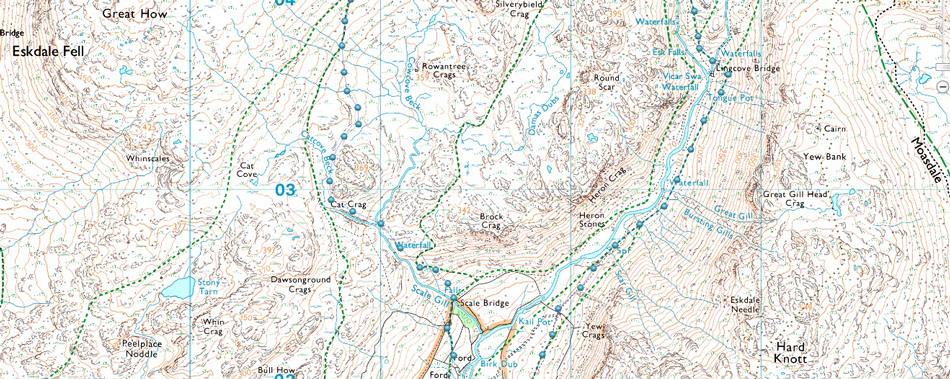
| We left Jubiliee Bridge and instead of walking through Brotherilkeld we walked back up Hardknott Pass until the end of a stone wall where we turned left, passed through two gates which then left us below Hard Knott Roman Fort to our right, our path passes through pastures until the wall is reached seen (centre left next to the lone tree) where we pass through a third gate before heading towards Lingcove Bridge. Between here and there my right foot is starting to feel pretty tight inside my boot so much so I could feel a blister forming. |
 |
| Views towards Bowfell from the banks of the River Esk. |
It was no good, I asked Rod would he mind I stop so I could re-adjust my boot laces if only to relieve the pressure, I tugged at both lower laces and re-laced up and for a moment I thought I'd solved the problem.
On another note, the wind right here at valley level was gusting so strong we really had to take things steady and as for conversation, that was almost nil, blimey if the wind is so strong here what will it be like across the summits? |
 |
| Lingcove Bridge. |
By the time we had reached Lingcove Bridge the blister on my right heel was really causing me problems, it wasn't so much the discomfort but the short time it had taken to form, I could have kicked myself for adding the insoles which after checking, had a heel rise of 22mm, the gel insoles which I had removed were probably half that hence the new blister, I just couldn't believe that I had to endure the pain of blister on a route such as todays.
I'd beat myself up enough, there was no point crying over spilt milk, I removed the new insoles and inserted my old ones which thankfully I had kept in my pack, then placed a plaster over the blister and re-laced up as tight as I could. |
 |
| Throstle Garth. |
| From Lincove Bridge we rise north alongside Esk Gorge with views over Throstle Garth up ahead. Earlier Rod thought he had seen two walkers who then quickly disappeared, as it turned out they had just summated Throstle Garth and were watching us from the summit, well at least we weren't seeing things. |
 |
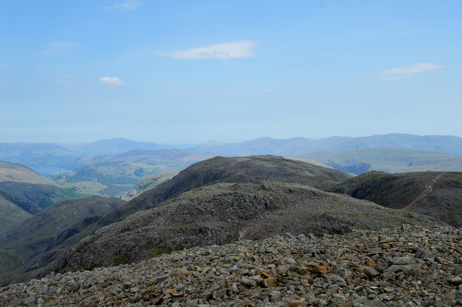
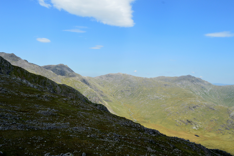
| Scar Lathing, Scafell Pike, Pen, Broad Crag and III Crag from Esk Gorge. |
| The path narrows as Esk Gorge falls away steeply to our left while ahead, Scar Lathing and the River Esk along with its notorious boggy bits. |
 |
| Scar Lathing with Scafell Pike over on the left. |
| There was no danger of disappearing into the bogs here as the ground underfoot was almost completely dry, so much so I didn't need to stick to the path which detours wide of the bog just right of the curve in the Esk. |
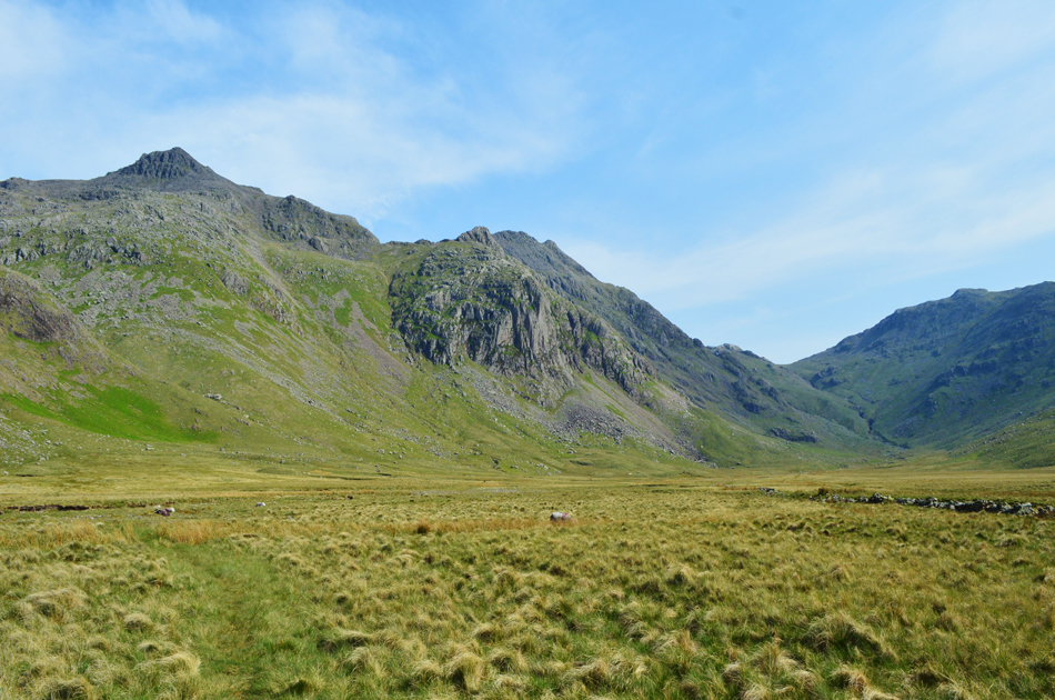 |
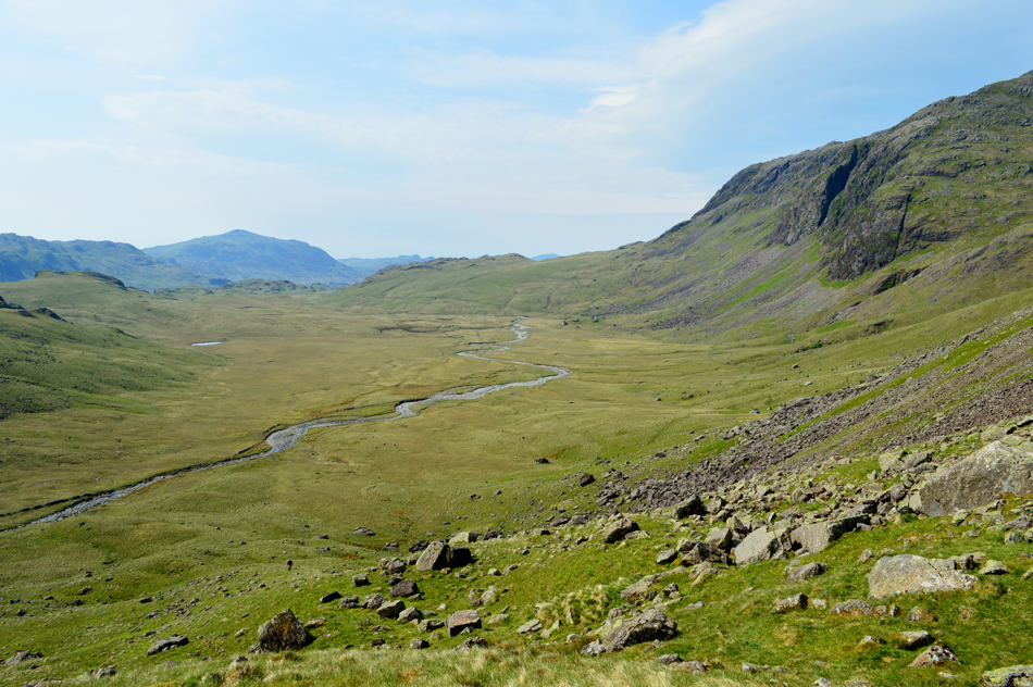
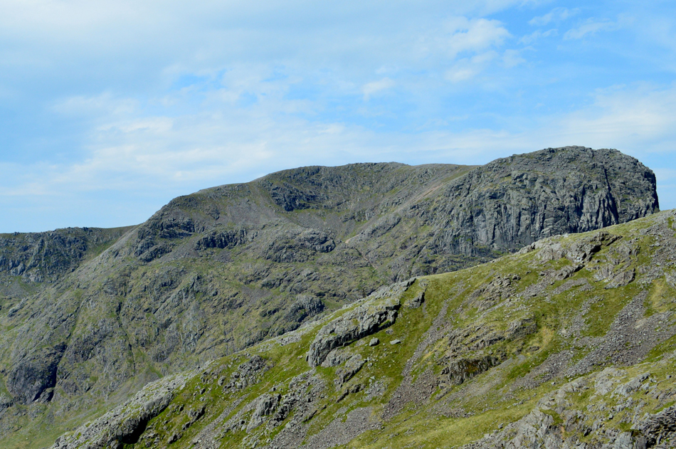
| Scafell Pike, Pen, III Crag and Esk Hause from Great Moss. |
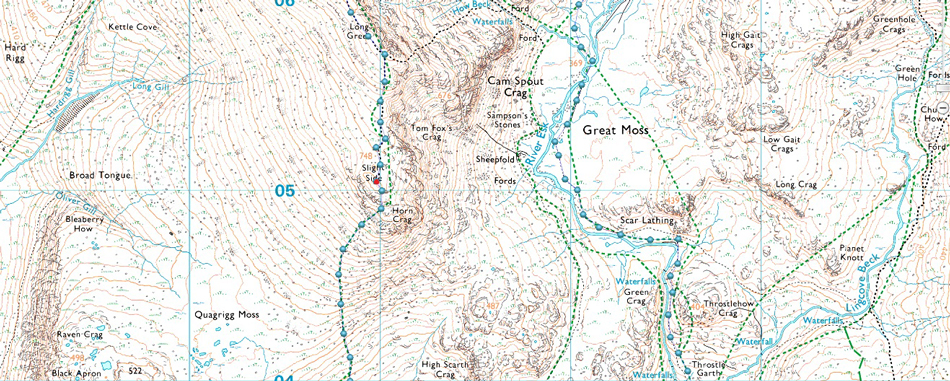
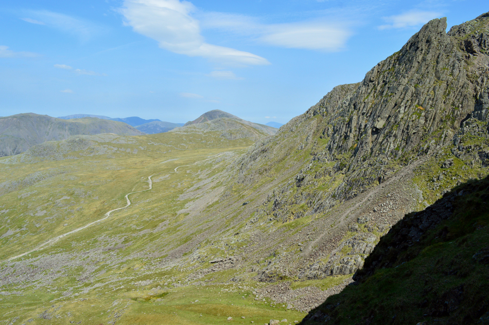
| Having followed the path below Scar Lathing the views soon opened out first over towards Slight Side then Scafell Pike with Pen below to the right. I've only ever gained Pen by two means of ascent one of which is the more popular route which ascends steeply via the far left keeping to a grass rake the whole ascent, secondly I gained Pen via a shelf route passing over the top of Esk Buttress which I would only recommend for the walker who doesn't mind a tough scramble. Todays ascent will be via Little Narrowcove, which for now is out of sight over on the far right and a route that I've never tried which I'm really looking forward too. |
 |
| Cam Spout Crag with Scafell in the distance. |
| That's How Beck over on the right, normally the quietude of Great Moss would be drowned out by How Beck Falls but today there's nothing more than a trickle falling between the gully, Great Moss really is feeling remote today. |
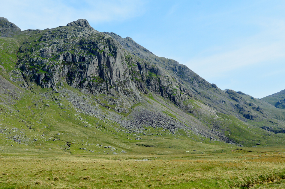 |
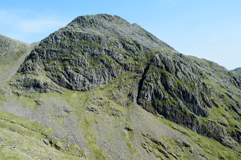
| Pen with III Crag beyond. |
| You can see the steep grassy rake over on the left of the photograph where Pen is usually gained by, the grass shelf route I used last year starts halfway up the rake before heading right across the crags and cliffs before the final ascent onto the summit itself. Todays route will see us pass below Pen (Esk Buttress) then head left via steep grass bank seen to the far right of the scree, it doesn't look it from here but that grass bank requires a good O'l slog.. |
 |
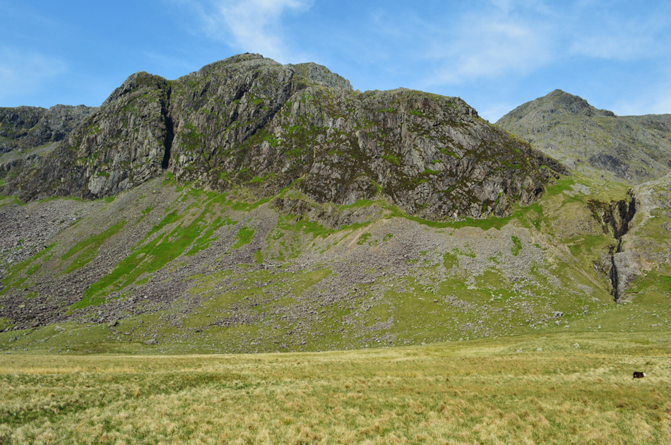
| Passing below the almighty Esk Buttress. |
| |
 |
| The view over the River Esk, Great Moss and Slight Side (right) Hard Knott (left) and Harter Fell (centre left) |
We hit the grass bank in good stead but soon the heat of the morning started to bear down leaving us panting like a hot dog on Summers day, we found a grass col on the horizon to aim for and slowly picked our way towards it.
By the way Rod, I think we are being followed... |
 |
| That's Cockly Pike seen centre. |
Cockly Pike appears to be no more than a grassy knoll at the base of III Crag south east ridge, what Cockly Pike actually is the start of the longest continuous scrambling gradient in England which ascends all the way to III Crag summit, I can wholly recommend it having completed it back in June 2014. |
 |
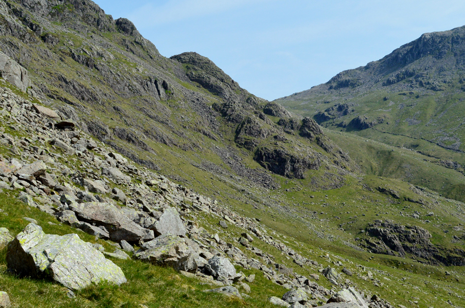
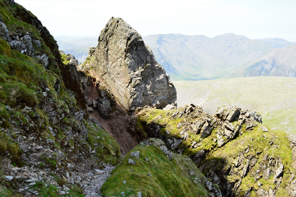
| The gully recommended by Bill Birkett to gain Pen by. |
Having reached the south facing grass col we found that we needed to move further north, this mean't having to trek around the 'waist' of Pen touching in on Little Narrowcove while doing so, this was hard work sometimes having no option to descend then re-ascend. We came upon a narrow gully and it was here I checked our location "Im sorry Rod, this isnt it, it's still further around" hey ho lets go.
We soon located the gully with Little Narrowcove falling steeply below with the summits of III Crag and Broad Crag over our shoulders. |
 |
| Broad Crag and III Crag seen over Little Narrowcove. |
| What happened to the couple who were following us? well they dropped into Little Narrowcove without so much as a Hi. |
 |
| III Crag over Little Narrowcove. |
| |
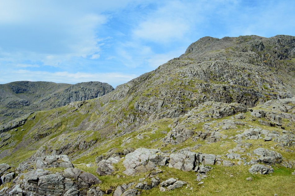 |
| Scafell, Scafell Pike and Rough Crag from Pen. |
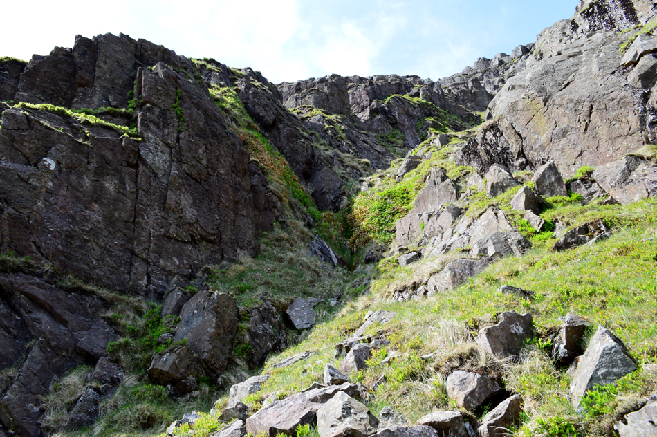
| The gully caught me slightly by surprise finding the odd 'hands on' scramble with steep drops into the gully below, rock soon turned to grass ledges we soon found ourselves just below Pen summit, all that was left was a series of rock steps from which you get a good perspective of the gully we had just ascended by. |
 |
| Scafell Pike, Rough Crag, Broad Crag Col and Broad Crag from Pen. |
| We could see that quite a few walkers were crossing Broad Crag Col in both directions, all heading to, and from Scafell Pike summit. |
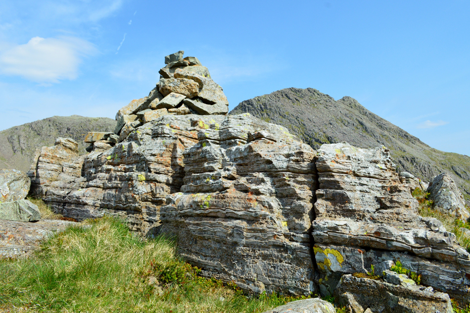 |
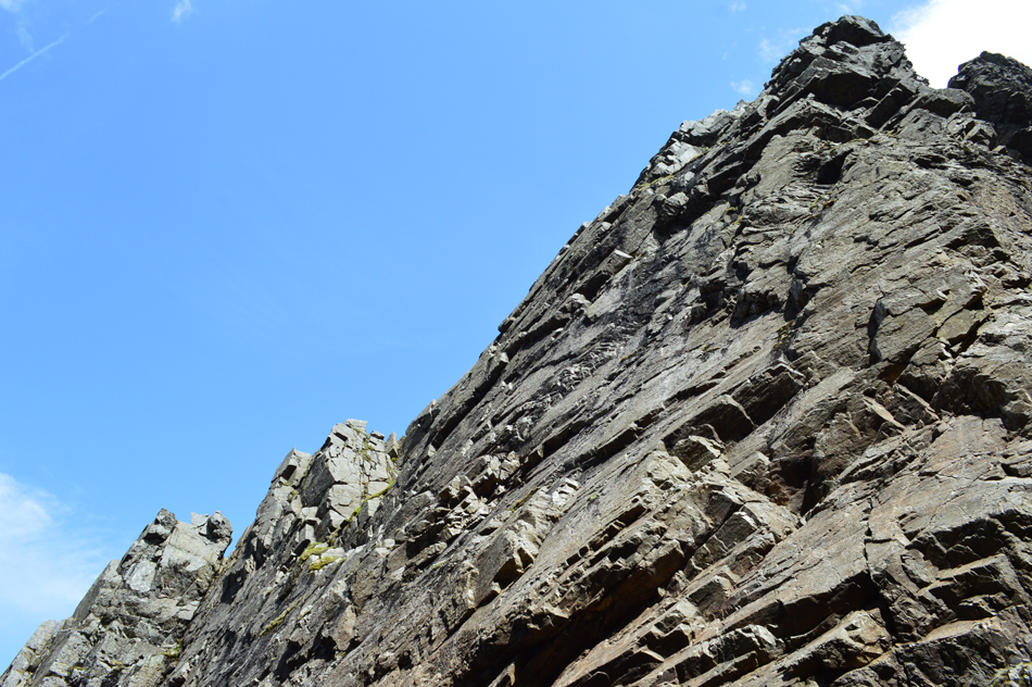
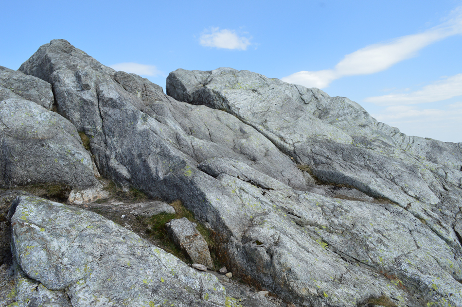
| The distinctive layered rock that makes up Pen summit. |
| Having been sheltered from the gusts on reaching Pen summit we were well and truly back in the firing line, a mix of strong gust and uneven rocky terrain wasn't the best combination but with care we even managed to spend a few moments here taking in the view and in my case, popping open the first Satsuma of the day. |
 |
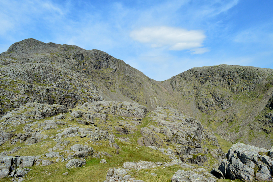
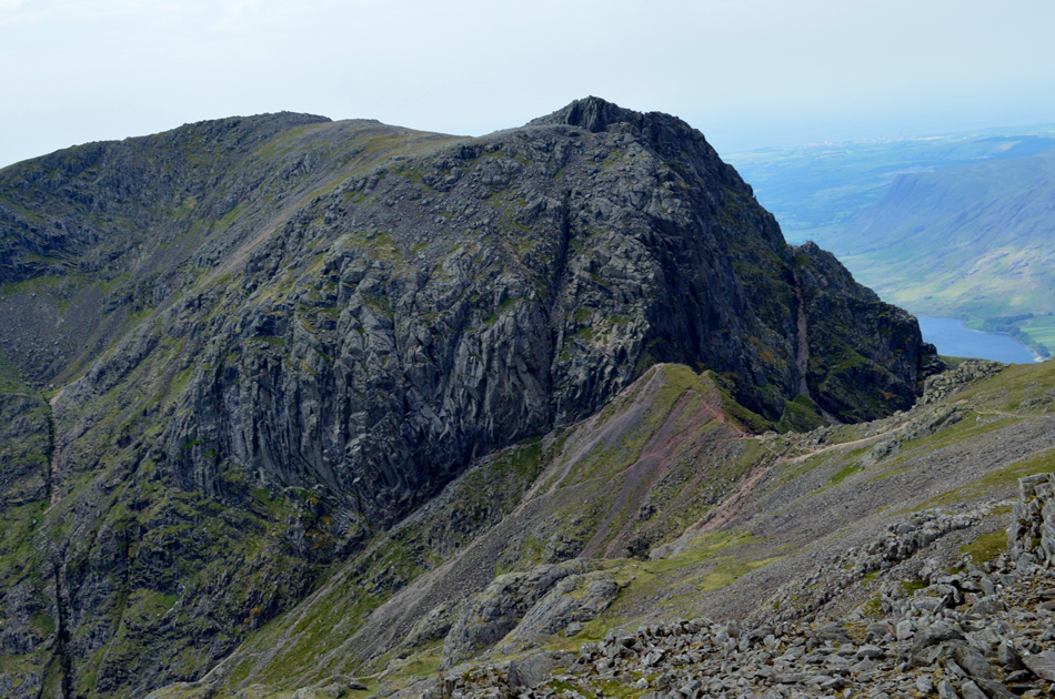
| Scafell from Pen with Broad Stand over on the right. |
| If you follow the ridge down from Broad Stand you can make out the cirque that forms Foxes Tarn and below, Foxes Tarn gully, these being the safer route onto Scafell if you are wanting to avoid Broad Stand or Lord's Rake. |
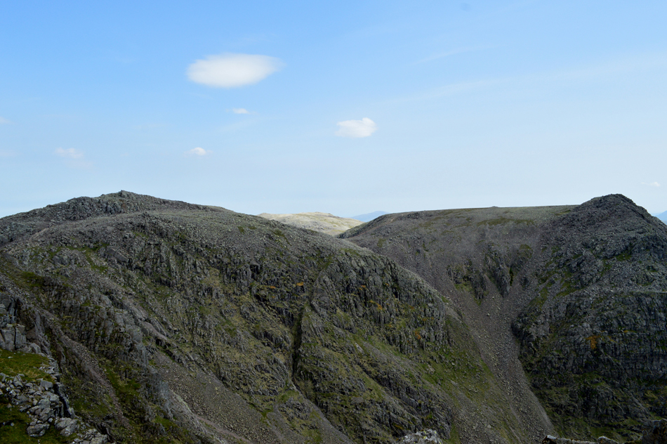 |
| Broad Crag, III Crag and Great End from the ascent of Rough Crag. |
| With Pen behind us we picked our ascent over the Rough Crag ridge right about the same time it started to cloud over with Great End being the place to be right now as it's still nice and sunny over that way, well at least for now. With the cloud cover came a drop in temperature and down came the sleeves! |
 |
| III Crag seen over Little Narrowcove with Rough Crag below right. |
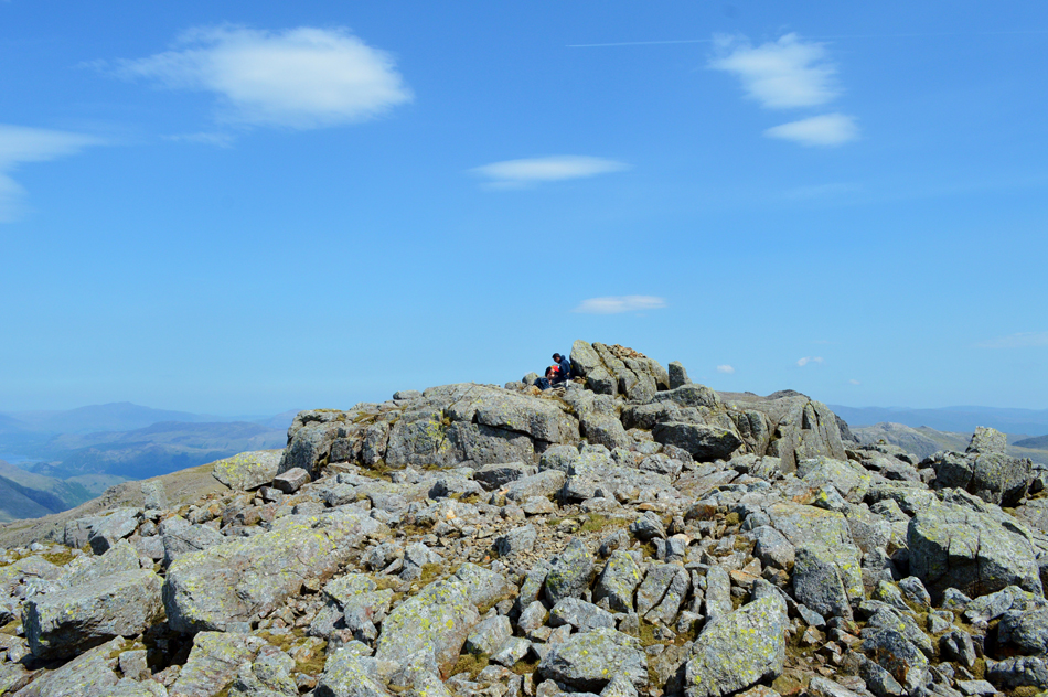
| We broke protocol once more and included a summit of Rough Crag. By eck Bill's going to have my guts for garters. Next, we fall back in line with a visit to the Eskdale Cairn situated on the southern tip of Scafell Pike summit which overlooks Great Moss and the upper Eskdale valley. |
 |
| Scafell, Broad Stand, Mickledore and Lord's Rake from the Esk Cairn/Scafell Pike. |
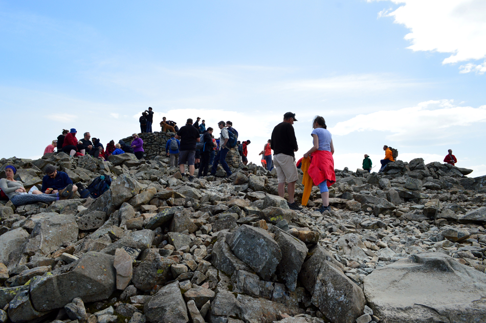
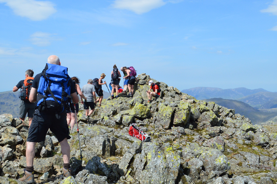
We made our way over to the Esk Cairn before our official summit of Scafell Pike, looking over our shoulders we could see that the summit was heaving with more walkers arriving with each minute passed. We reached the Esk Cairn (my first visit) and Rod explained that the cairn which once stood broad and prominant was now nothing more than a pile of stones although an attempt had been made to rebuild the current cairn it still looked nothing like Rod had remembered. Strong gusts shortened our visit leaving us no choice than to leave the Esk Cairn and make our way over to the masses who were currently stacked on top of Scafell Pike summit cairn.
I witnessed one chap clamber up onto the cairn without using the steps and in the process he knocked down a stone from the top of cairn. This, after National Park Rangers recently spent a week restoring the summit cairn and memorial at the beginning of this month, the sight of which really angered me, in some ways I was glad I'd witnessed it from a distance. |
 |
| Broad Crag, III Crag and Great End from Scafell Pike summit. |
| With hazy views stretching as far as Blencathra and the Dodds to Fairfield Ridge. |
 |
| Scafell Pike summit. |
| Having circled around the summit cairn we dropped to a lower level to take in the views over towards Styhead and the Gables. |
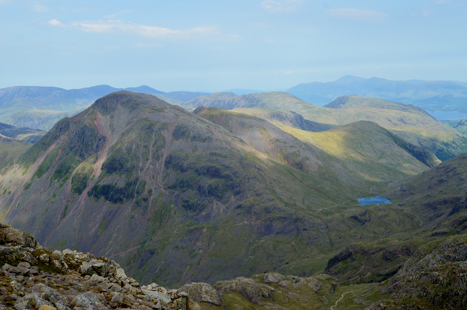 |
| The view towards Great Gable, Green Gable, Base Brown, Brandreth, Grey Knotts, Dale Head and Maiden Moor. |
| You can just make out the Corridor Route below leading towards Sty Head and Styhead Tarn. |
 |
| Descending Scafell Pike towards Mickledore, Broad Stand and Scafell. |
Having left Scafell Pike behind and followed the cairns to the Mickeldore Ridge, we had just about become accustomed to the wind but Mickledore was on a new level, the constant gusts here were deafening.
...tread carefully. |
 |
| Rakes Progress from Mickledore. |
Having crossed Mickledore with great care we dropped down onto Mickledore Screes and the Rakes Progress, descending just six feet was enough to shield us from the gusts and soon, calm returned.
You can see Rakes Progress up ahead but in order to reach it we must descend from the Mickledore Ridge, this involves a very steep descent over eroded stone which can act like ball bearings underfoot, today we found the stone loose, and deep enough to allow a controlled descent, it's not uncommon to find me on my backside here, however today I managed to keep upright. |
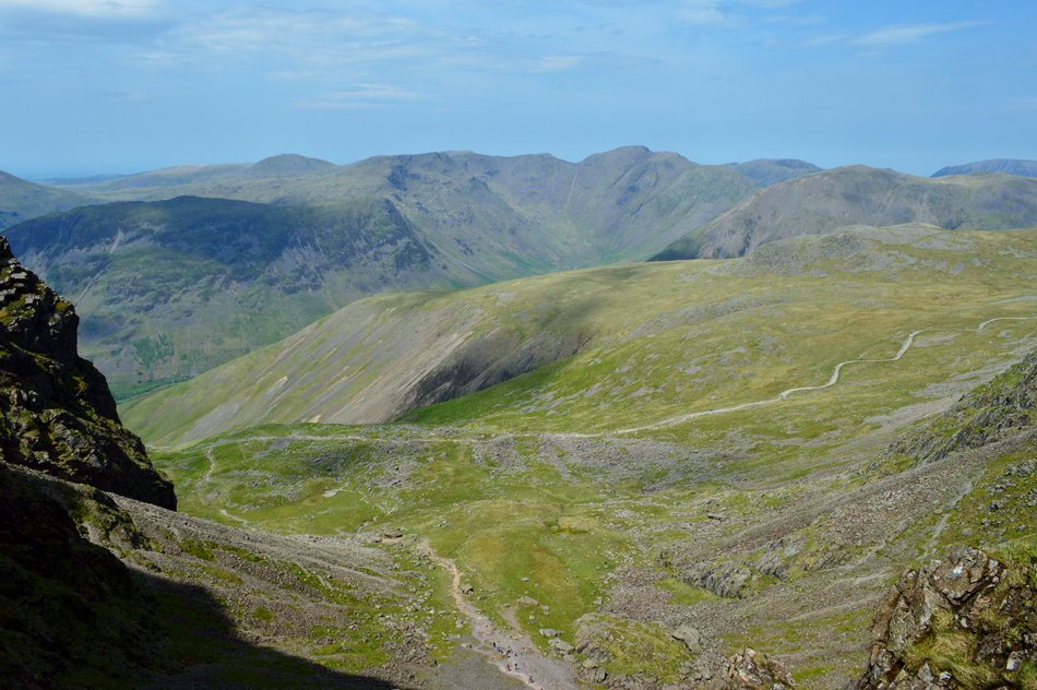 |
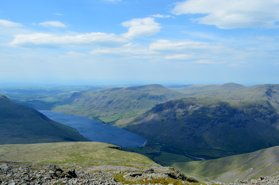
| A distant Mosedale seen over Hollowstones and Lingmell from Rakes Progress. |
| |
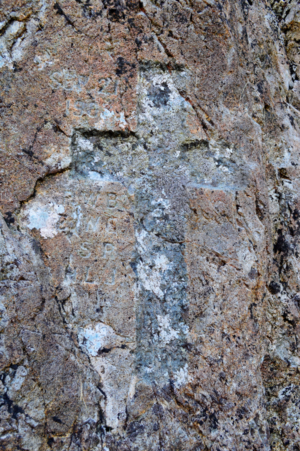 |
| The 1903 Memorial Cross found at the foot of Scafell Pinnacle. |
It is not known exactly what happened to the four experienced climbers, they were found roped together in a scree run far below Lord’s Rake three of whom were all ready deceased by the time help arrived, the fourth member of the group died during the descent back to Wasdale Hotel.
Having passed a couple who asked "whats this mountain called" to which I replied Scafell "we're looking for Scafell Pike" so I pointed back and directed them "this one looked higher was their answer" moving on... |
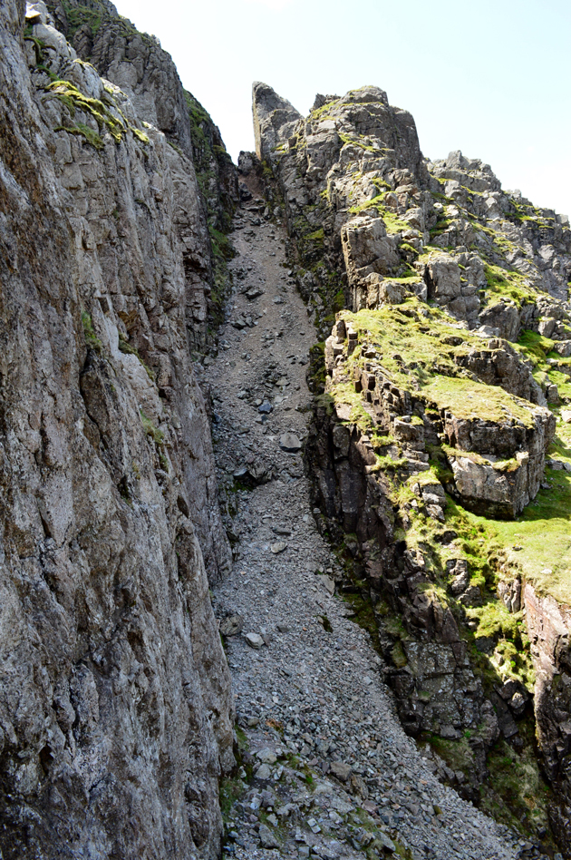 |
| Lord's Rake. |
We followed Rakes Progress to the base of Lord's Rake while observing the masses still heading for Mickledore via Mickledore Scree. After pointing out the direction of Scafell Pike to the couple we found ourselves the only ones in Lord's Rake which suited us perfectly given how loose and eroded the rake has become should rock slip occur.
As always we maintained ascent via the right of the rake ascending via the rock face wherever and whenever we could such the looseness of the stone underfoot, Rod allowed a gap between mine and his ascent just in case of any rock slip, this is the best practice when ascending in pairs, or a group.
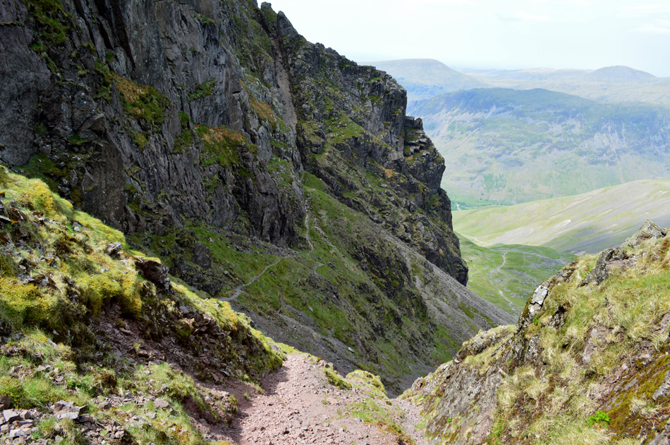
We won't be ascending the full length of Lord's Rake today instead we will also ascend Scafell via the West Wall Traverse and Deep Gill, found close to the top of the gully. |
 |
| Pulpit Rock (Scafell Pike) Lingmell, Great Gable and Kirk Fell from Lord's Rake. |
| |
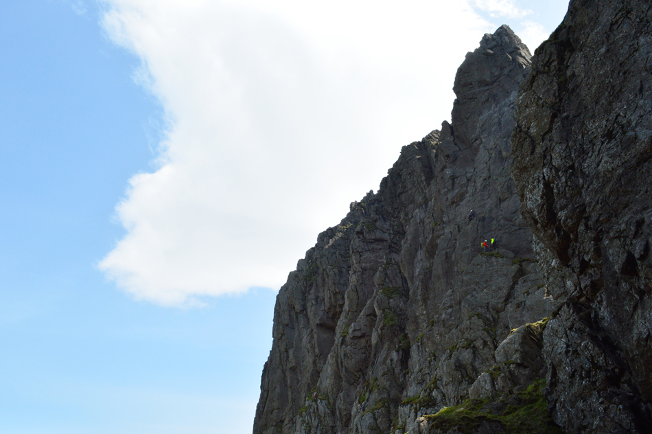 |
| Rock climbers on Scafell Pinnacle. |
| We'll soon be in talking distance with the climbers once the West Wall Traverse is reached, best not to disturb them though eh. |
 |
| Looking down on Lord's Rake and Chock Stone from the entrance to the West Wall Traverse. |
We made good timings ascending the rake and soon reached the resting place of the Chock Stone which up until the 15th August 2015 had arched over the top of the rake close to this position, it is not known exactly what brought the Chock Stone down but the most likely cause was an earthquake which, when considering the Chock Stone only rested against rock at a point no larger than the screen you are looking out seems the obvious reason.
I'm just pleased I wasn't here to see it no matter how awesome it may have looked. |
 |
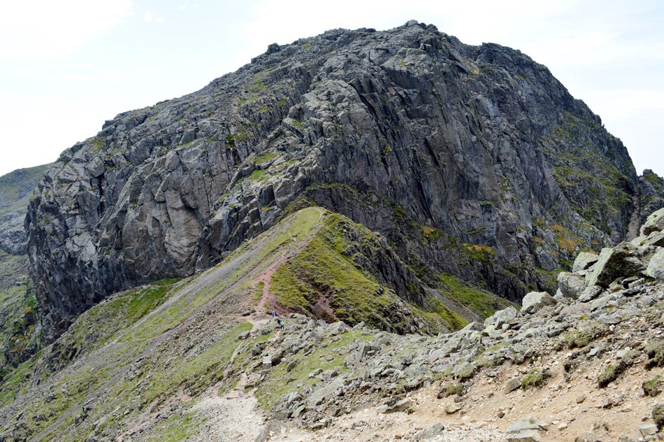
| Scafell Pinnacle from the West Wall Traverse. |
| The West Wall Traverse is gained directly from Lord's Rake, the traverse follows a narrow path with impressive views towards Scafell Pinnacle. The path is narrow, steady and with quite a lot of exposure to the left, today we were lucky enough to see a group of climbers in action which added scale to the steep cliffs of Scafell Pinnacle. |
 |
| Looking back on the start of the West Wall Traverse and Lord's Rake. |
| With Mosedale in the distance, it's started to get quite hazy now. |
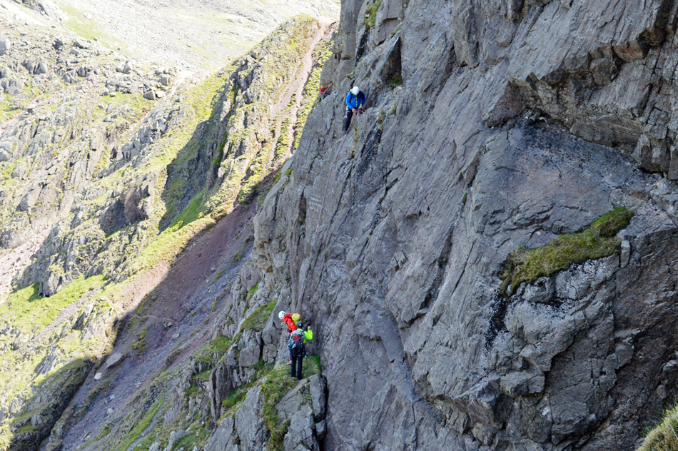 |
| Climbers on Scafell Pinnacle. |
| The traverse climbed steeply with over hanging views onto the lower half of Scafell Pinnacle, it was here we passed one group of climbers within ear shot. That's Mickledore in the background. |
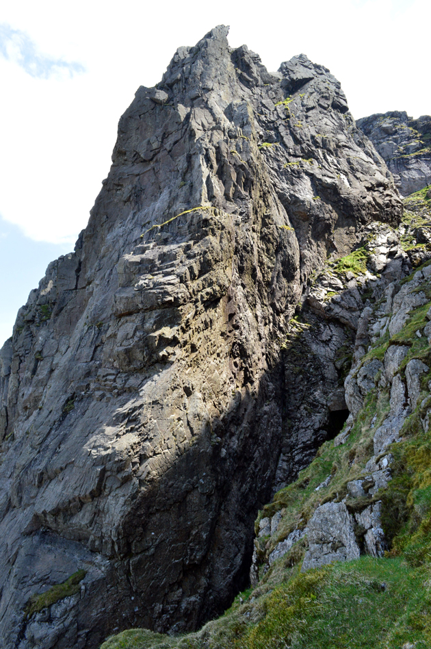 |
| Scafell Pinnacle. |
| With the lower section of Deep Gill in the foreground, this section of the gill is considered to be out of bounds to walkers while the West Wall Traverse continues to rise above it. |
 |
| Scafell Pike seen over Mickledore Screes from the West Wall Traverse. |
| |
 |
| Vertical rock that forms the top of Scafell Pinnacle. |
| |
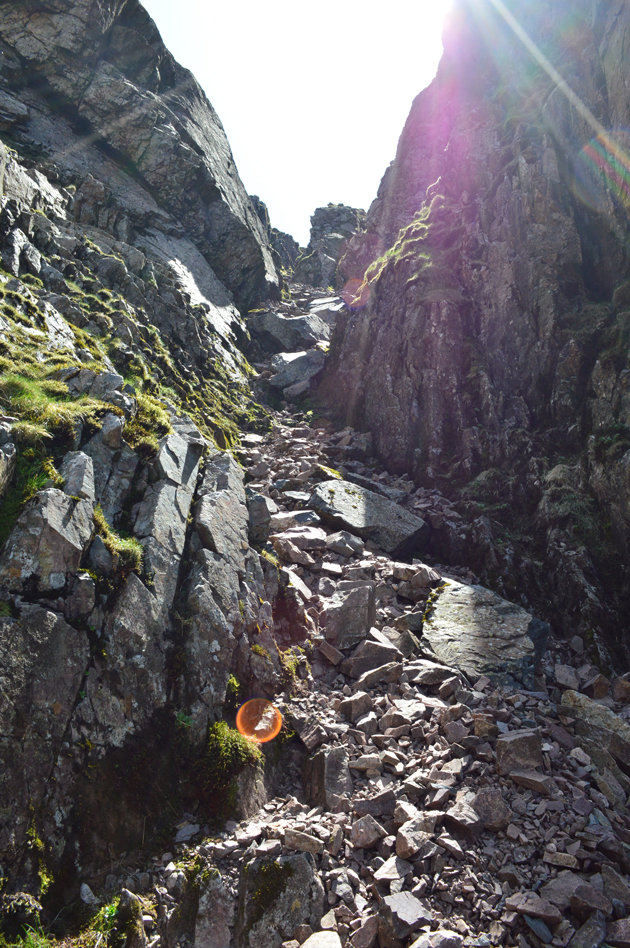 |
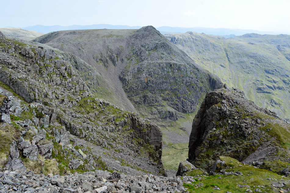
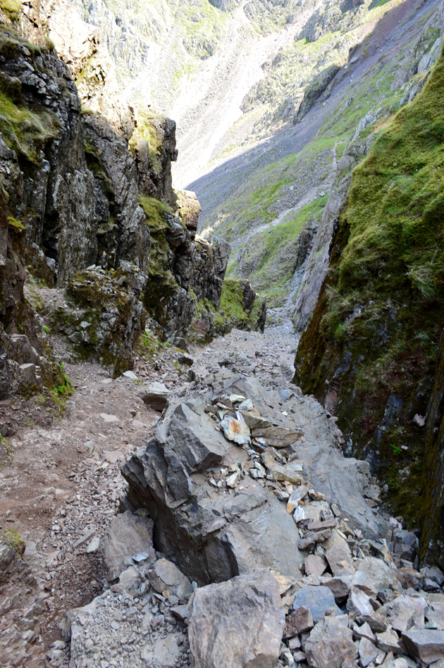
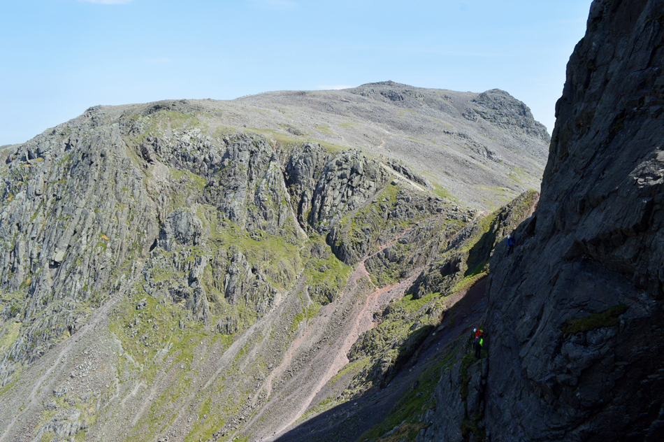
| Deep Gill. |
The West Wall Traverse ends above the unnavigable section of Deep Gill deep inside the mountain, we had been protected against the wind up until now but every now and again sudden gusts howled down the gill, it came as a welcome and helped us to cool down.
The sun beaming down from above made the ascent feel like we were climbing out of some sort of worm hole! |
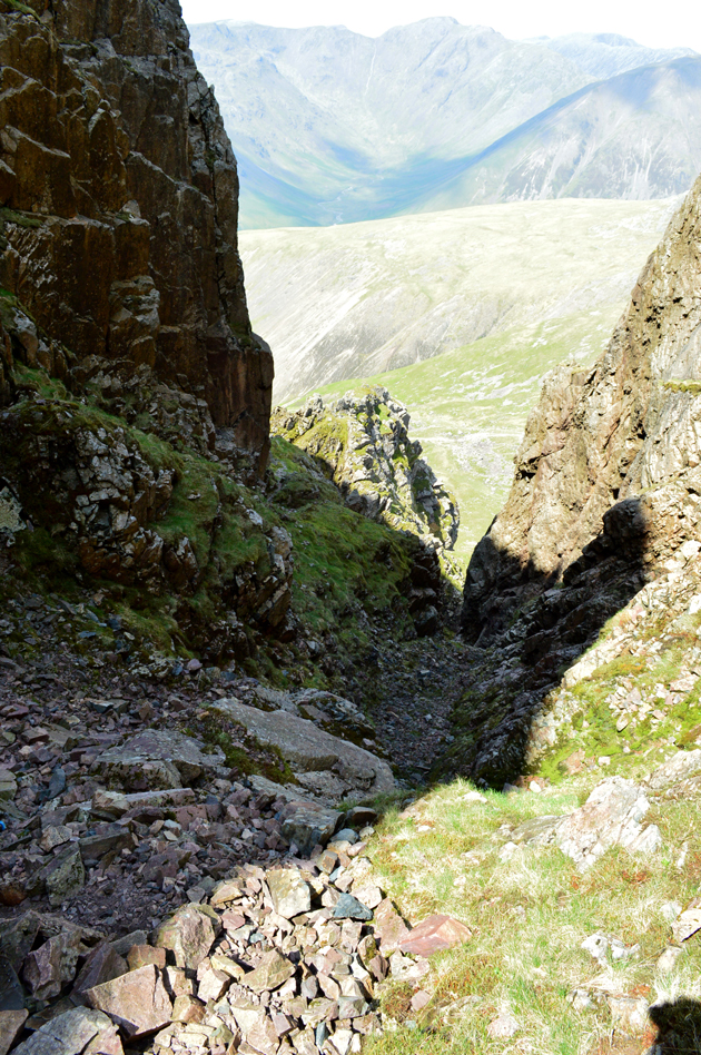 |
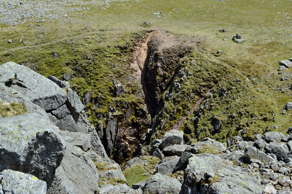
| Looking down on Deep Gill. |
| You can see where the West Wall Travese ends (patch of grass seen centre left) and where the ascent of Deep Gill starts. Deep Gill is quite steep but not as long, nor as loose underfoot as Lord's Rake. |
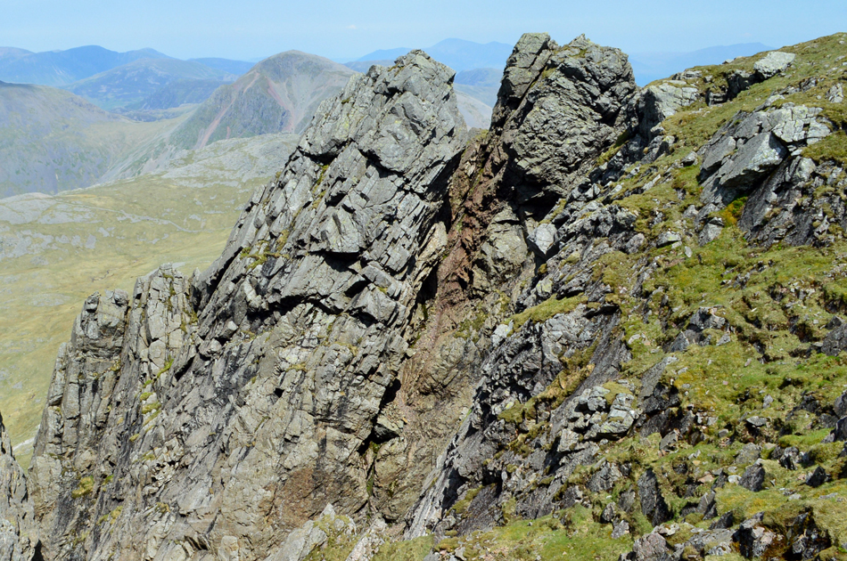 |
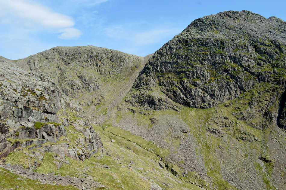
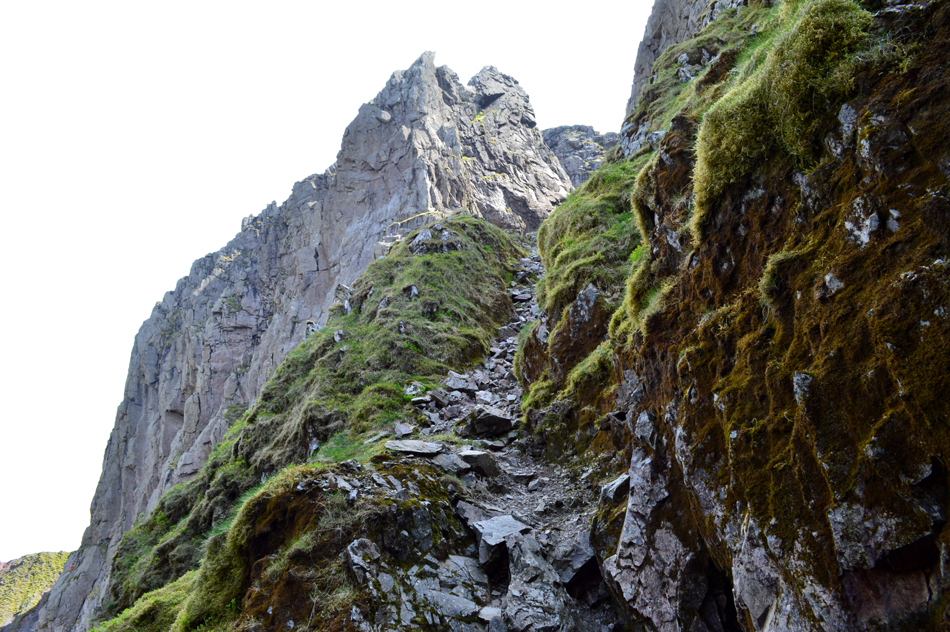
| The Pinnacle (left) and the Oracle (right) forming the head of Deep Gill. |
| I'm sure we earned ourselves some lunch by now but the wind was so strong we needed to find shelter, thinking ahead we knew the summit of Scafell wouldn't offer this nor would the shelter found between Symonds Knott and Scafell, our only option was to break protocol again and gain Symonds Knott, then drop down on the other side to find shelter from the summit winds. |
 |
| Symonds Knott summit. |
| We traced over boulder and easily reached Symonds Knott summit before checking the direction of the wind, then seeking shelter below it. |
 |
| Lunch with a view. |
| Just as we had on the Mickledore Ridge we didn't have to descend far to find ourselves sheltered from the wind, in our case around twenty feet below the summit on a precipice overlooking the Wasdale Valley, I'd pay good money in a restaurant to eat with views as good as this. |
 |
| Looking down at the head of Deep Gill from Symonds Knott. |
| After lunch I braved the summit winds to have a look down on Deep Gill, that last section really is a hands on scramble, in fact if I check my fingernails I'm sure I'll find Deep Gill still under them. |
 |
| Over to Scafell. |
| |
 |
| Scafell summit. |
| We had observed two large walking groups making thier way towards the summit one of which arrived much the same time as we did, it was no hardship although we didn't expect to find the usually scarce summit of Scafell so busy. |
 |
| The view from Scafell towards Symonds Knott and Scafell Pike. |
| The zoom on my camera couldn't pick out just how many people were on Scafell Pike summit right now, with a steady continuous line approaching the summit and queues forming around the summit cairn if I had to put a figure on it I'd say between fifty and sixty. |
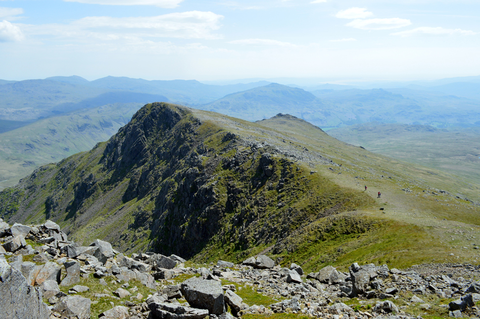 |
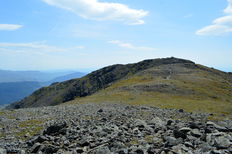
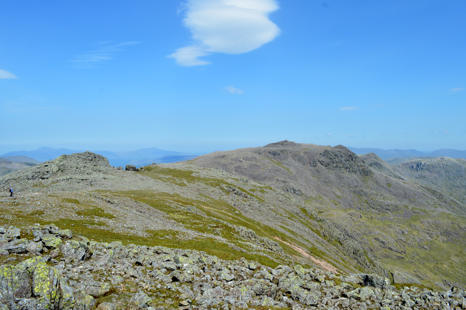
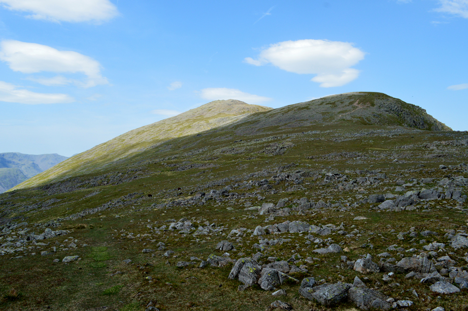
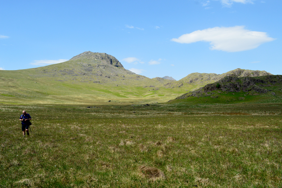
| Slight Side at the far end of the Long Green ridge. |
| With the wind for company we left Scafell summit behind and joined Long Green, it was here that Rod jokingly suggested that if I wanted to summit Cam Spout Crag he'd happily watch me do so, Rod of course was referring to a similar route we did during my Harry Griffin 2,000 Footers project where we undertook the Scafells via Lord's Rake - in not the best conditions and with tired limbs to boot we somehow managed to summit Cam Spout Crag before reascending back to Long Green "nah not today" was my simple reply, besides on a serious note, the Plantar Fascilitis in my right foot is starting to give me trouble as is the blister which is feeling a little raw. |
 |
| Looking back on Scafell from Long Green. |
Just prior to reaching Slight Side we found a gent looking a tad confused, on passing him he asked "was that Scafell behind?" not directly I answered, Scafell is in the distance and with that he thanked us and got on his way. |
 |
| Scafell Pike, III Crag, Esk Hause, Esk Pike, The Yeastyrigg Crags Ridge, High Gait Crags, Bowfell and Three Tarns from Slight Side. |
| With Great Moss below. |
 |
| Slight Side summit. |
| Even as we approached Slight Side a deafening wind could be heard howling over its summit, we climbed through the familiar crags and reached the base of the summit rock finding it was too dangerous to try and stand up, this was as close as we got to the summit top. |
 |
| Looking back on Slight Side, High Scarth Crag and Rowentree Crag as we approach the top of Cat Gill. |
| We left the summit and once again while away from the cross winds descended into a fiery hot afternoon calm. With aching limbs and tender feet we made our way to the top of Cat Gill while our feet soaked up the cushion that the soft grasses provided. |
 |
| Descending Cat Gill. |
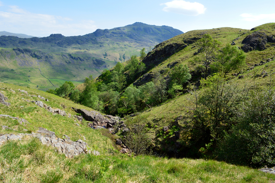
| With views over upper Eskdale towards Harter Fell. |
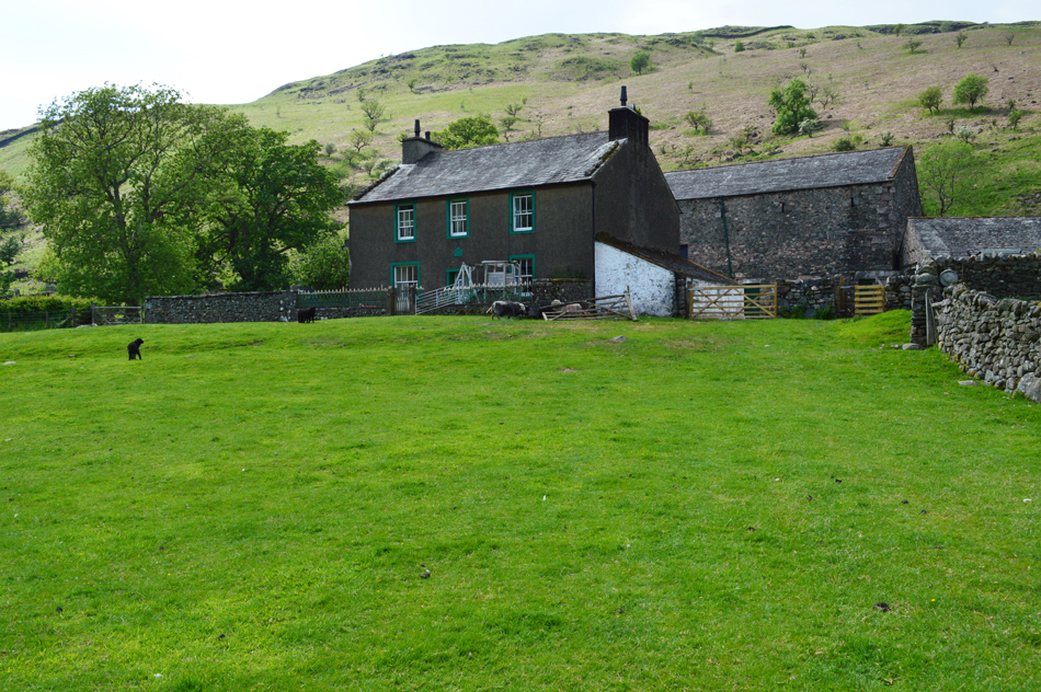 |
| Taw House Farm. |
Having reached the bottom of Cat Gill we crossed Scales Bridge finding a young family bathing in the water, feeling slightly disappointed as Rod had waited all afternoon to take a picture but somehow didn't have the nerve to take a photo of a waterfall with a bikini clad woman stood in front of it.
We continued to follow the walled lane walking through pockets of hot air which felt as if we'd had just opened mother natures oven door. Taw House Farm was reached where we were welcomed by the familiar barking of the farm dogs who were barking from behind a locked barn door. We crossed the field in front of the farm house and headed towards the footbridge where we'll cross the Esk for the last time today. |
 |
| Bowfell and Crinkle Crags from Taw House. |
| |
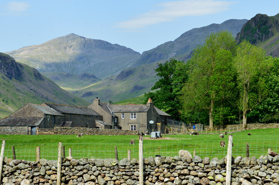 |
| Bowfell seen domineering over Brotherilkeld Farm. |
| |
 |
| A distant Slight Side and Scafell Pike seen from Brotherilkeld. |
Having crossed the River Esk we passed through Brotherilkeld Farm and onto the tarmac lane, for the first time in hours I felt the pressure of my right foot ease away. I said nowt. We had laughed about the tarmac climb back to Jubilee Bridge and had agreed not to collapse our walking poles just yet, "we're gonna need em we laughed" Under shade we passed over the familiar cattle grid and sighted our cars both basking under the heat of an afternoon sun. I made my way around to my car and unlocked it, sent the windows down and switched on the air conditioning.
Little plumes of dust escape my boots as I pulled at the laces before easing my foot first from my left, then right boot. The grass feels soft underfoot as I pull away at my socks, off came the useless plaster too. With my mid North Face trainers on I walk over to Rod who I shake hands with and thank for an excellent walk, all the while smirking at the rim mark around my ankles made up of sunburn and dirt. |
|
| |
| Back to top |
 |
|