|
Wansfell, Woundale and Red Screes from Ambleside |
 |
 |
12th May 2018 |
 |
|
David and Rod came up with this route back in January and ever since then we've been waiting for the perfect day to carry out the walk when all three of us could get together at the same time, it was agreed it had to be a good forecast.
With Spring arriving slightly later this year it mean't we kept having to put the walk back even further and at times looked it like we were never going to walk it at all, that was until last week when a strong forecast it looked like we would finally get to walk our 'Woundale' walk.
Both David and Rod have already been through Woundale previously but me, Woundale is a place I've only seen through the car window whilst travelling along the Kirkstone Pass. It's fair to say I've been looking forward to this walk since it was first mentioned all those months ago. Not just only do we all have Woundale to look forward to but to add a twist to the route we decided to gain Wansfell Pike via Kelsick Scar, an ascent that neither of us had tried before. |
|
|
|
| |
|
Overview |
|
|
| Ascent: |
3,823 Feet - 1,161 Metres |
| Wainwrights: |
2, Wansfell Pike - Red Screes |
| Visiting: |
3, Baystones - St Raven's Edge - Snarker Pike |
| Weather: |
Dry Warm & Sunny. Highs of 22°C Lows of 12°C |
| Parking: |
Parking Spaces, Ambleside C.E Primary School |
| Area: |
Eastern - Far Eastern |
| Miles: |
11.4 |
| Walking With: |
David, Rod & Michael |
| Ordnance Survey: |
OL5 - OL7 |
| Time Taken: |
7 Hours 40 Minutes |
| Route: |
Ambleside - Skelghyll Wood - Kelsick Scar - Wansfell Pike - Baystones (Wansfell) - Idle Hill - Kirkstone Pass - Woundale - St Raven's Edge - Top of Kirkstone Pass - Red Screes - Snarker Pike - Kirkstone Road - Ambleside |
|
| |
|
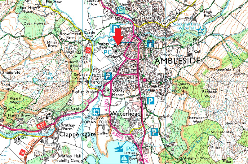
Parking Details and Map |
|
|
| Nearest Post Code: |
LA22 9DH |
| Grid Reference: |
NY 374 044 |
| Notes: |
There is room for half a dozen cars outside Ambleside C.E Primary School, please note that parking here is restricted to weekends and school holidays. There is a donation box found at the left hand side of the car park, all proceeds go to Ambleside C.E Primary School. |
|
| |
|
Map and Photo Gallery |
|
|
 |
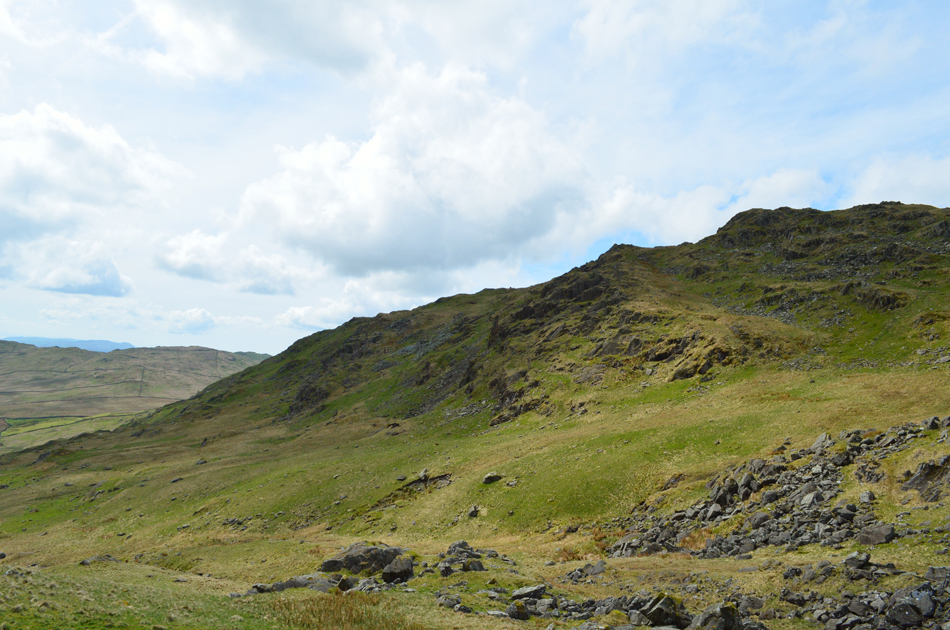
| Views towards Snarker Pike (right) and Low Pike (left) from Skelghyll Lane 09:02am 12°C |
In the words of Lou Todd from Little Britain "What a kerfuffle" this morning turned out to be. Having arranged to meet at 08:00am at Miller Bridge Ambleside I arrived early to find the lane has now been double yellow lined from Rothay Bridge all the way to Miller Bridge with the exception of a single yellow line for the duration of about fifty yards, this line was already occupied by a couple of motor homes. Rod and Michael had already arrived and were sat, as was I bewildered at what to do next, as it stood we were currently blocking the road so we decided to drive back to the Rothay Bridge end and wait for David who arrived a short time later "can't park, the road has been yellow lined from top to bottom" as quick as a shot David said he knew of some parking spaces (now that's knowledge!) between Ambleside C.E Primary School and and St Mary's Church, we quickly made our way through town and minutes later parked with ease leaving just one space left, phew.
The change of our starting point really was no hardship we just had to change our route through Ambleside to reach the Old Lake Road. It's a mild summery feel to the morning each of us wearing standard issue shorts. The forecast is for a dry day with plenty of sunny spells and if these minutes spent kitting up besides the cars are anything to go by were in for a grand day. Having locked the cars we made our way through town partly through a back street known as the Slack then emerging in front of the old Market Hall building before leaving Ambleside for the Old Lake Road from where we'll pick up Skelghyll Lane. It's still early and Ambleside is pretty quiet but give it a hour or so and you'll be hard pushed to find any room along these pavements.
We left the Lake Road and picked up the Old Lake Road before turning left into Skelghyll Lane on route to Skelghyll Wood, the lane is leafy, narrow and climbs steeply soon leaving the noise of any traffic behind as Hayes Garden World, or as David liked to call it "The Starship Enterprise" commands our fore-view with Loughrigg Fell in the distance. To the north, Snarker Pike as views over the Fairfield Horseshoe start to unfold. |
 |
| Looking towards the Fairfield Horseshoe from Skelghyll Lane. |
| There's still a little cloud clinging to the summits which soon burns away as the morning progresses. |
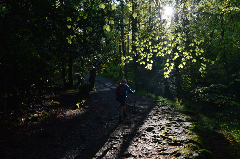 |
| Sunlight breaches through the trees, Skelghyll Wood. |
| We left Skelghyll Lane behind and its crystal views over Windermere towards Wray Castle. With the tarmac lane behind us we entered Skelghyll wood and followed the stony path which rises towards Jenkin Crag, it's close to here we leave Skelghyll Wood for Kelsick Scar. |
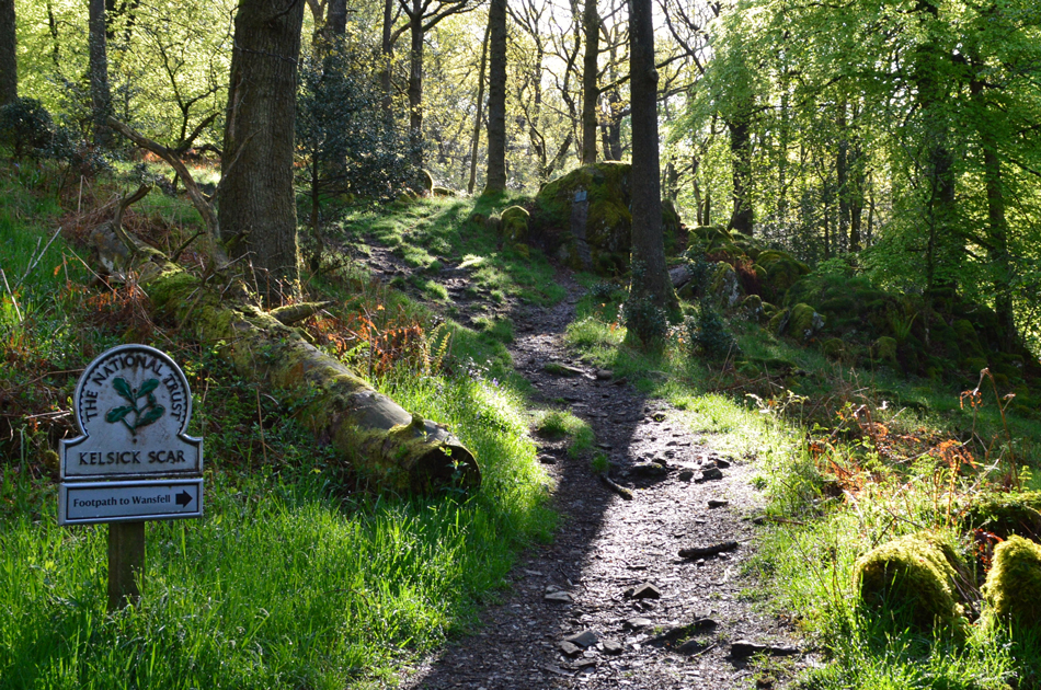 |
| Here it is. |
Just prior to reaching the sign posted 'Jenkin Crag' we tracked deeper into Skelghyll Wood towards Kelsick Scar, as previously mentioned non of us had used this path before and like little explorers we were quite eager to see what we would find.
The path climbs through the wood, often steep in places with pockets of Bluebells either side of the path, soon the path comes in line almost with the tops of the trees before arriving at a stone wall accessed via a ladder style, we cross the style and leave Skelghyll Wood behind. |
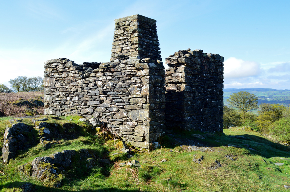 |
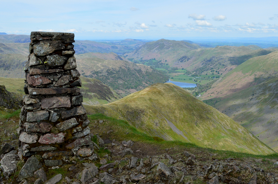
| One of two Survey Pillars found on Kelsick Scar. |
| Built between 1890 and 1925 this Survey Pillar, and one more like it found behind Lowood Hotel form part of the route for the Thirlmere to Manchester pipeline. |
 |
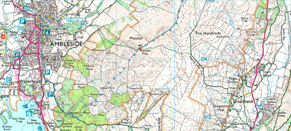
| That's Wansfell Pike on the skyline. |
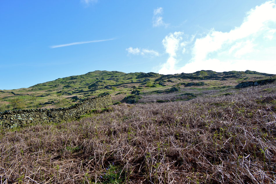
This part of the fell side is crisscrossed with stone walls which, when observed on a map can look a tad confusing knowing that a path passes through, the reality is there is no confusion at all, a prominent path traces all the way towards the summit having only to pass through two gates and one ladder style if I recall. |
 |
| That's the Fairfield Horseshoe again. |
| The cloud is starting to lift just nicely now. |
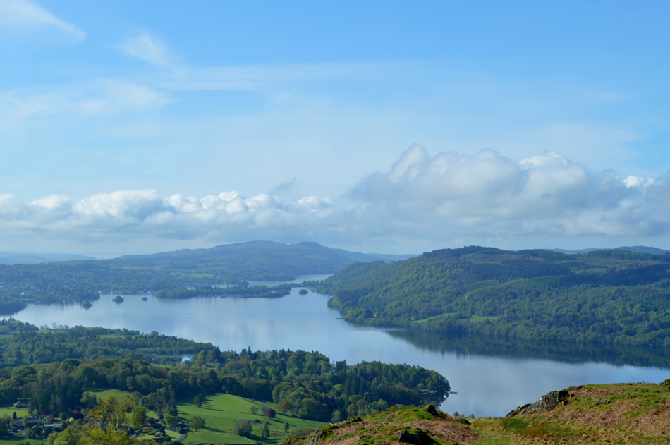 |
| Windermere looking towards Belle Isle. |
| The views from the path were fantastic and were well worth the short excursion to get this fantastic view of Windermere. |
 |
| Wansfell Pike is just up ahead. |
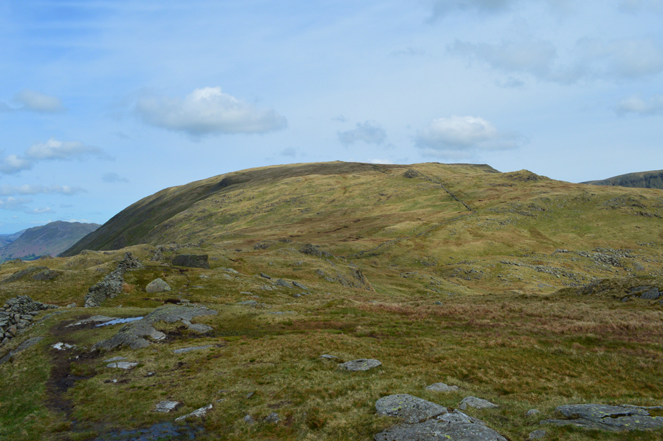
| Continuing to follow the path we soon come inline with the familiar stone wall seen over on the right. From here the view of todays last summit, Snarker Pike is outstanding. |
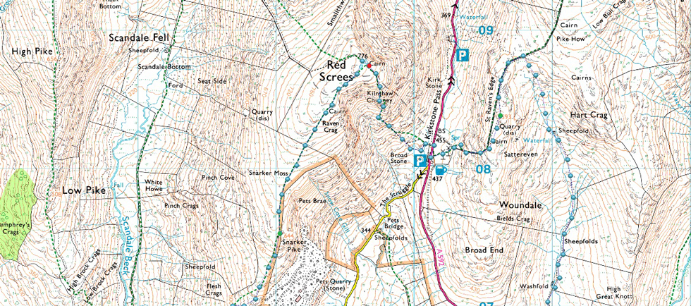
 |
| Snarker Pike, Red Screes and the top of Kirkstone Pass and Caudale Moor (Stony Cove Pike) from Wansfell Pike. |
| While over on the left Rydal Fell, Great Rigg, Fairfield, Hart Crag, High Pike and Low Pike forming the Fairfield Horseshoe. |
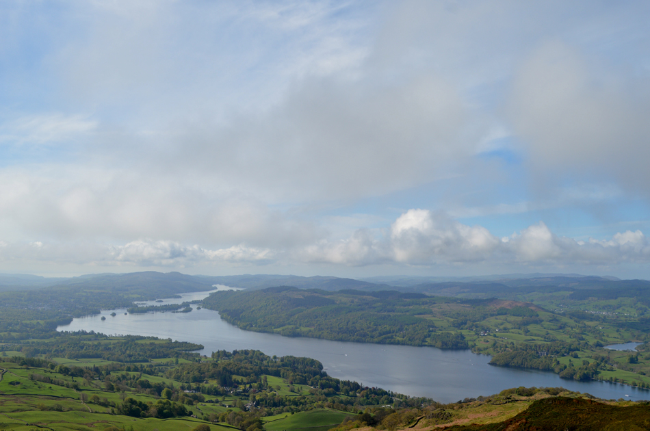 |
| Windermere from Wansfell Pike summit. |
| We arrived soon after two walkers had just left and had taken, as we would, the ridge route towards Baystones, it's quite a rare occurrence to have Wansfell Pike to yourself so we savoured the view for a few moments before we too made our way towards Baystones. |
 |
| On route to Baystones seen up ahead. |
| With extended views over Red Screes, St Raven's Edge, Caudale Moor (Stony Cove Pike) Thornthwaite Crag and Froswick. |
 |
| The view over The Struggle towards Snarker Pike leading to Red Screes. |
| |
 |
| St Raven's Edge, Caudale Moor (Stony Cove Pike) Thornthwaite Crag and Threshthwaite Mouth from Baystones (Wansfell) summit. |
We traverse the grassy ridge between Wansfell Pike and Baystones crossing over the numerous grassy outcrops while detouring around the boggy bits before arriving at the summit, at the same time the couple we had been following left in the direction of Nanny Lane. The temperature dips slightly as high cloud moves in temporarily right over our position.
With little to no wind we're going to have to walk our way out of the shade if that makes any sense! |
 |
| Here looking back on Wansfell Pike with the Coniston Fells in the distance. |
| |
 |
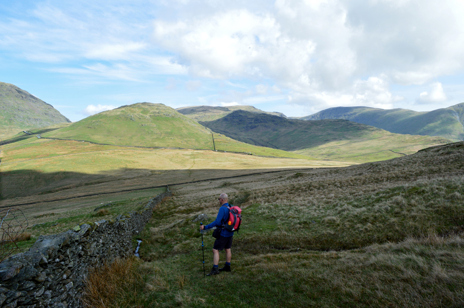
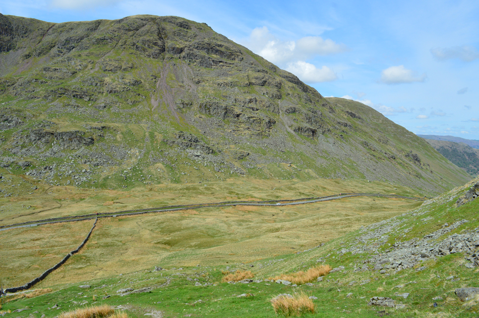
| Descending Idle Hill with views over St Raven's Edge, Woundale, Caudale Moor (Stony Cove Pike) Threshthwaite Mouth, Thornthwaite Crag and Froswick. |
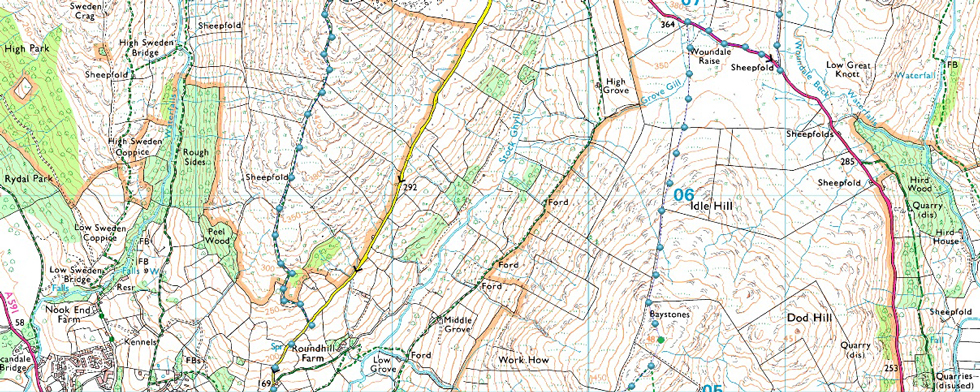
| With Baystones behind we trace north by the stone wall flanking Idle Hill to our right, it's pretty squelchy underfoot with far worse to come between here and Woundale Rise seen centre left. |
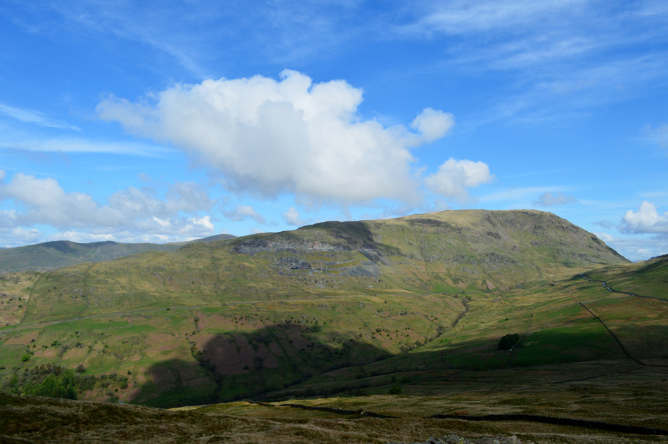 |
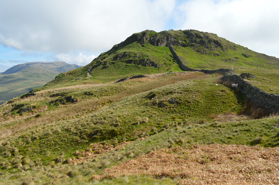
| Snarker Pike and Red Screes |
| That's Pets Quarry seen below Snarker Pike summit, for the life of us non of us could remember the name of the quarry which I had to check when I got home. |
 |
| Rod spots a ruined caravan left behind in the High Grove area of the fellside. |
| |
 |
| Kirkstone Pass/Woundale Rise. |
| Having squelched all the way to Kirkstone Pass we were pleased to have reached the style and dry terrafirma. We need to make our way towards a wooden gate which gives access into Woundale from the pass. It's a sad fact that each of us could have filled a bin bag with the amount of litter we found laying on the roadside. |
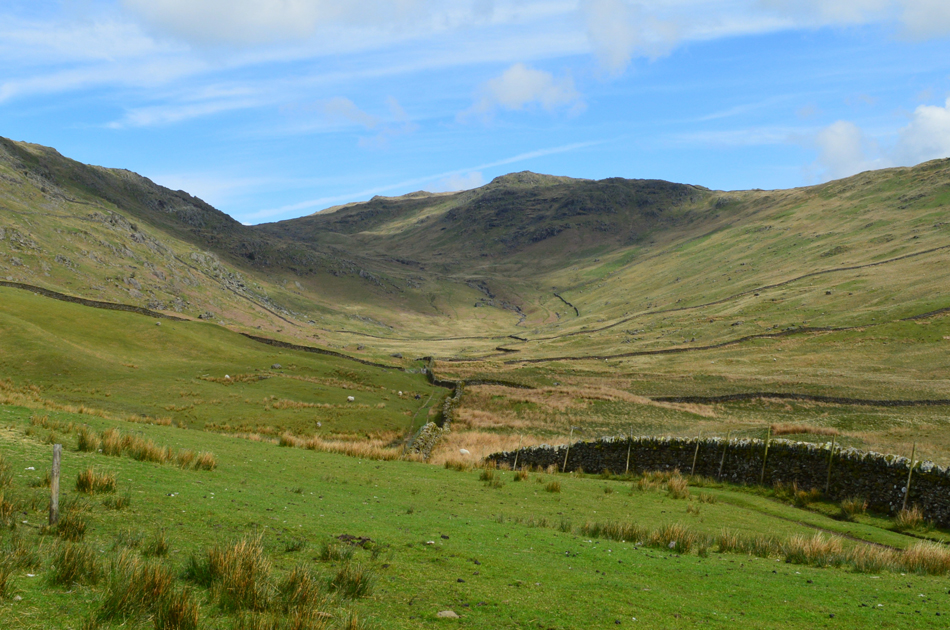 |
| Woundale. |
| Kirkstone pass dropped into a depression and over on the left, the large wooden gate which had seen better days. We pass through the gate and carefully closed it behind us. Up ahead Woundale, the part of the walk which we had all been looking forward too. Our route will see us walk through the centre of the valley close to Woundale Beck passing 'Washfold' the site of a large sheep pen where sheep would once get dipped in Woundale Beck. From the sheepfold we next pass a ruined quarry hut before ascending steeply towards a second sheepfold close to the head of the valley. |
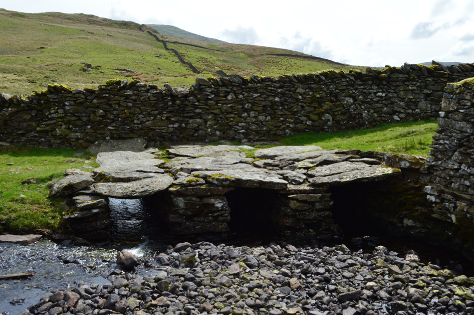 |
| Three arch Clapper Bridge, Woundale. |
| Under a hot afternoon soon we progressed into the valley alongside a stone wall, it was here we are disturbed by the sound of a dog who friendly charged at us before its owner, a stone wall builder who was repairing part of the sheepfold told the dog to calm down, or words to that affect "there's no harm in her" and despite the barking, I think we knew the dog was just greeting us. We passed the chap who was sat in a old Landrover by the looks of it, having lunch. The first of two joined sheepfolds are passed separated by this three arched clapper bridge. |
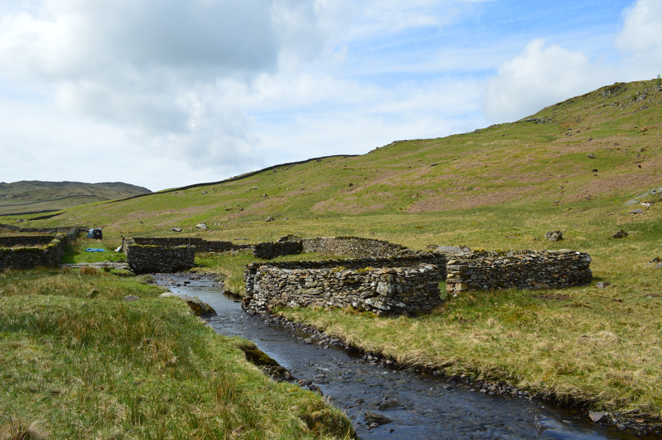 |
| Looking back on the Washfold, Woundale. |
| The second pen was where the action used to take place, here you can see a gap in the pen which opens out directly into Woundale Beck as it narrows, the beck here has been dredged to around four feet making sure that when the sheep left the pen, it was dipped/washed in the beck. A genius creation where with the thanks to the local stone wall builder, will hopefully see out another hundred years here in the Woundale valley. |
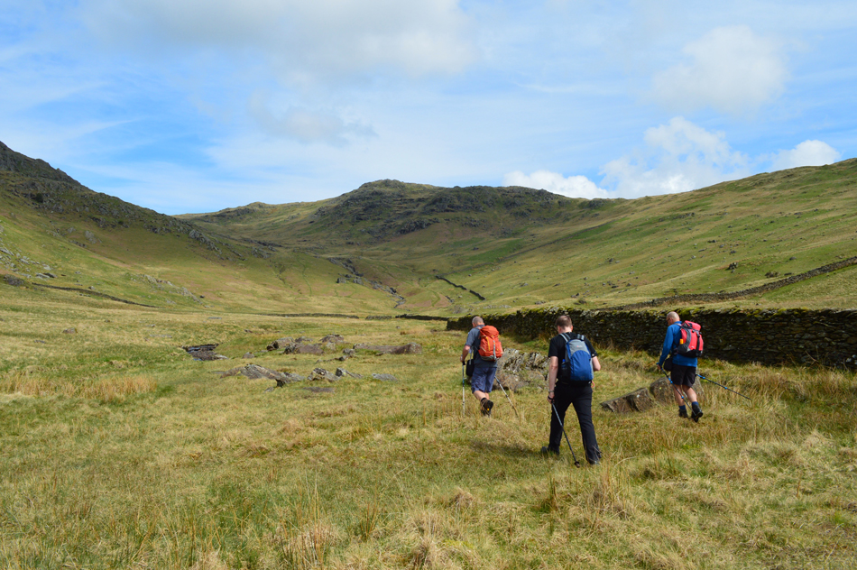 |
| David, Michael and Rod making their way through Woundale. |
| Next we ascend towards an old quarry hut found below Hart Crag seen in the centre of the photo. |
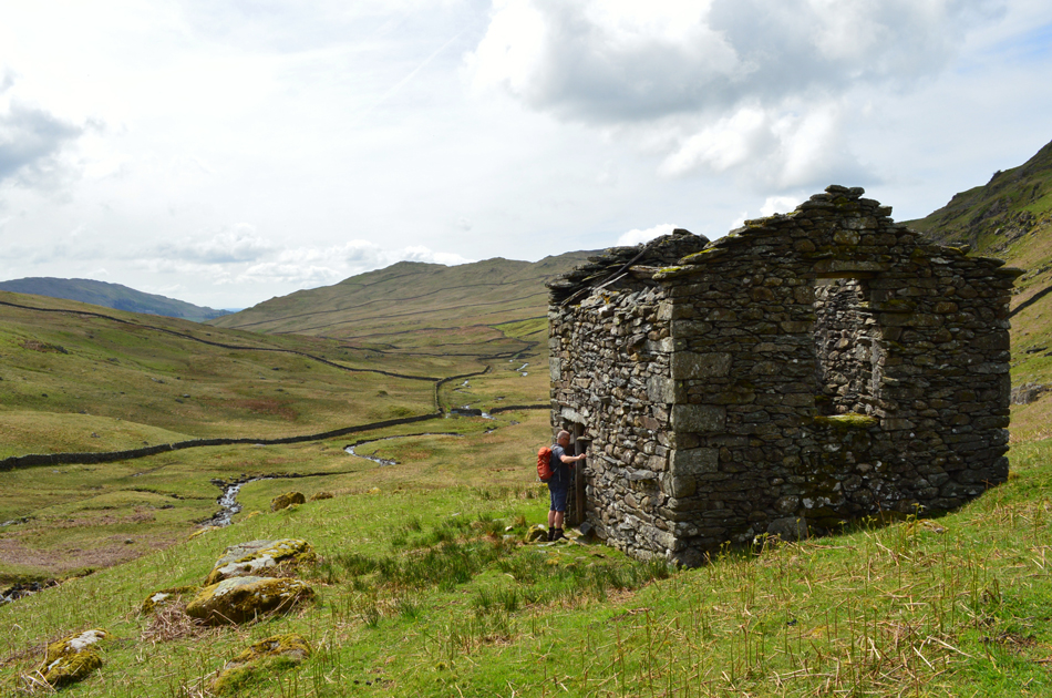 |
| Ruined Quarry Hut, Woundale. |
| A steep path leads from Woundale Beck towards the ruined hut although there was options to keep with the valley path which ascended alongside Woundale Beck which now fell away steeply to our right. Here David explores the hut finding wooden second floor beams still intact, at first glance we thought the building may have been a barn before finding the beams/second floor inside we concluded that this must have been a dwelling for the men who worked at a nearby quarry found below St Raven's Edge. |
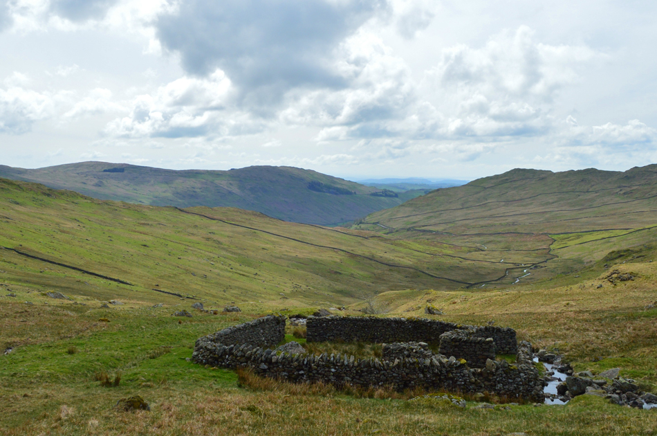 |
| The second sheepfold found close to the head of the valley. |
| It was a combination of midday heat, very boggy ground and no path to follow which made the ascent towards the second sheepfold feel like really hard work. |
 |
| Looking over towards St Raven's Edge. |
| In this image you can see the quarry in the centre left of the photograph. |
 |
| Looking back on Caudale Moor (Stony Cove Pike) |
| I think it was fair to say that all four of us were pleased to have ascended the head of Woundale where despite its historical interest it was very boggy indeed. The stone wall between Caudale Moor and St Raven's Edge slowly came into view and soon we were hoping between the familiar steeping stones on route to St Raven's Edge. |
 |
| Red Screes seen with Middle Dodd from St Raven's Edge. |
| |
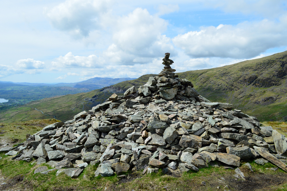 |
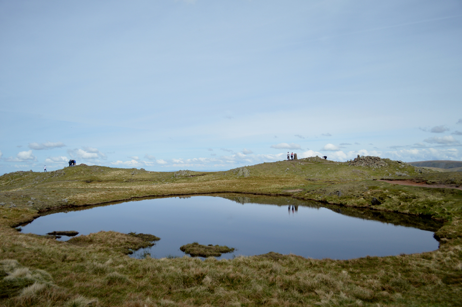
| St Raven's Edge impressive summit cairn. |
| The summit of St Raven's Edge lies on the actual path and with little effort under a glorious midday sun we soon found ourselves at the summit looking onward towards our next summit of Red Screes. It was agreed that we would wait until we had ascended Red Screes until we stopped for lunch, this way we won't be taking on the the steep and final ascent with full stomachs. |
 |
| Descending St Raven's Edge with views over Red Screes and the top of Kirkstone Pass. |
| |
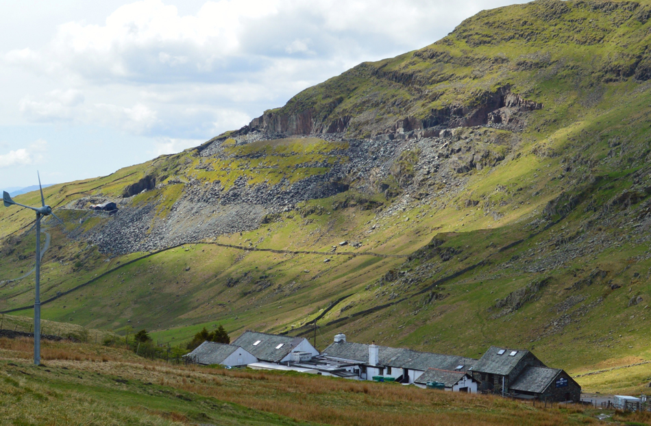 |
| Kirkstone Pass Inn with Pets Quarry domineering from above. |
| |
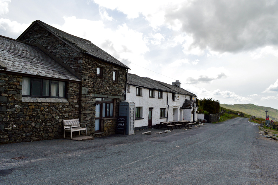 |
| Kirkstone Pass Inn. |
In may not look it but it was very busy as we crossed the pass, a bus had just pulled away having left half a dozen walkers while the car park opposite the Inn was busy with tourists eating lunch outside on the benches while motorbikes came and went as do cyclists having successfully ascended the top of the pass. It was all very relaxed and our heads could have easily fell in with the crowd, but our feet still had Red Screes to climb.
Time to pull our socks up lads. |
 |
| Looking down on The Struggle, Kirkstone Pass and Wansfell from the ascent of Red Screes. |
| The miles are starting to show now. |
 |
| Middle Dodd, Brothers Water and a host of Eastern fells from Red Screes summit. |
| It was the kind of 'dig deep' ascent, not so much on miles or total ascent but I think our bog trotting antics had tired limbs out much earlier, nevertheless in good stead we gained Red Screes finding a partially deserted summit with walkers approaching from the Scandale side, despite aching muscles it was the thought of lunch that spurred me on, I wasn't so much hungry, I just needed to refuel. |
 |
| Lunch with a view. |
| We ate lunch while overlooking Hart and Dove Crags all the while keeping an eye on some cloud movement from the west which was creeping in on the Langdale Pikes through to Great Gable. The sun was once again hidden by high cloud but I guess this allowed us to cool down as we ate lunch. Feeling refreshed we packed our lunches away to find the summit was getting quite busy with one group (far left) who were operating a drone. I think we timed our exit right on queue. |
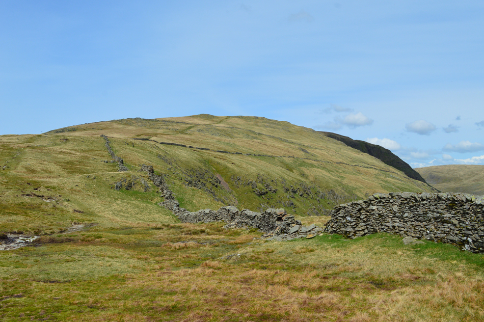 |
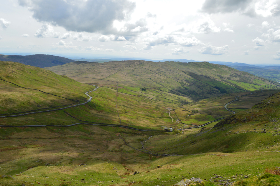
| Looking back on Red Screes from Snarker Pike. |
| We all had our favourite moments from the walk and the descent of Snarker Pike was the one I had been most looking forward to, a long smooth grassy descent all the way back to the bottom of The Struggle road. |
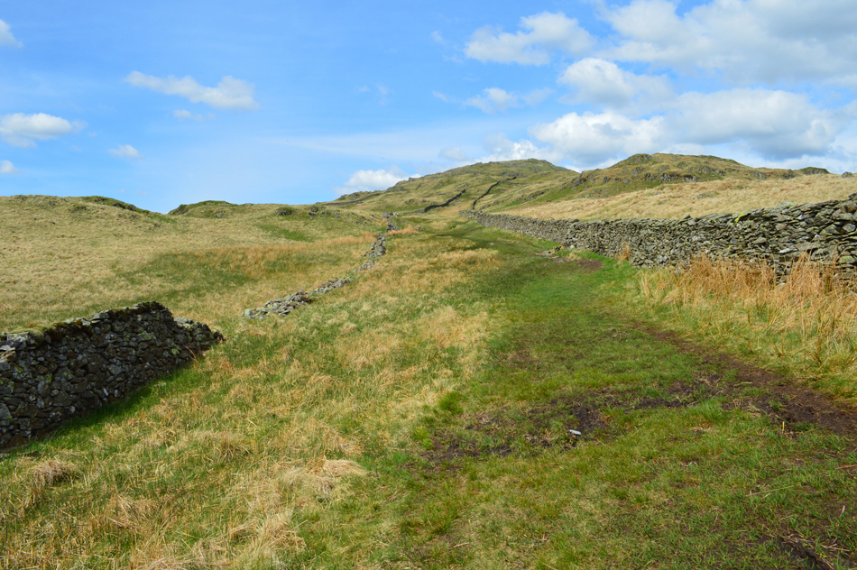 |
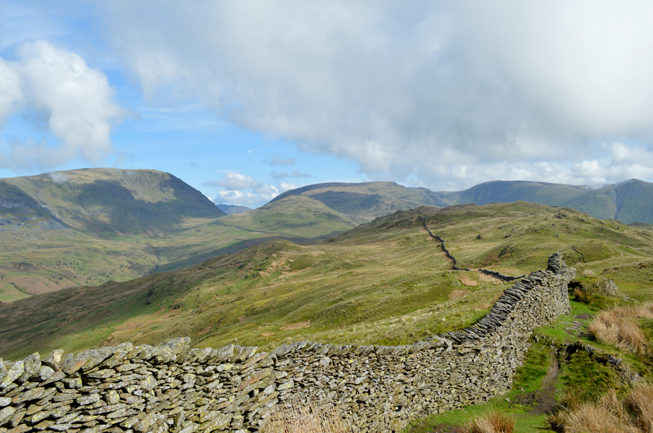
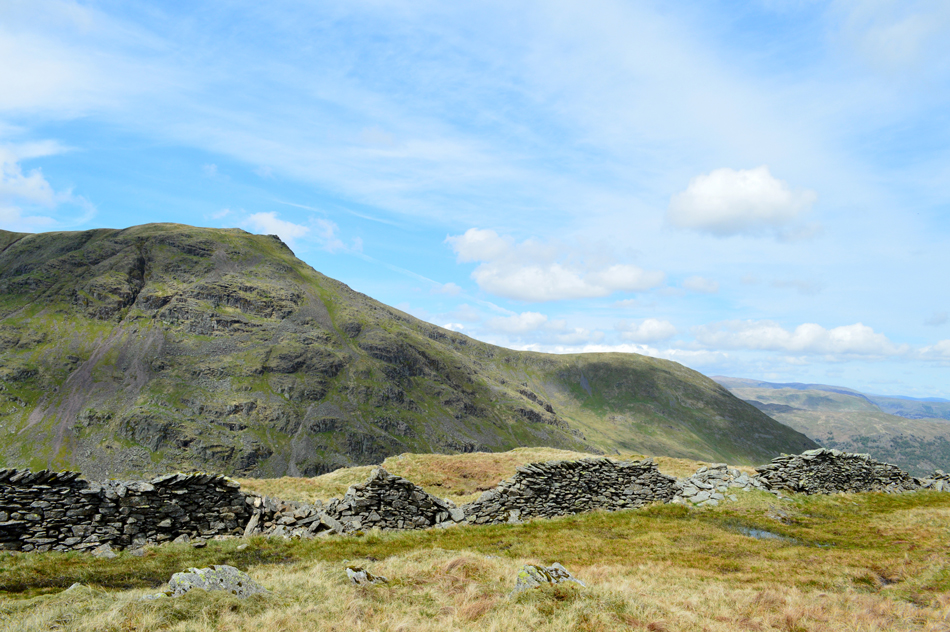
| The familiar twin stone walls found close to the bottom of the ridge. |
| |
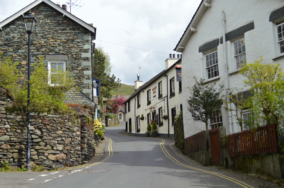 |
| The Golden Rule, Ambleside. |
| Having descended Snarker Pike we found ourselves still in descent along The Struggle where cars and bikes did exactly that 'struggle' not because of the gradient of the road but the volume of traffic, it didn't bother us the slightest, not after such a good day on the fell. |
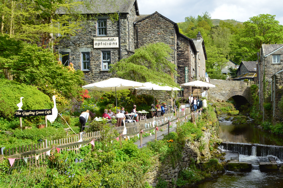 |
| The Giggling Goose Cafe, Ambleside. |
We reached the bottom of The Struggle at the mini round-about and turned into the main street where we had our own struggle in walking the pavement there was just that many people about, traffic was backing up both in and out of the main street all the while folk looked on through cafe windows and bars whilst relaxing just watching the world go by.
We turned right onto Compston Road, the main street through Ambleside whilst squeezing our way along the pavement before turning into Vicarage Road where at the end of the street awaited our cars all the while our nostrils are treated to the smell of fish and chips from a nearby chippy. |
|
| |
| Back to top |
 |
|