|
Walking the Birketts, Over Carrock Fell, High Pike and Knott |
 |
 |
28th April 2018 |
 |
|
I fancied something a little more different so with the weekend approaching I had two walks to choose from one of which was a Birkett walk behind the back O' Blencathra and the other was this one, Birketts walk over Carrock Fell, High Pike and Knott.
This route collects nine summits in total and because some of those summits lie on pathless ground good visibility is key to a successful tour of these grand fells. The forecast was set for a dry day with sunny spells with any lingering cloud lifting throughout the morning. The day started off clear and bright with temperatures rising and I was even treated to a cloud display rolling in from the east before settling down on the flanks of Carrock Fell, with blue skies overhead I thought I might even get a cloud inversion but said cloud just kept coming until visibility dropped to around thirty feet.
It wasn't really any hardship having no visibility my only complaint being the beautiful views of the Carrock Pike ridge and High Pike which I missed out on, I was so busy navigating the clag I completely missed the cloud lifting behind me, by which time I was stood on Great Lingy Fell summit. |
|
| The Complete Lakeland Fells |
 |
| By Bill Birkett |
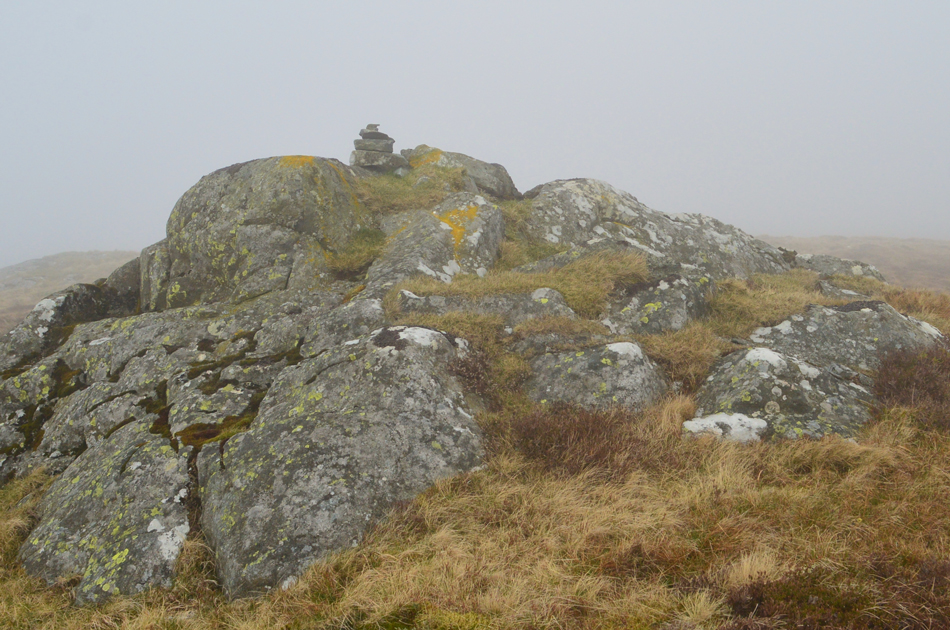
-Little Lingy Hill
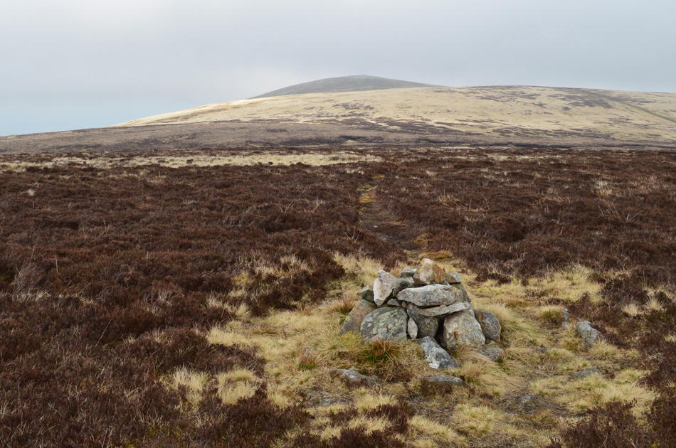
Climb to Great Lingy Hill, which is marked by a small cairn, beyond lies a dome with a cairn which must be Little Lingy Hill. |
|
|
|
| |
|
Overview |
|
|
| Ascent: |
2,501 Feet - 763 Metres |
| Birketts: |
9, Carrock Fell - Round Knott - Miton Hill - High Pike - Hare Stones - Great Lingy Hill - Little Lingy Hill - Knott - Coomb Height |
| Weather: |
A Bright Start Though Hill Cloud Developing, Clearing Mid Morning With Some Brightness PM. Highs of °C Lows of °C |
| Parking: |
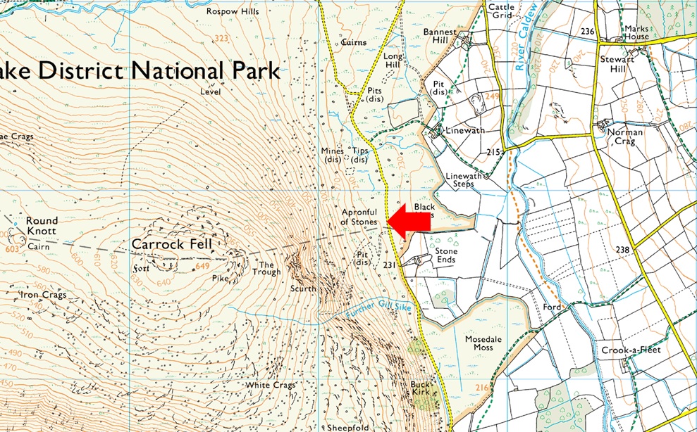
Roadside Parking, Apronful of Stones, Mosedale |
| Area - Group: |
Northern - N/NOS |
| Miles: |
10.1 |
| Walking With: |
On My Own |
| Ordnance Survey: |
OL5 |
| Time Taken: |
5 Hours 10 Minutes |
| Route: |
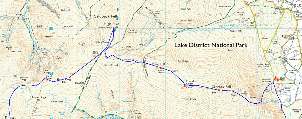
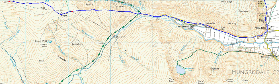
Apronful of Stones - The Trough - Carrock Fell - Round Knott - Miton Hill - High Pike - Hare Stones - Great Lingy Hill - Little Lingy Hill - Knott - Coomb Height - River Caldew - Mosedale - Apronful of Stones |
|
| |
|
Parking Details and Map |
|
|
| Nearest Post Code: |
CA7 8JS |
| Grid Reference: |
NY 353 633 |
| Notes: |
Apronful of Stones is the name given to the area around a mile north of Mosedale hamlet. If travelling from the direction of Mosedale roadside parking can be found to the left just past Stone Ends Farm which will appear on the right. The parking area isn't tarmac'd but a grass clearing to the left will give the parking spaces away. Apronful of Stones provides excellent access to Carrock Fell and High Pike amongst others and parking is free. |
|
| |
|
Map and Photo Gallery |
|
|
  |
| |
| |
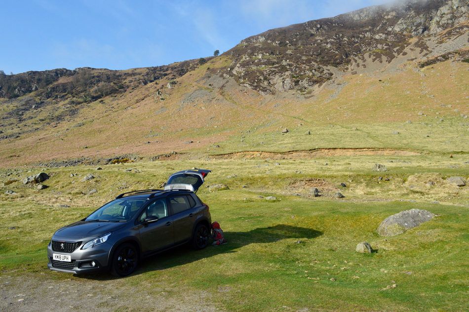 |
| The East flank of Carrock Fell from Apronful of Stones, Mosedale 08:15am 5°C |
The morning started so beautiful with only a slight nip in the air and clear blue skies overhead. I reached Apronful of Stones and parked easily on the grassy lay-by not far away from Stone Ends Farm. I'm back to wearing long trousers after summit temperatures were forecast to remain above freezing not forgetting to mention that today I'll be walking pathless through bog and heather between some summits, a decision which I was pleased to have made on more than one occasion today.
You can see the path that I'll be using behind my car, it's a pretty steep start that gets steeper once The Trough (situated where you can see the tree in the centre of the photograph) is reached which will then ascend on to the shoulder of the fell before steadily levelling out towards the summit. This is one of two steep ascents on todays route which can only mean one thing, lots of rolling grassy ridges.
Sounds so romantic doesn't it, just wait until I go off path, that's where we lose the romance! |
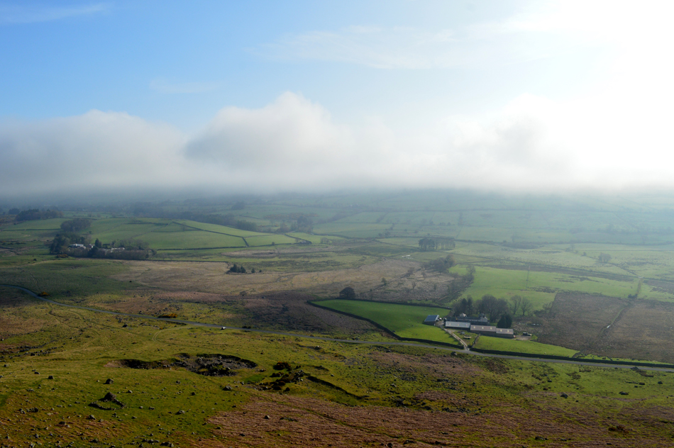 |
| Looking down on Apronful of Stones and Stone End Farm. |
| Do you remember the cloud that I mentioned ealier, here it is slowly making its way towards the Caldbeck Fells. At this point the only thing on my mind was that I could just about see over the top of the cloud which could mean If I get a move on I might find myself looking over the top of a cloud inversion. |
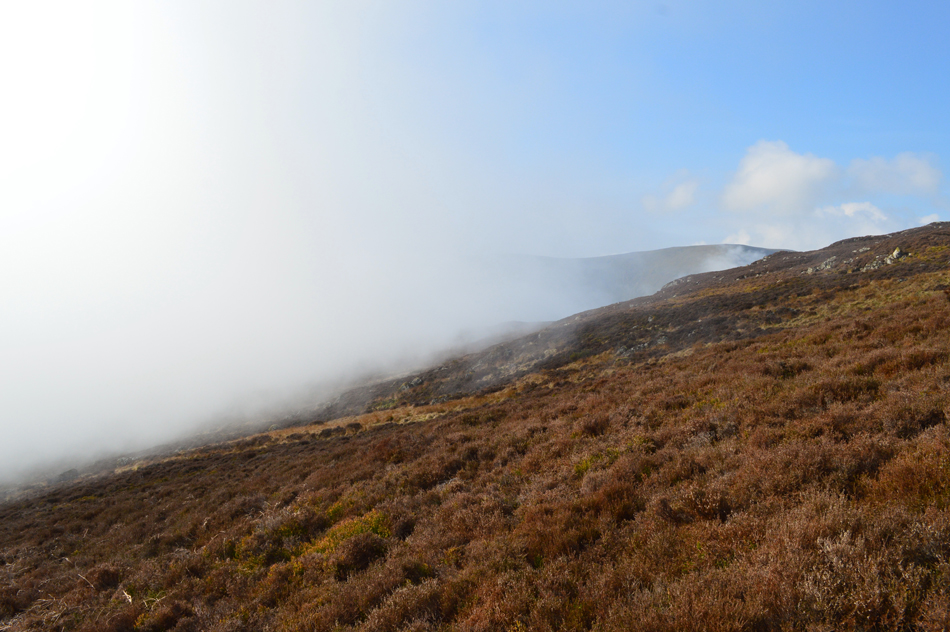 |
| Here it comes... |
| |
 |
| ....magnificent. |
By the time I had almost ascended to the top of The Trough the cloud finally caught up with me, I don't know why I figured I could 'out climb' the cloud, maybe it was because of the total lack of wind but it just proves even with nothing to push it along the cloud advances much quicker than I imagined. It was here I pulled out my mobile phone to capture the cloud approaching, it was so peaceful with the only sound being the gurdle from a Grouse hidden beneath Heather somewhere in the distance.
And maybe a little heaving coming from my direction. |
 |
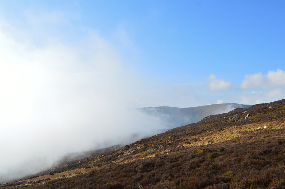
| Approaching Carrock fell, beaten by the advancing cloud. |
I passed the familiar sheepfold on the shoulder of the fell from where the path levels before a short pull over boulder towards the summit, it was here the cloud rolled in masking what once was, a bright blue sky overhead. This didn't worry me at all because visibility was changing so rapidly I was still thinking that by the time I reached the summit conditions might start to clear.
How wrong I was. |
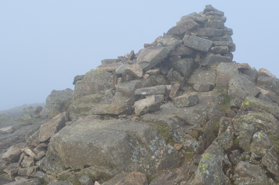 |
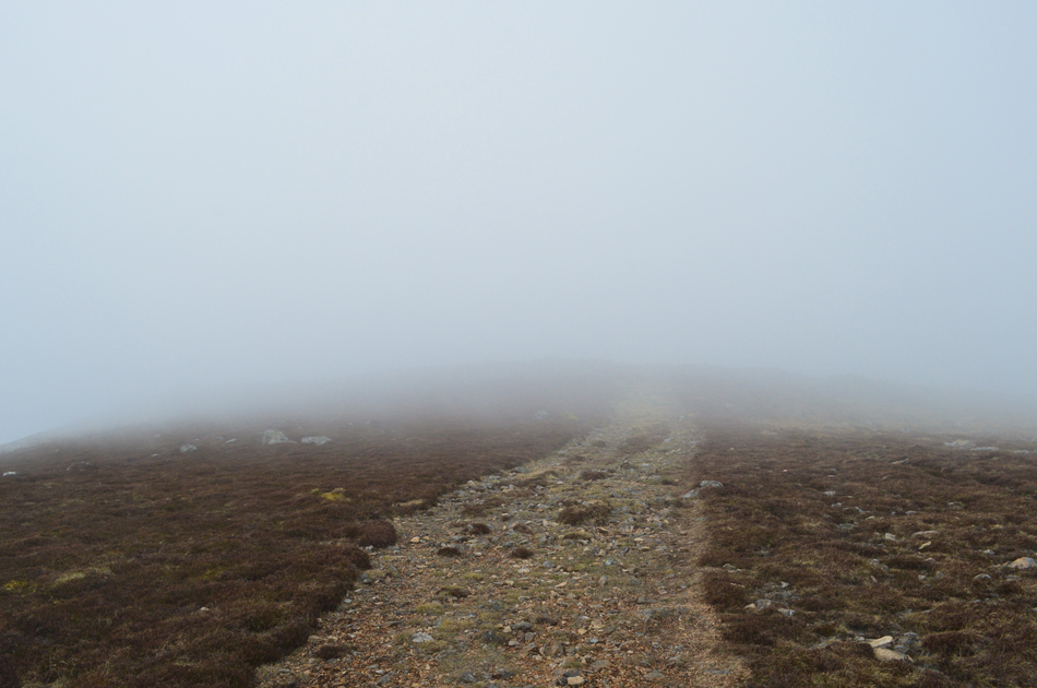
| Carrock Fell summit. |
| I hung around for around five minutes just to see if the cloud might clear but if anything visibilty dropped even more and with it, so too did the temperature. I peered vertically towards the sky were snippets of blue would appear which told me I was in the upper layer of the cloud and, I might still get that inversion. |
 |
| On descending Carrock Fell I head across the ridge towards Round Knott. |
Despite my lack of visibility this view was extremely promising with blue skies seen upper left, surely if I stood on a high enough outcrop of rock my head would pop out of the cloud! Only joking, but it surely felt that way.
Here I follow a prominent footpath towards my second summit of Round Knott. |
 |
| Round Knott appears out from the cloud. |
| Having Carrock Fell behind I continued to follow the path, my heart fluttering at every break in the cloud all to no avail. I had expected to find the ridge much boggier and I was pleased at not having to detour with the exception of the odd skip and jump. Just under half a mile west of Carrock Fell lies Round Knott, to reach its summit the main path must be left upon reaching a left fork in the path. With no great visibility I followed a faint path sometimes through bog before the impression of Round Knott appeared. |
 |
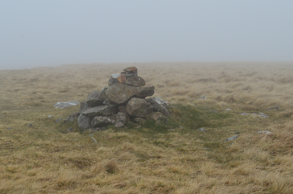
| Round Knott summit cairn. |
| From the summit of Round Knott a prominent path directs you back towards the main ridge path now Miton Hill bound. |
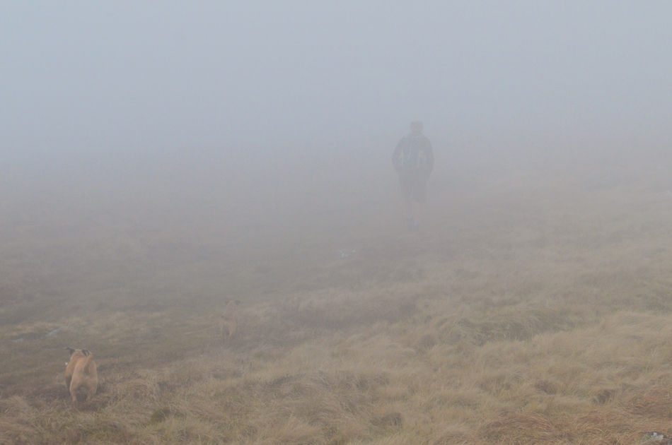 |
| A walker and his two dogs appear out of the cloud while on route to Miton Hill. |
I rejoined the ridge path before checking my position in comparison to my third summit of Miton Hill, in clear conditions both Round Knott and Miton Hill can be seen from Carrock Fell summit, even as an experienced fell walker and knowing the area well I still find myself checking my position every now and again, I guess it's human nature when presented under such conditions.
Prior to reaching Miton Hill I'm joined by this chap and his Terriers and we stop to chat for a while, he too mentioned how lovely it was in the valley and couldn't believe how quickly conditions changed, turns out he had parked in Mungrisdale and had ascended Carrock Fell from Mosedale via the south east flank "a great alternative" he said, I'll have to try it someday I replied. |
 |
| Miton Hill summit. |
| There was no problem locating Miton Hill summit as it is found on the actual path itself (not to be confused with a stone cairn found within a cluster of boulders prior to reaching this cairn) |
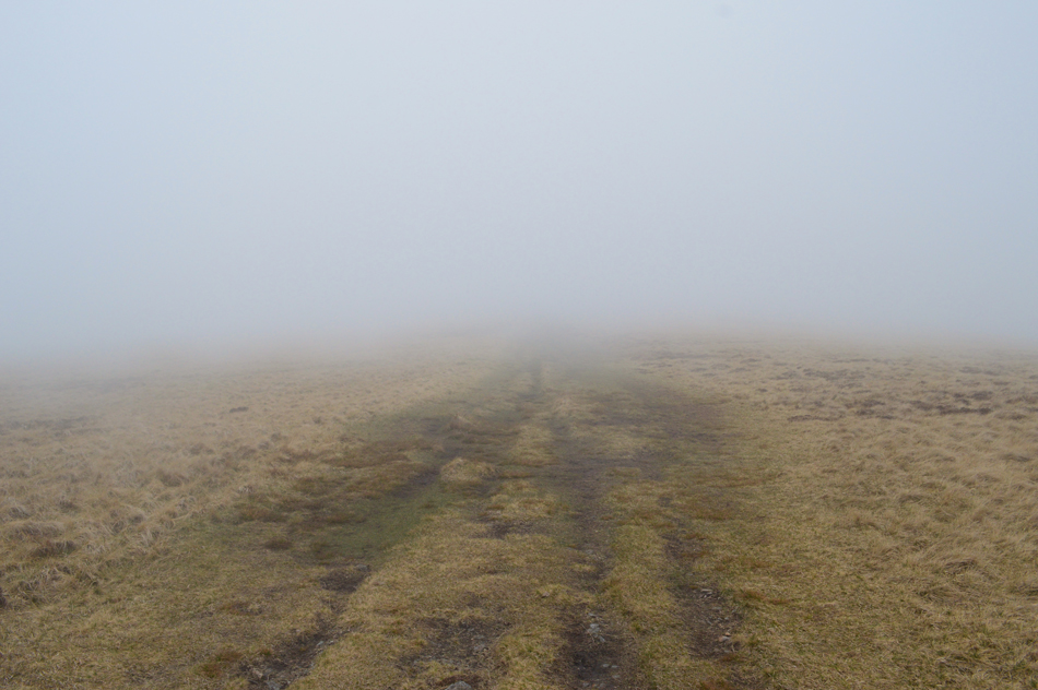 |
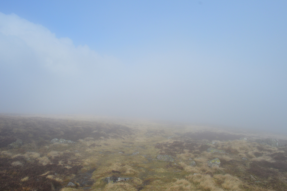
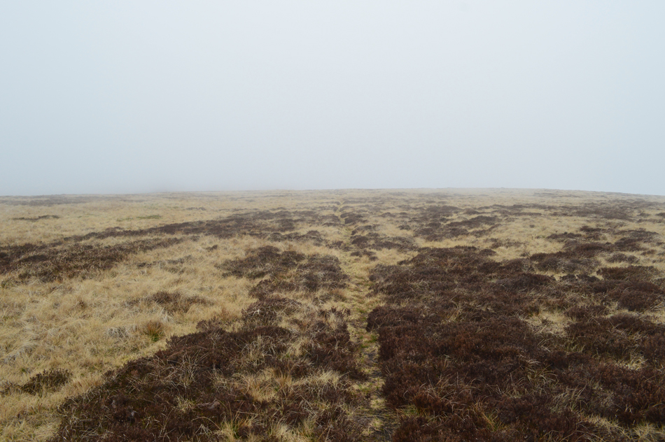
| Into the clag. |
| As I head towards Drygill Head. |
 |
| Drygill Head. |
| I could still hear my fellow walkers dogs barking in the distance followed by the sound of his voice as he tried to quieten them down but that soon faded by the time I reached Drygill Head. Up ahead the path crosses over the Cumbrian Way where I bear right before beginning the ascent of High Pike. |
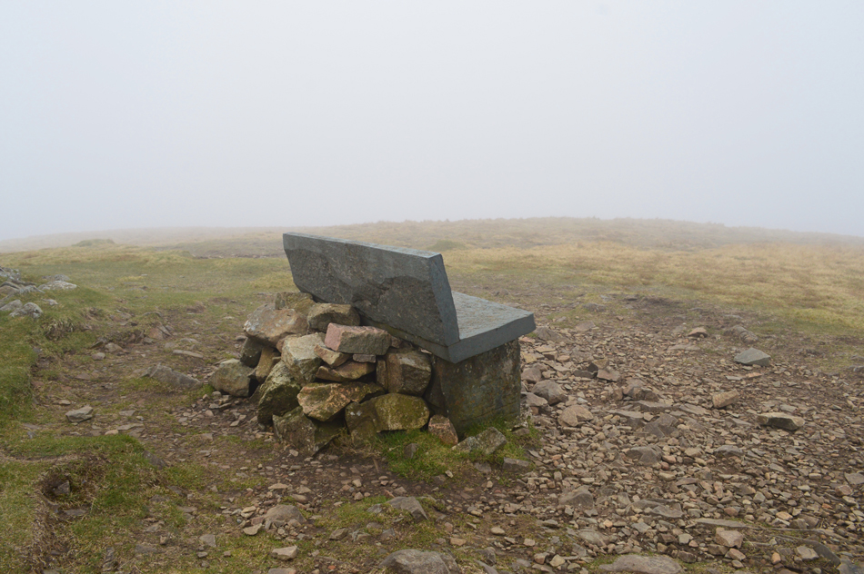 |
| The Bench, High Pike summit. |
| There isn't much effort required to reach High Pike from the Cumbrian Way and I seemed to reach the summit in no time at all spotting the chap and his two dogs fading off into the distance in the direction of Low Pike. |
 |
| Descending High Pike back towards the Cumbrian Way. |
| I hung around a while peering into a void of white cloud in every direction before making my descent via a different path from which I ascended which steers south westerly back towards the Cumbrian Way and my next summit of Hare Stones. |
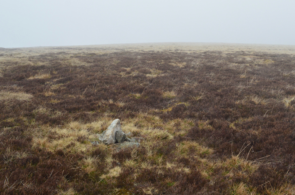 |
| Hare Stones summit cairn. |
| I rejoined the Cumbrian Way and steered towards Lingy Hut before coming to a stop at the Cumbrian Way's highest point along this stretch, this is Hare Stones, even on a day with bad visibility such as today the summit cairn was still visible from the path, just. |
 |
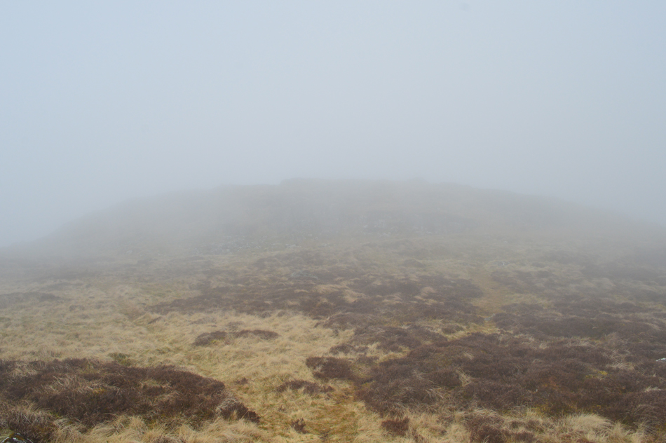
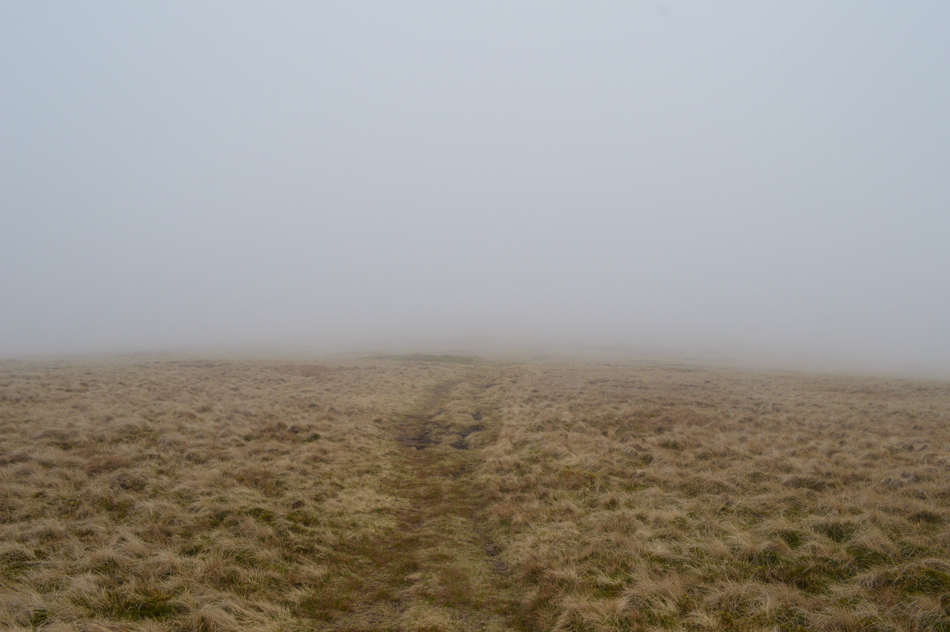
| Continuing south westerly towards Great Lingy Hill. |
| From the summit of Hare Stones a prominent path cuts through the heather towards Great Lingy Hill which is somewhere out there! |
 |
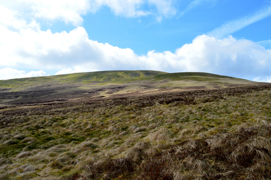
| That's better, here's High Pike and Hare Stones from Great Lingy Hill summit. |
| Unbeknown to me the cloud was lifting behind me, with me being lost in my world of silence I didn't notice a thing until I turned around upon reaching Great Lingy Hill summit cairn. Here you can see Hare Stones (foreground) with High Pike beyond, if you look closely you might be able to spot the path I used which fades into col/peat hags below, from where only a gentle gradient is required before arriving at the summit cairn. |
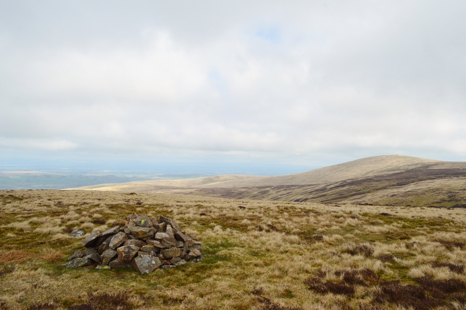 |
| High Pike from Little Lingy Hill. |
A significant path from Great Lingy Hill descends then crosses a col before a steady ascent on Little Lingy Hill which hosts a rather prominent cairn seen clearly from its big brother just across the way.
Footnote: The OS Map credits a grassy hump found at Miller Moss as Little Lingy Hill but this isn't the case. The actual summit is credited as 'Pile of Stones' at 609' on the OS Map. |
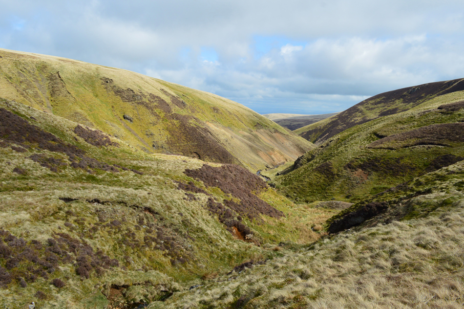 |
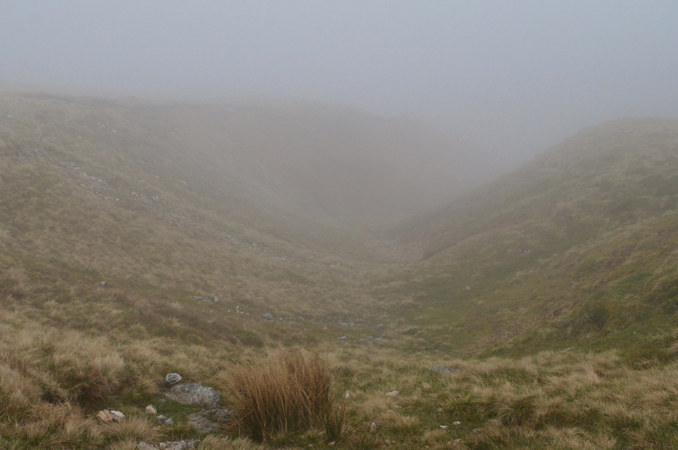
| Fabulous views into Roughton Gill. |
| |
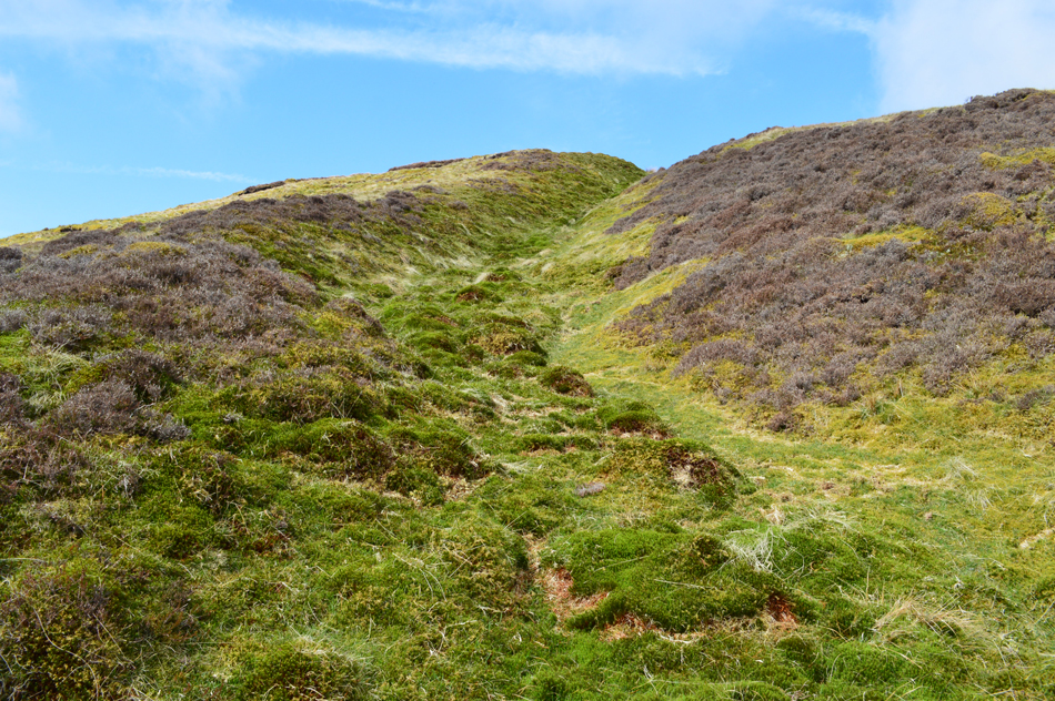 |
| The grass grove found at the top of Roughton Gill. |
| Just look at those blue skies, mind you it's still feeling very cool in the sunshine. |
 |
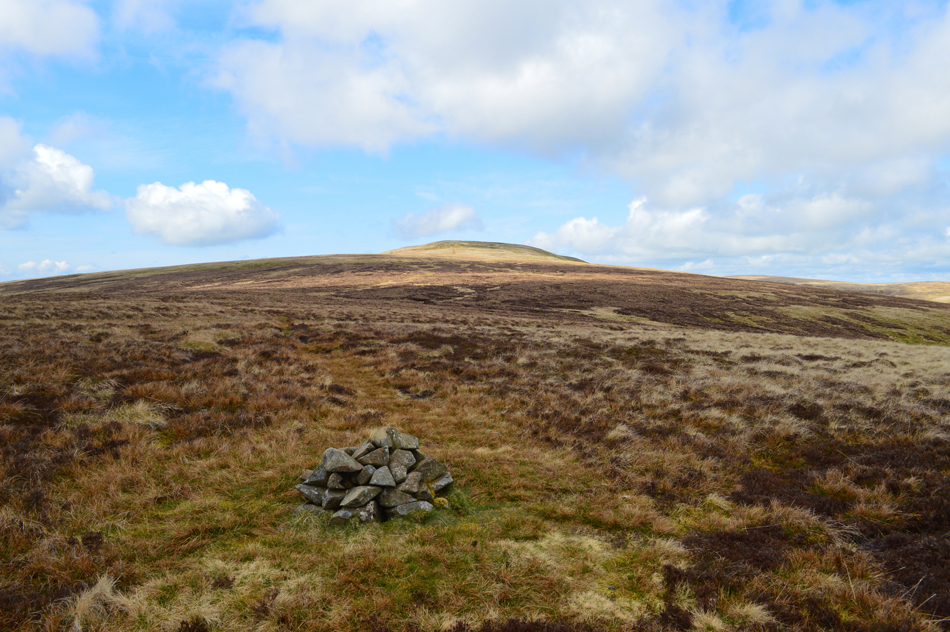
| Knott from from the top of the groove/Balliway Rigg. |
From the top of the grass groove I continued to follow the path before deciding to make a direct ascent on Knott. Bill Birkett describes this as rough grassy ground, he wasn't wrong.
Now feeling the heat crossing the pathless rough ground was slow, the best way to attempt crossings like this is to fix your eye on a target and aim for it, my target was a bright green boggy section which appeared path like from a distance but it was something to aim for, this kept me below the first shoulder of the fell which I was to soon find was the steepest, the second being the steadier, shorter ascent. |
 |
| Fine views to keep my mind of the rough ascent, here looking back in trodden ground. |
| The miles are really starting to show now. |
 |
| Great Sca Fell under late morning sunlight. |
| |
 |
| The view back over Roughton Gill towards a distant High Pike. |
| |
 |
| Knott summit. |
On gaining the first shoulder of the Knott I spotted a walker in descent heading towards Great Sca Fell, we were parallel 'so to speak' and had he or she of turned around they would have spotted my slow, pathless ascent. I gained the summit and let my shoulders back, breathed heavily and composed myself before making my way towards the summit cairn, it's been two years since my last visit and I lapped up my summit time just standing there looking towards the Scottish mountains.
The sun continued to shine but I could see high level cloud was bubbling up overhead, feeling a tad on the cool side I started my descent marveling the grassy ridge of Coomb Height before me. |
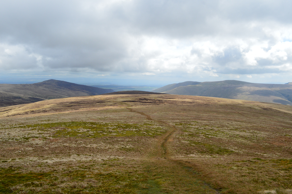 |
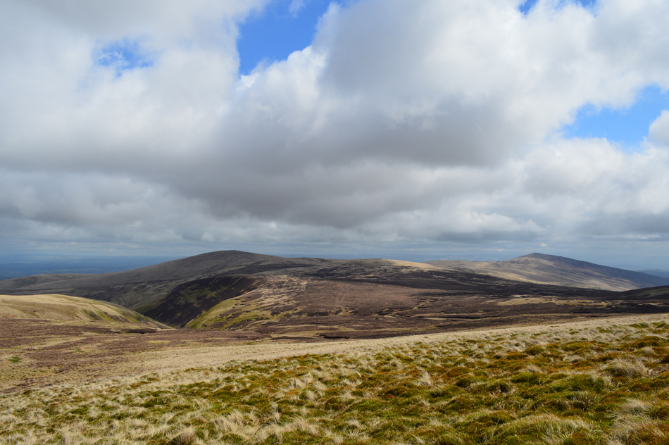
| Carrock Fell, Coomb Height and Bannerdale Crags from Knott. |
| |
 |
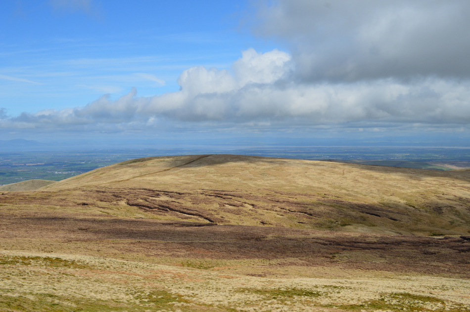
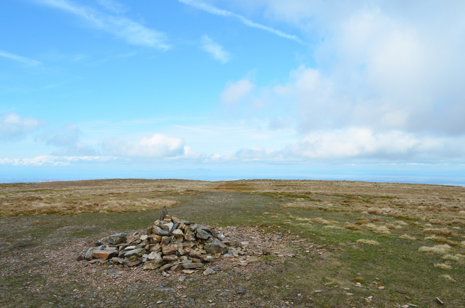
| Looking back on Knott from Coomb Height. |
The affects of my Plantar Fasciitis was starting to niggle at my right heel and I found this a tad uncomfortable at times so much so I pulled a rock from the cairn and stretched my foot over the top for a few minutes which eased the discomfort before putting the rock back.
It's time to leave Coomb Height now and descend via the east ridge, it can be steep and heathery but the views more than make up for it. |
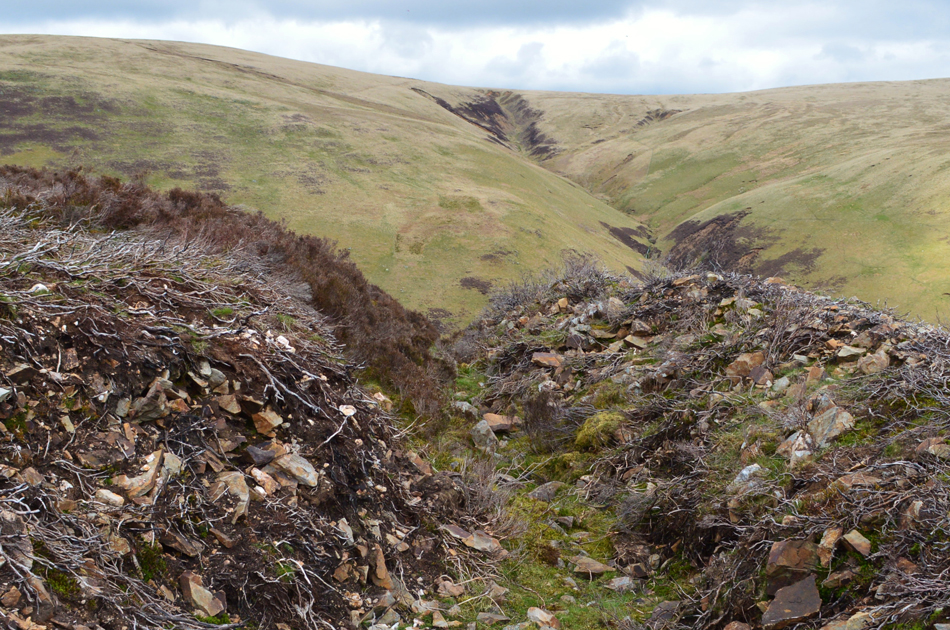 |
| Ancient mineral slope Wolfram mine workings/Coomb Height. |
| "There is danger here - do not under any circumstance follow it. This is the top of a ancient mineral slope where the ore has been extracted to a considerable depth underground. In places it opens and falls vertically" -Bill Birkett. |
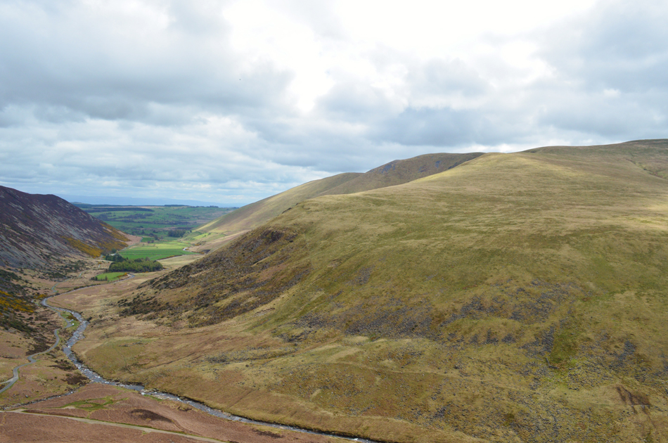 |
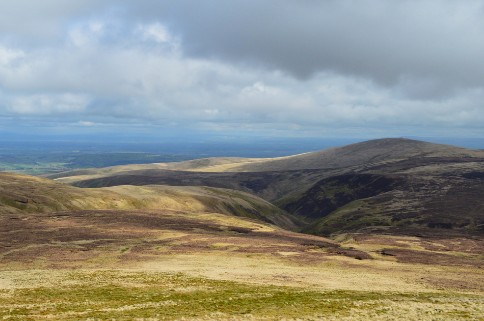
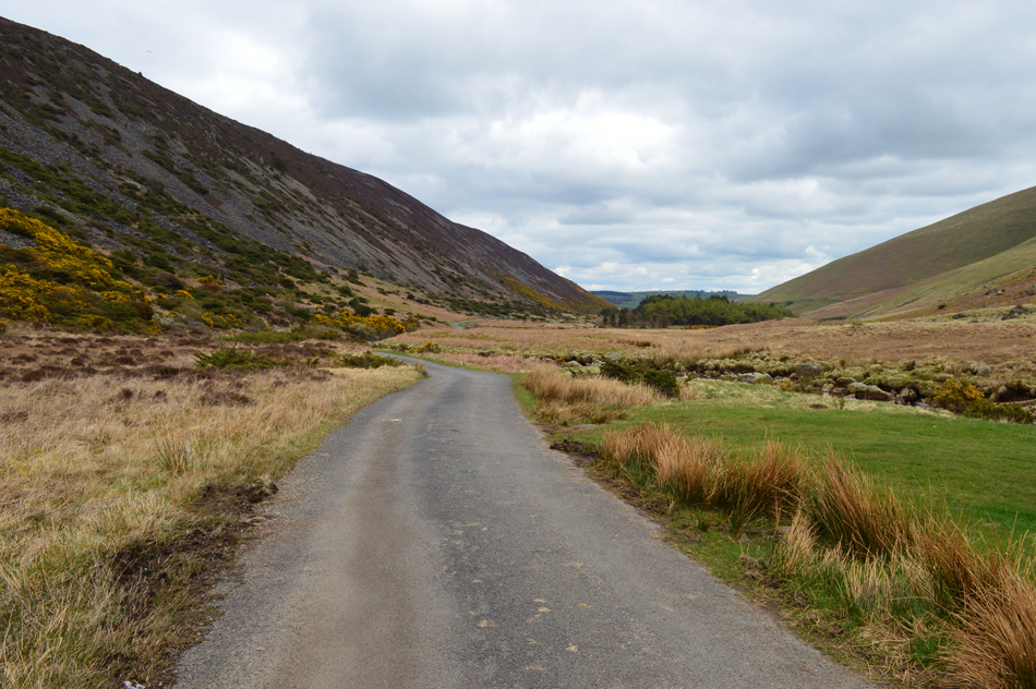
| Grand views over the River Caldew towards Bowscale Fell and the Mosedale. |
| Taken during the descent of Coomb Height. |
 |
| Looking South West towards Blencathra, Mungrisdale Common and Lonscale Fell. |
| |
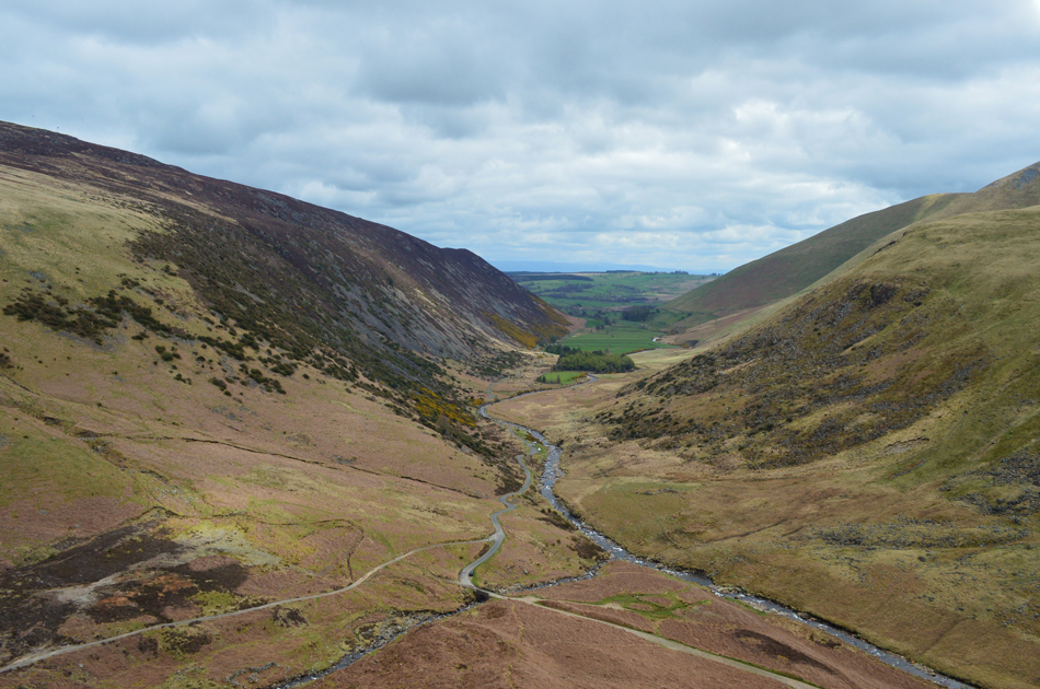 |
| Mosedale flanked steeply by Carrock Fell on the left and Bowscale Fell on the right. |
| Lunch is calling and I have the perfect spot to spend it. |
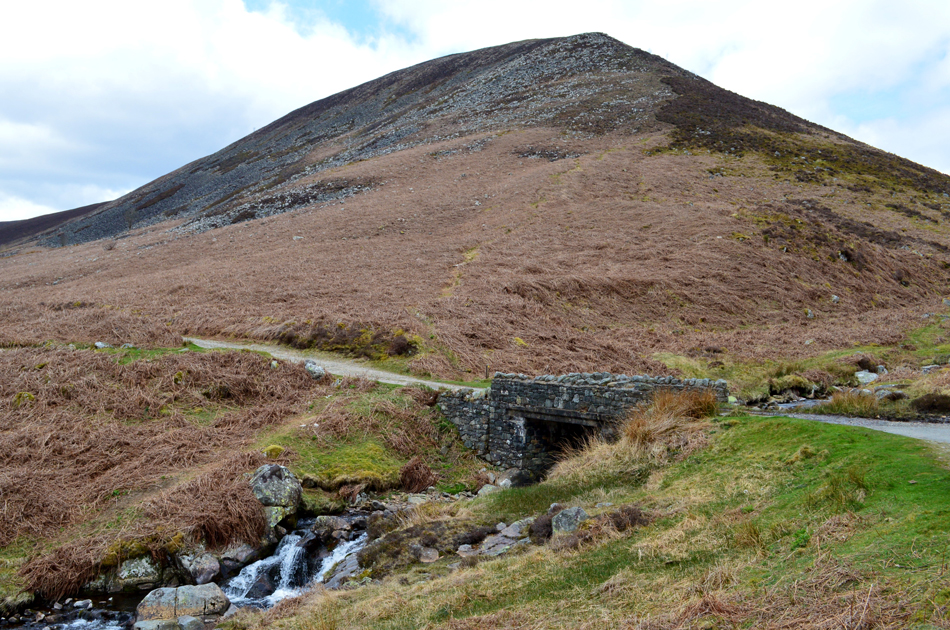 |
| Lunch with a view, here looking towards the lower section of the Coomb Height ridge. |
The bridge provided the perfect spot for a spot of lunch and I even dared to take off my jacket for a while before the cool breeze started to freeze my sweat forcing me to put it back on again. This area of Mosedale is popular with parked cars and today was no different, oddly no one around though, well for now anyway. |
 |
| Mosedale seclusion. |
| Despite collecting my last summit the walk is far from over with a three mile walk back to Apronful of Stones, what better way to end todays walk than with a walk though Mosedale accompanied by the sound of the River Caldew and bleeting lambs. |
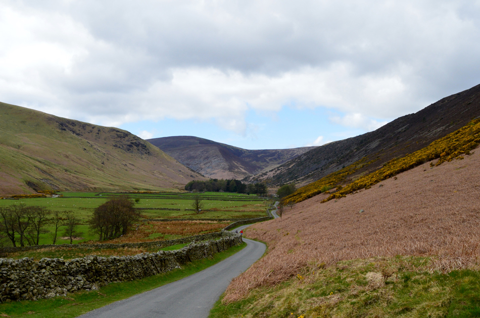 |
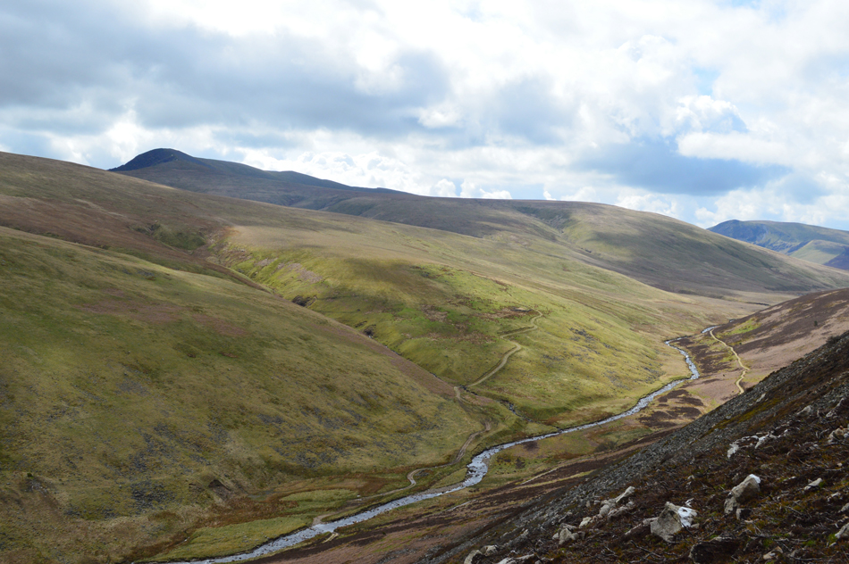
| Looking through Mosedale towards Coomb Height and Great Lingy Hill. |
| |
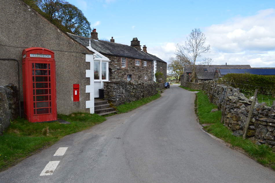 |
| Mosedale Hamlet. |
| Complete with working telephone box. |
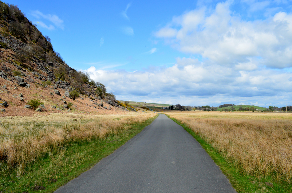 |
| Enjoying the miles. |
| As I pass by Mosedale Moss. |
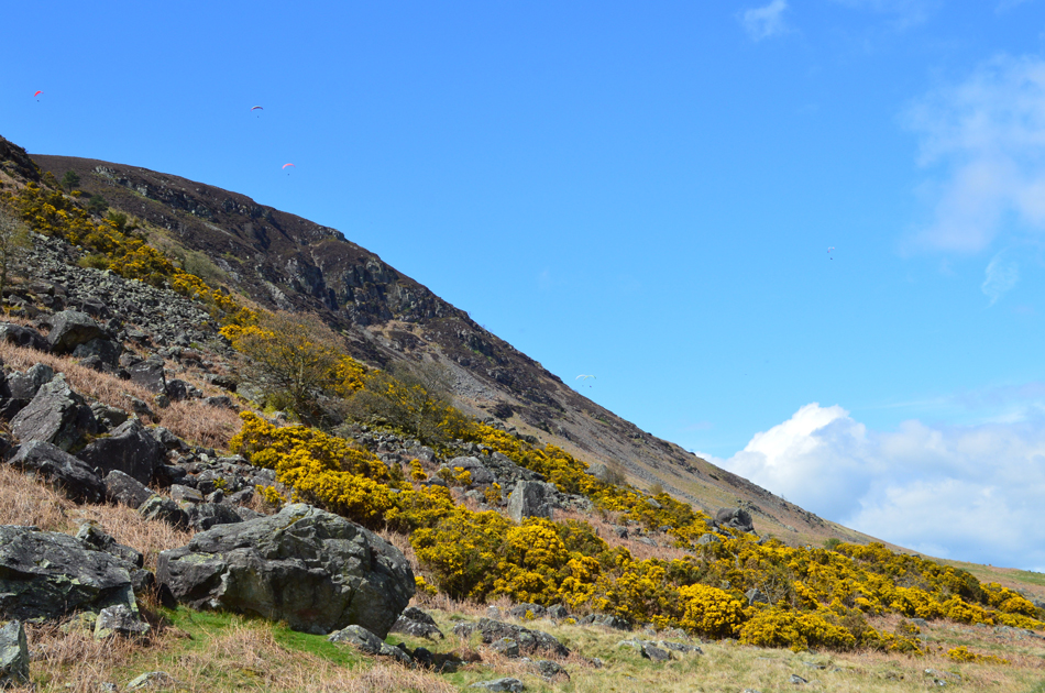 |
| Gliders above Carrock Fell. |
Despite my ailing foot I seemed to pick up a march covering the three miles in forty minutes. The road walking between Mosedale and Apronful of Stones was quite busy often having to step aside for cars and large groups of cyclists before reaching the last incline of the day prior to Stones End Farm, I had kept my poles extended for this short, but steep tarmac stretch and reached the top of the incline soon sighting my car along with half a dozen others.
I'm passed by another large group of cyclists one of whom who after looking up at the Gliders soaring overhead said in a strong Yorkshire ascent "tha wudnt get me up theer" |
|
| |
| Back to top |
 |
|