|
Walking the Birketts, Hope Gill Horseshoe |
 |
 |
21st April 2018 |
 |
|
With the later evenings it's that time of year when after a Saturday morning in work I can drive up to Lakeland straight after work, there are quite a few things I need to look out for when doing this two of which are traffic delays and parking as come midday parking in Lakeland can be somewhat tricky.
I put a lot of thought into where to walk not forgetting to mention that today, according to the forecast it was the last bright day with yellow warnings of rain including for some parts, thunder too. I took into account that I can reach the north west of the district only ten minutes (traffic dependable) later than I could lets say Coniston which is down to no B roads to slow me down not forgetting the queues through Ambleside which can frustratingly add half an hour to a journey through peak seasons.
This particular walk had been standing out all week and no matter which conditions I walked in under it was going to get walked, thankfully I was able to reach Hope Beck exactly two hours and ten minutes after leaving Salford, the transition between both locations couldn't have been further apart and it took a few moments to sink in not helped by the fact I was still wearing my shirt and tie.
The Hope Gill Horseshoe is a fantastic way to spend four hours on the fells collecting eight Birkett summits on what was the last day of sunshine until, well Summer returns. I only wish I hadn't eaten that cheese burger from the burger van for breakfast because this walk packs a devilishly steep gradient straight from the off. |
|
| The Complete Lakeland Fells |
 |
| By Bill Birkett |
-Hopegill Head
In local circles, the distinct peak is known as Hobcarton Pike.
|
|
|
|
| |
|
Overview |
|
|
| Ascent: |
2,442 Feet - 744 Metres |
| Birketts: |
8, Dodd - Whiteside (East Top) - Whiteside (West Top) - Gasgale Crags - Hopegill Head - Sand Hill - Ladyside Pike - Swinside |
| Weather: |
Warm Dry and Sunny. Highs of 22°C Lows of 20°C |
| Parking: |
Roadside Parking, Hopebeck, Lorton |
| Area - Group: |
North Western - NW/GRI |
| Miles: |
6 |
| Walking With: |
On My Own |
| Ordnance Survey: |
OL4 |
| Time Taken: |
3 Hours 40 Minutes |
| Route: |
Hope Beck - Dodd - Whiteside (East Top) - Whiteside (West Top) Gasgale Crags- Hopegill Head - Sand Hill - Ladyside Pike - Swinside - Hope Beck |
|
| |
|
Parking Details and Map |
|
|
| Nearest Post Code: |
CA13 9UA |
| Grid Reference: |
NY 168 924 |
| Notes: |
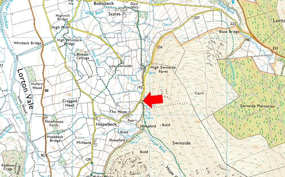
Found just past High Swinside Farm at Hopebeck there is room for up to four cars but be advised that the lane is narrow with the odd gate to open and close before reaching the parking spaces. Parking here gives excellent access to Hope Beck, Whiteside, Hopegill Head and Ladyside Pike. Parking is free. |
|
| |
|
Map and Photo Gallery |
|
|
  |
| |
| |
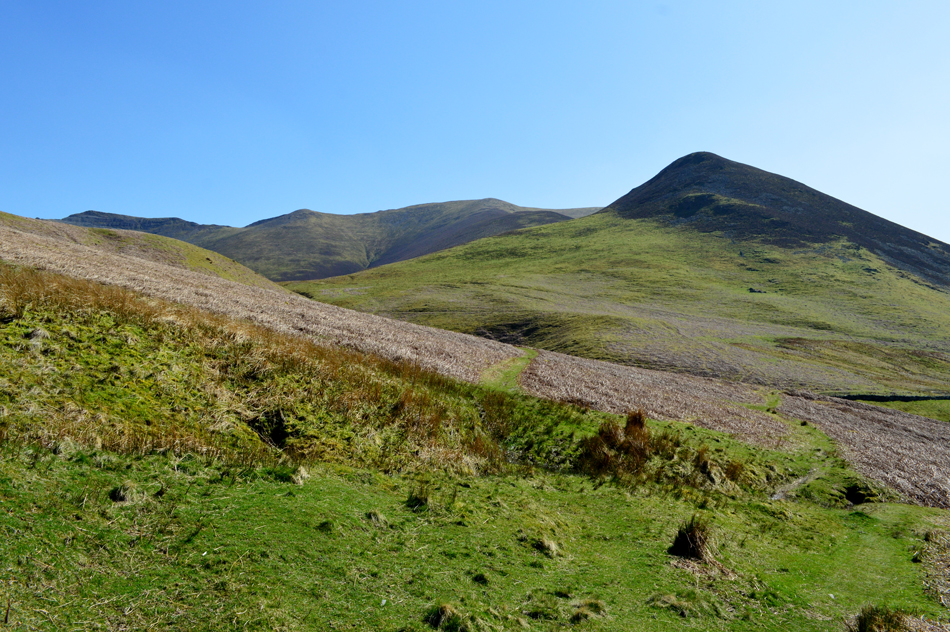 |
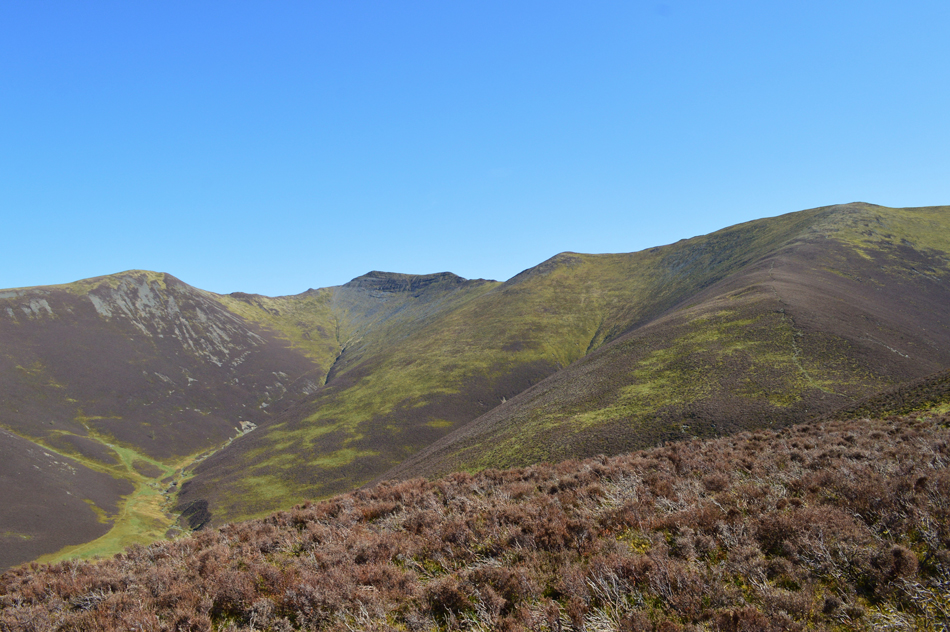
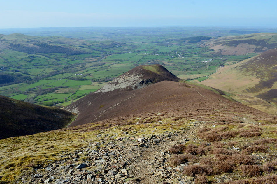
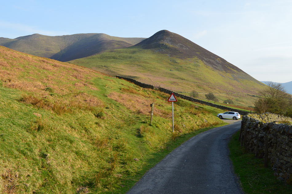
| Dodd (Lorton) Whiteside and Hopegill Head from Hope Beck 14:50pm 20°C |
I'd been snarled up where the M61 joins the M6 at Bamber Bridge for around fifteen minutes which felt like much longer before the congestion eased after the Blackpool exit then I was back up to speed soon finding myself travelling on the A66 spotting walkers on the slopes of Blencathra as I drove by. Braithwaite was reached then the Whinlatter Pass where I turned off prior to Darling How Farm for Hope Beck. I've only parked at the 'cutting' once before and I knew there weren't many parking spaces to start with, this was a big gamble and should I fail to park I'd already sorted a plan B walk within proximity, thankfully however, I arrived to find one last parking space, phew, panic over.
The grass was dry and I was able to change from my work clothes into my walking gear at the side of the car (I don't think anyone saw me!) For the first time this year I'm back to wearing shorts and boy did the afternoon heat demand them. With a thin longsleeve base layer added I tucked my waterproof jacket into my pack, took a long swig from my canteen and set off under the afternoon sun towards Dodd seen here, in the right of the photograph. My route entails crossing Hope Beck first (lower right) before joining a prominent grassy path swinging left before a steep jolt right, through the heather and up onto the summit. Instead of being enticed into a greasy cheese burger for my breakfast by my work colleagues (go on, go on you know you want one) what I should have eaten was four Weetabix instead. |
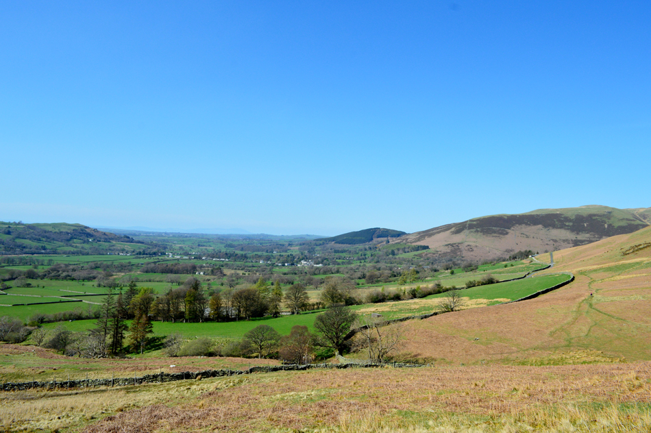 |
| Looking back on Lorton Vale towards Kirk Fell (Lorton) and Harrot. |
I arrived at Hope Beck around the same time an elderly lady did and being the gentleman that I am I offered that she could cross the beck first "but what if I fall she replied, you'll have to go to the trouble of helping me out, you go first" so I did not before a quick look back to make sure she crossed OK, you might just be able to spot her on the grass path over on the right.
What a lovely afternoon. |
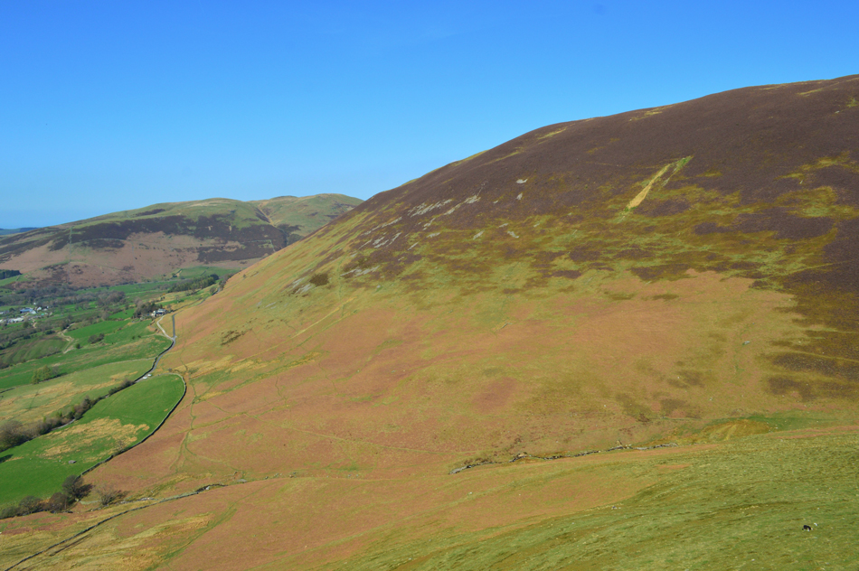 |
| Looking back on the bulk of Swinside and Kirk Fell (Lorton) from the ascent of Dodd (Lorton) |
After crossing Hope Beck I picked up the prominent grassy path which gradually rises then steepens after passing the ruins of an old building. With Dodd still looming down I took an almost direct line for the summit ascending first through boulder then steep heather before branching out at the summit shoulder. I'm not sure if it was the long drive, the steep ascent or a combination of both but it felt much harder than it should. From car to summit, the ascent took around forty five minutes, infact if you look closely you can see the 'cutting' where my car is parked centre left. |
 |
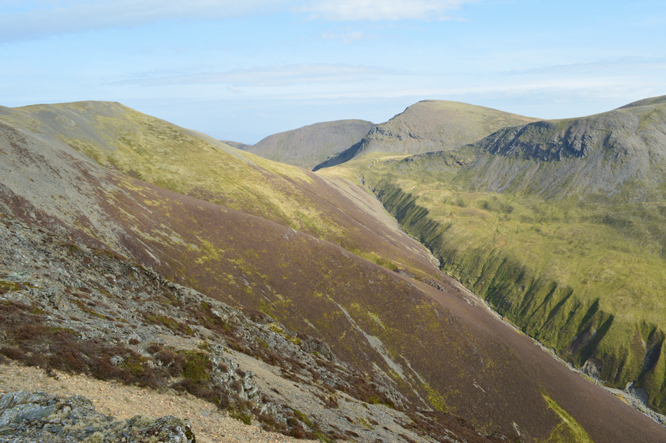
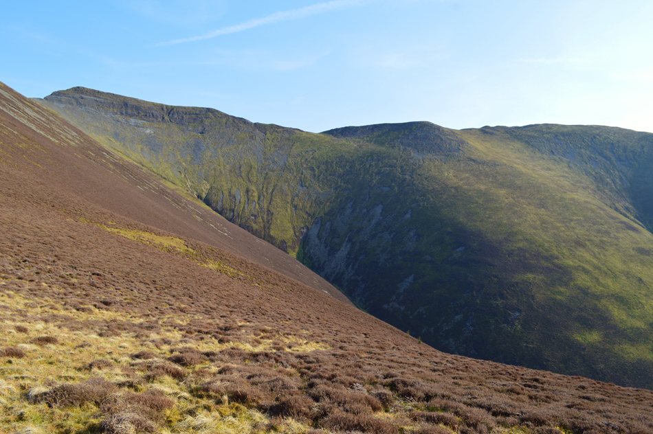
| Looking into Hope Beck with Hopegill Head and Ladyside Pike over on the left. |
| |
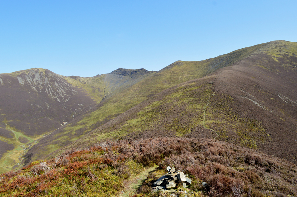 |
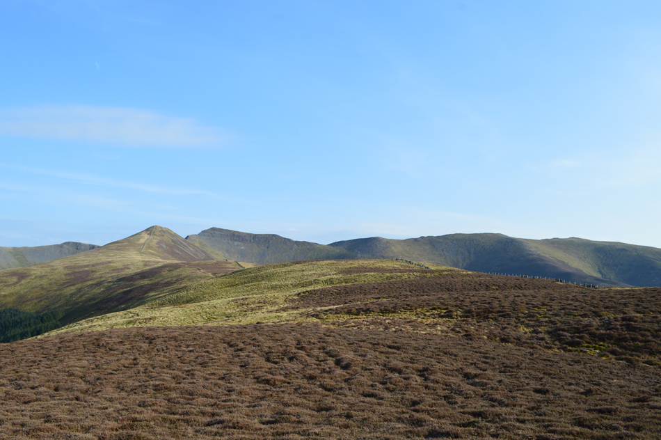
| Whiteside, Hopegill Head and Ladyside Pike from Dodd (Lorton) summit. |
| That's Whiteside north ridge seen over on the right which is where I'm heading next, not before the steep descent into the col which divides Dodd from the north ridge. |
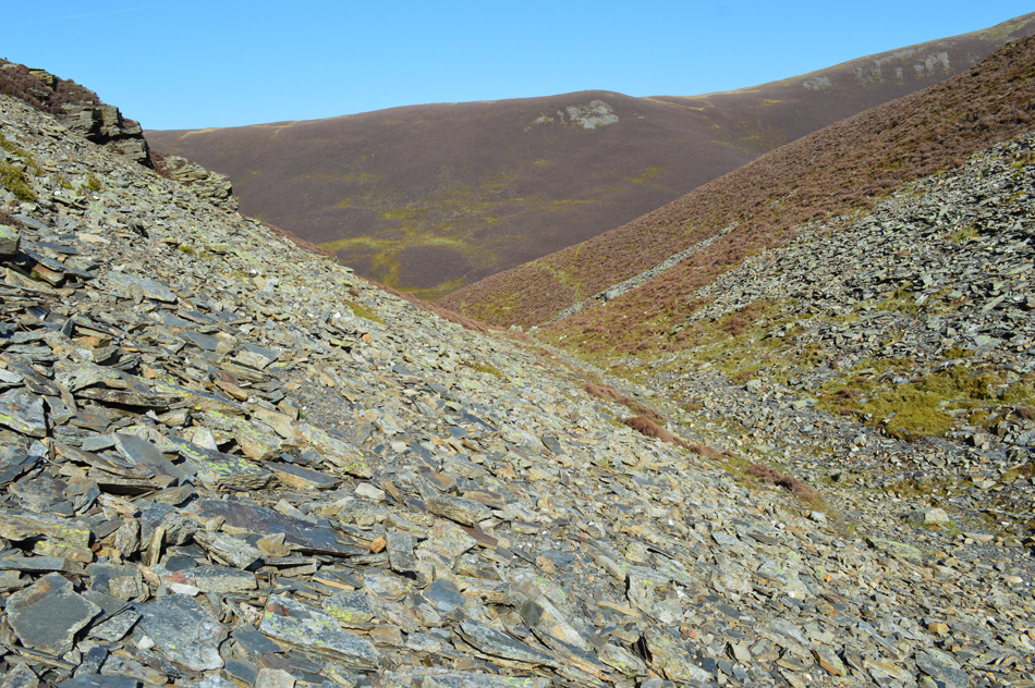 |
| The Col between Dodd and Whiteside North ridge. |
| That's Skiddaw slate just in case you were wondering. |
 |
| Ascending Whiteside North ridge. |
| To escape the col, another steep ascent awaited to gain the north ridge which after the initial steepness, eases before one last push to Whiteside West Top. |
 |
| Looking back down towards Dodd (Lorton) and the Lorton Vale. |
| At no point upto now have I not been able to see the roof of my car although that is about to change as I join the Whiteside ridge. |
 |
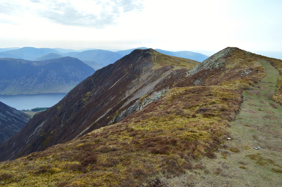
| Here looking towards Whiteside East Top, Hopegill Head, Ladyside Pike, Grisedale Pike and Sand Hill. |
| The highest point in the foreground is Whiteside East Top at 2,358ft which is recommended to visit first before doubling back to visit the West Top. It appears that it's starting to cloud over and with it, a sudden drop in temperature, down come the sleeves! |
 |
| Doubling back now to visit Whiteside West Top seen in the distance. |
| |
 |
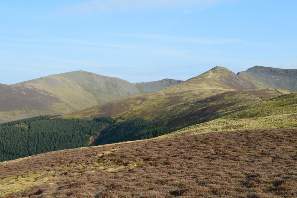
| Hopegill Head, Sand Hill and Grisedale Pike from Whiteside West Top (Wainwright summit) |
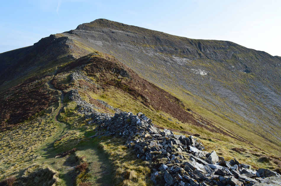
Ok, time to head back along the ridge now to the summit of Gasgale Crags (not seen in this photograph) who if your like me, you might be a little surprised by a certain lack of summit presence, more soon. |
 |
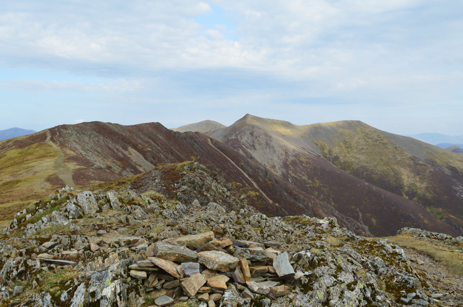
| Gasgale Crags (seen left) Hopegill Head, Sand Hill and Grisedale Pike. |
So that little itch I'd been feeling all week has now been firmly scratched, I'm really fond of the Whiteside ridge and todays visit was just as special with tingling views down the rugged cliffs of Gasgale Crags to a winding Liza Beck far below, meanwhile little dots of walkers meander over the summit of Grasmoor set against the blue of a late afternoon sky. It's fast approaching four thirty in the afternoon and I just love being out on the fell so late into the day.
Incidently, the flat area of ridge seen centre left is the summit of Gasgale Crags shown at 703' on the map, I left the path to explore finding no cairn just a scatterting of rock and confirmed my position before continuing along the ridge towards Hopegill Head. |
 |
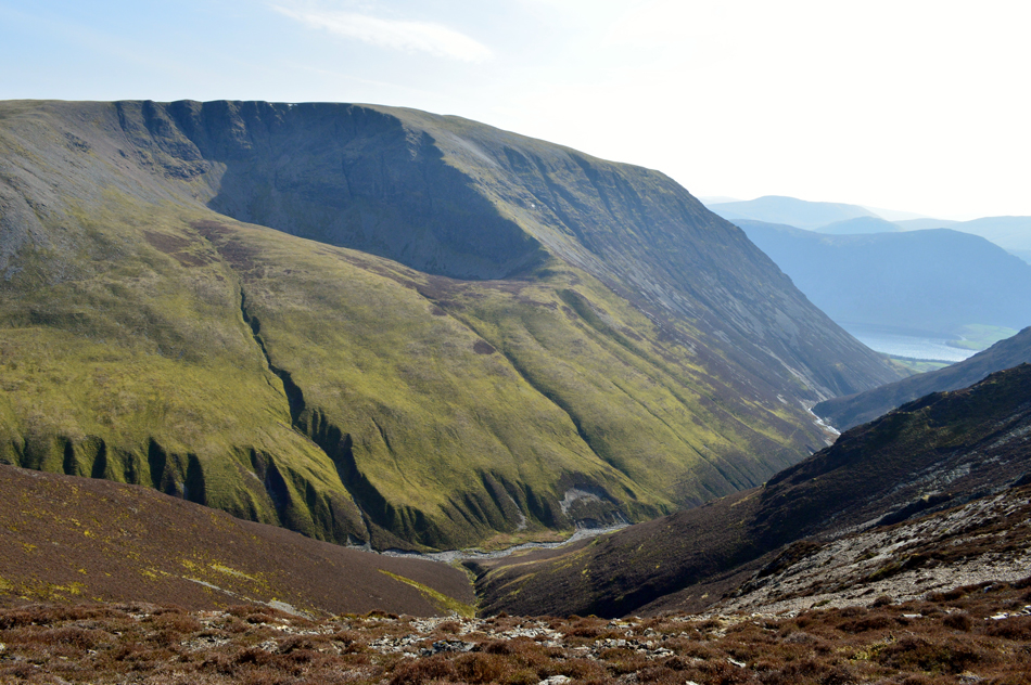
| Views towards Coledale Hause flanked by Sand Hill, Eel Crag (Crag Hill) and Grasmoor. |
| Sand Hill is on todays list which I'll be visiting after my summit of Hopegill Head as an 'out and back' |
 |
| Looking back at the mass of Grasmoor. |
| It looks like the sun is back out, good times. |
 |
| Views back along the Whiteside Ridge incorporating Gasgale Crags, Whiteside East Top and Whiteside West Top. |
This stunning view was interrupted by two, well I can't call them walkers because they held no respect for anyone else on the hill carrying what I can only assume was a Bluetooth loud speaker which played drum and base at full blast while they swigged Budweiser from bottles, words failed me and still do.
Still a great view though eh. |
 |
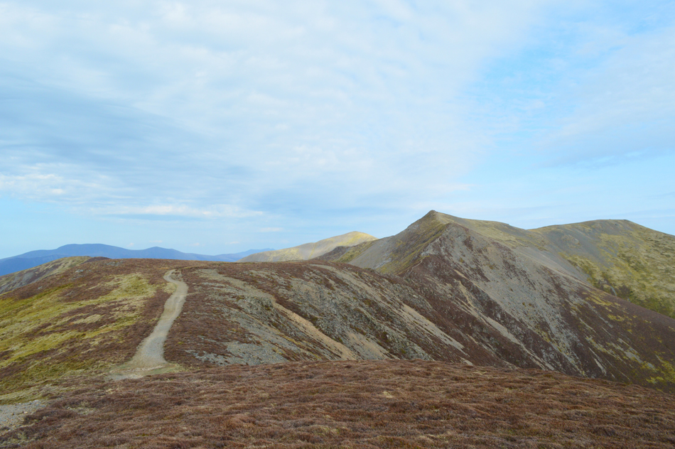
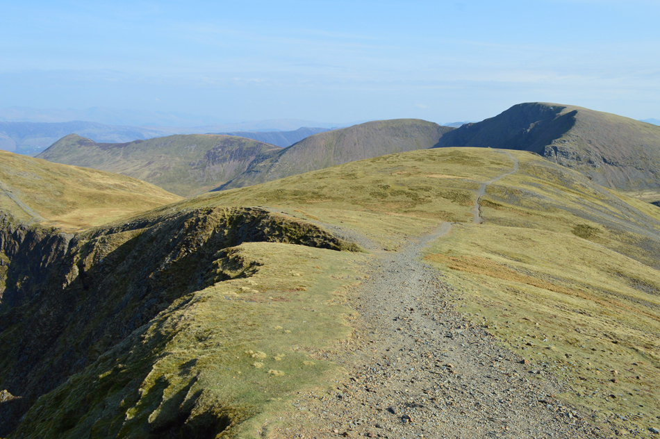
| The last push towards Hopegill Head with Sand Hill not far away over on the right. |
| |
 |
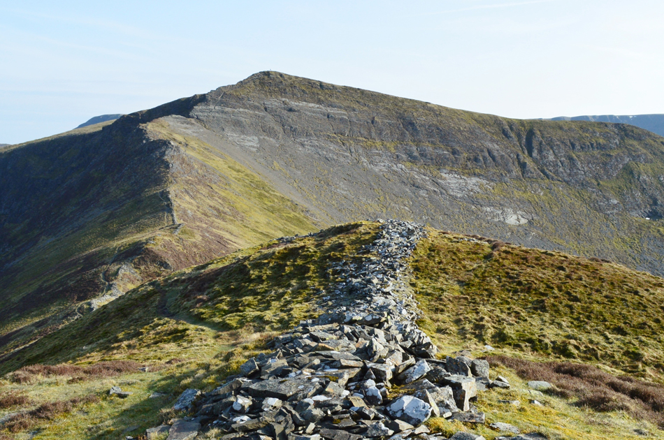
| The Whiteside Ridge from Hopegill Head summit. |
| You get a good prospective of covered ground from here with Whiteside's north ridge falling away centre right, |
 |
| Time to head over to Sand Hill with views towards Eel Crag (Crag Hill) Sail, Scar Crags and Causey Pike. |
| It seems I've got the whole place to myself now that Mr & Mrs drum and base have faded into the distance which is one the advantages of walking the fells so late into the afternoon. |
 |
| Hopegill Head from Sand Hill. |
| |
 |
| Eel Crag (Crag Hill) seen domineering over Coledale Hause. |
| I couldn't leave with taking a peak over Coledale Hause towards Eel Crag which reminds me, I must ascend via Eel Crag which can be seen as the rugged ridge which overlooks Coledale Hause, that's another walk added to my ever increasing list. |
 |
| The view over Hobcarton Crag towards Grisedale Pike. |
I left Sand Hill but instead of heading straight back to the summit of Hopegill Head I left the path and joined the path at the head of Hobcarton Valley where you get these stunning views over Hobcarton Crag back towards Grisedale Pike.
Like I say, it wasn't on route but hopefully I'm forgiven for straying slightly off. |
 |
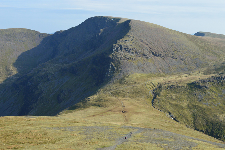
| Views over Ladyside Pike and Swinside as I prepare to descend Hopegill Head the hard way. |
This is the point in the walk where care is required to negotiate a steep rock slab, if wet, avoid this route down and steer further left and descend via a series of steep grass ledges. From Hopegill Head summit a path skirts the edge of Hobcarton Crag off to the right which I find to be the more exposed descent, instead keep left and pick your way down the slab not being afraid to use your bum! I found it handy to pack my walking poles away as the descent is more 'hands on' in places.
A path (seen lower right) then steers below a rocky knoll before easing at the start of a stone wall, from where an easy ascent awaits before the final push up towards Ladyside Pike. |
 |
| Looking back at the summit of Hopegill Head with the rock slab below. |
| The rock slab from here looks impossible to ascend/descend but it is manageable with care. |
 |
| Hopegill Head from Ladyside Pike summit. |
| I took a short break at the summit absorbing the quietness with only the hint of wind for company, it was bliss. |
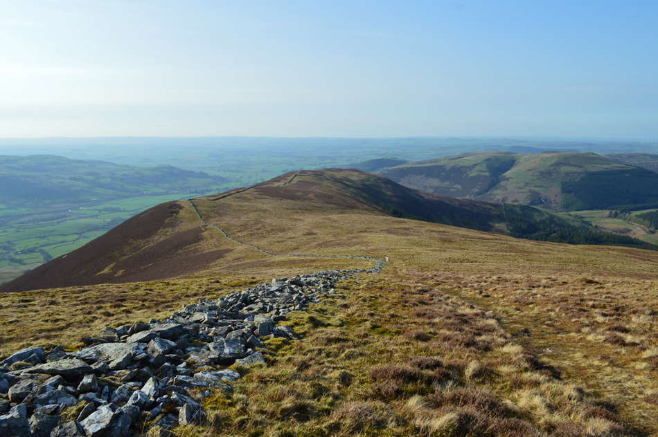 |
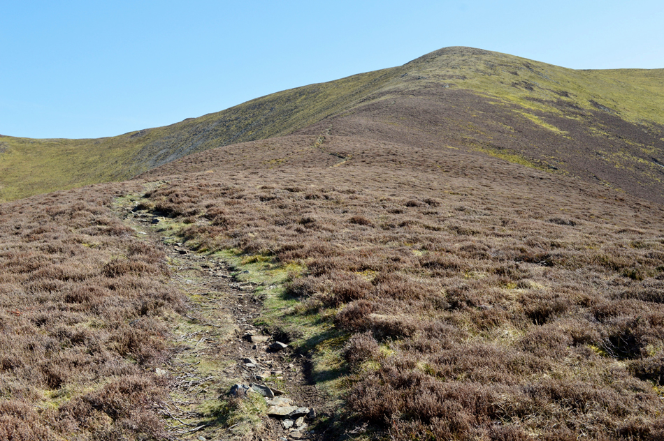
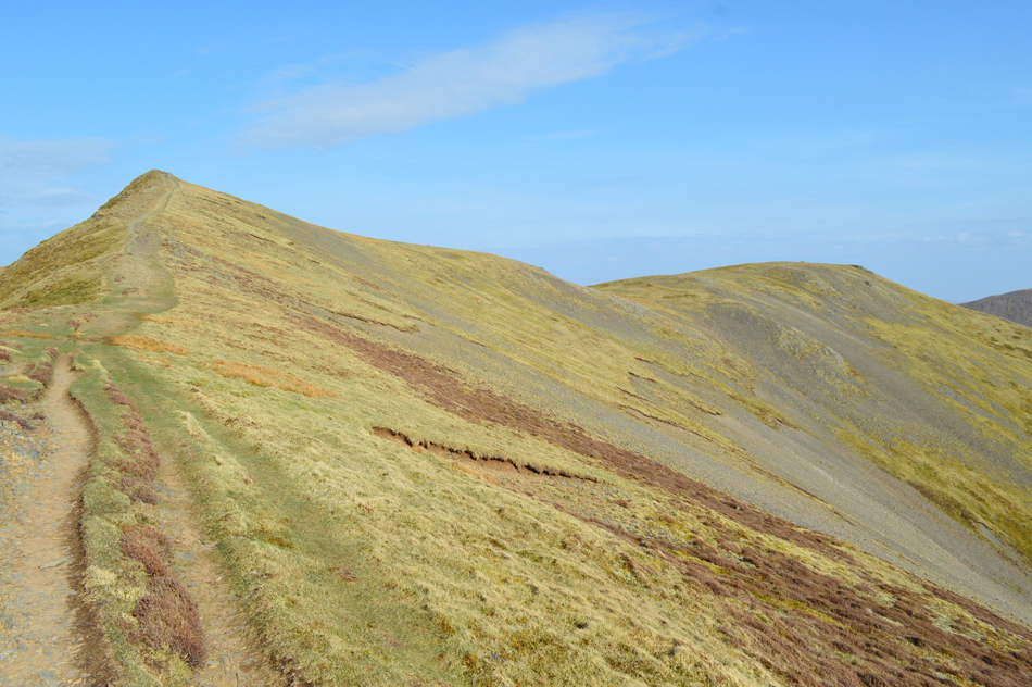
| Descending Ladyside Pike for Swinside. |
| My walk isn't over just yet with the eighth summit up ahead, as far as I'm concerned this ridge just wasn't long enough, what a perfect way to enjoy the last mile with dry grass underfoot, long distant views of the Cumbrian coast and tweeting Skylark's for company. |
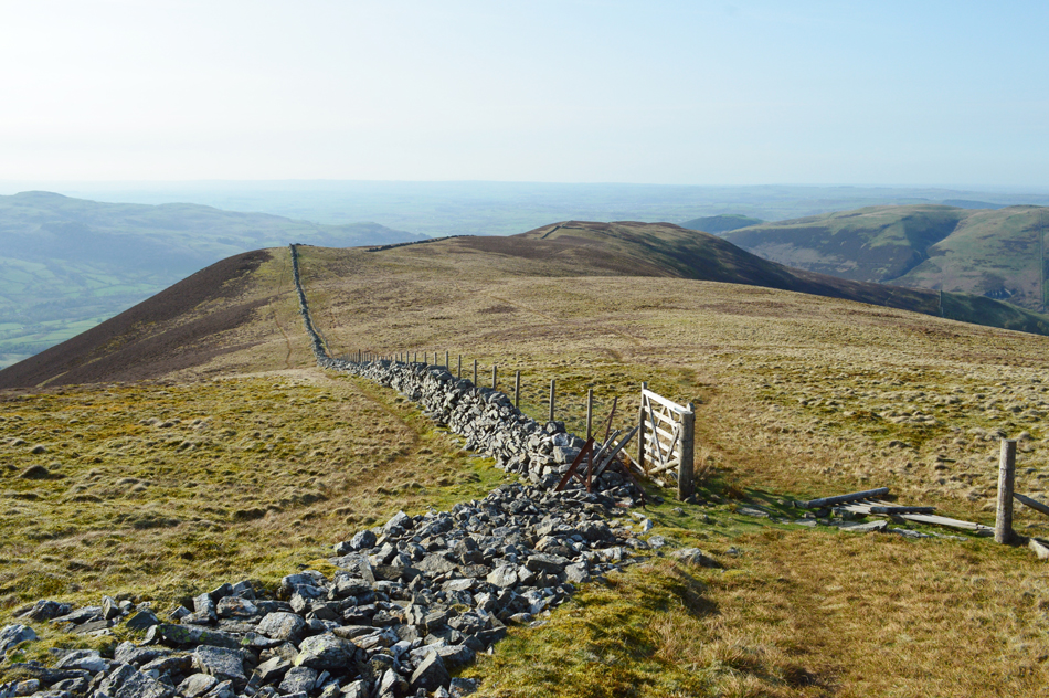 |
| I crossed the stone wall here from right to left. |
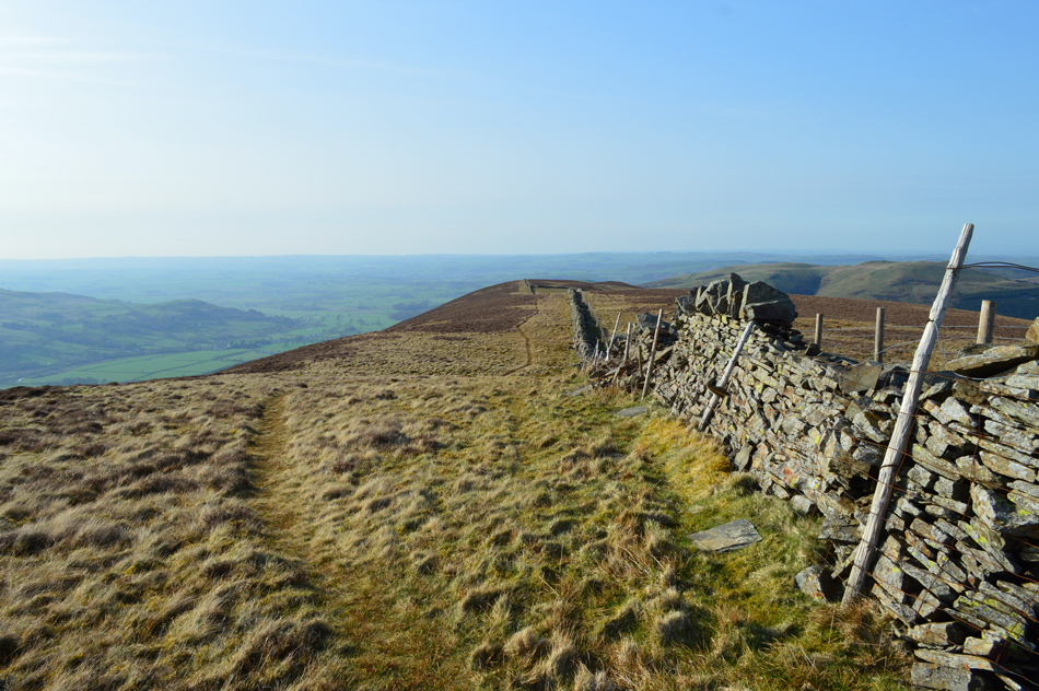
| I did notice a faint path which took a direct line to Swinside summit accessed through the wooden gate, for those I guess, who are in a rush! If you follow the wall towards the centre of the photograph you might just be able to make out a stone wall which falls away to the right, that's Swinside summit but I won't be stopping as the summit cairn is found further ahead and over the stone wall off to the right. |
 |
| Hopegill Head. |
| The flat area of ridge off to the right is the summit of Gasgale Crag which from here, has a lot more presence than seen from the ridge itself. |
 |
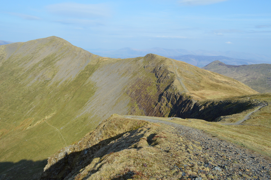
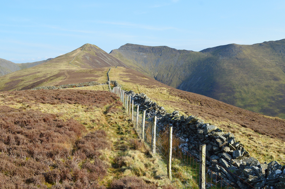
| The last turn in the wall presents you with a view of Swinside summit just up ahead. |
| No wonder Bill Birkett chose to walk the Hope Gill Horseshoe in an anti-clockwise direction, the Swinside ridge is a marvelous way to bring the walk to a end. |
 |
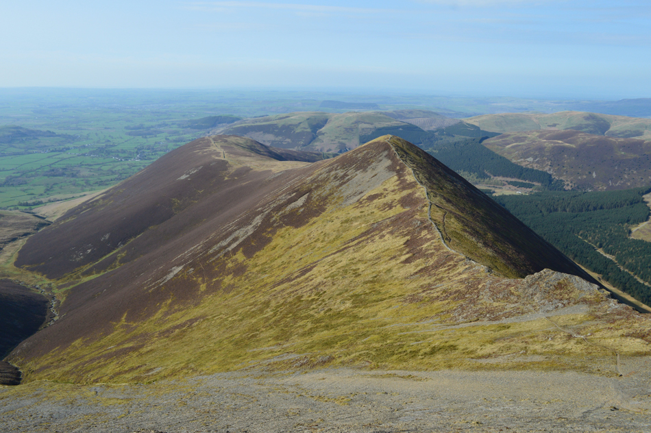
| Looking back on Ladyside Pike and Hopegill Head from Swinside. |
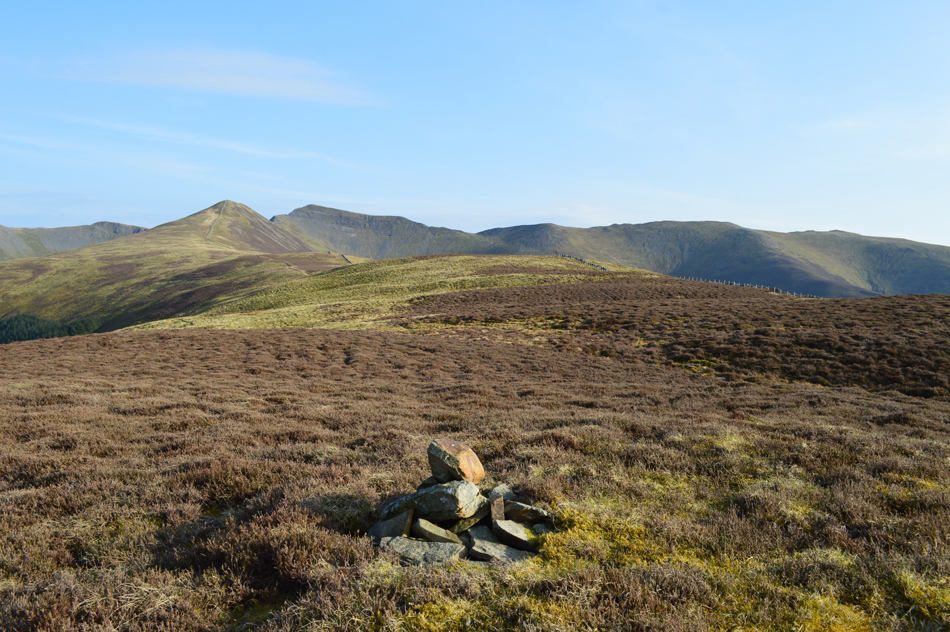
| You may have noticed I have crossed the stone wall again back at Swinside summit which is back there where the wooden fence starts, but as mentioned the summit cairn lies further north and I have a theory why. |
 |
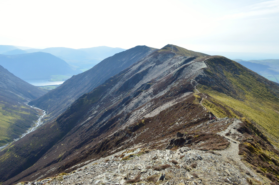
| Hopegill Head and the Whiteside Ridge from Swinside summit cairn. |
| Because look at that view. |
 |
| Stunning in every direction. |
| Here's Grisedale Pike north ridge seen over the tree lined Hobcarton valley with Ladyside Pike and Hopegill Head seen further right. |
 |
| Back at Hope Beck with views of todays first summit Dodd. |
I really could have lingered at the summit of Swinside for much longer, in fact I did I just couldn't believe the fantastic view around the compass coupled with crisp late evening sunlight at a point when the afternoon heat was at its peak, the perfect combination.
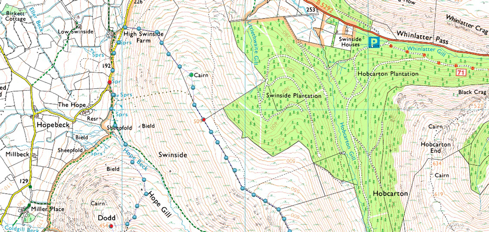
But, all great walks have to come to an end which I and this walk ends by rejoining the stone wall until it descends the ridge joining the tarmac not far from High Swinside Farm. It's almost six thirty now and as I walk back towards the cutting while the only sound I can hear is from a distant tractor working in a field in the valley below. |
|
| |
| Back to top |
 |
|