|
Walking the Birketts, Deepdale Horseshoe |
 |
 |
14th April 2018 |
 |
|
It's been an incredibly busy year in work so far which has seen me working even longer hours with fewer breaks, March and April are amongst the busiest months of the year and because of this an old foot injury has reared called Plantar Fasciitis which is a painful condition affecting the tendons, nerves and muscles in the sole of the foot which is once again causing issues to my right foot, It wouldn't be so bad if I knew it was my walking which has caused this but work, that makes it that bit more painful to swallow. The best way to describe the condition is in the most severe cases is like your walking on drawing pins although for me at the moment it hasn't reached that stage, yet my right heel is very tender and I can feel my tendons pulling which causes my toes to twitch on their own, all I can do is carry on with the home treatment and hope that work slows down because believe it or not, my walking boots are the comfiest shoes I own.
With a peppered head I asked David would he mind suggesting where to walk this weekend, my mind could not escape my workload. I left it with David until I arranged to call him last night and we both came to the decision of Birketts 'Deepdale Horseshoe' a fitting high level route which also includes Gavel Pike. As David said on the return to Patterdale after the walk "it feels ages since I've done a ten miler" you could say that this walk ticked all of our boxes, even if the forecast didn't. |
|
| The Complete Lakeland Fells |
 |
| By Bill Birkett |
-Deepdale Horseshoe
This is a long circuit through impressive mountain scenery, with views of Fairfield's rugged north face. |
|
|
|
| |
|
Overview |
|
|
| Ascent: |
3,521 Feet - 1,073 Metres |
| Birketts: |
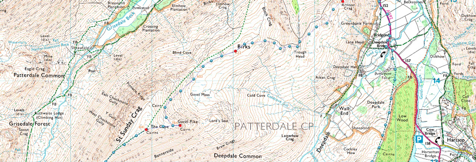
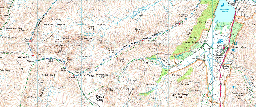
9, Arnison Crag - Birks - Gavel Pike - St Sunday Crag - Cofa Pike - Fairfield - Hart Crag - Giil Crag (Hartsop above How) - Gale Crag |
| Weather: |
A Cloudy Day, Mild & Dry With Light Winds. Some Brightness PM. Highs of 16°C Lows of 8°C |
| Parking: |
Parking Spaces, Patterdale Primary School |
| Area - Group: |
Eastern - C/FAR |
| Miles: |
9.5 |
| Walking With: |
David Hall |
| Ordnance Survey: |
OL5 |
| Time Taken: |
7 Hours 10 Minutes |
| Route: |
Patterdale - Oxford Crag - Arnison Crag - Trough Head - Birks - Gavel Pike - St Sunday Crag - Deepdale Hause - Cofa Pike - Fairfield - Link Hause - Hart Crag - Giil Crag (Hartsop above How) - Gale Crag - Deepdale Bridge - Patterdale |
|
| |
|
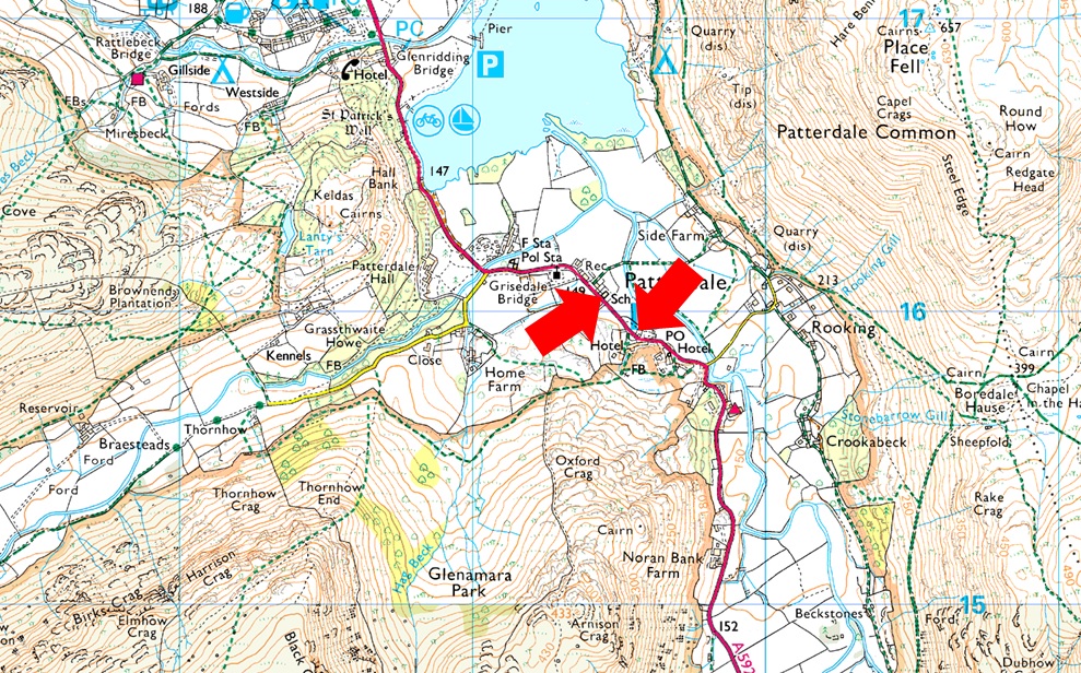
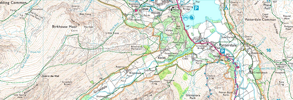
Parking Details and Map |
|
|
| Nearest Post Code: |
CA11 0NW |
| Grid Reference: |
White Lion Hotel - NY 395 315 - Patterdale Primary School NY 394 516 |
| Notes: |
Patterdale alongside Glenriddging acts as a hub for the eastern and far eastern fells yet unlike Glenridding Patterdale doesn't have a centralised car park. With this said parking in Patterdale, especially during the height of Summer can be a problem with only two main sites to leave your car. The first is very popular with fell walkers which is just opposite the White Lion Hotel, here you will find a short layby with room for up to five parked cars. Parking is free. The second place to park is found just outside Patterdale Primary School where you can park on the kerb right outside the School, here you will find spaces for around three to four well parked cars. Parking is free. |
|
| |
|
Map and Photo Gallery |
|
|
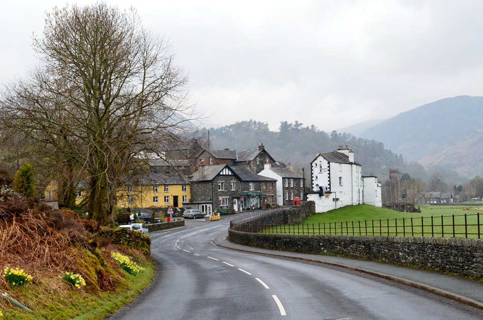 |
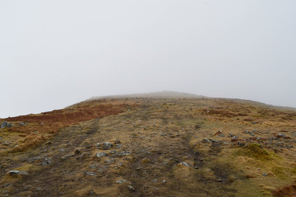
| Patterdale 07:40am |
The official starting point of the walk are the parking spaces opposite the White Lion but as suspected, and despite being early this morning the spaces are full so we had no option than to park next to Patterdale Primary School just outside the village. |
 |
| Leaving the footpath at the wooden gate for Arnison Crag. |
Luckily there were plenty of spaces left next to the School and I parked with ease while waiting for David to arrive. It had been forecast to be a dry but cloudy day with mist clearing through the morning. I must admit there was a lot more fog/mist about than I anticipated after driving over the top of Kirkstone Pass with my fog lights on, Kirstone Inn appeared faintly to my right before starting the descent towards Hartsop where mist lingered above the tree tops. By-eck this is going to take more than a morning to clear I thowt.
It was mild and dry which was the main thing, if it started to rain now we really would have to rethink this walk. By the time David arrived about five minutes later I was more or less ready and we both touched on the subject why really, at this time of year we should be setting out in shorts. With the cars locked we walked back towards the Patterdale Hotel and followed a sign posted Bridleway through the car park before picking up the path at the rear of the Hotel, from here we head right towards Glenamara Park.
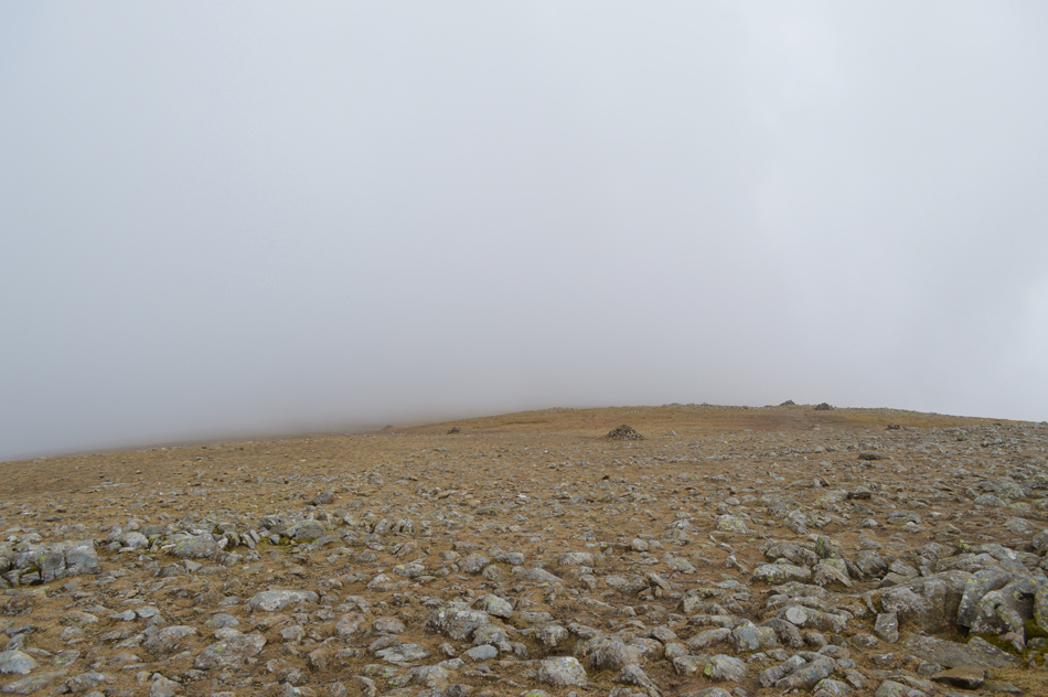
It's pretty wet underfoot after last nights rain and the footpath reflected this. After around 200 yards the path passes through this gatepost along side a stone wall which rises steeply towards Oxford Crag then Arnison Crag, keep left and follow the wall where you might wish you'd eaten all three weetabix this morning! It's a steep and steady slog towards Arnison Crag summit. |
 |
| But the views more than make up for the steep ascent. |
| Here looking back on the southern tip of Ullswater. |
 |
| Sheffield Pike, Brownend Plantation, Place Fell and Ullswater from Arnison Crag summit. |
| It's still pretty misty out there, we could only hope it starts to lift, and soon. |
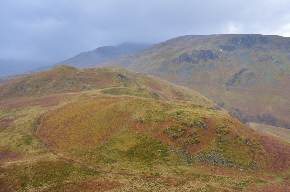 |
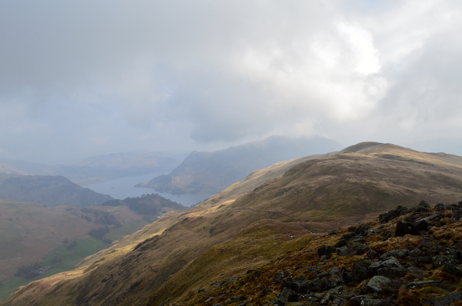
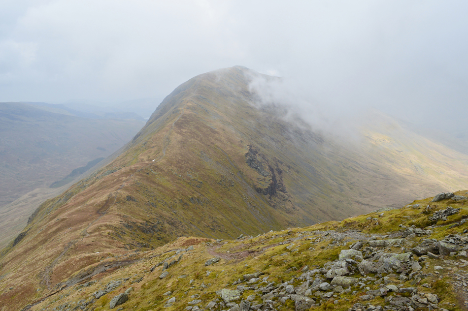
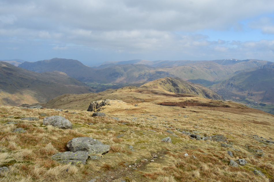
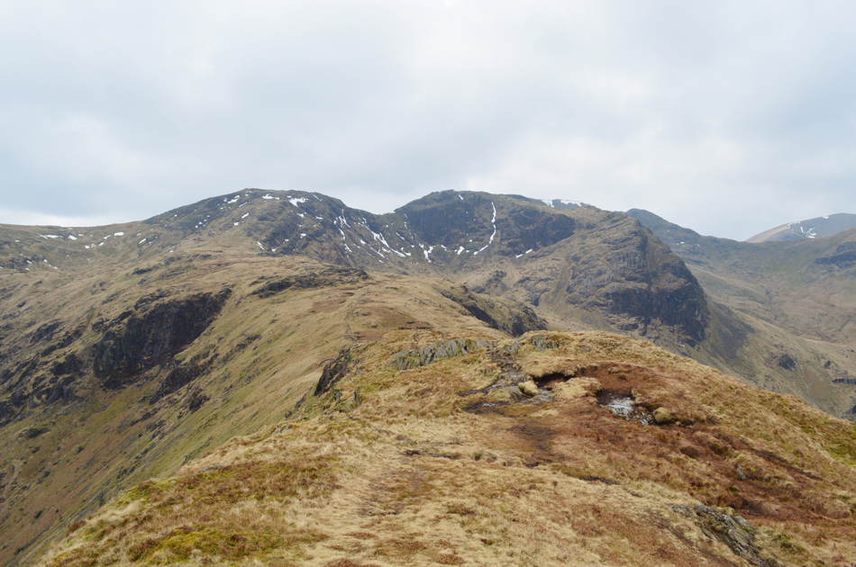
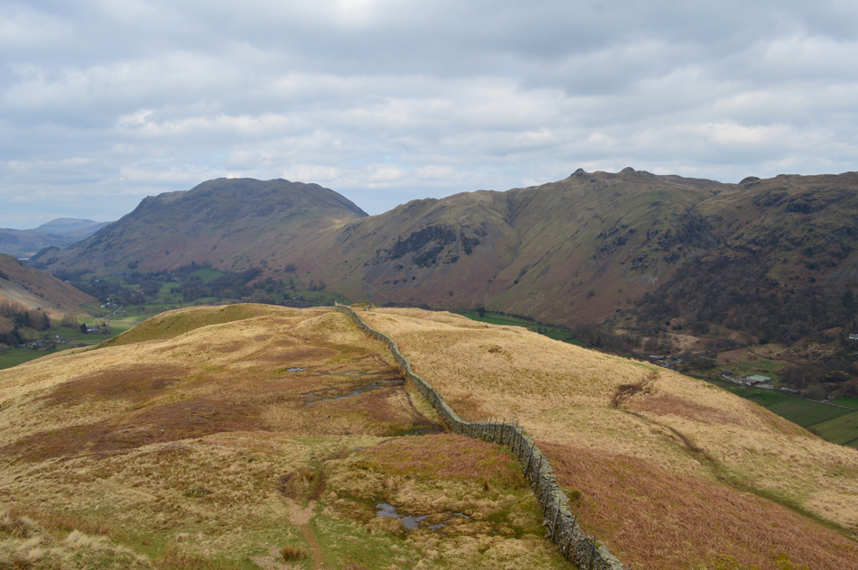
| Looking towards Trough Head, Birks and Gavel Pike from Arnison Crag. |
This is the area of ground found between Arnison Pike and Trough Head which marks the head of Glenamara Park seen rising from the right of the photo. We're heading for Trough Head before the steep ascent onto Birks summit, it's the type of ascent that's never far from mind and is one of three steep ascents found on route, the first of which is now behind us after gaining Arnison Crag.
We descend Arnison Crag then follow the footpath seen below which leads directly over Trough Head. |
 |
| Ullswater from Trough Head. |
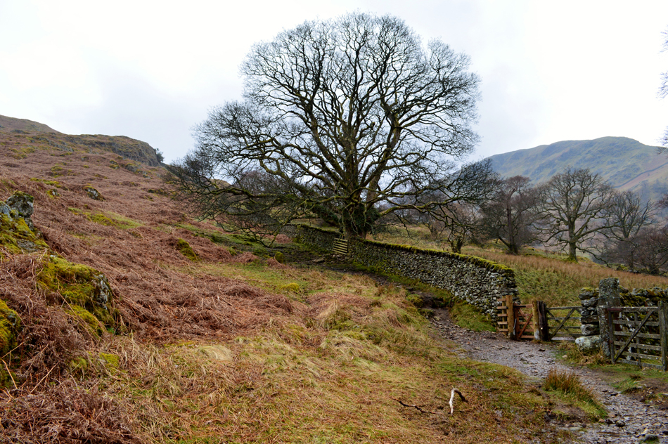
| As long as I've been coming here the tree has always been there. |
 |
| Looking back on Arnison Crag from the ascent of Birks. |
| Apologies over the quality of this photograph not helped by the haze and mist (and being out of focus!) Place Fell is still below the cloud as we look back over Trough Head towards Arnison Crag while every now and again the sun pokes through the cloud giving an instant heat source which really, we could do without while taking on the steep ascent towards Birks summit. |
 |
| St Sunday Crag from Birks summit. |
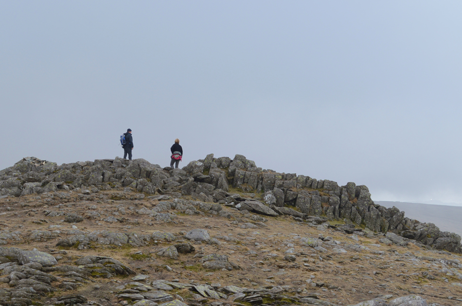
There are no false summits when ascending from the top of Trough Head, it's just one steady pull before reaching a stone cairn and the grassy plateau of Birks summit, from the stone cairn the summit cairn is just yards away which is where we assessed our situation, it didn't look good. Gavel Pike was below fleeting cloud and thicker cloud covered the summit of St Sunday crag ahead of us, by now we could feel a light breeze but hundreds of feet overhead the cloud was moving at a great pace, whatever cloud was pushed along there was more behind it to take its place. I guess the stall had been set, at least for now anyway.
From the summit of Birks we trace towards St Sunday Crag before heading left through Gavel Moss towards Gavel Pike seen far left below the cloud. |
 |
| Looking back on Birks, Place Fell and Ullswater. |
| |
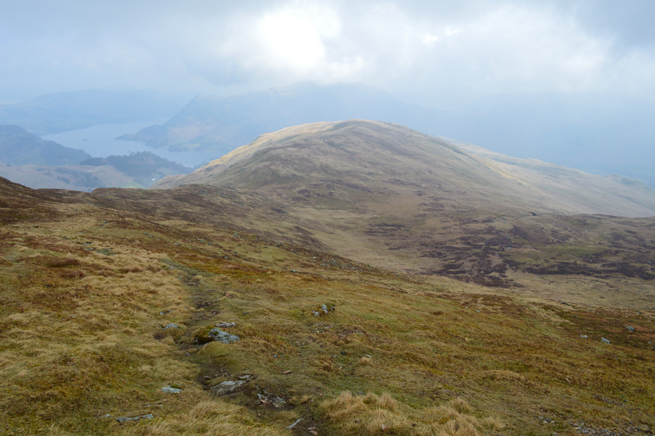 |
| Birks Place Fell and Ullswater from Gavel Moss. |
| With Birks behind us we start a slight ascent on St Sunday Crag before heading left and follow a prominent path which steadily rises to a col from which we trace further left onto Gavel Pike summit. |
 |
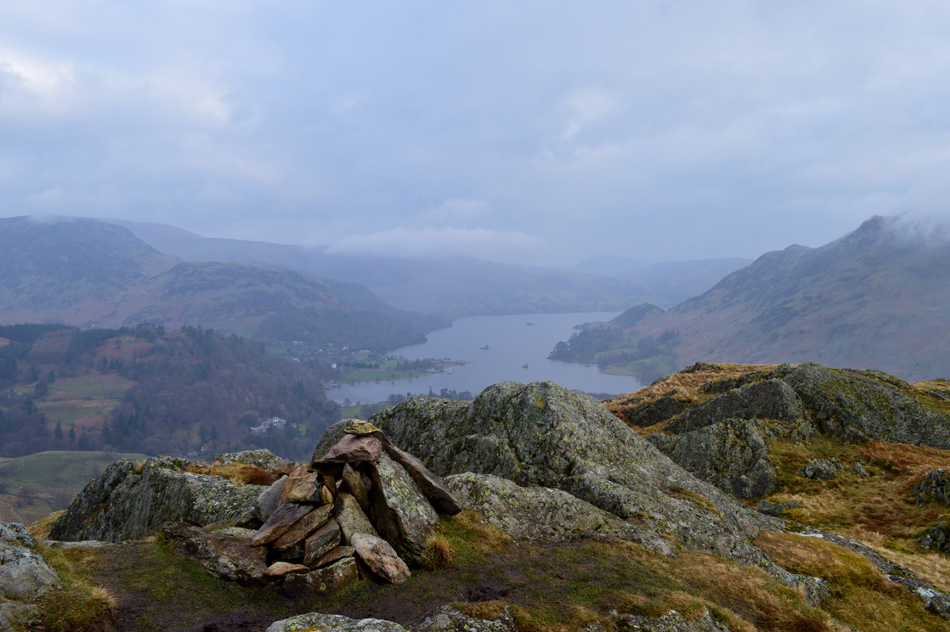
| Gavel Pike summit cairn. |
| The stone cairn of Gavel Pike was predominantly below cloud during our crossing of Gavel Moss but every now and again the cairn would appear through gaps in the cloud. Sporadic patches of snow covered Gavel Moss, some found alongside the path which ranched from soft and slushy to frozen solid,luckily non of the snow patches caused any issues. |
 |
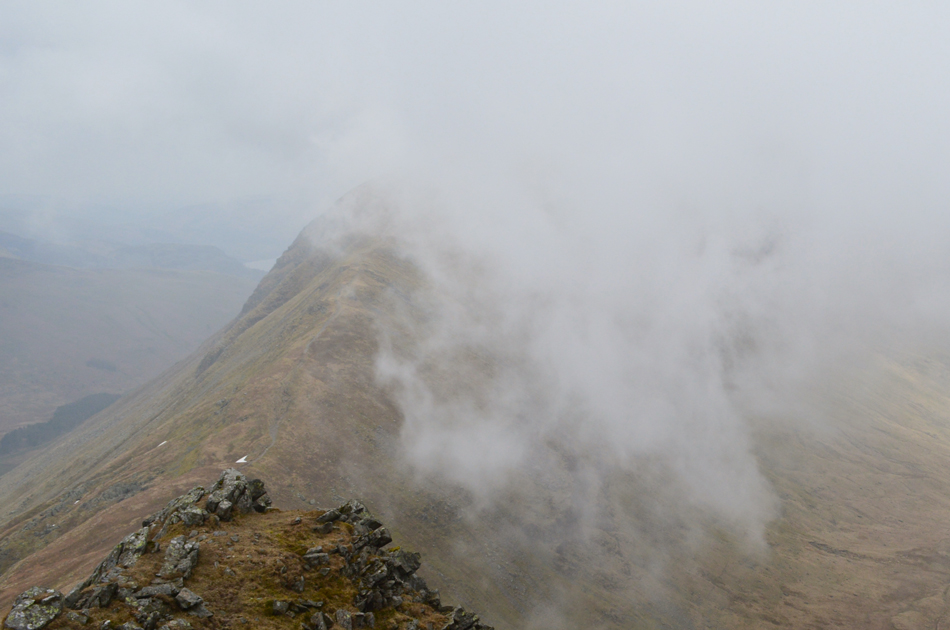
| St Sunday Crag summit. |
Soon the breeze turned into a steady wind which brought on a windchill cold enough to add gloves. This was back at the col between St Sunday and Gavel Pike at a point when we lost all visibility and despite the potential of the remainder of the walk being done below cloud senses are certainly ignited like little fireworks exploding every second, well that's my version anyway, you don't get that with blue sky days.
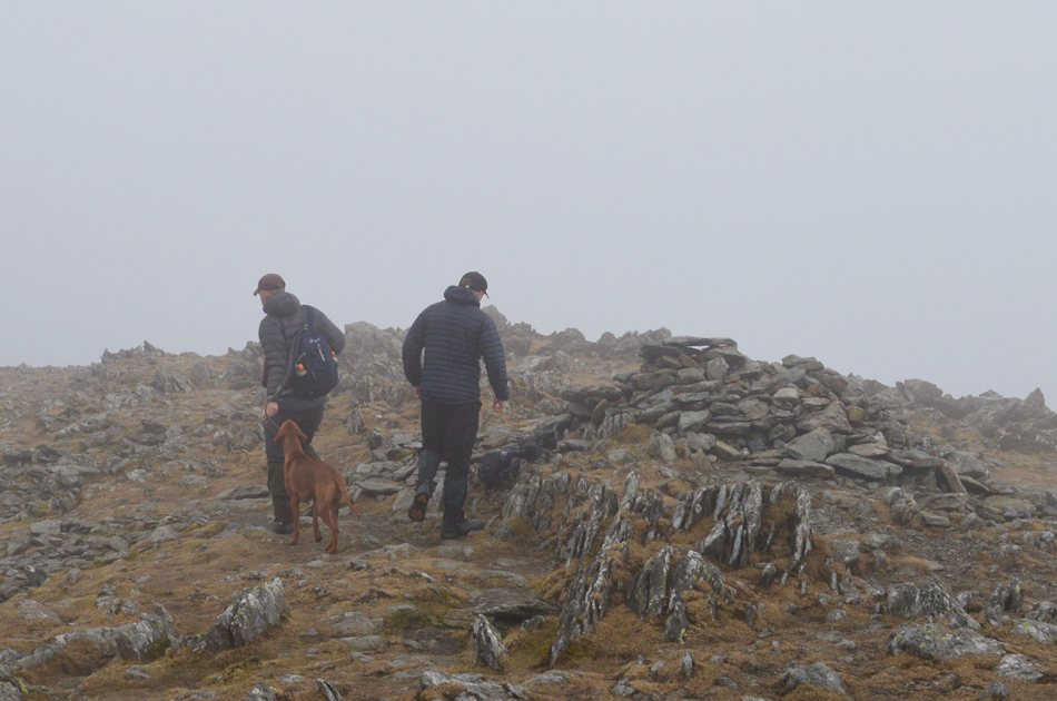
It's a short but steady ascent to reach St Sunday Crag from Gavel Pike all of which was done below the cloud where we found two lads along with their dog who we had seen back on Birks summit, their dog, a boisterous one year old bounced everywhere which brought us into conversation were as it turned out they were heading back to Patterdale the same way due being on a stag night in Manchester later this afternoon "well I said, while holding that pint in the hustle of the Manchester later think back a few hours to the few moments spent on St Sunday Crag this morning" and with that we bid each other a good day and parted into the cloud. |
 |
| St Sunday Crag summit plateau. |
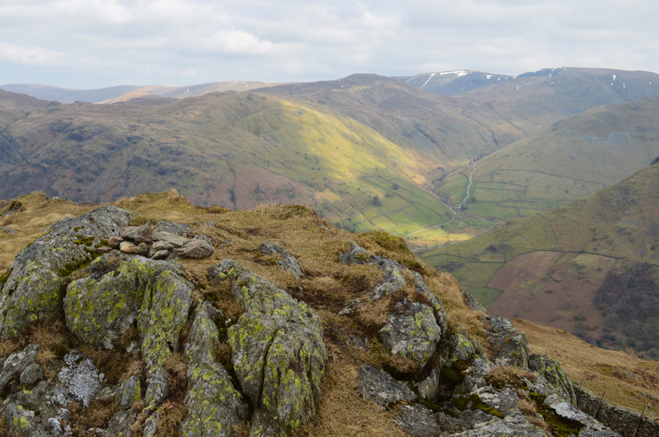
| Possibly my favourite image of the whole day. |
 |
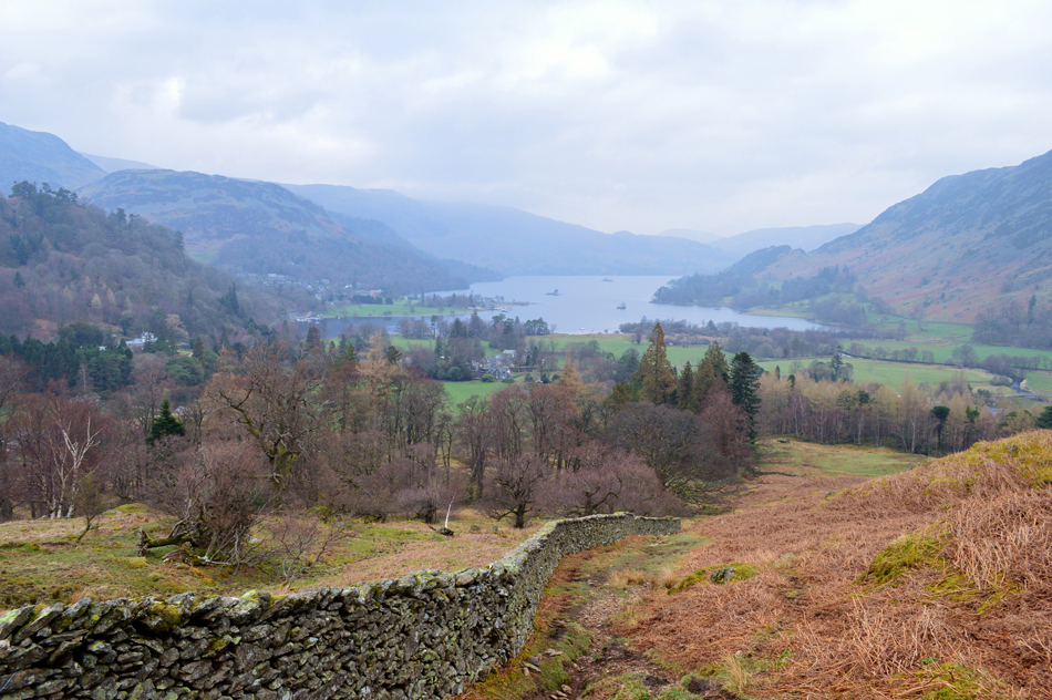
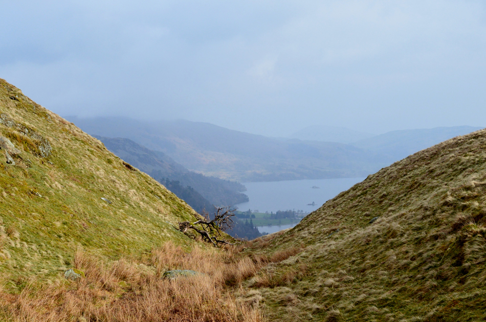
| Peering down into Deepdale. |
| At the moment a gap opens out between the cloud revealing Greenhow End. |
 |
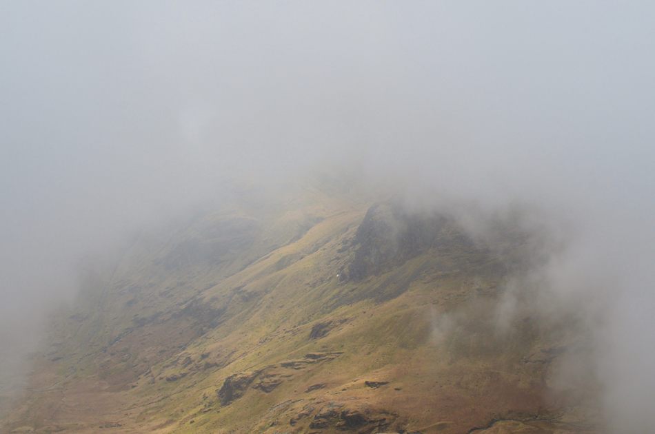
| Cofa Pike from Deepdale Hause. |
| |
 |
| Cofa Pike from Deepdale Hause. |
| Still in cloud we left St Sunday summit and started our descent towards Deepdale Hause, I guess, although we never spoke of it each of us was wondering was this it, had our cards been dealt, would we spend the whole walk walking in cloud? I had looked forward to the ascent of Cofa Pike which during our descent of St Sunday remained hidden behind cloud, as did Fairfield and indeed Dollywagon Pike on the other side of the Grisedale Valley. It was only as we reached Deepdale Hause did the cloud start to peel away as if it was waiting for us, a few magic moments was spent just watching the cloud lift revealing the cliffs of Fairfield's north face. |
 |
| Looking back over Deepdale Hause towards St Sunday Crag. |
| |
 |
| St Sunday Crag from Cofa Pike summit. |
| Cloud continued to lift and peel away only to be replaced by more cloud, ahead a clearing view of Grisedale Tarn with Seat Sandal behind. The cloud is still shifting and changing second by second which is potentially a good sign that the cloud is starting to clear. On the opposite side of the valley Dollywagon Pike is almost cloud free with the exception of a bank of cloud building up across the edge of the summit before dropping into Cock Cove, the sight of which accompanied the whole ascent of Cofa Pike. |
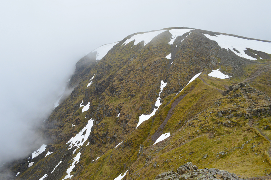 |
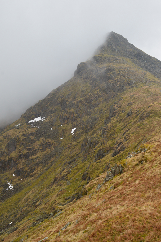
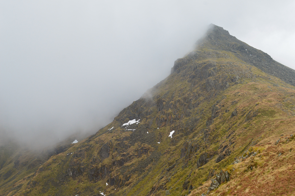
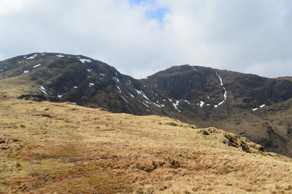
| Fairfield from Cofa Pike. |
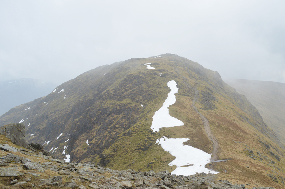
| If you look closely over towards the right two paths make up an ascent over the shoulder of the fell, bearing left here is found to be the 'fun steeper, more active ascent' while keeping right ensures a safer sturdy route over the shoulder, we bear right taking in todays conditions and last nights rainfall despite having to ascend via the large patch of snow seen right. |
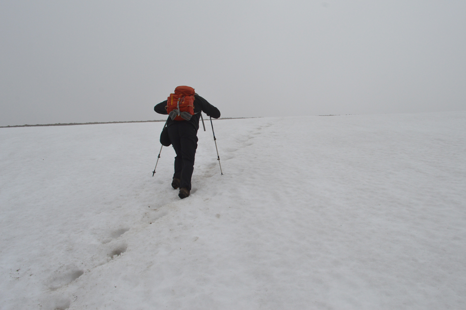 |
| David ascends the patch of snow towards Fairfield summit. |
| We found the snow semi-frozen and even slushy in places, despite this we kicked deeper existing holes which left a much firmer ascent, it was said that this might be the last of the snow we would encounter until next Winter arrives. |
 |
| Fairfield summit. |
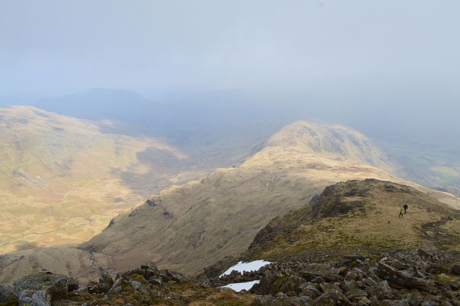
With the exception of a couple who left the summit as we approach we pretty much had the place to ourselves. From the summit plateau we strike east and follow the cairns towards Link Hause seen centre left. Following the cairns over on the right descend from the summit and onto the ridge towards Great Rigg.
Some of you may remember David's Spring project last year where he summated Fairfield consecutively from every possible approach, since then David has found he has quite a bond with Fairfield and speaks of those walks with great fondness ever since, todays visit being no exception. |
 |
| Hart Crag as we begin our descent from Link Hause. |
We walked into the thickening cloud and traced our way across Link Hause in almost zero visibility passing a couple along the way where 'mornings' were shared even though by now it had gone midday.
How do I know without looking at my watch that it's lunch time? the stomach was growling that's how! The ascent from the col to Hart Crag marks the last 'real' ascent of the walk and by the time we would reach the summit just a short time later I reckoned we would have earned that lunch. |
 |
| Hart Crag summit. |
Despite being the last real ascent of the walk gaining Hart Crag from Link Hause is relatively easy work although I must admit right about now my right foot is starting feeling tender again.
We crested the summit along with around half a dozen who were approaching from Dove Crag, no doubt walkers doing the Fairfield Horseshoe. The cloud had lifted although not entirely owing to the mist and a general haze which stretched out as far as the High Street range. Right, time to find a quiet spot out of the wind and stop for lunch. |
 |
| Looking down on Hartsop above How and the Deepdale Valley from our lunch spot. |
I hadn't took the lid of my Sandwich box before hearing a young girl who was asking "how far was it to the summit" she was polite and was with another girl who held a dog on a lead, next she asked "where's the Priest Hole" so we pointed towards Dove Crag and the whereabouts of its location "do you think we'd be OK getting there she asked?" We bore in mind that these were possibly the first time summits and from their dress (boots, leggings and waterproof jackets) that they hadn't much experience on the fells so I answered while straining my voice "possibly not today, not after last nights rain and given the slime that builds up on the rock on the approach to the cave my advice would be to come back another day" she took our advice before answering a call on her mobile "oh Hi, where not going to the cave, we've bumped into two walkers who have advised us not too" the person on the other end, we presumed, agreed this was OK.
The two chaps seen below unbeknown to us are the girls partners who after catching them up are troubled in hearing they wouldn't be visiting 'the cave' "that's the only reason why I've come one said" while the other moaned at just how knackered he was, his casual street wear not helping. The two girls thanked us for our advice and so too did one their boyfriends before continuing towards Hart Crag summit.
This wasn't the last time I'd see the couples but more on that later. What struck me most was just how brazen they were about asking "where's the Priest Hole" as if it was the hairdressers down the street, I suspect that social media has a lot to answer for on this matter showing no real concern for past or present conditions.
It's deep filled beef salad barm cakes or 'tea cakes' as David called em for dinner, yum yum. |
 |
| The magical Hartsop above How ridge. |
| With lunches packed away we left Hart Crag and descended steeply keeping to the right via a scree path, this being the more pleasant path than the left option which can be craggy sometimes requiring hand and bum contact! |
 |
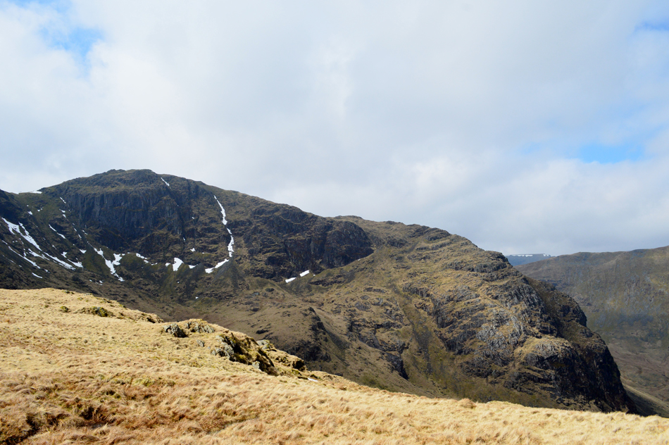
| Fantastic views from the ridge towards Hart Crag and Fairfield. |
| Well, what a difference a couple of hundred feet makes, tired of complaining it was too hot we stripped off our jackets and rolled up our sleeves. One of the most satisfying aspects of the Deepdale Horseshoe is just how pleasant the Hartsop above How ridge is both underfoot and the views back to Fairfield. It feels like a completely different day from when we were standing in the cloud on St Sunday Crag just a few hours ago. |
 |
| Views over Link Cove towards Fairfield, The Step and Greenhow End. |
| All of which brought back great memories from our ascent of Fairfield via The Step during May last year. |
 |
| That's Hartsop above How ahead. |
| But it isn't todays last summit, that would be Gale Crag further along the ridge. |
 |
| Views into Dovedale towards Dove Crag. |
| "Fancy descending Dove Crag via Stand Crags one day Paul" David asked, aye lets get it sorted. Stand Crags being the knobbly ridge over on the left. A route we've never used and one where hugely looking forward to, watch this space. |
 |
| Looking back on Hart Crag, Fairfield, Cofa Pike and Greenhow End from Hartsop above How summit. |
| The Hartsop above How ridge seems to roll on forever with fantastic views into the Dovedale and Deepdale Valleys, having only passed a young girl and her mother eating lunch whilst sat on a craggy outcrop we seemed to have the ridge to ourselves. It was only when I arrived home hours later that I found out Facebook friend Jenny Fraser along with her friend was also doing the Deepdale Horseshoe travelling around half an hour or so behind us, in fact they're probably in this photo. |
 |
| Todays last summit of Gale Crag seen on the Eastern spur of Hartsop above How. |
| While in the distance, Angletarn Pikes (south peak only) Brock Crags, Rest Dodd, Rampsgill Head, The Knott, Gray Crag and Hartsop Dodd. |
 |
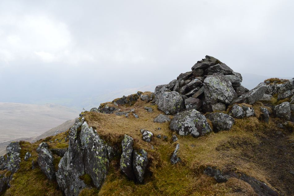
| Gale Crag summit. |
| With views into Hayeswater Gill while the sun shines down over Hartsop. |
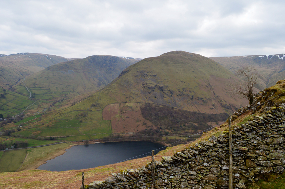 |
| Gray Crag, Hartsop Dodd and Brothers Water taken during the descent of Gale Crag. |
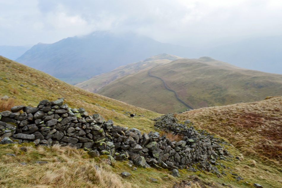
| After summating Gale Crag we continue to follow the wall (although not strictly at times) as the path does tend to veer away from time to time. |
 |
| Views towards Angletarn Pikes, Boredale Hause and Brock Crags. |
| With Great Mell Fell seen in the distance. |
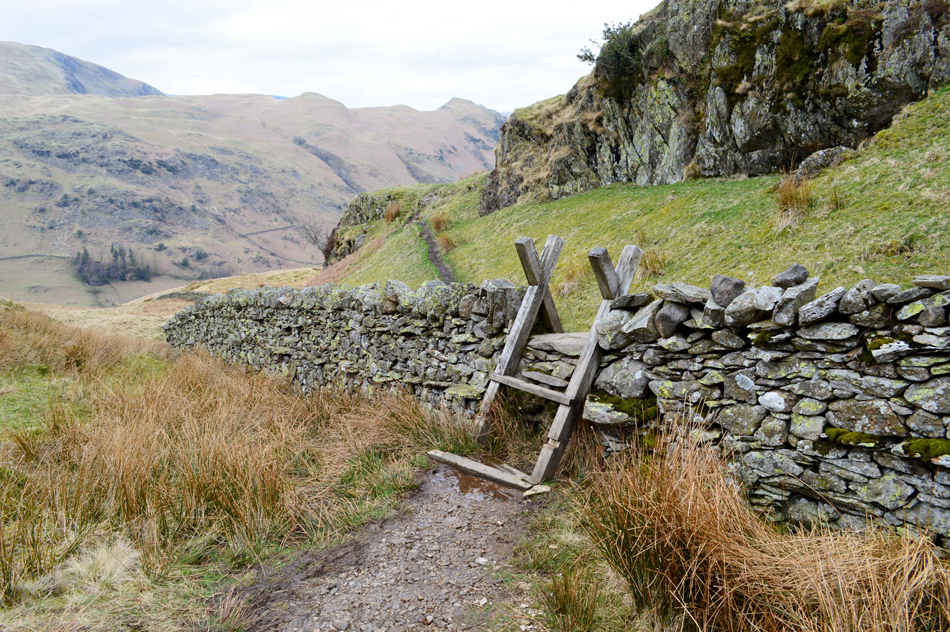 |
| Crossing the wall at this ladder sty. |
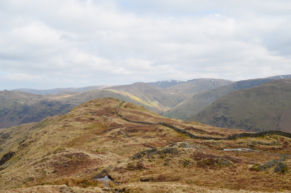
| Despite the ridge wall continuing we veer left slightly into a hollow with Deepdale Park over to the left. You might be able to see that the bottom run of the ladder is missing which is no hardship I'm just glad David noticed it first. On the other side of the sty a dead sheep which was the first thing I saw as I crossed the wall. It may have only died during the night, any longer and the foxes would have had it we imagined. We wasn't sure what killed the poor thing but its stomach was bloated to twice its size and its eyes had already been pecked out by the Ravens, not the best image to see when climbing over a wall but one that you tend to get used to after years walking the fells. |
 |
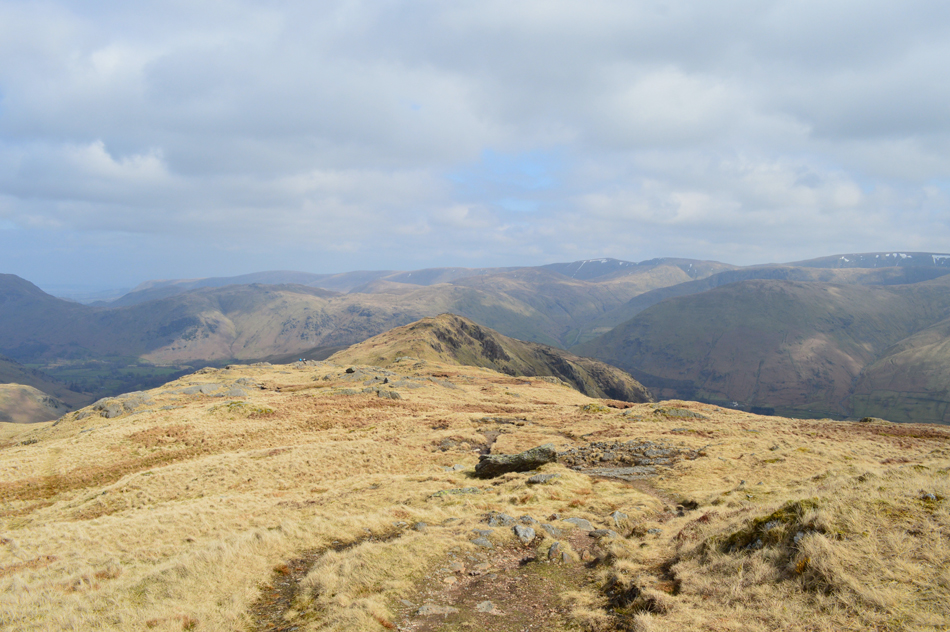
| The distinct profile of Gavel Pike and St Sunday Crag seen over the Deepdale Valley. |
| If you look closely you can see the path we used while crossing Gavel Moss earlier just below the large patch of snow. |
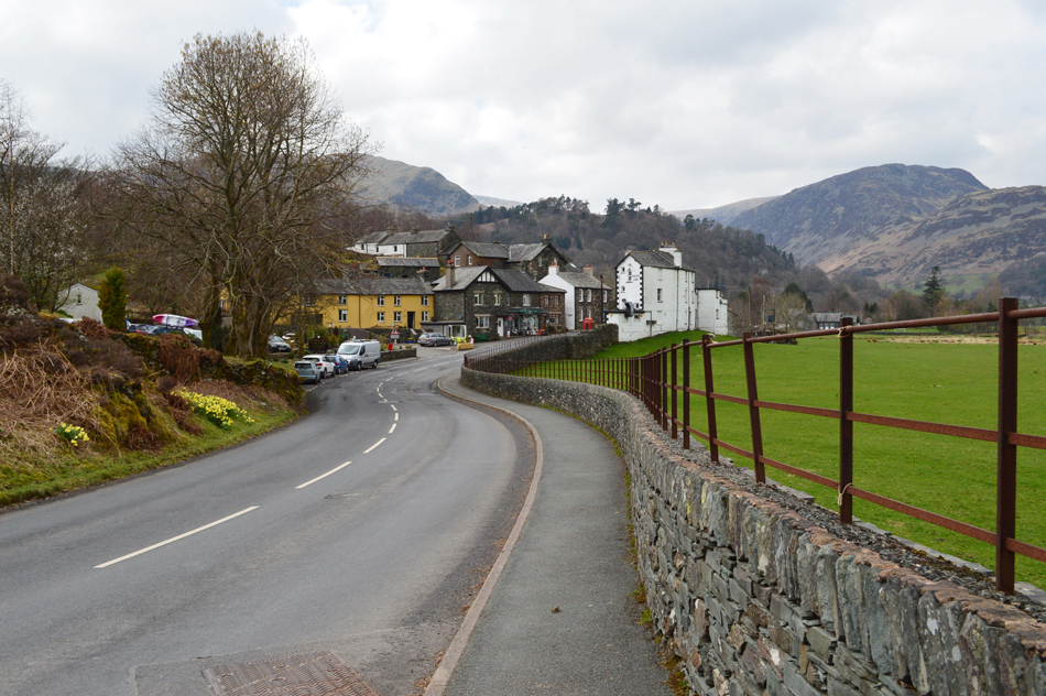 |
| Back in Patterdale. |
Our route back to Patterdale saw us criss-cross the A592 from Bridge End all the way back to the village. Feeling warm, humid and Spring like amid views of new born lambs in the adjacent fields all the while nostrils are filled with the smell of silage and cooking from a nearby campsite. Patterdale was soon reached passing the village store along with its old fashioned newspaper stand on the flags outside. Continuing towards the Primary School we pass Patterdale Hotel where people sit on benches and dogs bark only to be shushed by their owners, it certainly didn't feel like Spring on St Sunday Crag earlier but all the tell tale signs that Summer is on its way are already here.
After shaking Davids hand I set off for home leaving Patterdale behind before spotting the two young couples who had asked us for advice back at Hart Crag, judging by their timings it looked like they had listened to us despite the girl we were speaking to looking like she had taken a fall in the mud somewhere, It could have been much worse. Seconds later I cross the bridge at Bridge End and spot Jenny and her friend before starting the steep climb towards the top of Kirkstone Pass behind a dozen other cars all of which tail behind a camper van at the lead. On reaching the top of the Pass the camper van pulls at the layby close to the Kirkstone Inn over while I take in the long distant view over a glistening Windermere five miles below. |
|
| |
| Back to top |
 |
|