|
Walking the Birketts, Dow Crag to White Pike Skyline |
 |
 |
1st April 2018 |
 |
|
I wasn't meant to be walking today after an evening out with Paula last night but come mid morning I found myself checking the forecast which appeared to be clearing nicely. I always tend to keep on top of my gear which meant after my walk in Longsleddale on Good Friday all I had to do was stuff my gear in my pack not worrying too much about food which I would buy from the Petrol Station as I filled up.
In the eventuality of a walk today I'd already chosen which walk to do and thankfully the forecast allowed me to continue with my plans, there were even reports of 'extensive sunshine' which would be great after a rather dreary walk back on Friday.
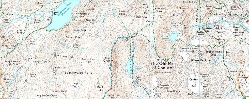
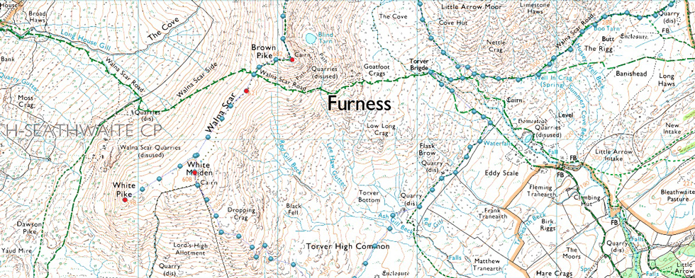
Todays walk takes in seven Birkett summits from Fell Gate, Walna Scar and is based around Dow Crag, being fond of not just Dow Crag but the whole Coniston group this walk had my name written all over it. Only two summits visited during the walk will be new to me which are White Pike and High Pike Haw. I've been within a stones throw of White Pike after visiting White Maiden as part of my 2,000 Footer Project but High Pike Haw will be a brand new summit in an area that I'm not too over familiar with. |
|
| The Complete Lakeland Fells |
 |
| By Bill Birkett |
-The Dow Crag to White Pike Skyline
The high skyline between Dow Crag and White Maiden forms the watershed between Dudden Valley and Coniston. It provides a mountain walk of considerable quaility. |
|
|
|
| |
|
Overview |
|
|
| Ascent: |
2,481 Feet - 757 Metres |
| Birketts: |
7, Dow Crag - Buck Pike - Brown Pike - Walna Scar - White Pike - White Maiden - High Pike Haw |
| Weather: |
Sunny to Start, Light Snow Showers, Turning Brighter PM. Highs of 8°C Lows of 7°C |
| Parking: |
Car Park, Fell Gate, Walna Scar Road |
| Area - Group: |
Southern - S/DOW |
| Miles: |
8.8 |
| Walking With: |
On My Own |
| Ordnance Survey: |
OL6 |
| Time Taken: |
3 Hours 45 Minutes |
| Route: |
Fell Gate - Boo Tarn - The Cove - Goats Water - Goats Hawse - Dow Crag - Buck Pike - Brown Pike - Top of Walna Scar Road - Walna Scar - White Pike - White Maiden - High Pike Haw - Ash Gill - Torver Beck - Walna Scar Road - Fell Gate |
|
| |
|
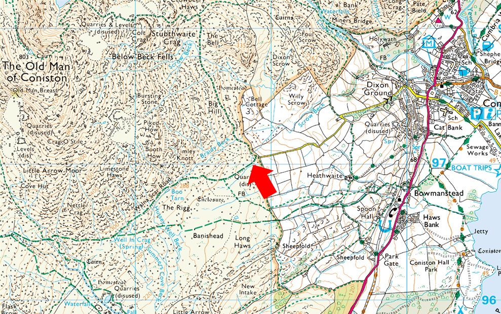
Parking Details and Map |
|
|
| Nearest Post Code: |
LA21 8HQ |
| Grid Reference: |
SD 289 197 |
| Notes: |
The car park at Fell Gate is very popular all season round and therefore can fill up quite quickly especially throughout the Summer, my best advice is to arrive early although I have been known to park here in the middle of Summer in mid afternoon after work and secure myself a parking spot. The nearest postcode is for The Sun Hotel just outside of Coniston. Follow the postcode for The Sun Hotel which will appear on the right, from here the road climbs and bends sharply to the left before arriving at a junction, head straight ahead ignoring the left turn onto Walna Scar Road for a mile before arriving at a large metal gate where you will find the entrance to Fell Gate Car Park. Parking is free. |
|
| |
|
Map and Photo Gallery |
|
|
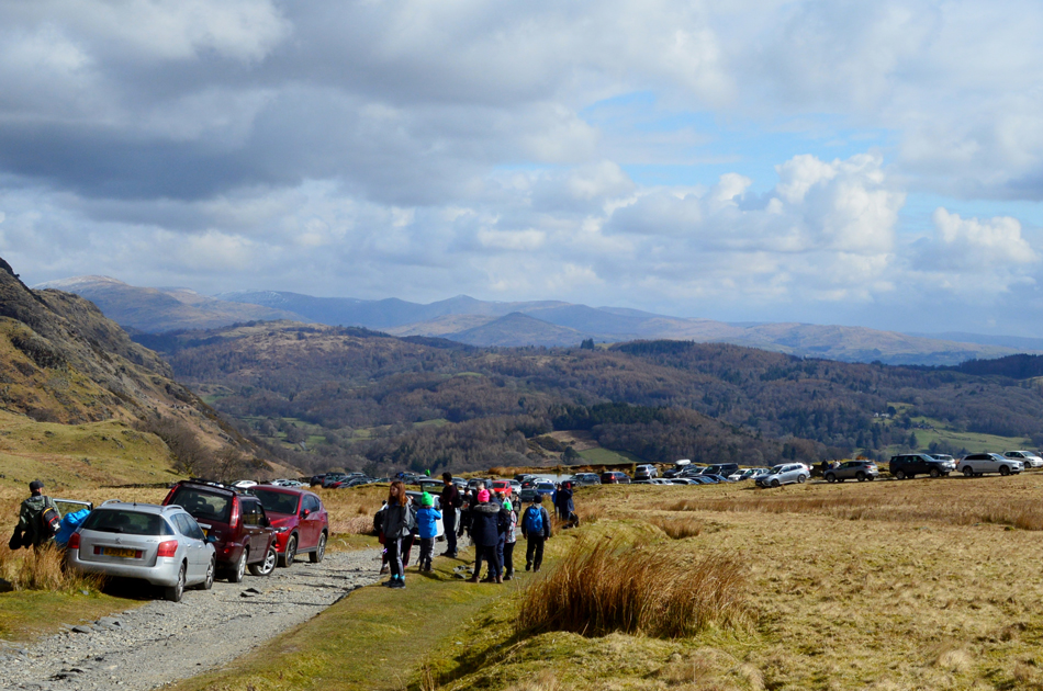 |
| 11.30am Fell Gate, Walna Scar Road, Coniston 8°C |
Having only left home around 09:30am I arrived at a bustling Fell Gate around 11:15am. The tell tale signs that it was busy was an understatement with parked cars left in passing places all the way down Walna Scar as far as Coniston Village. My mind told me there was no way I was going to park but my heart told me to at least try. The gate at the entrance to the car park as I approached was left open after a car which had just left, I told the chap I'd close it after I had passed through where chaos awaited me, my heart sank at not just the amount of people or traffic at just how disturbed the place looked. Luckily the chap who I had passed at the gate left a space next to the wall and I was able to slot my car in the vacant space, had my timing been just minutes later I'd have lost it and I don't think this walk would have happened.
Cars littered the lane as far as Boo Tarn and after the quickest kit up ever I locked my car and headed up the track just wanting to get away from the hustle as quickly as possible. |
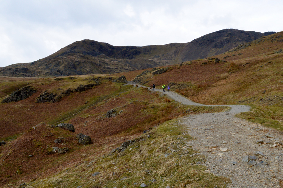 |
| Views soon open out over Brown Pike (L) and Buck Pike (R) |
| Not expecting to walk today I'd eaten heavily the night before and found my break-away from the crowds rather exhausting but nontheless I managed to leave around thirty behind me, only the three blokes I clocked returning to their car appeared to be fell walkers, the rest tourist or families here to enjoy a day on the Old Man. |
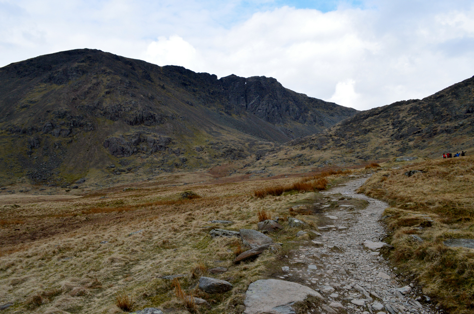 |
| Dow Crag soon after leaving Walna Scar behind. |
I turned right at the sign posted 'Levers Hawse' and continued to walk along the track after finally getting my breath back! More families are passed including the large one up ahead who left the path for a direct ascent up Old Man's Breast, ok I guess if your an adult used to rough, craggy ground but not for young children wearing just tracksuit bottoms and trainers.
Moving on. |
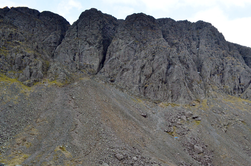 |
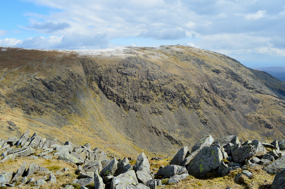
| Dow Crag Buttresses appear as I near Goats Water. |
Three more walkers are based one of whom asked would I mind I take their picture with "those crags" in the background, I oblige and take a few snaps before handing the chap his camera back asking would I like my picture taken on my camera "nah it's ok I replied" |
 |
| Looking back on Goats Water. |
| I was saddened to see that the blue Stretcher Box below 'B Buttress' is not there anymore, the only visible remains being either a side or the lid which now lies between in the scree between B Buttress and Goats Water, there was a lot of history, and not to mention a Memorial Plaque attached to that box. |
 |
| Looking down on Goats Water with Dow Crag over on the right. |
| It's been some time since I last ascended to Goats Hawse and I had forgotten how steep the gradient gets just below the top! It was here more large groups were over-taken all of whom appeared to be heading for the Old Man. |
 |
| Views towards Grey Friar, Great Carrs, Swirl How and Brim Fell from Goats Hawse. |
| The light is spectacular right now as the fells contrast against a greying sky. |
 |
| Coniston Old Man taken not far from Dow Crag summit. |
| It's difficult to see just how many people are ascending and descending the Old Man right now, I lost count when I got to sixty. It was like watching a steady stream of ants, Bank Holidays sure bring the crowds out, lets hope everyone gets down safely. |
 |
| Distant views towards the Scafells Group with Grey Friar and its long south west ridge lit up in Spring sunshine. |
| It's looking a little murky towards Upper Eskdale with what appears to be a snow shower passing through having just experienced one during my ascent on Dow Crag. |
 |
| Looking back over Goats Hawse towards Brim Fell, Swirl How and Great Carrs. |
| |
 |
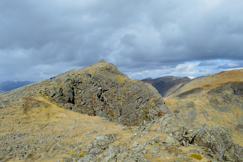
| Dow Crag summit. |
Having reached the summit of Dow Crag all that was left was the last scramble towards the summit, I rarely ascend from this side but enjoyed the scramble nevertheless. Descent, however was blocked by a large group waiting themselves to reach the summit and this would have been made easier had it not been for the chap seen sitting in the photograph who didn't realise he was holding people from ascending and descending.
After lowering myself down two walkers, a man and his wife pass asking in the broadest of Lancashire ascent "what time is it? tha knows I ant had meh dinner yet" I could only chuckle replying it's quarter to one mate. |
 |
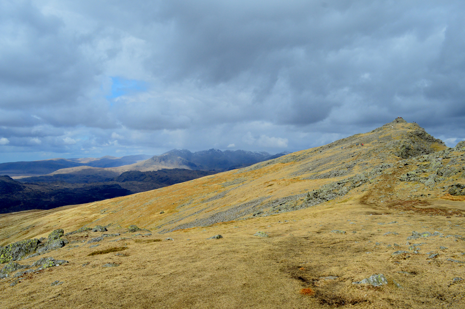
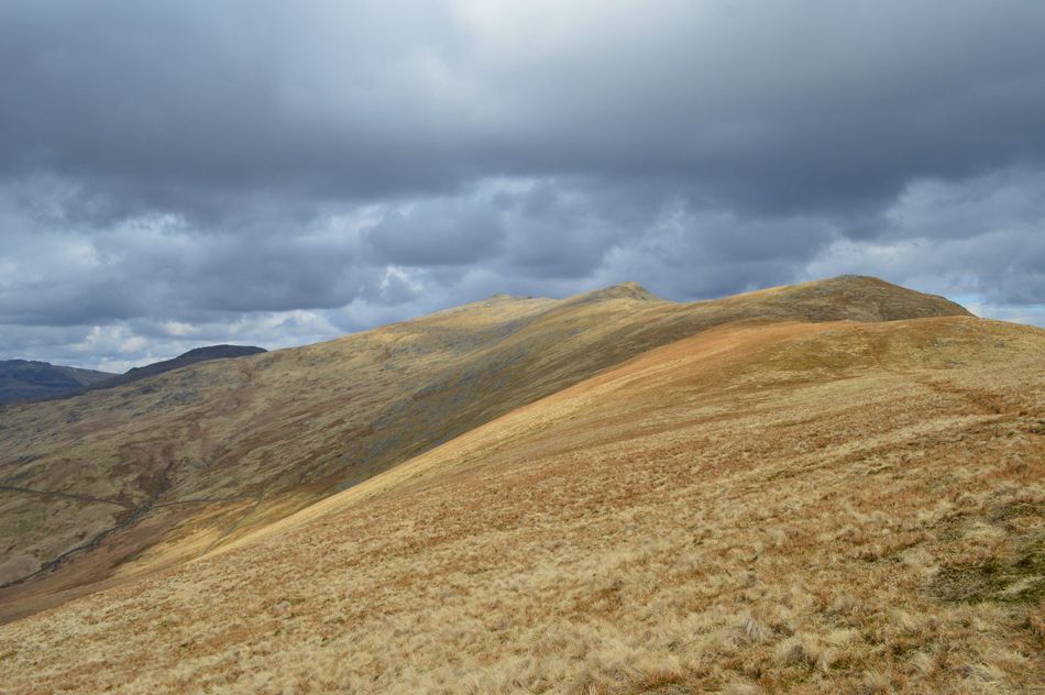
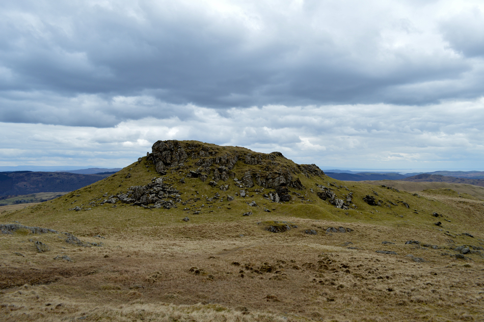
| Buck Pike seen beyond the head of Great Gully. |
| While further right Walna Scar, White Maiden and White Pike and in the distance, the Dudden Estuary and Morecambe Bay, what a glorious afternoon it's turning out to be, the light is fantastic. |
 |
| Looking back to Dow Crag summit. |
| The summit is still looking busy with more people on thier way up. |
 |
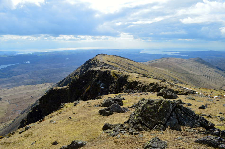
| The fantastic ridge route to Buck Pike. |
| |
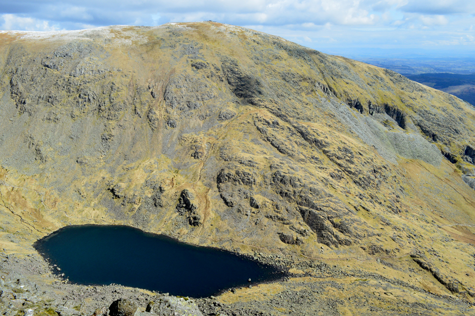 |
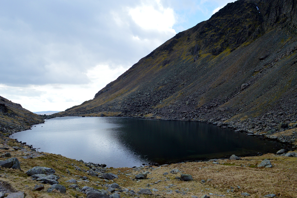
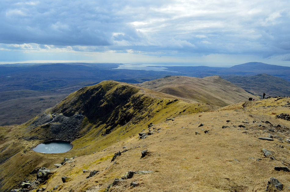
| Peering down on Goats Water with the mass of Coniston Old Man behind. |
| "When tranqil it appears aqua blue in colour due to the natural copper deposits. When black and furious, the wind lifts sheets of water from her surface to showering the surrounding rocks" Bill Birkett. |
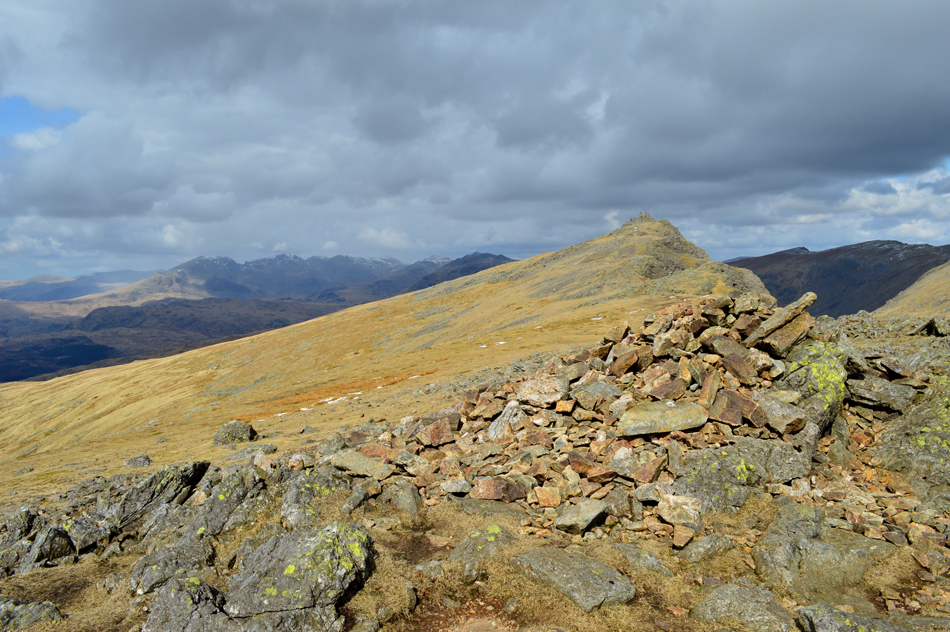 |
| Dow Crag from Buck Pike summit cairn. |
| |
 |
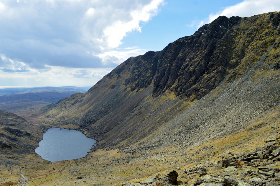
| Blind Tarn, Brown Pike, Walna Scar, White Maiden and White Pike from Buck Pike. |
| I continue southwards along the most pleasant of Lakeland ridges towards Buck Pike south shoulder, a slight descent is required as views open out over the spectacular Blind Tarn (named Blind as it has no visible feed or exit) before re-joining the ridge towards Brown Pike. |
 |
| Brown Pike is just ahead while three of my four remaining summits tease from a distance. |
| |
 |
| Looking back on Buck Pike with Coniston Old Man seen over The Cove over on the right. |
| |
 |
| One last photograph of Buck Pike. |
| Before I make the slight descent towards the top of Walna Scar Road. |
 |
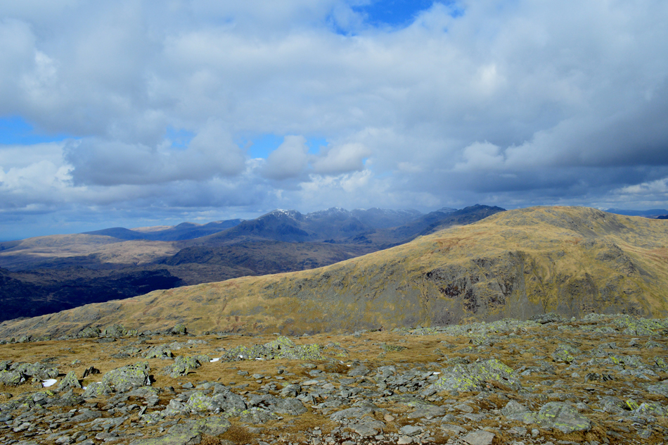
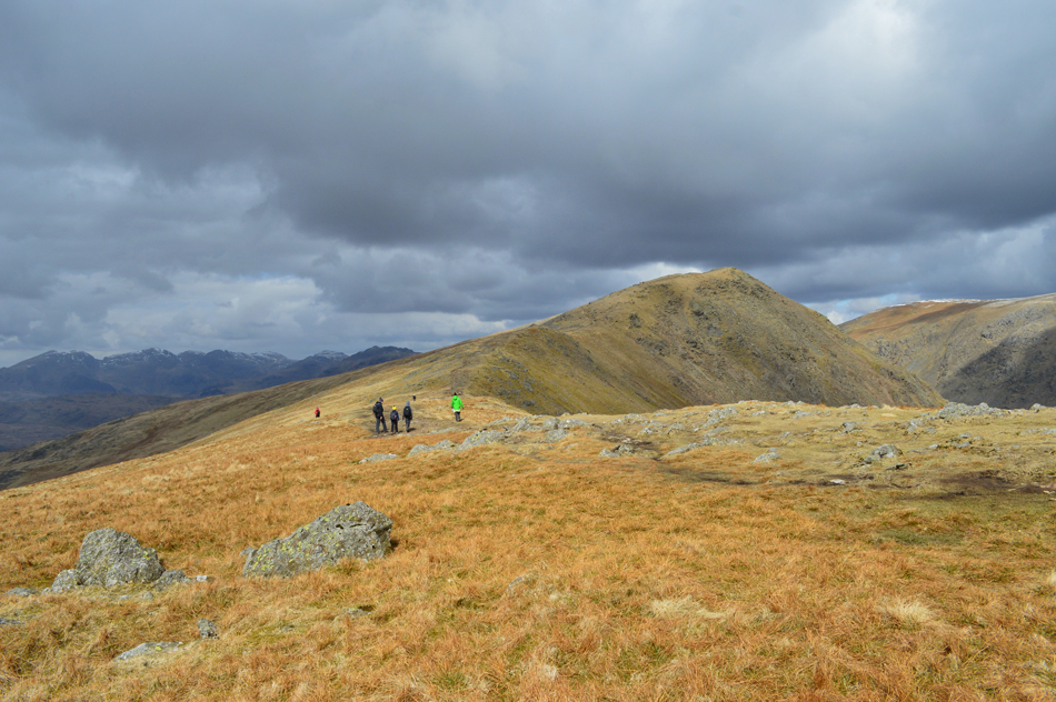
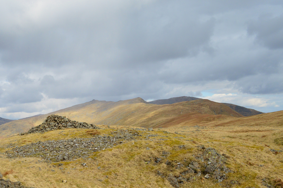
| Walna Scar, White Maiden, White Pike and Caw seen over the top of Walna Scar Road. |
| This is where the walk takes on a different role swapping high ridges for rolling grassy summit. I descend Brown Pike and cross the top of Walna Scar track then ascend easily towards the next summit of Walna Scar. |
 |
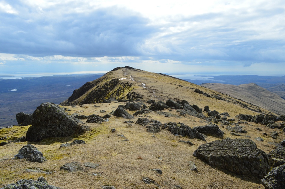
| White Maiden, White Pike and Caw seen from Walna Scar summit cairn. |
| Within moments of breaking the grassy shoulder the summit cairn of Walna Scar is reached. White Pike is seen as the craggy outcrop off to the left which will be summited after visiting White Pike first seen at the far end of the ridge, |
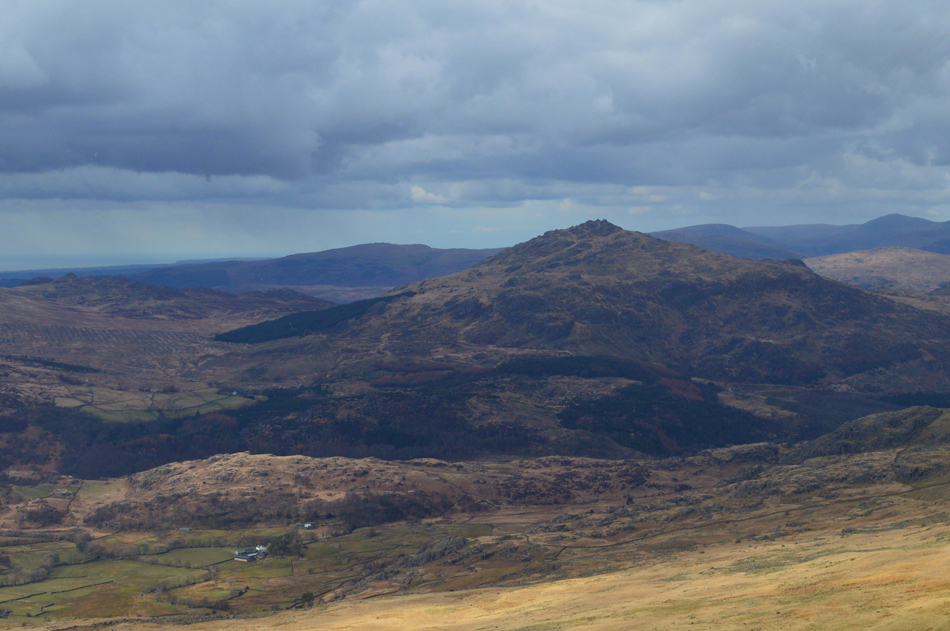 |
| Harter Fell (Eskdale) |
| Unfortunatly for Eskdale and Dunnerdale it's been clouding over for the last twenty minutes or so, I guess it won't be long until the cloud heads my way too. |
 |
| Here looking back on Brown Pike, Buck Pike and Dow Crag. |
| There's still a little brightness about creating dramatic affects over the fells but I can clearly see the cloud is starting to thicken. |
 |
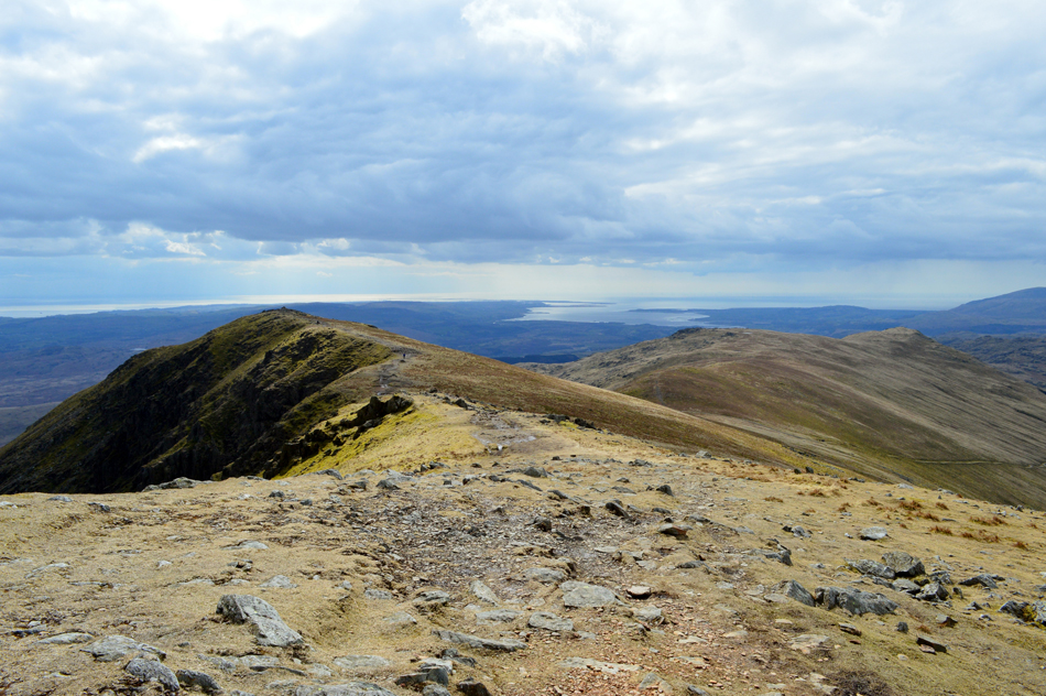
| Brown Pike, Buck Pike and Dow Crag from White Pike summit. |
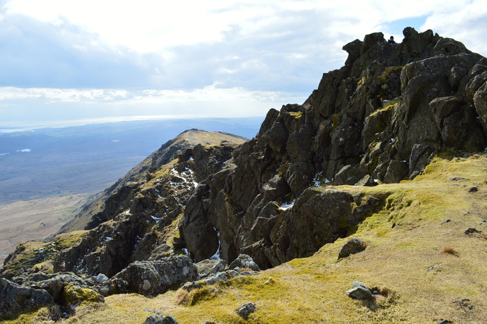
| If you've never visited White Pike before you may wonder where does the 'Pike' come into the fell, the question is answered if you take a short walk right to the end of the ridge where as I did you will be met by a sudden drop of around 600ft, a splendid top. |
 |
| White Maiden from White Pike. |
| After leaving the summit of White Pike a singular track ascends slightly directly towards the summit...It's those 'slight ascents' that feel much harder by now than they should! |
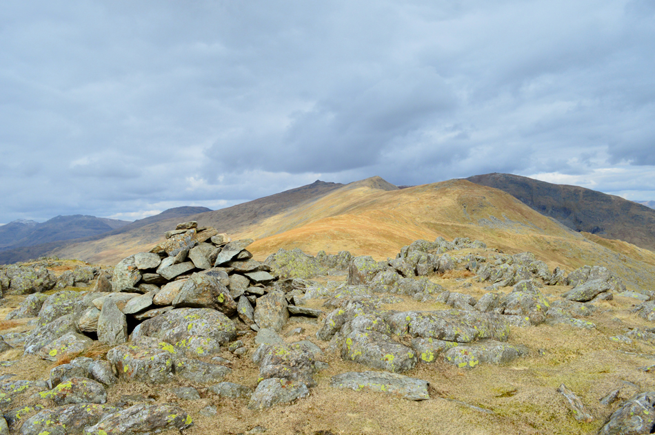 |
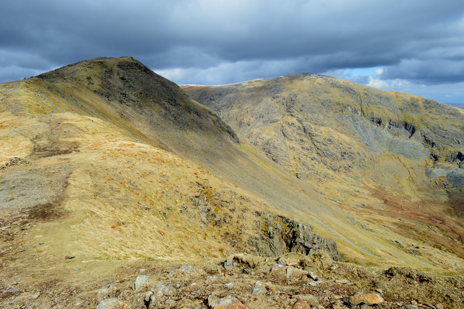
| Brown Pike, Buck Pike and Dow Crag and Coniston Old Man from White Maiden summit. |
| |
 |
| What a fantastic view. |
| |
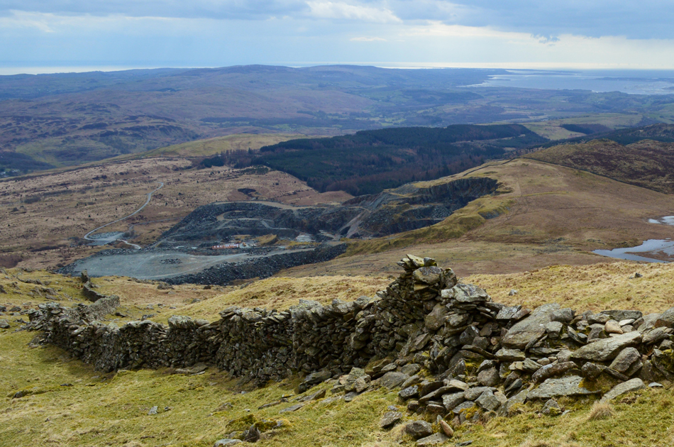 |
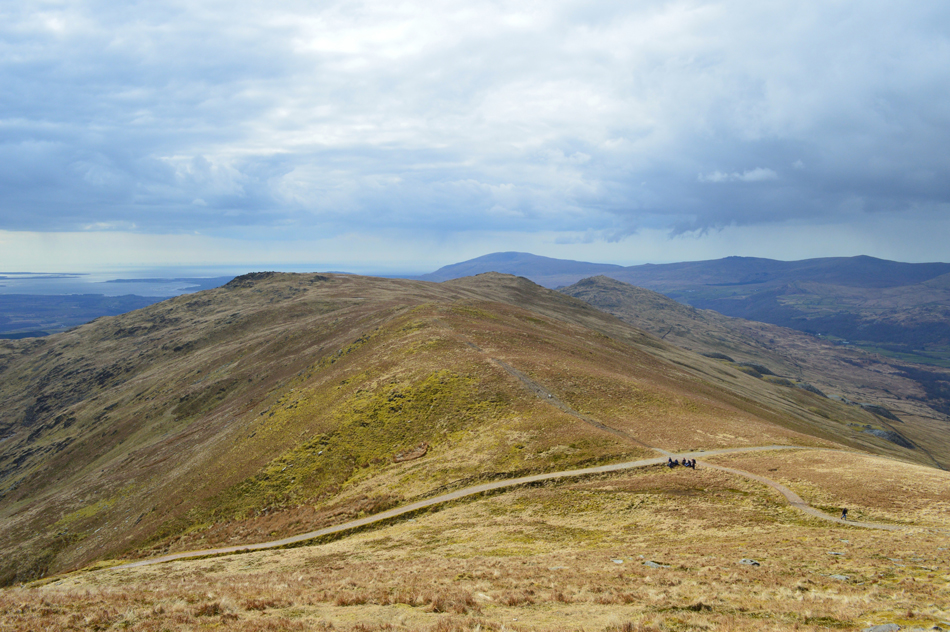
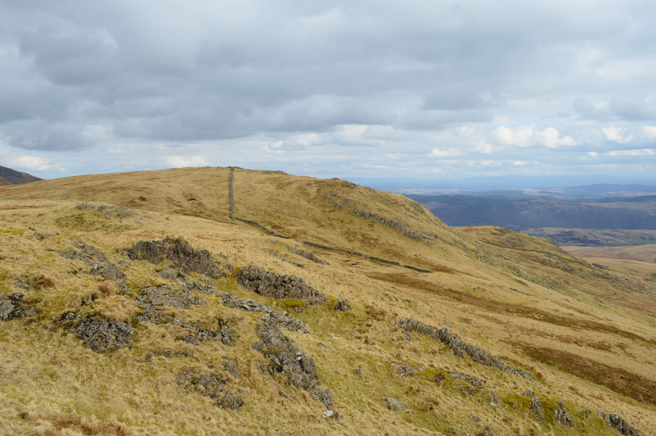
| Descending White Pike with views over Broughton Moor Quarry. |
| Having left the summit I descend steadily while keeping as suggested, the stone wall to my right. |
 |
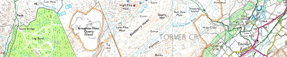
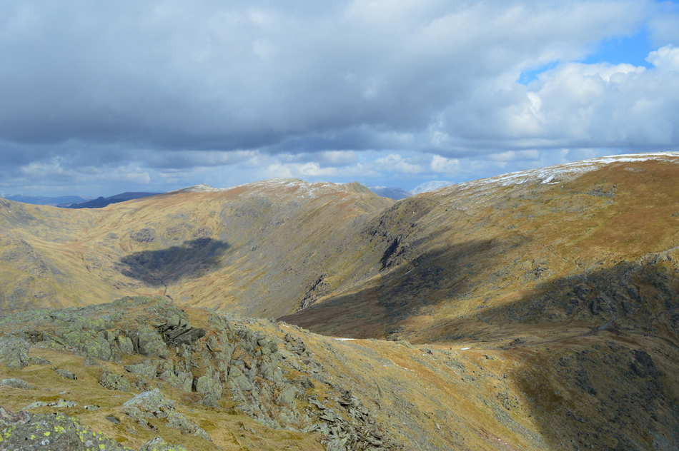
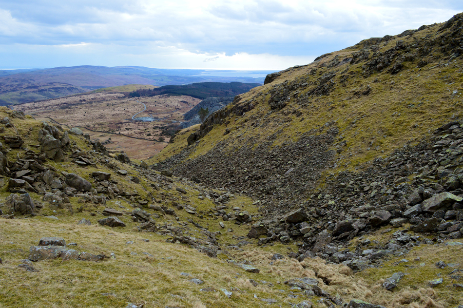
| The descent picks its way over the top of Dropping Crag as High Pike Haw comes into view seen as the dark crag centre left. |
| A faint path traces from the stone wall across the craggy shelf like plateau of Dropping Crag, I'm heading towards the craggy outcrop seen dead centre in the photograph, this outcrop sits above a micro valley which I will traverse. Although it is mentioned that an easy descent can be made I found the descent steep in places which caught me off guard, nevertheless, and with care I found myself over looking the micro valley and followed a faint path around its head. |
 |
| The micro valley found below Dropping Crag. |
| The walls of the valley are much steeper than they appear in this photograph and again care was excised during my descent, a faint path however does navigate around the head of the valley which crosses the upper part of the boulder field seen lower right. |
 |
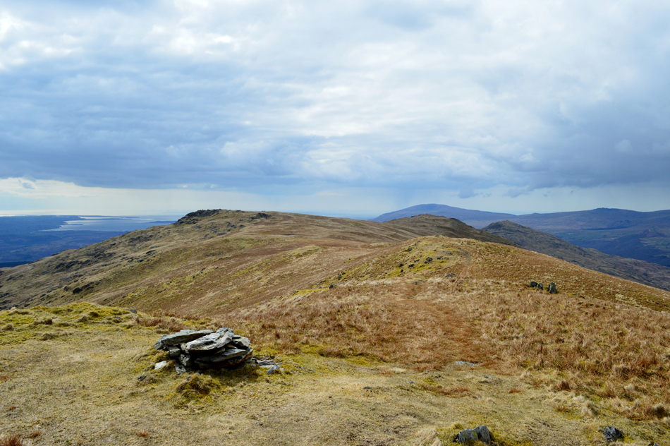
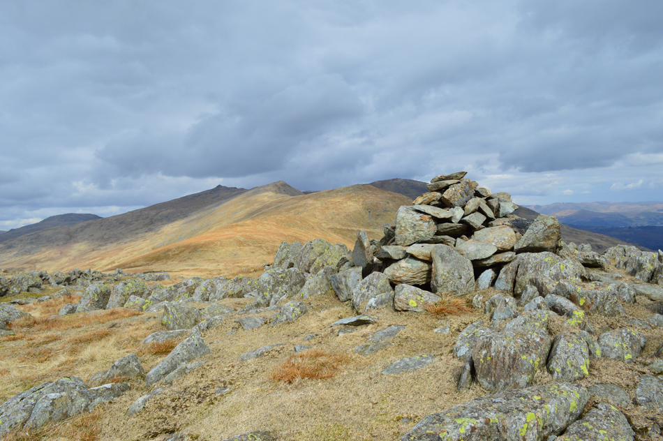
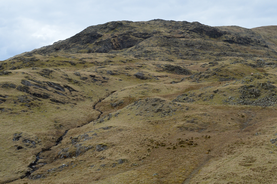
| High Pike Haw. |
| With the steep descent behind me High Pike Raw soon came into view, a sudden burst of energy saw me at the summit within a few moments, it's a short but very steep climb mind! |
 |
| Dropping Crag from High Pike Haw. |
Well, during my time spent descending Dropping Crag I've well and truly lost the sunshine, oh well not to worry, this is one amazing place with the Coniston Group never far from sight.
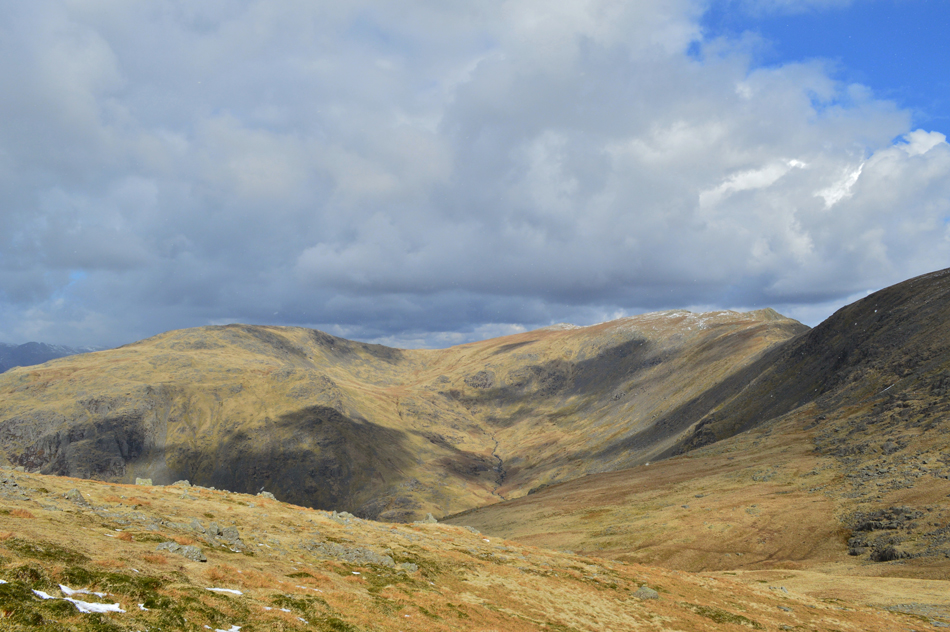
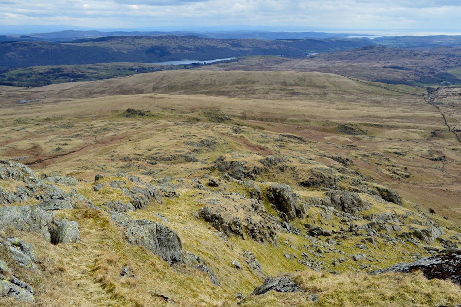
It's time to head back now via Torver High Common and Ash Gill Quarries, from the summit non of which can be seen just undulating moorland with the Coniston Fells in the distance. It's easy for the nerves to make an appearance here and I wouldn't blame anyones whose didn'nt because at first glance, in low light, Torver High Common can appear slightly daunting. |
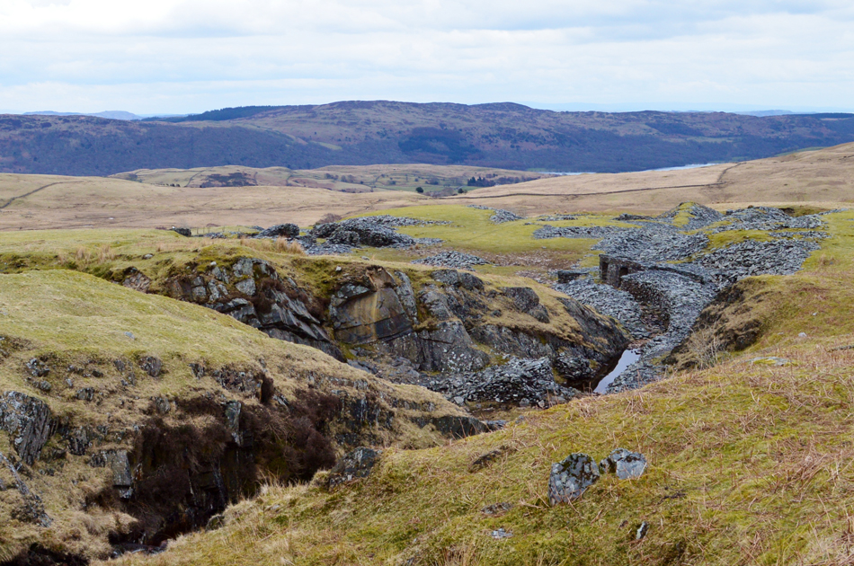 |
| Ashgill Quarries from Ash Gill. |
Before leaving the summit I consult my map before taking a good reading of the land, paths appear scarce only because I hadn't been here before, on descending High Pike Haw I spot a singular grassy path nestled to the left of Seal Gill, I follow it which in turns passes through dead bracken (a blessing) with Ashgill Quarries over to the right, the faint path continues shouldering outcrops here and there before arriving at Ash Gill from where I took this photograph.
A waterfall descends attractively and for the first time I stand and rest whilst watching the water flow into a narrowing gorge. Behind me, the mass of the Coniston Fells starting with Brown Pike through to the Old Man, I can still see movement but only at their summits. From Ash Gill I trace north westerly towards Torver Beck and ascend a grassy knoll from which hoards of walkers appear ahead of me on Walna Scar track, I make a direct B-Line crossing Torver Gill at the head of gorge and re-join the masses who are all heading back to Fell Gate.
The only time I have experienced walking within crowds was from my days watching Wigan Athletic, you walk from your car in a crowd towards the stadium and visa versa, this was how it felt walking back to Fell Gate, it's something that I'm not used to not being particularly good in crowded places anymore (comes from my time walking alone I guess)
With my car reached I make for a hasty retreat, I would have normally stopped to eat lunch during the walk but the sandwiches I bought from the garage earlier are still waiting to be eaten which is probably due to the McDonald's breakfast I had after filling my car with fuel.
Its feeling pretty Spring like now as I put both my front windows down. I look through the windscreen towards The Bell and say farewell to the Coniston Fells while thinking it might of been mayhem on the Old Man today but not so on Dow Crag, a walk recommended even on a Bank Holiday, |
|
| |
| Back to top |
 |
|