|
Walking the Birketts, Upper Eskdale Round |
 |
 |
24th March 2018 |
 |
|
It's been a tough week in work and todays walk choice probably reflects my need to get out into the wide open, with both the Wrynose and Hardknott passes re-opened after the recent Winter storms a walk in Upper Eskdale seemed the obvious answer.
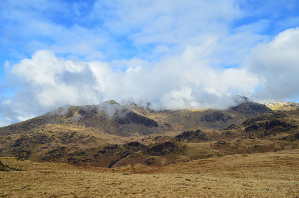
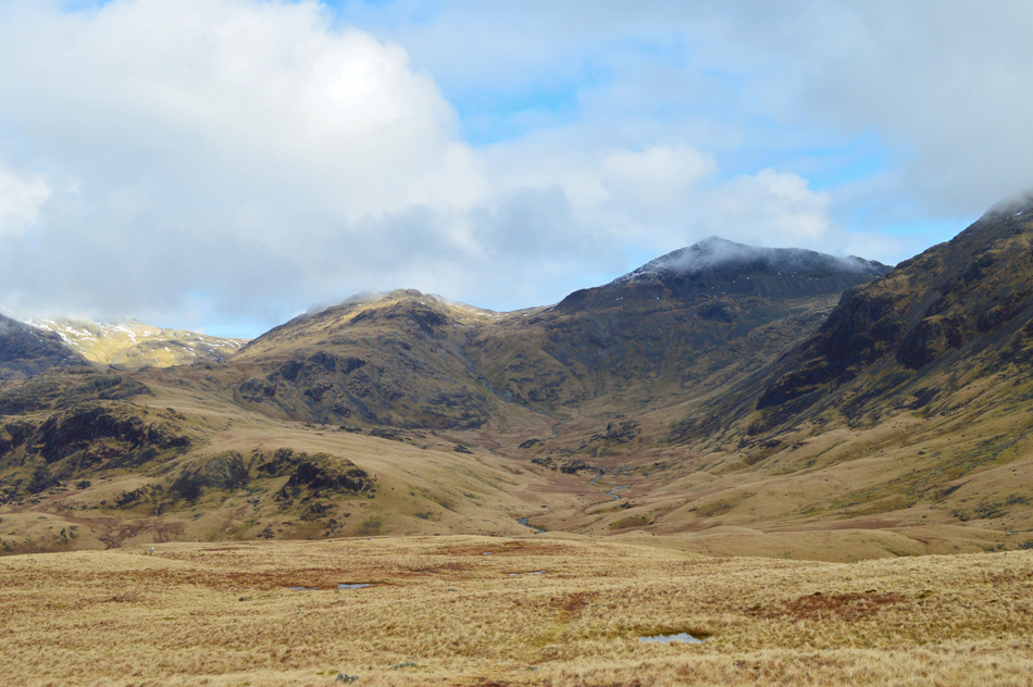
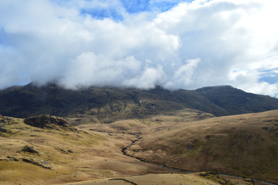
I guess you could say that despite the valleys feeling Spring like the Lakeland fells are still in Winter condition, especially over 600 metres where snow is still affecting some routes which is one of the reasons why I chose to hover below the snow line whilst soaking up a area of Lakeland which is known for its isolation, Upper Eskdale and Great Moss.
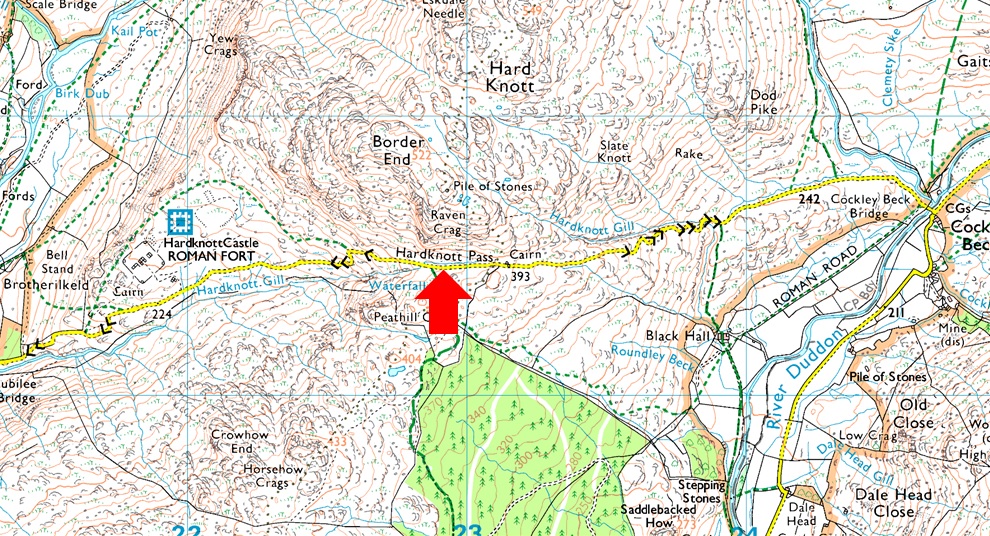
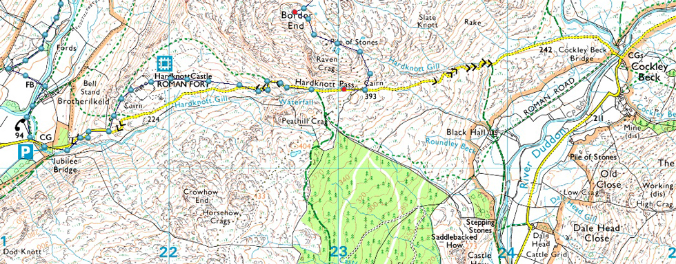
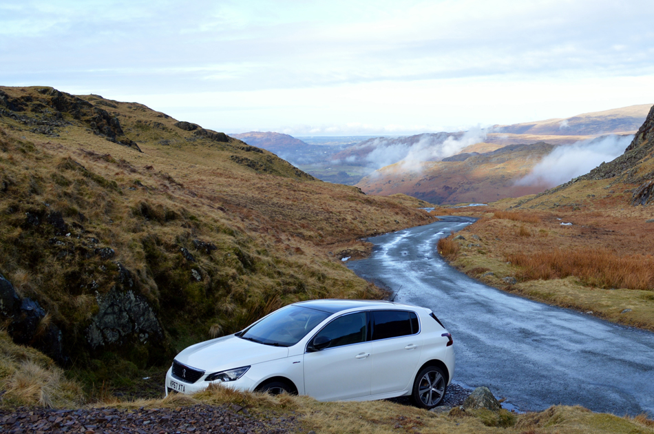
Today I'm following Birketts original route of the Upper Eskdale fells collecting seven summits starting from the top of Hardknottt Pass, this route as explained by Bill Birkett can be made into a circular walk as I made it or alternatively you can opt to finish the walk at the parking spaces close to the telephone box in Brotherilkeld, I chose to complete the route as a 'round' which entails the ascent of Hardknott Pass from the Eskdale side, alternatively use two cars leaving one at the top of the pass and the other in Brotherilkeld, I suspect the two car option would be much easier on the lungs as I was later to find out. |
|
| The Complete Lakeland Fells |
 |
| By Bill Birkett |
-Upper Eskdale
Steep Crag, scree and bracken form its flanks,while crystal clear waters of the River Esk flow along its base. |
|
|
|
| |
|
Overview |
|
|
| Ascent: |
2,798 Feet - 853 Metres |
| Birketts: |
7, Border End - Hard Knott - Yew Bank - Throstlehow Crag - Scar Lathing - High Scarth - Silverybield |
| Weather: |
Overscast to Start, Turning Brigher, Feeling Mild. Highs of 12°C Lows of 5°C |
| Parking: |
Roadside Spaces, Top of Hardknott Pass |
| Area / Group: |
Southern - W/ESK |
| Miles: |
8.8 |
| Walking With: |
On My Own |
| Ordnance Survey: |
OL6 |
| Time Taken: |
5 Hours 35 Minutes |
| Route: |
Top of Hard Knott Pass - Border End - Eskdale Needle - Hard Knott - Yew Bank - Lingcove Beck - Throstlehow Crag - Scar Lathing - River Esk - High Scarth - Silverybield - Damas Dubs - Scale Gill - Scale Bridge - Taw House - Brotherilkeld - Hard Knott Pass - Hardknott Fort - Top of Hard Knott Pass |
|
| |
|
Parking Details and Map |
|
|
| Nearest Post Code: |
CA19 1TH |
| Grid Reference: |
NY 229 001 |
| Notes: |
Parking can be limited due to the nature of Hardnott Pass due to how narrow the road is. If travelling from the Cockly Beck side the parking spaces can be found just past the summit of the pass on the left, a few yards further a few spaces can be found on the left hand side with room for around three cars, if this area is busy there are more spaces found along the top of the pass but these spaces only have room for just the one or two cars. Parking is free.
Please take caution and check the weather forecast the day before travelling over the Wrynose and Hardknott passes as during the Autumn, Winter and Spring months snow and black ice may affect your journey sometimes resulting in both passes being closed. |
|
| |
|
Map and Photo Gallery |
|
|
 |
| The top of Hardknott Pass 08:15am 5°C |
I'd passed through a few showers since leaving the M6 most of which were the tail end as the rain cleared northwards, this was good news as I half expected to start the walk in the rain. With clearing skies under the mildest of temperatures I parked easily at the top of Hardknott Pass and kited up behind my car not encountering any other traffic whilst doing so. Despite the warm morning air I still added my jacket even though I knew I'd only end up removing it early into the walk, force of habit I guess.
With my car locked I walked the twenty yards or so back to the summit cairn which overlooks the Coniston fells where I stood for a few moments looking down on Wrynose Bottom and Grey Friar's long south west ridge while beyond Dow Crag, Brim Fell and Coniston Old Man all had a skittering of snow over their summits. |
 |
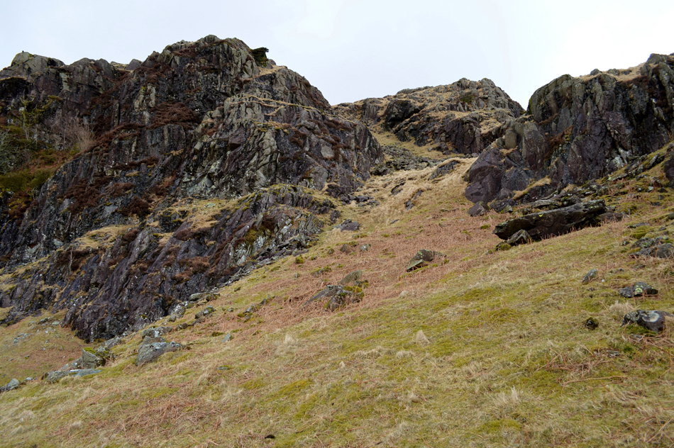
| Looking back over Hardknott Pass towards Harter Fell (Eskdale) |
| Having left Hardknott Pass behind I started the steep climb towards todays first summit of the day in Border End, the ground soon levels (after much puffing and panting) it was here, just minutes into the walk I second guessed why on earth I added my jacket, I decide to leave it on at least until I reach Border End summit. It had rained heavily yesterday and the ground underfoot reflected this with beads of water running down the fell side, soon the ground levels as Raven Crag appears on my left flank, I head steadily towards its summit before stumbling upon... |
 |
| Raven Crag Tarn. |
| Such an idyllic spot I could have sat here all morning. |
 |
| Here looking towards Hard Knott with Little Stand, Stonesty Pike, Crinkle Crags, Bowfell and Esk Pike in the distance. |
| Taken from the large cairn at Raven Crag summit, Border End is in sight and it won't take me long to reach, the views are just stunningly clear this morning. |
 |
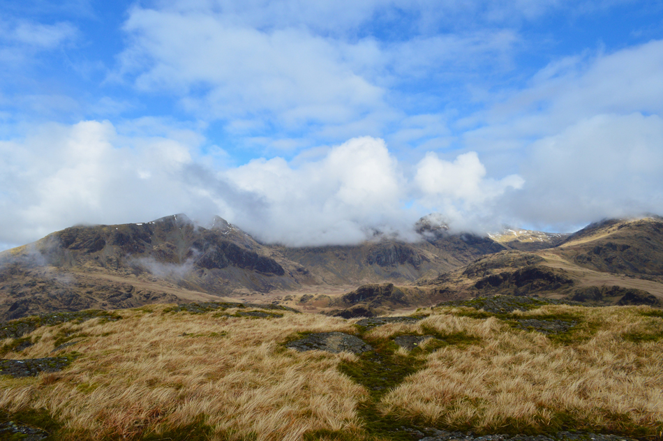
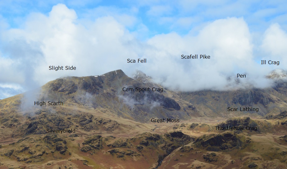
| Slight Side, Cam Spout Crag, Sca Fell, Scafell Pike, Pen, Broad Crag, III Crag and Great End seen above Great Moss from Border End. |
| While in the foreground from R-L we have High Scarth, Silverybield ~ crossing the gorge at Esk Falls ~ Throstlehow Crag and Scar Lathing all of which I'll be visiting as part of todays walk. |
 |
| Cam Spout Crag, Sca Fell, Pen, Broad Crag, III Crag and Esk Pike from Border End summit. |
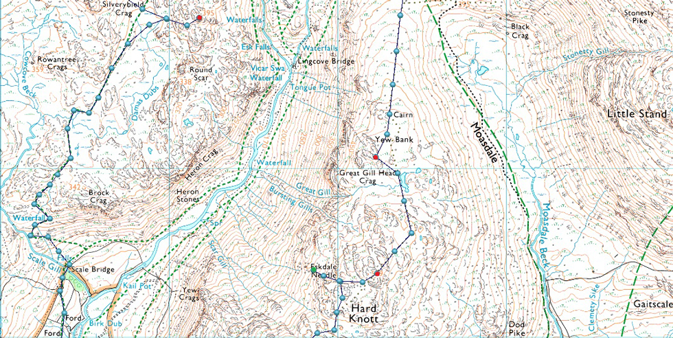
From Raven Crag I cross the summit plateau sometimes having to skirt the boggy areas soon finding myself at the summit cairn which sits on a plinth of rock. I'm not sure why I checked my watch and despite numerous stops, it had only taken me twenty minutes to reach the summit of Border End from leaving the car.
Such a great reward for so little effort. |
 |
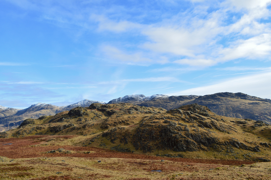
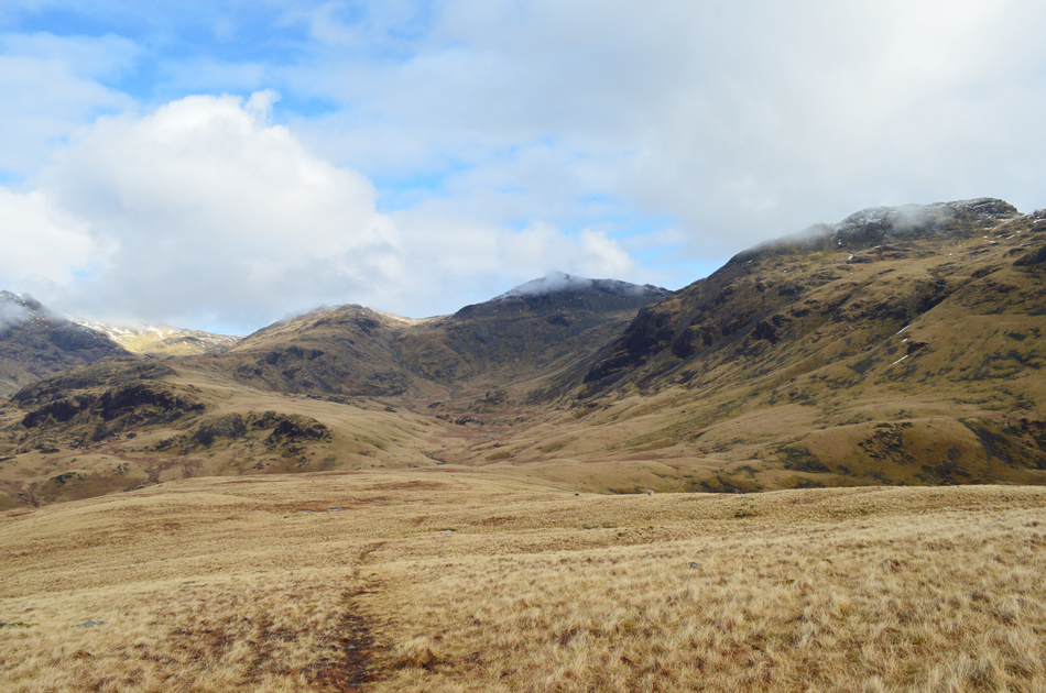
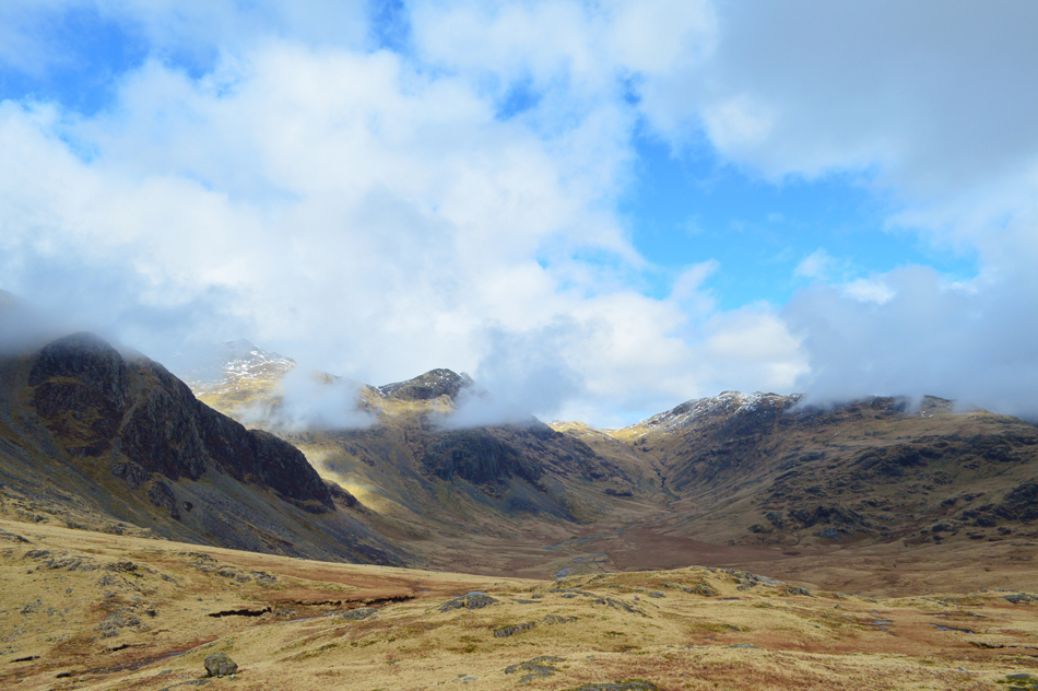
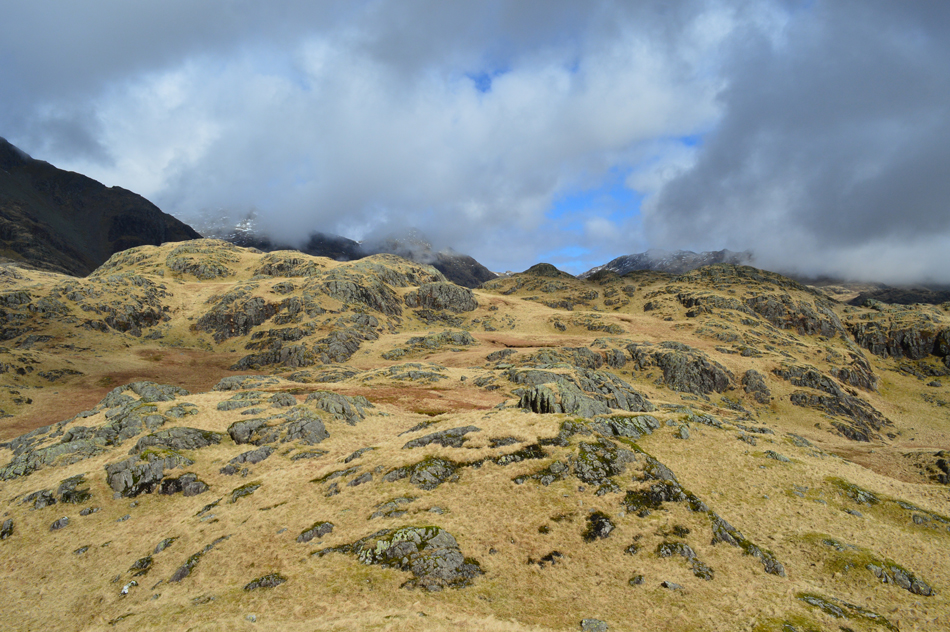
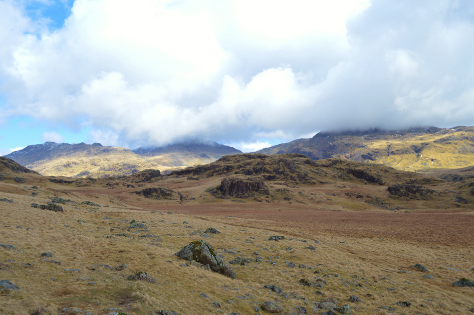
| The Upper Eskdale Fells from Border End summit. |
| Here looking out over the pools of water towards the northern spur of Border End, I descend from the summit keeping the pools to my left and re-join the ridge all the while I eye up an 'off the path' route to visit Eskdale Needle, found around 600 ft west below Hard Knott summit. |
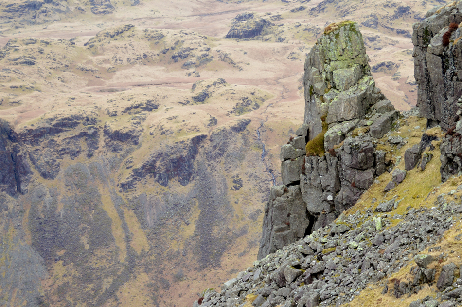 |
| The Eskdale Needle. |
The weather changed as I left Border End soon clouding over leaving the temperature to drop too. From the summit of Border End it was easy to take a bearing on the Needle, and the position of the fell side from which I needed to start my descent, I fix sight on the area above the Needle.
With the Needle now out of sight owing to my slight drop in height I keep to the left of the ridge as the summit of Hard Knott flanks to my right (high out of sight) I check my bearing and begin to descend into a familiar hollow, my descent is steep and rocky and I try to stick to the grassy ledges making the descent that bit more stable, soon the full length of the Needle appears although with each steep step my mind is occupied by the re-ascent required to reach Hard Knott summit, it's still pretty early into the walk and I don't want to have to use my reserves just yet, not when the ascent of Hard Knott Pass is never far from mind either!
As it turned out, and after a few brief moments at Eskdale Needle I'm still feeling strong and begin the steep climb back to the summit using the same grass ledges as I descended by and re-appear at the same spot I left earlier.
The summit of Hard Knott is still above me but only a short distance away, I leave the ridge and climb directly towards the summit cairn which soon appears. |
 |
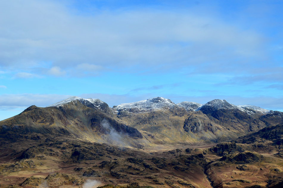
| Cam Spout Crag, Sca Fell, Pen, III Crag and Esk Hause from Hard Knott summit. |
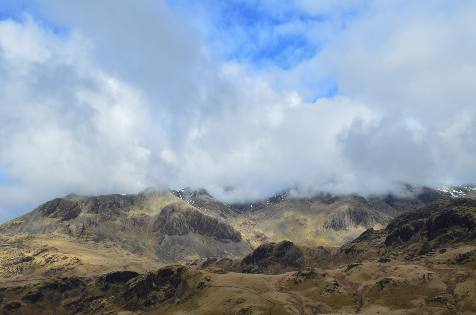
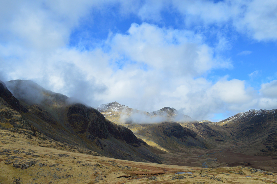
The cloud I had spoken of earlier has now made its way over into Upper Eskdale and the surrounding valleys, south east of Hard Knott the Coniston Fells are under cover as are Crinkle Crags to the east. The cloud had been forecasted to clear around midday, let's hope the forecasters have got it right.
But for now... |
 |
| I can still enjoy the fantastic views into Upper Eskdale. |
| I'm beginning to think that the cloud lying just above the Scafells is only adding a little drama to the scenery, spot on. |
 |
| Yew Bank with Slight Side and Cam Spout Crag in the distance. |
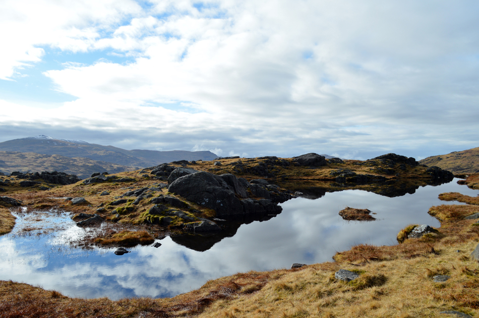
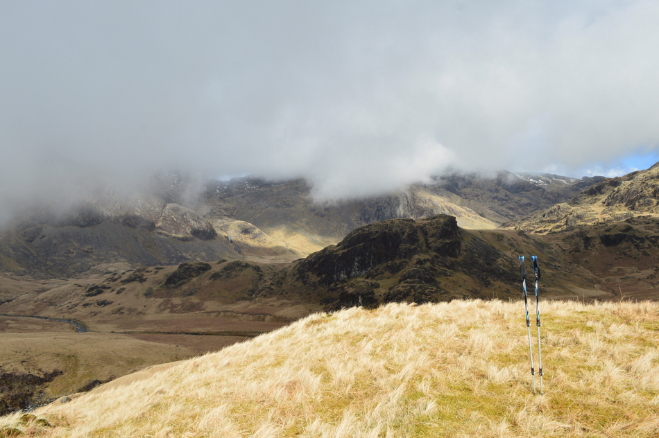
Having left Hard Knott summit behind I began my descent down the Yew Bank ridge. The summit of Yew Bank sits just over half a mile (a mile as the crow flies) north of Hard Knott, I follow the singular path which always tends to be boggy even during the Summer months until a large Tarn appears to the right.
Two craggy outcrops make up the actual summit of Yew Bank, the right outcrop at 499m 1,637ft being the actual summit itself, it's only a short walk before the easy climb to the summit but before that I need to get myself through the boggy area seen in the lower half of the photo. |
 |
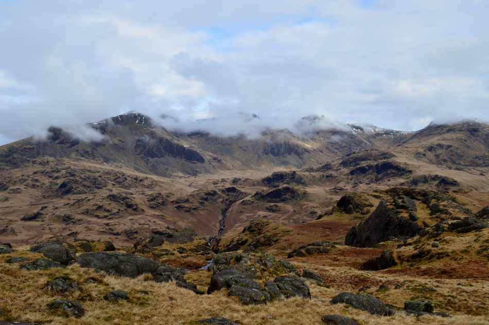
| Esk Pike, Bowfell and Crinkle Crags from Yew Bank Tarn. |
| It looks like the sun is about to make a re-appearance. |
 |
| Fantastic cloud drama over the Scafells from Yew Bank summit. |
| |
 |
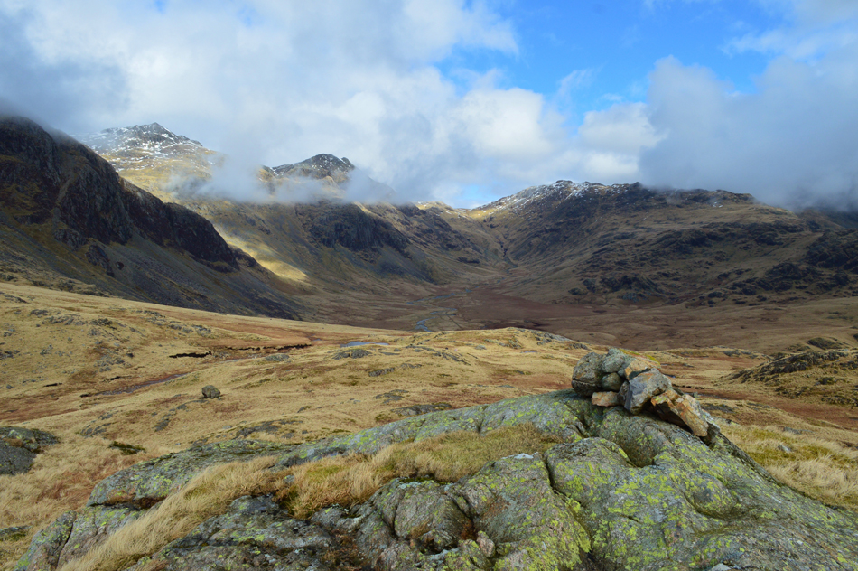
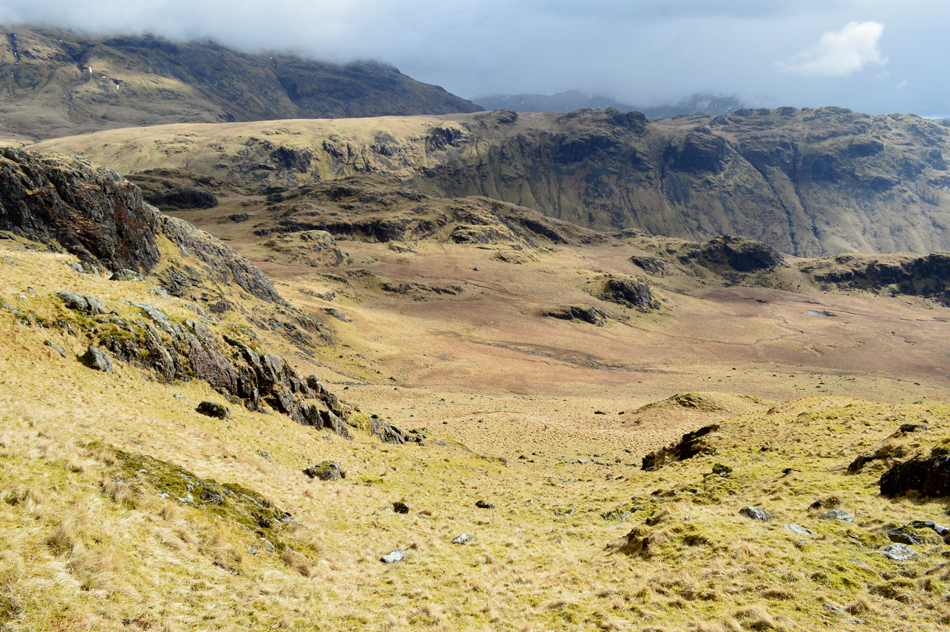
| Upper Eskdale Fells from Yew Bank. |
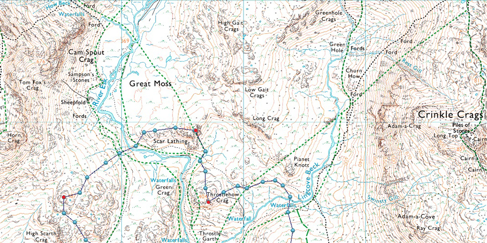
| The next summit in todays walk will be Throstlehow Crag seen lower right, but before I make my ascent I need to descend all the way to the end of the Yew Bank ridge before crossing Lingcove Beck. |
 |
| Low and High Gait Crags, Yeastyrigg Crags, Esk Pike, Bowfell and Crinkle Crags as I near the northern spur of the Yew Bank ridge. |
As previously mentioned Throstlehow Crags is my next summit which lies due west as I near the end of the Yew Bank ridge (my immediate left) it might appear to make sense to cut this last section of the ridge out and make a direct line for Throstlehow Crag but, reading the lay of the land and indeed the gorge/rapids of Lingcove Beck it makes better sense to go the longer way around all the while maintaining a constant height.
I hope that makes some kind'a sense! |
 |
| Here's a close up of Throstlehow Crag, Scar Lathing and the now domineering Cam Spout Crag. |
| |
 |
| High and Low Gait Crags seen with Bowfell. |
| The cloud appears to be clearing over Esk Pike and Bowfell... |
 |
| Dramatic views over the Scafells and Great Moss. |
| ...not so much over the Scafells, still great atmospheric views. |
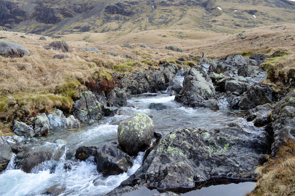 |
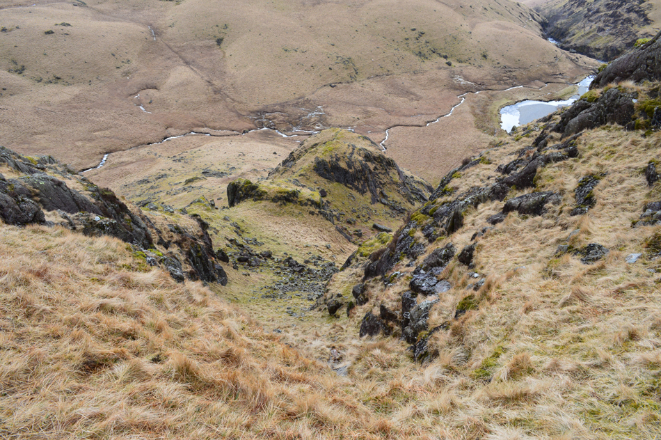
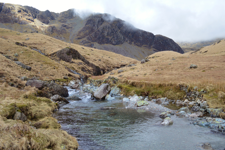
| Crossing Lingcove Beck. |
| As I came to the end of the Yew Bank ridge the sound of Lingcove Beck drew closer, it was only when I was looking for the safest place to cross did I spot this girl crossing a little further upstream, I heard more voices (but couldn't see them) egging the girl on who soon made it across. It wasn't the crossing of Lingcove Beck which was my concern, more so the River Esk sometime later in the walk but I had a right to be concerned as the previous nights rainfall had filled the beck with deep, fast flowing water, I eventually found my own crossing point using submerged stepping stones then a leap on to the opposite bank before spotting the girl and her friends making their way into the Great Moss area, I would tail them but only briefly before leaving the path for Throstlehow Crag. |
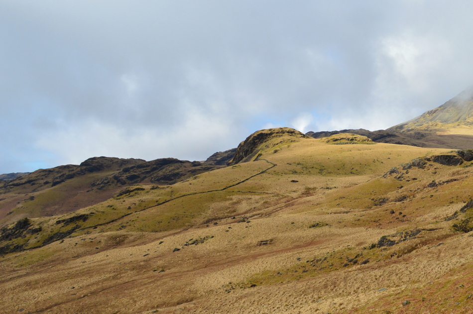 |
| Throstlehow Crag is ahead. |
| It's around about this point I left the path and started to make the easy ascent on Throstlehow Crag, the eye is naturally trained to head towards the stone wall which I kept a wide berth of only passing the upper corner off by around twenty yards. |
 |
| Pianet Knott, Lingcove Beck, Crinkle Crags and Little Stand from my ascent of Throstlehow Crag. |
| Even though the cloud can't make its mind up it's leaving a real dramatic feel to the walk, more so as I've been walking in warm sunshine for the last hour or so. |
 |
| Bright sunlight from Throstlehow Crag summit as I look towards Scar Lathing and the River Esk. |
| Sadly no views over the Scafells for now due to low cloud. |
 |
| Descending Throstlehow Crag to the north towards Scar Lathing. |
| |
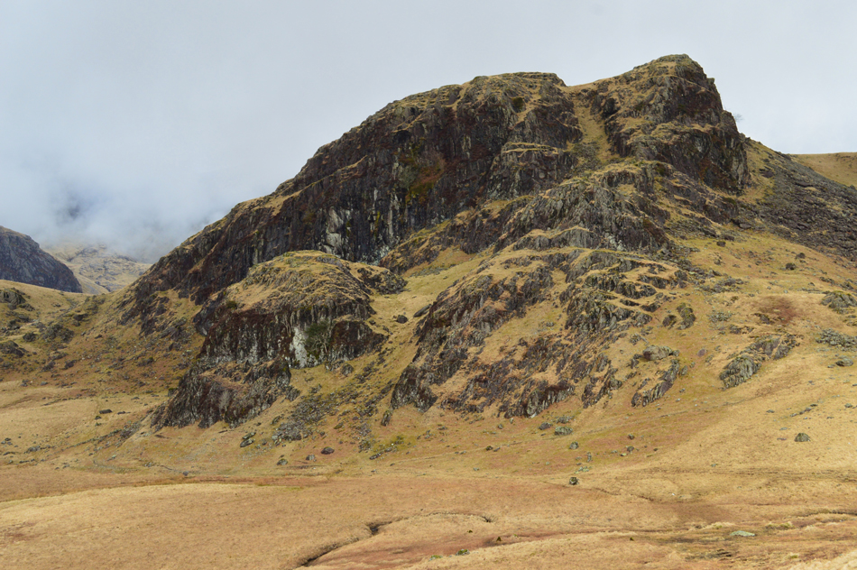 |
| Scar Lathing. |
| Todays ascent of Scar Lathing recommended by Bill Birkett is via the grass gully which starts lower left to upper right. The ascent looks pretty steep but I'm prepared. |
 |
| The grass gully from lower down. |
| |
 |
| And from the top. |
| Could someone fetch me a stretcher please! |
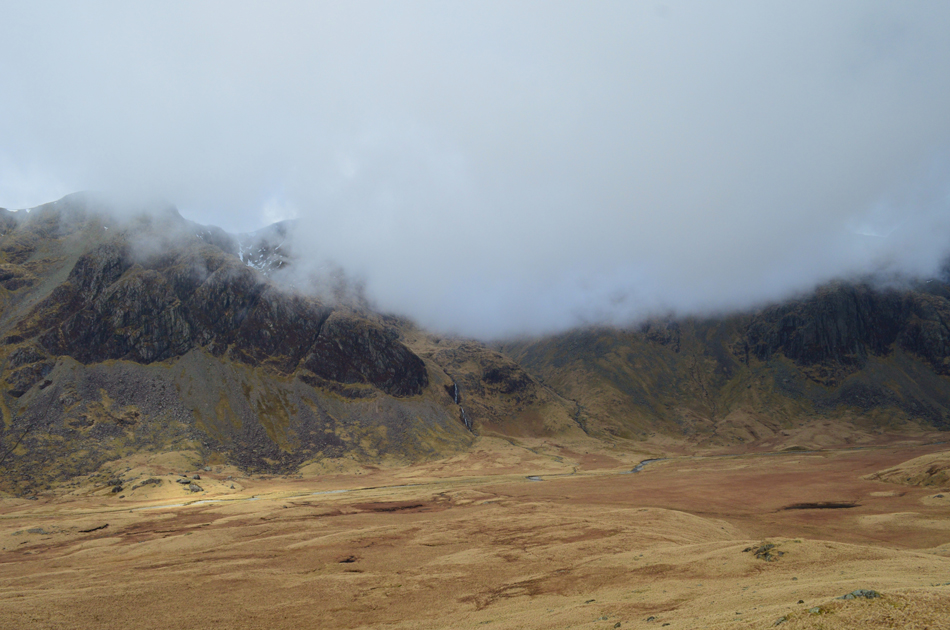 |
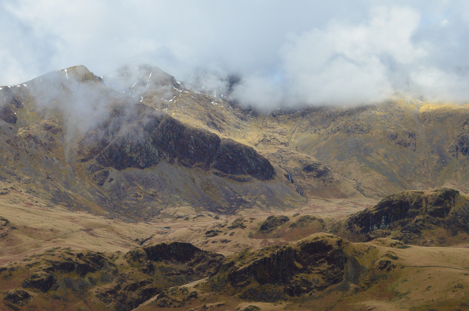
| Cam Spout Crag and the Scafells (now completely hidden by cloud) from Scar Lathing summit. |
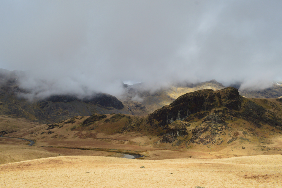
The good news was the gully topped out right at the summit of Scar Lathing, the bad news was, the cloud was so low the view I had been waiting for all day had gone. |
 |
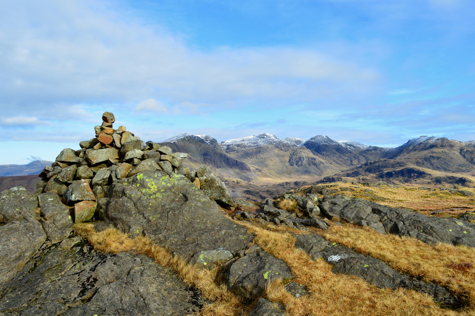
| Here looking back over Esk Falls towards Throstlehow Crag, Hard Knott, Border End and Harter Fell (Eskdale) |
| Feeling slightly deflated I descend to the west while remembering a chapter from the walk where Bill refers to the crossing of the Esk "where a large boulder can be seen on the other side of the River Esk" |
 |
| Cam Spout Crag from my crossing of the River Esk. |
| I surveyed my descent scouring the land for the large boulder which Bill had referred to, I came up with two possibilities, the larger than large outcrop of rock seen left or the two boulders next to one another in the foreground, either way I figure I'm at the exact point (or thereabouts) I need to be for my ascent on High Scarth. |
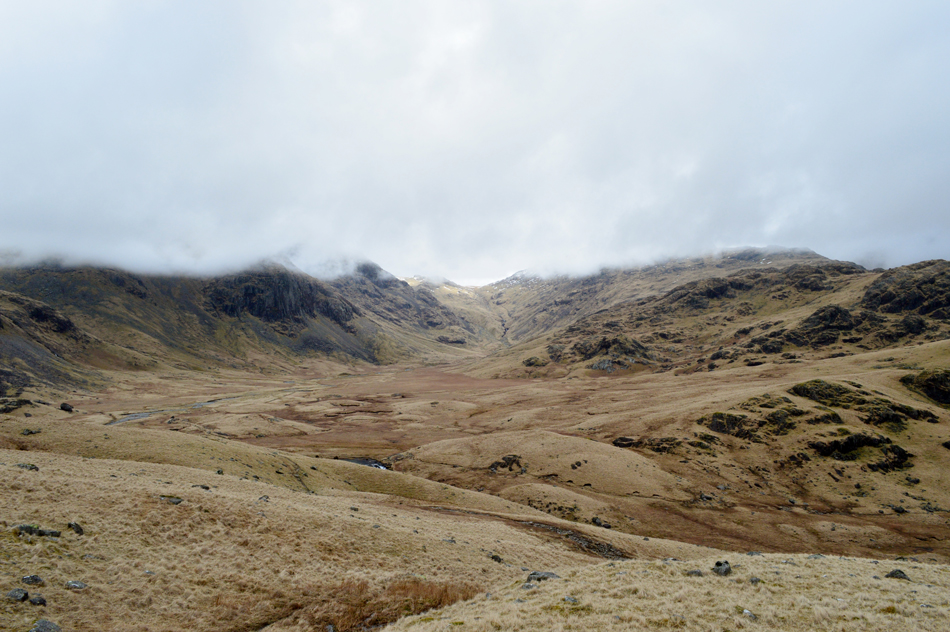 |
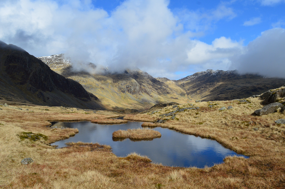
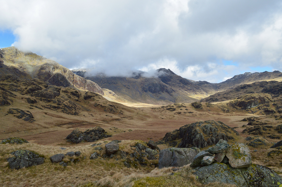
| Great Moss. |
| With Esk Hause just peeping below the cloud in the distance. |
 |
| That's more like it. |
| The cloud begins to break... |
 |
| Revealing Cam Spout Crag and III Crag in the distance. |
| My sulk is officially over. |
 |
| Splendid. |
| |
 |
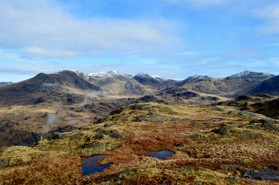
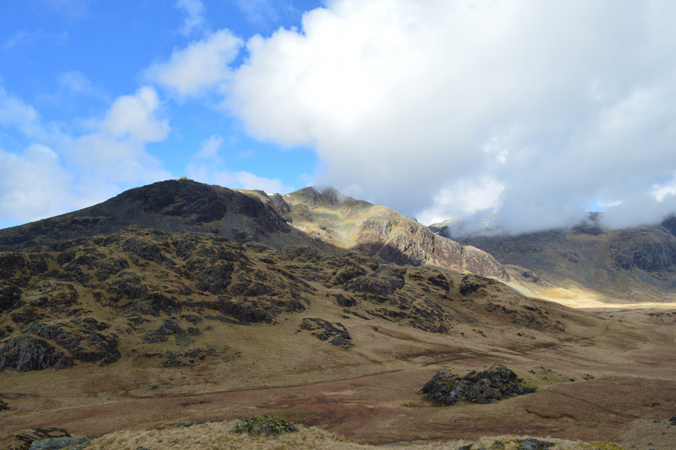
| Cam Spout Crag, Scafell Pike, Pen, III Crag, Esk Pike and Great Moss from High Scarth Summit. |
As my summit count neared six my legs started to feel the affects of dragging wet leather boots over pathless ground, my ascent of High Scarth was tiring until the sun came out and the cloud cleared, it's amazing to think that something so natural was just enough for me to find my second wind. |
 |
| The cloud continues to clear above England's highest ground. |
| |
 |
| A small pool provides the perfect foreground for the perfect backdrop. |
| It's not very often I would use my mobile phone to take photographs but on this occasion I did which I later published on my Facebook page. |
 |
| The many grassy outcrops of High Scarth. |
I left the summit and traced southwards remembering to descend a "grassy corridor" which Bill had recommended, fearing I might not find the descent route due to the lay of the summit I pass the "rocky knoll" which Bill had also referred too although rocky knolls were a pretty common sight! |
 |
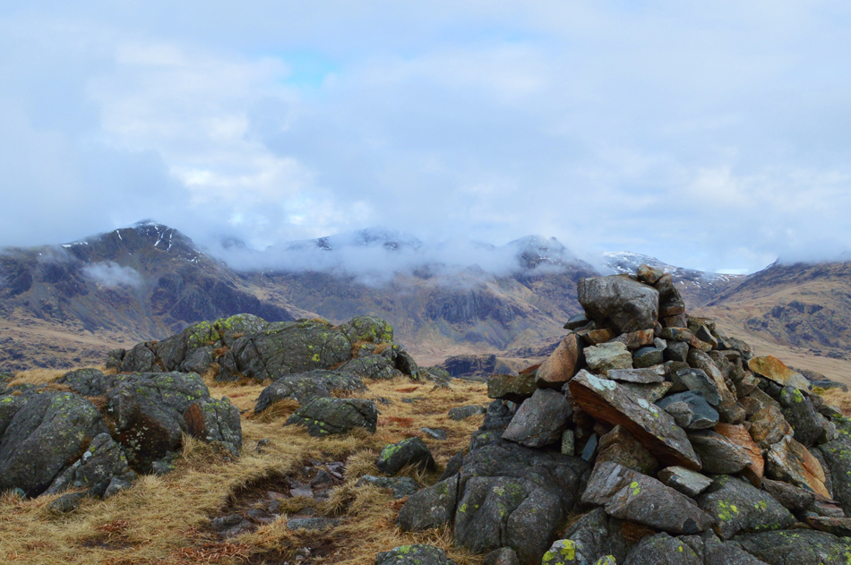
| Silverybield, Yew Bank and Hard Knott from High Scarth. |
Knowing Silverybield lay directly to the east and after reading the lay of the land on my map I came upon grass corridor and, the track down below with Silverybield on the other side.
Feeling thankful I begin the steep descent. |
 |
| Cam Spout Crag, Scafell Pike, III Crag, Esk Hause Esk Pike, Great Moss and Scar Lathing from Silverybield summit. |
| I made the my descent in total sunshine passing a flock of sheep who had nestled into a grassy cove, not one of them moved, As soon as I reached the main track below as cloud cover obscured the sun and I felt the sudden drop in temperature. I crossed the main path and tried (and failed) to avoid the worst of the bogs while using reserved strength to leap over any streams. It's a short ascent to reach the summit of Silverybield, your granny could do it in slippers but with tiring limbs and heavy wet boots it felt much harder than it should have. |
 |
| But the views were rewarding. |
| Here looking over High Scarth towards Slight Side, Cam Spout Crag and Scafell Pike. |
 |
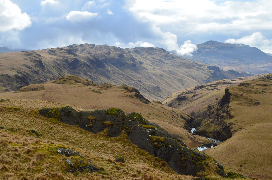
| Looking back on Silverybield, Yeastyrigg Crags, Bowfell and Crinkle Crags from an area known as Damas Dubs seen over on the right. |
| "Keep right and remain high" Bill Birkett. |
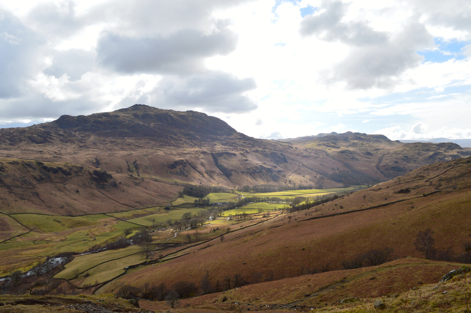 |
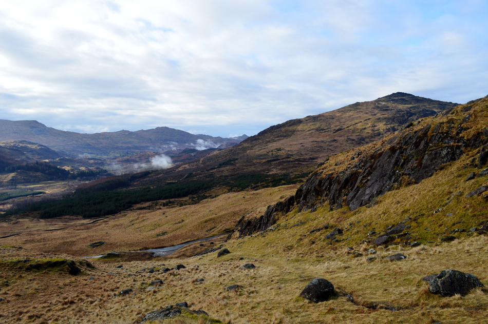
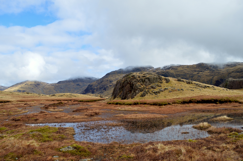
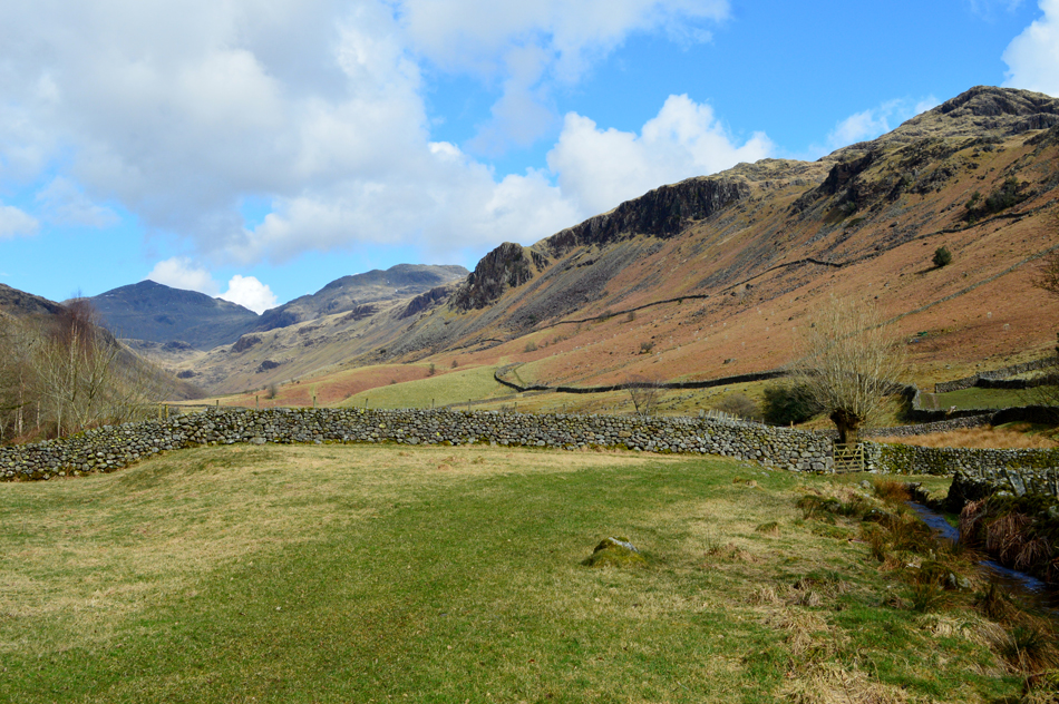
| Impressive views over Eskdale towards Harter Fell from my descent alongside Scale Gill (R) |
| |
 |
| Views towards Border End with the impressive Yew Crags below. |
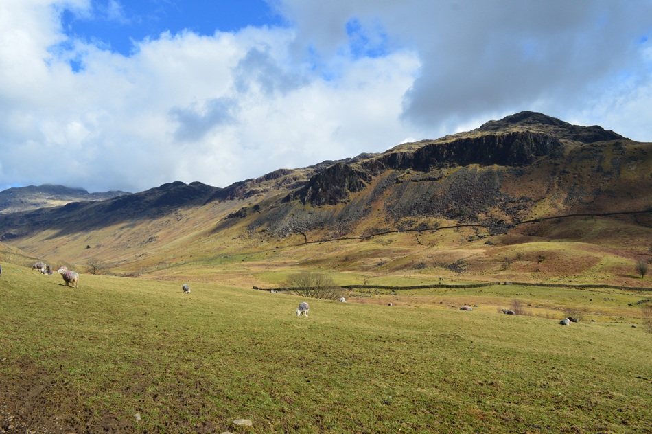
| I was treated to a bright warm descent as I made my way back to Brotherilkeld via Taw House finding dozing sheep and crazing cattle, it really is starting to feel very Spring like. |
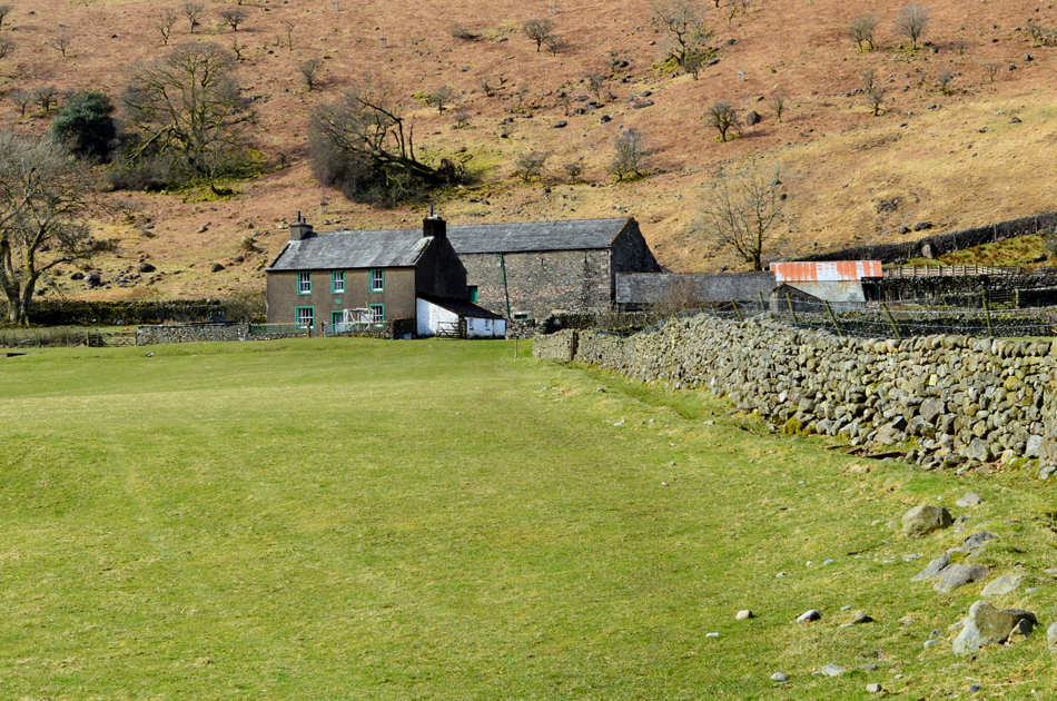 |
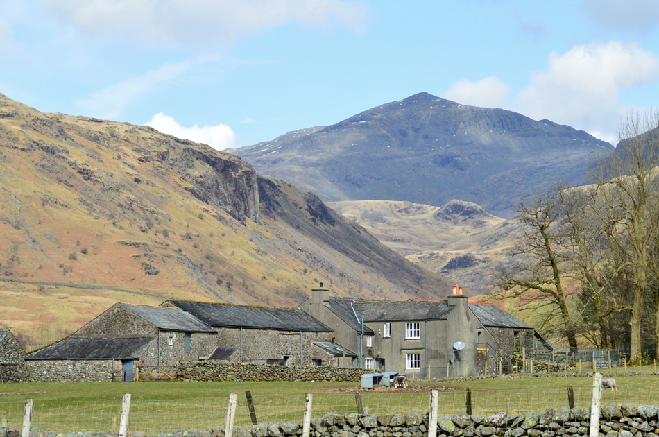
| The track passes through Taw House Farm. |
| Note the fallen tree behind the Farm House. |
 |
| Views towards the distinctive pyramid of Bowfell, Crinkle Crags, Hard Knott and Border End from Brotherilkeld Farm. |
| |
 |
| A close up of Bowfell from Brotherilkeld Farm. |
| After passing by Brotherilkeld Farm I arrived at the Eskdale side of the Hardknott Pass first passing the familiar telephone box. Eskdale is bustling, infact it feels like Ambleside with many a walker / couples taking to the road on foot soaking in the valley. I cross the cattle grid close to Jubilee Bridge and begin the long drawn ascent of Hardknott Pass, all 1,005 ft of it. |
 |
| The top of Hardknott Pass from Hardknott Roman Fort. |
| First port of call, Hardknott Roman Fort. There wasn't much traffic that passed me but what did broke my momentum, I either had to stand aside and let the car pass or risk being hit, not wanting to get hit I frustratingly stood aside. The path from the pass to the Roman Fort was reached and I went for it, slowly. On reaching the Fort I figured I'd made a mistake, again finding swollen ground underfoot which slowed my progress even further. Once passed the Fort I maintained height as much as I could before re-joining the pass. |
 |
| Views into Eskdale from Hardknott Pass. |
I rejoined the pass just below the last zigzags below the summit, a cyclist on a road bike had passed me and I watched him disappear rounding the curves out of sight as my poles seemed to punch holes in the tarmac, thankfully only one car passed me where the road was wide enough not to break my stride. A couple had walked down from the top of the pass and were stood at the top at the zigzags, great an audience! We pass with a Hi while trying not to let my tiredness show, it worked.
The tarmac levelled out as I catch the glare from the sun as it streaks across my passenger window, the roof of my car appears then slowly the cairn at the top of the pass. The ascent of Hardknott Pass had laid in the back of my mind since leaving the car this morning but you know what, when you prepare your mind for a tough o'l slog the legs will just follow.
I had only seconds before reaching my car and during that time an elderly couple had reversed their car into the space along side mine, I don't disturb them during my kit down before the gent wound down his window and asked "is Hardknott Fort around here" aye, it;s just down there you can't miss it over on the right "shall I leave the car here then he asked?" I paused, and replied, probably not. |
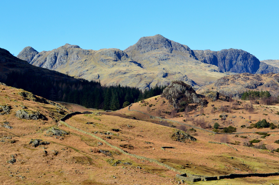 |
| The Langdale Pikes from the bottom of Wrynose Pass. |
| Well, what a fantastic day I've had in Upper Eskdale, best get home now and dry my boots out, |
|
| |
| Back to top |
 |
|