|
Latrigg via the Keswick Railway path |
 |
 |
3rd March 2018 |
 |
|
"The beast from the East" well, at first I scoffed at this namely because naming storms no matter their origin is too 'americanised' for me but I scoff no more, not after hearing and seeing for myself how this brute of a storm has not just affected myself, my friends and work colleagues but at first hand the people of Cumbria. It's not unheard of to have snow at this time of year, in fact it's common but for so much snow to fall resulting in the closure of major motorways, main road arteries in out of counties and god forbid you lived in the remotest of villages which as I write this are still to be reached despite the best efforts from rescuers, snow ploughs and snow blowers. This beast from east almost crippled the whole of the country all around the compass. This was the weekend I was meant to officially start my Birketts with a wonderful circuit of Nether Wasdale which of course I had to shelve due to conditions. Instead it was suggested I stop off at David's who would assist me on tying up some odds and ends on the website which meant a lengthy drive to the west coast of Cumbria. Having watched numerous weather and road reports the night before it looked like I might just scrape through, with care of course.
To avoid the worst hit M6 around Shap I thought it was best if I stuck to the coast and take the longer way around which was working out fine until I heard reports of 'trees down' on the A595 between Whicham and Bootle which forced me stick to my original route via the M6 which fortunately was clear through to Penrith despite passing half a dozen stranded cars, lorries and coaches which were left on the hard shoulder and even the central reservation, it was a thought provoking few moments thinking how desperate it must have been just 48hrs previous. With limited spare time to walk we planned to visit Walla Crag from Keswick which was subsequently changed moments after locking the cars to this walk which took in the old Keswick Railway before being blasted by those ferocious east winds on Latrigg summit. |
|
| Wainwright Guide Book Five |
 |
| The Northern Fells |
-Latrigg
Latrigg is to Keswick what Loughrigg is to Ambleside and Helm Crag to Grasmere: a small hill, an excellent viewpoint. a great favourite of local folk and visitors. Latrigg is pastoral and parkland in charactor, not rough fell, and the summit is the easiest promenades, so that this is not a climb climbing for old clothes and heavy boots: 'Sunday best' is quite appropiate dress.
|
 |
|
|
|
| |
|
Overview |
|
|
| Ascent: |
1,215 Feet – 370 Metres |
| Wainwrights: |
Latrigg |
| Weather: |
Overcast With Frequent Snow Showers. Highs of 0°C Lows of -3°C Feels Like -13°C |
| Parking: |
Roadside Parking, Spooney Green Lane, Keswick |
| Area: |
Northern |
| Miles: |
5.5 |
| Walking With: |
David Hall |
| Ordnance Survey: |
OL5 |
| Time Taken: |
2 Hours 35 Minutes |
| Route: |
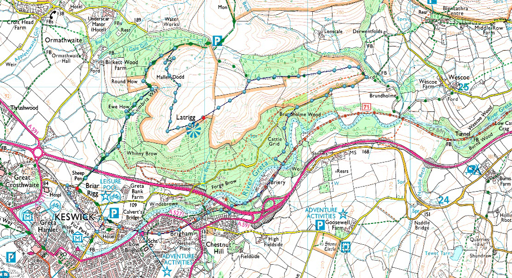
Keswick - Fitz Park – Old Keswick Railway Path - Briery - Low Briery - Brundholme Wood - Latrigg - Mallen Dodd - Cumbrian Way - Keswick |
|
| |
|
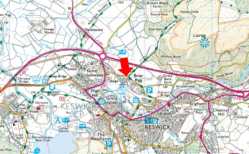
Parking Details and Map |
|
|
| Nearest Post Code: |
CA12 4PJ |
| Grid Reference: |
NY 267 324 |
| Notes: |
Spooney Green Lane, Keswick is perfectly positioned for a short walk onto Latrigg, a visit to the old Keswick Railway or even Skiddaw. There is room for up to half a dozen cars but please be considerate when parking as this is a residential street. Parking is free. |
|
| |
|
Map and Photo Gallery |
|
|
 |
| |
| |
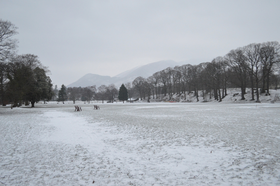 |
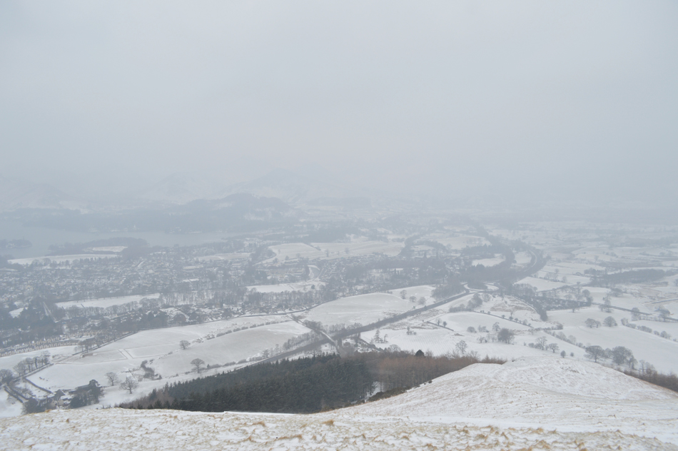
| Causey Pike from a snowy Fitz Park, Keswick 07:40am 0°C |
There was no point taking risks getting into the heart of Lakeland with only limited roads open so we planned this walk around access to the A66 parking close by on Spooney Green Lane just north of Keswick town centre. We parked with ease and kitted up in full Winter kit on the lane which had been heavily gritted. It was overcast, grey and murky and to add to this a cold easterly wind made the temperature feel much cooler, adding waterproof trousers would hopefully help protect against this once out into the open. At this stage we still had our sights on Walla Crag which given its not so lofty altitude was lingering in low cloud, the only thing that was slightly off putting was our lack of walk time and the depth of snow we may encounter whilst up there.
It was only whilst walking through Fitz Park on route to Keswick town centre did David look up at Latrigg whose summit was completely clear before suggesting we completely change the walk from Walla Crag to Latrigg, we went through the route roughly in our heads before agreeing it was probably the best alternative certainly from where we were standing. |
 |
| Fitz Park residence. |
| He just stood there with this alarming look on his face! |
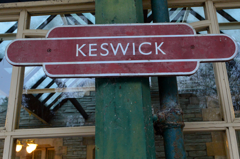 |
| Platform signage, Keswick Railway Station. |
| Which is now part of Keswick Country House Hotel. |
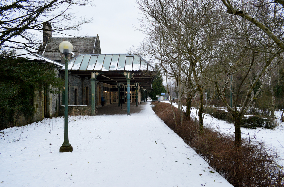 |
| Looking back on what was Keswick Railway Station Platform. |
It certainly was a nostalgic few moments as we walked along the old Platform while imagining what life was like here only as far back as 1972 when the last train left this platform. During its heyday this platform served thousands of Victorian passengers who arrived at Keswick via the Penrith to Cockermouth Railway. |
 |
| Looking back along the route of line as it approaches Keswick Railway Station. |
| This is the first of three bridges over the River Greta all of which pass through the Greta Gorge. |
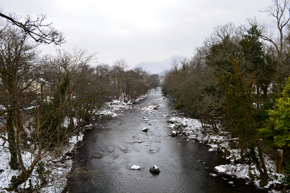 |
| Looking SW towards Causey Pike as we pass over the River Greta. |
| |
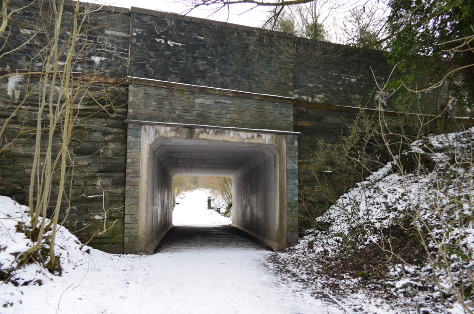 |
| Tunnel found below the A5271 on the original line (Railway Path) |
| Despite the conditions the old Railway Path was quite busy with dog walkers and runners. Here we pass below one of the original tunnels the old steam trains would have passed through, now modernised and strengthened to support vehicle traffic from above and foot traffic from below. |
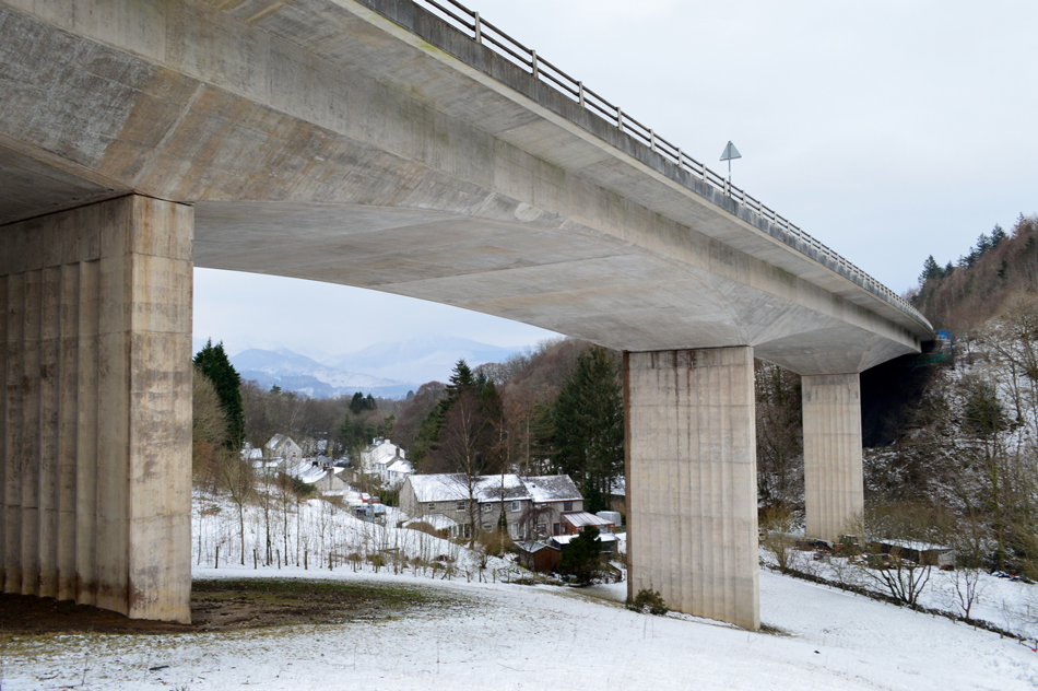 |
| A66 Viaduct. |
| The Railway path continues alongside Forge Brow seen centre before passing below the impressive A66 Viaduct, traffic above was pretty light today leaving the Gorge feeling eerie silent. |
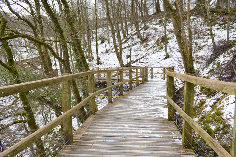 |
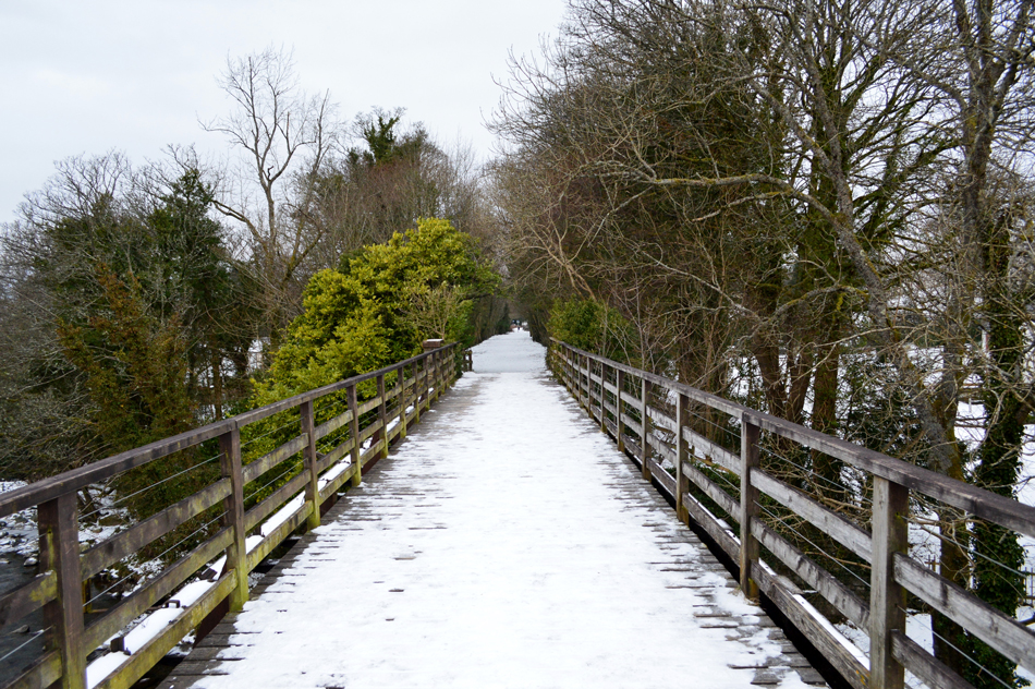
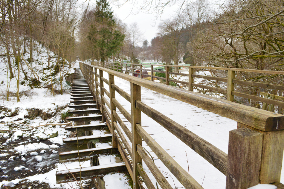
| The footpath diverts around the original line via this equally impressive wooden walkway. |
| Those of you without a head for heights are urged not to look down as the River Greta appears a good hundred feet below. |
 |
| Looking back on what was the original line and buried railway tunnel. |
The wooden walkway diverted around what was the original route of the line finding this stone tunnel which now supports the A66 above, how do we know it's a tunnel you may ask? well if you look closely enough you can just make out the original upper arch and you don't need to dig to see it.
Very impressive stuff. |
 |
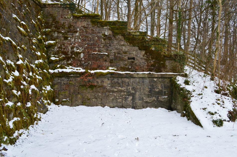
| Looking back at the remains of Briery Platform from the Railway path. |
| |
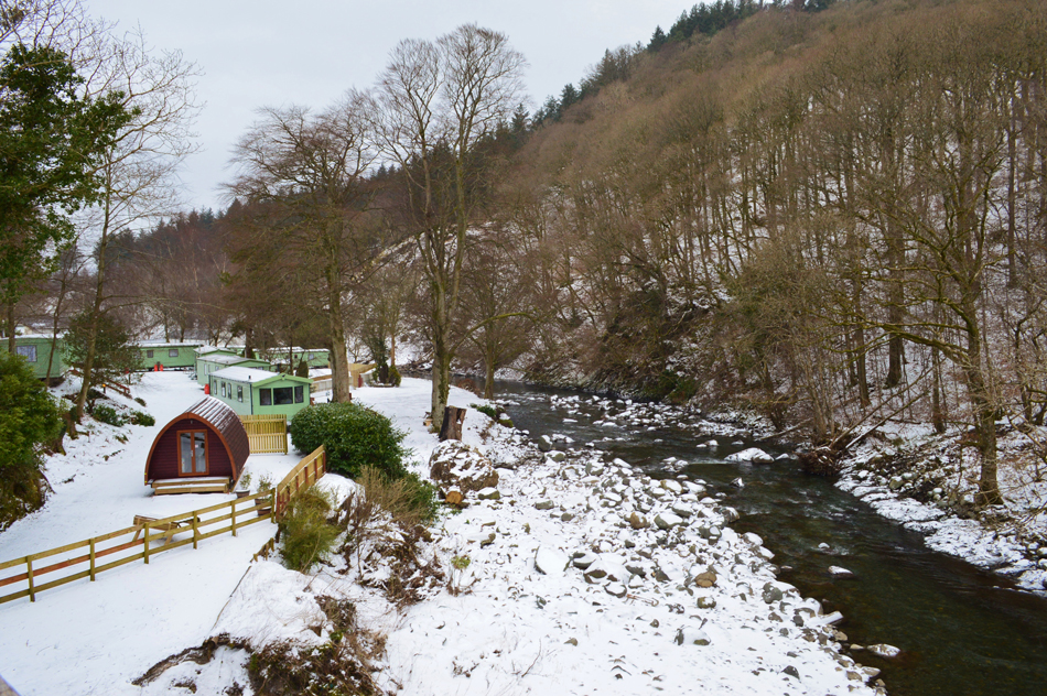 |
| The Railway path passes another bridge over the River Greta close to Briery Lodges. |
| |
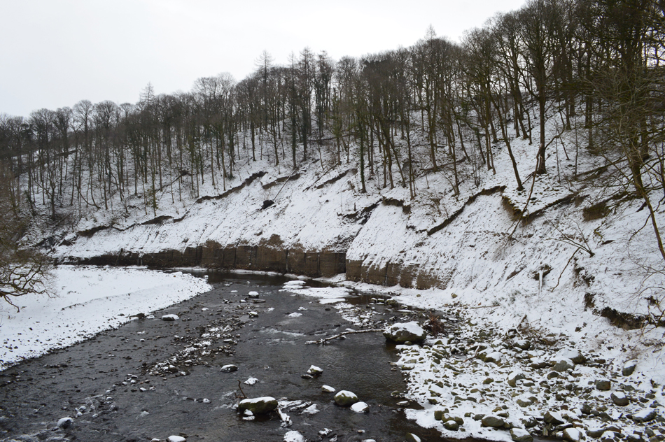 |
| Landslip above the River Greta. |
| You can only imagine the force of water coming around this curve in the river which subsequently caused this huge landslip on the hillside above including uprooting trees like match sticks during the storms of December 2015, it's any wonder this bridge over the river survived, many more original bridges along the Railway Path did not. |
 |
| Bridge over the River Greta at Low Briery. |
During the construction of the Railway Path the Lake District National Park built this new bridge over what was the original iron tracks which would at one point have supported the railway tracks.
"If it ain't broke don't fix it" comes to mind, which is testament to the Victorian engineers who built this bridge and many others from Penrith to Cockermouth. |
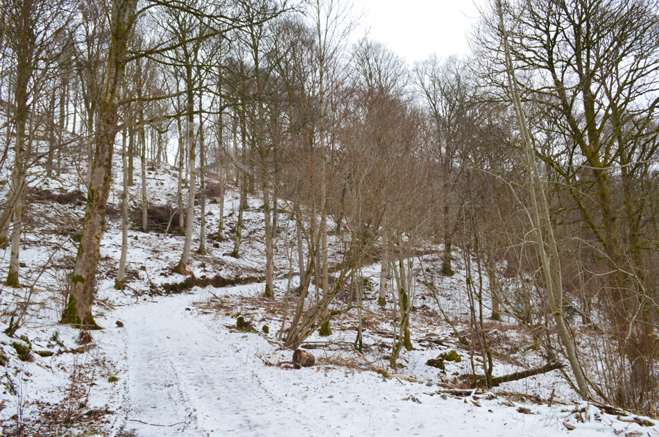 |
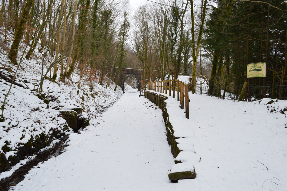
| Entering Brundholme Wood. |
Sadly the Railway Path actually ends around half a mile further due to one Bridge which did not make it through the floods of December 2015 but the few miles we did walk today provided us with enough history, entertainment and views to make us feel thankful of our sudden change of plan walk.
From the Railway Path we entered Brundholme Wood and climbed steadily onto Brundholme Road which ran parallel to Latrigg's east spur, we follow the road along its entirety encountering Deer which we spotted in the woods above the road, then a single sighting on the road itself before passing a trio of fell runners. At times the woodland opened up revealing Low Rigg and High Rigg and in the distance, Clough Head is seen during a snow shower before the cloud lowered yet again limiting our views.
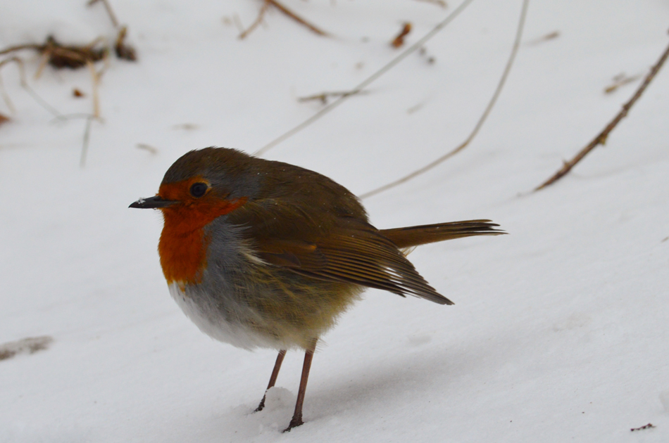
Before coming to the end of Brundholme Road we came across three very tame hungry Robins. |
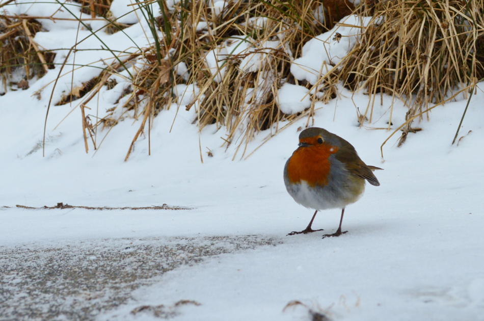 |
| This fellow was just feet away. |
| |
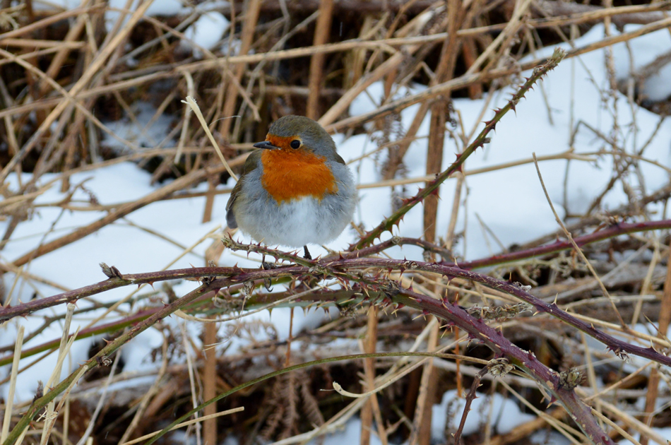 |
| Another Robin watched from the brambles alongside the road. |
| |
 |
| While this one let me get really close. |
| It was plain to see the Robins were hungry but with limited food ourselves we couldn't think of what we could give them, all I had with me was a chocolate bar before David quipped "I think I have an apple in my pack" David then bit large chunks from the apple and threw it for the Robins all of whom swooped down and tucked into dinner, in all I reckon we spent a good fifteen minutes with our new friends who provided a real highlight to the walk. |
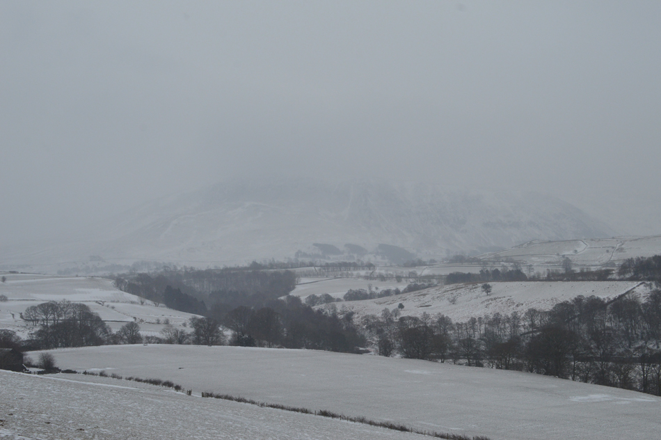 |
| Clough Head appears through the mono murk. |
| |
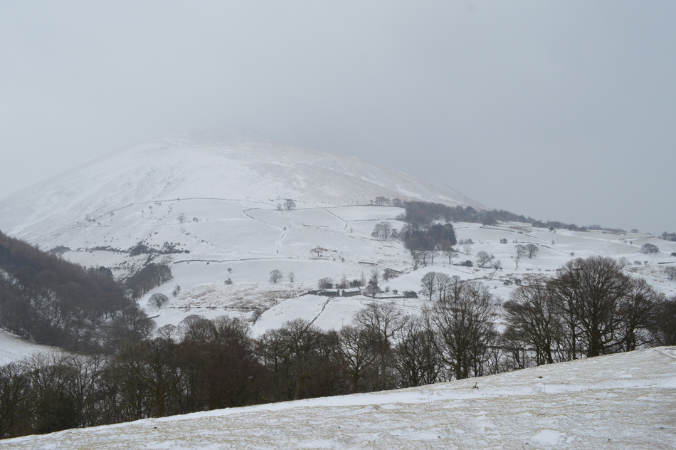 |
| Here's Blease Fell not looking very appetising at all. |
| |
 |
| On route to Latrigg summit now. |
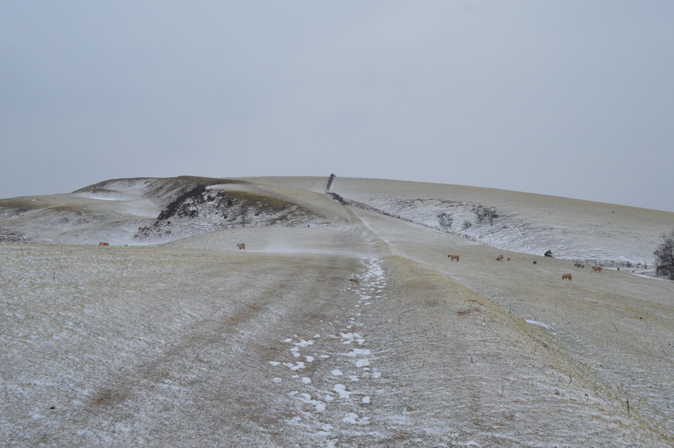
There wasn't much snow underfoot but what snow there was had drifted and quickly became air borne during the sudden gust before being swept across the fell side which provided momentary entertainment. Once the shoulder of the summit was reached things really started to cool down soon losing the feeling in our foreheads, cheekbones and chins to the windchill. It was wild to say the least and this was remarkably only at 1,180 Feet.
Ahead, a solo walker struggles towards us wearing full winter kit including snow goggles "is it any better down there?" pointing from the direction of which we had just come, not much we laughed! In hindsight it was noted that walking the route in an anti-clockwise direction inadvertently meant we at least had the devil of the eastern wind on our backs, not so much for the fellow now heading directly into it. |
 |
| Looking down on a deserted A66 from Latrigg summit. |
| It was at the summit did David take out his Wind Meter which recorded a summit temperature of -3.1°C with 29mph Winds which helped to create the -13°C Windchill. If the windchill was so low on Latrigg we could only imagine how severe it must have been on Skiddaw summit, on which we saw no-one making an ascent of from the car park at the top of Gale Road, it was agreed not even a pot of gold would tempt us to make a summit today! |
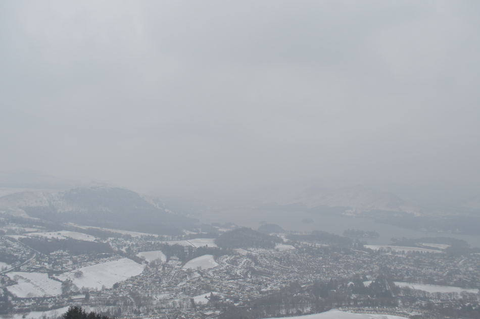 |
| Walla Crag in the distance. |
| While Derwent Water disappears into the mono scenery. |
 |
| Almost back at Spooney Green Lane now. |
We passed more walkers during the descent of Latrigg which was great to see despite the windchill, at least some were prepared to get out including a couple in full winter kit who appeared to be attempting an ascent on Skiddaw, we only hoped how uninviting Skidda looked today might be enough to put them off.
More walkers are passed, in fact the Cumbrian Way is getting quite busy with walking groups and dog walkers. The A66 is crossed and we pause to look down below, I've never seen it look so deserted. |
|
| |
| Back to top |
 |
|