|
Red Pike to Haystacks from Buttermere |
 |
 |
23rd February 2018 |
 |
|
It's been a fortnight since I was last on the fells which I can put down to work followed by a weak forecast, on any other given day I'd have taken the bad weather and planned around it but I thought it was best to put some hours in website preparation ready for when I start my Birketts which should hopefully be within the next two weeks and I guess my time away only made me more eager to get back, being away from the fells kinda works on both levels.
In the back end of December good friend, climber and fell walker Ian Sharples suggested it was about time we did another walk together and my reply was to arrange one on my first free Saturday in January. That Saturday came but the forecast wasn't too great if I remember correctly and we put the walk off for a better forecast, with personal commitments finding a Saturday which suited us both was becoming harder and harder until Ian suggested we widen availability by arranging a walk on a Friday/Saturday that way we at least had a couple of days to choose from.
I wrangled a Holiday of with work and the forecast stayed true throughout the week and by Wednesday evening we were texting each other on where we should walk, I suggested Red Pike to Haystacks simply because it's a walk I haven't done for two years (how time flies) and Ian replied with "sounds perfect Paul"
After two years away, today we had a lot of catching up to do, both on and off the fell. |
|
| Wainwright Guide Book Seven |
 |
| The Western Fells |
-The High Stile Ridge
No mountain range in Lakeland is more dramatically impressive than this, no other more spectacularly sculptured, no other more worth climbing and exploring. |
 |
|
|
|
| |
|
Overview |
|
|
| Ascent: |
3,847 Feet - 1,173 Metres |
| Wainwrights: |
4, Red Pike (Buttermere) - High Stile - High Crag - Haystacks |
| Visiting: |
Seat |
| Weather: |
A Bright Day Mixed With Light Cloud, Freezing Level Above The Summits. Highs of 4°C Lows of 0°C |
| Parking: |
Roadside Parking, Bottom of Newlands Pass, Buttermere |
| Area: |
Western |
| Miles: |
9.7 |
| Walking With: |
Ian Sharples |
| Ordnance Survey: |
OL4 |
| Time Taken: |
7 Hours 40 Minutes |
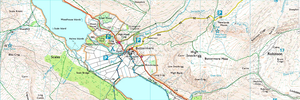
| Route: |
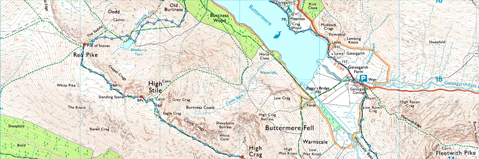
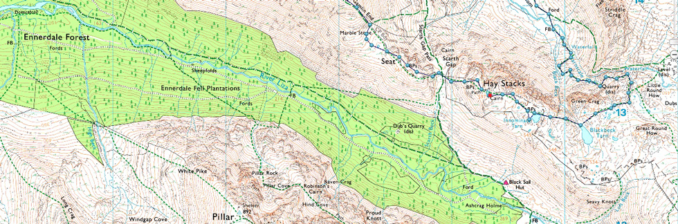
Buttermere – Old Burtness – Bleaberry Tarn – Red Pike (Buttermere) – High Stile – High Crag – Gamlin End – Seat – Top of Scarth Gap – Haystacks – Blackbeck Tarn – Warnscale Beck – Warnscale Bothy - Warnscale Bottom – Gatesgarth – Buttermere |
|
| |
|
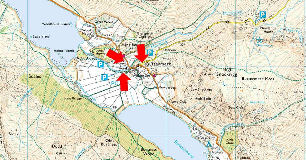
Parking Details and Map |
|
|
| Nearest Post Code: |
CA13 9XA |
| Grid Reference: |
NY 176 317 |
| Notes: |
Buttermere is a fairly small village and due to this finding a place to park can be difficult especially during the Summer months. There is free off road parking at the end of the Newlands Pass (right arrow) where there is room for around a dozen cars but being a popular area these spaces fill up quickly, parking here is free. The Fish Inn and The Bridge Hotel also have small car parks which are for patrons only. During busier months Syke Farm Campsite allows parking for non patrons but charges apply. |
|
| |
|
Map and Photo Gallery |
|
|
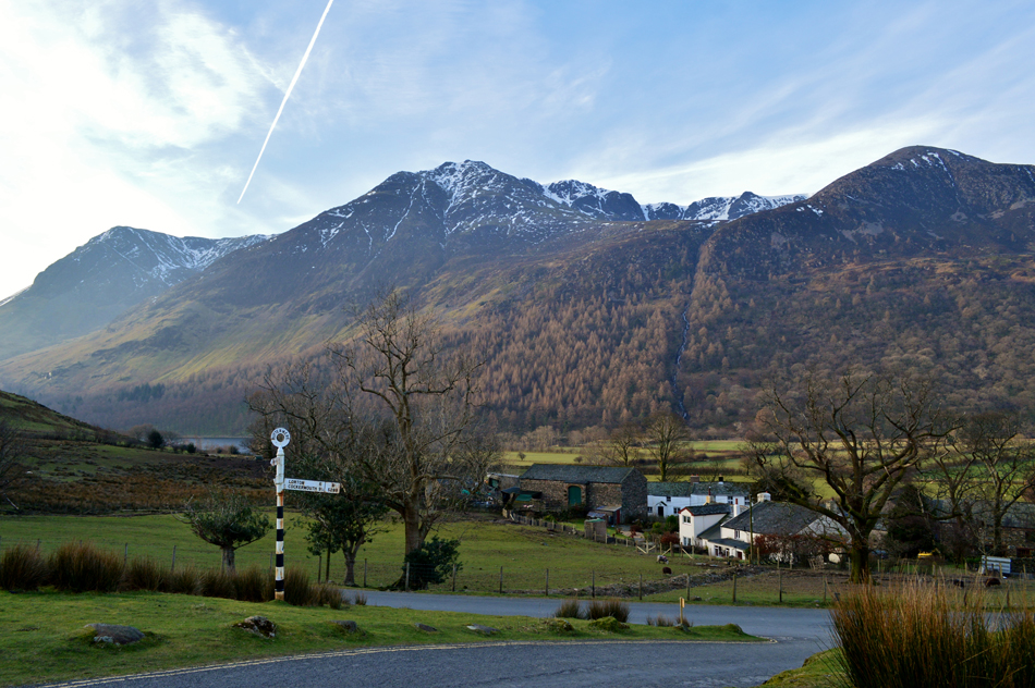 |
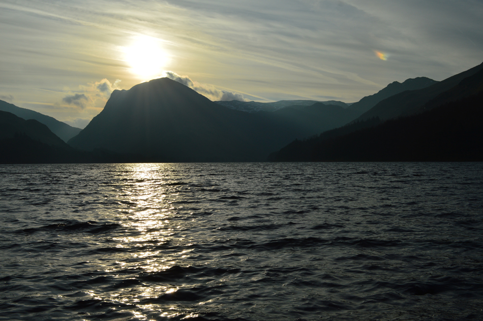
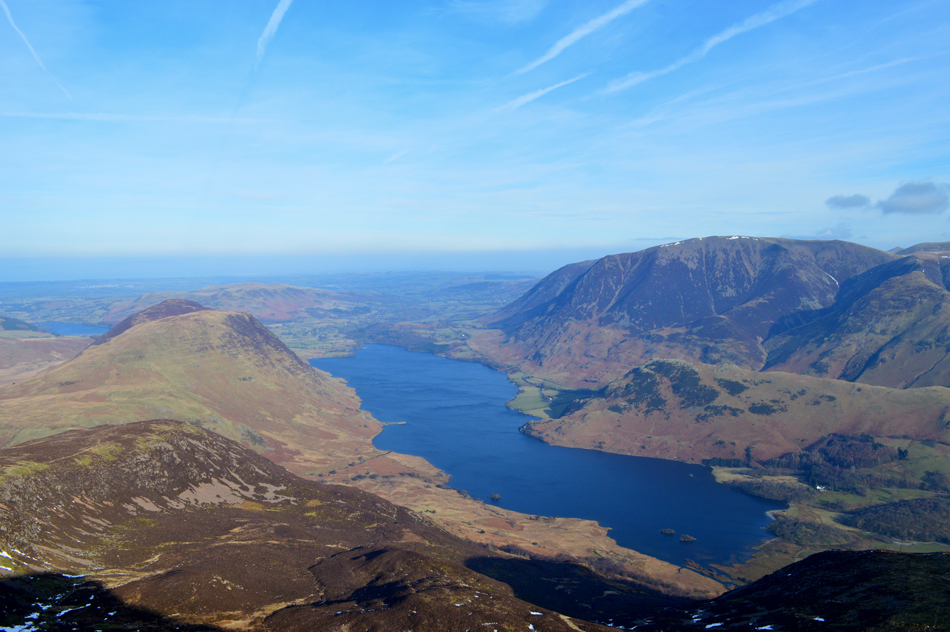
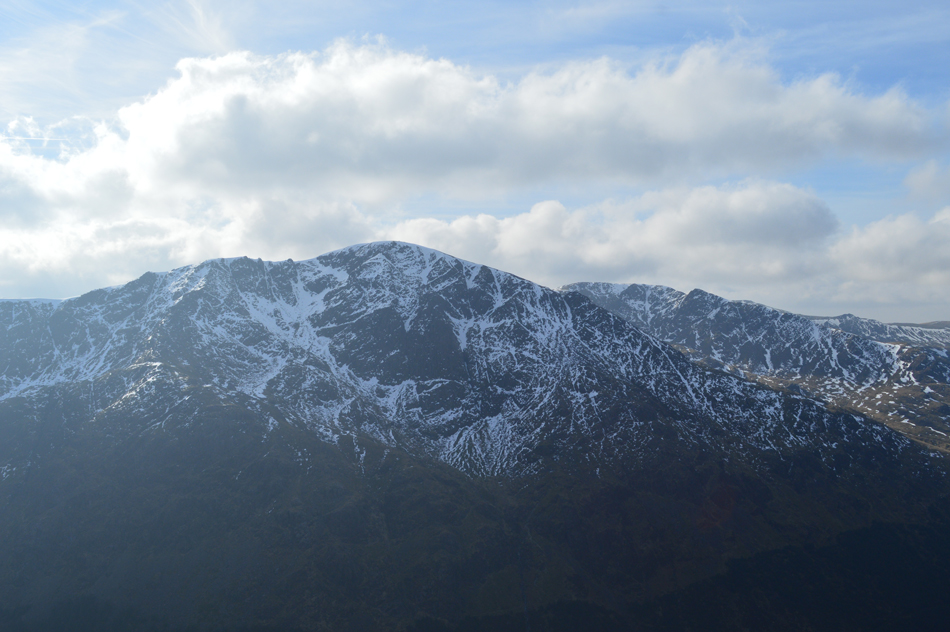
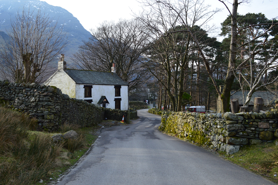
| Red Pike (Buttermere) High Stile and High Crag seen over Buttermere 08:20am 0°C |
With valley temperatures hovering around zero care had to taken whilst driving over Newlands Pass where on previous occasions at this time of year I've been forced to turn around due to ice, this morning we made the decision to risk it due to this weeks lack of rainfall, our risk paid off only encountering sporadic ice patches mostly on the Buttermere side of the pass which was avoidable with care. We arrived at the parking spaces close to Buttermere Church earlier than expected soon feeling a brisk chill whilst kitting up behind the car, it was no surprise with this arctic chill being all over the news lately but that doesn't stop that sudden shock you feel after leaving the comforts of a warm car.
From the bottom of the pass we had a clear view over the ridge and the winter condition it was in, any snow that was left was left was NE facing at around 2,100ft, it appeared from the valley as no threat and we made the decision not to pack ice axes. I was amazed to see that Ian had brought along his Karrimor pack which he used on our last few walks some years ago, I couldn't believe when Ian told me that his pack was 37 years old and despite the odd repair, was still going strong, back then Paul Ian said, Karrimor lead the way in mountaineering packs before reinventing themselves again with a wider range of outdoor gear over the last ten years.
Before we officially begin the walk I asked Ian would he mind we pay a quick visit to St James Church if only to view the Shepherds Gate found at the entrance. |
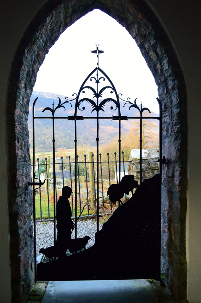 |
| The Shepherd's Gate, St James Church, Buttermere. |
| The wrought iron ‘Shepherd’s Gate’ is the symbol of shepherds both religious and agricultural. A visit to Buttermere isn't complete without taking time to view the Shepherd's gate. |
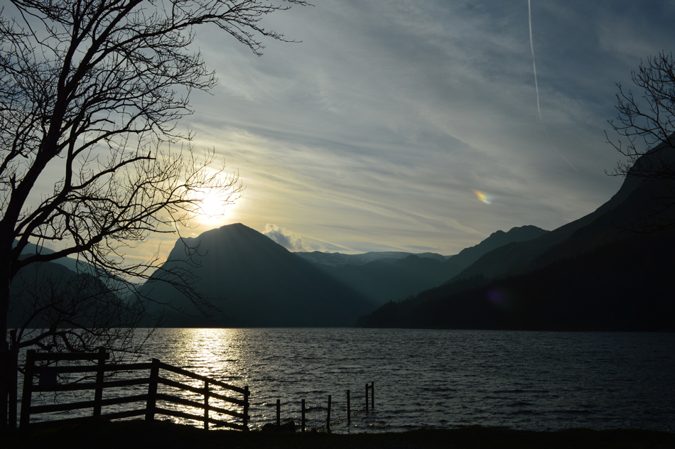 |
| Fleetwith sunrise. |
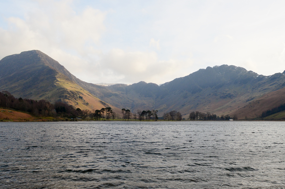
We left the Church behind before making our way through the village still catching up whilst at the same time silently taking in our surroundings. I still can't believe it had been so long since my last visit and if truth be known I'm sure we would have liked to have spent more time just soaking up the views, they sure deserved it. We arrived at the lake to find the sun rising in the southern sky which created a vivid profile on Fleetwith Pike, a scene I've seen many times in the February so much so I used to plan my walks at this time of year just to get this view. We wondered down to the shale beach and took a few moments to take in the view accompanied by the sound of Sourmilk Gill in the distance.
The feeling of missing this place was starting to close and it didn't take long not to feel like a visitor anymore. |
 |
| |
| |
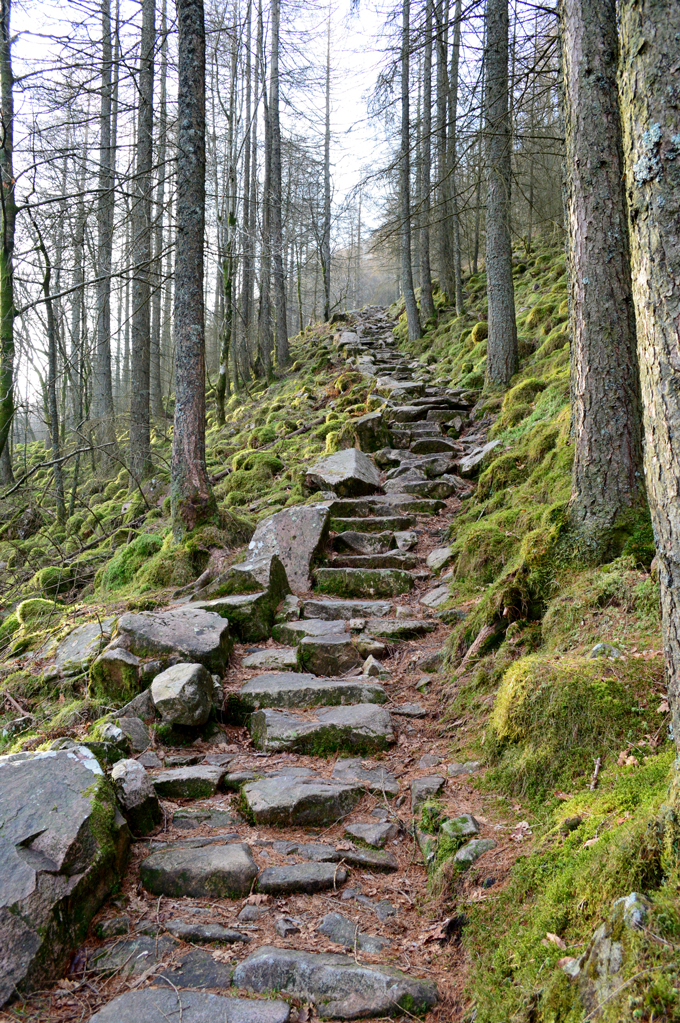 |
| Ascending through Old Burtness Wood. |
| It's just a short stroll from the shoreline to the path which ascends to Bleaberry Tarn, it's pretty steep but of great pitch and before long views start to open out over the tops of the pines. |
 |
| Here's High Snockrigg seen with Robinson. |
| That's Ard Crags over on the left with Dale Head over on the right, you can see there's a light wind over the top of the lake which is starting to build with more height gained. |
 |
| Crummock Water seen with The Grasmoor Fells. |
With Old Burtness Wood now behind the gradient eases slightly once a wooden gate is passed before taking on a stone path towards Bleaberry Tarn. Soon the tops of the trees are left below revealing clear views over towards the bulk of the Grasmoor fells which looked splendid in the clear morning light, this wasn't the case further east towards the Helvellyn Ridge whose summits are all below cloud.
It would seem we chose wisely with our fell choice and location today. |
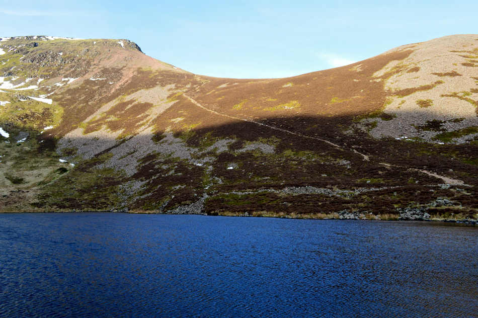 |
| Red Pike (Buttermere) and The Saddle from Bleaberry Tarn. |
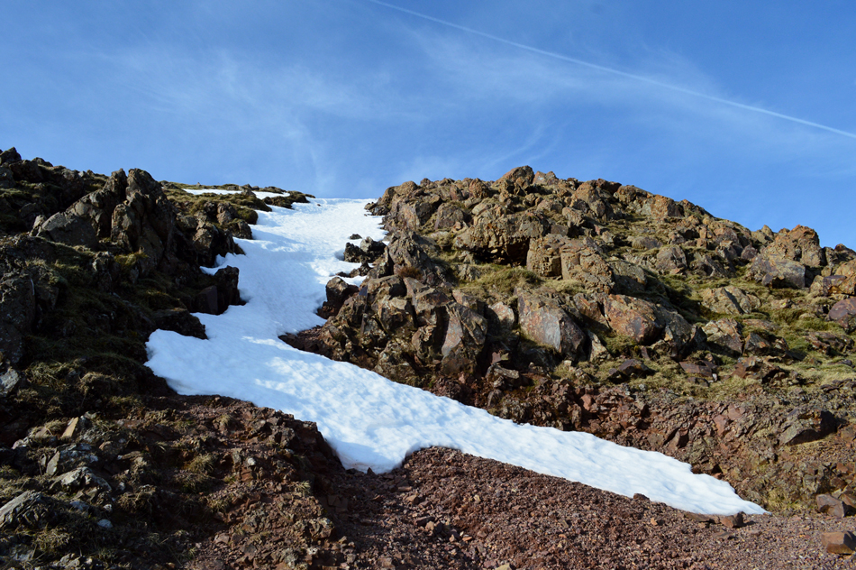
We encountered sporadic, unavoidable patches of hard snow and ice at around 1,700ft just prior to reaching top of Sourmilk Gill, it was here care had to be taken no matter how small the snow patch, mainly because of how hard and compact the snow was. Earlier we were caught up by a solo walker who we got chatting to who was making his way to Great Borne which was a great alternative to the section of the ride we'll be traversing today. From the tarn we watched the chap gain Dodd first before heading towards Red Pike summit.
The corrie around Bleaberry Tarn has two distinctive gullies split by Chapel Crags, these gullies were full of snow and would have been a great alternative ascent had we bothered to bring our ice axes, I won't say we wasn't slightly disappointed but hey-ho never mind.
That's our path from the bottom right to top left, it's pretty steep and steady and by the looks of it we'll soon be climbing into bright sunlight. |
 |
| Looking down on Bleaberry Tarn. |
| It was around here we heard the sound of dogs barking followed by whistles which appeared very close but as sound travels in the mountains we figured they could if been as far down as the valley. |
 |
| The Grasmoor Fells seen beyound Dodd. |
| I can't look at Dodd anymore without remembering my cheeky little out and back during my Harry Griffin 2,000 footers which I gained from Red Pike summit on a glorious hot sunny day back in 2015, the out and back took around eighteen minutes which always brings back great memories. |
 |
| Snow patch below Red Pike (Buttermere) summit. |
| More snow was encountered just below the summit most of which was easily avoidable with the exception of this patch directly below the summit, we avoided it by using alternative path just left of the main approach path, both of which were quite eroded. |
 |
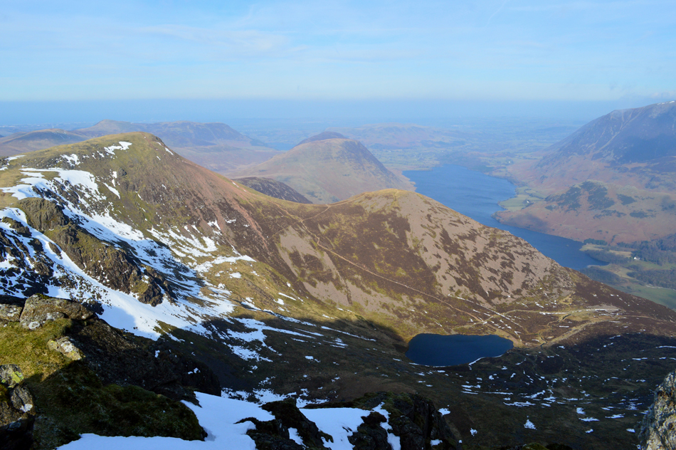
| Mellbreak, Crummock Water, Grasmoor and Rannerdale Knotts from Red Pike (Buttermere) summit. |
| Odd for this time of year we could see a slight haze towards the west coast but at least it's clear overhead unlike the eastern fells which are still below cloud. Incidently that's Loweswater in the distance with Low Fell and Fellbarrow towards the right. |
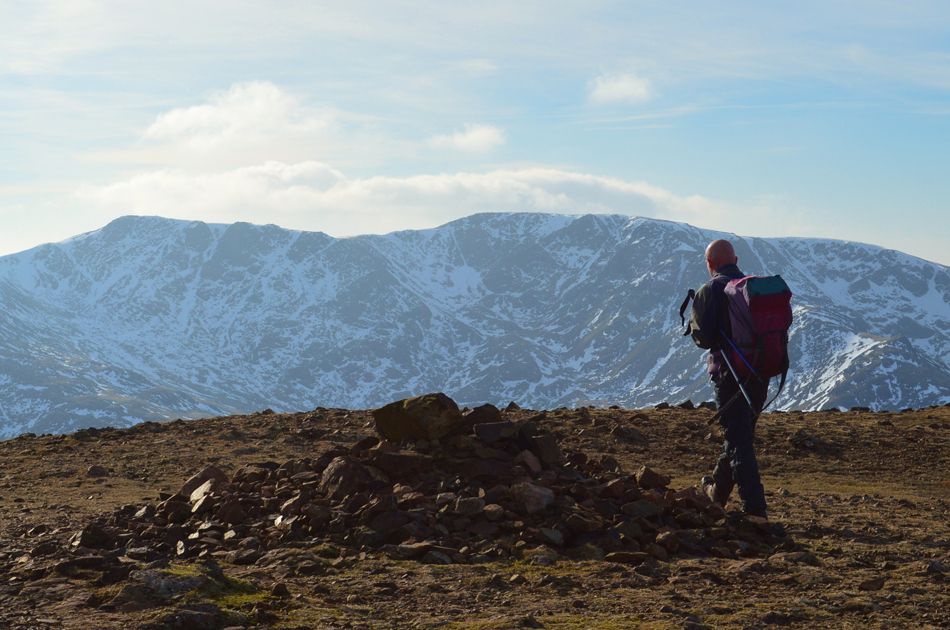 |
| Ian checks out Scoat Fell and Steeple from the summit cairn. |
| |
 |
| Fabulous views into Ennerdale towards Crag Fell with Starling Dodd and Great Borne at the westerly end of the ridge. |
| |
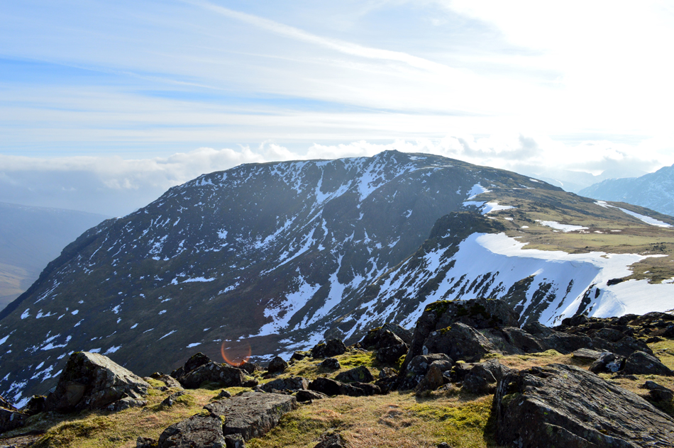 |
| High Stile from Red Pike (Buttermere) |
| |
 |
| Chapel Crags, Red Pike, The Saddle, Dodd and Bleaberry Tarn as we approach High Stile summit. |
You get this grand view of Red Pike just below the summit of High Stile which shows why muscles are starting to ache while over on the left, Chapel Crags seen with the snow filled gully in the foreground.
Not far from the summit now. |
 |
| Looking back on Chapel Crags, Red Pike (Buttermere) Starling Dodd, Great Borne, Ennerdale and Crag Fell from High Stile summit. |
| |
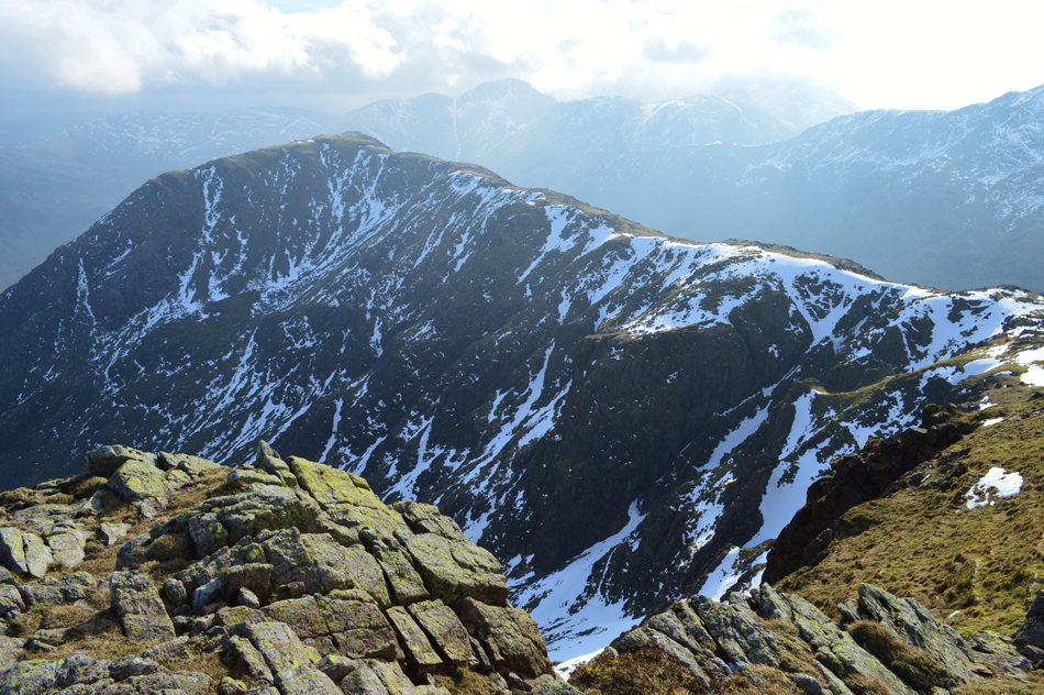 |
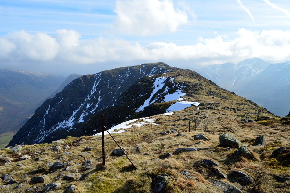
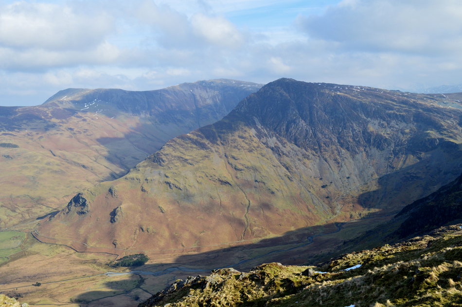
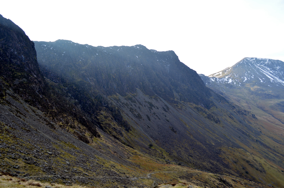
| High Crag seen over Burtness Comb. |
| Those of you with a keen eye may be able to spot Eagle Crag in the foreground which Ian told me he'd climbed the east face many times back in his climbing days, those of you with a keener eye might be able to spot Sheep Bone Rake in the far left of Burtness Comb defined by a layer of snow from top to bottom. In the distance the Gables and Kirk Fell which are about to be lost in cloud. |
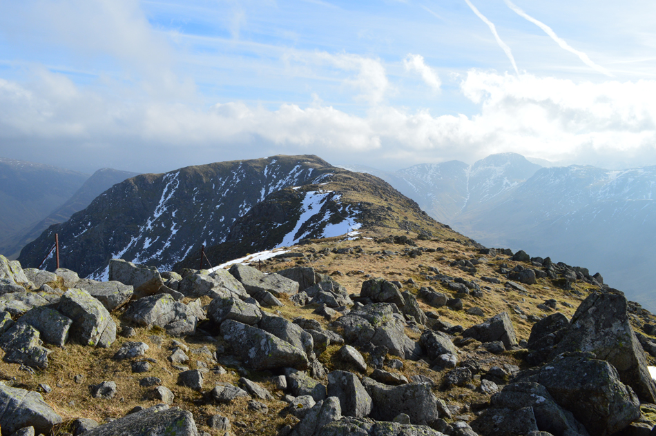 |
| The High Stile Ridge. |
| Perhaps, one of, if not thee, best ridge walks in Lakeland. |
 |
| High Crag. |
| And It's not hard to see why. |
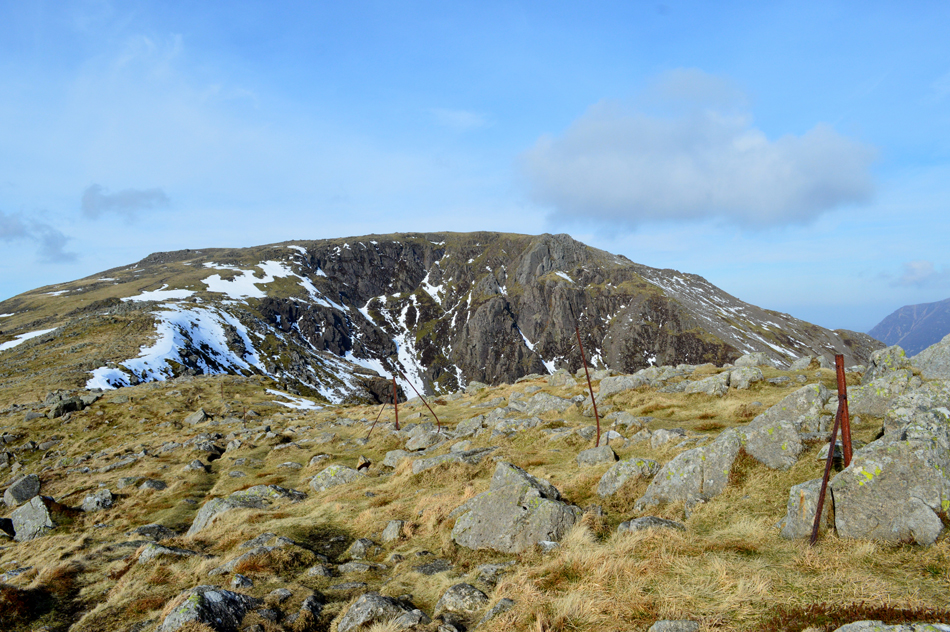 |
| High Stile seen over Burtness Comb. |
| Despite the fantastic scenery we'd been open to the elements and we were starting to feel the affects of the windchill. I later spoke to David who after work did a quick walk over Sale Fell and recorded -7.7° windchill, I'm guessing here on the ridge we were easily into double figures, it's certainly starting to feel it. |
 |
| High Crag over Burtness Comb. |
| A solo walker gains the summit who we had spotted walking the ridge from High Stile, he must have enjoyed the ridge so much after a quick stop he retraces his steps and we pass just prior to gaining the summit ourselves. |
 |
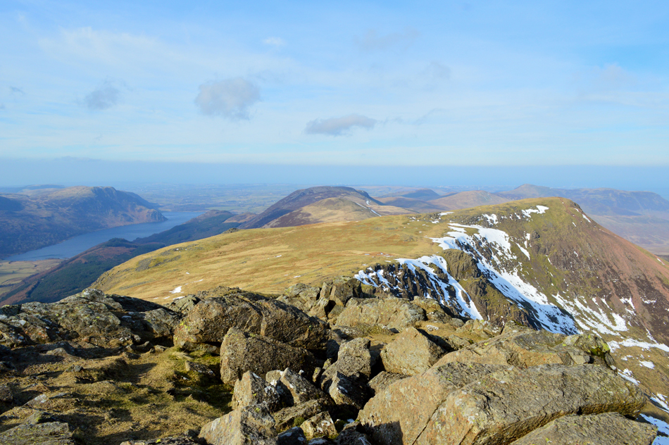
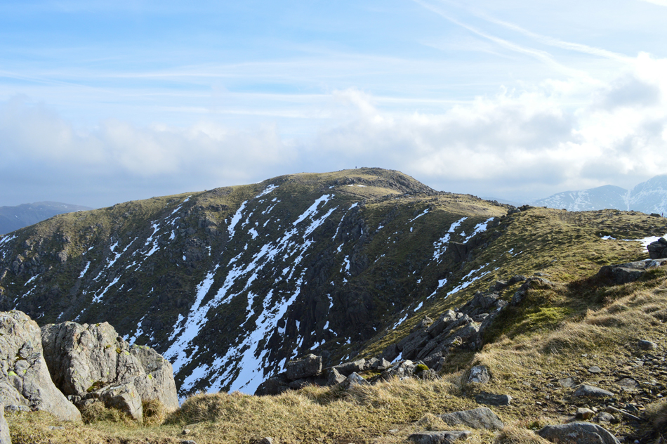
| High Stile over Burtness Comb. |
| From here it's easy to see what little snow is left on the High Stile Ridge, however this isn't the case further west across the Ennerdale Valley as Pillar comes into view. |
 |
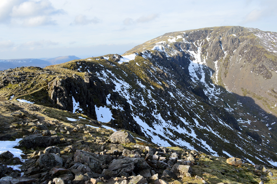
| Pillar, Pillar Rock and Steeple from High Crag summit. |
| |
 |
| Sipping tea with a view. |
| Ian suggested we have a quick stop if only to try some of the left over home made Christmas cake which had been topped off with lashings of Brandy "don't worry Paul you'll have sobered up by the time we get back to the cars!" The Christmas cake went down a treat which was washed down with piping hot tea. |
 |
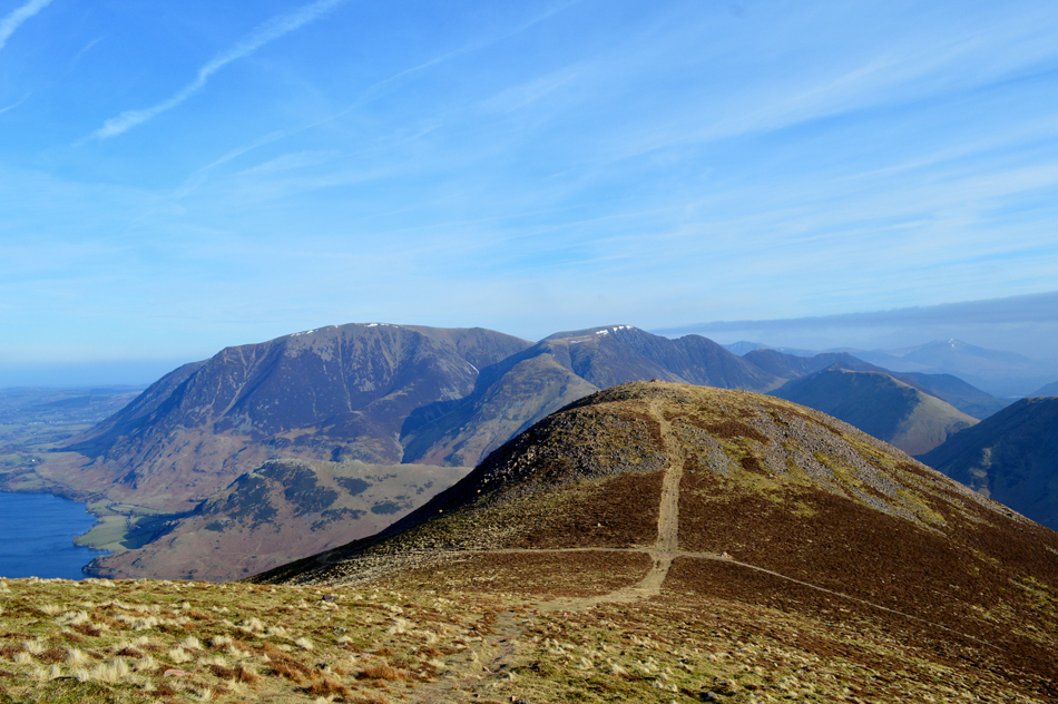
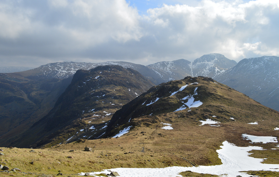
| Descending High Crag via Gamlin End as Seat and Haystacks come into view. |
| |
 |
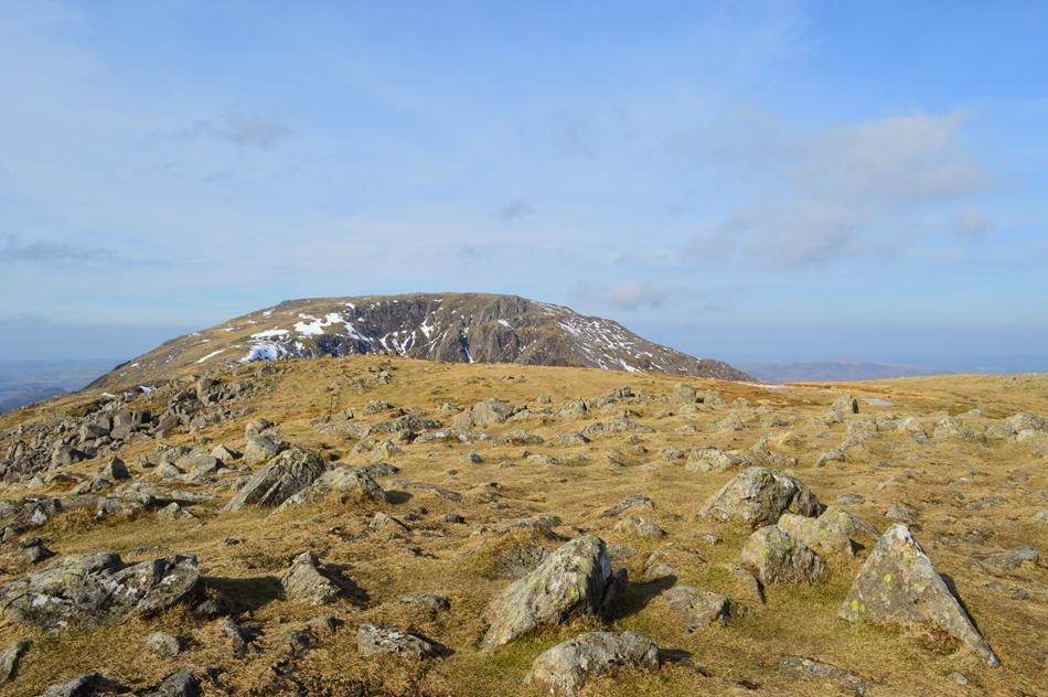
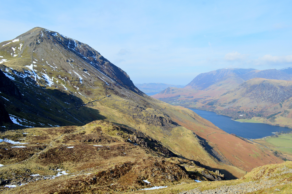
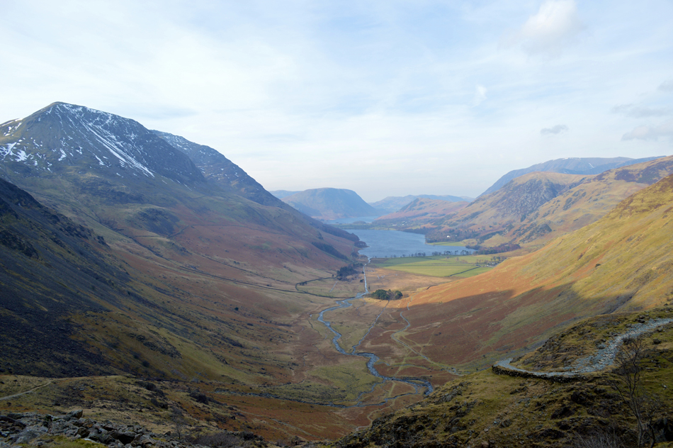
| Seat and Haystacks. |
The descent of Gamlin End was quite tricky due to the amount of snow and ice build up especially around the mid section of the path below the zigzags, at times we gained a cautious trot before being forced off the path due to hard snow and ice, all of which was easily avoided by taking a wide berth and soon we were looking back up at one of Lakelands steepest ascents!
There isn't many that comes close to Gamlin End. |
 |
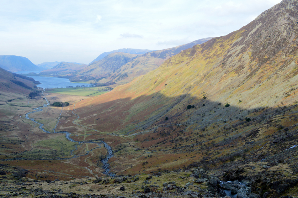
| That classic view of Fleetwith Pike seen over Warnscale Bottom from Seat. |
| In the disance, Dale Head and Hindscarth. |
 |
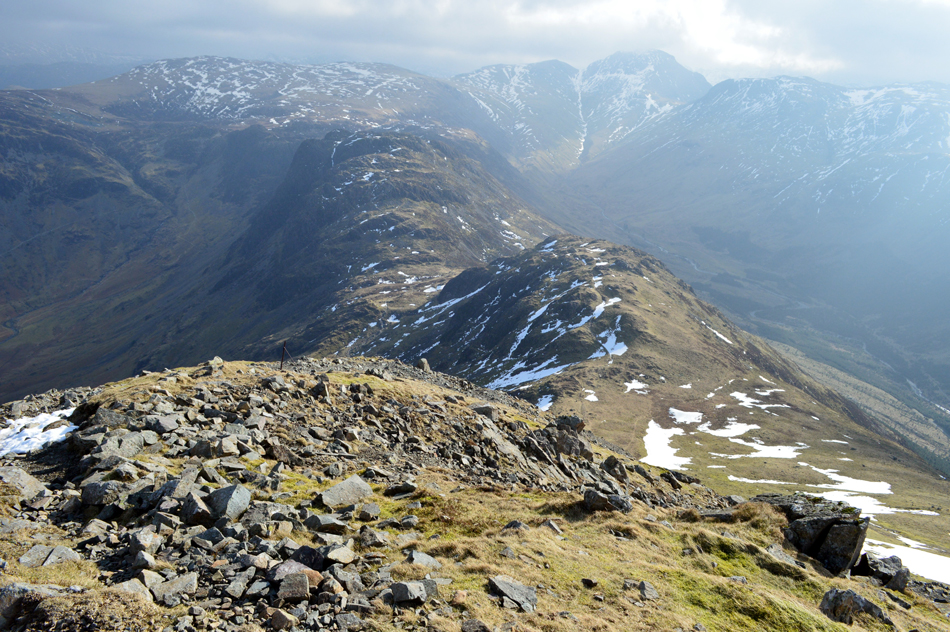
| Looking back over Scarth Gap towards Gamlin End and High Crag. |
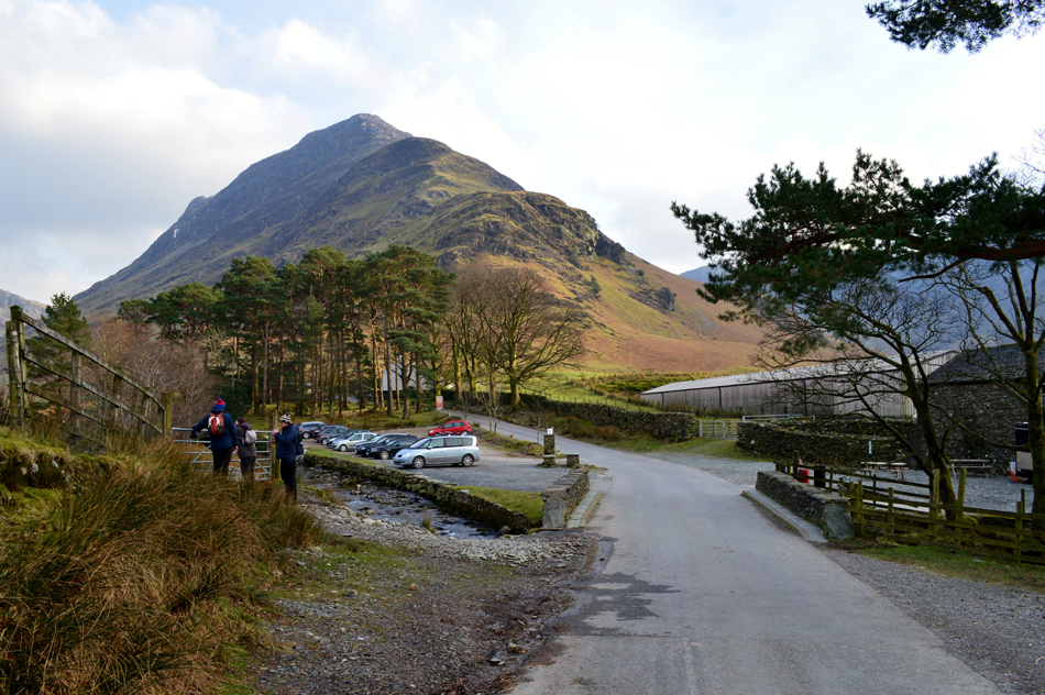
| We had started to pass more walkers now mainly who had ascended from Gatescarth each going their separate ways once the top of the pass was reached. Earlier we had passed a group of walkers during our descent of Gamlin End who appeared to be in good stead but they were still enduring the zigzags close to the summit, I guess that's Gamlin End for you, it respects no one and can finish the freshest of legs off! |
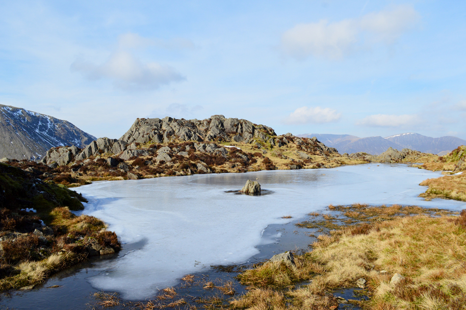 |
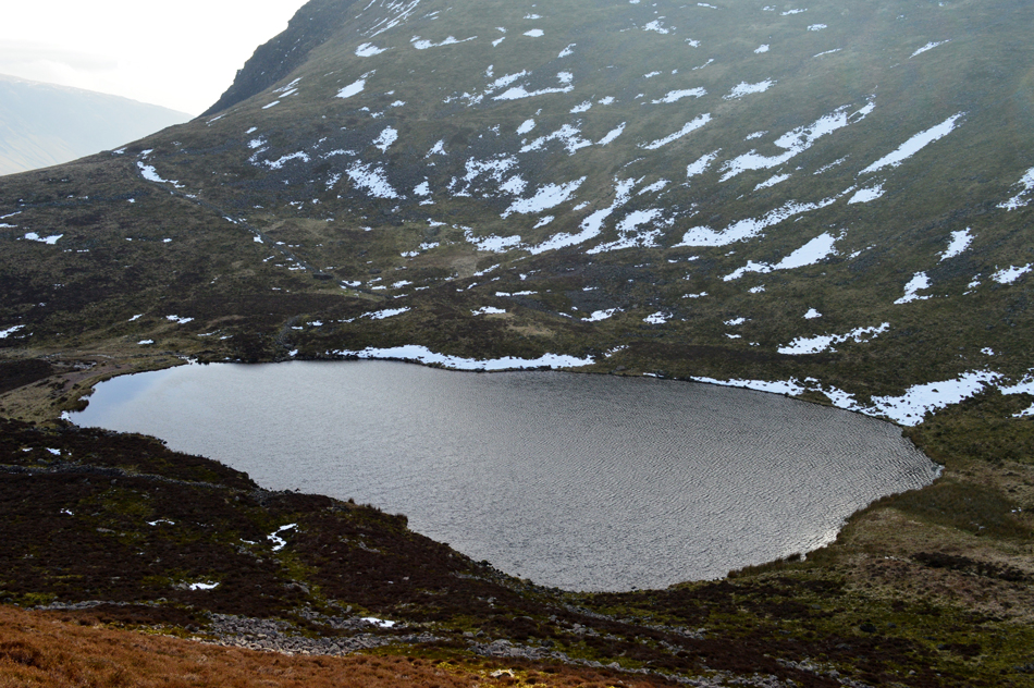
| The small un-named Tarn found close to Haystacks summit. |
| We agreed despite our previous work summating Haystacks never feels like hard work and todays summit was no different. Our ascent was much busier encountering quite a few walkers in both ascent and descent some of which we stopped to talk too. We soon reached the un-named tarn which over looks the summit crags before arriving at the summit cairn at the same time as a young couple who had ascended from the opposite side, we both had been here numerous times before and let the younger couple have their summit time, besides, it's lunch time and we're getting hungry! |
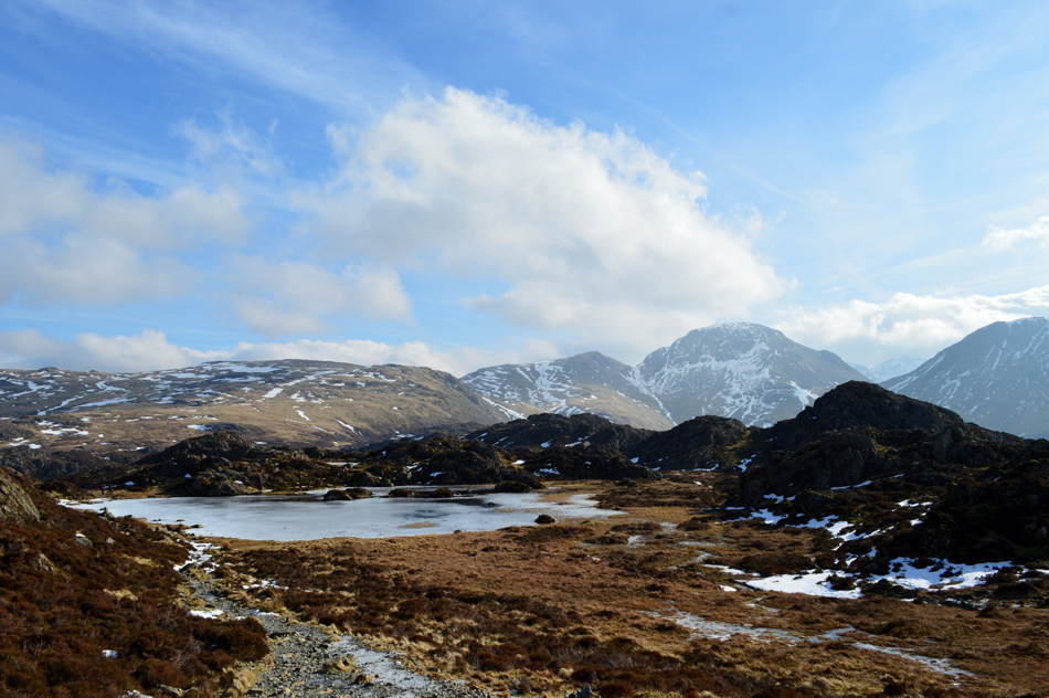 |
| Brandreth, Green Gable, Great Gable and Kirk Fell as we approach Innominate Tarn. |
| Despite losing height the windchill was still a major factor and after spending the best part of the morning with frostnip we agreed to have lunch within the comfort of shelter which was much harder to find than it looks. |
 |
| Lunch with a view, Innominate Tarn. |
| We traced around the western edge of Innominate Tarn finding the ground underfoot frozen and relative easy going, we aimed to find shelter within the crags which did nothing to ease away the windchill, in the end we perched ourselves on a outcrop whilst the wind whistled above our heads, it wasn't perfect but our view more than made up for it. |
 |
| Green Gable, Great Gable and Kirk Fell from a frozen Innominate Tarn. |
| |
 |
| The Gables from Black Beck Tarn. |
| We left Innominate Tarn before pausing for one last look back before making our way towards Black Beck Tarn which looked as peaceful as I'd ever seen it. Having passed the top of a snow filled gully which dropped steeply into Warnscale Bottom we took the shelf route and crossed the top of Black Beck before descending steeply directly below Haystacks NE face in search of Warnscale Bothy, a place I had seen many times but have never visited. |
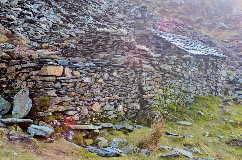 |
| Warnscale Bothy. |
We found the path quite tricky in places and care had to be taken due to ice all of which was avoidable before the Bothy roof was sighted within the shadow of Haystacks NE face. The sun had peaked and had vanished behind Haystacks leaving the east side of the valley in shadow and we soon started to feel the pinch once again.
Ian wanted to see the new Chimney that had been installed after the previous one by all accounts, let the smoke back in. We heard voices coming from inside but went in anyway finding two young lads along with a Labrador. They were chatty and we shared a laugh later finding out that they had both forgotten thier maps meaning their oringinal route from Wasdale Head (I think) had to be shelvled in favour of a simpler route from Honister Slate Mine, they admitted they now found themsleves with a lot more time to kill than they had planned for. |
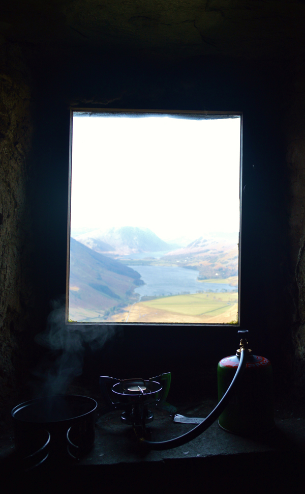 |
| Through the viewing window, Buttermere and Mellbreak. |
| |
 |
| Descending into Warnscale Bottom. |
| We left the lads in the Bothy and began the rough descent into Warnscale Bottom, it's my first time descending into Warnscale via this path as I usualy use the path on the opposite side of Warnscale Beck as Ian noted he found this one slightly less rough, I tend to agree. |
 |
| And the views aren't bad either. |
| We've still a long way to go until we reach the car back at Buttermere! Talking of the opposite path you can make it out here seen lower right, it's one of the paths that lets your feet know what a tough day they've had! |
 |
| Warnscale Bottom. |
| We soon reached the valley floor and after kicking feet back into boots Ian knelt down and cupped a couple of handfuls of Warnscales finest. It maybe quite a distance by foot to Buttermere but at least it's all easy walking. |
 |
| Passing through Gatescarth. |
| |
 |
| Fleetwith Pike from Gatescarth Farm. |
| Plenty of cars in the car park for a Friday afternoon I see. |
 |
| A Buttermere Skyline. |
There was only one way we were going to reach Buttermere by and that was via the east lake path which provided these fabulous views back into Warnscale and of course, Fleetwith Pike and Haystacks. The path was understandably busy with dog walkers and couples all out enjoying the fantastic views despite a sudden drop of light due to cloud cover. Waves licked at the shoreline brought on by sometimes sudden gusts that howled down the lake, gloves had previously been removed and hadn't they have already been packed away we may have been reaching for them if only to take out the nip.
Wilkinsyke Farm was reached as we watched the farmer load hay with his tractor accompanied by the smell of farmyard swill as Ian smirks and says" bloody hell there's still that steep bit next to the Church before we get back to the car "aye that's Buttermere's own 'Bad Step" I thowt. |
|
| |
| Back to top |
 |
|