|
Swirl How, Brim Fell and Coniston Old Man |
 |
 |
20th January 2018 |
 |
|
I'm only into my third walk of 2018 and all three walks are already contenders for walks of the year already experiencing almost every different aspect that walking on the Lakeland fells in Winter can throw at you, I feel like I've won the lottery to some degree.
Walking the fells in January is very hit and miss yet 2018 so far for me has been everything I could ask for after my first walk on Skiddaw where we experienced a bright Winter sun from start to finish to last weekends walk when the severe windchill forced us to abandon our original route and then came up with a even better one, yeah I know it doesn't sound that thrilling but you had to have been on therel to fully understand what I mean.
Then there's todays walk, a route that Rod came up with mid week although the original plan was to visit both Great Carrs and Grey Friar but after drudging through knee deep snow for the best part of the morning, sadly time wasn't on our side. The forecasters predicted another fine bright day which fell through at the death leading to what you expect for a bleak January on the hill, low cloud, limited visibility and snow but boy was we rewarded once we gained our first summit. |
|
| Wainwright Guide Book Four |
 |
| The Southern Fells |
-Swirl How
Swirl How, although not quite the highest of the Coniston Fells, is the geographical centre of the group, radiating splendid ridges from a peaked summit to the four points of the compass.
|
 |
|
|
|
| |
|
Overview |
|
|
| Ascent: |
3,263 Feet - 995 Metres |
| Wainwrights: |
3, Swirl How - Brim Fell - Coniston Old Man |
| Weather: |
Overcast With Low CloudThrough The Morning, Above The Cloud From Midday, Some Bright Spells. Highs of 2°C Lows of -1.5°C Feels Like -6.9°C |
| Parking: |
Coniston Sports and Social Centre, Coniston |
| Area: |
Southern |
| Miles: |
8.4 |
| Walking With: |
David Hall and Rod Hepplewhite |
| Ordnance Survey: |
OL6 |
| Time Taken: |
6 Hours 30 Minutes |
| Route: |
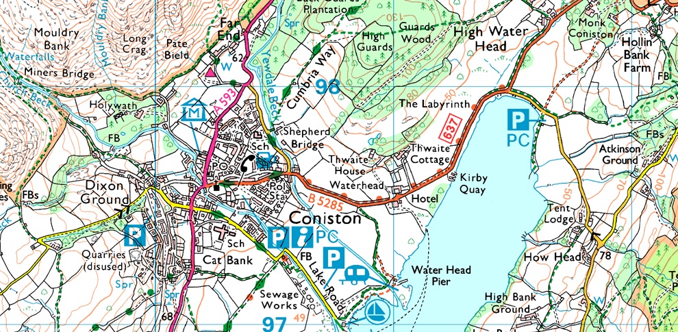
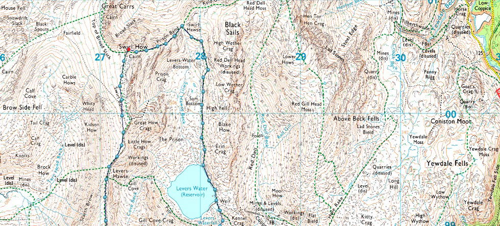
Coniston - Miners Bridge - YHA Coniston Coppermines - Levers Water Beck - Levers Water - Swirl Hause - Prison Band - Swirl How - Swirl Band - Levers Hawse - Brim Fell - Coniston Old Man - Low Water - Crowberry Haws - Miners Bridge - Coniston |
|
| |
|
Parking Details and Map |
|
|
| Nearest Post Code: |
LA2 18DW |
| Notes: |
Coniston is a very popular village providing access to the ever popular Coniston Fells, below is a list of car parks found within the village with exceptions of the roadside parking that I tend to use close to Ruskin Museum where parking is free.
Coniston Tourist Information Centre (Pay and Display) Ruskin Avenue Coniston LA21 8EH SD 303 597 ~ Car Park (Pay and Display) Old Furness Road, Coniston LA21 8HU SD 299 897 ~ Lake Road Car Park (Pay and Display) Lake Road, Coniston LA21 8EW SD 307 097 ~ Roadside Parking, Ruskin Museum, Coniston, Parking is Free LA2 18DW SD 301 597 ~ Car Park, Coniston Sports and Social Centre, Charges Apply LA21 8AL SD 305 397 |
|
| |
|
Map and Photo Gallery |
|
|
  |
| |
| |
 |
| Coniston Sports and Social Club car park, Coniston 08:35am 2°C |
We had arranged to meet at Coniston Sports and Social Club in the centre of the Coniston, a car park that I had never used before which was suggested by Rod after his last visit where he failed to park alongside the Ruskin Museum some time last year due to the lane being coned of completley. Parking here only adds around a ten minute walk through the village so it was no hardship only having to pay £3.00 for all day parking. I arrived early and started to kit up behind my car noting strangly, the three Heron's on the football pitch behind me. Despite the low morning temperature it feels quite mild but I add hat and gloves if only to save time de-shoudering my pack later. Soon Rod and David arrived and we greet as normal with handshakes. The good news is the snowline is low at around 1,000ft the not so good news is it's murky and grey but that's no hardship either, at least it's dry
£3.00 each lighter we leave the car park, turn left and head into a sleepy Coniston. |
 |
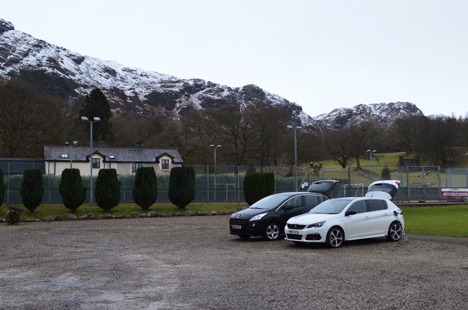
| Yew Pike from the Black Bull, Coniston. |
Within minutes we are in the village where we were greeted by a waft of cooked bacon, the smell of which was enough to stop us in our tracks, we figured it best not try and find where it was coming from, next Sara's Indian is passed where we glance at the menu in the window, I'm sure I can vouch for David and Rod when I say this but I could never eat a Indian so early in the morning so why right now am I craving one after reading that menu!
Up ahead we head left at the village store just where you can see the red car. |
 |
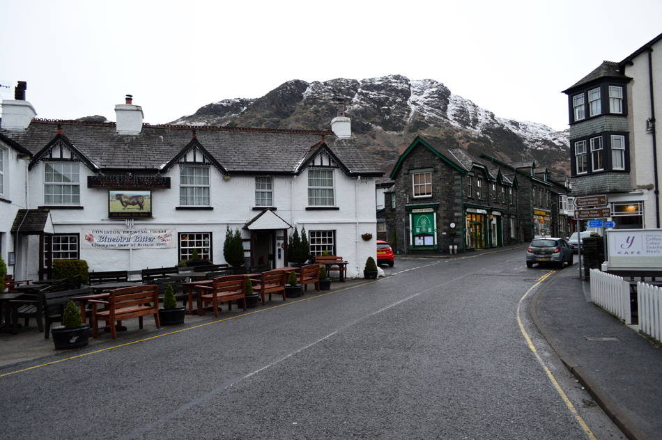
| Miners Bridge over Church Beck. |
We left the village behind soon passing the Ruskin Museum and to our amazement rows of cars are parked whose owners are kitting up for a day on the fells, this was good news and confirmed that the lane is still open to parking in the future, it's highly likely that when Rod was last here the lane was closed to parking possibly for repairs or an event, either way it was worth the few extra minutes walking for the smell of bacon alone!
The track steadily rises after leaving the road behind and shortly after passing over the familiar cattle grid we found at dead sheep lying at the side of the road, we couldn't see how it had died but figured it had been hit by a car possibly through the night, the poor thing just looked asleep. Miners Bridge is reached where we are overtaken by two fell runners who cross the bridge and head right towards Crowberry Haws. |
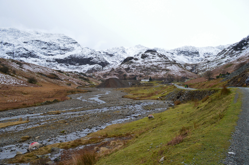 |
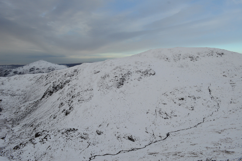
| Brim Fell, Raven Tor, Great How Crags, Kennal Crag and the Black Sails ridge from Coppermines valley. |
| With Miners Bridge now behind we follow the old mine track towards YHA Coppermines (seen as the white building up ahead) It was decided to gain Levers Water by the Simon's Nick/Levers Water Beck route which is found on the east flank of Grey Crag (the very dark crag centre left) |
 |
| Looking down on Coppermines valley from Levers Water Beck. |
We had reached the snow line close to the footbridge over Levers Water Beck where we are able to access conditions up ahead. Even here at the footbridge we were stood in a couple of centimeters of soft snow which would only deepen with more height gained. The couple you see in the last photo catch us up here but it's their dog who gets all the attention, they appear to be kitted out for the cold, but not generally the hill if that makes sense.
With Levers Water Beck crossed we begin the steady climb alongside Levers Water Beck, the stone path is completely covered by fresh snow ranging between just a couple of centimeters to sixty - I blaze a trail making sure I keep into the hillside while avoiding the few patches of cornice where I could, I guess it was here I knew we'd be in for a hard, but enjoyable day on the fell.
In only the way that three friends would, I am sarcastically thanked for my hard work!
I mentioned the crossing of Levers Water Beck at the outflow further ahead and the possibility of it being a tad risky with so much water and snow around so instead we cross below the Waterfalls at a narrowing of the Beck, but just prior we also decided to add our crampons owing to my slight slip where David had to recover me by a well timed grab at my back pack, this wouldn't be the last time I would be requiring the swiftness of David's actions! |
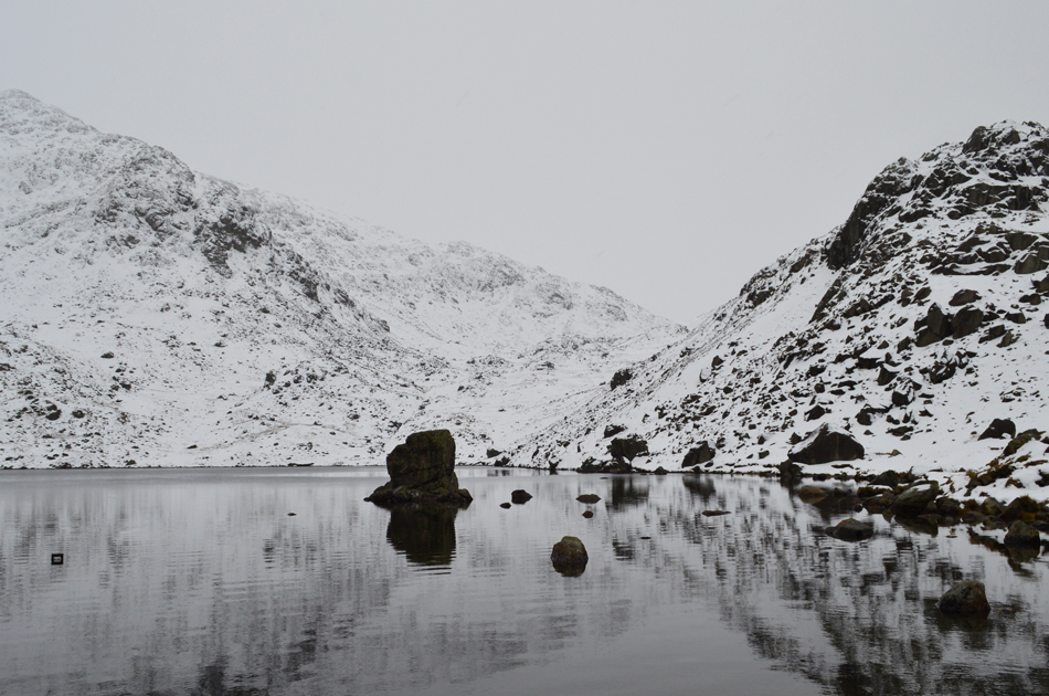 |
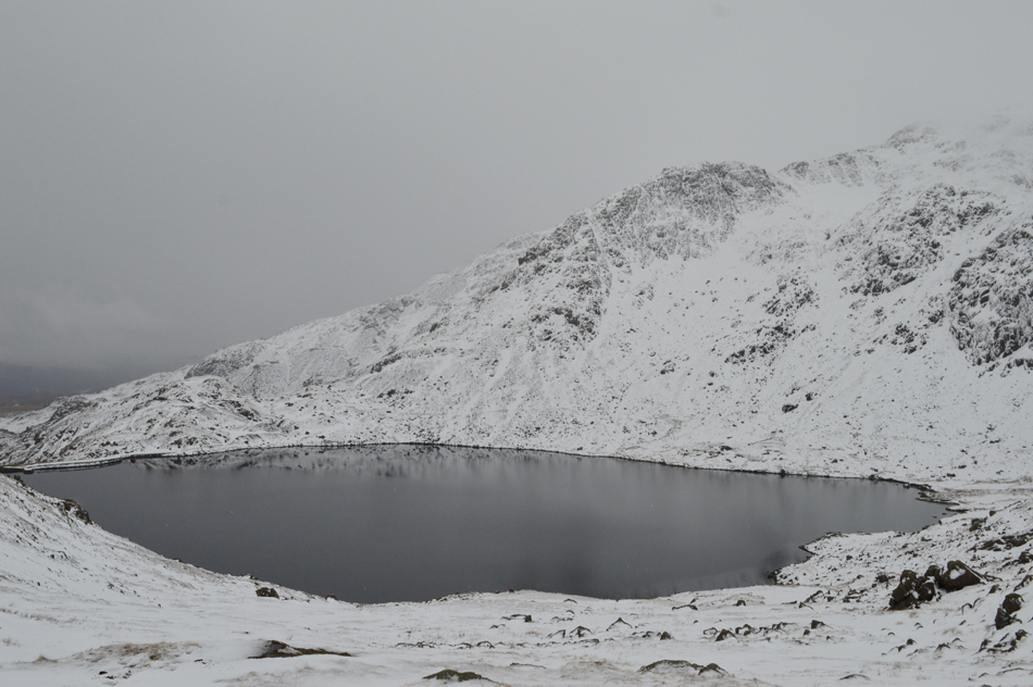
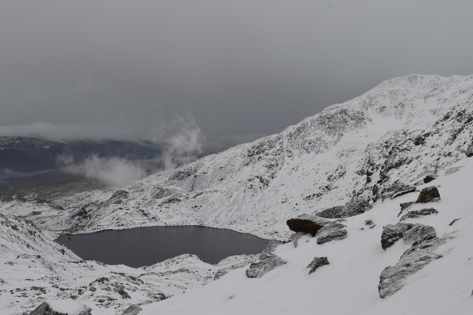
| Great How Crags and Prison Band from Levers Water. |
Despite the snow still being soft underfoot adding the crampons earlier just seemed the right thing to do. On reaching Levers Water we again could access conditions which were deteriorating rapidly with height gained. Back at the YHA Coppermines we could clearly see the summits from the Old Man through to Brim Fell but now we found the cloud was lowing and with it came snow showers.
Our path now follows the east shoreline of Levers Water which as you can see is quite rocky to say the least, it's the type of place you just can't rush especially with snow under foot. |
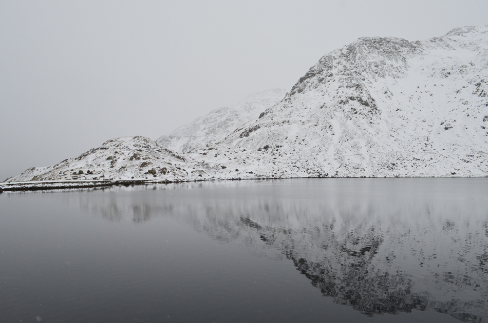 |
| Here looking over Levers Water towards Raven Tor with Coniston Old Man in the murky distance. |
| |
 |
| The same view from a little height gained. |
| |
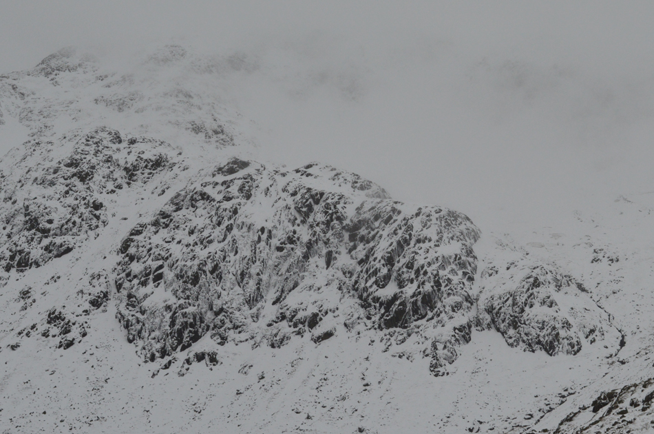 |
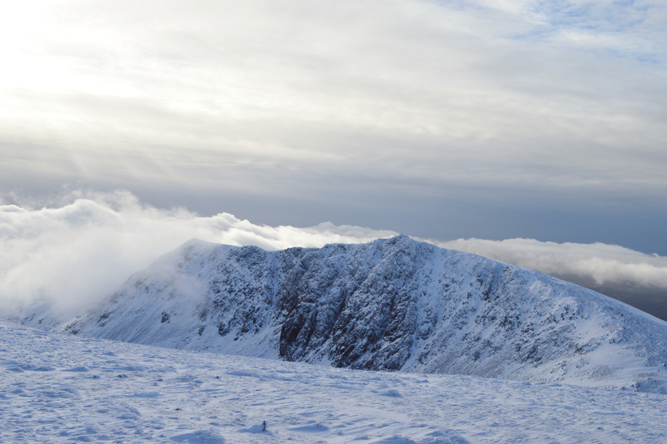
| Gill Cove Crag. |
With the cloud at its lowest visibility dropped and we found ourselves in a world of black and white, with only a light breeze and snow falling the whole drama of the walk started to change from here on in, it may look bleak but this is what makes my senses come alive.
Rod spots movement around Cove Beck (seen lower right) two walkers were making slow progress on an alternative ascent of Raven Tor, their jackets just seemed to blend into the background despite their bright colours. |
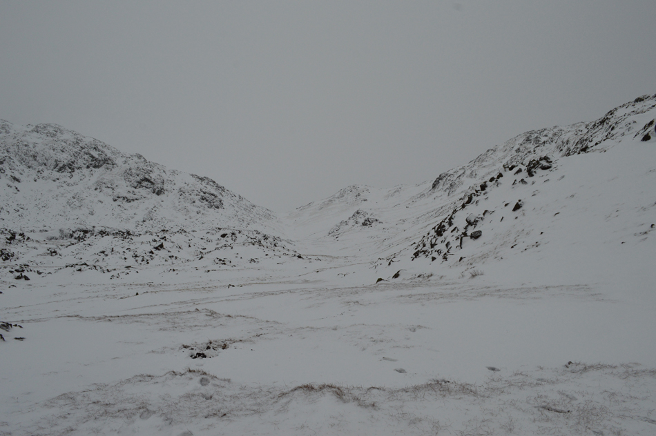 |
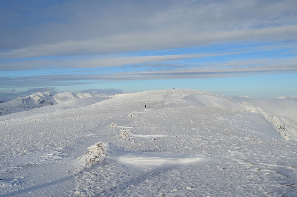
| Swirl Hawse is up ahead. |
We had only gained around 1,400ft since leaving Levers Water which was hard work sometimes having to trudge through knee height snow for much of the way but with fresh legs it was more entertaining than a challenge (well for now anyway) All three of us would often break through the snow dragging the contents of the bog below with our outward steps but for me I was about to take it one step further.
The snow depth was now between 30 to 60 centimeters, it wasn't uncommon for us to break away 'off path' if only to find patches of grass which for a while took the strain away, in doing this with such deep snow underfoot you don't always know what you are walking over as I found out when my left leg punched through the snow pack right to the top of my thigh leaving my upper body leaning over to the right, I had only fallen into a snow covered stream...all that was left was to pull myself out which I couldn't do because this meant putting hand pressure on top of the snow which still covered the stream, by-eck.
David quickly runs over and once again grabs my pack back while shouting for Rod to grab my right hand, it was over in seconds and despite never being in any danger the worst I would have got would have been a complete soaking which would have probably put an end to my walk.
I sincerely hoped that's the last time I have to call on anyone for help for the rest of the day. |
 |
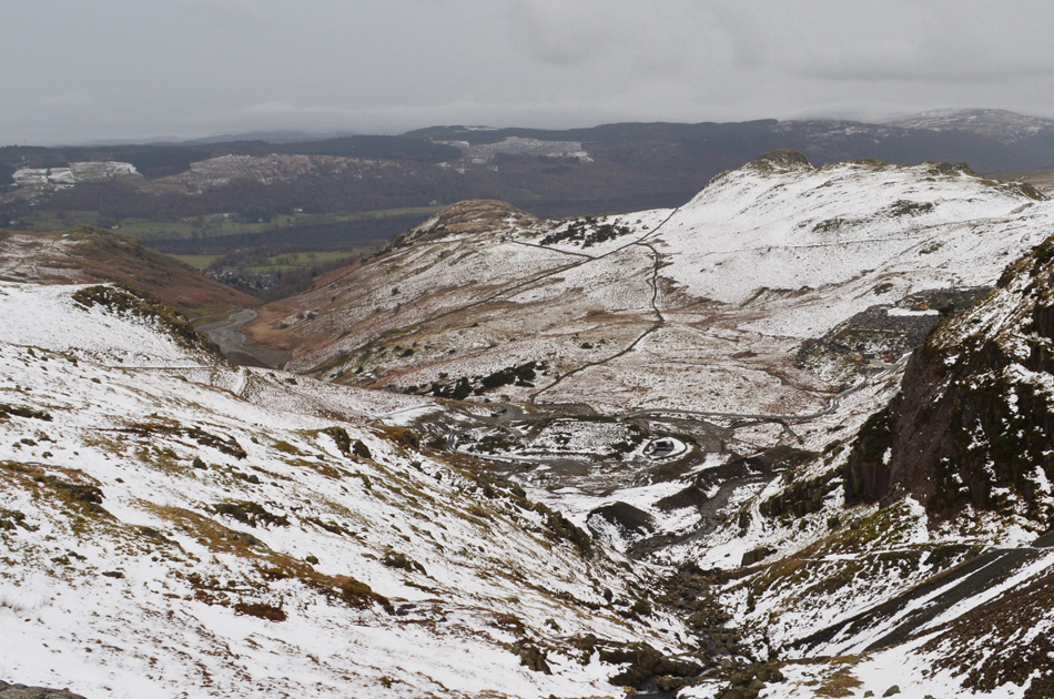
| The view over Sam Bottom towards Great How Crags. |
| |
 |
| Raven Tor and Levers Water. |
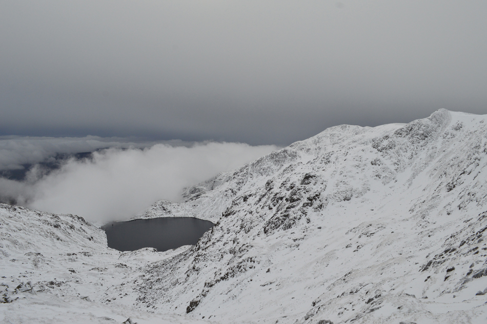
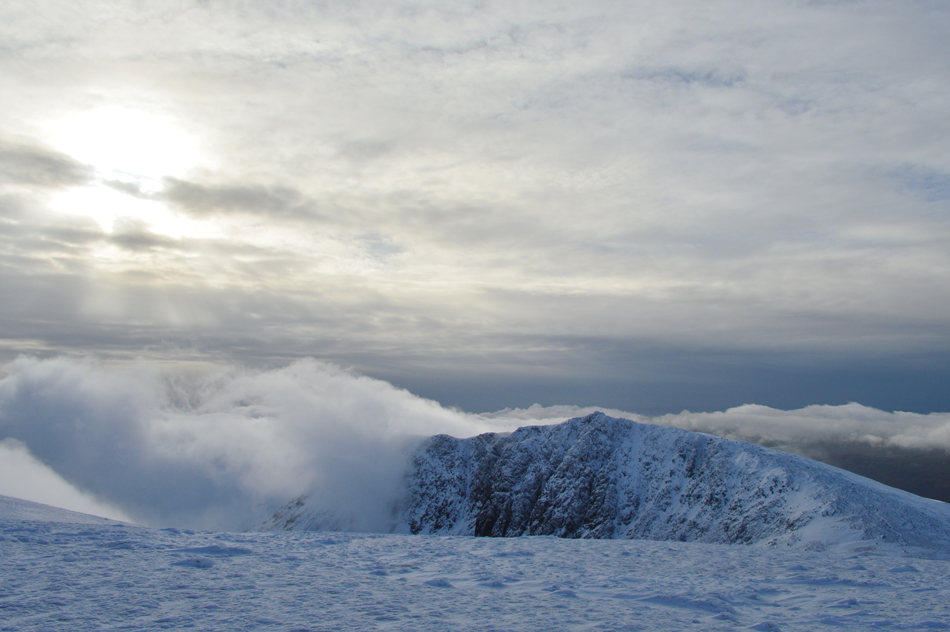
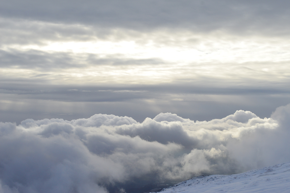
| Silence ensued and we each began to dig deep and the once distant Swirl Hawse finally started to appear closer. It took a staggering one hour and fifteen minutes to reach Swirl Hawse after navigating through deep snow and drift but rewards were plentiful after the cloud began to lift revealing Raven Tor and what appeared to be an advancing cloud inversion. |
 |
| Crinkle Crags and Pike O'Blisco seen over Wet Side Edge. |
| Noting the chink of grey/blue sky in the distance. |
 |
| The inversion continues its advance at an astonishing pace. |
| |
 |
| This image taken during our ascent of Prison Band just moments later. |
| The cloud inversion is vast, stretching over the Grizedale Forest towards Windermere and beyond. |
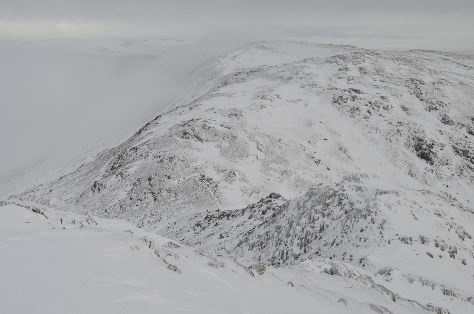 |
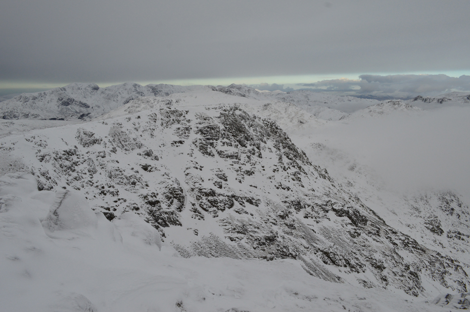
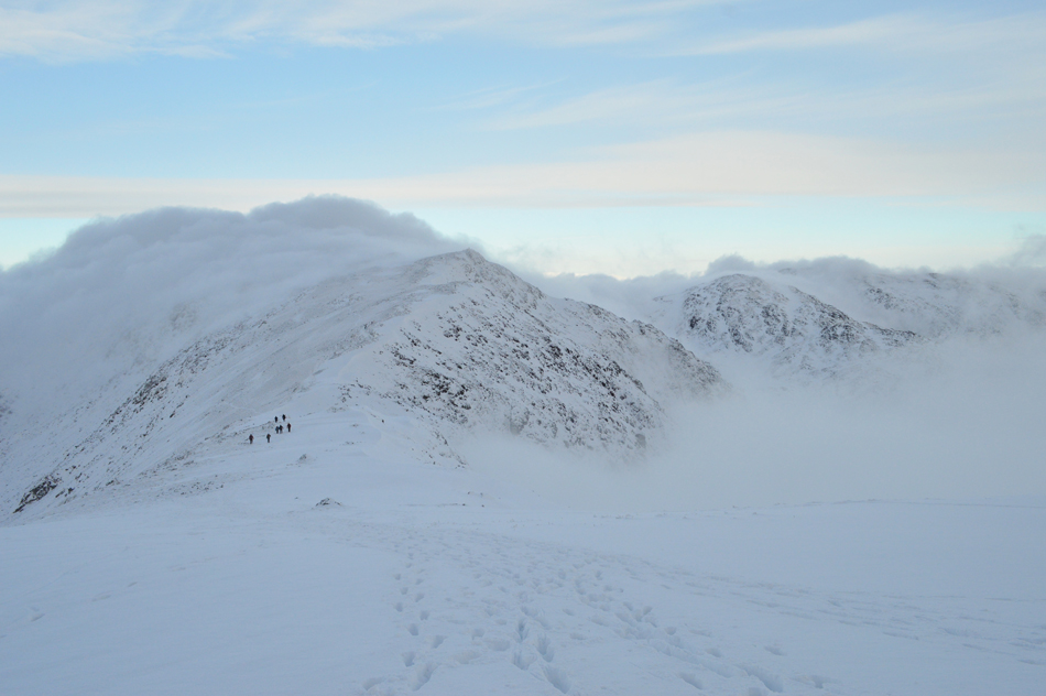
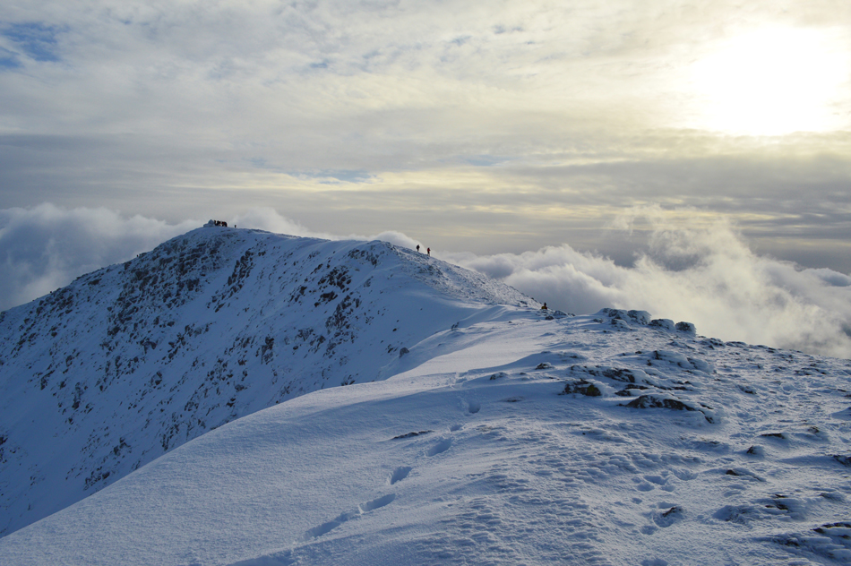
| Looking down on Prison Band towards over top of Swirl Hawse towards Black Sails and Wetherlam. |
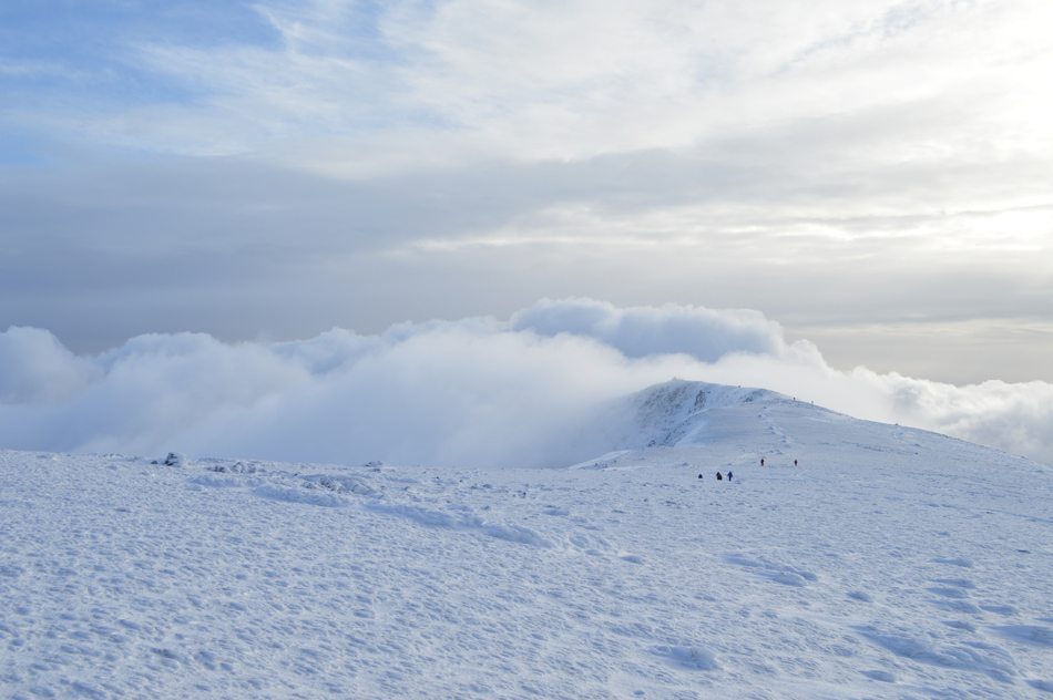
We gathered ourselves still in good stead on reaching the top of Swirl Hawse no doubt helped on by the advancing cloud inversion, at this point we just wanted to reach Swirl How summit where hopefully we would find ourselves above the cloud, but with the swiftness of the advancing cloud we would have to climb like mountain goats and that posed a problem in this snow.
We agreed to ascend Prison Band from the left it being the easier, less rocky route and with this we encountered snow drift amounting to around 60 centimeters in depth which no doubt slowed the whole process of ascent, we would sometimes take turns to lead/blaze trails and each would follow and at other times we found our own 'routes' and soon four fell walkers who we had seen at the summit from Swirl Hawse are passed.
The inversion has now caught up with us leaving us in mother natures hands whether we top out of the cloud or find ourselves within it on reaching Swirl How summit. |
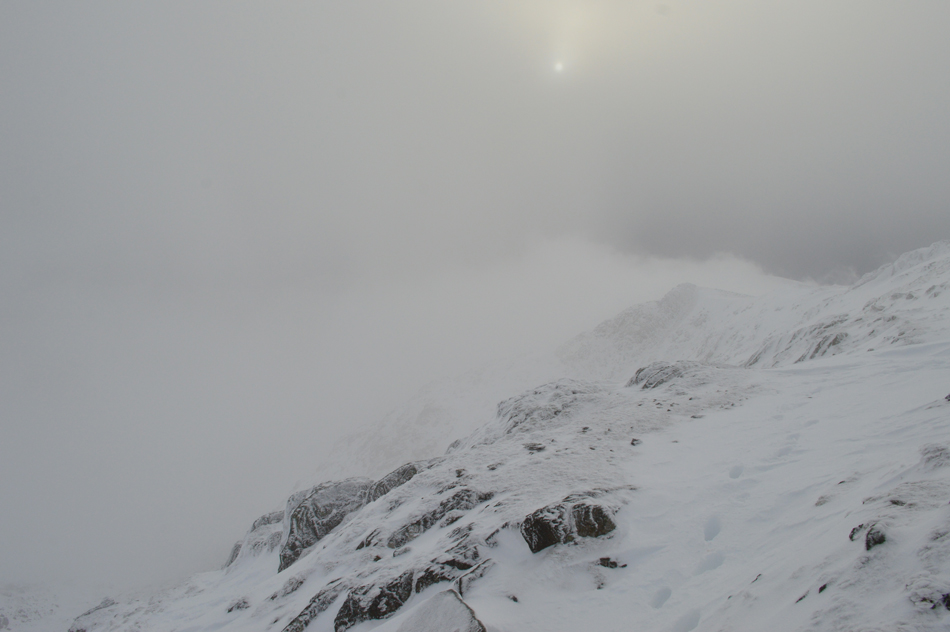 |
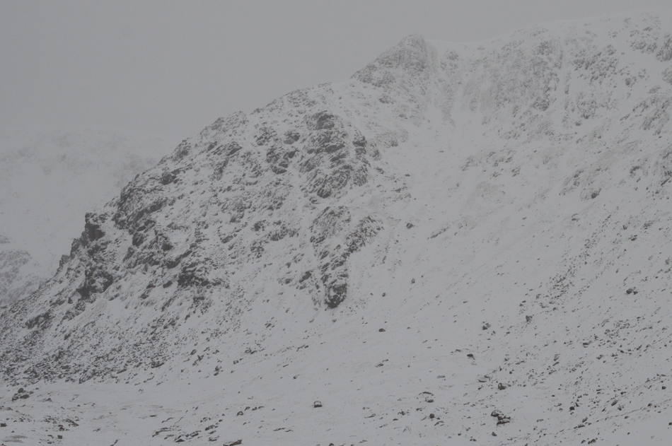
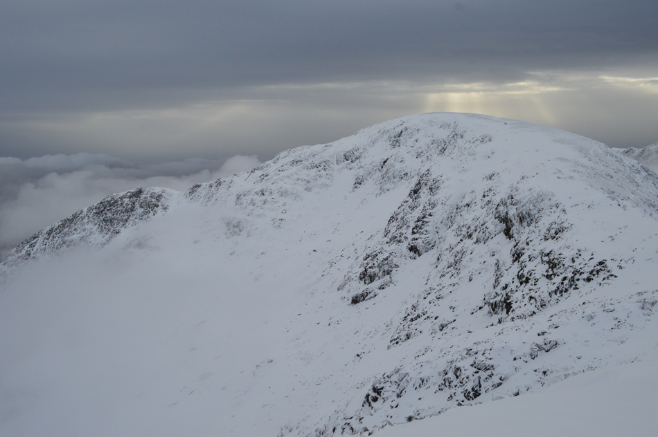
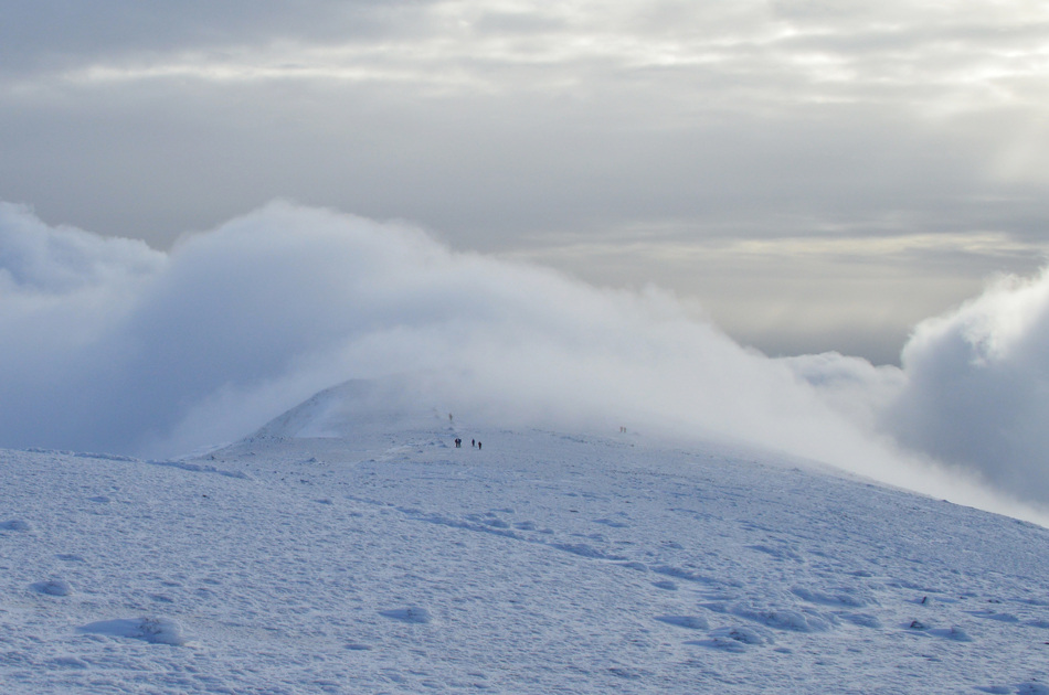
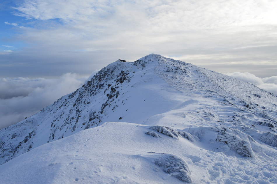
| Great How Crags seen through the cloud. |
| We're on the shoulder of the summit now and with any luck we might just top out of the cloud after all. |
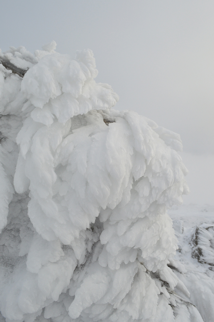 |
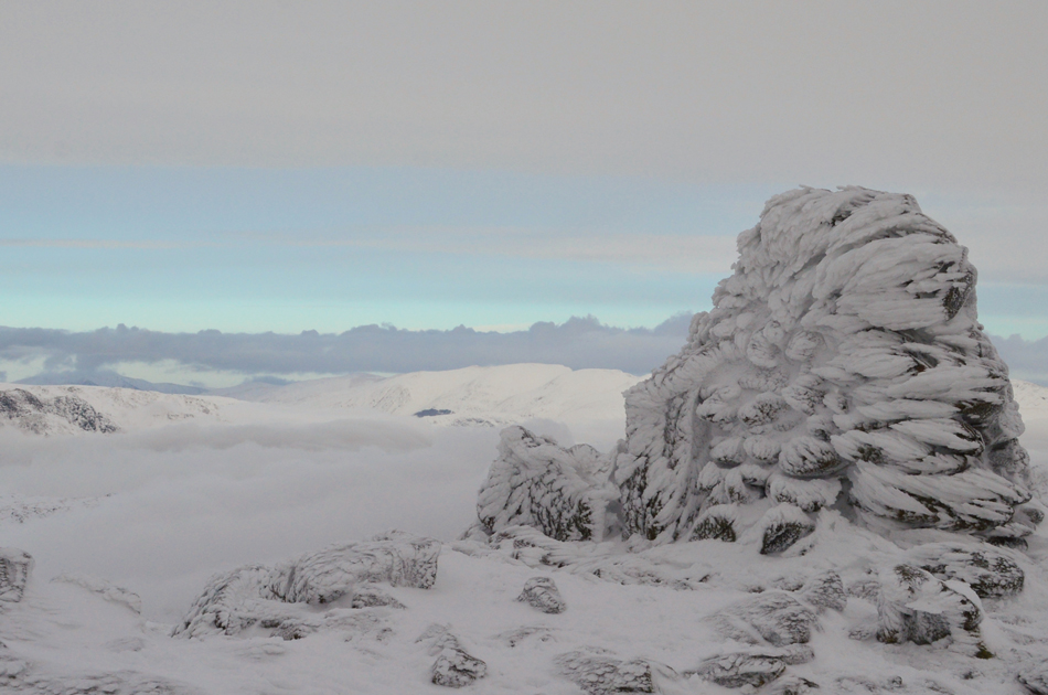
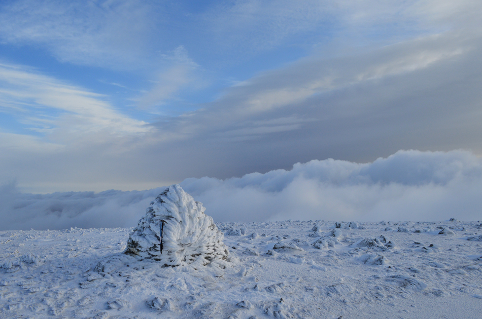
| Swirl How summit. |
| Beautiful ice formation over Swirl How summit. |
 |
| Dow Crag from Swirl How summit. |
We were elated to find that we had climbed through the cloud which infact had started to retreat back into the coves leaving for now, the ridge clear. We at first had to wait for the cloud to clear but this didn't take long which was when we agreed to have a break and maybe break out some lunch. It was a wise decision and with little to no wind the cloud continued to break halting between 500-600ft below. There might have been a severe windchill but the mood was certainly joyful.
We ate lunch stood up and I walloped down two chicken tika wraps which I had bought from the petrol station this morning followed by a sausage roll for afters, David was in heaven again with his oats and yoghurt lunch while the pair of us looked on as Rod sips hot chicken soup from his flask. |
 |
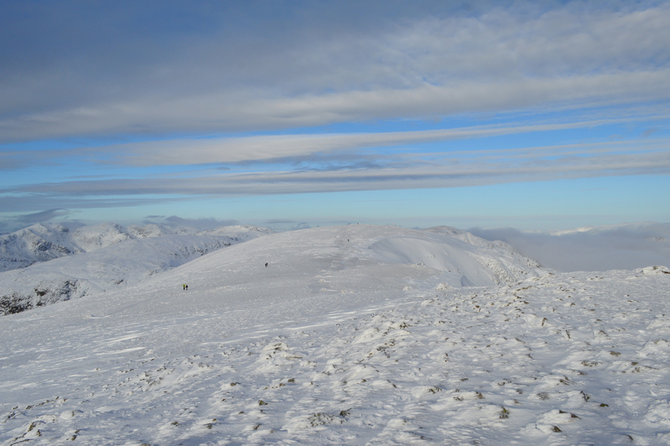
| The view over the Top of Broad Slack towards Great Carrs with the Scafells and Bowfell in the distance. |
| |
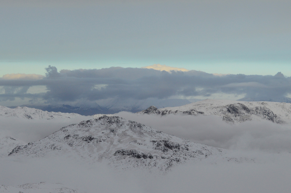 |
| Great Langdale and Little Langdale succumb to the cloud inversion. |
| The cloud inversion leaves Pike O'Blisco and the Langdale Pikes looking like Islands in the sky. |
 |
| Distant Eastern Lakeland fells from Clough Head to Fairfield. |
| It's astonishing how quickly the cloud is breaking beyond Great Langdale leaving vast patches of blue sky overhead but for now, the inversion remains in the valleys. |
 |
| One last photo of Swirl How summit before we leave. |
| What an incredible day it's turning into. |
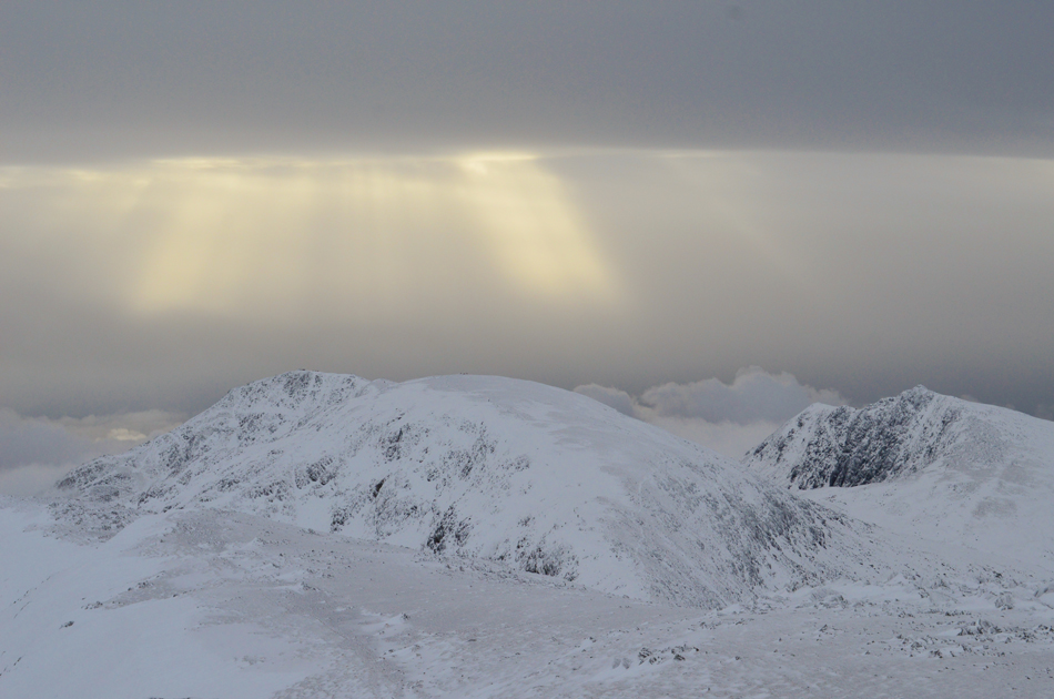 |
| Shafts of light over Coniston Old Man, Brim Fell and Dow Crag. |
| I prefer to call them 'Angels Torches' |
 |
| Great How Crags, Raven Tor, Brim Fell, Coniston Old Man and Dow Crag taken during the descent of Swirl How. |
| |
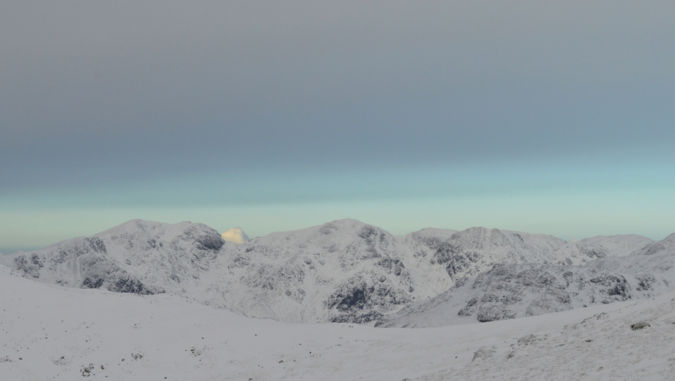 |
| Looking north westerly towards Cam Spout Crag, Sca Fell, Mickledore, Scafell Pike, Pen, Broad Crag, III Crag and Great End. |
| Wowzers the cloud sure is clearing from the north very quickly. |
 |
| Raven Tor and Brim Fell seen over Levers Hawse. |
| |
 |
| Here we have Grey Friar with Harter Fell (Eskdale) in the distance. |
| |
 |
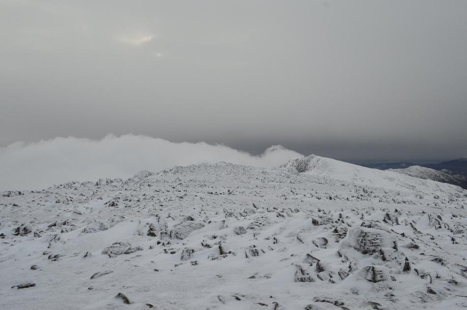
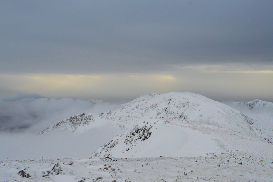
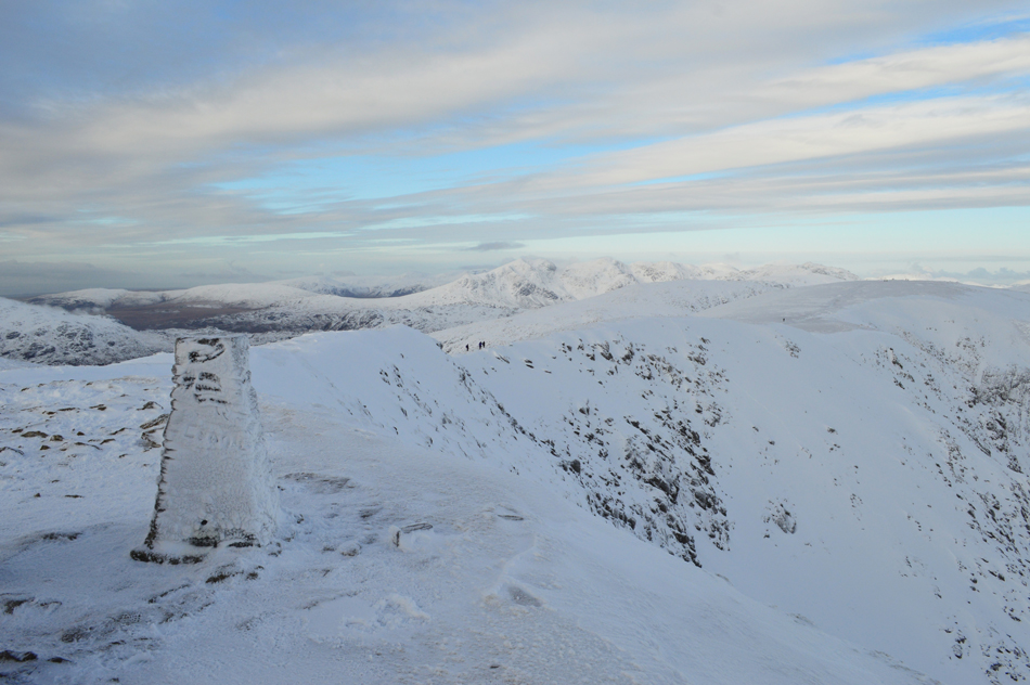
| Looking back over Levers Hawse towards Swirl How, Black Sails and Wetherlam. |
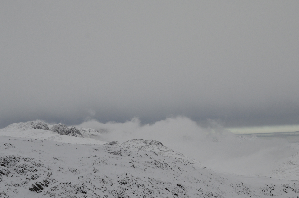
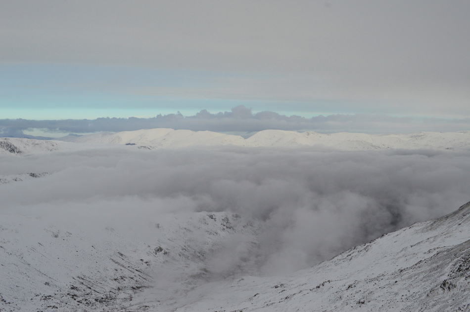
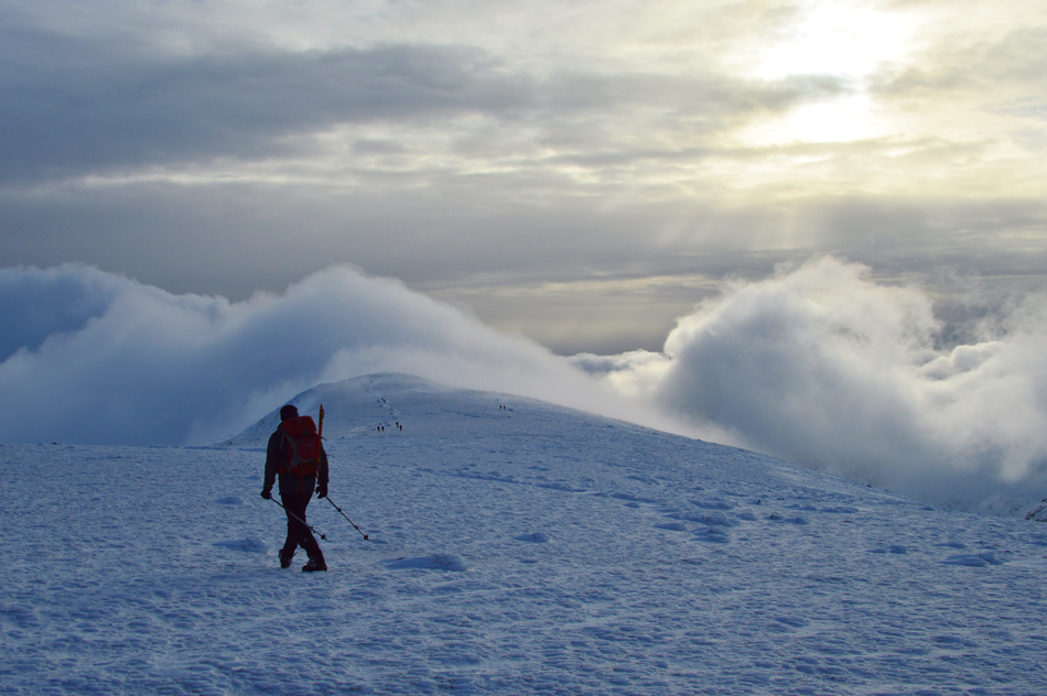
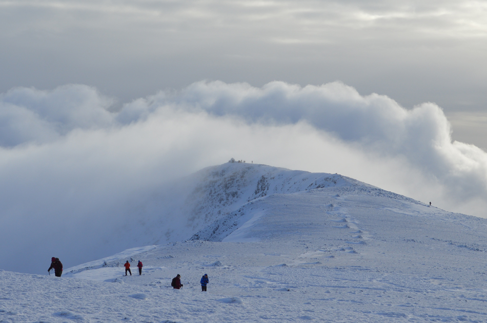
We were right not to judge how quickly the cloud was as once again it advances on our position after only leaving Swirl How around fifteen minutes earlier its summit is about to be engulfed by the inversion. It's soon made clear that the cloud inversion is working with air pressure rather than wind speed of which there is little to speak of.
Talking of cloud, it appears that Brim Fell, our next summit is just below it. |
 |
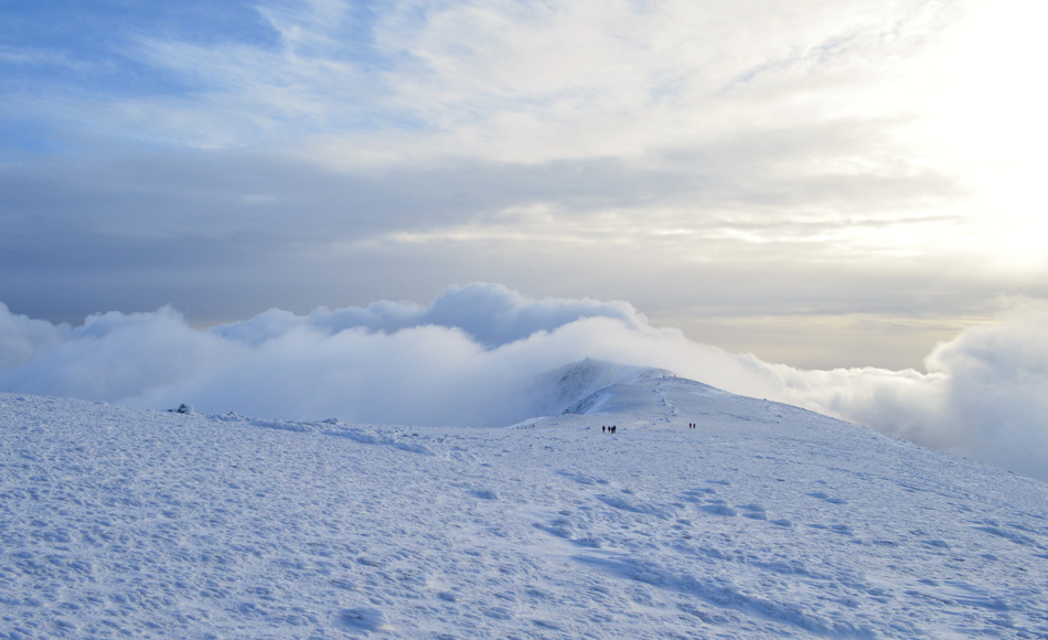
| Brim Fell familiar summit cairn appears through the cloud. |
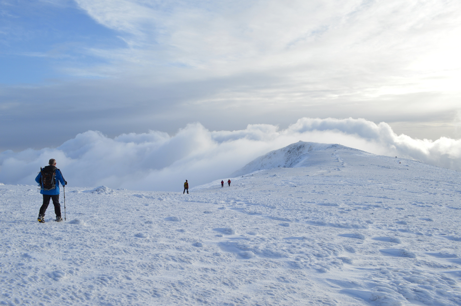
We were reminded of our earlier mornings work as we arrived at the shoulder of Brim Fell to be met with more snow drift, some of which was avoidable but it made sense to make a direct ascent no matter the pull on ones calfs. I had the intuition that we were just within the cloud and that just 80ft above our heads, clear skies, we all agreed, sooner or later the cloud had to clear.
We didn't have to wait long. |
 |
| Brim Fell summit cairn. |
| Within minutes of reaching Brim Fell the sun penetrated through and with it the cloud parted and the sky cleared. |
 |
| Dow Crag seen over Goat's Hawse from Brim Fell. |
| |
 |
| ...Cloud begins to retreat from Coniston Old Man summit |
| |
 |
| While I look on... |
| |
 |
| Coniston Old Man from Brim Fell. |
| Slowly the cloud starts to peel away from Coniston Old Man right at the same time the sun breaks through the cloud. |
 |
| Buck Pike and Dow Crag. |
| |
 |
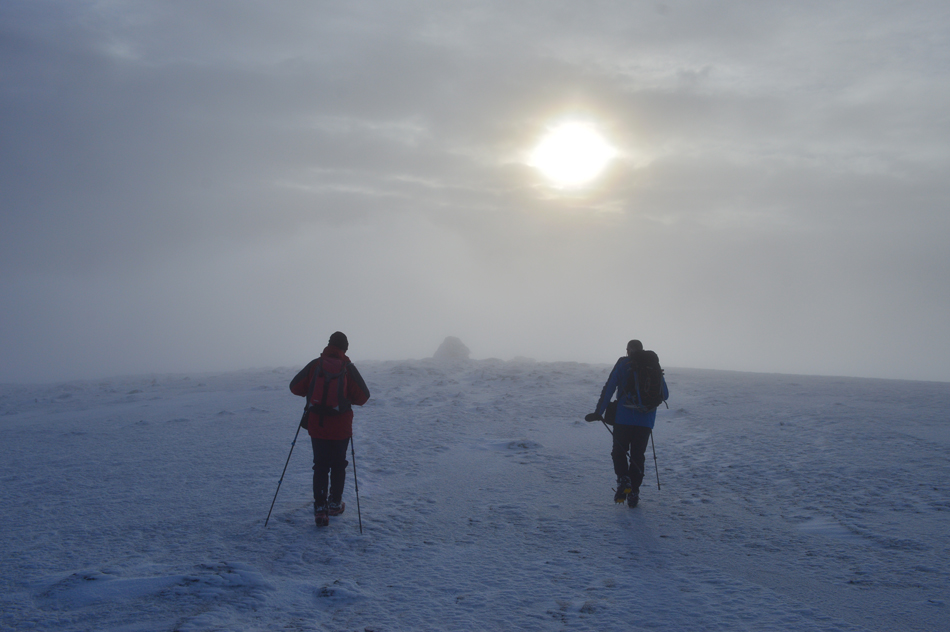
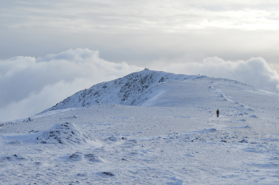
| Coniston Old Man is just up ahead. |
| It's looking increasingly busy. |
 |
| We press on along one of Lakeland best half miles. |
| |
 |
| "Like mother nature undressing" |
| We had met the chap seen up ahead back at Swirl How summit who turned out to be a Primary School Teacher from Staveley, a chap familiar to the Lakeland Fells who as it turned out spent last year back packing in South America on his mountain bike and has plans this year is to travel to Norway doing the same, a nice chap who we never got the name of who came up with term back on Brim Fell as the cloud lifted "like mother nature undressing" aye, we couldn't agree more. |
 |
| Looking back on Brim Fell as we near Coniston Old Man. |
| |
 |
| The Old Man is just up ahead now. |
| While the cloud and light dramatics continue. |
 |
| Coniston Old Man summit. |
| As we approach we can see a large gathering around the summit trig point. |
 |
| Brim Fell and the distant Scafells from Coniston Old Man Trig Point. |
We arrived at the summit while an organised group of school children numbering around a dozen in total posed at the summit trig point (this photo was taken while they were stood to the left of the trig point) the reason why I couldn't wait any longer was because we had each, camera in hands waited around five minutes to get the shot I wanted so I took it anyway. I don't like to write such things but why is it we are increasingly seeing such bad practice by organised groups on the fells and I'm not referring to the wait for the summit photo but shivering kids wearing nowt but track suit bottoms and school coats while group leaders sip tea from pop up shelters
Moving on.
Okay, we all got frustrated during our not so brief summit time and if we were to save this sinking feeling in the pits of our summits we needed to leave the summit. Did reaching the Old Man tinge what a great day we had, maybe, for the few moments we were there but it was soon forgotten as the sun did its magic and came out for the remainder of the walk. |
 |
| Reflection time. |
We left Coniston Old Man and began our descent via the mine track and Low Water, our descent seemed to take no time at all taking advantage of the soft powdery snow reaching Low Water in just eight minutes, looking back beyond a steady line of walkers a deep blue sky is clearing above the Old Man and faith feels restored. Crampons are finally removed beyond the ruined mine buildings and all that is left is the mile walk back to the village all the while reflecting on how todays walk started and ended with an incredible bit in between.
|
|
| |
| Back to top |
 |
|