|
Wetherlam Edge, Wetherlam and Steel Edge from Tilberthwaite |
 |
 |
3rd December 2017 |
 |
|
It's unusual, even rare to have such a clear spell of weather during the Winter months especially on the only day off you have meaning when this happens you have to grab it with both hands. The forecasters were telling me that east was best but after walking the east of the district these last few weeks I wanted to try my luck somewhere different so I set my sights on the Coniston fells.
The forecast differed but only between light cloud and prolonged bright spells, this I could work with. Initially I wanted to return to the Black Sails ridge, a favourite of mine that never fails to disappoint no matter the amount of times I've walked it. Then came Saturday evening when I was milling about on Memory Map on my laptop when Wetherlam and in particular Wetherlam Edge caught my eye, this caused me to think back of my last ascent which was actually a descent back in 2014 I knew right there and then where I'd be walking the next day.
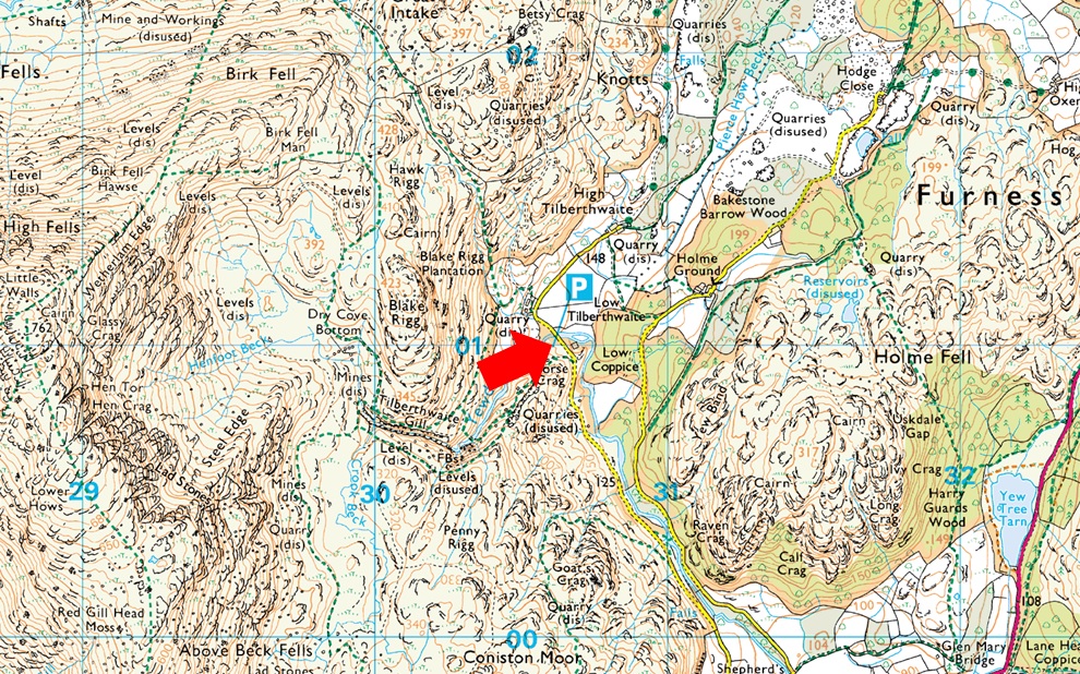
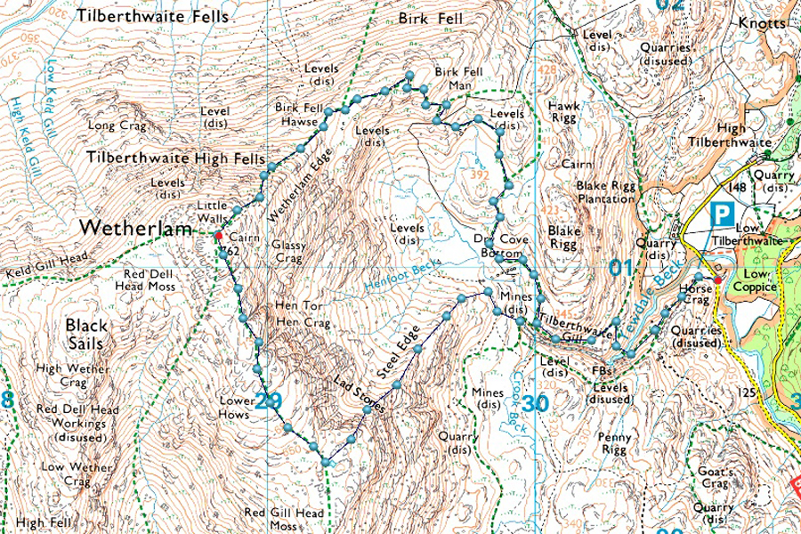
Next came which route would I take and seeing that I didn't have a full day to play with I came up with this route which takes in the impressive Wetherlam Edge and Steel Edge, all packed into a walk less than 5 miles long with enough punch to knock Mike Tyson over. |
|
| Wainwright Guide Book Four |
 |
| The Southern Fells |
-Wetherlam
Quite apart from an unusual shape of structure, however, and in addition to its merit both as a climb, and as a viewpoint, Wetherlam has one great climb deserving of close attention. |
 |
|
|
|
| |
|
Overview |
|
|
| Ascent: |
2,472 Feet - 753 Metres |
| Wainwrights: |
Wetherlam |
| Weather: |
Overcast to Start Remaining Dry and Sunny, Brisk Over the Summits. Highs of 9°C Lows of 8°C |
| Parking: |
Car Park, Tilberthwaite |
| Area: |
Southern |
| Miles: |
4.4 |
| Walking With: |
On My Own |
| Ordnance Survey: |
OL6 |
| Time Taken: |
3 Hours 50 Minutes |
| Route: |
Tilberthwaite - Tilberthwaite Gill - Dry Cove Bottom - Birk Fell Man - Birk Fell Hause - Wetherlam Edge - Wetherlam - Steel Edge - Tilberthwaite Gill - Tilberthwaite |
|
| |
|
Parking Details and Map |
|
|
| Nearest Post Code: |
LA21 8DG |
| Grid Reference: |
NY 306 100 |
| Notes: |
Nestled within the Yewdale fells Tilberthwaite car park is perfect for taking on Wetherlam and the Yewdale Fells. The car park is spacious but during peak season can fill up quite quickly, late arrivals maybe disappointed. There is an Honesty Box sittuated on the quarry side of the car park. |
|
| |
|
Map and Photo Gallery |
|
|
 |
| |
| |
 |
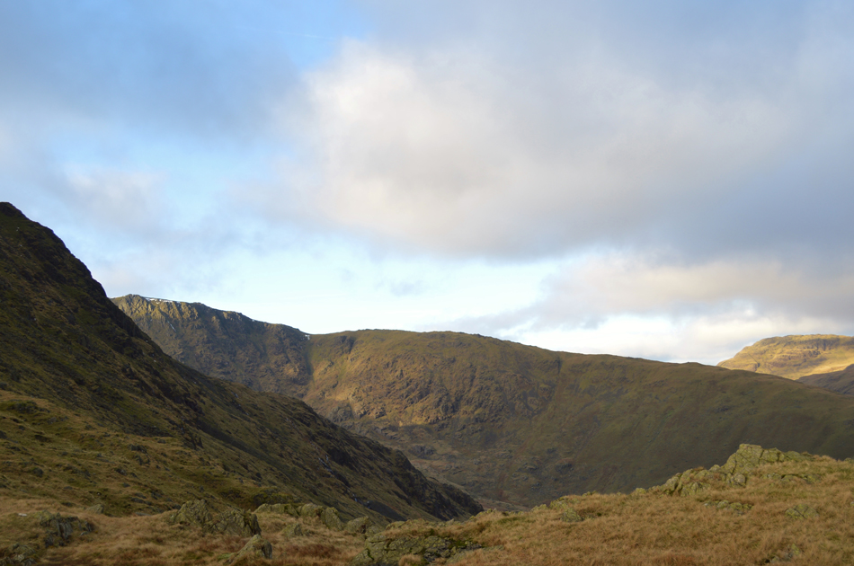
| Over looking Tilberthwaite with views towards Great Intake 08:40am 8°C |
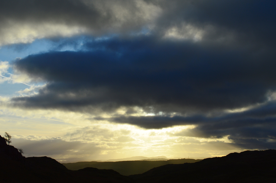
After working yesterday (Saturday) I thought I'd treat myself to a lie in only leaving home around 06.50am which saw me arrive in Tilberthwaite around 08:30am. Sunrise had already broke and by the time I arrived in Tilberthwaite sunlight was creeping into the valley leaving a bright horizontal streak against the fell side, it was mild too at a barmy 8°C which was accompanied by a gentle breeze leaving the morning feeling more like early Spring rather than the depths of Winter. I leave my warm hat and instead put my baseball cap on leaving my gloves tucked into the lid of my pack which I have no doubt I will need later.
After locking the car I turned around and started the steady ascent via the familiar stone staircase which then levels out after catching my breath at the top alongside Tilberthwaite Quarry which I have passed on many occasions but have never really explored, seeing that today I have a little extra time on my hands given the length of my walk I thought I'd go and have a quick look around. |
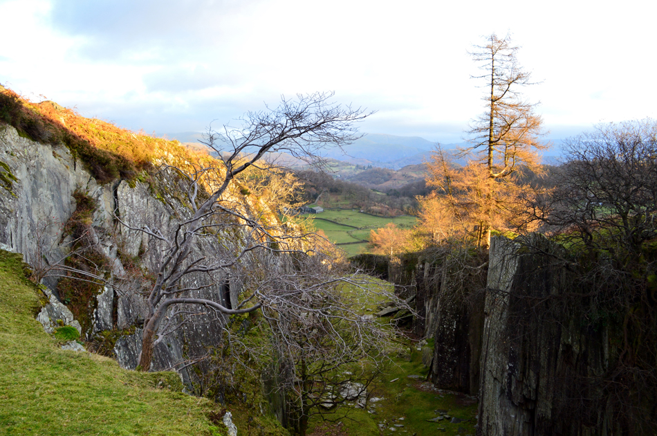 |
| Tilberthwaite Quarry. |
| From the high level looking down into the quarry...I'm not sure what caught my eye the most, the vertical quarry walls or the sunlight captured in the Pine Trees. |
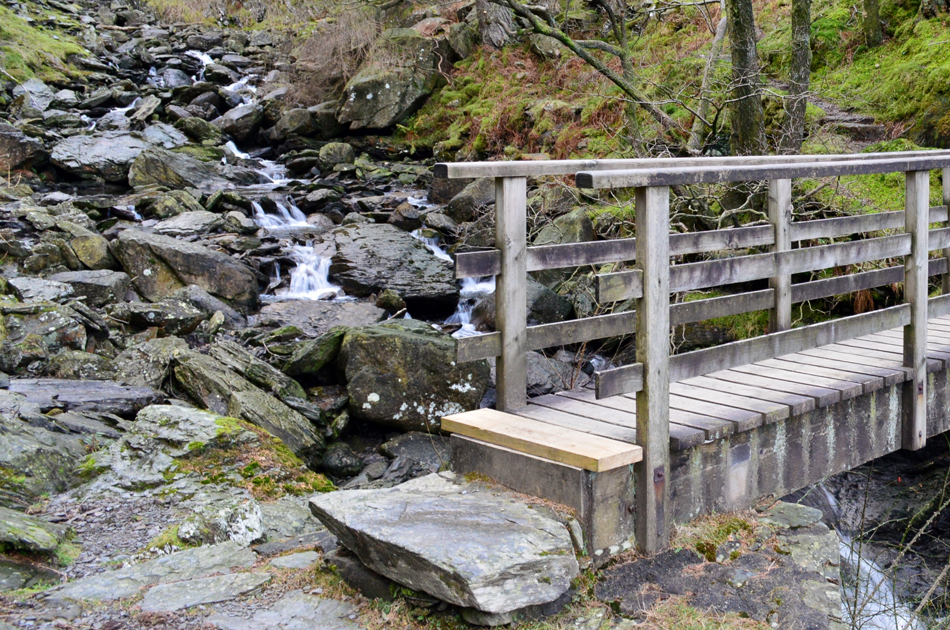 |
| Crossing Yewdale Beck at Tilberthwaite Gill. |
| The path continues as my view opens out over the tree tops in Tilberthwaite Gill towards the mass of Wetherlam and Steel Edge, here the path forks left or right, heading left here navigates around the southern edge of the Gill while heading right descends into and then out of the Gill on its north side, I head right and begin the steep descent towards the footbridge over Yewdale Beck. The observant will notice the new wooden step on the footbridge! |
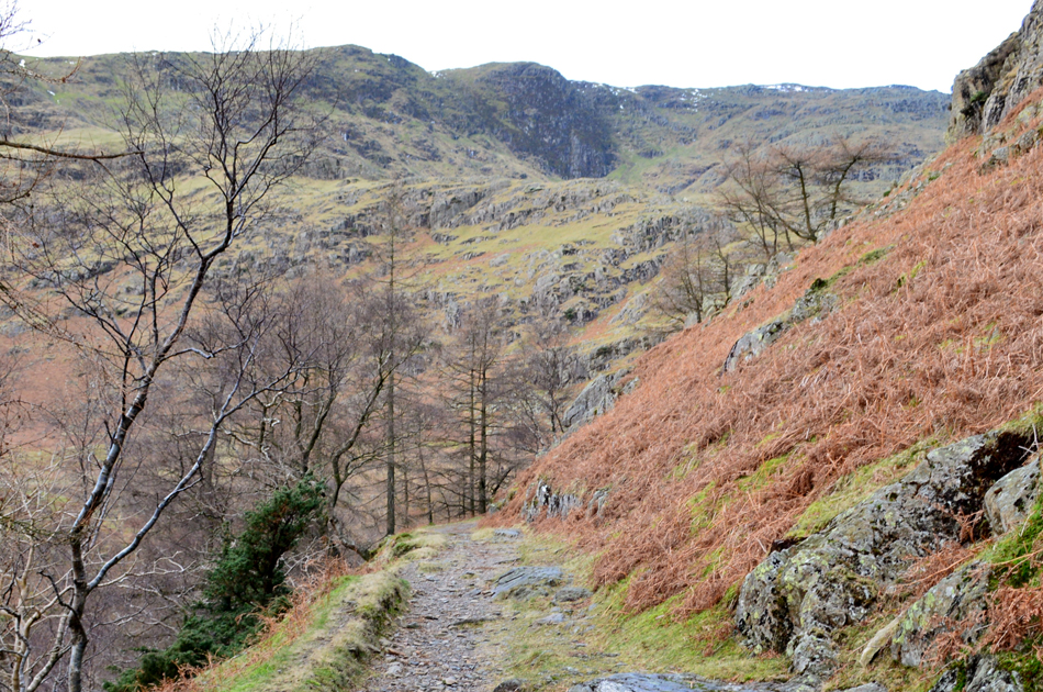 |
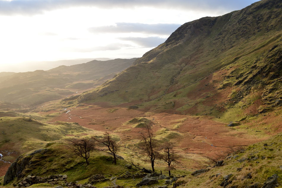
| Distant views of Steel Edge as Tilberthwaite Gill falls sharply to my left. |
You'd be forgiven for saying that from here, Steel Edge doesn't look like an edge nor a ridge for that matter but it's just trickery of the eye as you will see later.
Soon after taking this photo I am passed by two walkers, a chap and his wife who appeared to have wild camped last night but I didn't ask them where. |
 |
| Steel Edge. |
| Steel Edge is starting to look more like a ridge now and from here I can get a good view of the ground conditions although to confirm this I'll have to be on the ridge itself. My main concern was of snow and ice and although I can confirm there appears to be no snow albeit a few patches, until I am on the ridge later I'll just have to keep my wits about me. |
 |
| Steel Edge seen over Dry Cove Bottom. |
A good path keeps the boots dry navigating around Dry Cove Bottom while steadily climbing past the disused levels which in these modern times are fenced off to prevent sheep and even humans from falling into them but only as far back as forty years ago these levels weren't fenced off at all and the only way you knew you'd fallen into one was when it was too late.
Just in case you were wondering that's Hen Crag on the right with the wonderfully named Hen Tor further right...I've always wanted to get up close with Hen Tor, who knows one day I will. |
 |
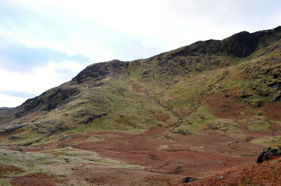
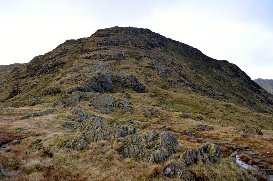
| Birk Fell Man with Birk Fell Hause seen over on the left. |
My path to Birk Fell Hause can be seen just above the trees in the bottom right corner which then zigzags steadily towards Birk Fell Man summit, should you want to continue onto Birk Fell Man summit it's just a simple case of keep right once the top of the path is reached.
I won't be visiting Birk Fell Man summit today, I'll leave that until I start my Birketts next year. |
 |
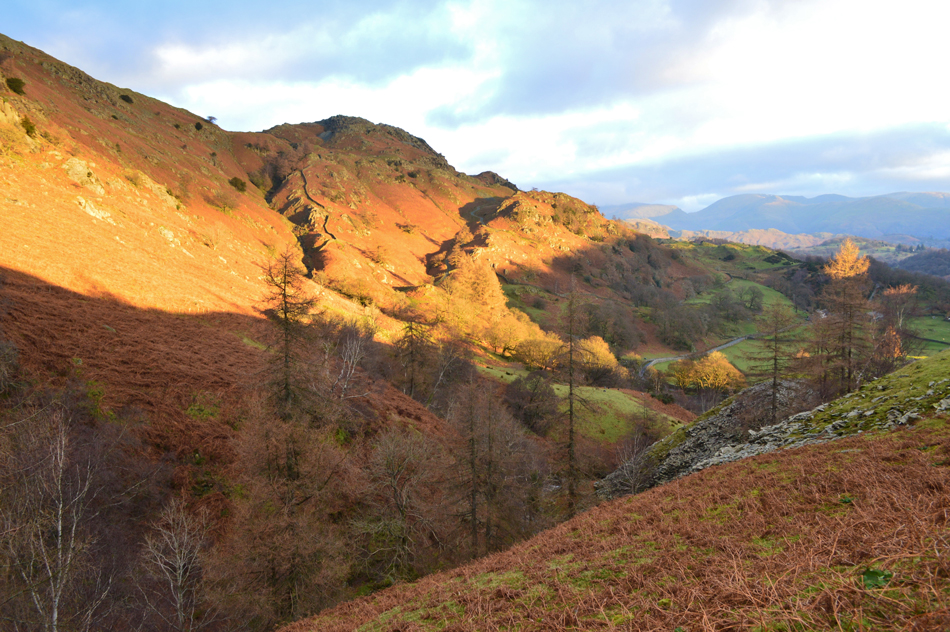
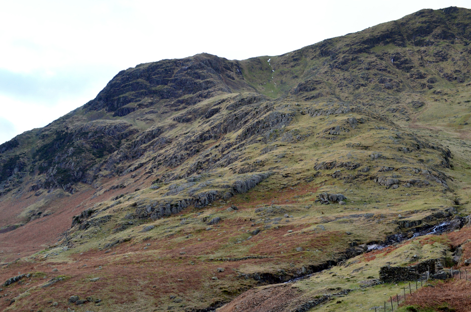
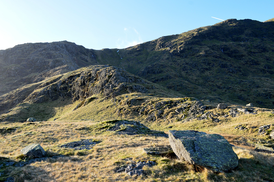
| Wetherlam Edge and Birk Fell Hause. |
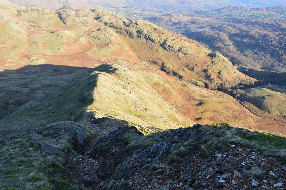
| I've had it too easy up until now where the hard work now begins, here you can see the path more clearly in the centre right of the photo where it appears to take a direct route towards Birk Fell Hause but this isn't the case, instead the path veers right through the upper crags. |
 |
| Steel Edge seen over Dry Cove Bottom |
Steel Edge is really taking form now although I must admit I think I must have lost my footing slightly when I pressed the shutter button on my camera, I'm sure Steel Edge really isn't that steep!
Just in case you were wondering the craggy outcrop in the foreground appears as '392 on the map at the top of this page. |
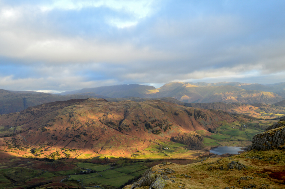 |
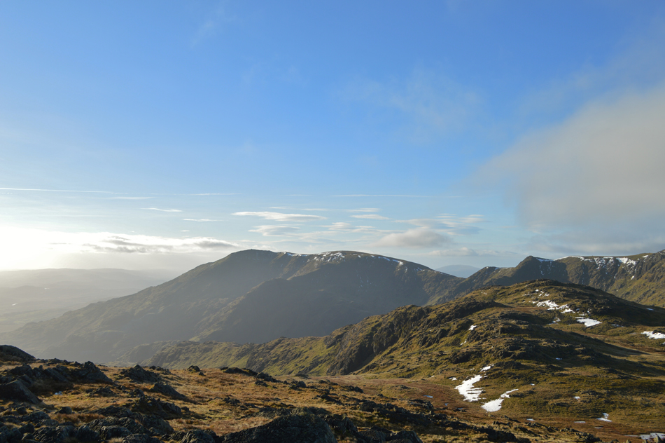
| Views over Little Langdale towards Lingmoor Fell and Little Langdale Tarn from Birk Fell Hause. |
| That's the Hevellyn group on the left who's summits are just below cloud while further right the Fairfield group escapes the cloud with Great Rigg and Fairfield enjoying a glimpse of sun. |
 |
| Distant Langdale Pikes with Blea Tarn and Side Pike over on the right enjoying a hint of sunshine. |
| |
 |
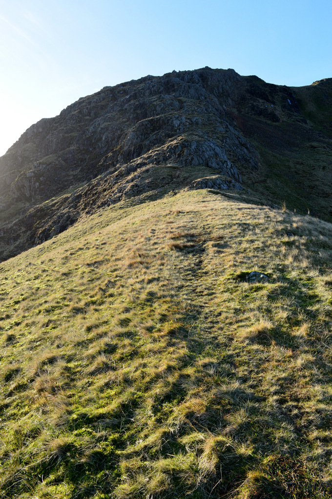
| Wetherlam Edge from Birk Fell Hause. |
Having the right to exercise caution is a must during the ascent of Wetherlam Edge while from down below the ascent appears to be straight forward yet there are many 'little hands on scrambles' to be dealt with while at the same time box clever by checking the next twenty yards of ascent you are about to take especially if its your first time on the edge. |
 |
| Great Carrs, Wet Side Edge and Little Stand seen over the Greenburn Valley from Birk Fell Hause. |
| |
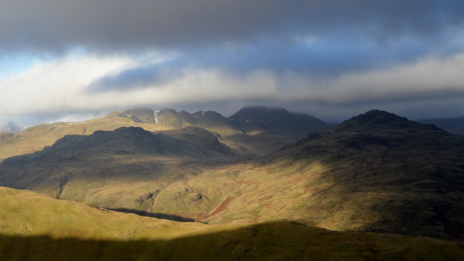 |
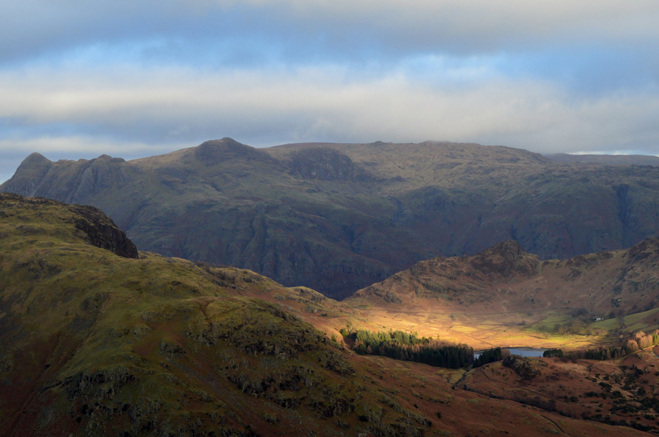
| Atmospheric views towards Pike'OBlisco, Cold Pike, Great Knott, Crinkle Crags and Bowfell. |
| The snow filled gullies of Crinkle Crags really caught my eye. |
 |
| Looking down on Birk Fell Hause and Birk Fell Man from Wetherlam Edge. |
| The ascent of Wetherlam Edge is quite steep from the start and there are two paths you can follow although both meet and join together around half way up the ridge, I took the left path which climbs through gullies with the odd little hands on scramble mixed in, the path on the right tends to avoid this. It wasn't long before I started to feel the affects of the windchill mainly on my hands and so I found a nice little perch and de-shouldered and slipped my gloves on, turning around I noticed a patch of unavoidable ice which only stretched about three feet in width but it stretched straight across the path, I could have gone for the spikes but after a quick look around I noticed a series of grassy ledges off to my left, I followed the ledges around by eye making sure I could link back up with the path which I found I could, that was my only encounter with ice during my ascent of Wetherlam Edge although this isn't to say that that more ice wasn't seen, its just that it was easily avoided. |
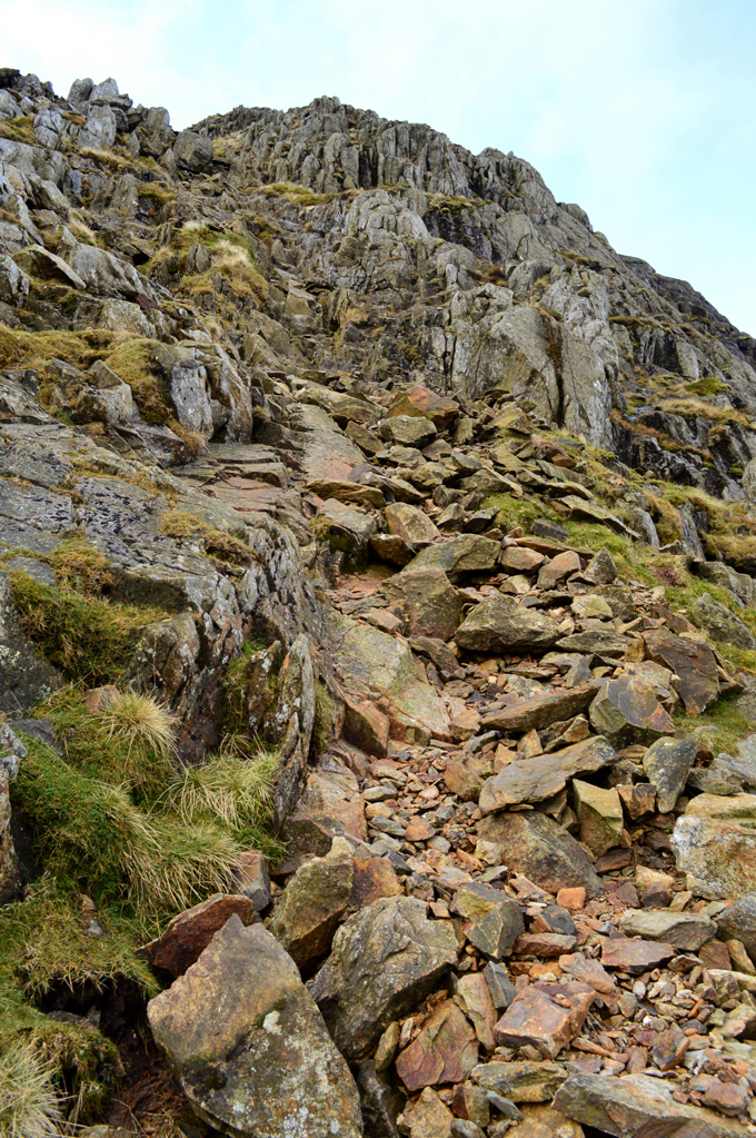 |
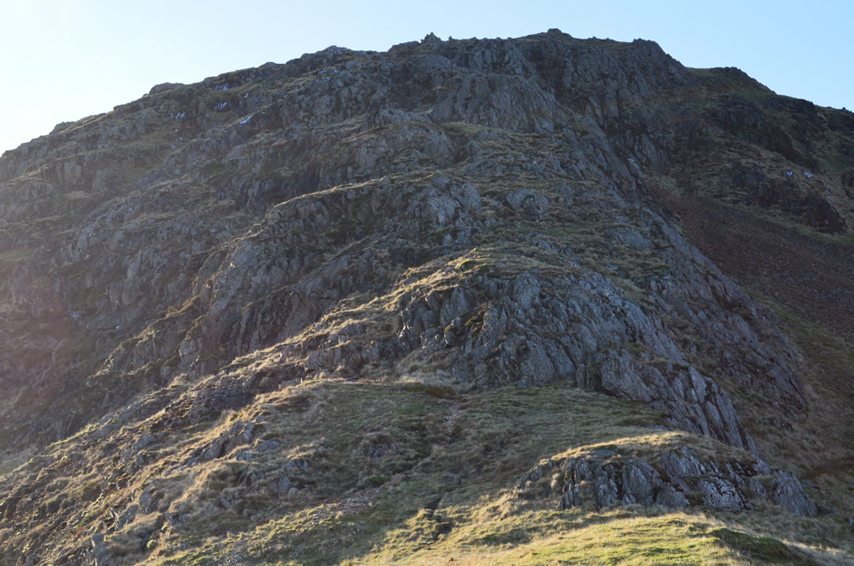
| Not far from the summit now. |
| It's hard to describe this last bit of the ascent as a gully or a rake because there's no real feeling of enclosure. Care was taken mainly due to the loose boulders and rocks meaning it was always best to test footings first especially during the lower half of the ascent where the rock was loose and unstable. |
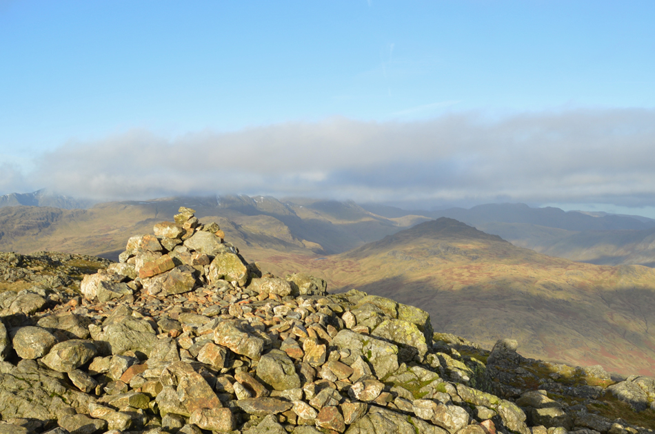 |
| Wetherlam Summit Cairn. |
| After topping out at the top of the stone gully the summit cairn was almost in sight leaving just a short steady stroll over the summit shoulder right about the same time the sun decided to make an appearance. I hadn't seen anyone since the couple earlier back at Tilberthwaite Gill that however was before I spotted movement a few feet away from the summit cairn. |
 |
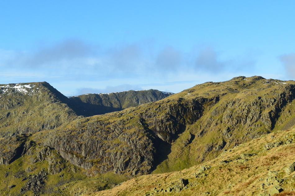
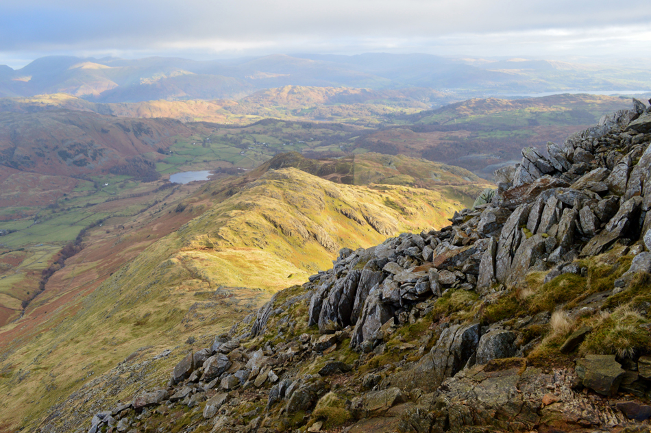
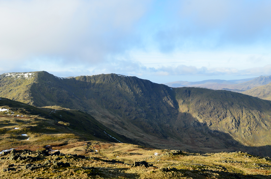
| Outstanding views over the Black Sails ridge towards Great How Crags, Brim Fell, Raven Tor and Coniston OId Man. |
| It turned out to be two young girls who were fell runners, on arrival at the summit cairn I smiled a 'morning' but never got one back, ney bother. I turned around and took in the views over Little Langdale and beyond noting that cloud still layered the Helvellyn fells and it looked to be in for the day but it's still early I guess. The two fell runners checked their map and descended from the summit and made a pathless ascent on Black Sails, the last I saw of them they were stood at its summit. |
 |
| The view from my perch overlooking the Greenburn Valley with Swirl How, Great Carrs and Wet Side Edge. |
It felt great knowing that I had reached my one and only summit of the walk, more so because I knew I had wee bit of spare time which I spent whilst sitting down observing this view over the Greenburn Valley just watching the crispness of the light as it cast long shadows over the cols and ridges, a spectacle that can only be captured and not photographed.
I took a 360° short clip with my camera phone and in doing so I had to grip my glove with my teeth in order to pull it off so I could press the touch screen on my phone, 30 seconds later that hand started to feel the windchill so I eased the glove back on and tucked my phone back into my chest pocket.
Finding a place out of the windchill was easy, tearing myself away was much harder. |
 |
| Wetherlam Edge, Birk Fell Man and Lingmoor Fell from the top of Hen Crag (gully) |
| |
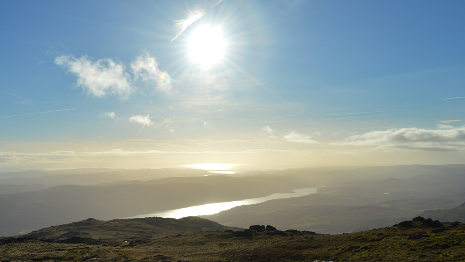 |
| Winter sun over Coniston and Morecambe Bay. |
| |
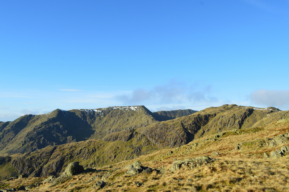 |
| The view over the Black Sails ridge towards Great How Crags, Prison Band, Swirl How and Great Carrs. |
| The light just seems to be getting clearer by the minute. |
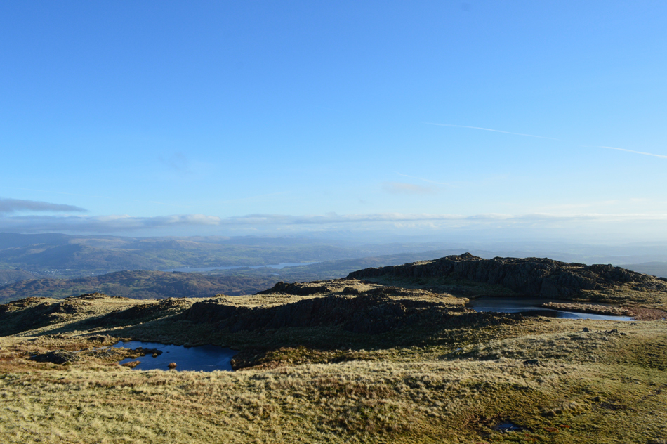 |
| The two un-named Tarns found at the top of Steel Edge. |
| I was in no hurry to reach Steel Edge just yet instead I pottered my way down the ridge taking in the hazy view towards the Old Man with a glistening Morecambe Bay beyond. With the Tarns reached this is the point where I head north eastwards towards the top of Steel Edge (you can see the top of the ridge in the far left of the photograph) The ridge is easily reached from the Tarns but I found the path from the far Tarn more prominent and less uneven. |
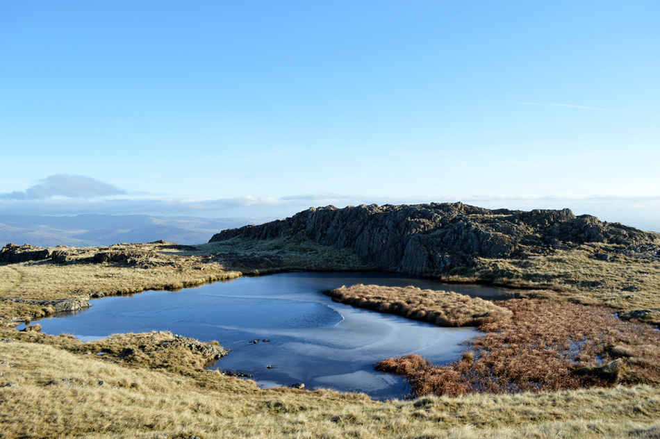 |
| Frozen Tarn, close to the top of Steel Edge. |
| |
 |
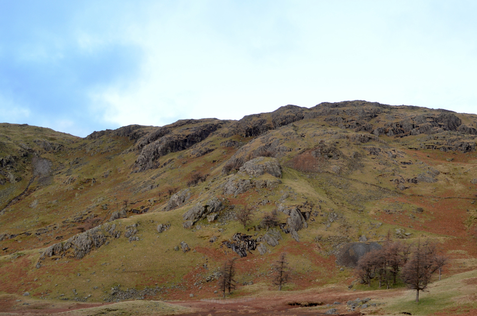
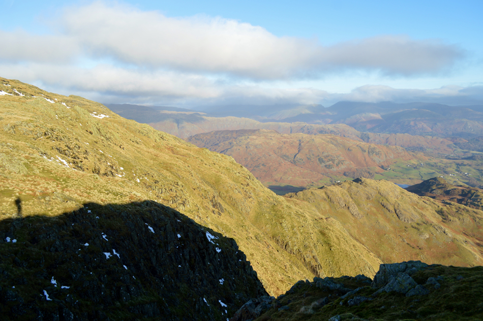
| Blake Rigg from my Steel Edge descent. |
It was wise to avoid the two rock gullies found close to the top of Steel Edge, this I did by carefully studying a way around via a series of grass ledges sometime nipping into, or crossing the gully at safe points, my concern from the start was of course ice which I never encountered then second, wet greasy rock. I avoided most firm boulders when I could mostly coming into contact with fixed rock before trusting my footings first, this made for a steep but safe descent by using a combination of grass ledges, gully and scree. |
 |
| Looking back up at the upper section of Steel Edge. |
| You may just be able to make out the two rock gullies in the upper centre of the photograph. |
 |
| Looking back on Steel Edge. |
| |
 |
| Steel Edge. |
| My plan now is to make my way over to Crook Beck from where I think I've earned myself an early lunch. |
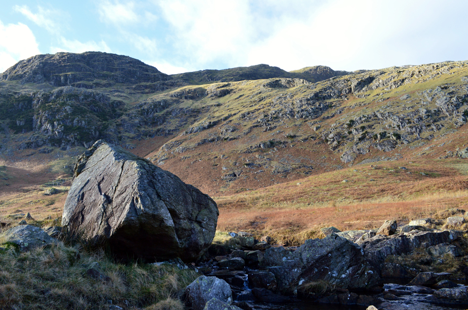 |
| Steel Edge from Crook Beck. |
I pass an elderly gent wearing a pair of green tweed trousers tucked into a long pair of blue walking socks and we both mumble our 'mornings' as we pass by. On the opposite side of Tilberthwaite Gill two large groups make their way around Drybottom Cove just as I had this morning as I sit lent against a boulder eating my early lunch. The sun beams down low in the sky and I could easily take off half my kit and get away with walking back to the car with my sleeves rolled up but seeing as I'm so close to the car the faff is too much so I sweat it out instead.
With lunch over I cross Crook Beck and take in Tilberthwaite Gill from t'other side before beginning to walk the last half mile back to Tilberthwaite. From the top of the quarry I spy my car and about a dozen more while one other car scours for a parking place, happen I'll be done soon and he can have my place but I've got my peanut Kit Kat to finish first. |
|
| |
| Back to top |
 |
|