|
The Esk Hause Fells from Seathwaite |
 |
 |
2nd September 2017 |
 |
|
Despite having a green light for a walk this Saturday I hadn't really thought too much about where to walk mainly because with the weather being as unsettled as it has been planning walks days ahead as of late is fast becoming a memory, due to this I've been planning routes only days before or sometimes just 24hrs previously but this weekends forecast looked more settled and the forecast from Thursday onwards remained that way.
At last, a dry bright Saturday.
With this I came up with this route "The Esk Hause Fells from Seathwaite" and on Thursday evening I e-mailed David to ask would he like to join me after touching on the subject last weekend on how David had been missing out on the higher Fells as of late due to ongoing treatment to his right foot which is recovering better than expected, I half expected David to air on the side of caution and maybe leave it for another week but David agreed to join me and added instead of starting and ending the walk in Seathwaite why don't we first park at Stonethwaite before heading out to Seathwaite meaning we could take in the magnificent Langstrath valley on our return, sounds like a plan to me.
With a green light on both forecast and route Rod e-mailed at Friday lunchtime to ask "when was we three getting back together for a walk" I was mad busy in work but returned Rod's e-mail with details of todays route ending my e-mail with "you know you want to!" |
|
| Wainwright Guide Book Four |
 |
| The Southern Fells |
-Esk Pike
Did it but stand alone, away from such enticing neighbours, Esk Pike would rank highly among the really worth while mountain climbs. |
 |
|
|
|
| |
|
Overview |
|
|
| Ascent: |
4,154 Feet - 1,266 Metres |
| Wainwrights: |
3, Allen Crags - Great End - Esk Pike |
| Summits Visited: |
5, Allen Crags - Great End - Broad Crag - III Crag - Esk Pike |
| Weather: |
A Bright And Sunny Start Turning Overcast Around Midday. A Warm Sun Retured Towards The Latter Of Walk. Highs of 20°C Lows of 5°C |
| Parking: |
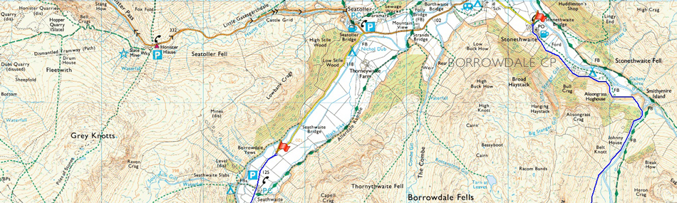
Using x2 Cars, Seathwaite Farm - Parking Spaces, Stonethwaite |
| Area: |
Southern |
| Miles: |
15 |
| Walking With: |
David Hall & Rod Hepplewhite |
| Ordnance Survey: |
OL6 |
| Time Taken: |
8 Hours |
| Route: |
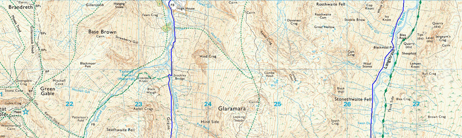
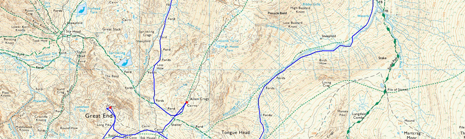
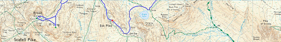
Seathwaite - Grains Gill - Esk Hause - Allen Crags - Calf Cove - Broad Crag - III Crag - Great End - Calf Cove - Esk Hause - Esk Pike - Ore Gap - Angle Tarn - Angletarn Gill - Langstrath - Langstrath Beck - Tray Dub - Stonethwaite |
|
| |
|
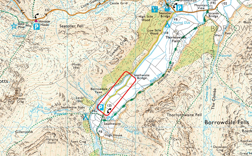
Parking Details and Map |
|
|
| Nearest Post Code: |
CA12 5XJ |
| Grid Reference: |
NY 235 712 |
| Notes: |
I guess its fair to say that Seathwaite is to Lakeland what Times Square is to New York. Set deep within the heart of Borrowdale, deep within the heart of the Lake District Seathwaite is the hub of Lakeland. Seathwaite is the starting point for many a walker heading for the highest ground in England including, during the Summer, when hundreds of 'Three Peakers' visit Scafell Pike. There is room for ample parking and its quite difficult to put a figure on how many cars and mini buses park in the valley at any one time which I estimate between thirty to fifty cars per day, the latter parked half way up a hedgerow! Up until Spring 2017 the Farmer would allow parking right up to the entrance to Seathwaite Farm but because of the many inconsiderate parkers the Farmer has now restricted this by leaving large boulders on either side of the lane for up to two hundred yards. If early you can still park close to the Seathwaite Farm and still enjoy a great day on the high fells but please be considerate to Seathwaite Farm by not blocking any access gates because I have seen pictures of vehicles being lifted away by a fork lift truck. During peak season such as Summer the Farmer opens up a field on the left hand side and charges £3.00 for all day parking. Not bad value considering the amount we all take away from a day on the fells. Off peak, Parking is free. |
 |
|
| |
|
Map and Photo Gallery |
|
|
 |
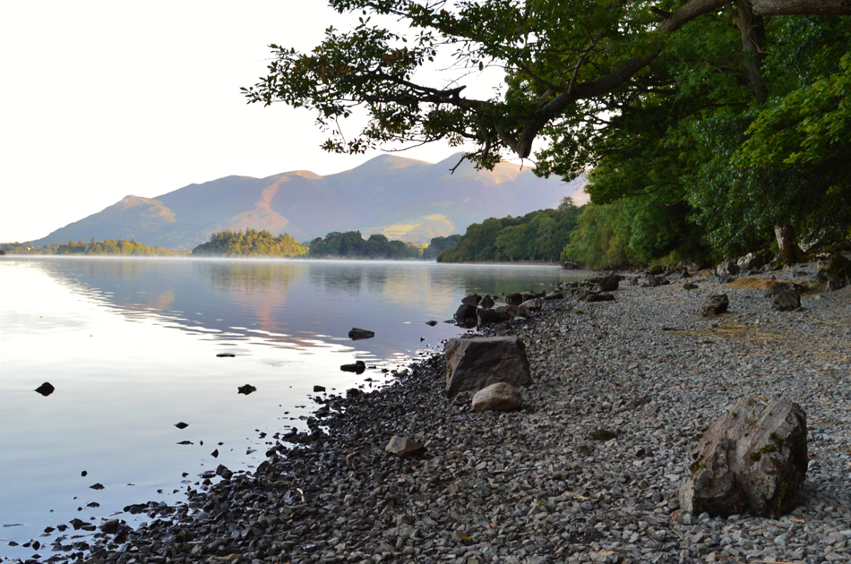
| Cat Bells and Barrow from Ashness Landing Stage. |
| With just a few moments to spare before meeting up with David at Stonethwaite I couldn't resist taking a few photographs from the Landing Stage at Ashness. |
 |
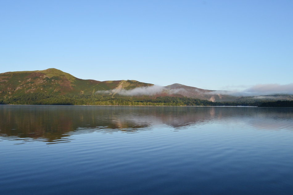
| Morning mist over Derwent Water with views over Skiddaw. |
| With not a cloud in the sky, it's set to be a great day to be out on the fells. |
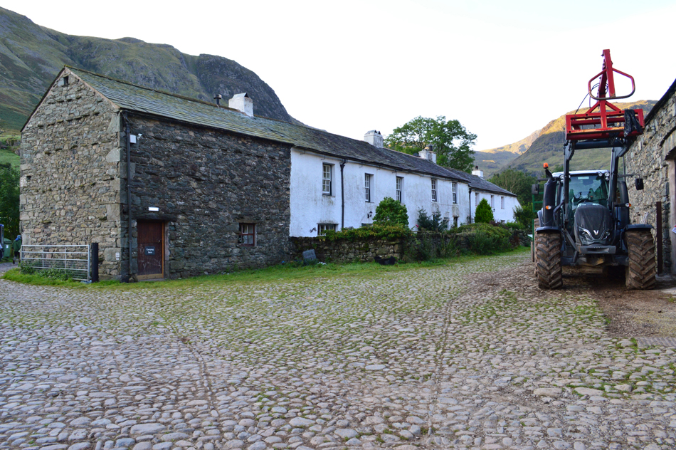 |
| Seathwaite Farm 08:00am 5°C |
I had in fact been following Rod from the A66 and we were heading through Keswick together before I stopped at the bottom of Ashness Bridge to take a few photographs from the Landing Stage before I headed back to the car to meet David at the arranged time of 07:45am. David was already there by the time I arrived at Stonethwaite where we agreed to leave my car before taking the short journey to Seathwaite where we knew Rod would be waiting. Minutes later we arrived in Seathwaite and found Rod getting his kit ready parked next to the gated entrance to field, David eases his car into a gap a cars length from Rod's car leaving space for the farmer to enter the field should he wish.
It's been a few months now since the farmer quite rightly so left large boulders on either side of the narrow lane if only to alleviate irresponsible parking which would often block access for large machinery and even emergency vehicles in and out of the farm yard and photographic evidence proves that the farmer will literally forklift said offenders vehicles out of the way which I guess he has every right to do so. Because parking is now an issue the farmer has kindly opened up a field on which to park for just £3.00 a day, I don't think you can get any fairer than that given that Seathwaite is the main starting point for a trip onto Scafell Pike and surrounding peaks as todays walk demonstrates not forgetting to mention 'Three Peakers' who often start from Seathwaite.
We as always greet with a handshake before lacing our boots up and getting the final bits of our kit ready. Despite the valley being largely in shade it's quite a chilly start to the morning at just 5°C possibly the coolest start I've experienced since last Winter which can only mean that we're caught between two seasons of Summer and Autumn, a great period to be out on the fells, lets just hope the coming weeks remain dry and clear. |
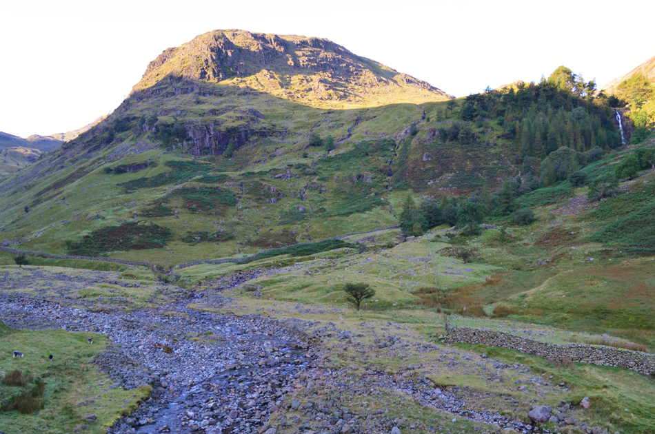 |
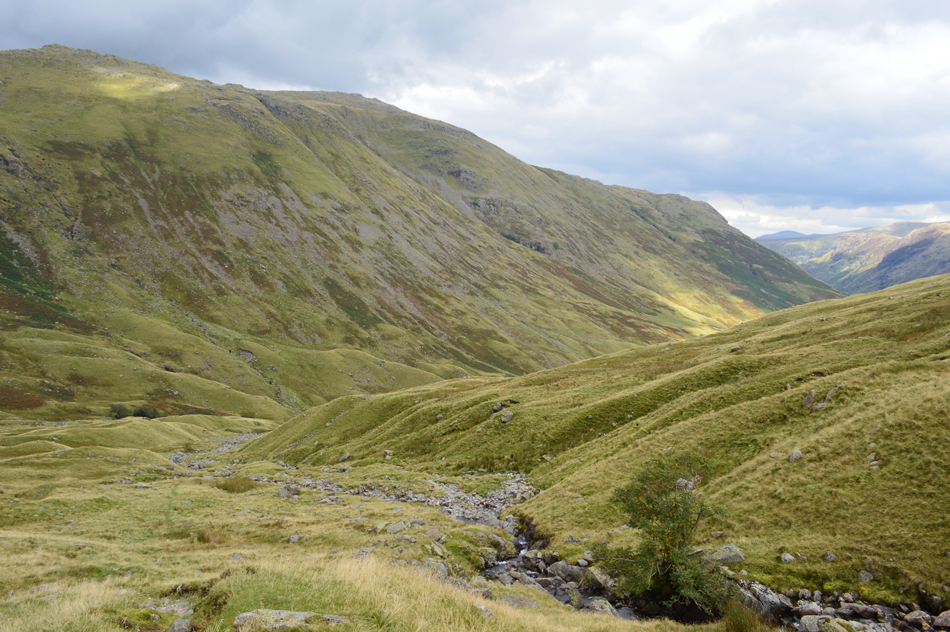
| Seathwaite Fell with Taylor Force over on the right. |
| The shade continues to leave valley temperatures low leaving the tips of fingers feeling the bite of the morning chill, thankfully however, once we start to climb higher out of the valley the heat from the sunlight up ahead along the sides of the valley will feel instant. |
 |
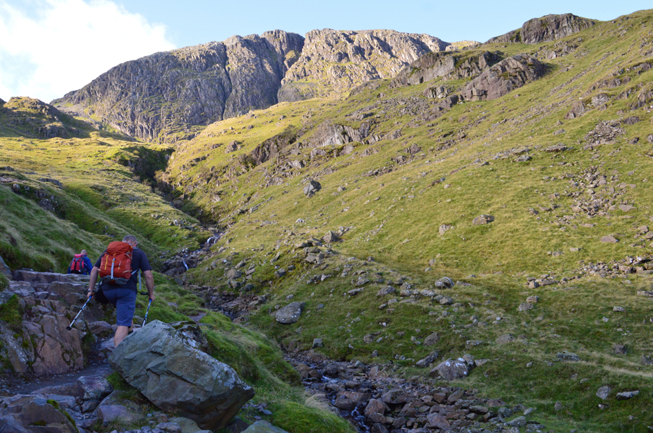
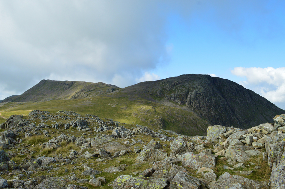
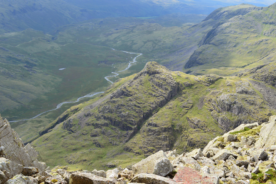
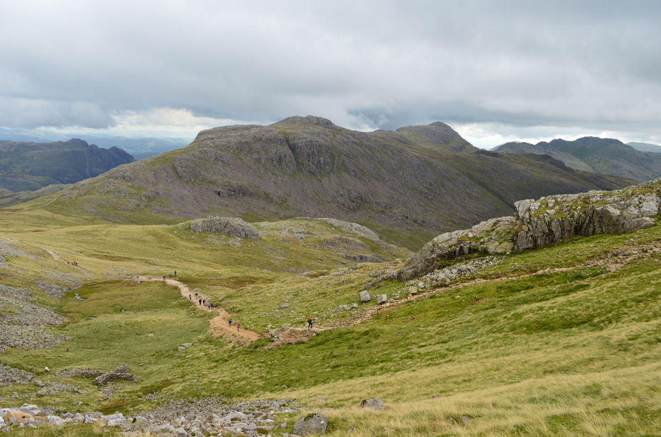
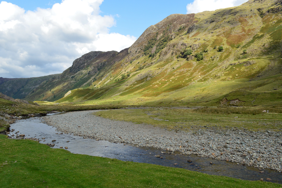
| Great End appears as we continue to climb alongside Grains Gill. |
| I hadn't quite noticed while I took this photo but that instant heat I just spoke of is just steps ahead, the contrast was remarkable with the temperature almost doubling within the space of minutes, Rod and I agree to sweat it out until the top of Ruddy Gill is gained but David, well, David never feels the cold hence his standard summer attire since the start of the walk. |
 |
| Distant views of Skiddaw from Grains Gill. |
| That's Seathwaite Fell on the left with Glaramara over on the right still in shade. |
 |
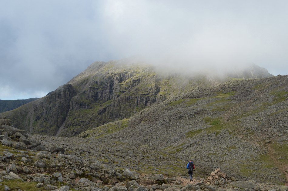
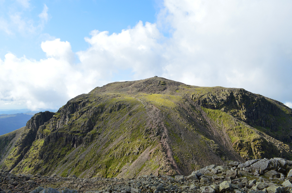
| Great End continues to command our ascent. |
| |
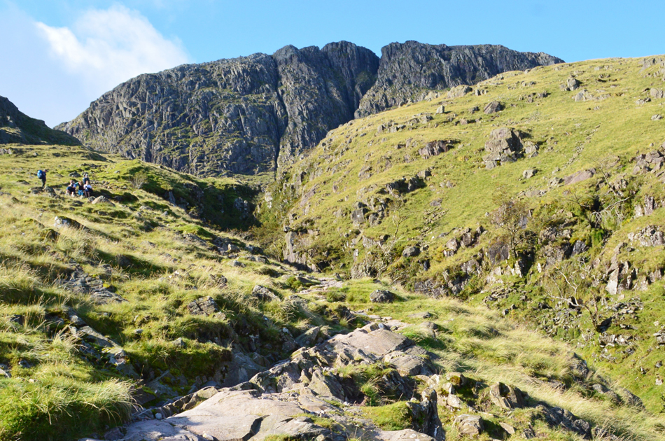 |
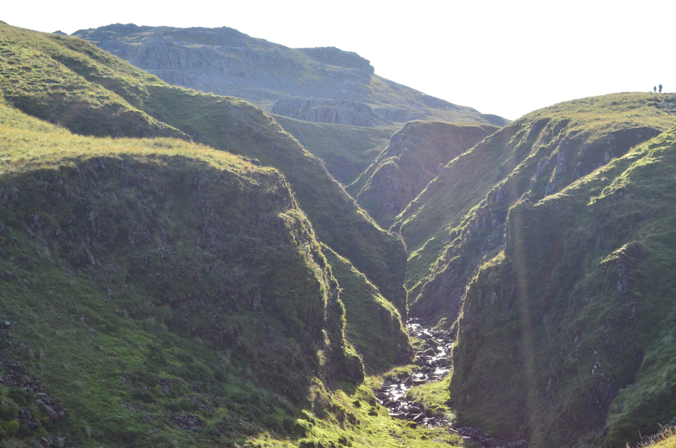
| Great End from Ruddy Gill. |
| Up ahead is where Ruddy Gill flows into Grains Gill during a series of Waterfalls as the gill starts to narrow and get much deeper. |
 |
| Views back down Grains Gill into Seathwaite. |
| |
 |
| Glaramara seen over Low How. |
| With the Seathwaite flank of Glaramara still in shade it's only the summit ridge which is doused in morning sunlight. |
 |
| Great End from Ruddy Gill. |
| Rod had noted earlier that an elderly chap had left Seathwaite packing a fishing rod and net and having just caught him up I opened up a conversation where he was heading, he replied that he was heading for Sprinkling Tarn having fished their before for Brown Trout and Vandace, a rare fish apparently known to Derwent Water and Bassethwaite. Back in 2011 25,000 Vandace where transported by Llama while accompanied by fisheries staff and were introduced to Sprinkling Tarn who's inaccessibility will help the Vandace to thrive, despite their large numbers the chap I spoke to said he was still yet to catch one, you never know today might be your day I replied. |
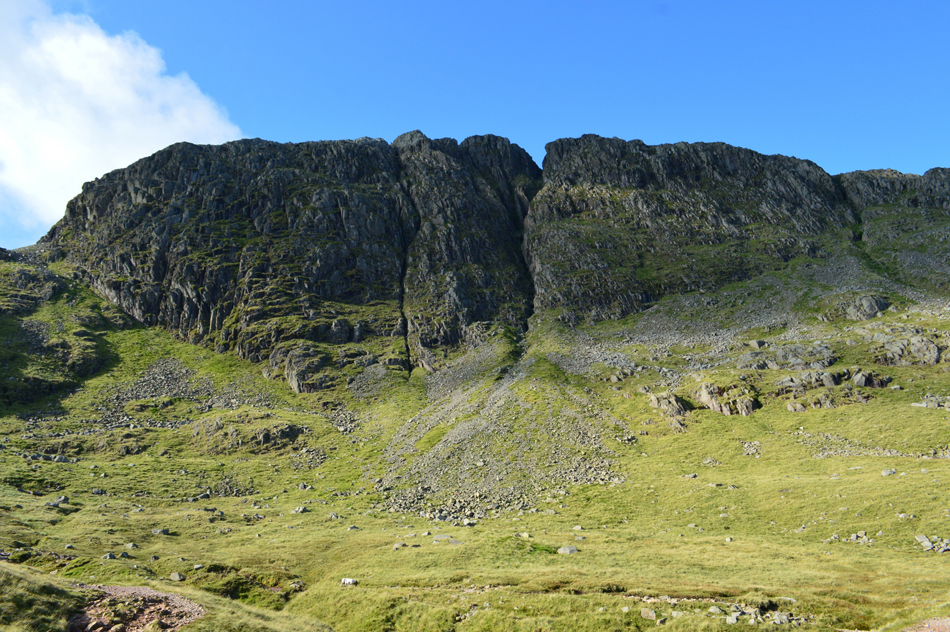 |
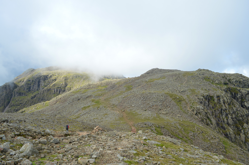
| Great End from the top of Ruddy Gill. |
| "Fancy an ascent via Central Gully" nah not today thanks. |
 |
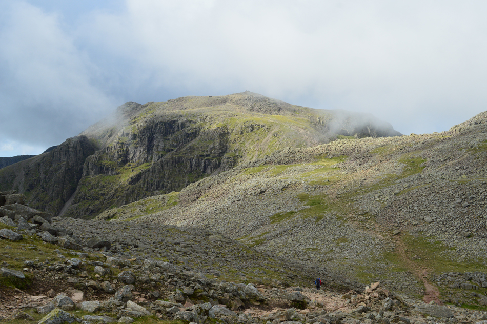
| Allen Crags from Ruddy Gill. |
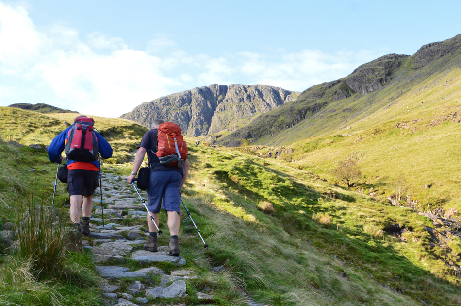
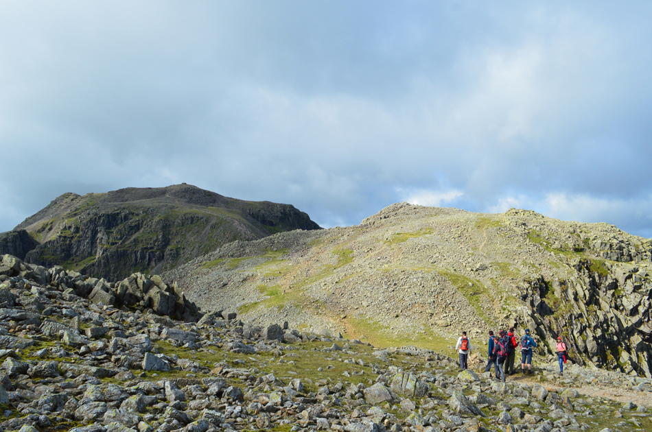
| By the time we had reached the top of Ruddy Gill we could see more walkers heading to Esk Hause from the direction of Wasdale Head with more on the Esk Hause skyline who had ascended via Great Langdale, to our right a large group of Duke of Edinburgh (D.O.E) teens are heading towards us. |
 |
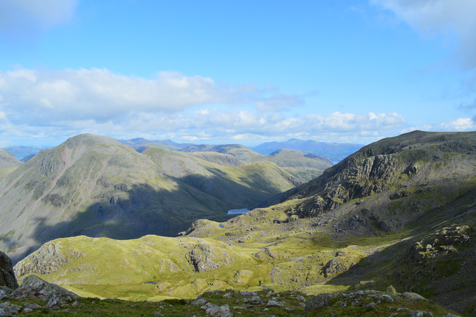
| Views over Great End, Great Gable and Green Gable. |
The young group of D.O.E's consisted of all boys who had left Wasdale Head earlier with hopes of reaching Langstrath via Stake Pass, the young men soon caught us oldies up but paused at the top of a crest to rest and wait for others, David asked are you Duke of Edinburgh and two replied they were, I know full well the youth of today can sometimes get a raw deal but the ones we met here today were the most polite young teenagers I've spoke to and certainly didn't need our help with their route even when prompted, they showed me their map and went onto say they were heading for Angle Tarn next before their descent into Langstrath.
A credit to their families and teachers. |
 |
| The view over Esk Pike, Hanging Knotts and Bowfell from the ascent of Allen Crags. |
| |
 |
| The view over Esk Hause towards Great End (right) and III Crag (left) |
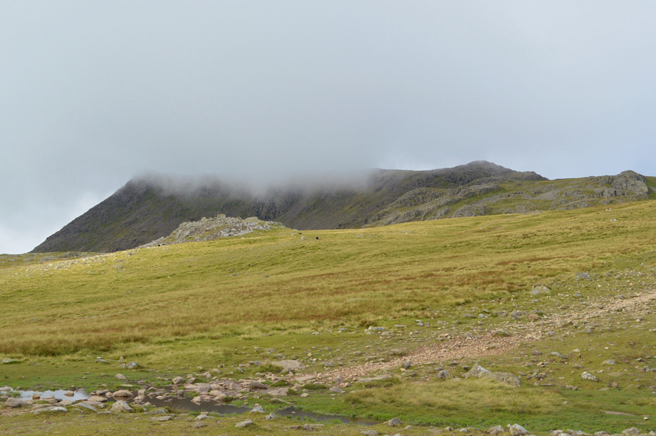
A short burst of ascent saw us soon reach the summit of Allen Crags while views of our surrounding summits where it appeared that cloud was beginning to bubble up from the direction of Eskdale, this wasn't forecasted until at least after lunchtime so with this in mind we changed the route slightly where instead of summiting Great End end next we'd head towards Broad Crag first hoping that the cloud may pass. |
 |
| Glaramara from Allen Crags summit. |
| I de-shouldered with intent on tucking my jacket under the lid of my pack and also added my sunglasses but with a cool breeze blowing across the summit myself and Rod left our lightweight jackets on if only to take the nip away while David, you already know the answer to that. |
 |
| Looking westwards over Seathwaite Fell / Sprinkling Tarn towards Great Gable, Aaron Slack and Green Gable. |
| I reckon the old boy would just about be setting up his fishing tackle right about now. |
 |
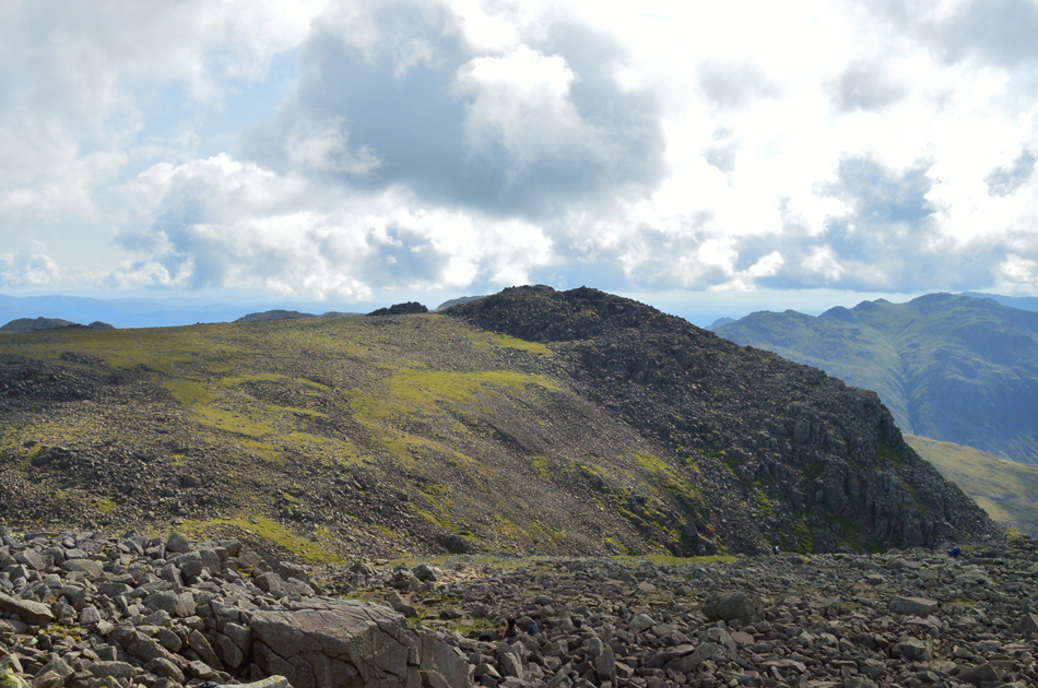
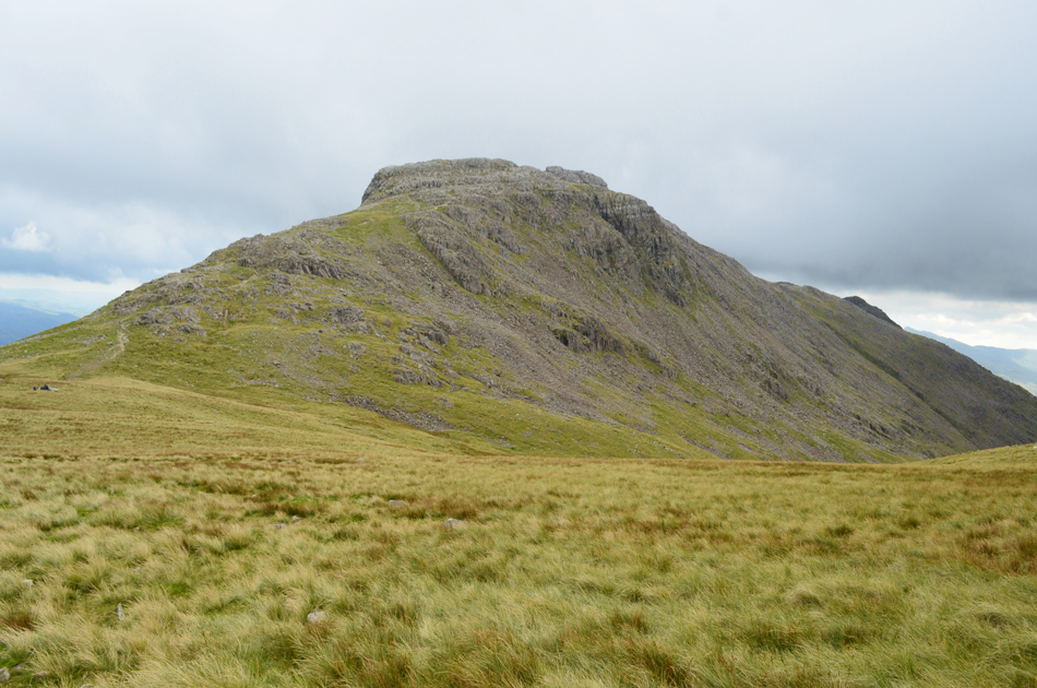
| III Crag from Esk Hause. |
We descended Allen Crags while passing the first of three large British Heart Foundation charity groups who were also heading towards Allen Crags summit while another large group had just reached Esk Hause from Great Langdale, it was obvious they were all heading towards Scafell Pike as part of a charity event some of whom also decided to collect summits on route such as Allen Crags, Great End and Broad Crag which gave a healthy mix to their charity walk.
Within the short space of time it took us to descend Allen Crags and cross Esk Hause the sun was now behind a large blanket of cloud directly above our heads with more cloud on its way. While stopping to see what was happening it was obvious it was localised cloud with many surrounding summits mainly towards the east which remained in the sunshine. |
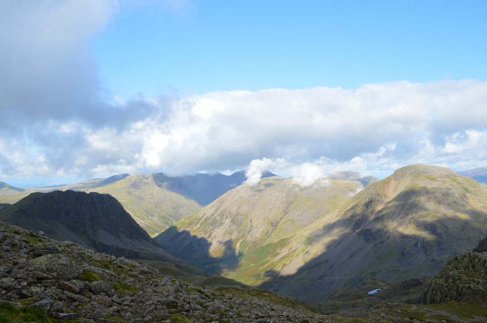 |
| The view towards Wasdale Head with Great Gable, Kirk Fell, Pillar (in shade) Yewbarrow and Lingmell (in shade) |
| Incidently thats Lambfoot Dub in the bottom right corner which sits on steep ground between the Corridor Route and Great End. |
 |
| Cloud dramatics over Scafell Pike from the col between III Crag and Broad Crag. |
| The advancing cloud would come and go within the blink of an eye which if your like me is the best way to view Scafell Pike, no cloud is great but cloud that spirals over the summits, well that's just perfect. |
 |
| Scafell Pike and Broad Crag. |
Typically not many would venture off the beaten path to summit Broad Crag but Broad Crag and III Crag rank highly in todays walk meaning spirits were most definitely high by the time we reach this part of the ridge from where we could take in this magnificent view of Scafell Pike and Broad Crag.
It was here I suggested would the guys like to ascend directly from the grassy col seen below instead of heading straight ahead before a sharp right over steep and boulder-some rock "aye why not" was the reply I got.
Twice as a novice fell walker did I reach the top of this col with hopes of gaining Broad Crag but was beaten back by thick low cloud and I don't mind admitting perhaps a little fear which is why after years of experience a special bond has been forged between myself and Broad Crag. |
 |
| Within minutes the cloud clears revealing Scafell Pike summit. |
| "Plenty on top" - aye "like the candles on a birhday cake" David refers to the walkers stood on the summit shelter on Scafell Pike summit. |
 |
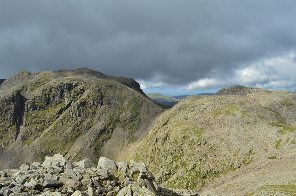
| The view over Round How and Lambfoot Dub, towards Great End, Styhead Tarn, Great Gable, Green Gable, Base Brown, Hindscarth and Dale Head. |
| |
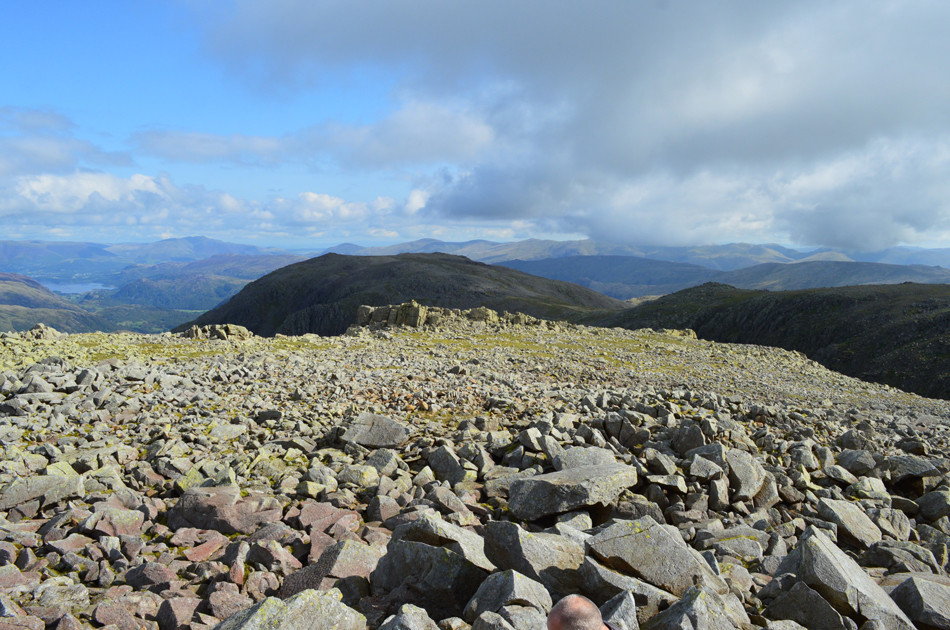 |
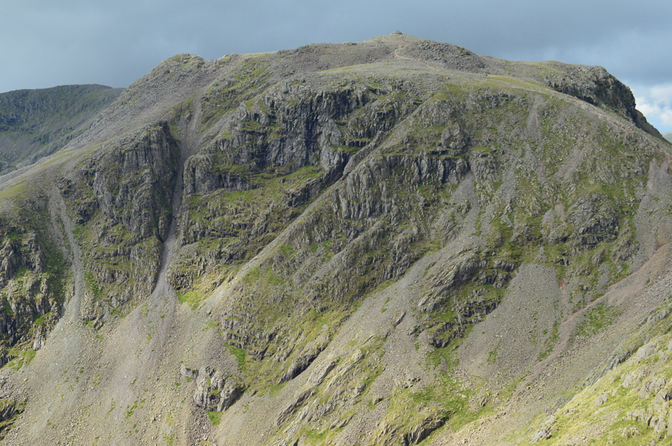
| Great End from the rock strewn summit of Broad Crag. |
We shouldered Broad Crag while taking in the fantastic views over Great End, Lingmell and Wasdale Head before heading over the boulder-field towards the craggy outcrop of Broad Crag's summit which always reminds me of the summit of Dow Crag in that after a short climb to the highest point it can be quite an awkward place to find a place to sit.
But the views are definitely worth it. |
 |
| Scafell Pike from Broad Crag summit. |
| |
 |
| Views over Lingmell and Wasdale Head towards Kirk Fell, The High Stile Ridge, Pillar, Scoat Fell, Red Pike (Wasdale) and Stirrup Crags (Yewbarrow) from Broad Crag summit. |
| For now the sun is back out but it's still a tad nippy across the summits and I still can't make my mind up about the cloud some of which is starting to get very dark in some places. |
 |
| One last photograph of Scafell Pike with Rough Crag (left) before we head towards our third summit of III Crag. |
| This time we descend via the rough boulders over looking the highway to and from Scafell Pike. |
 |
| III Crag seen over a branch gully over Little Narrowcove. |
It was here I was reminded of my own ascent during my Lakeland 2,000 footers challenge in 2015 when I gained III Crag from Little Narrow Cove which spat me out at the top of this branch gully, an ascent not for the faint hearted and one I had gained after summiting Rough Crag and Pen. |
 |
| Scafell Pike and Broad Crag as we head towards III Crag. |
I can vouch for all three of us when I say we're not ones to "butt in" especially when the leader of a walking group points over the Wasdale Valley and says "that's Lakelands most remote valley, Ennerdale" ok, people make mistakes, it's life, but when a group are leaning on your every word?
It was only afterwards when David joined us he felt the urge to say "no its not" but being a gent he held back yet under different circumstances i.e.; zero visibility ect it maybe worth having a quiet word. |
 |
| Scafell Pike, Rough Crag, Broad Crag Col and Broad Crag from III Crag summit. |
| |
 |
| Looking steeply down on Pen, Slight Side (top right) Great Moss and the River Esk. |
| More memories came flooding back from a previous ascent on III Crag via the Cockly Pike ridge which is known as “The longest continuous scrambling gradient in England” I was called a few names non of which I can repeat on this here website! but seriously, a route I aim to repeat in the coming future. |
 |
| Scafell Pike and Rough Crag (left) seen over Little Narrowcove from III Crag summit. |
Rough Crag can be seen over on the left with its steep scree gully on the right. Rough Crag was gained via the scree gully on the same day that III Crag was summited via Little Narrowcove, even now just two years later I wonder how I managed it! I suppose I have the legend that is Harry Griffin whose routes I was following which later paved the way for my Wainwrights in 32 walks project.
Anyway, that's enough about me but great memories all the same while I was stood on Broad Crag and III Crag summits today. |
 |
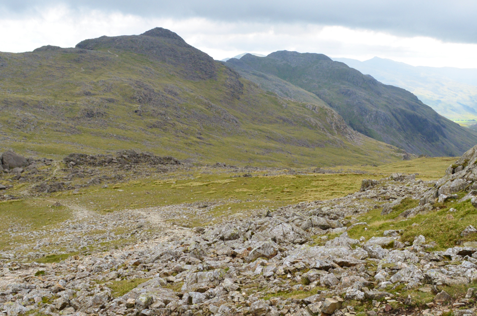
| Broad Crag from III Crag summit. |
| Time to descend now and head for Great End. |
 |
| III Crag, Broad Crag from Great End summit. |
After the descent of III Crag we re-joined the highway and tracked north not before passing another large British Heart Foundation charity group one of whom, a young girl asked me "was it worth it" a snap decision told me was she referring to us summiting Scafell Pike to which I replied "no we didn't summit Scafell Pike, we summited Broad Crag and III Crag today, the look of complete disappointment just dawned over her face as if to say that we had come all this way and not summited Scafell Pike.
I guess that's the difference between how a seasoned fell walker feels, and what a non walker see's...sorry to have been such a disappointment! |
 |
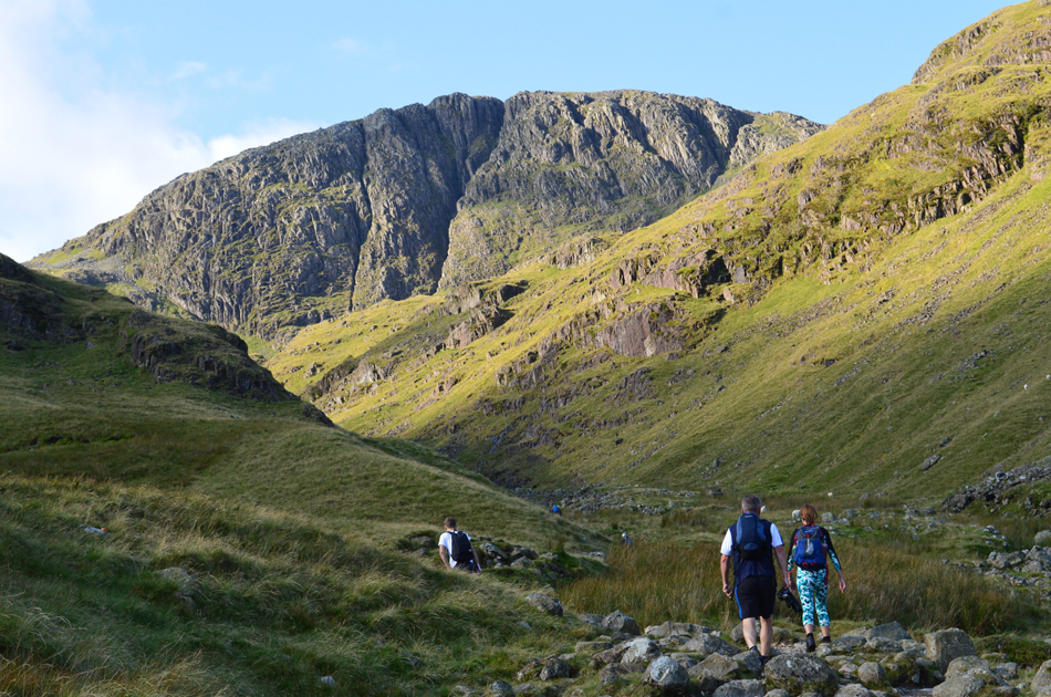
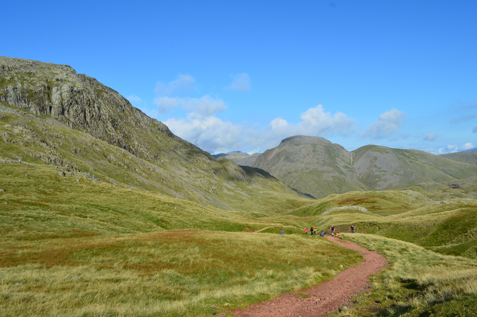
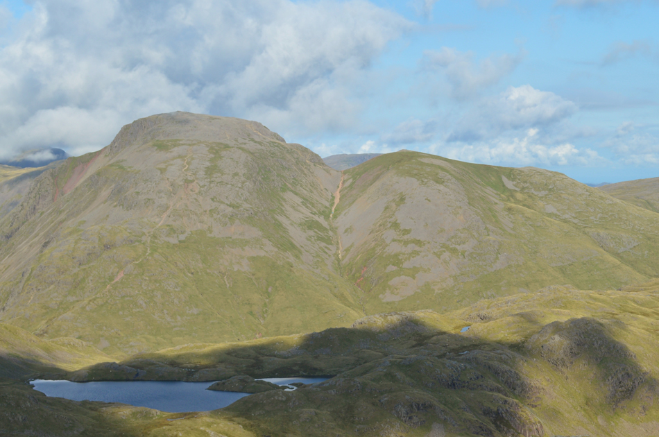
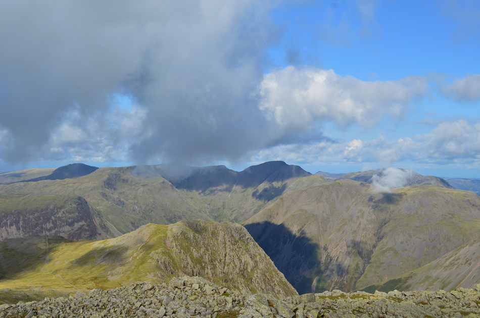
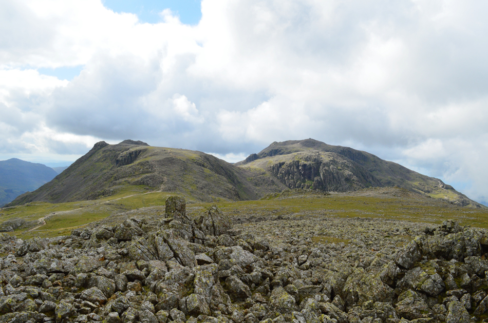
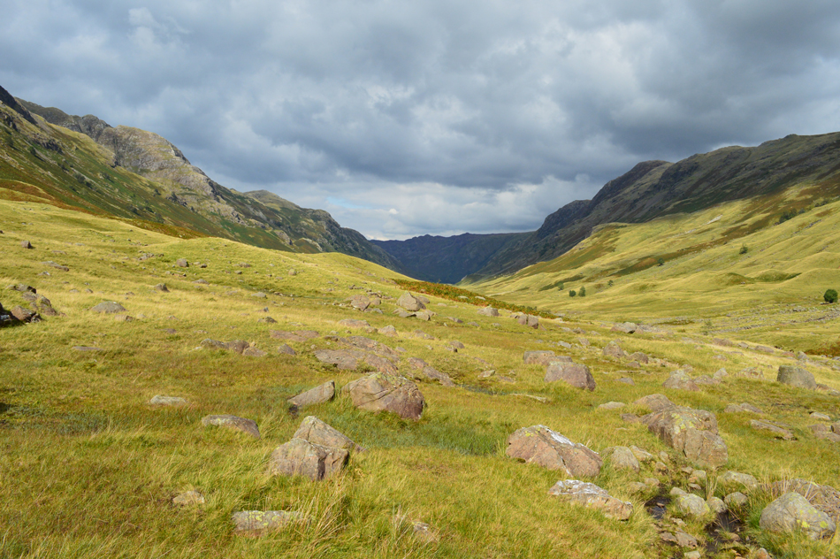
| Esk Hause, Esk Pike, Bowfell and Crinkle Crags seen from the top of Calf Cove. |
| Earlier we had suggested it was time for lunch and what better place to take a break than the cross-shelter directly below in Calf Cove. Rather than re-join the path over on the right we made a pathless descent towards the shelter not before taking a quick visit to the rock (seen right of the shelter) which hosts an original metal ring which would have been used to tie horses up back in the day when Victorian visitors to the fells would have gained Scafell Pike via guided horseback, another metal ring can also be found on the summit of Scafell Pike. |
 |
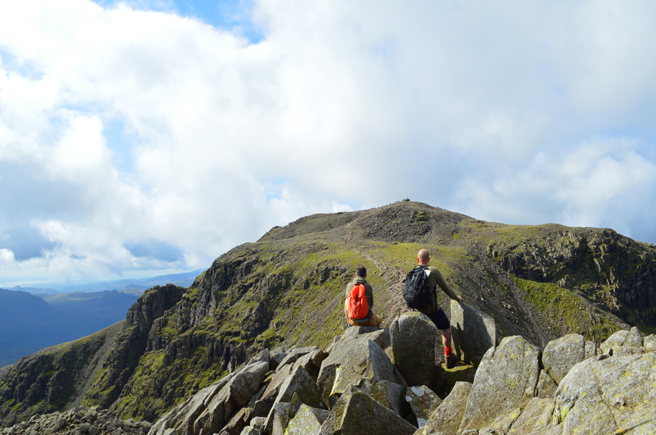
| Esk Pike from Esk Hause. |
| The last of todays summits will be Esk Pike and with most of the hard work already done it shouldn't be long before we reach the summit. |
 |
| Esk Pike summit is just ahead. |
| Sometime during the descent we had lost the sun again as the sky clouded over and with this we also lost the warmth that the sun was providing, everything turned to deep shades of green and grey leaving a subdued dullness to the fells, fingertips began to sting and for our short time spent on Esk Pike we could feel that Autumn was truly on its way. |
 |
| Descending Esk Pike for Ore Gap with views towards Bowfell, Crinkle Crags and Harter Fell (Eskdale) in the far distance. |
| |
 |
| Hanging Knotts from Angle Tarn. |
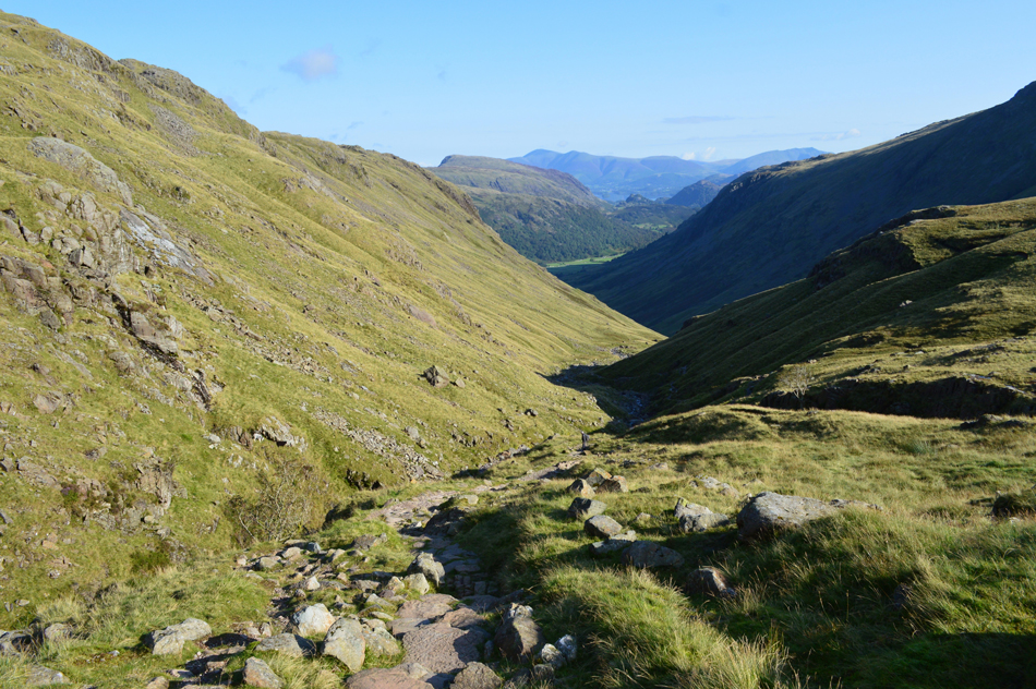
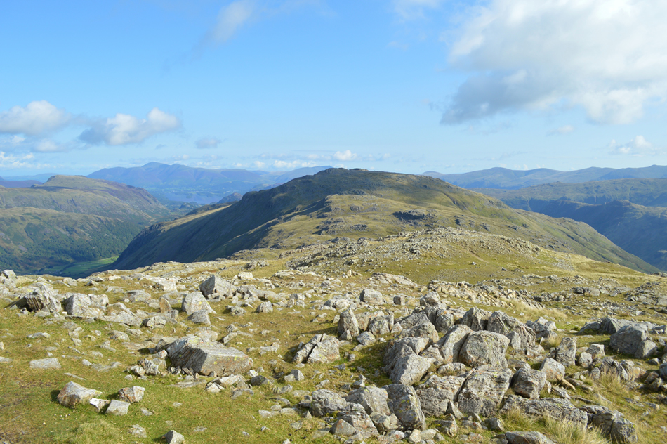
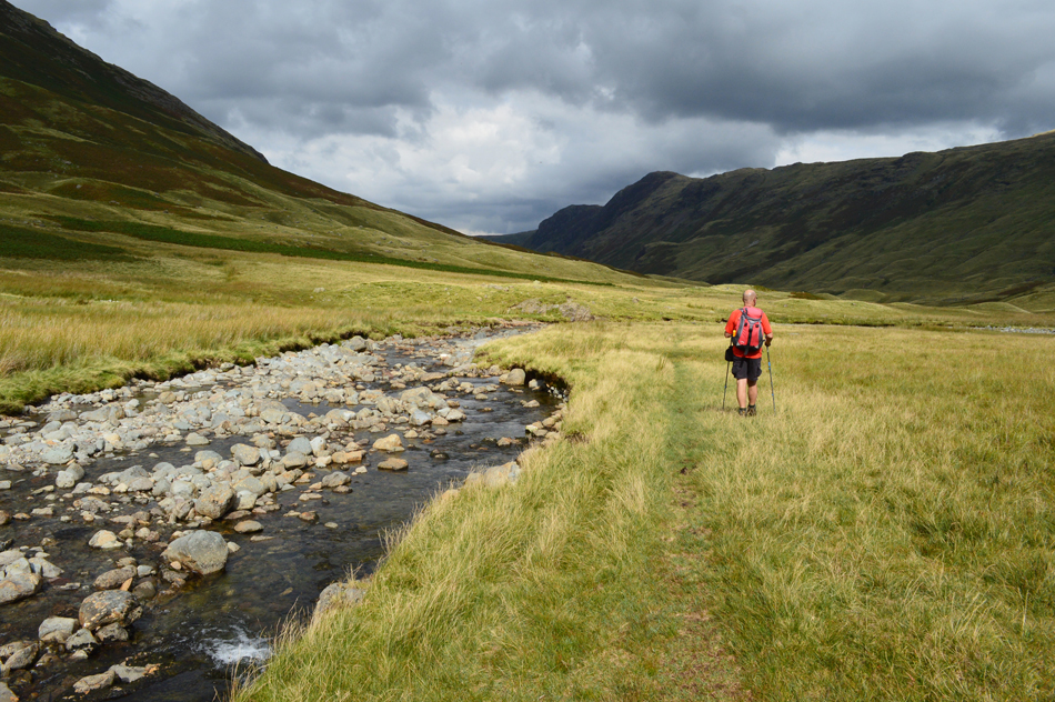
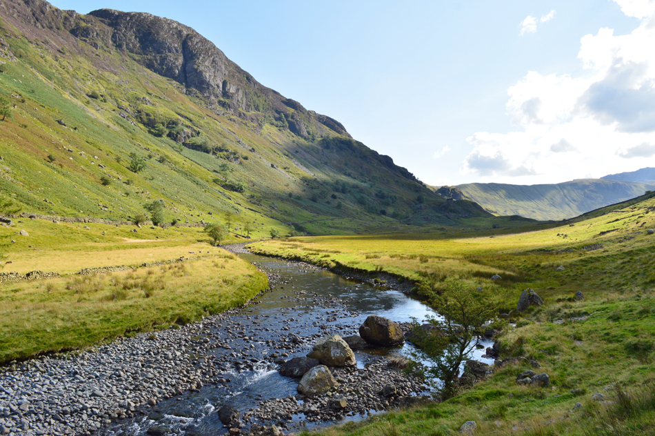
The path between Esk Pike summit and the top of Ore Gap was quite busy with many walkers heading for Esk Pike mainly from Bowfell but we also encountered one chatty fellow during the descent from Ore Gap to Angle Tarn who asked us of our route and where we were heading, we explained that we were on route to the Langstrath Valley as he replied "that's one long valley and what you can see from here is just the tip of the iceberg" he was right Langstrath is quite a long valley reaching just under five miles in length which is part of why we chose it to head back to Stonethwaite by.
What better way to end a walk than with a feeling of remoteness beauty accompanied by the sound of Langstrath Beck for company. |
 |
| Views over Glaramara as we descend into the Langstrath Valley. |
| There's no better time than the present than to take off any extra layers, we can see the sun is trying to peak through and with the protection of the valley the temperature is already starting to climb again. |
 |
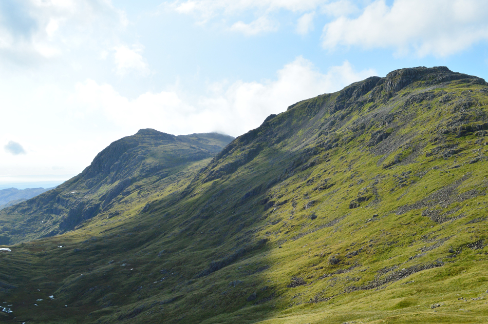
| Sergeant's Crag and Eagle Crag from Langstrath. |
There are two paths which straddle Langstrath Beck one of which we are using follows the course of the Beck all the way through the valley towards the footbridge close to Tray Dub.
The alternative footpath on the other side of the Beck appears just as prominent but at some points takes a wider berth. |
 |
| Langstrath. |
| Having just treated our boots to a wash in Langstrath Beck we switch paths close to the base of Stake Pass and continued to follow a prominent footpath towards Tray Dub. |
 |
| The silhouette of Great Crag appears on the Horizon with the prominence of Cam Crag (Rosthwaite Fell) seen over on the left. |
| |
 |
| Sergeant's Crag and Eagle Crag from Langstrath Beck. |
Prior to reaching Tray Dub we stumbled upon a wild camping site complete with camper who I think might of been reading a book as we passed by "eh-ups" were passed and we were still talking about how large the site looked with a gear tarp piled high with food, and chopped wood then the tent itself close by, it appeared that the guy had moved in! our continuing conversation was one of the reasons why we walked straight past Tray Dub without so much as a look in.
Oh well not to worry. |
 |
| Sergeant's Crag from Langstrath Beck. |
On the opposite side of the valley we were almost in line with a group of walkers as Rod mentioned it could be the D.O.E's we had seen at the top of Ruddy Gill earlier this morning and judging by their bright rain covers over their packs which we recognised we reckoned Rod was right, the group had a quarter of a mile on us and no matter how close they appeared our now tiring legs are unable to catch up. As we approach the footbridge below the nose of Eagle Crag we pass a lady sat alongside Langstrath Beck with two Collies and "afternoons" are passed before rounding the corner where we approach the last half mile towards Stonethwaite.
The path underfoot is rough yet silently behind our aching feet our walk is about to come to an end but not before passing two women who we recognised also from the top of Ruddy Gill, both heading back into Stonethwaite. Loud music is blaring away from Stonethwaite Campsite which brings us back into instant reality and like three owd men we all complain that it's too loud before we arrive back in Stonethwaite while passing the Langstrath Inn whose customers eat and drink from the beer garden.
We arrive back at my car which I had left parked opposite the ever so familiar Phone Box and start to de-shoulder before I drop all the windows just to let the heat of the afternoon escape. We leave Stonethwaite and confirm it was the teenagers who by now are grouped around metal farm gate possibly waiting to be collected and I nod through my open window, brake and head left towards Seathwaite before arriving back at David's and Rod's cars who thankfully hadn't been boxed in or worse, towed away by the farmer.
All that was left was to shake hands, smile and say what a wonderful day we had before as a trio we head back along the Borrowdale Road towards Keswick where it took an hour and a half to pass through as my aching body slumped deeper into my drivers seat I could see Skiddaw above the Keswick rooftops while thinking...
I've sat in worse traffic jams. |
|
| |
| Back to top |
 |
|