|
Steeple via the Long Crag Ridge from Bleach Green |
 |
 |
17th June 2017 |
 |
|
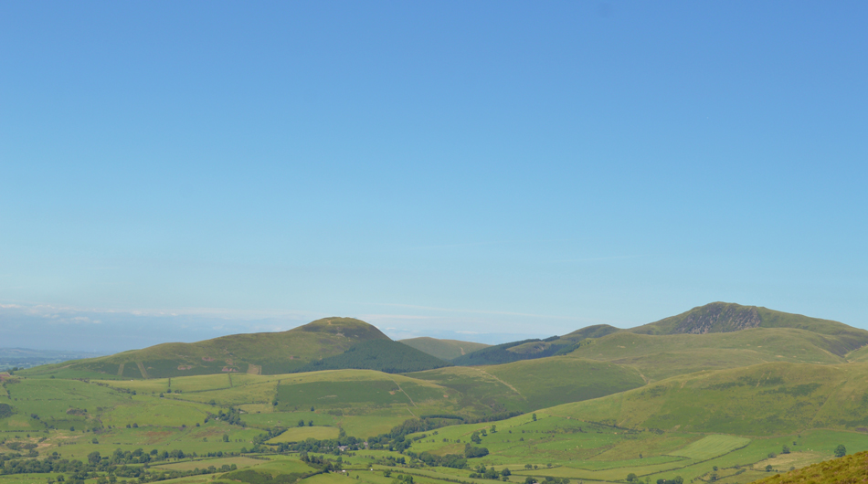
I had a valid reason for being away from the fells last weekend which saw me celebrate my wifes birthday around Manchester and my lack of fell time didn't hurt too much mainly because of the unsettled weather back then. I came up with this route around two weeks ago and routes can come and go depending on my mood but I guess this particular route wasn't shifting, it simply had to be my next walk.
This walk has a combination of everything that I love about fell walking from lonely grass ridges to scrambles to some of Englands highest ground and also one of the key points to todays route was to include Caw Fell and Iron Crag, two of my favourite western fells despite the popularity of their neighboring summits.
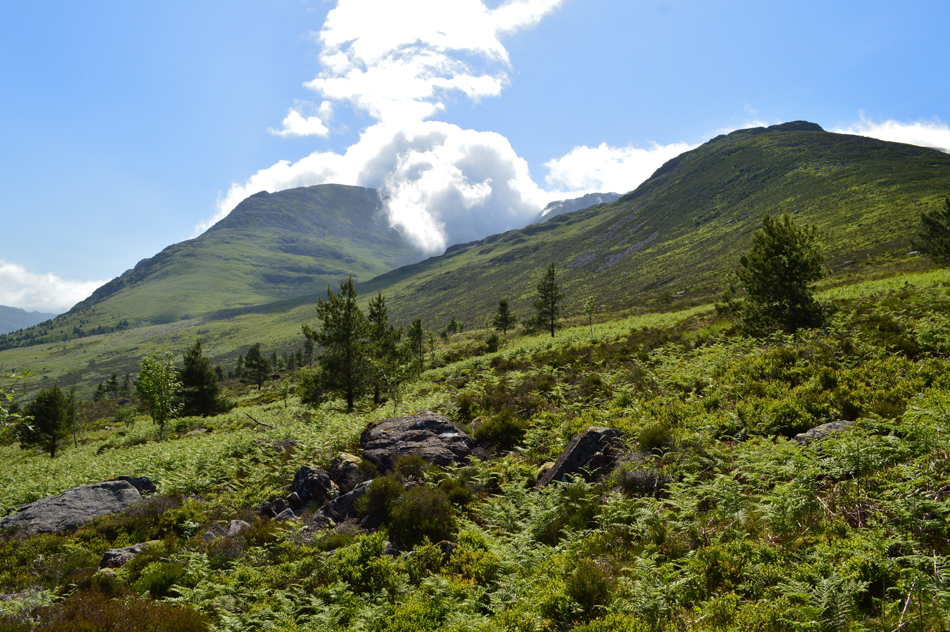
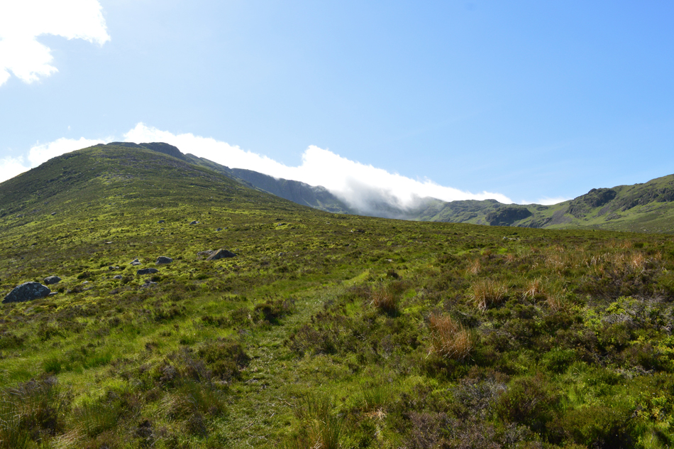
Todays main ascent is Steeple gained from the valley via Long Crag or Steeple's north ridge, a tough but equally rewarding ascent with fantastic views through the valley towards the Gables in one direction and the Cumbrian coastal plain in the other. The forecast stayed true, in fact improving just 24hrs previous which confirmed my green light for the two and a half hour drive to Ennerdale, what the forecast failed to mention was the cloud inversion that I encountered which continued to roll in then descend into Mirk and Windgap Coves like spectacular waterfalls.
It was a day on the hill I shall never forget. |
|
| Wainwright Guide Book Seven |
 |
| The Western Fells |
-Steeple
The unknown man who named this fell was blessed both with inspiration and imagination. Few mountains given description names have fared better, Steeple is a magnificent choice. |
 |
|
|
|
| |
|
Overview |
|
|
| Ascent: |
3,883 Feet - 1,184 Metres |
| Wainwrights: |
5, Steeple - Scoat Fell - Haycock - Caw Fell - Crag Fell |
| Visiting: |
Iron Crag |
| Weather: |
Warm and Sunny With Strengthening Winds Over the Summits. Highs of 22°C Lows of 16°C |
| Parking: |
Bleech Green, Ennerdale Bridge |
| Area: |
Western |
| Miles: |
14 |
| Walking With: |
On My Own |
| Ordnance Survey: |
OL4 - OL6 |
| Time Taken: |
7 Hours 30 Minutes |
| Route: |
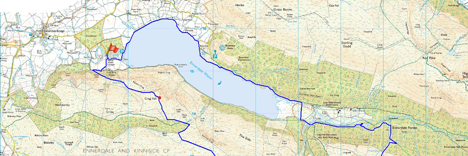
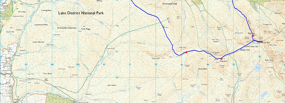
Bleach Green – Ennerdale Lake Path - Bowness – Irish Bridge - Ling Mell Plantations - Ennerdale Forest - Low Beck - Long Crag - Steeple - Scoat Fell - Haycock - Little Gowder Crag - Caw Fell - Iron Crag - Crag Fell - Top of Revelin Crag - Ben Gill - Bleech Green |
|
| |
|
Map and Photo Gallery |
|
|
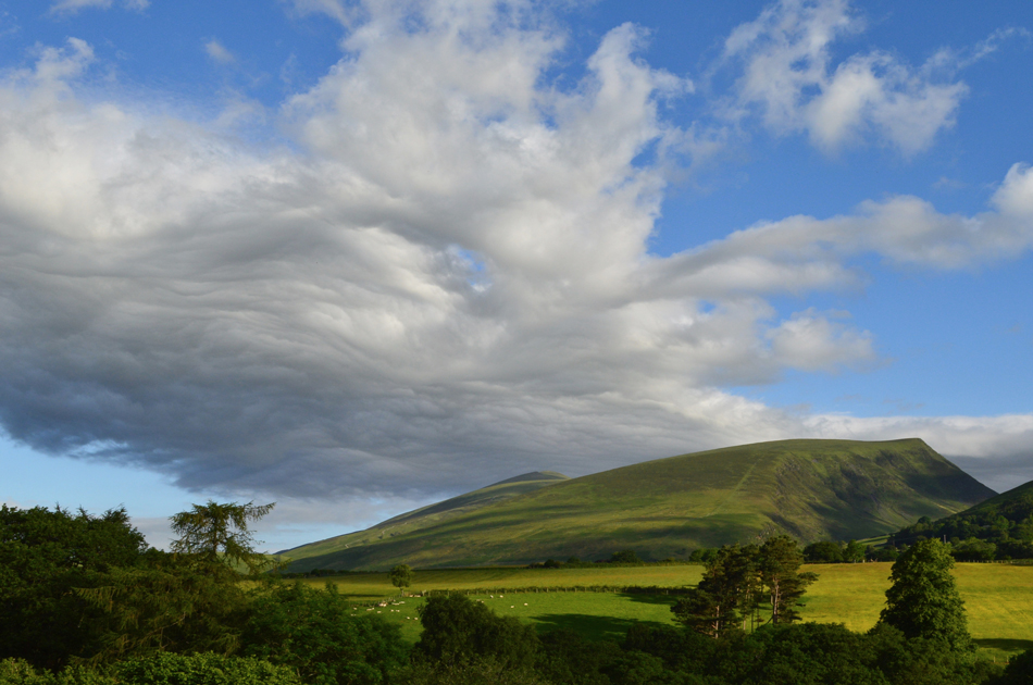 |
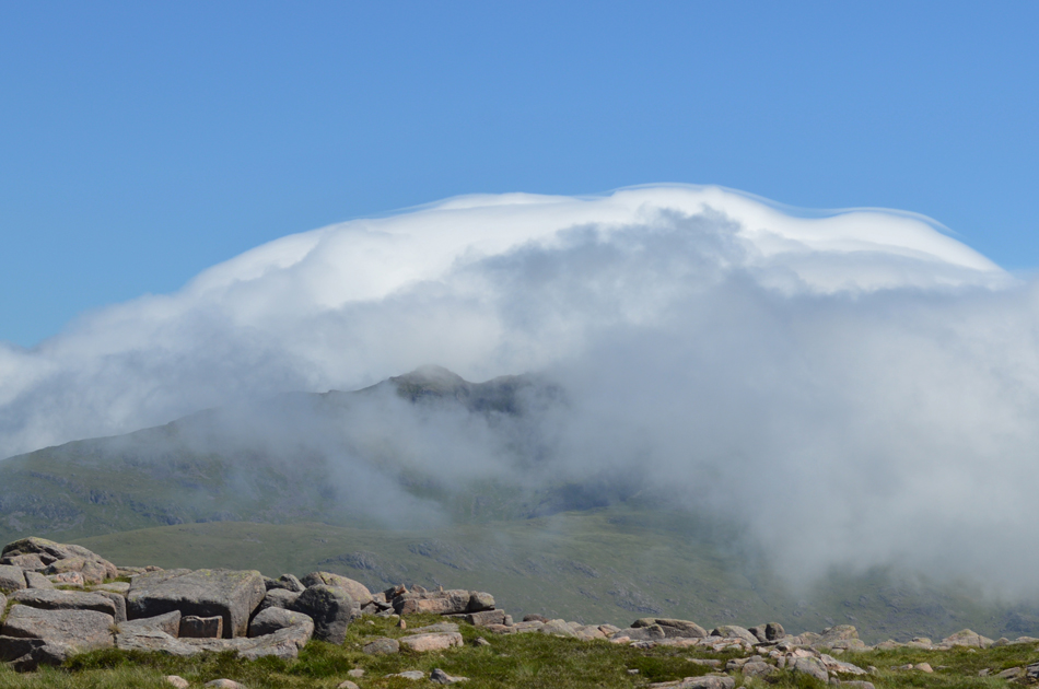
| Strange cloud formation over Lonscale Fell. |
| I couldn't resist pulling into a layby along the A66 to take this picture of some very strange cloud over the northern fells, it looked like something straight out of Lord of the Rings. |
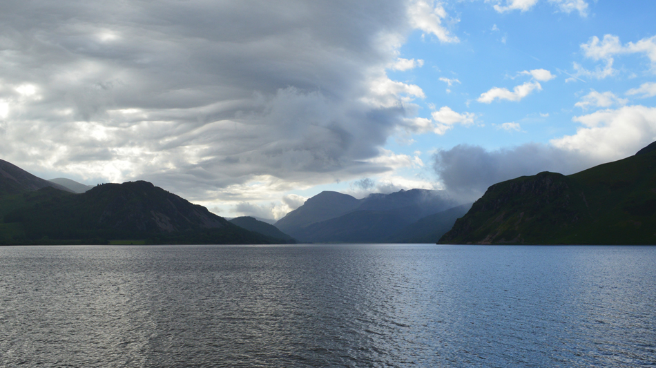 |
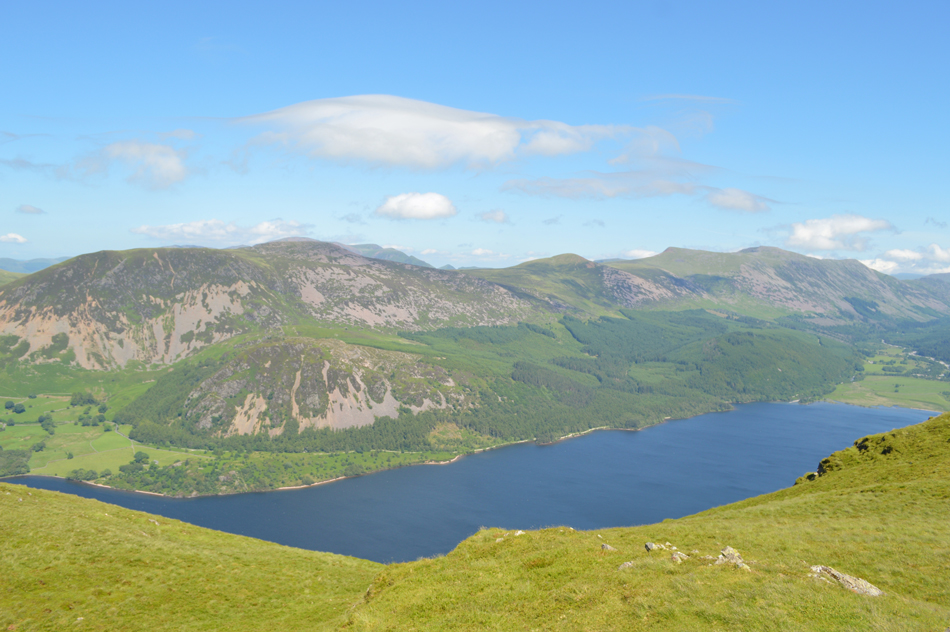
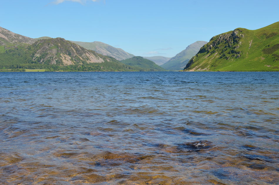
| A distant Pillar seen over Ennerdale Water 07:46am °16C |
I really hadn't noticed the two and a half hours it took me to drive to Ennerdale Bridge which I guess showed my enthusiasm to get boot onto fell side. During the last week I had somehow managed to twist my right knee which at times was quite painful when pressure was applied, it didn't help how busy work was but after treating it when I got home with ice the swelling started to subside leaving a build up of fluid on the back of my knee, something of which has been there since my footballing days, nevertheless today I will be packing a knee strap should I need it.
The further west I drove the more it started to cloud over but after checking the local weather report I remained confident that the brighter skies were still to come. I park easily on the car park at Bleach Green beneath a canopy of trees which should protect the car from the heat, when it finally arrives that is. Soon I am joined by a fellow who parks his van beside my car and cheery 'mornings' are shared over the cars roofs, it turns out that the chap is from Pooley Bridge and we both commented at having to drive through clear skies and sunshine only to arrive at Ennerdale below darker skies. I pack light making sure though that I have a full 2.5ltrs of hydration and had a knowledge of where I could douse my head in the becks and streams along the course of the route, if it's going to get as hot as they say, it's always worth just checking the map first.
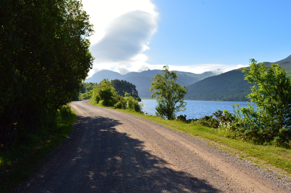
With the car locked I leave the car park and instantly I can feel a sharp twinge in my right knee but I walk through it, after all, should it become to uncomfortable I can easily change the route well before committing to the high fells. After passing through a gate and onto a dirt track the bridge over the Weir is just up ahead. Here I join Ennerdale's north western shoreline and I can already see large chunks of blue dividing the skies overhead, it didn't go unnoticed that a large amount of low lying cloud on the back of Crag Fell either which stretched as far as Iron Crag, I shall have to keep my eye on that I muttered. |
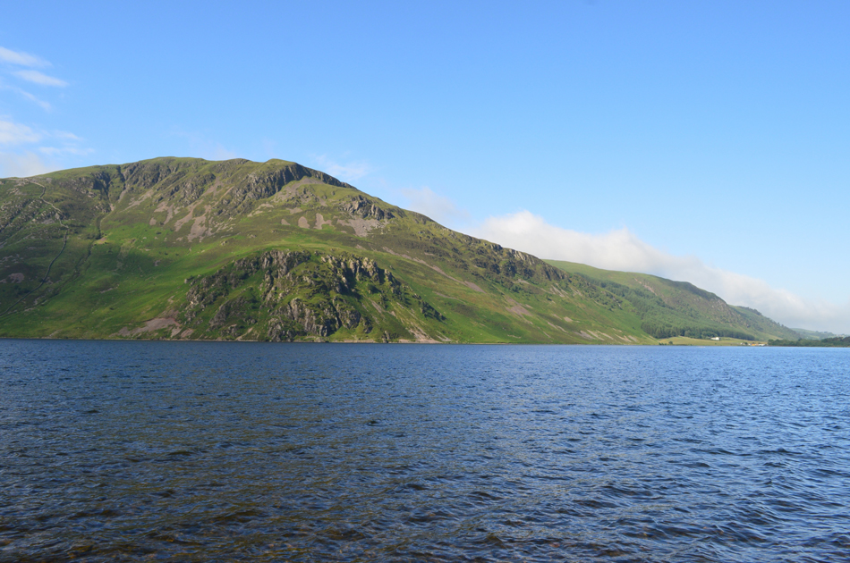 |
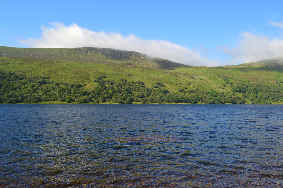
| Views over Ennerdale Water towards Crag Fell and Angler's Crag. |
| Crag Fell features as todays fifth and final summit on the day seen here as those grey skies start to make way for blue. |
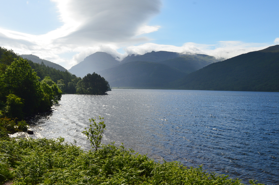 |
| A silhouetted view up the lake towards Steeple and Pillar. |
Instead of taking leaving the Lake path towards Bowness Knott I continued and followed the shore path which at times was overgrown with shrubbery and not to mention Bracken. Yes I admit this decision added a little time but it was worth it just to hear the water lapping on the shoreline and the gulls in the distance.
The shore path soon joins up with the main track, not before wading through more Bracken that is. |
 |
| Crag Fell and Angler's Crag once again. |
| |
 |
| Pillar is up ahead on the skyline. |
However, the pointed summit of Steeple is where I'm heading and the north ridge on which I will ascend by is a little under six miles away, most of which is easy walking with fantastic scenery in every direction.
Time to empty my head !! |
 |
| Boathow Crag seen over Ennerdale Water. |
| |
 |
| Crossing the River Liza at Irish Bridge. |
| With the exception of a farmer on a quad bike and two woman joggers, I seem to have the whole valley to myself this morning. |
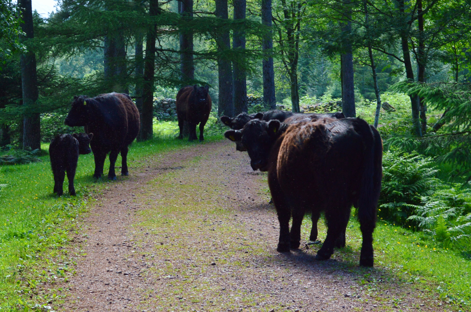 |
| Galway Cattle. |
After crossing the River Liza I continue along the path towards the large footbridge over Woundell Beck where I encountered these girls. It was a stop me in my tracks moment after realising that their calfs were present so I detoured into the trees over on the right when really I bet all they wanted to do was lick my face.
Joking aside these Galways are no strangers to people and are considered domesticated to the valley, either way when there are young ones present it isn't worth taking the risk. |
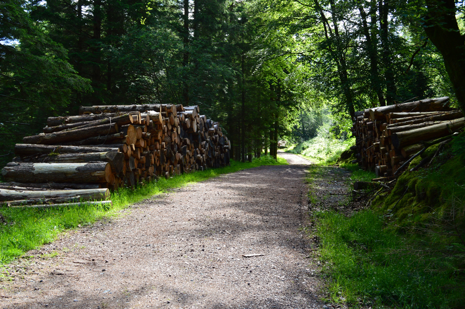 |
| Continuing towards Moss Dub. |
| Past the log stacks. |
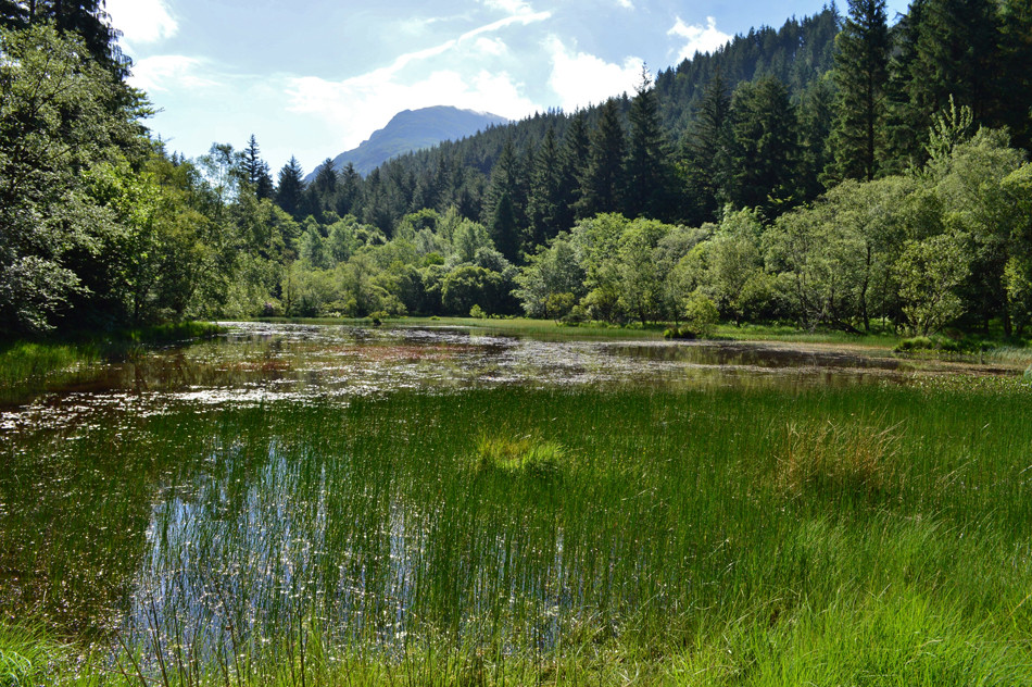 |
| Delightful Moss Dub with Pillar commanding the skyline. |
| Moss Dub is found just off the beaten track, in fact it can seen from the track if you look through the trees, getting to it however is a little more trickier because of how overgrown the surrounding trees are, it was well worth those painful pine needles stabbing me in the arms and legs for just a few quiet moments here at Moss Dub before realising I've got to go through it all again. |
 |
| Low Beck, Ennerdale Planation. |
Crossing the concrete footbridge over Low Beck signalled my entry into the Ennerdale Plantation. I did however, have two options one of which was to use the Droveway (sheep passage) which I had seen from Irish Bridge earlier but this was more of a direct route towards Scoat Fell and Haycock respectively and would have meant a traverse over pathless ground once out of the plantation towards the Steeple's Long Crag ridge.
My chosen route via Low Beck is much more direct and at times the path can be hard to follow, what I didn't expect to see was two Scottish wild campers making a descent and 'mornings' were shared, within the density of the plantation the heat was trapped and soon the sweat began to pour.
Not far from the edge of the plantation instead of continuing along a very narrow path I veered left at a fork and soon realised my mistake, I had gone too far to go back so I continued until I reached the forestry track and followed the noise of Low Beck where the track came to an abrupt stop, its wasn't the kind of place you would expect to find a path but found one I did which lead me to the very edge of the plantation. |
 |
| Pillar and seen with Steeple North Ridge (Long Crag) after emerging from Ennerdale Plantation. |
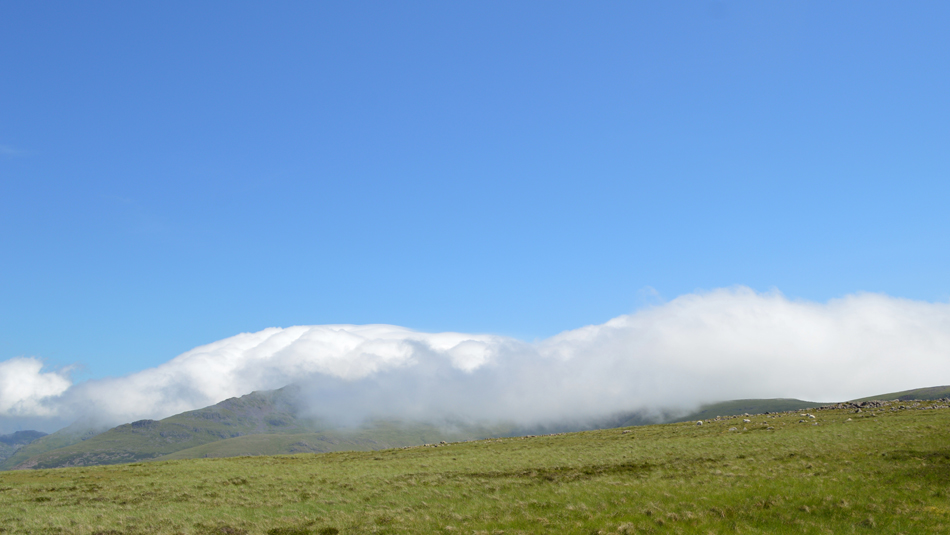
I'm not sure if it was the density of the plantation or the sheer humidity but I sure was relieved after emerging from the forest. I needed to collect myself as I was overheating and sweat had just about soaked me from top to bottom. On the plus side I was met with a cool wind which I instantly started to feel the benefit from, after wiping my sunglasses free from sweat I could see that the cloud that I had spotted earlier on during the walk continued to roll over the summits of Pillar, Black Crag and Scoat Fell before dispersing in Windgap Cove.
At this point it was difficult for me to realise just how much 'backing' the inversion had, after all it could be over in minutes. |
 |
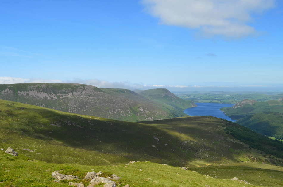
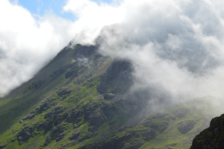
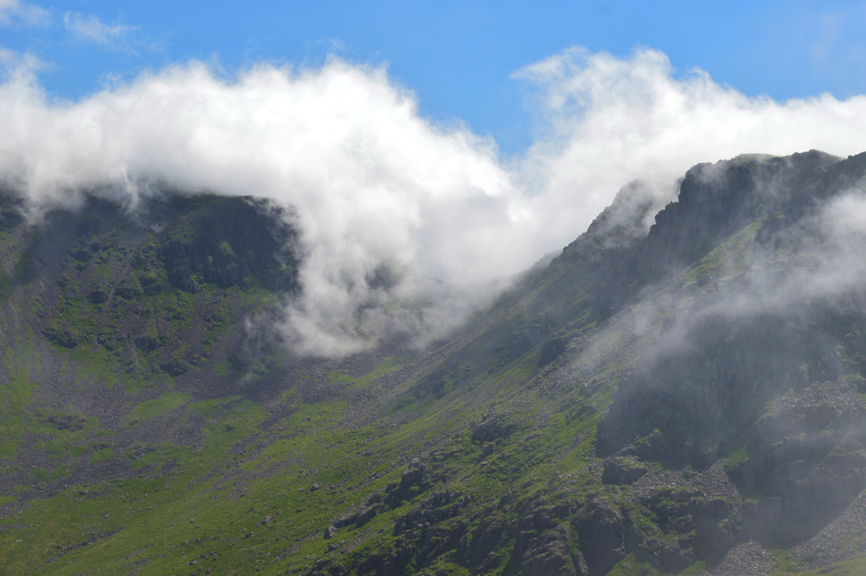
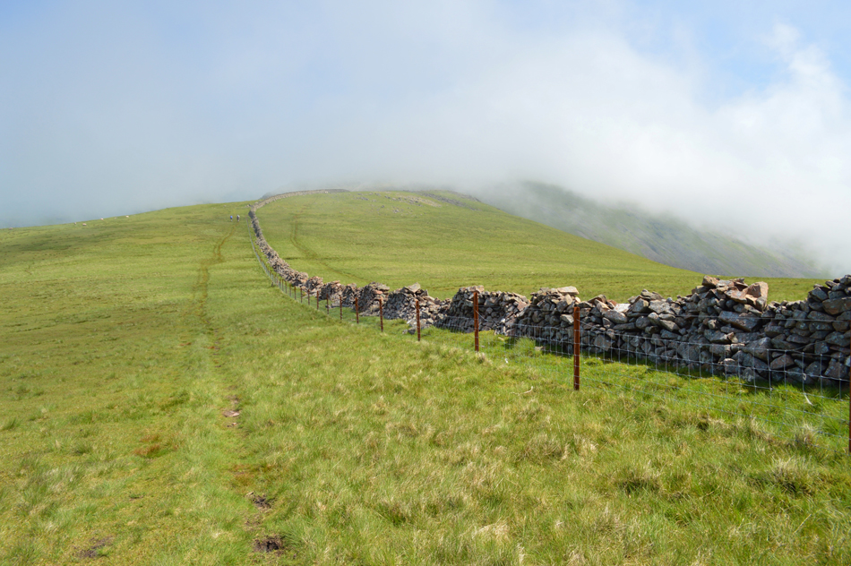
| Views towards Long Crag and Mirkiln Cove seen right. |
| From the top of the plantation gaining the ridge isn't as simple as it looks on the map with an area of bog to negotiate most of which was up hill. I persevered by following a narrow footpath which after a few hundred feet forked left for the Long Crag ridge or straight ahead for Mirkiln Cove, I head left. |
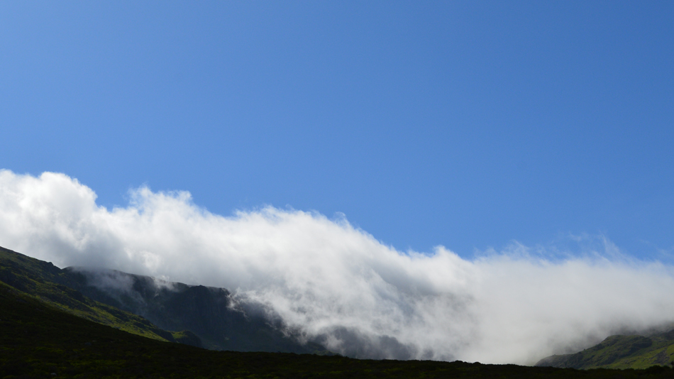 |
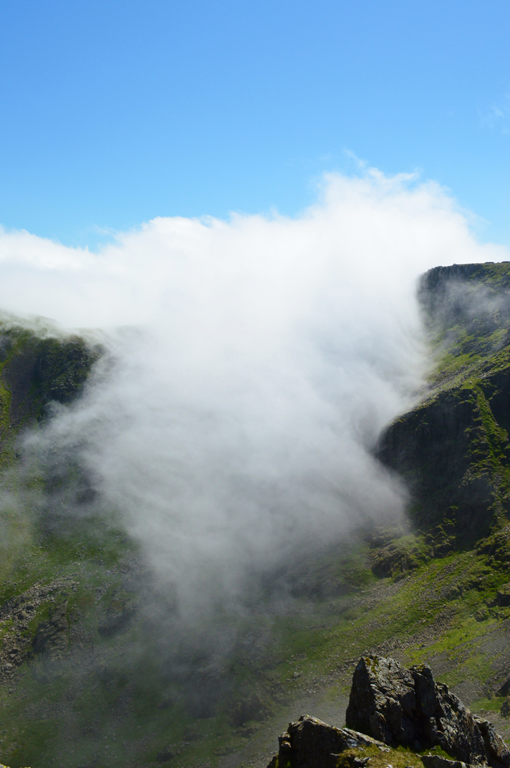
| With impressive views of the cloud as it spills into Mirkiln Cove. |
| |
 |
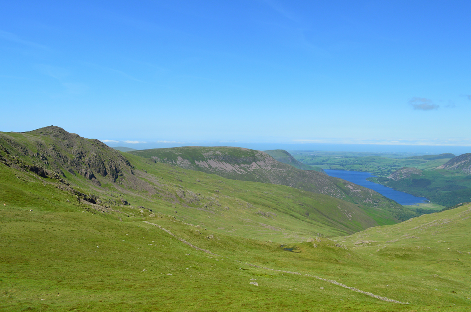
| The view back down the ridge over the Ennerdale Plantation towards Red Pike (Buttermere) Starling Dodd and Great Borne. |
| |
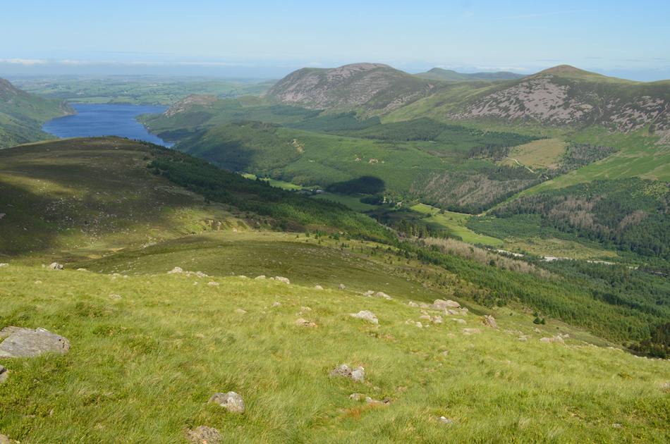 |
| A similar view now seen with Ennerdale Water. |
| Going back to the Droveway that I had mentioned earlier the top of which can be seen centre left in an area of the fell side know as Lingmell. From here you can see the trackless traverse towards the top left of the treeline which I would had to have made if I had ascended via the Droveway. I suppose back in Wainwrights days this area although still heavily forested was very different to as it is now where through the years walkers have found their own routes onto the high fell side. |
 |
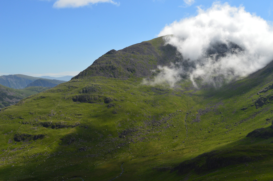
| That's Iron Crag seen over the Tewit How ridge with Crag Fell and Ennerdale in the distance. |
| The knee is fairing very well I can report. |
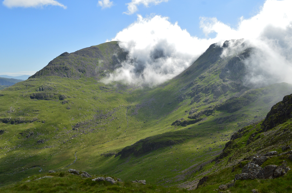 |
| Pillar and Black Crag seen over Windgap Cove from Long Crag. |
| The ridge ahead was always higher meaning I was unable to get a full view down the rdige but mainly up, however, after reaching Long Crag the view into Windcap Cove as the cloud poured over the ridge just exploded leaving me speechless. |
 |
| Pillar, Wind Gap and Black Crag. |
| There was nothing I more to do other than stab my walking poles into the grass and pull up a boulder. |
 |
| There are many reasons why we walk. |
| And views like this are certainly at the top of that list. |
 |
| White Pike, Pillar and Wind Gap seen over Windgap Cove. |
| I'm not sure who is the luckiest, the two walkers who I have just watched ascend Pillar from Wind Gap or me !! |
 |
| Magical Black Crag. |
| |
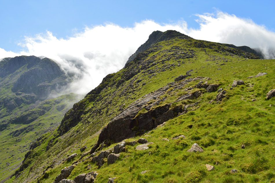 |
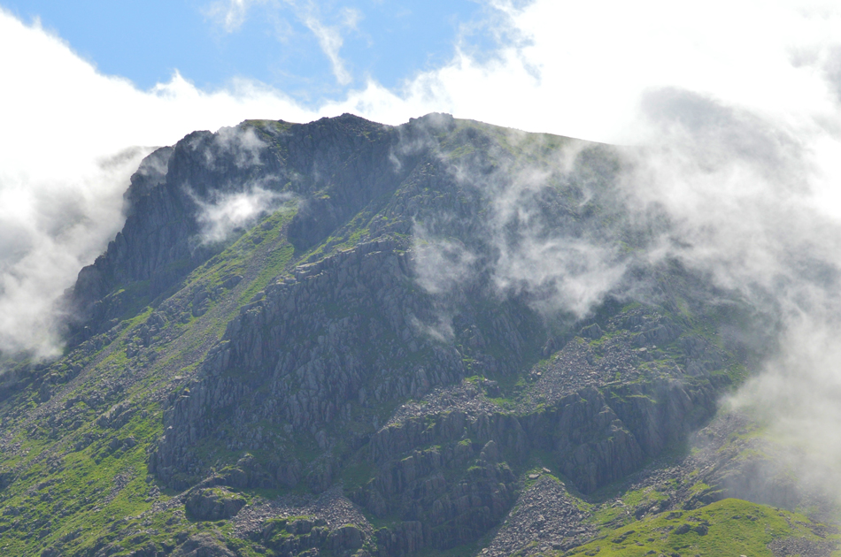
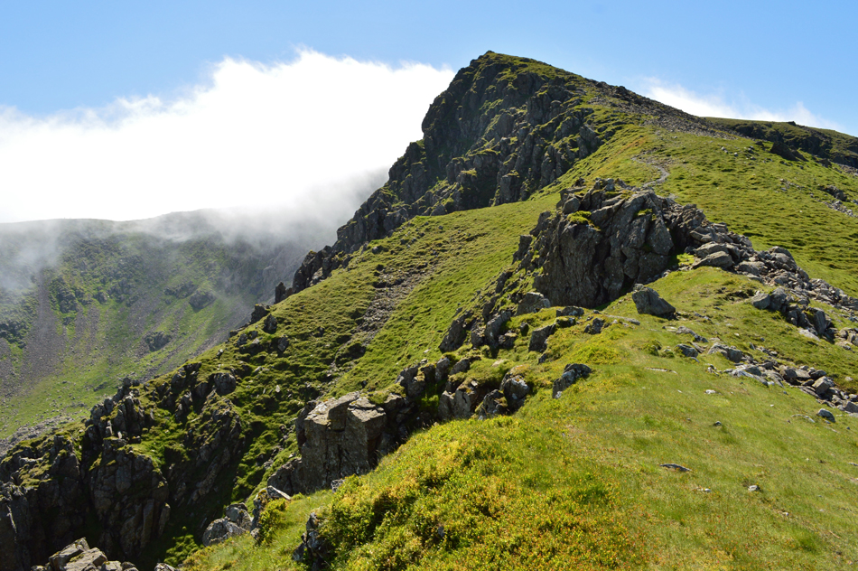
| The ridge towards Steeple summit. |
| I'm not sure how long I had sat there, perhaps twenty minutes, perhaps half an hour but long enough to snap back into the decision that I still had the summit to gain. Between the gaps in the cloud I could see walkers walking on the ridge and only the thought of their views and what laid ahead spurned me on. |
 |
| The cloud continues to spill into Windgap Cove flowing like a waterfall. |
| |
 |
| Steeple summit cairn now clearly in sight. |
| Despite having the whole day walking ahead of me I would have been happy to turn around after summiting Steeple, such the feeling of content with my surroundings. |
 |
| Black Crag and Pillar seen over Windgap Cove and Mirk Cove from Steeple summit. |
| |
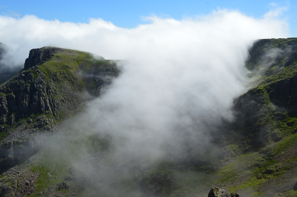 |
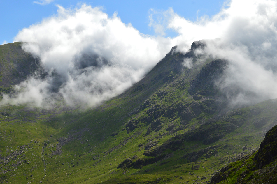
| Cloud literally pours into Mirk Cove helped along by the gusty summit winds. |
It hadn't gone unnoticed just how strong the wind was beginning to feel, more so as I gained Steeple summit as footings had to be secured before reaching for my camera, although strong in strength the wind continued to do a grand job of cooling me down.
After all I think I'm going to need cooling down with views as good as this! |
 |
| Mirk Cove. |
| |
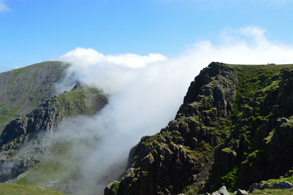 |
| Views over Mirk Cove and Windcap Cove towards Black Crag and Pillar. |
| Okay, time to make a move mainly because there's a large group now heading from the ridge towards Steeple summit. |
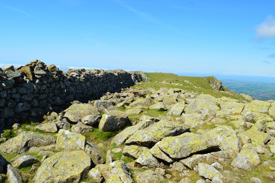 |
| Scoat Fell summit cairn. |
I soon gained the ridge before I made my way towards Scoat Fell summit where I was stopped by two walkers who asked "is that Scoat Fell summit cairn" pointing towards the large cairn between Steeple and Scoat Fell, err technically yes and no, but the highest ground is marked by a stone cairn on the wall, you might have passed it, " no wonder we bloody missed it they laughed" it's okay though we can get it on the way back after summiting Steeple as they were on a round of the Mosedale Horseshoe "what's Stirrup Crag like on Yewbarrow, will we be able to get up?" they asked
I stabbed my poles into the ground and explained in fine detail the scramble needed to gain the top of Stirrup Crag and they thanked me for my advice before wishing each other "enjoy the rest of your day"
Come to think about it, the summit cairn does appear to have thinned out. |
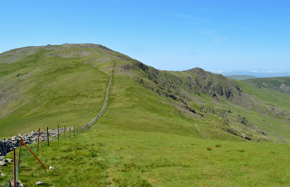 |
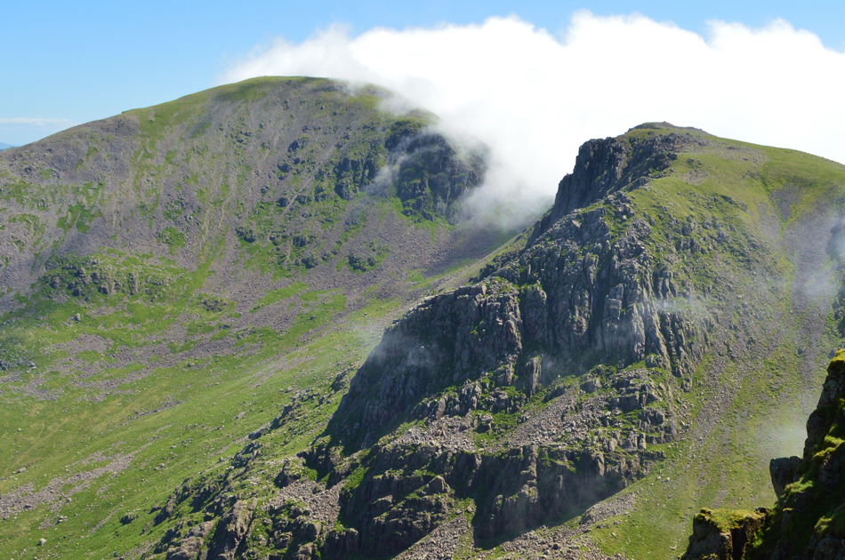
| Views towards Haycock and Little Gowder Crag as I descend Scoat Fell. |
| Despite having a clear view as far as the coast cloud is now starting to build and lower over the Wasdale Valley soon succumbing the Scafells before advancing into the Mosedale Valley, I wondered was I now on borrowed time. |
 |
| Distant views over Great Cove towards Little Gowder Crag, Iron Crag, Crag Fell and Ennerdale Water. |
| Crag Fell still looks a fair distance away from here but at least my knee is doing well. |
 |
| The view back towards Scoat Fell, Steeple, Red Pike (Wasdale) and Great Gable. |
| With the midday heat on my back I make my ascent of Haycock stopping to check on the cloud inversion which appeared to have deteriorated whilst my back was turned. The decision to continue with my original route will be made once I have gained Haycock summit where I can make an observation on the cloud situation. |
 |
| Haycock summit. |
It was now easy to see where all the cloud had been coming from which appeared to be advancing on the western fells from the direction of the Irish Sea. The wind made this much quicker and looking back I under estimated how long the next wave of cloud might take to reach the fells whilst sheltering behind the summit wall during my lunch break.
It is what it is I guess. |
 |
| Caw Fell seen beyond Little Gowder Crag as I start my descent from Haycock. |
I was undisturbed the whole time I ate lunch, it felt so peaceful just sitting there. World War three could have been around the corner and I wouldn't have noticed a thing but sadly all good things must come to an end so I packed my lunch away leaving a sausage roll for after which almost choked me, my mouth was so dry such my dehydrated state.
This was solved by sipping long sips from my bite valve. Good grief I think I lost my voice there for a moment too. |
 |
| Looking back on Little Gowder Crag as I start the gentle approach to Caw Fell. |
The cloud had lowered and was hurried along by strengthening summit winds which caused the cloud to fleet by right before my eyes. The temperatures were still high and I found it strange to be walking in just shorts and a short sleeved base layer under such conditions.
The cloud did lift revealing the summit cairn where I stood for a few moments watching the cloud break here and there, this summit holds special to me purely because of its isolation and all that brings. Despite wanting to spend more time here just soaking it all in I knew that I still had the two mile to walk over Iron Crag before gaining my last summit so after scratching my wedding ring on the summit cairn, I left for the col between Caw Fell and Iron Crag. |
 |
| Descending Caw Fell summit towards Iron Crag. |
| After leaving Caw Fell I made a pathless traverse towards the stone wall seen right and hoped over a crumbled section then descended steeply towards the col before the gentle ascent towards Iron Crag wonderful grassy summit plateau. |
 |
| Views back over the grassy col towards Caw Fell. |
| |
 |
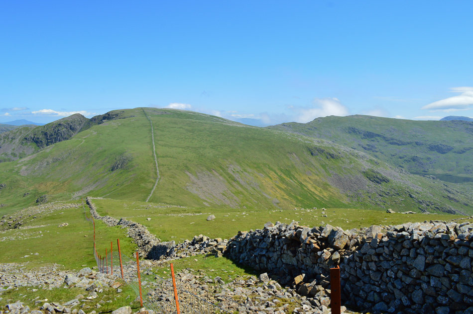
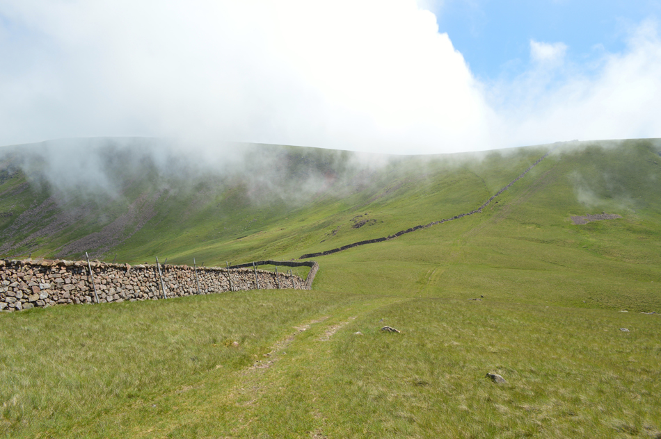
| Following the stone wall (seen right) as I head towards Iron Crag summit. |
| It's almost two miles of walking bliss before the final ascent of the day, for now I shall enjoy. |
 |
| A peak of White Pike (Pillar) through the cloud, here seen from Iron Crag summit. |
| It felt great to be on Iron Crag again where the wind blew so strongly I had to secure my baseball cap to my pack through fear of it being blown away. I continued to follow the stone wall which at times was just above my head meaning I never got to see the cloud inversion creeping down on Pillar, this time in spectacular fashion. |
 |
| Iron Crag. |
| Soon after leaving the summit I noticed that the same cloud was approaching from the west and advancing quickly on my position and I soon found myself walking at times in just ten/twenty feet of visibility, to add to this the temperature notably dropped and once again the wind gained in strength, it was questionable whether to add another layer or just to preservere until the cloud hopefully passes, either way I'm enjoying myself way to much to care. |
 |
| Herdus, Great Borne, Starling Dodd, Red Pike and High Stile taken close to Crag Fell summit. |
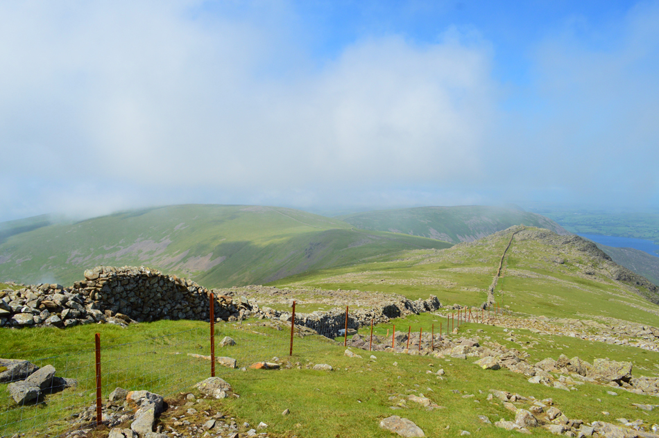
The cloud remained low so much so I was checking my position in relation to Crag Fell which was not too far ahead, walking in cloud for long durations can alter perception of where you think you actually are I guess.
The cloud first scattered and soon Crag Fell over the felled trees opened out ahead of me then like you would whip the duvet of a bed the cloud just lifted in an instant, by which time I was negotiating the bogs in an area known as Black Pots. I of course knew that between my position and reaching my starting point on which to ascend Crag Fell by I first had to de-tour around the felled trees, not an easy job but I persevered until I reached a wooden gate.
Here I had no option than to collect myself before taking on the final ascent of the day. I pass through the gate and take a narrow track alongside the fence before picking up a second track that lead towards the summit, by which time the wind now really is whipping up a hooley.
The summit cairn appears and I was pleased to have the summit to myself, I could have rested but the wind made that a tad uncomfortable so I take in my views back towards Pillar who's summit is still breached by low cloud as too is Steeple and Haycock leaving me feeling thankful that at least I had the views whilst I was there.
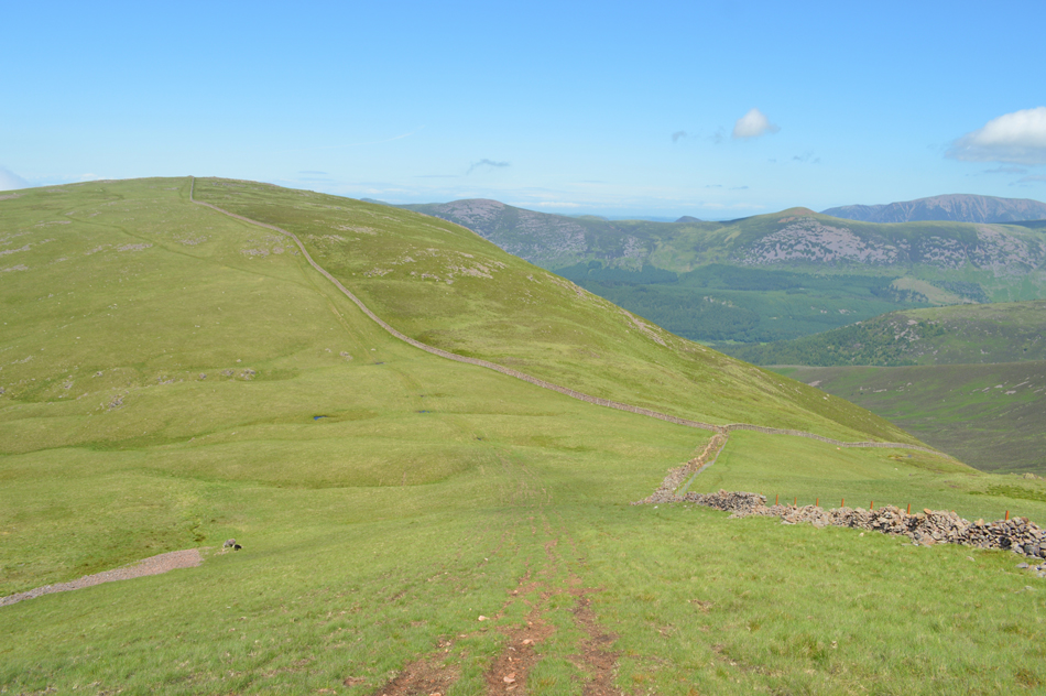
Bleach Green is also in sight and I can see the tiny figures heading to and from the car park. My choice of descent will be via Ben Gill, a route that I have never used before and I'm quite looking forward to doing. |
 |
| Views over Grike as I start my descent towards Ben Gill. |
| From the summit cairn I head westwards towards the end of the ridge which overlooks Revelin Crag, you might be able to spot Ben Gill seen running diagonally through this picture but the main ravine in which the gill descends drops sharply to the right, my path continues straight ahead passing the top of the ravine before descending further into woodland. |
 |
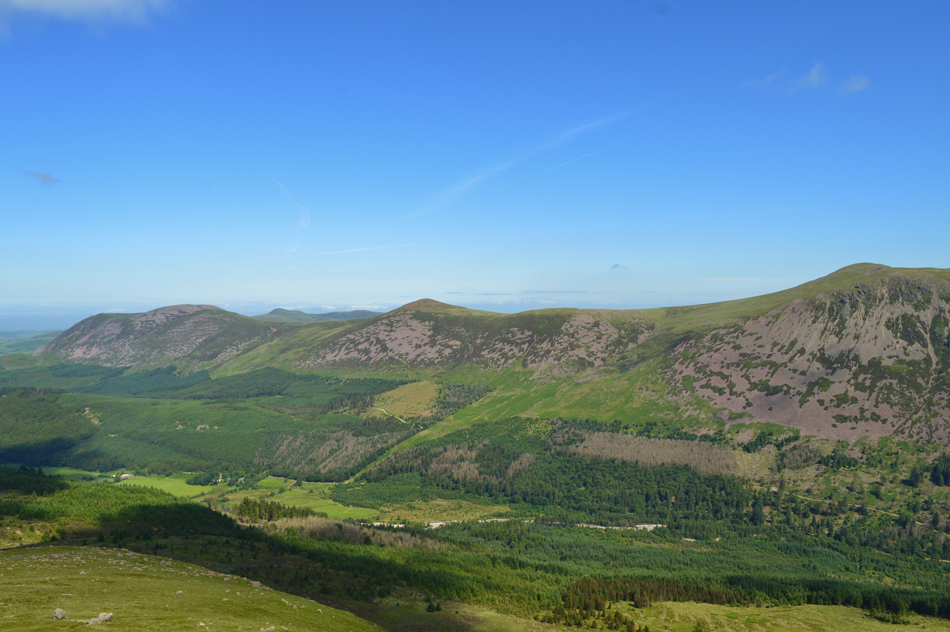
| Views over Croasdale towards Banna Fell, Knock Murton and Blake Fell. |
| |
 |
| Lakeside. |
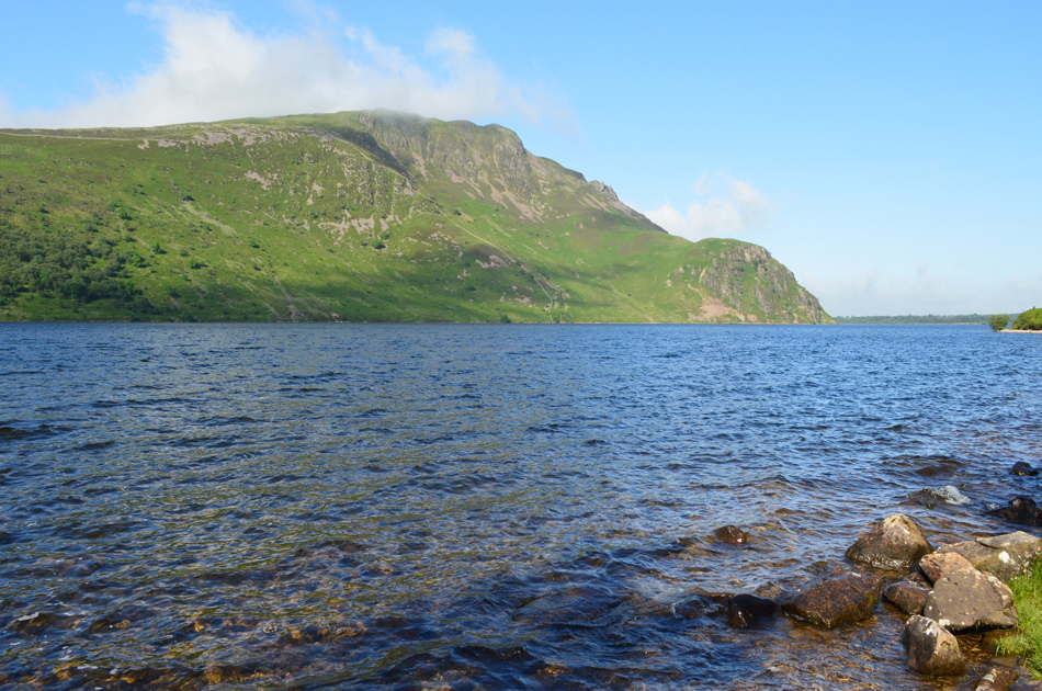
After descending through woodland where I was treated to spectacles of light all that was left before reaching my car was to pass Crag House Farm. Here I stopped while I kicked my heel into the back of my boots and thanked my knee for fairing well today. I leave the farm behind and pick up the farm track which leads directly back onto Bleach Green car park which by now was full to almost bursting. I told myself this morning that after taking that one photo under low light that should it remain brighter I would return to the exact same spot which was what I did after dumping my pack into the boot of my car and walked the five minutes back to that tiny beach holding my camera in one hand.
By now the track is alive with families and dogs and in an adjoining field children shoot arrows at targets. I soon found myself at the exact same spot as I stood this morning and while I stand there and let the water lick at my boots I get that sinking feeling that sadly the walk had drawn to an end. |
|
| |
| Back to top |
 |
|