Arthur's Pike, Bonscale Pike and Loadpot Hill from Row Head

12th May 2017

Today I am walking with Tim where up until last night we had planned to walk The Langdale Pikes via Jack's Rake with a return into Mickledon via the Langdale Axe Factory. All that changed after receiving a text from Tim around 9pm the previous evening informing me that his Discovery had broken down and his wife Sarah would require their second car to use get to work, moments after receiving that text Tim rang, the disappointment was plain to hear in Tim's voice "leave it with me a few minutes, I'll get back to you"

Around half an hour later Tim called back and asked would we able to meet at a later time which would be fine with the exception that we would have to ditch our Jack's Rake walk mainly because rain was forecast for early afternoon. The good thing about us walkers is we always have a plan B

Our plan B was this walk which would collect two new Wainwrights for Tim in Arthur's Pike and Bonscale Pike so it was agreed we would meet at the later time of 10:00am at the Little Chef restaurant just of the A66 before then driving through to Pooley Bridge and Row Head from where our plan B walk starts.

 
Wainwright Guide Book Two
The Far Eastern Fells

-Loadpot Hill

Man is not the enemy, only the fox and the buzzard. Loadpot Hill is a sanctuary for all wild life.


Overview
Ascent: 1,480 Feet - 451 Metres
Wainwrights: 3, Arthur's Pike - Bonscale Pike - Loadpot Hill
Weather: Sunny To Start Turning Overcast. Hazy With A Warm Breeze Blowing. Highs of 16°C Lows of 14°C
Parking: Parking Spaces, Rowhead
Area: Far Eastern
Miles: 8
Walking With: Tim Oxburgh
Ordnance Survey: OL5
Time Taken: 4 Hours
Route: Roehead - Barton Fell - Arthur's Pike - Swarth Beck - Bonscale Pike - Loadpot Hill - High Street Roman Road - The Cockpit - Roehead
 

Map and Photo Gallery


Arthur's Pike from Row Head 10:30am 16°C

Tim arrived spot on 10:00am at the Little Chef when minutes earlier I went to swap my the sunglasses that I use for driving for my Bloc Billy's which were still in the lid in my pack, after zipping open the lid to my shock I discovered that one arm had completely snapped away and this saddened me because funnily enough its only my third pair in ten years, the previous two had been left on summits but the current pair Id had for for a good four years and they'd accompanied me on many a walks...I'm not sure why I get attached to material objects the way I do.

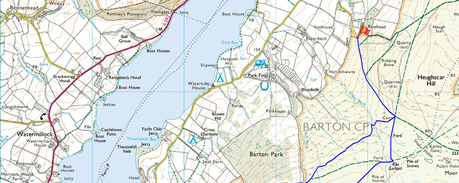
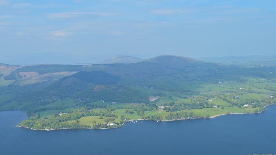
Anyway, we drove through a busy and bustling Pooley Bridge after following a slow moving tractor which had been pulling two large bails on a steel trailer, at the other end of the village, at the junction the tractor turned right towards Howtown and Tim and I headed straight over the junction taking time along the narrow tree lined lane until we reached Rowhead before grabbing the last two available parking spaces, so much so Tim had to reverse park his car neatly behind mine.

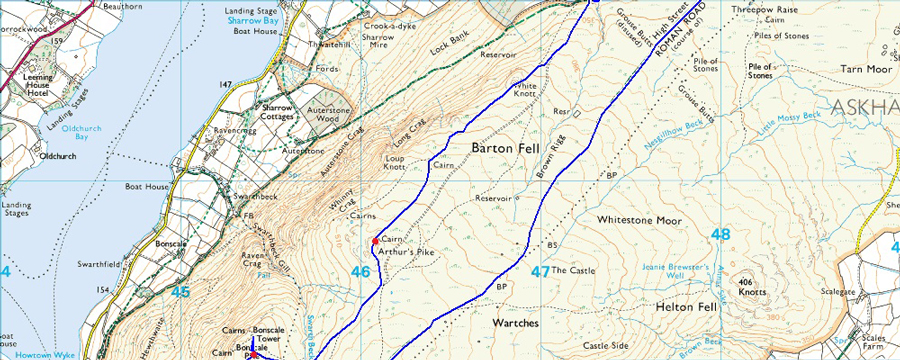
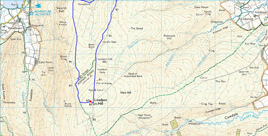
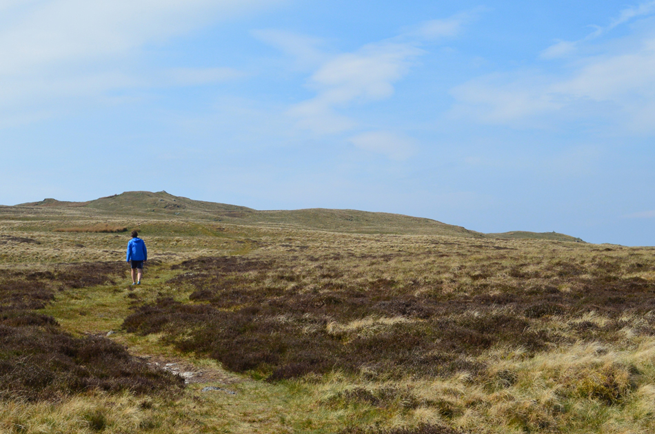
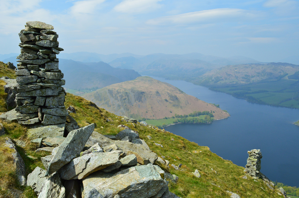
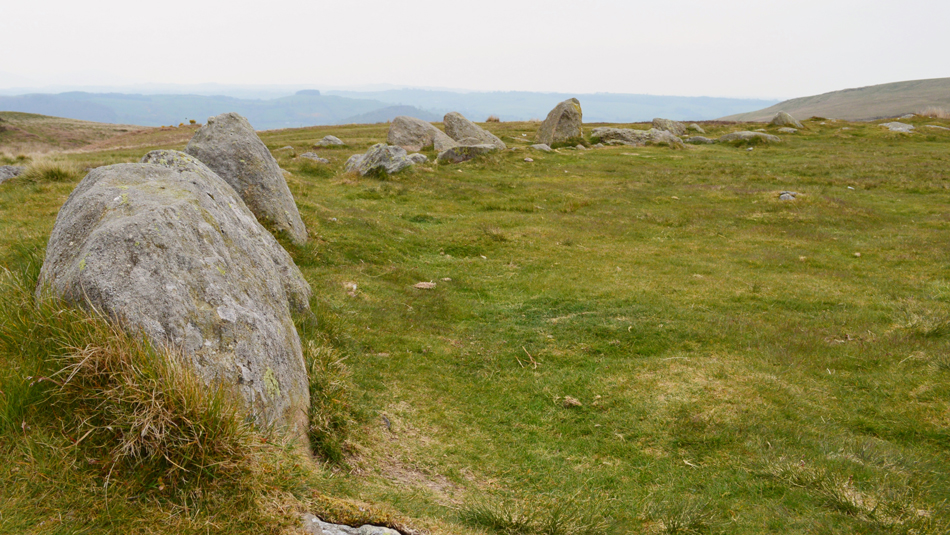
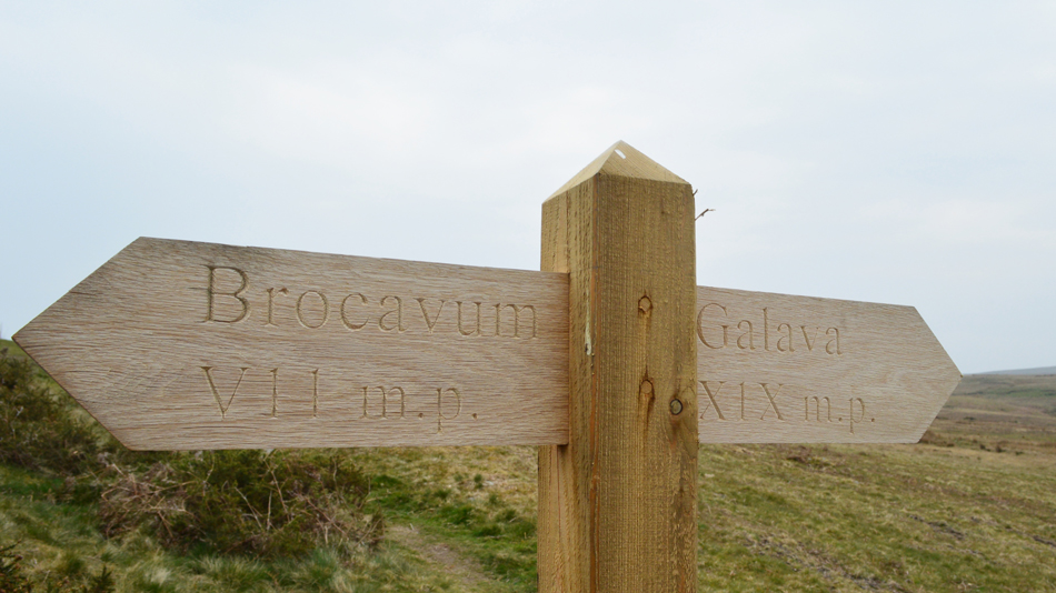
We kit up as a group of walkers we had previously passed pass and cheery 'mornings' are shared. Its Tim's first time here at Rowhead and he wanted to get a feel for the place and its relation to the High Street Roman Road which is part of the first leg of the Joss Naylor over 50's Lakeland Challenge, a fell run designed for the over 50's which is spread out over 48 miles taking in 17,000 feet of ascent which starts at Pooley Bridge and ends at Greendale Bridge Wasdale, those brave enough to attempt it should hope to finish between 12-15 hours.


Barton Fell and Arthur's Pike are just up ahead.

Having left our cars behind we pass through the wooden gate at the end of the lane taking note of the new markers for the Ullswater Way, yet another walk I plan to do over the Summer which takes in 20 miles around Ullswater shores with options to visit Gowbarrow Fell and Aira Force too. We pick up the dusty track which rises below Ridding Brow and Heughscar Hill before arriving at a faint grassy path; it was here we decided to visit the Cockpit Stone Circle on our return instead opting for the scenic path over Ullswater on route to Barton Fell and Arthur's Pike.

The haze that I have already experienced midweek continues to disrupt any long distant views with only Gowbarrow Fell on the other side of Ullswater barley visible, anything further than that would only appear as black silhouettes as we strike off each summit one by one, St Sunday being the defining summit in view with Catstye Cam not far behind.


Easing our way onto Barton Fell.
 

Hazy UIlswater views.
 

Arthur's Pike summit cairn appears on the horizon.
The breeze is blowing, its warm and sunny and the Lapwings are parading, what more could we ask for.

Tim's oath to Arthur's Pike.

It hadn't gone unnoticed just how dry the ground is underfoot with what was once bog like conditions along sections of this path are now cracked and the once bogs are brittle, which maybe good news for us walkers but Farmers right now all over the country are hoping for rain this week, they hopefully wont have to wait too long.

Tim stretches ahead and gains the summit and collects Arthur's Pike completing his Far Eastern fells leaving just five remaining Wainwright summits after today.


Bonscale Pike over Swarth Beck.
Two paths traverse towards the top of Swarth Beck (far left) one upper and lower, the upper being the more prominent but today, for a change we use the lower path, both paths however meet at the familiar ruined Sheepfold.

Sheepfold at the top of Swarth Beck.
Here we cross Swarth Beck at its narrowest and begin the gentle rise towards Bonscale Pike summit were we can see two walkers are now stood.

Hallin Fell, Beda Fell and Ullswater from Bonscale Pike summit cairn.
The two walkers had left by the time we reached the summit, in what direction we was unsure because they appeared to have vanished! Lazily we soak up the views before dropping down towards Bonscale Towers where we de-shoulder and relax by sitting bums on dry grass all the while watching the Ullswater Steamers sail silently far below.

More hazy Views over Ullswater and Watermillock towards Little Mell Fell and Great Mell Fell from Bonscale Pike.
That cloud over the Mells seems to be going nowhere.

Hallin Fell and Ullswater from Bonscale Towers
After around fifteen minutes we re-shoulder and decide where to go next, fancy Loadpot I asked? Aye why not we can make it up as we go along.

As good as the haze will allow.
That's St Sunday Crag centre left with Fairfeild and Hart Crag behind, meanwhile further right we have Dollywagon Pike, Nethermost Pike, Catstye Cam and Helvellyn.

The view back towards Bonscale Fell and Arthur's Pike over on the right.
We follow a singular prominent trod and are soon passed by two fell runners while a Spaniel follows in toe, they gain Loadpot Hill summit by a pathless ascent while we opt to follow our trod around the western flank of the summit crossing the original Roman Road before a rather steep pull onto the summit by pathless ascent.

Loadpot Hill summit trig point.

It was noted during those last hundred feet over pathless ground that the light was starting to fade and even a drop in temperature could be felt, by the time we arrived at the summit trig point the haze was replaced by advancing low cloud from the east, earlier we had spoken about the forecasted rain that was due and what direction it would arrive from because due to the haze, it was any ones guess.

I guess we now have our answer.


Passing Lambert Lad as we pick up the High Street Roman Road once again.
 

High Street Roman Road with Arthur's Pike over on the right.

There was no rush to get back to Rowhead leaving the walk back at a dawdles pace to say the least despite the advancing cloud we figured we were still ahead of the forecasted showers. A fell walker approaches and stops to chat "excuse me, could you tell me the names of these summits" pointing towards Arthur's Pike, Bonscale Pike and Loadpot Hill, we realised he from the Netherlands and he just wanted to double check his bearings and of course we obliged, the guy went onto say that he was doing a 'reckie' for the first leg of the Joss Naylor over 50's challenge the first part being from Pooley Bridge to Red Screes.

Blimey what a coincidence, we was only talking about that earlier. We wished him luck and he trotted off towards Loadpot Hill.


Heughscar Hill from the Cockpit Stone Circle.

Having continued along the course of the Roman Road it was agreed that we would chance our luck ahead of the advancing rain and eat lunch at the Cockpit Stone Cirlce which was deserted when we arrived. O'Yonder we can see walkers descending Heughscar Hill and behind us, more walkers heading back to Rowhead.

It kinda felt like when you were kids and the mums would come out and "come in its raining!"


Lunch with a view.
Lunch wasn't the longest but it was laid back and complemented by a Lion Bar each. OK that's definitely rain in the air, time to head back to the cars.

Brocavum Roman Fort (Penrith) 7 Miles - Galava Roman Fort (Ambleside) 19 Miles

We soon found ourselves back on the dust track with Rowhead only minutes away. Arthur's Pike blends into the hillside against a white and grey backdrop as the advancing rain highlights the dusty track below our feet but it feels much later than just 14:20pm in the afternoon. We arrive back at our cars just in time as the rain starts to get heavier and hands are shaken until another day.

We both really had been looking forward to tackling Jack's Rake again and it will be climbed one day over the Summer, yet earlier I remembered walking towards Barton Fell as a the birds danced over our heads and a breeze billowed through the wild grasses , the sun shone down warningly and I silently thought, not a bad plan B after all.


Back to top