|
The Wasdale Head Watershed |
 |
 |
22nd April 2017 |
 |
|
It was a couple of months ago when I came up with this route and named it The Wasdale Head Watershed based upon the fact that each fell climbed water course eventually flows into Wast Water, this isn't strictly true regarding The Scafells who's main watershed flows into the Great Moss area of Upper Eskdale and eventually the River Esk yet this was a fitting name nevertheless given the geography of Wasdale Head.
This walk demanded a bright clear day preferably during Spring when the temperature hovered in the low teens, it is also a very demanding route even for the experienced given the fact that I could have well made the ascent of Scafell Pike much easier by following the tourist path directly from Wasdale Head, instead I opted for the Brown Tongue/Mickledore Ridge route if only to spice things up a little, the extra effort needed was more than worth it during the climb to the Mickledore ridge.
It's fair to say that after Winter has passed I was eager to test myself all the while enjoying some of the most stunning mountain scenery the UK has to offer in under what can only be described under some of the best walking conditions the year has seen so far with crystal clear skies combined with cool summit temperatures, it was the perfect setting for my first 'biggie' of the year. |
|
| Wainwright Guide Book Four |
 |
| The Southern Fells |
-Scafell Pike
Roughness and ruggedness are the necessary attributes, and the Pike has these in greater measure than other high ground in the country – which is just as it should be, for there is no higher ground than this. |
 |
|
|
|
| |
|
Overview |
|
|
| Ascent: |
5,244 Feet - 1,599 Metres |
| Wainwrights: |
4, Scafell Pike - Lingmell - Great Gable - Kirk Fell |
| Weather: |
Remaining Cool BeforeTurning Warm, Bright & Sunny. Highs of 17°C Lows of 7°C |
| Parking: |
Car Park, Wasdale Head |
| Area: |
South Western |
| Miles: |
10.2 |
| Walking With: |
On My Own |
| Ordnance Survey: |
OL4 - OL6 |
| Time Taken: |
7 Hours 35 Minutes |
| Route: |
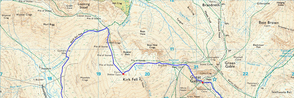
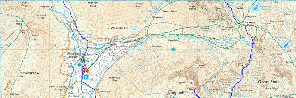
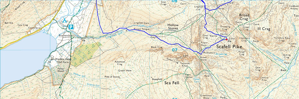
Wasdale Head - Lingmell Gill - Brown Tongue - Mickledore - Scafell Pike - Lingmell Col - Lingmell - Lingmell Col - Corridor Route - Sty Head - Great Gable - Beck Head - Rib End - Kirk Fell - Kirkfell Crags - Top of Blacksail Pass - Gatherstone Beck - Mosedale - Mosedale Beck - Wasdale Head |
|
| |
|
Map and Photo Gallery |
|
|
 |
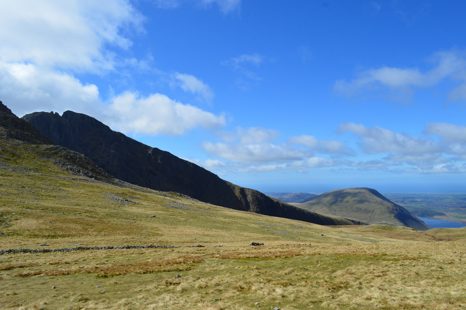
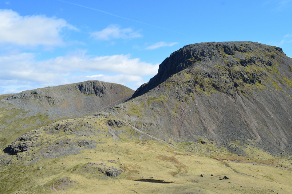
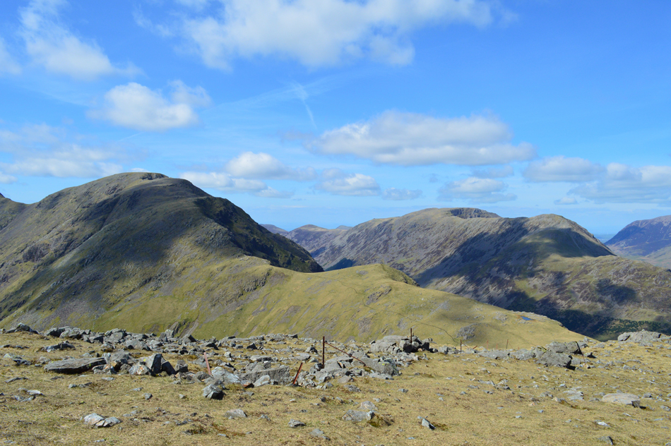
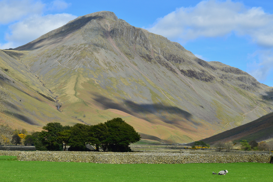
| Kirk Fell and Great Gable from Down-in-the-Dale 08:10am 7°C |
The Wasdale valley was largely in shadow as I drove along the Lake road towards Wasdale Head as the morning light hadn't quite breached IIIgill Head and the Wast Water Screes. I stopped to take a few photographs from the shoreline all to no avail blaming the low light. Further towards Wasdale Head columns of horizontal sunlight penetrated over the surface of Wast Water illuminating Yewbarrow and slowly but surely the sun started to creep over Illgill Head's north ridge, but for now the valley will remain in shadow.
I had expected to find the car park at Wasdale Head busy but there was only around four cars and one motor-home pitched up leaving parking easy, I park with a distant view of Pillar through my windscreen. Despite the blue skies it's a cool morning made slightly cooler with the valley still in shadow but I won't have to wait long before the sun is up and with this I kit up wearing my fleece lined walking trousers, a light mid-layer, baseball cap and jacket. Gloves could have been added too but I resist safe in knowledge that the blood will be pumping soon enough.
With my car locked I head out of the car park passing the site of the old School before crossing a wooden sty on the edge of Down-in-the-Dale where after a short walk through open farmland I cross Lingmell Beck. |
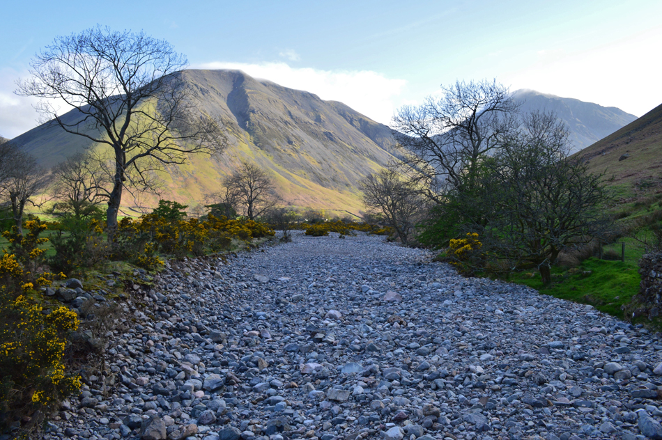 |
| Kirl Fell and Great Gable seen as I cross Lingmell Beck. |
| It was German prisoners of war who cut the channel from here to where Lingmell Beck flows into Lingmell Gill a quarter of a mile from the shores of Wast Water where now the stream finds its way to the lake under the debris of rock, however, during times of heavy rainfall Lingmell Beck returns to its natural, and sometimes fierce state. |
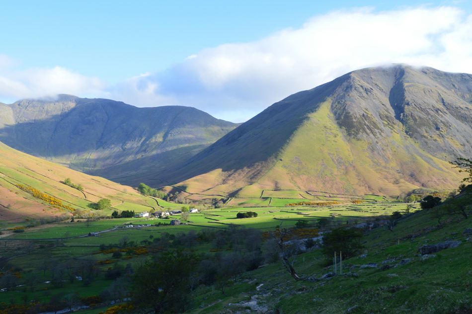 |
| Pausing to look back on Wasdale Head towards Kirk Fell and Pillar. |
| The sunlight is just starting to streak through the head of the valley despite my continuous ascent under shade, such the chill to the morning air I billow warm air into cupped fist if only to add warmth to my cold hands. |
 |
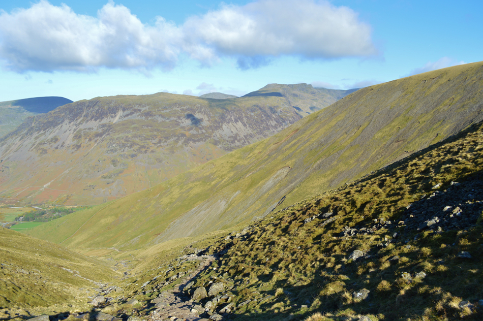
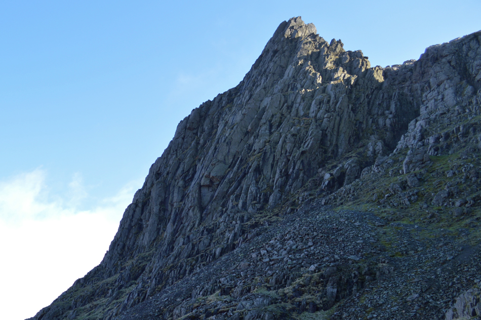
| Scafell Pike seen towering above Brown Tongue. |
| Still in shade I pick up the path towards Brown Tongue seen centre left in the photograph, it's quite a busy ascent with families of walkers behind me all of whom have started their ascent from the National Trust campsite at Brackenclose, while up ahead more groups of walkers are heading down after spending the night on the mountain. |
 |
| Views back over Wast Water, IIIgill Head, Buck Barrow, Middle Fell and Yewbarrow as I approach Brown Tongue. |
By now the morning sunlight had breached the valley bringing with it warmth leaving my ascent a very hot one indeed. I had now gone from one extreme to the other after ascending in shadow and now I am over-ruled by the incredible amount of light shining directly down on me as the sunlight breaches the Mickledore ridge directly ahead of me. |
 |
| Here looking back on Seatallan, Lingmell, Yewbarrow, Red Pike (Wasdale) Scoat Fell and Haycock from Brown Tongue. |
| |
 |
| Continuing from Brown Tongue towards the Mickledore Ridge. |
I had been following the steep stone staircase on the flank of Brown Tongue and Lingmell Gill which I had now left behind after forking right at a stone cairn, steering left here continues towards the Hollow Stones route which is still busy with walkers heading down from the summit.
While heading towards the Mickledore ridge my ascent started to feel more tranquil from where I could look back on walkers both in ascent and descent, here below Mickledore, I had the whole place to myself, it was just me and the breeze...
...and let's not forget that sunlight, blimey it was strong! |
 |
| The view back over Brown Tongue towards Seatallan, Yewbarrow, Haycock, Red Pike (Wasdale) Scoat Fell, Pillar and Lingmell. |
| |
 |
| Here taking in the view over Hollow Stones towards Lingmell (far right) while beyond the Mosedale Valley, Pillar and Black Crag. |
| |
 |
| Pulpit Rock domineers my left flank. |
| |
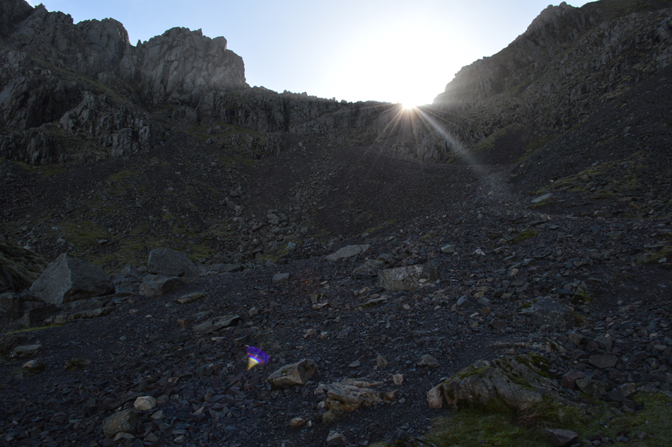 |
| Ascending the scree below the Mickledore Ridge. |
| By the time I had reached the steep scree section below the Mickledore ridge I was back in shade and the drop in temperature was instantly felt. Here the path ascends steeply over boulder and sometimes loose scree where I ascend keeping to the right of the scree path where the boulders had gathered meaning they maintained traction rather than opting to ascend via the middle of the path which was loose and tiresome, something that I didn't want to inflict on myself so early into the walk. |
 |
| In the shadow of Mickledore. |
| |
 |
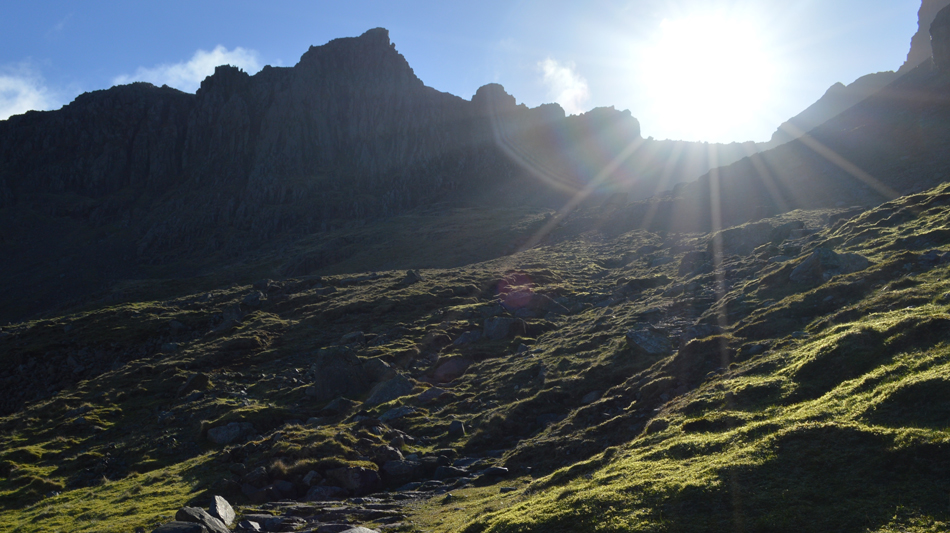
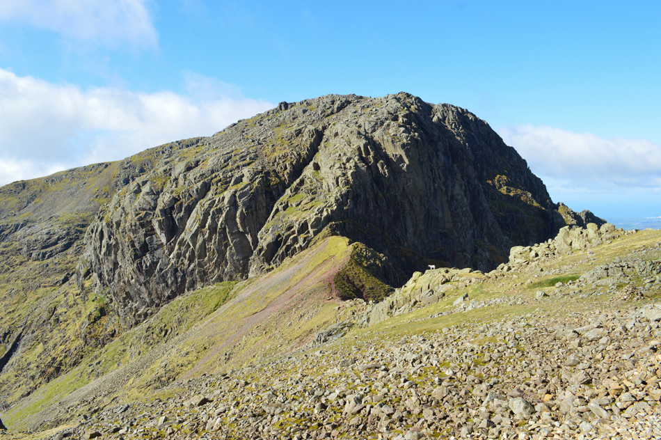
| Scafell Pike from Mickledore. |
I had gained the ridge in good stead and topped out at a stone cairn marked with a wooden stake in the centre which appeared into view from the top of the stone rake.
Just a few yards away is the Mickledore Stretcher Box which I will pay a visit to next before heading towards the summit. |
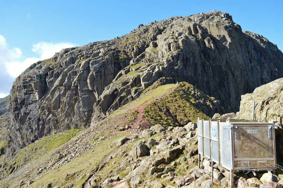 |
| Sca Fell and Broad Stand from the Mickledore Stretcher Box. |
| I observe the view into Upper Eskdale scouring for movement but spot nothing, I do the same while looking towards Sca Fell and Scafell Pike and still, nothing, pure bliss. |
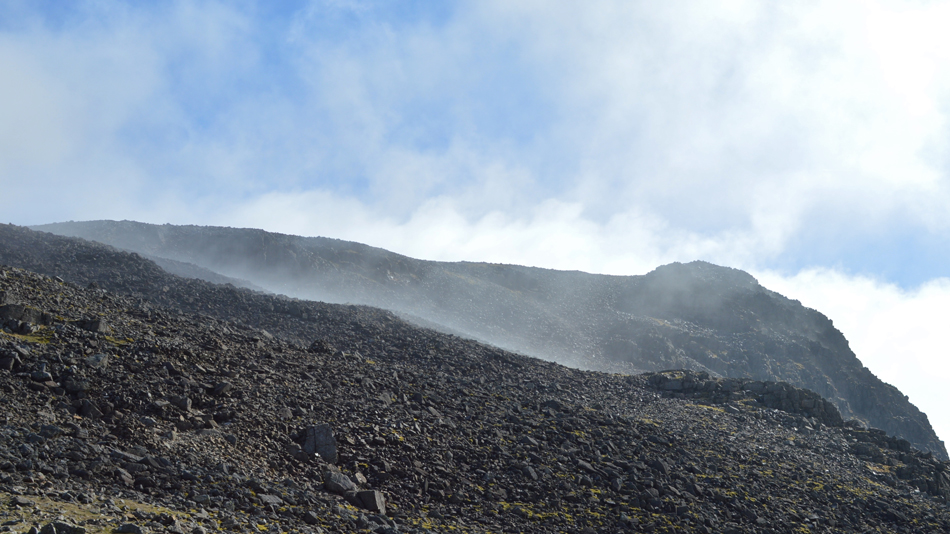 |
| Cloud clearing from the summit of Scafell Pike. |
| This was one of those magic moments when minutes earlier the summit had been lightly coated in cloud which was gradually lifting while I watched on. Two fell runners broke the silence as they sent rock tumbling as they hurtled across the path, they wave before I begin the short, yet rocky ascent towards the summit, conditions couldn't have been more perfect. |
 |
| One last photo of Sca fell and Broad Stand over the Mickledore Ridge. |
| |
 |
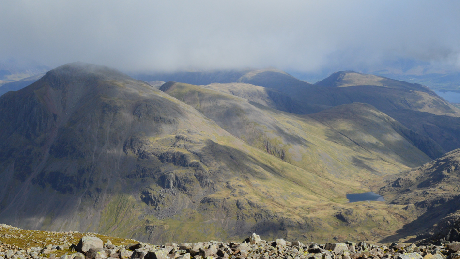
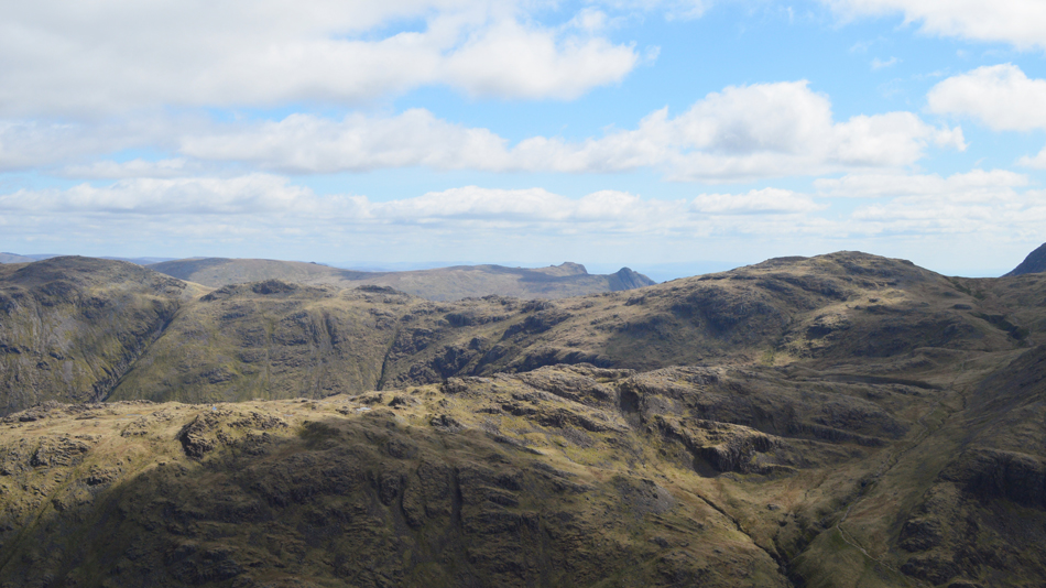
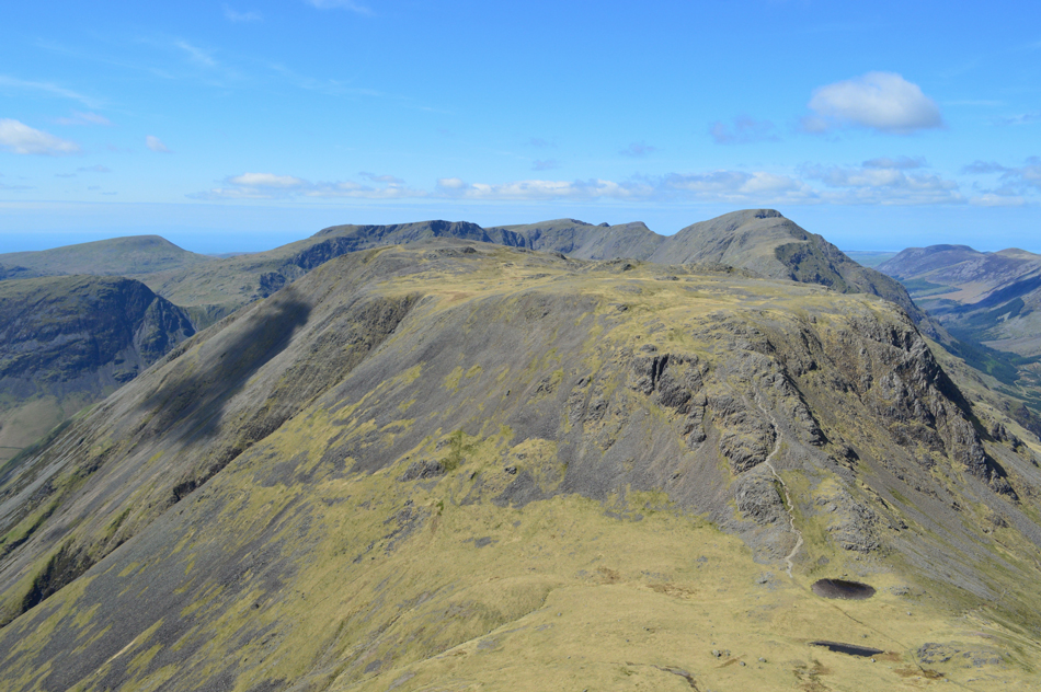
| Views over Broad Crag, Great End and III Crag from Scafell Pike. |
My approach saw more cloud come and go, more cloud was yet to arrive heading over from the direction of Mosedale which looked quite sinister with no real wind to keep it moving, here thoughts occurred that I might have had the best out of the day already.
But I was wrong. |
 |
| Great Gable, Green Gable, Sty Head, Styhead Tarn, Base Brown, Brandreth, Grey Knotts, Dale Head and Maiden Moor from Scafell Pike. |
Thankfully the low cloud passes within the space of around ten minutes and soon the clear views return. There was only two other people at the summit, a young teenage couple who showed blatant disrespect as they wondered into and out of my shots, even a stern look from my direction whilst I held my camera from shoulder height didn't seem to drop the hint.
Okay...time to move on. |
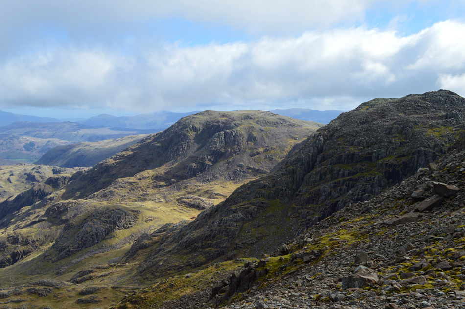 |
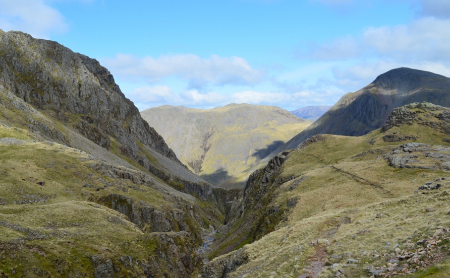
| Broad Crag and Great End seen as I descend from the summit. |
| Those with a keen eye may be able to spot the Corridor Route in the lower left which is where I'm heading next not before visiting Lingmell first. |
 |
| A clearer view of the Corridor Route which starts at the head of Piers Gill and ends at Sty Head. |
| It's been sometime since I last traversed the Corridor Route and I'm quite looking forward to my return. |
 |
| That's lingmell over Lingmell Col. |
| It was a busy descent over sometimes eroded ground but nevertheless I was feeling in great stead and ready for the short detour to visit Lingmell where I first pass over Lingmell Col which offered soothing grass underfoot for comfort if only for a little while! |
 |
| Sca Fell, Green How and IIIgill Head from Lingmell Col. |
| |
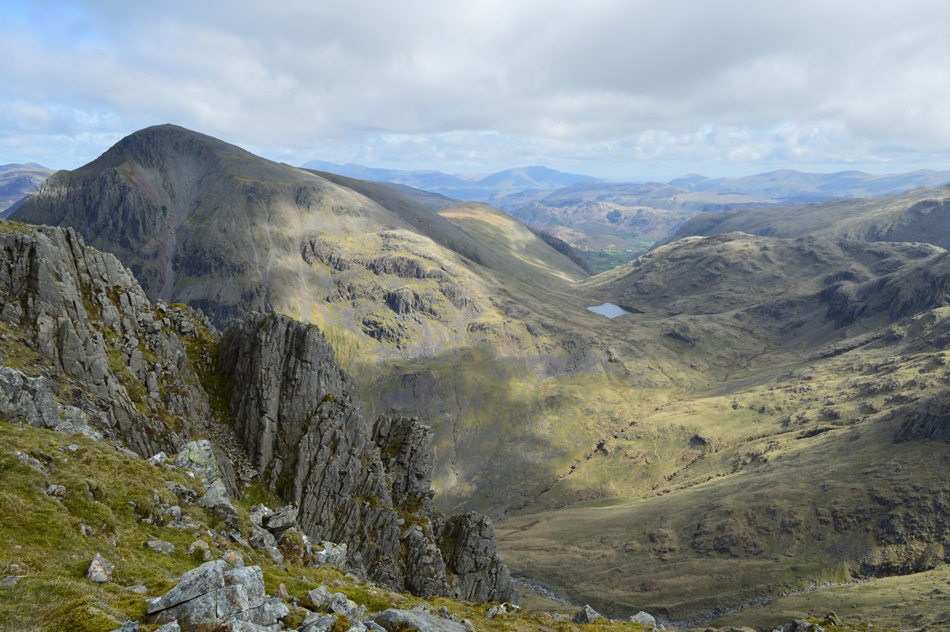 |
| Fantastic views towards Great Gable, Seathwaite Fell and the Borrowdale Valley from Lingmell summit. |
It was a quick and easy summit which didn't pull at any reserves and by the time I had reached the summit cairn my mind was wondering to previous visits when visibility was almost zero, the contrast of todays visit couldn't have been further apart.
I am soon joined by a young fell runner who I heard well before I could see him, his lungs doing all the work, mornings are shared before I retrace my descent slightly towards the top of Piers Gill. |
 |
| Great End seen with Greta Gill ravine below. |
| The light isn't great in this photo but you can see the course of the Corridor Route if you start from Styhead Tarn then trace right across the head of Greta Gill then along the flat bit (below Round How) which is where I'm heading next. |
 |
| The dominance of Piers Gill with Kirk Fell and Great Gable in the distance. |
| |
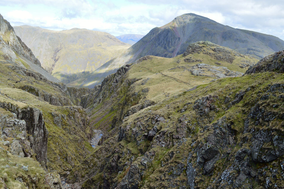 |
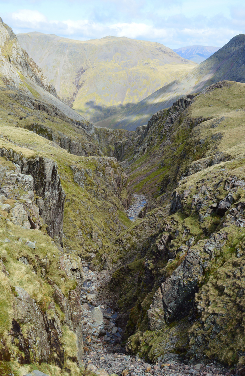
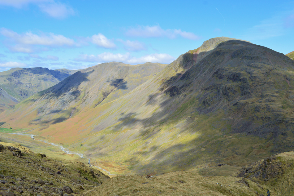
| Kirk Fell, Great Gable and Middleboot Knotts from the head of Piers Gill. |
| The path seen onto the right of the ravine descends below Sty Head and eventually back towards Wasdale Head with a couple of 'hands on' scrambles thrown in. Piers Gilll itself is not navigable. |
 |
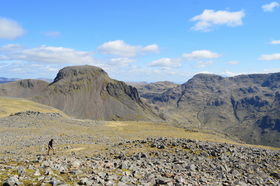
| Lingmell, Kirk Fell and Great Gable from Piers Gill. |
| Two down two to go. |
 |
| Lingmell and Kirk Fell from Piers Gill. |
| |
 |
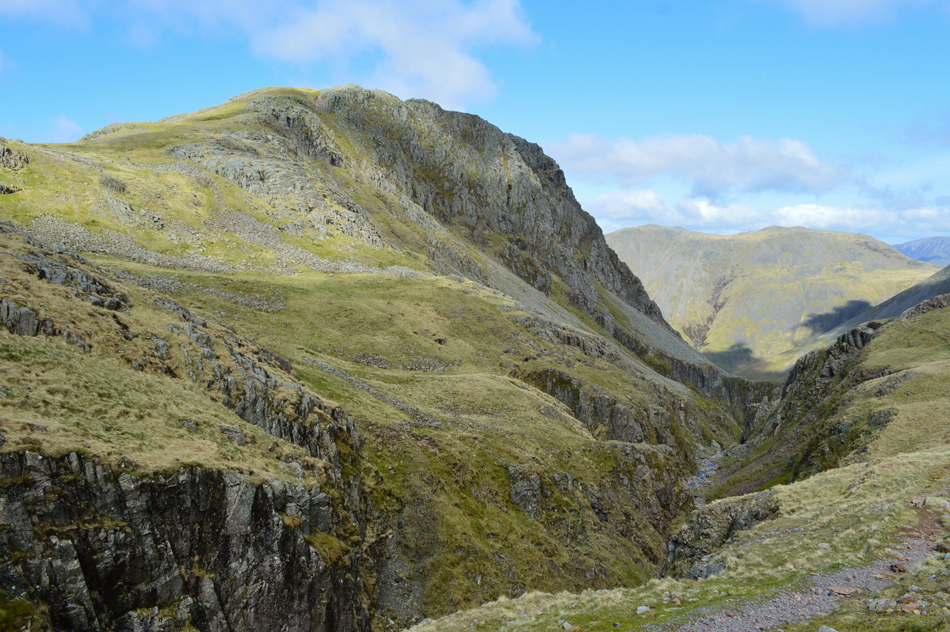
| Lingmell and Piers Gill from the Corridor Route. |
| I had expected to find the Corridor Route much busier than I found it only passing around three walkers during my traverse, here, soon after crossing the head of Gretna Gill I look back on Lingmell and Piers Gill with Yewbarrow/Dore Head, Red Pike (Wasdale) and Scoat Fell in the distance. |
 |
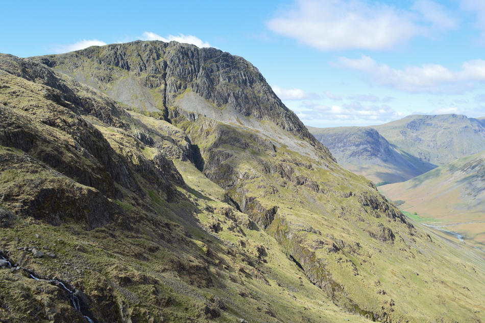
| Great Gable and Kirk Fell from from the Corridor Route. |
| Taken close to the bottom of Skew Gill. |
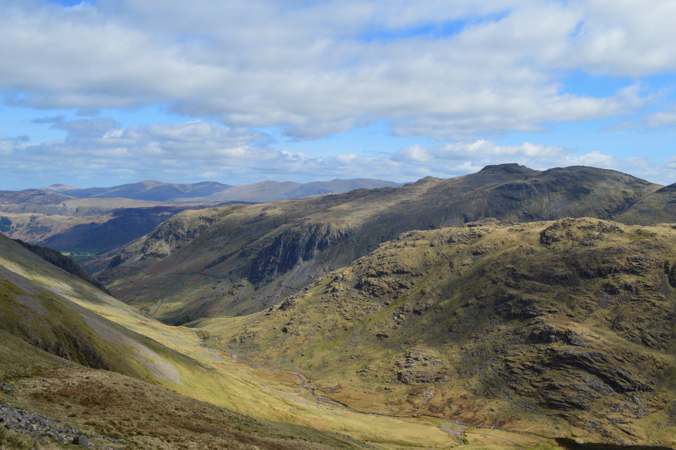 |
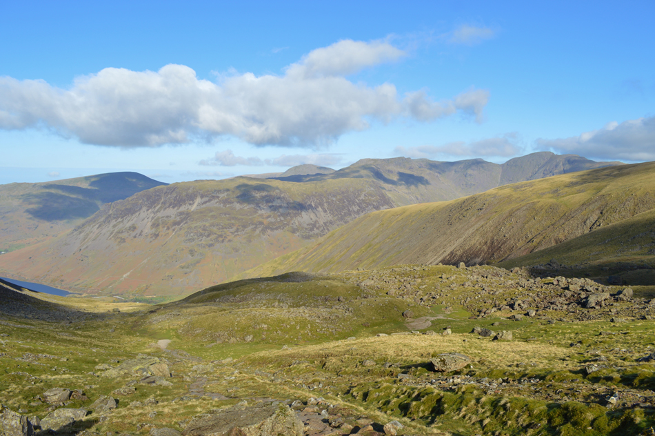
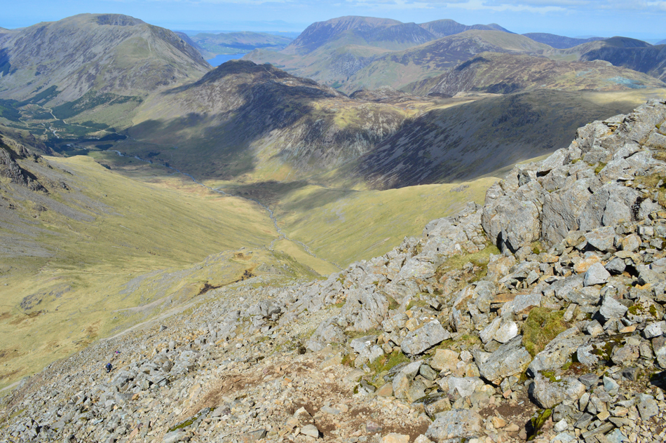
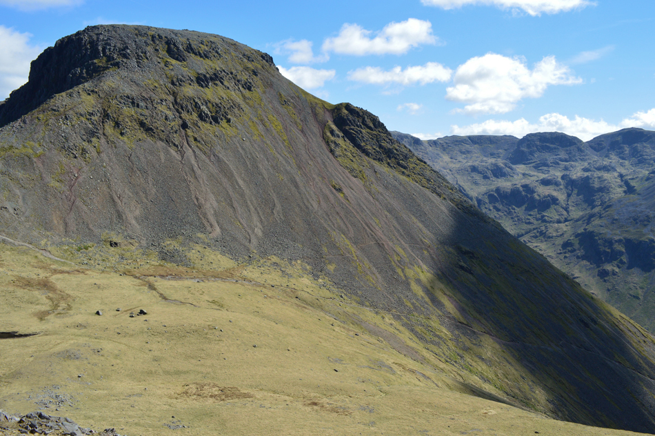
| Seathwaite Fell, Glaramara seen with a host of central and eastern fells in the distance from the ascent of Great Gable above Sty Head. |
Purely for mental purpose I had split the walk into two with the second half of the walk starting at Sty Head. From the Corridor Route I approach Sty Head and take a short diversion to Styhead Tarn finding a large boulder to take two minutes time out which is when I remembered the packet of jellied teeth and lips that Tim had given to me which are still in the side pocket of my pack at the start of last weeks walk at Deepdale Bridge, great, I'm actualy glad I forgot to eat them because now they'll hopefully provide a sugary energy boost as I start my ascent on Great Gable.
From Styhead Tarn I head towards the Stretcher Box which is busy with walkers all of whom are kitted out in the latest trendy designer outdoor gear, I take a look at myself, my faded muddied Mountain Equipment trousers are starting to look worn despite being less than a year old and my Rab base-layer, well that's been with me from the start and has served me well. I may not look the part at Sty Head today, but I certainly feel it.
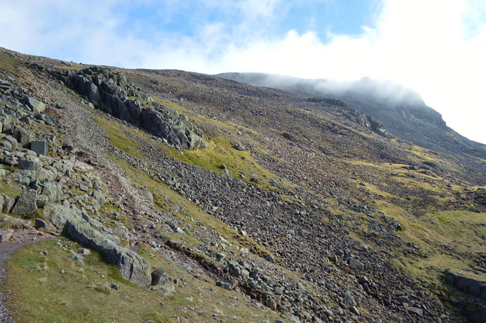
I start my ascent and wind myself up the stone staircase as the Stretcher Box quickly disappears below, the air temperature drops leaving me feeling relieved and I concentrate at the task in hand. The last time I was here just a few weeks ago this path was under snow, sometimes a foot deep, today it is dusty and I start to see my panting breath, a perfect combination for the climb. |
 |
| Distant Langdale Pikes seen over Allen Crags and Esk Hause. |
| |
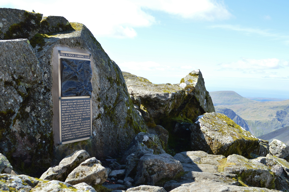 |
| Great Gable summit memorial plaque. |
I persevered in ascent only stopping to take the odd photo or to chat to two eastern European walkers who asked me of my route, Good lad one replies. Further ahead and close to the summit I pass a solo woman walker who comments "not far now" grrr why must one assume I have never been here before?
I know I politely smiled.
The summit area although boulder-some is busy with walkers taking time out for lunch, I don't see their faces, just the colours they are wearing. At the summit I took just the one photo and strike up a brief conversation with a woman who has a West Highland White Terrier with her, the first I've seen so high, I have two Westies I replied, but their too pampered for the fells I say, she gets sad if she know's we're going walking without her! We bid each other a good walk before I decided to take a quick break whilst sitting down on a perfectly positioned rock, I eat half my lunch proportion of cold beef rice and juicy sliced tomatoes, the rest I will finish off after descending Great Gable at Beck Head.
Before the last ascent of the day that is. |
 |
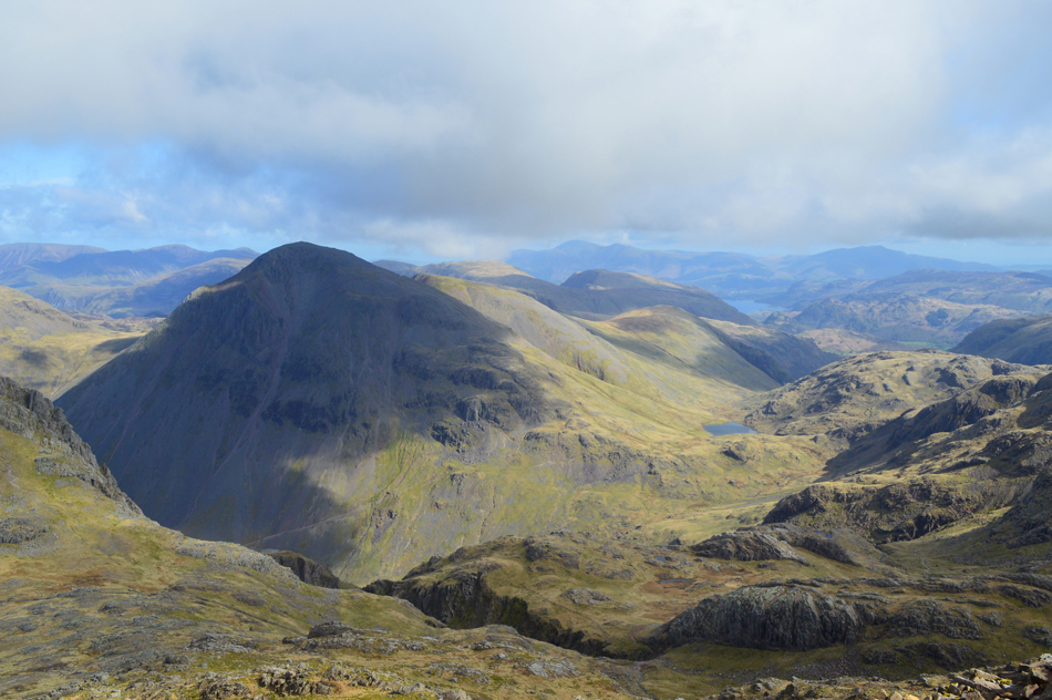
| Views over Beck Head towards Kirk Fell, Pillar, Scoat Fell, Red Pike (Wasdale) Seatallan and Stirrup Crag as I descend Great Gable. |
| |
 |
| Descending Great Gable North West Ridge with views into Ennerdale, the High Stile Ridge and the Grasmoor Group. |
It was important during the descent of Great Gable despite tiring legs to keep to the path which can be easily lost if attention is not paid which is what happened to the two separate walking groups who followed one another onto the extremely steep scree above Beck Head, this can be avoided it you steer right once above the screes and to try not to follow someone else because they might know where they are going more than you.
Come prepared and enjoy! The four were still held up in the scree by the time I arrived at Beck Head even though they had set off whilst I was still eating lunch back at the summit.
An easy mistake to make, trust me I know. |
 |
| Fantastic view into Ennerdale dominated by Hay Stacks, High Crag, High Stile, Starling Dodd and Great Borne. |
| |
 |
| Brandreth, Grey Knotts, Hay Stacks, Fleetwith Pike, Dale Head, Hindscarth, Robinson, Whiteless Pike, Grasmoor, Wandope and Crag Hill. |
| Time for that second lunch break now. |
 |
| Lunch with a view, Lingmell and Sca Fell from Beck Head. |
| Three young walkers were also having lunch close to the base of the north west ridge who had watched me descend, we pass with hi's and hello's before I find a quiet spot overlooking one of two Tarns found at Beck Head, the other close to the start of the ascent on Kirk Fell being substantially drier. |
 |
| Looking back on Great Gable and Green Gable from Rib End/Kirk Fell ascent. |
From here you can see where many walker have left their traces in the scree, it can be quite an unpleasant descent should you find yourself there and not very kind on the knees!
Down below next to Beckhead Tarn, my lunch spot. |
 |
| The mass of Great Gable seen over Beck Head. |
| |
 |
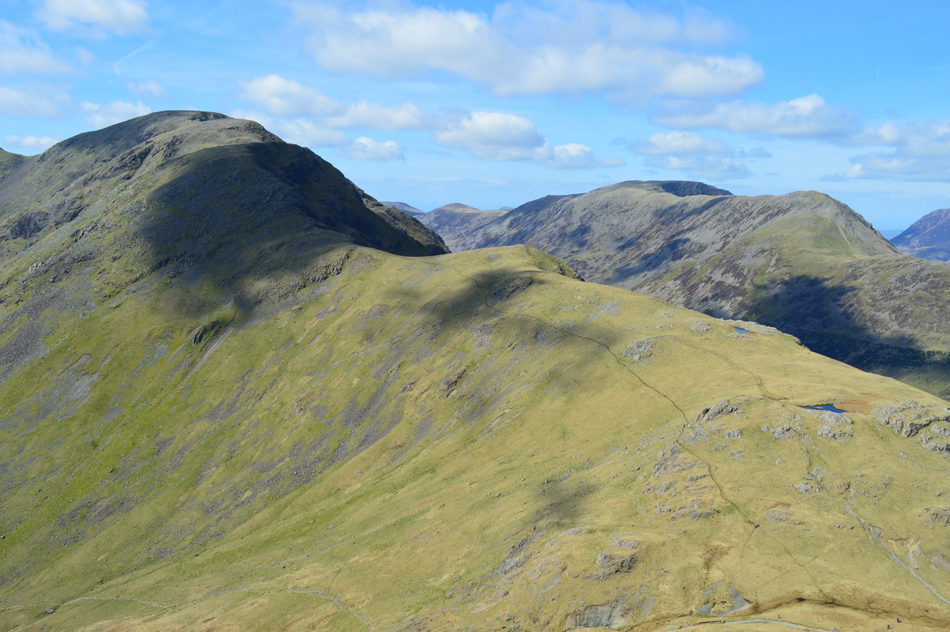
| Sca Fell, Scafell Pike, Lingmell, Broad Crag (and the course of the Corridor Route) from Kirkfell Tarn. |
Two of the walkers who had descended Great Gable had descended to Wasdale Head while the other two had just breached the summit shoulder by the time I reached Kirkfell Tarn who appeared to be heading for Kirk Fell north top. Here I strike up a conversation with a friendly fellow with a long haired Jack Russell in tow, he asked me about my camera clip, a clever device which is postioned on my pack shoulder strap which allows quick and easy access to my camera, he asked me where I bought it and how it worked but mainly the conversation steered to just how clear and warm the day had been and indeed, it was still turning out to be.
He heads off to make his Beck Head descent while I head towards the last summit of the day, Kirk Fell. |
 |
| The Gables, Great End, Sty Head and Esk Pike from Kirk Fell summit. |
| |
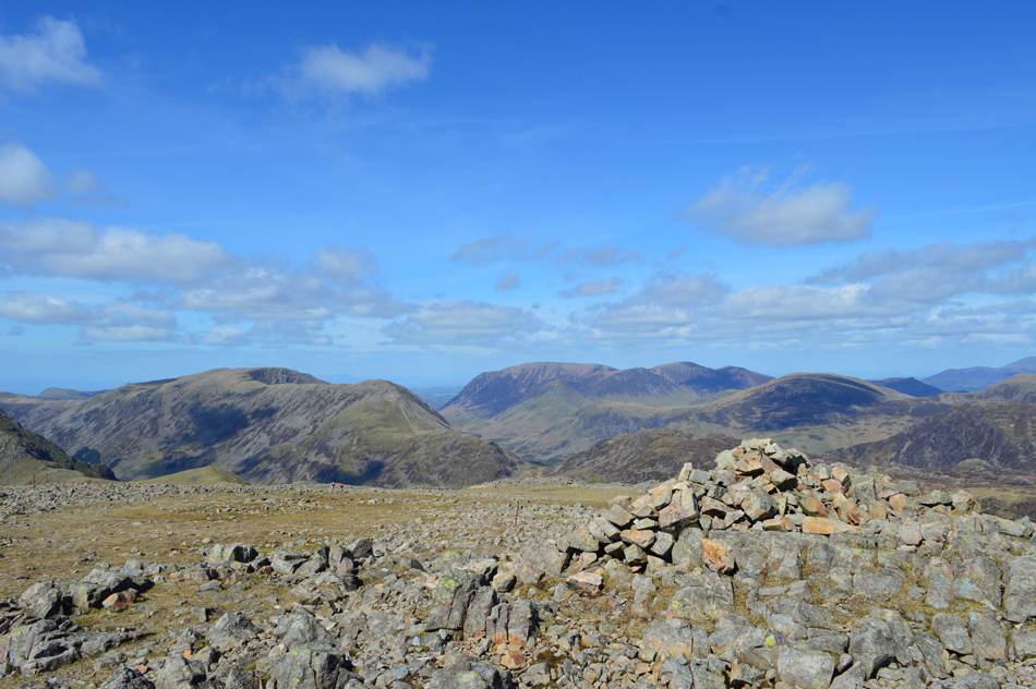 |
| Pillar and the Grasmoor fells from Kirk Fell summit cairn. |
| For a reason why I don't quite know I de-shoulder before quickly re-shouldering, why I did that I wasn't quite sure, maybe that I subconsciously thought I would be tired by the time I reached the summit, of that there was little doubt, but not tired enough to sit and rest. |
 |
| Views over Pillar, High Crag and High Stile as I steer towards the top of Kirkfell Crags. |
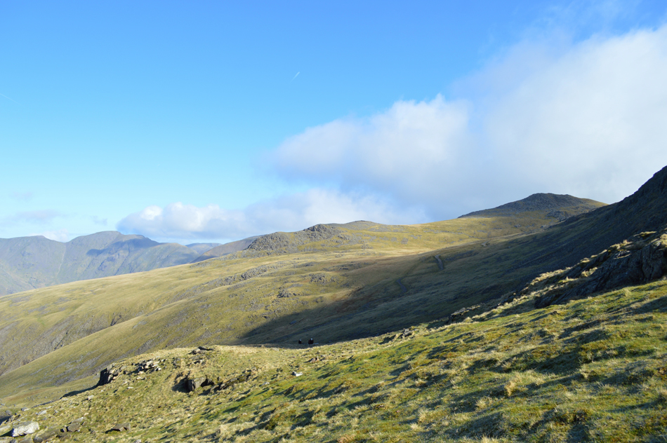
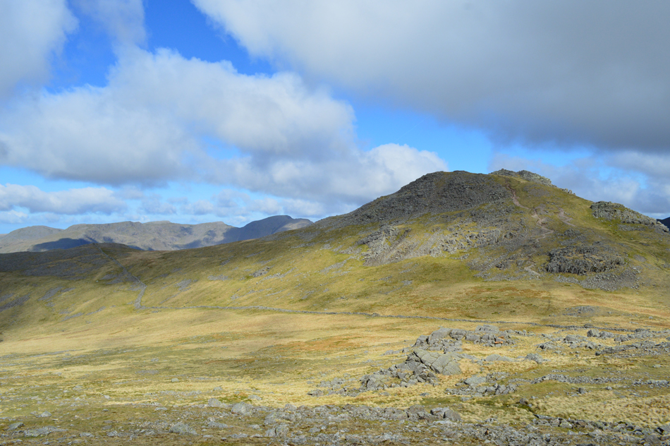
| From the summit cairn it's just a case of following the old fence post towards the top of Kirkfell Crags from where the descent to the top of the Black Sail Pass begins, it's not a descent for tiring legs and concentration is a must. |
 |
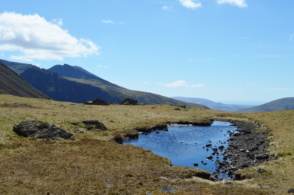
| But the views over Pillar more than make up for the unforgiving descent! |
| You might be able to spot the little pool above the top of Black Sail Pass over on the right. While ascending Pillar I always make a detour as I find it one of the best vantage points to view Pillar from, and it's lovely and peaceful too. |
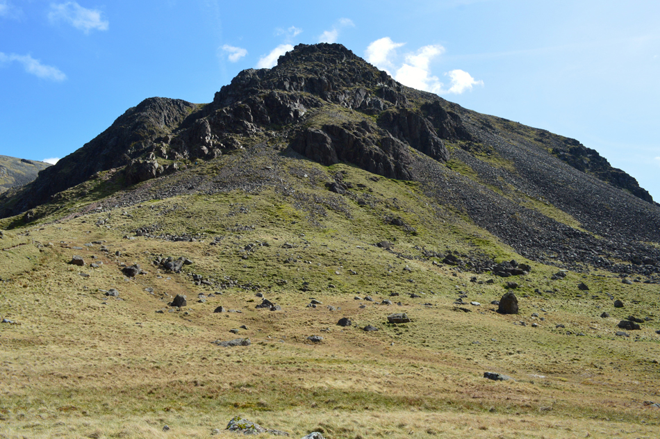 |
| Kirkfell Crags. |
I guess I wouldn't be telling the whole truth if I said that I breezed down Kirkfell Crags because if anything it was here leg muscles started to tighten and feet began to ache. |
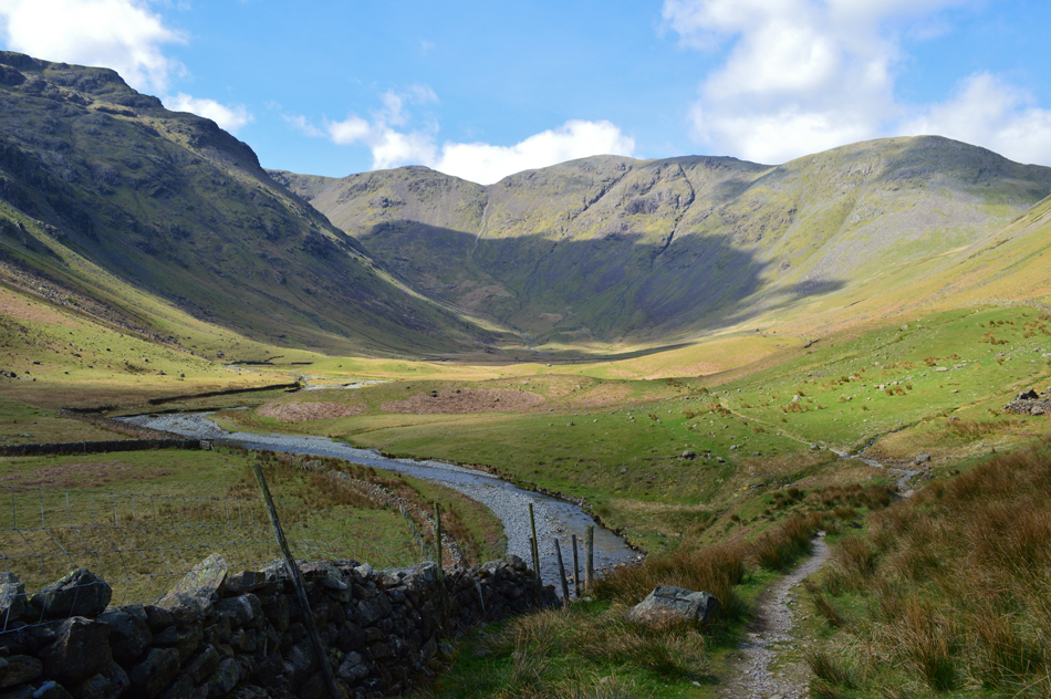 |
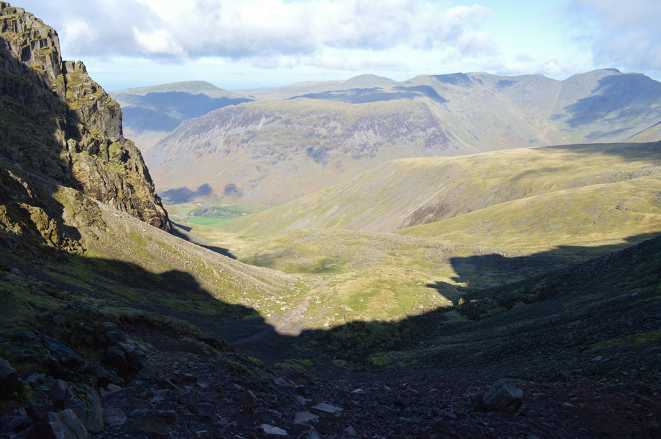
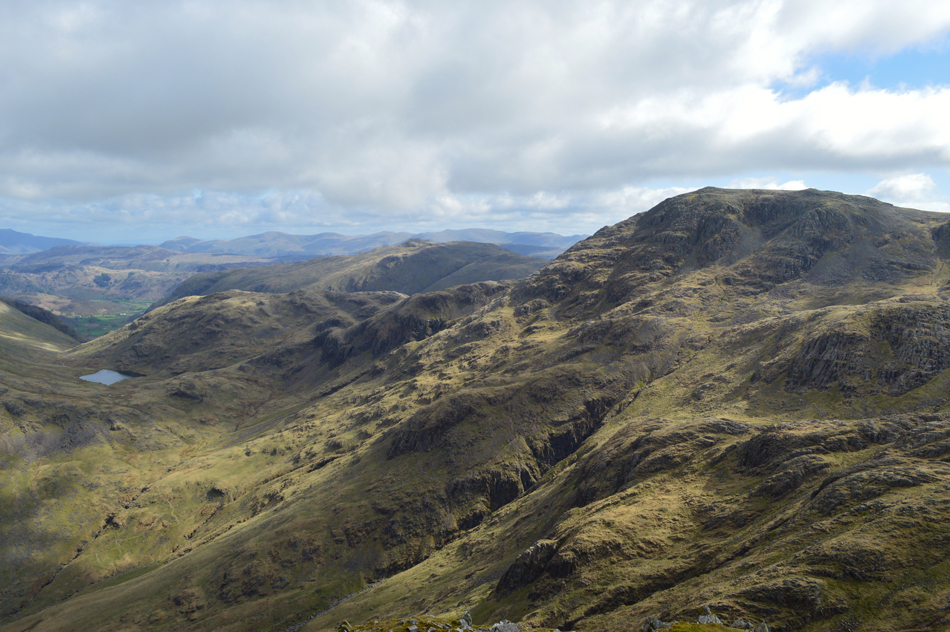
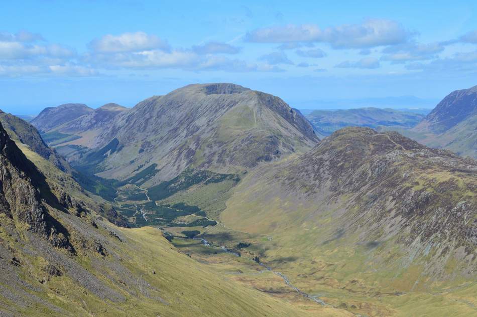
| Pillar and the Mosedale Valley as the walk nears it's end. |
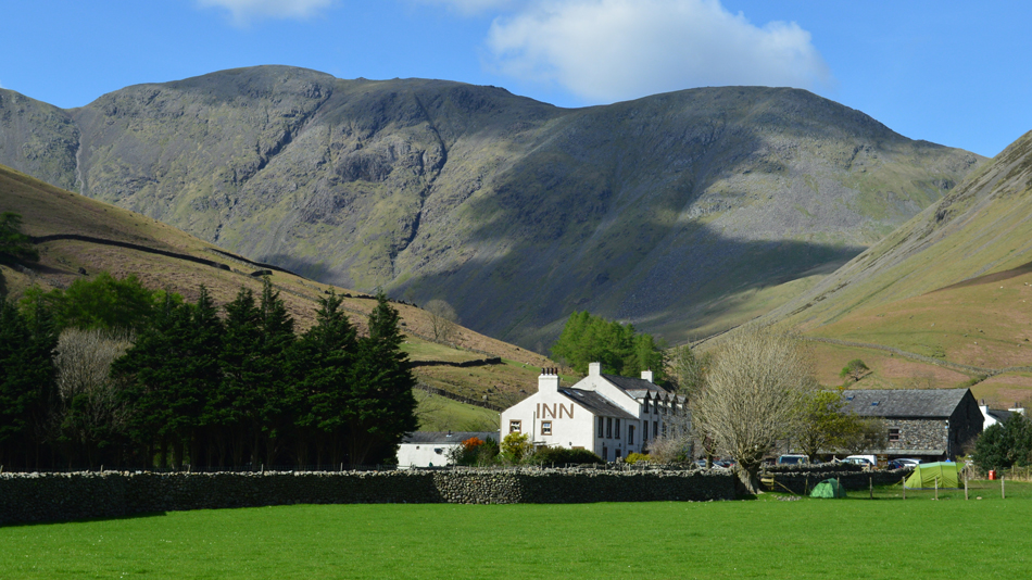
I knew as the afternoon light caught the countless car windscreens that Wasdale Head was going to be busy place, especially my route back through Ritson's Bar beer garden at the rear of Wasdale Head Inn so before I head back into normality here's a view of the Mosedale valley.
The walk through the valley was sublime at a point when the temperature entered the high teens at a time when I regretted wearing long trousers or for not packing shorts. I had already ditched my jacket into the lid of my pack where it remained for the duration of the walk. While crossing Gatherstone Beck I made a point of cupping handfuls of water into cupped fist before splashing it over my face and hair, many more fistfuls quenched my thirst despite still having adequate hydration left.
A fell runner passes as I approach a stone wall where I hold open the wooden gate, I receive a "many thanks!" for my trouble before the ground underfoot eases where the last mile or so will be covered over a plush carpet of grass. I took this last photo of Mosedale before it disappeared, but it isn't just a photo, it's a reminder, a reflection on my day. |
 |
| Great Gable from Wasdale Head. |
| |
 |
| Pillar seen over Wasdale Head Inn. |
| |
 |
| Brown Tongue and the Scafells from Down-in-the-Dale. |
Returning to normality can be a good experience but sometimes, after a walk as great as todays, it gets you right in the throat.
|
|
| |
| Back to top |
 |
|