 |
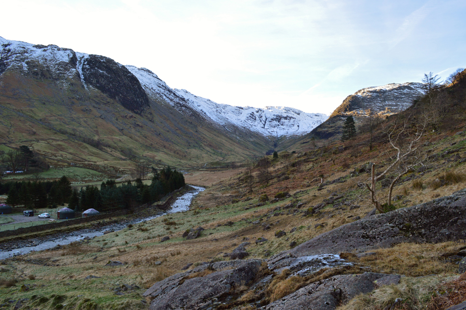
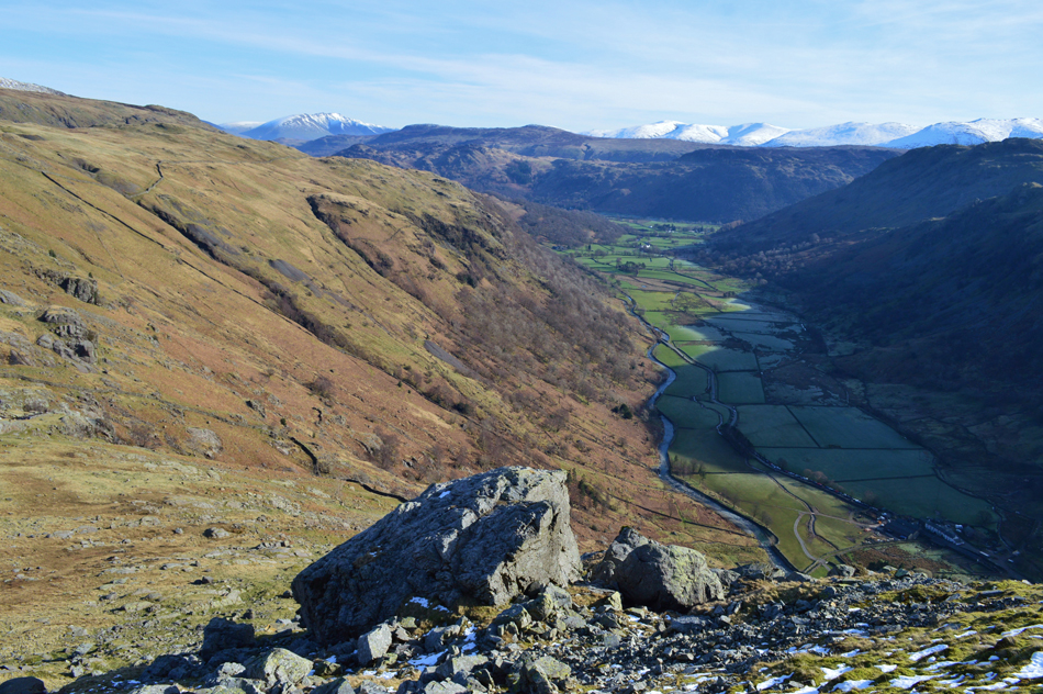
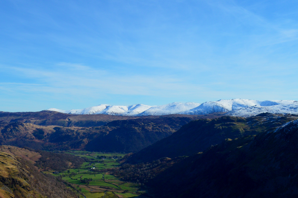
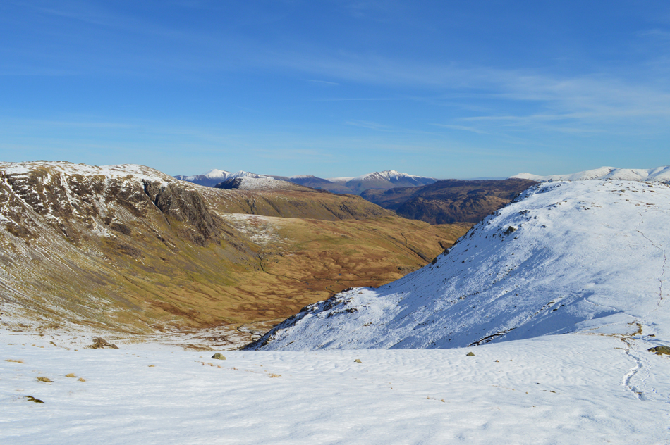
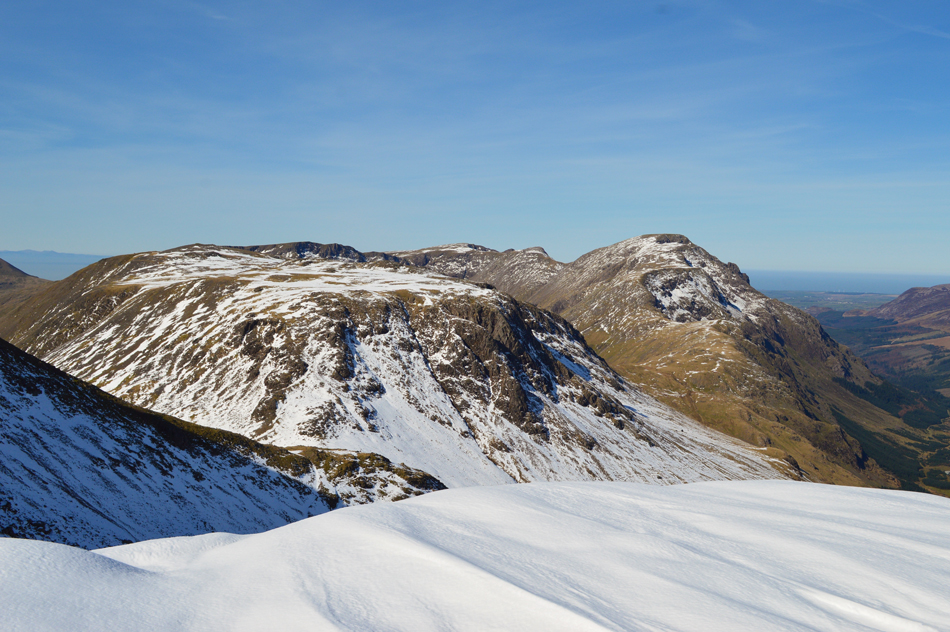
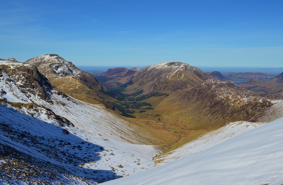
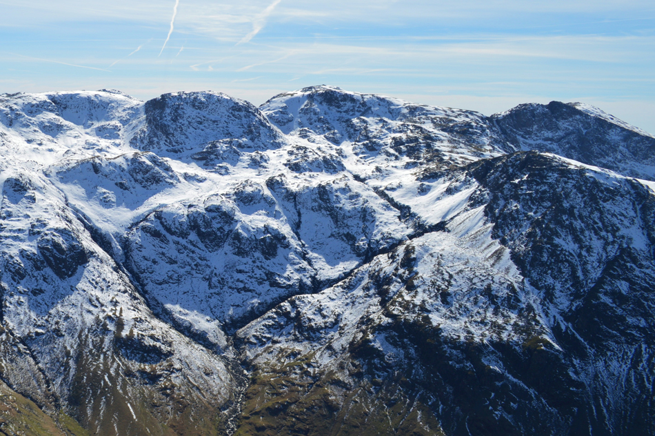
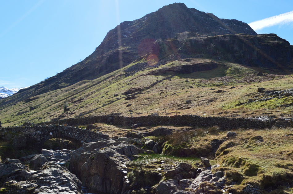
Base Brown and The Gables from Seathwaite |
 |
 |
25th March 2017 |
 |
|
I always said I would never climb Jack's Rake again on Pavey Ark mainly due to how uncomfortable I felt while experiencing the exposure along certain parts of the scramble but that was six years ago and I think after the experience I've picked up in between then and now I've kind'a earned the chance to give it a second go.
Tim was also keen to take on the scramble so around six weeks ago we planned a day for it which was today, what we didn't know back then was just three days before our planned ascent the Lakeland fells would experience a last heavy covering of snow which despite the snow now being in a state of thaw with Spring temperatures rising day by day we knew that the gully would be gushing with melt water which consequently forced us to look for a plan B walk with just days to go.
We arranged two phone calls midweek one to talk about the cancellation of Jack's Rake and the next, two days later on fell choice, me, I came up with two walks one of which would take in Skiddaw or the High Stile Ridge while Tim came up with this route, Great Gable from Seathwaite on a day when conditions couldn't have been more perfect it almost felt like it was a gift from mother nature. |
|
| Wainwright Guide Book Four |
 |
| The Southern Fells |
-Westmoorland Cairn
Errected in 1976 by two brothers of the name Westmoorland to mark what they considered to be the finest mountain viewpoint in the district. It stands on the extreme brink of the south face, above steep crags and overlooks Wasdale. |
 |
|
|
|
| |
|
Overview |
|
|
| Ascent: |
3,050 feet - 930 Metres |
| Wainwrights: |
3, Base Brown - Green Gable - Great Gable |
| Weather: |
A Cold Start Turning Warm, Bright and Sunny. Highs of 18°C Lows of 0°C |
| Parking: |
Roadside Parking, Seathwaite Farm |
| Area: |
Western |
| Miles: |
6.1 |
| Walking With: |
Tim Oxburgh |
| Ordnance Survey: |
OL6 |
| Time Taken: |
6 Hours |
| Route: |
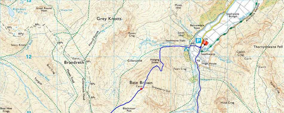
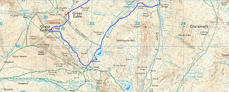
Seathwaite - Sourmilk Gill - Hanging Stone - Base Brown - Blackmoor Pols - Green Gable - Windy Gap - Green Gable - Westmoorland Cairn - Sty Head - Styhead Tarn - Styhead Gill - Stockley Bridge - Seathwaite |
|
| |
|
Map and Photo Gallery |
|
|
  |
| |
| |
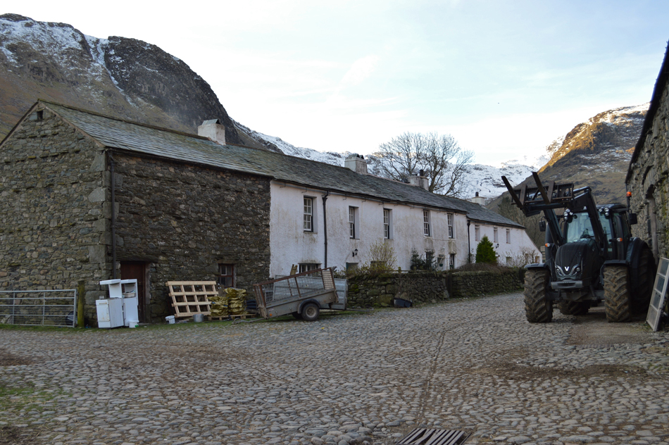 |
| Seathwaite Farm 08:00am 0°C |
Both Tim and I had arranged to meet at 08:00am in Seathwaite, Tim arrived first after stopping off along the shore of Derwent Water to take some photographs which came as no surprise as I too intended to stop but after seeing how busy Ashness Jetty and Kettlewell was I decided to continue while observing the reflections and stillness of the lake through the trees as I drove by. It's rare to see such stillness coupled with a deep blue sky and I couldn't but help feel a little disappointed at not having stopped. I continued and drove through Rosthwaite before the sight of Great End greeted me above the Seathwaite Valley, this image more than made up for what I left behind along the shores of Derwent Water. I turned left and drove slowly over the packhorse bridge into the Seathwaite valley observing the lambs frolicking in the pastures, it was a site to behold and a turning point in the yearly calender. Up ahead and further into the valley I caught the reflections from the car windscreens which had already parked up close to the farm, I hoped that there was still space left to park which was confirmed on arrival. I spotted Tim's car and pulled my car up along side but...no Tim,
If I know Tim he'll be wondering about just having a look around which was confirmed when I saw him walking back through the farm yard with a toilet roll in one hand "well I had ten minutes" Tim laughed, we greet with a handshake and turn to our first summit of the day, Base Brown who's fell side is largely in shade but beyond the shaded line, brightness, and heaps of it. We kit up behind our cars and I feel the morning chill almost instantly. Tim adds a hat and gloves while I do bout, well for now that is. With the cars locked we head out towards the farm yard and the tunnel between the two barns which allows access to the footbridge over Grains Gill and our starting point below Sourmilk Gill which is heard loudly over a series of waterfalls. |
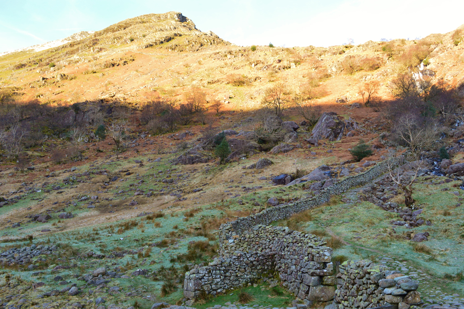 |
| Base Brown with Sourmilk Gill Waterfalls to the right. |
We are still in shade and although we have only just left the cars my fingers are starting to feel numb. We cross Grains Gill by the wooden footbridge having just had a conversation about our route of ascent onto Base Brown summit "how about we give the Hanging Stone route ago" I asked which is seen as the north ridge in this photograph, it's a route we both hadn't tried and with today being so clear we were both keen to give it a go, little did we know we would encounter wet rock which almost halted our ascent but more on that later.
Tim de-shoulders his pack after crossing the footbridge and rest it against the stone wall "don't worry I'll be back in a minute, I just need to nip back to the car, I'll run" Seconds later Tim has vanished which gave me time to also de-shoulder if only to add gloves, by-eck it was cold in the shade. The peculiar thing was even so early in the morning the difference between being here in the valley and up there in the sunlight was about 10°C which we would soon find out. Tim returns and I ask why he needed to go back to his car "thought I'd left my lights on and I couldn't have that going through my head all day it would of ruined the walk" aye he was right...no sooner had we both de-shouldered we threw our packs back on and started the steep ascent alongside Sourmilk Gill. |
 |
| Views over Grains Gill towards Hind Crag (Left) and Seathwaite Fell (Right) |
| |
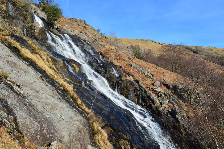 |
| Sourmilk Gill Waterfalls. |
Well what a difference between light and shade, by the time we had ascended through the shade (which was around ten minutes) it was like someone had turned the heating on full so much so I instantly removed my gloves and lowered not just my jacket zip but my base layer zip too as far it would go exposing my chest to the cool air, flipping eck it was so warm!
Now where's my sunglasses. |
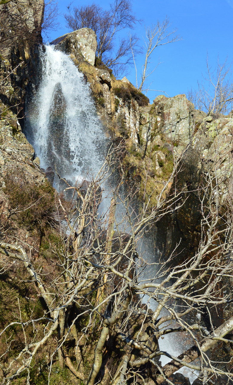 |
| Sourmilk Gill upper falls. |
| |
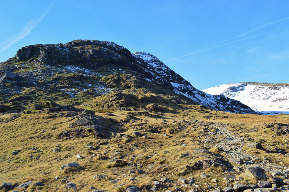 |
| Base Brown North Ridge (Hanging Stone route) with the Gillercomb valley over on the right. |
| By the time we had reached Gillercomb we had decided to give the Hanging Stone route onto Base Brown summit a go and proceeded to plan a route through the crags towards the Buttress in the upper left of the photograph. We follow a faint path steeply and start to ascend through the snow line picking off the best line of ascent where at times the path lay below a thin layer of hard snow. |
 |
| Views over the Seathwaite Valley towards the snow capped peaks of Blencathra and the Helvellyn group. |
| In the foreground with no snow on their summits are Great Crag, Grange Fell with the High Seat / High Tove ridge just beyond. |
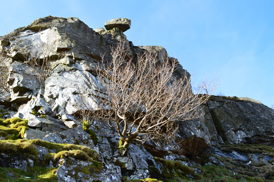 |
| The Hanging Stone. |
We soon found ourselves back in shade overlooking the rocky Buttress with the Hanging Stone perched precariously above our heads "it's almost like we have to whisper Paul" Tim said, aye I know what you mean!
It came to no surprise that we wouldn't be ascending via the rocky buttress and found an alternative terrace path around the left side of the slab, here a light scramble would see you onto the ridge above but on getting closer to the rocky surface we found that the rock was wet and covered in slime.
Tim went first while I observe from below, sometimes steering Tim or with Tim giving a running commentary for use when I start my ascent. On reaching the second grass terrace in order to go any further Tim needs to stretch one leg over wet rock onto dry grass, with legs widely stretched Tim takes the stride and eases his way onto the grassy terrace, now it was my turn. |
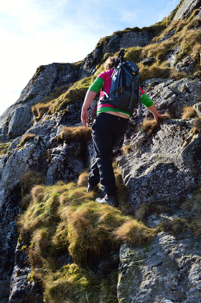 |
| Easy does it. |
It wasn't by far technical and had it have been dry the very rock we were stretching over would have been used in ascent in an area of which the climb which was quite exposed - nevertheless I follow Tim and soon we had cleared the wet rock and are making our way towards the Hanging Stone and the start of a short ridge walk towards the summit.
You can see Tim's new roughed up look mainly caused by far too much stretching for our liking! |
 |
| Outstanding views towards Seathwaite Fell, Great End, Allen Crags, Esk Hause and Esk Pike taken from the Hanging Stone. |
| |
 |
| Distant views towards Clough Head, The Dodds and Helvellyn. |
| The clarity seemed to getting clearer as the morning progressed. |
 |
| Seathwaite Fell, Great End, Allan Crags, Esk Hause and Esk Pike from Base Brown summit. |
| From the Hanging Stone we entered a sporadic snow line which was firstly avoidable but got more unavoidable as we took in the ridge below the summit. It was here I encountered tired legs probably brought on by walking yesterday in very similar conditions, the ascent was thoroughly enjoyable but energy sapping at the same time, the view took the mind away from any aches or pains it was just incredible to have the whole place to ourselves while scouring for movement, we spot nothing until well into the ascent on Green Gable but for now we soak it all in. |
 |
| A close up of Glaramara from Base Brown summit. |
| |
 |
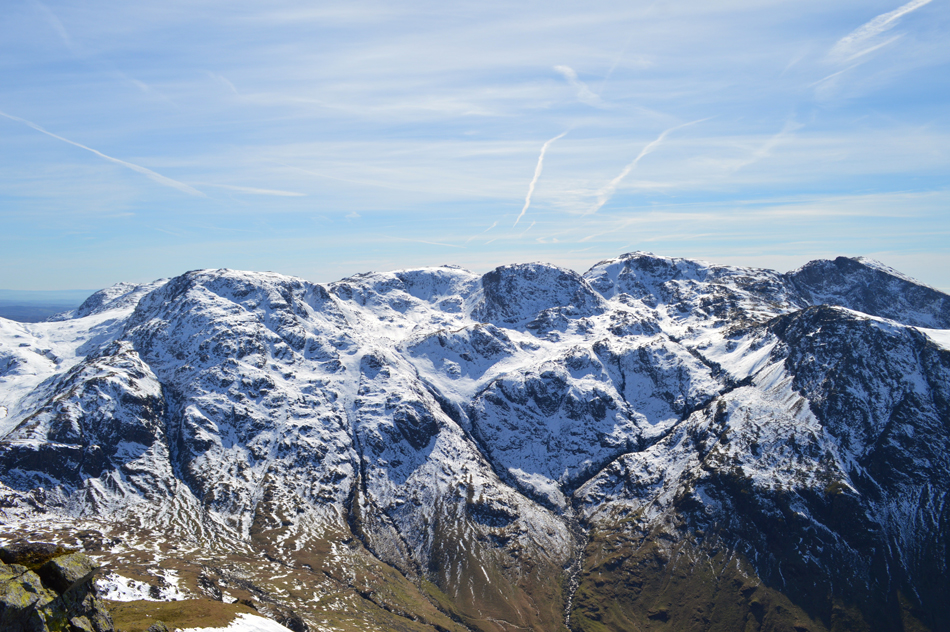
| Green Gable over Blackmoor Pols with Gillercomb over on the right. |
| We took in our surrounding views before heading out over Blackmoor Pols towards our next summit of Green Gable where we found a more substantial covering of snow, on the plus side some kind walkers had blazed a trail through the snow which was semi frozen and as you can see was up to a foot in depth, the down side to this was our ascent on Green Gable was going to be once again very energy sapping. |
 |
| Fantasic views over the Gillercomb Valley towards Grey Knotts with Base Brown over on the right. |
| |
 |
| A close up of The Band, Great End, Esk Hause, Esk Pike, Hanging Knotts and in the distance the distinctive peak of Bow Fell. |
| If you look closely you may even be able to spot a hint of Sprinkling Tarn in the lower left of the photograph. |
 |
| Further south looking towards the Langdale Pikes. |
| With perseverance we topped out on the shoulder of Green Gable and instead of heading straight towards the summit we had a wander to take in the views over the Buttermere and Ennerdale Valleys. |
 |
| A close up of Pillar, Pillar Rock and Looking Stead seen over the top of the Black Sail Pass. |
| |
 |
| Further West Kirk Fell comes into view with Pillar and Scoat Fell in the distance. |
| Time to head towards the summit I guess, it was only around this time did we spot walkers approaching the summit from the direction of Brandreth and Grey Knotts, one chap is particularly close by and we summit Green Gable together. |
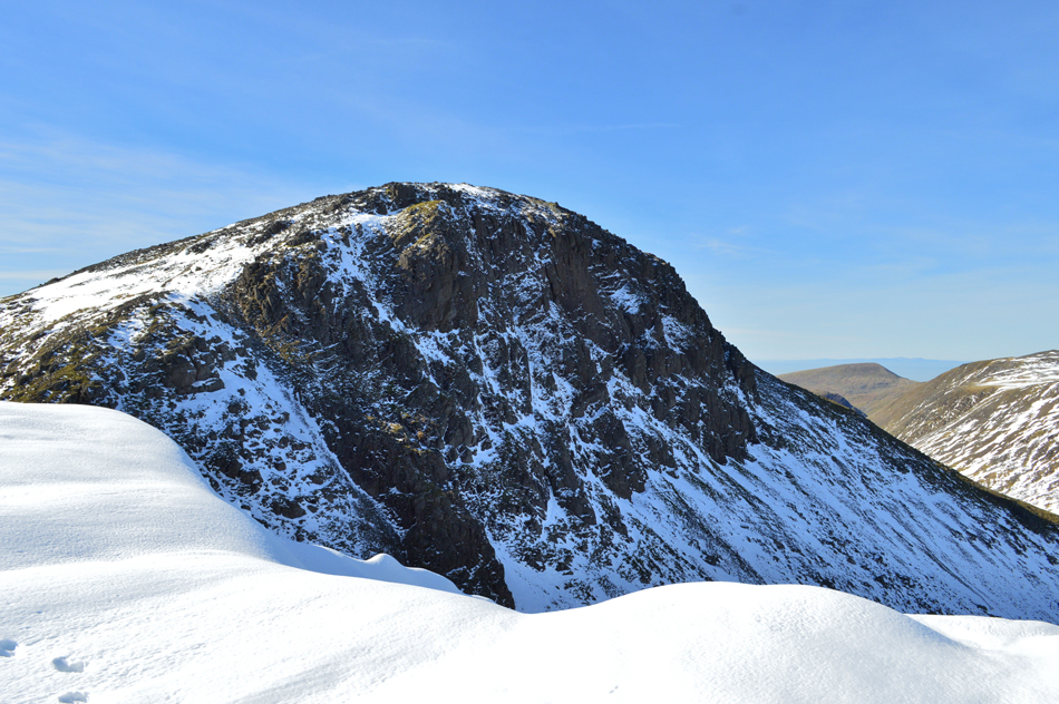 |
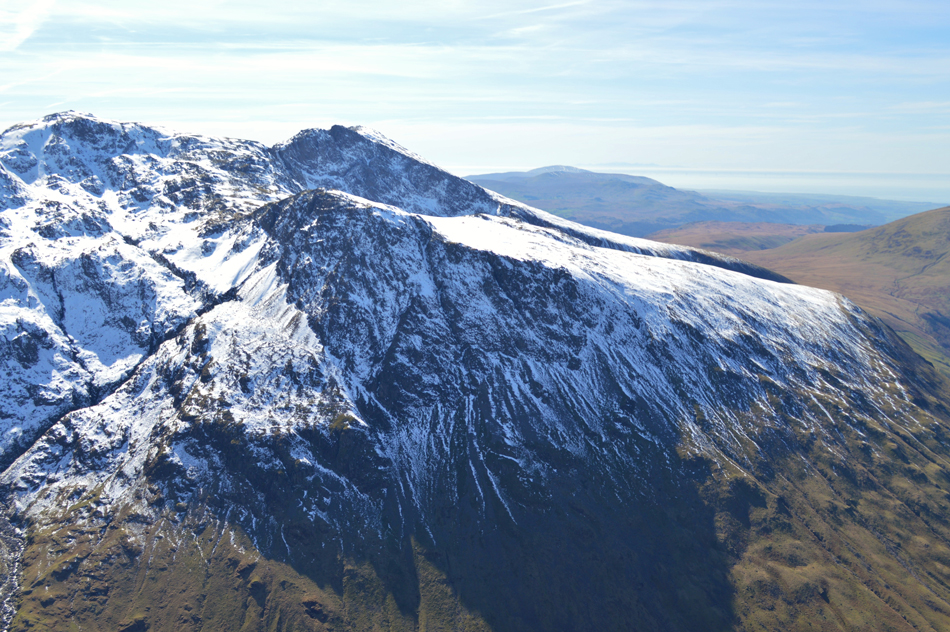
| Great Gable from Green Gable. |
| The view from Green Gable onto Great Gable was memorizing set against a deep blue sky all the while large cornices of snow had built up along the western edge of the summit, those footprints you can see were about as far as you dare tread, maybe even too close for comfort, I'm just pleased they weren't ours. The chap who summated alongside us had taken a call on his mobile phone and while I continue to take pictures Tim heads off towards the start of the descent on Windy Gap. |
 |
| Then de-shoulders. |
| |
 |
| Great Gable seen over Windy Gap. |
We are soon joined again by the chap who joined us at the summit and we strike up a conversation about how great the day was turning out and how we couldn't quite believe how clear, bright and warm conditions are. We get up from our short rest and re-shoulder as the guy says "you go first and I'll follow" I may be wrong but I got the feeling it was this chaps first ascent on Great Gable.
We descend into Windy Gap which as you can see was void of snow, dusty even before making our ascent on Great Gable, it's going to be another tough ascent but again, the views more than made up for this. |
 |
| The view into the Ennerdale Valley with Pillar to the left and the High Stile Ridge on the right from the top of Windy Gap. |
| |
 |
| Views over Styhead Tarns, Sprinkling Tarn towards Allen Crags, Esk Hause, Great End, Esk Pike and the Langdale Pikes. |
From the top of Windy Gap we started our ascent on Great Gable first ascending a short section of path void of snow, from here the climb took on an almost alpine effect with crisp deep white crunchy snow underfoot which at times was deep enough to almost swallow up my walking pole but sturdy enough to maintain support, it was a pleasurable yet tiring climb helped on by a strong sun which caused sweat to pour down my face. Quite a bit behind the walker we had spoken to earlier on Green Gable is also making his ascent slowly but surely.
We were stopped by a fellow walker like us completely kitted out but had layered down to just a T-shirt, he could easily get away with it, in fact had we not have been concentrating so much on our ascent I'm sure we too would have lost more layers not helped by the sheer crags protecting us from any form of breeze. |
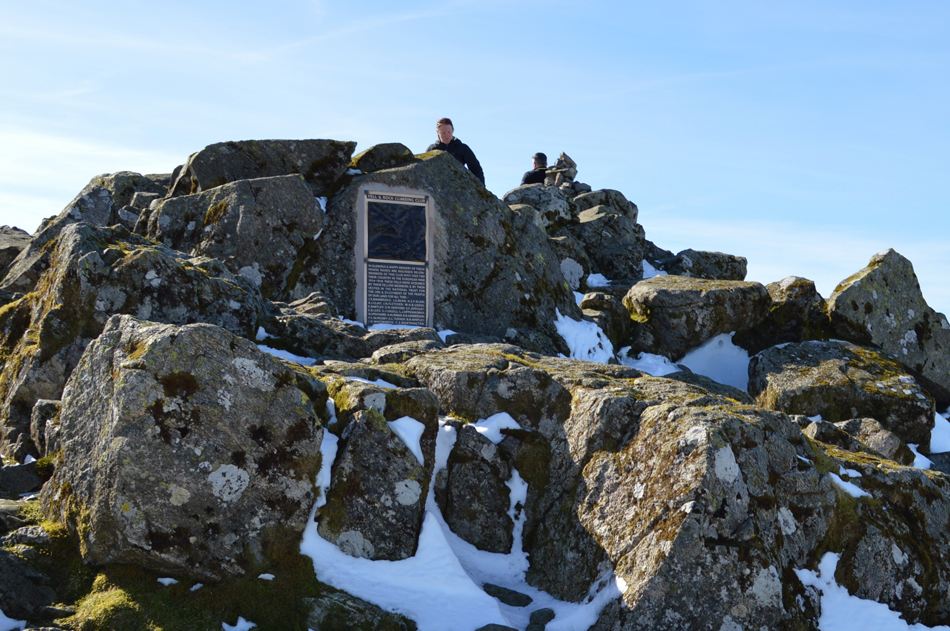 |
| Great Gable summit. |
| Having crested the summit shoulder we made our way towards the summit Memorial someway apart from one another for no particular reason other than to avoid the deep snow arriving at the summit at the same time as around five or six people who were stood eating and admiring the view. It was crystal clear in every direction, warm and calm but to take the best advantage of the views we decided to pay the Westmoorland Cairn a visit which is found around a 150 metres away in the direction of Wast Water. |
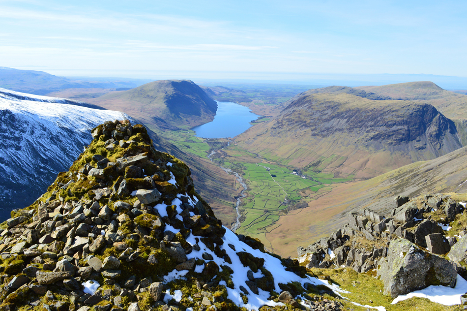 |
| Wast Water, IIIgill Head, Middle Fell, Seatallan, Yebarrow and Wasdale Head from the Westmoorland Cairn. |
We trace our way towards the Westmoorland Cairn as Wast Water is slowly revealed as are its surrounding summits set against a cloudless sky with only the Cumbrian Coast and the Isle of Man beyond while to the north, the Solway Firth and Criffle seen over a hazy Irish sea, further south as we follow the coast the Welsh Mountains appear which confimirmed for the first time, we could see both Scotland and Wales from the summit of Great Gable which was simply awe inspiring.
I think this calls for a... |
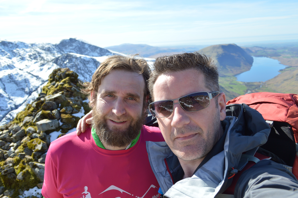 |
| ...Selfie. |
| |
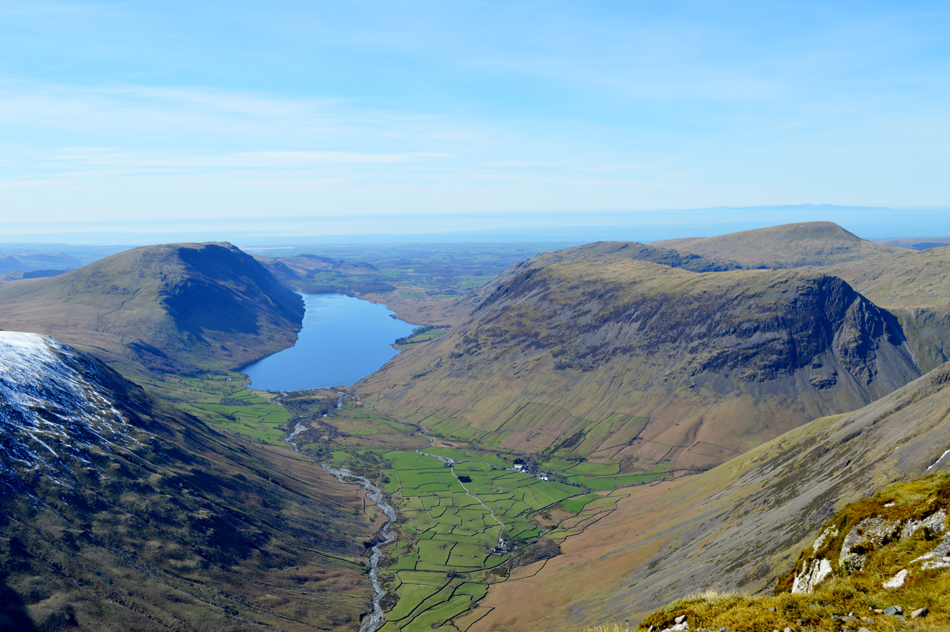 |
| Lingmell Wast Water, IIIgill Head, Middle Fell, Seatallan, Yebarrow and Wasdale Head from the Westmoorland Cairn. |
| |
 |
| More views from the Westmoorland Cairn this time towards Great End seen with Skew Gill below. |
| |
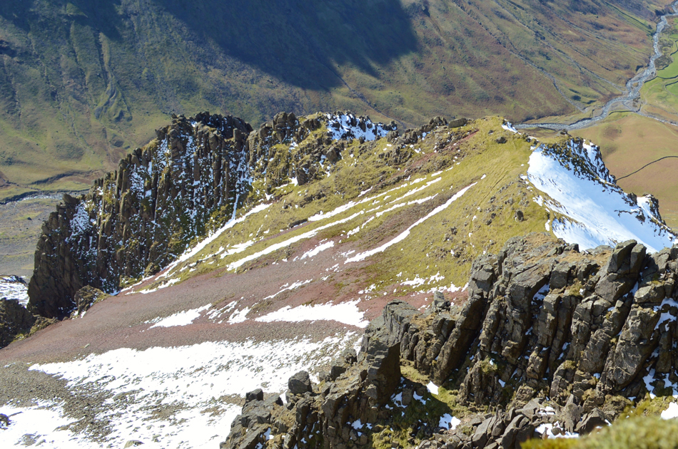 |
| Looking steeply down on Tophet Bastion with Great Hell Gate running down towards the left. |
This shot took some guts to take which involved me lying flat bellied as close to the edge as I could get, it's fair to say that my stomach was somewhere in my throat when I took it with a direct drop below, I can still hear Tim sternly saying do not drop that camera Sharkey!
The photograph simply does not do the head of Great Napes any justice. |
 |
| England's highest ground. |
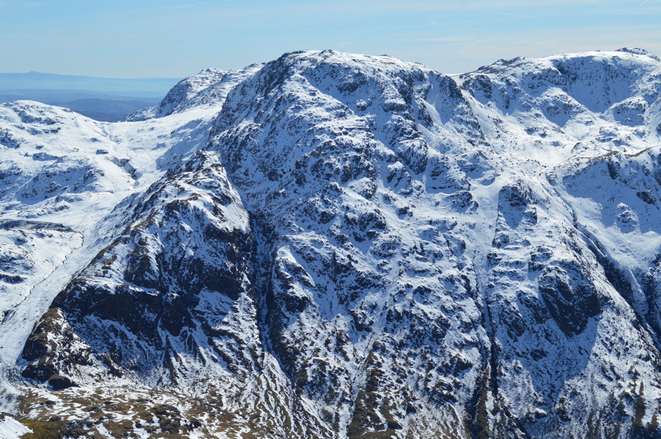
Here looking towards the Corridor Route with the gapping chasm of Piers Gill climbing towards Lingmell centre left towards Middleboot Knotts. Also centre left we have Broad Crag followed by Scafell Pike seen centre right and finally Sca Fell far right.
We knew that those summits would be busy but from our perch here at the Westmoorland Cairn they all looked deserted as did the Corridor Route. |
 |
| A wider view of the fells above the Corridor Route starting with Esk Pike, Hanging Knotts, Great End, III Crag, Broad Crag, Scafell Pike, Lingmell and Sca Fell. |
| |
 |
| Scafell Pike, Piers Gill, Sca Fell and Lingmell with Black Comb on the horizon. |
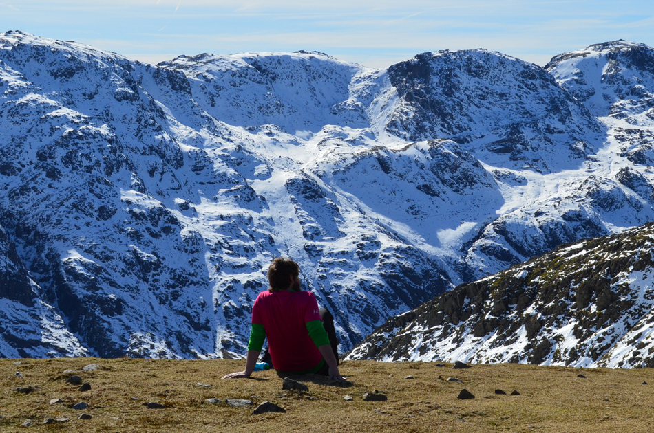
It's quite difficult to put into words how released one feels when presented with such mountain scenery, in fact I don't think we spoke for a good few minutes while we just took it all in.
Soon, however before we were about to leave we are joined by a young couple who pick a spot directly behind us, they mind their own business and tuck into snacks before we heard the sound of a Drone being released, I'm still not too sure how I feel about Drones but in todays case, the young man behind the controls turned out to be very courteous and not to mention a dab-hand at flying. |
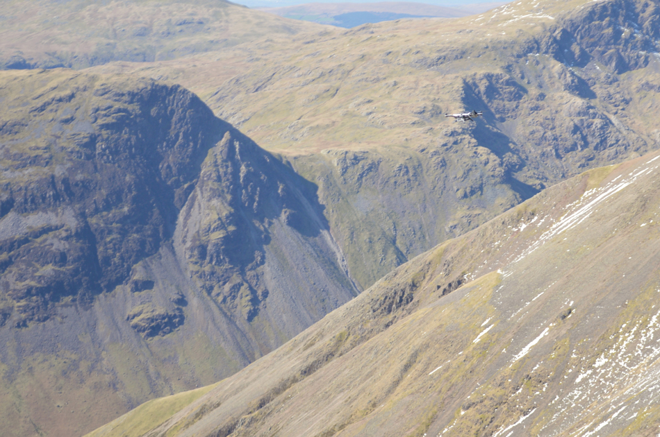 |
| Drone above Great Napes. |
OK the noise isn't perfect but it wasn't excessively loud like I've experienced with some Drones which seem to drown out the valley, this Drone let out a slight buzz which was manageable to the ear, the young chap flew it expertly as far out as Wast Water (yes really that far) never taking his eye of the screen on his controller before returning it via Beck Head (we could hear it humming below) then viewed the Great Napes and returned it to a hover just above his head then cut the power before it landed gently in one hand, it was fair to say that this wasn't your hundred pound Drone, more like eight hundred we reckoned.
We shouldered packs and before leaving I congratulated him on his flying skills, he replied with a thank you but was more concerned had he disturbed our time at the cairn, I replied not at all it was a pleasure to watch. I asked what would happen if he lost control and the Drone crash landed to which he laughed, I wont be going getting it! Once it's gone it's gone.
I'm still not too sure how I feel about the Drone, on a practical side watching aerial footage you've shot of places you will never find yourself in must be fantastic, but to always be aware you might be spoiling someone elses enjoyment might just be enough to stop me from buying one, in this case the chap was well aware of this and it was pleasing to know he acknowledged it. |
 |
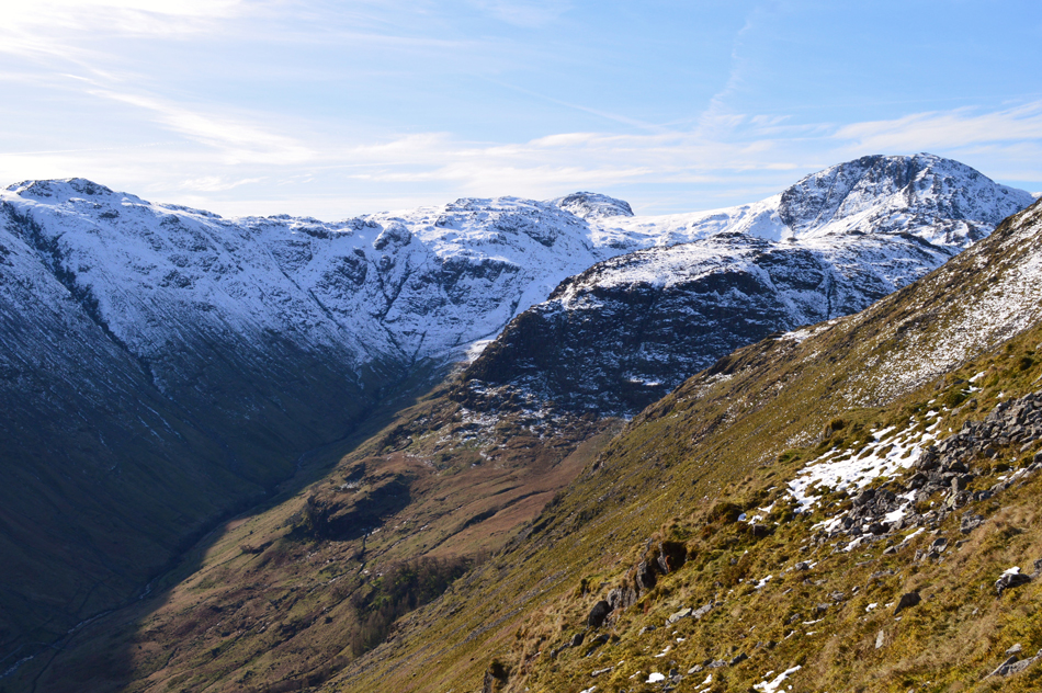
| Descending Great Gable with views of Styhead Tarn and Sprinkling Tarn. |
| It was spoken off to descend via Windy Gap but after agreeing the Styhead Route would mix things up a little we followed a succession of cairns alongside the path some of which are almost buried below snow. It didn't really matter what height we were at as the snow affected the whole descent all the way down to the Stretcher Box, sometimes we might descend through drift and others over bare rock, it was an odd combination which reflected the mountain in thaw. |
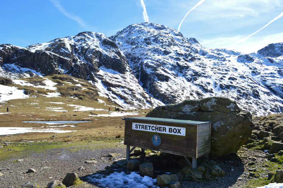 |
| The Band and Great End from Sty Head Stretcher Box. |
| |
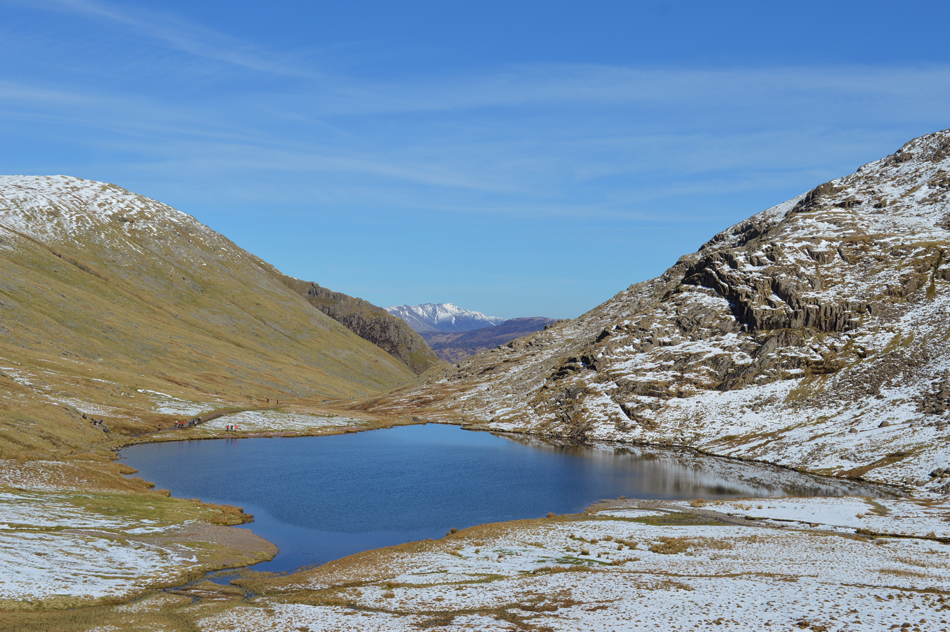 |
| Lunch with a view, Styhead Tarn towards a distant Blencathra. |
| After passing through a very busy Sty Head and having already agreed to eat lunch at Styhead Tarn we made our way to a rock island passing through swollen ground along the way, despite walking in the snow for the best part of the morning this was the first time our boots had actually got wet. We broke out lunch over looking Styhead Tarn while watching the masses come and go. By now it had just gone midday and the sun was at its warmest, in every direction we looked people were losing layers leaving our lunch break feeling much like the middle of Summer rather than the start of Spring, it was very surreal indeed but we weren't complaining. |
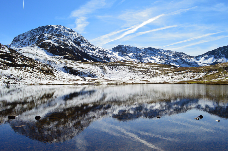 |
| Great End reflections over Styhead Tarn. |
| |
 |
| Seathwaite Fell from Stockley Bridge. |
We had passed more people all heading to and from Styhead Tarn all in great spirits which just shows what a bright spell can do to a person including myself. We begin our retreat back to Seathwaite via Styhead Gill sometimes stopping to swill the melt water over our heads before continuing with our descent. Two young local lads take over and I was envious of the bounce in their step.
There was more flesh to see during our descent, some prepared for the hot afternoon weather and others, not, who had stripped down to shorts and T-shirts and not to mention the odd sports bra. We descend in silence and I feel a second wind come on and I bounce back into chat. While at Stockley Bridge I look back on Seathwaite Fell and the tiny dots ascending and descending alongside it, our day is almost over as we take on the Valley back to Seathwaite Farm before arriving back at our cars where Tim and I grip hands at a job well done on possibly the most perfect climbing day we had the pleasure of encountering. |
|
| |
| Back to top |
 |
|
