|
Walla Crag to High Rigg via Bleaberry Fell |
 |
 |
11th March 2017 |
 |
|
As we approach the weekend another weak front desends on the Cumbrian fells bringing with it low cloud and mist which is becoming something of the norm while frustratingly the clear days are reserved during mid week when most of us are at work but I like to think that I am a positive person and soon Spring will arrive and hopefully this null that we are in will become a distant memory.
As always throughout the Winter and Spring months I planned todays walk around the forecast where hopefully I would stay below the cloud all the while maintaining a rather arduous walk (far more than it looks on paper) although this can also be put down to the extra weight I put on through the Christmas period which at the moment I'm trying to burn off with extended walks both back home and on the fells.
So here I have the perfect combination of a walk which packs in the miles and takes in one of Lakelands most secluded valleys and a personal favourite of mine in Shoulthewaite situated north east of Thirlmere, a valley just a stones throw away from the busy A591 yet it feels like there's no one around for miles, as it so happens it's been three years since my last visit meaning todays, is way overdue. |
|
| Wainwright Guide Book Three |
 |
| The Central Fells |
-Raven Crag
The vertical face of the crag, now receiving the attention of expert rock-climbers, is a truly formidable object, standing out starkly from the dense surround of plantations. |
 |
|
|
|
| |
|
Overview |
|
|
| Ascent: |
3,540 Feet - 1,079 Metres |
| Wainwrights: |
4, Walla Crag - Bleaberry Fell - Raven Crag - High Rigg |
| Weather: |
Drizzle On And Off Throughout The Day With Low Mist And Fog, Highs of 9°C Lows of 9°C |
| Parking: |
Roadside Parking, Castlerigg Stone Circle |
| Area: |
Central |
| Miles: |
11.7 |
| Walking With: |
On My Own |
| Ordnance Survey: |
OL4 |
| Time Taken: |
6 Hours 20 Minutes |
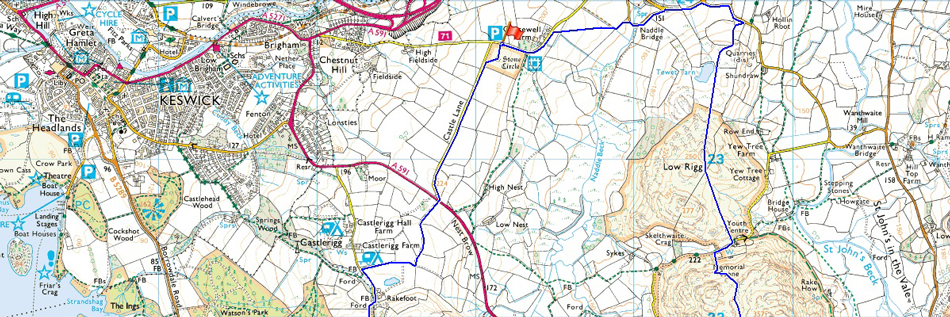
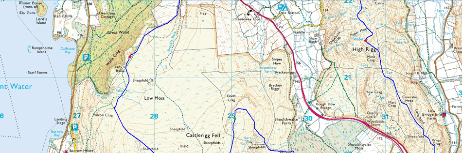
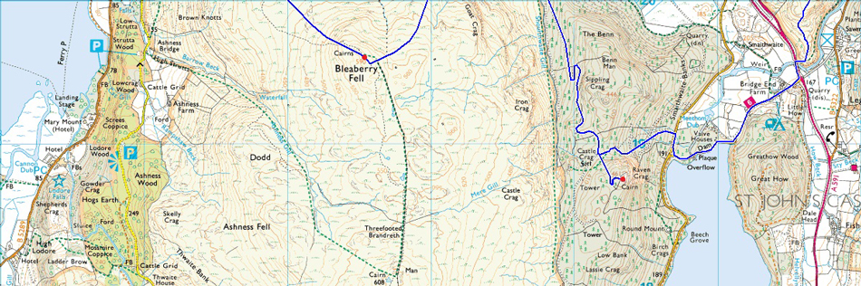
| Route: |
Castlerigg Stone Circle - Castle Lane - Rakefoot - Walla Crag - Bleaberry Fell - Dodd Crag - - Shoulthwaite Gill - Forestry Path - Raven Crag - Thirlmere Dam - A591 - High Rigg - Low Rigg - Naddle Bridge - Goosewell Farm - Castlerigg Stone Circle |
|
| |
|
Map and Photo Gallery |
|
|
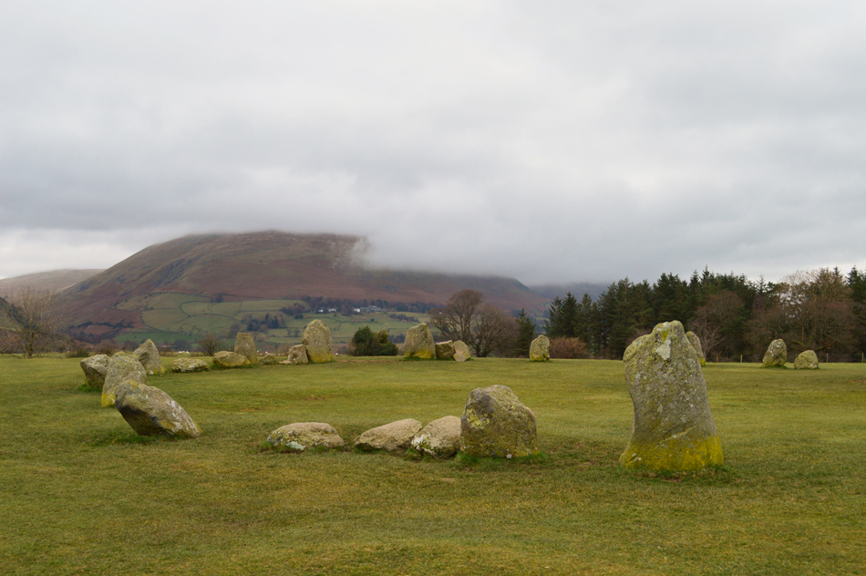 |
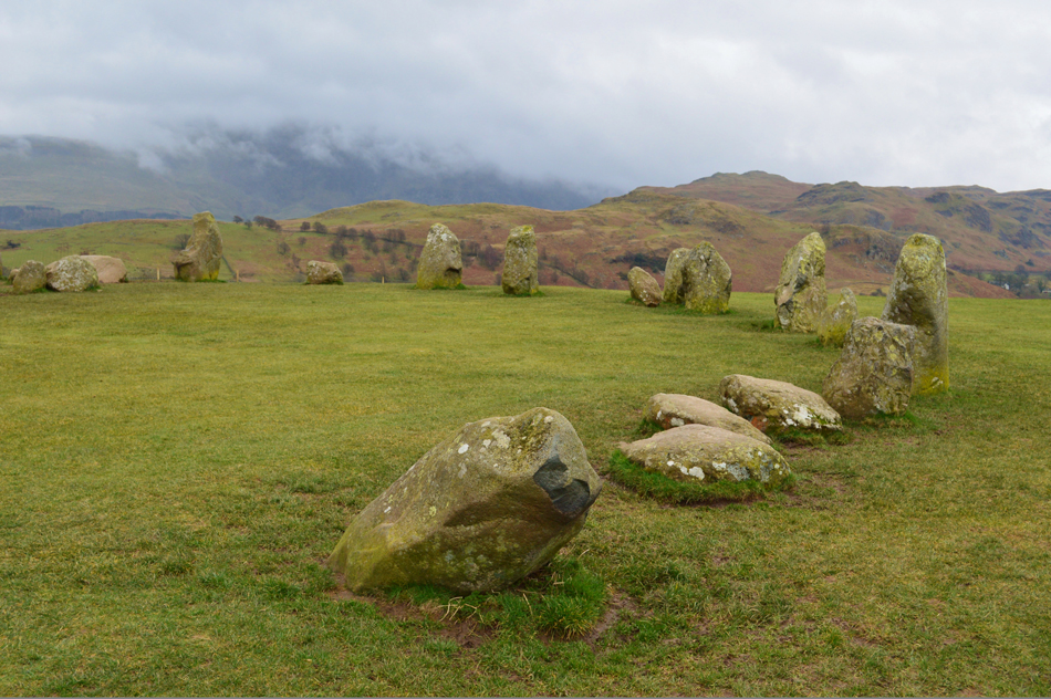
| Blencathra from Castlerigg Stone Circle 08:20am 9°C |
I hadn't expected to see anything in the way of views due to the low confidence forecast which is exactly what I got passing the Howgills from the M6 motorway which were completely below cloud all the way down the bracken covered slopes and continued as I drove along the A66 where I passed the Mell Fells who's summits were also too, below cloud. The theme continued as I passed Souther then Blencathra, Lonscale and Skiddaw all of whom completely unrecognisable below cloud but this wasn't the same further east as I spot a clearing above the Lord's Seat and Coledale Fells but for how long they would remain clear, it was unknown. I arrived at Castlerigg Stone Circle and parked easily noting only one other car was parked up which had probably been there all night. For now the rain holds off and it feels mild although the wind does have abit of a chill to it. I kit up for the forecast but I won't be putting on my waterproof over trousers just yet, I'll just see how the rain progresses. |
 |
| Low Rigg and High Rigg from Castlerigg Stone Circle. |
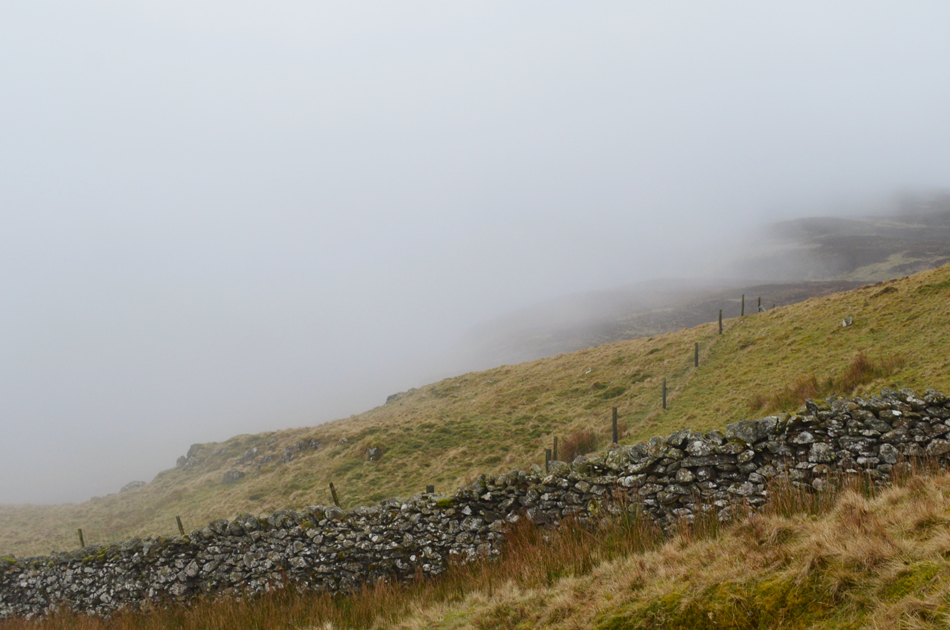
With the car locked I open the gate and start to make my way towards the stone circle which on any other given day would normally be teaming with photographers but not this morning, this morning low cloud rules. After taking a few photographs from the stone circle I head out towards Castle Lane next which is accessed via a stepped wall in the south east corner of the field, I had only been away from the comforts of my car for the best part of ten minutes but that nip in the wind is causing me to blow warm air into cupped fist.
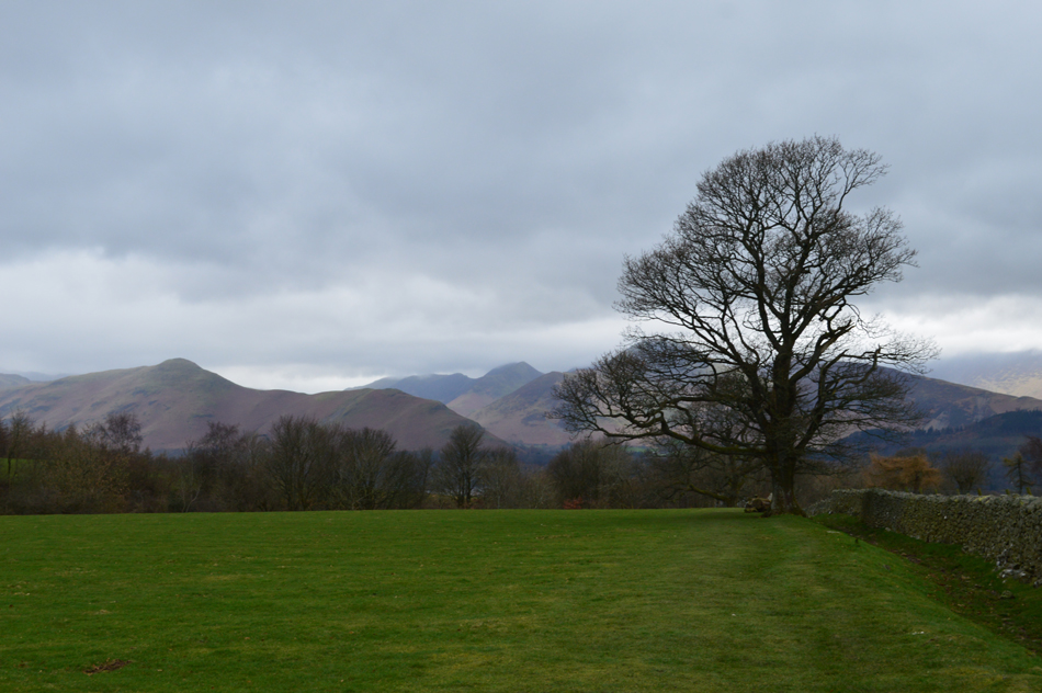
Incidently that's High Rigg and Low Rigg in the distance and possibly only a mile away from the Stone Circle and feature as my last two summits of todays walk, but I'll have to walk nearly eleven miles before I reach them. |
 |
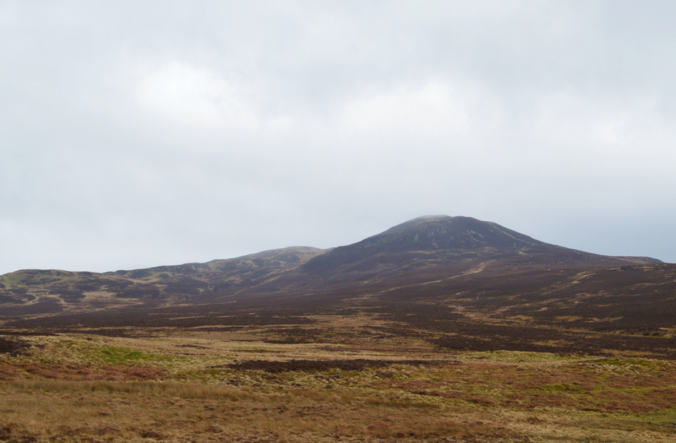
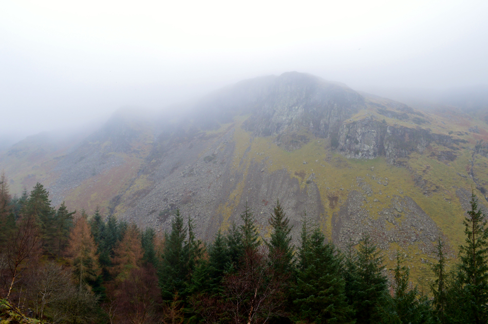
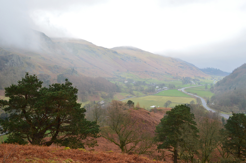
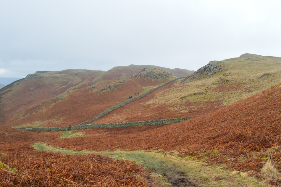
| Walla Crag, Pike and Bleaberry Fell from Castle Lane. |
| I won't have to walk as far before I reach Walla Crag seen over on the right soon followed by Bleaberry Fell in the centre from where I walk off path for a while in order to gain Dodd Crag summit, but more on that later. |
 |
| Causey Pike, Outerside and Barrow from Castle Lane. |
| All cloud free for now. |
 |
| Walla Crag from Rakefoot Farm. |
| At the bottom of Castle Lane I arrived at the A591 and crossed with ease onto a Bridleway which rises gently towards Rakefoot Farm where as expected it was very muddy underfoot, despite the path being a gentle incline it still took one step forward and two slides back to make any progress although I shouldn't moan too much I've been here many times before and it's always the same, sometimes worse. |
 |
| The view isn't too bad though, here's Cat Bells from Rakefoot. |
| By now my boots are caked in heavy mud so before I start my ascent on Walla Crag I think I'll swill my boots out in Brockle Beck which flows alongside the trees at the end of the field. |
 |
| Walla Crag is just ahead. |
I didn't get the chance to swill my boots in Brockle Beck because I found a large deep puddle instead which did the job just nicely. Soon I pass the entrance to Rakefoot Farm where two woman have parked up and are adding waterproofs, I pass with a cheery Hi before crossing Brockle Beck via the wooden footbridge where the ascent on Walla Crag starts almost immediately, first steep then steady and over very quickly before the ground plateaus and all that is left is a gentle walk towards the summit.
Today I decide to follow the wall all the way towards the summit instead of heading over the top of Great Wood via a sometimes narrow path where I imagined would be quite slippery today. |
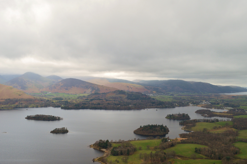 |
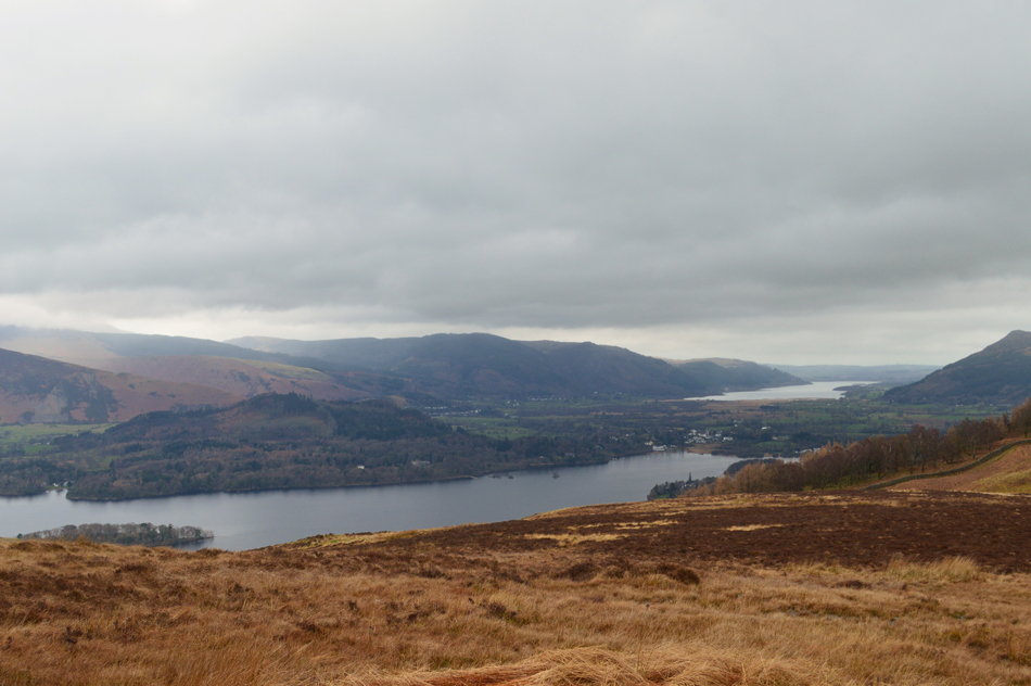
| The view over Derwent Water from Walla Crag summit. |
| |
 |
| Further south Cat Bells comes into view with the cloud topped Newlands Fells in the distance. |
| |
 |
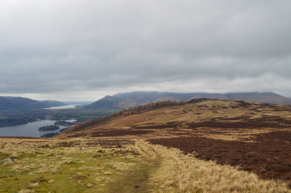
| Bleaberry Fell and Dodd Crag from Low Moss. |
I spent quite a bit of time taking in the views from the summit of Walla Crag, not just with the camera but soaking them up too, it felt great to be out. The two ladies who I had passed are approaching in the distance and from my perch at the summit I have also spotted two walkers heading towards Bleaberry Fell for some reason, off path.
I take in the short descent from the summit taking care over wet rock and tree root before making my way across Low Moss via a raised path which is a pleasure to walk over. By now it had started to drizzle brought on by a breeze which was sweeping in from the direction of Borrowdale which managed to wet everything only on my right side. |
 |
| In between the showers the views would open back out over Derwent Water and Bassenthwaite Lake. |
| |
 |
| Here stopping to look back on a cloud topped Skiddaw. |
| With only Walla Crag and Dodd below the cloud. I wonder if I shouted really loudly would David and Jennifer hear me, who are out for a walk on Dodd this morning. |
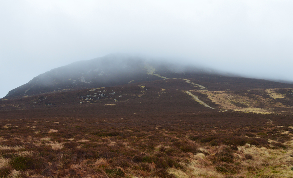 |
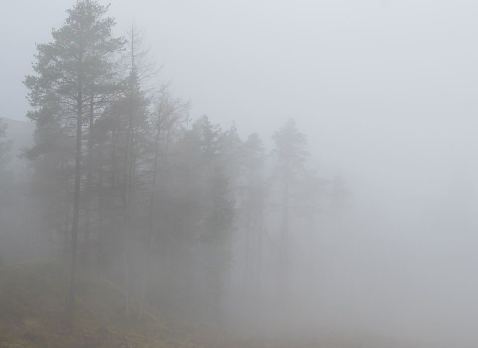
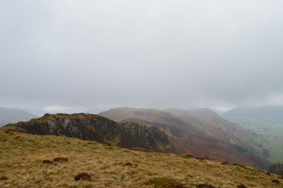
| The mist rolls on over Bleaberry Fell summit. |
The drizzle continued and by now the whole of the Borrowdale valley was lost in low cloud although at times Kings How might peak out before the cloud rolled back in again. Up ahead the two walkers who I had seen earlier are sheltering from the rain in a hollow drinking from a hot flask, we share a Hi as I pass but I don't get offered a cuppa!
Onwards and upwards as they say. |
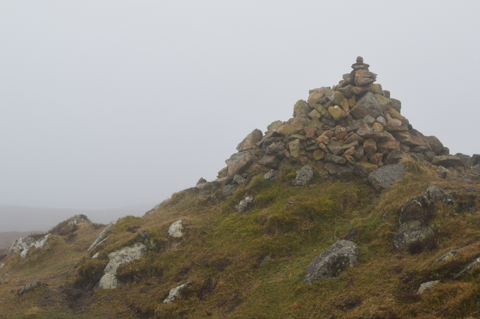 |
| Bleaberry Fell summit. |
The cloud had clung to the summit shoulder for much of the ascent and by the time I reached the summit it was raining, the wind had picked up and visibility depending on which direction I looked was down to just a few yards. I collect myself. I guess this is where todays walk takes in a twist as from Bleaberry Fell I now plan to descend towards Dodd Crag from where I will dscend into the Shoulthwaite valley.
I steer north east in search of a fence... |
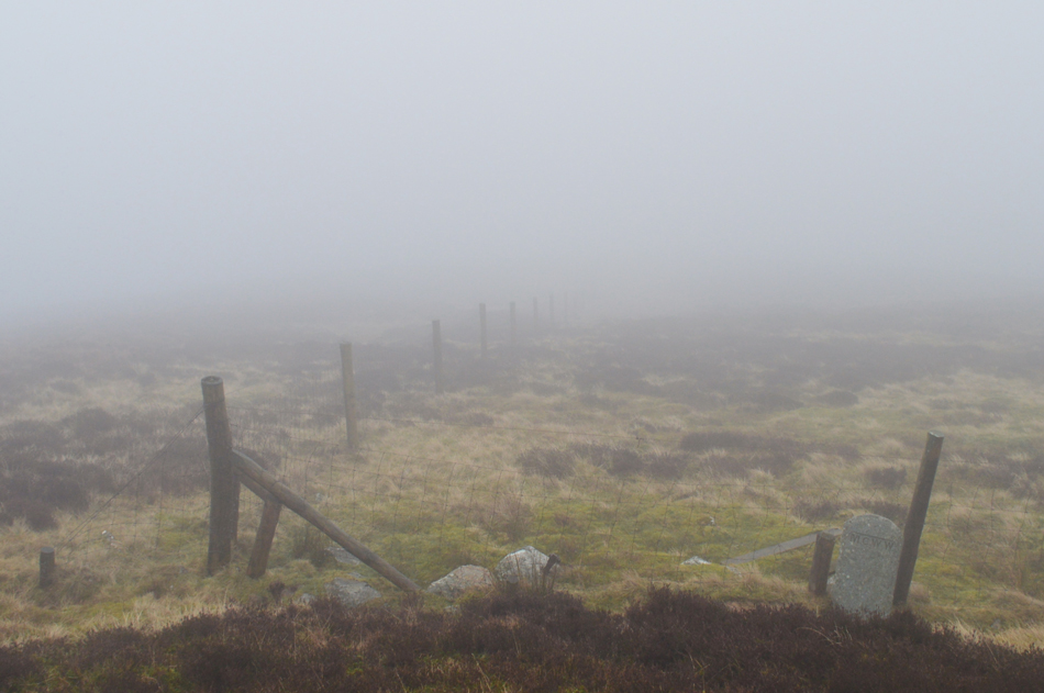 |
| Ahh, found it. |
| Such the poor visibility I couldn't see this fence from the summit which was only twenty yards behind me. From here the fence will follow much of my descent towards Dodd Crag before it splits north to south at a stone wall, but that's around half a mile away, now all I need to do is follow the fence. |
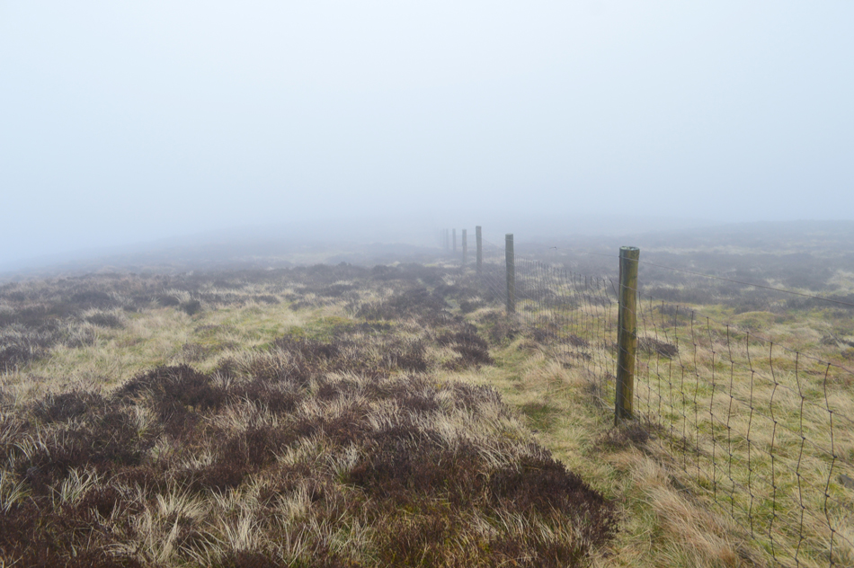 |
| Following the fence towards Dodd Crag. |
| |
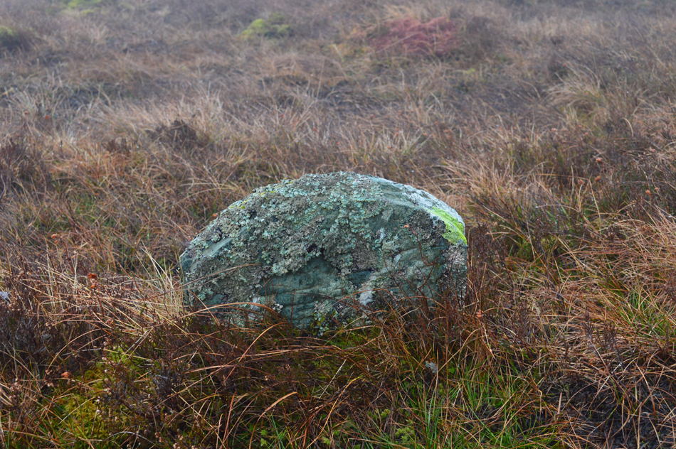 |
| One of three Boundary Stones that I passed alongside the fence. |
The ground underfoot was boggy to say the least and at times I had to detour away from the fence just to get around the boggy bits, my boots thankfully keep the damp out but this wasn't the case for the back of my jacket and trousers which seemed a lot more wetter than they should be.
Oh nooo, my hydration bladder in my pack has leaked out, all two litres of it which is why my lower back and backside are so wet, all the way through to my boxer shorts! Thankfully, however my hydration bladder slots neatly into a external pocket of my pack (great design) which has kept everything in my pack bone dry, that's the good news, the bad news is now I have no hydration four miles into a thirteen mile walk.
It looks like I'll have to fill a spare water bottle that I carry with water from the becks but it's only 330m, the next ten minutes is spent where along my route I'll be able to fill my water bottle.
Note to self; do not buy cheaper versions of the tried and tested Camelbak Bladder off Ebay as they will only leak. |
 |
| To state the obvious this is where the fence ended at the stone wall! |
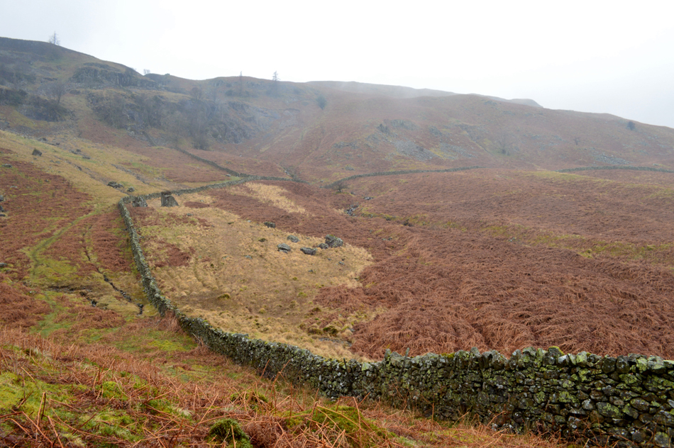
Just over half a mile away from Bleaberry Fell summit I arrived at the stone wall, a significant marker point along the Dodd Crag ridge. The wall builder had very kindly built in two large stepping stones on the Bleaberry Fell side, the wall being a little higher on that side which left a short jump onto the Dodd Crag side of the wall.
The cloud was still low but thankfully lifting due to the height I had lost, ahead of me a sea of wild grass lines the ridge, however my view is still limited I decide to wait it out and see if the cloud might break, after all it's not very often I would find myself here and besides navigation I actually wouldn't mind seeing Dodd Crag summit as I approach it. |
 |
| Dodd Crag is just ahead. |
| I didn't have to wait too long until the cloud cleared which broke first over the Shoulthwaite Valley revealing that Dodd Crag was just up ahead. As expected there isn't a path to follow but it's pretty much easy walking once the boggy bits had been negotiated. |
 |
| Bleaberry Fell from Dodd Crag summit. |
| I soon arrived at Dodd Crag summit which didn't have a cairn to mark its highest point. By now the views had started to open out and the drizzle had eased but this wasn't to say it had completely stopped as it would stop and start pretty much at the drop of a hat. It pays to check the map here because on the Low Moss side of the summit, steep crags fall steeply down with the exception of carefully negotiated route that I would follow between the outcrops which would see me descend towards Bracken Riggs below, however once the cloud had completely cleared I was able to view a topography of the Shoulthwaite side of the ridge which also presented access into the valley, albeit over steep fell side and thick tangled dead bracken. |
 |
| Goat Crag domineers my descent. |
The fell side north of Goat Crag appeared to be in two tiers and I descend without the valley in sight before the ground plateaus then I descend the second tier from where Shoulthwaite valleys appears below. During my descent I plot my route before stumbling across a singular faint path which ran parallel across the fell side, this was a great find as it seemed the path traced towards a ravine seen in the lower centre of the photograph. Last night I had seen this ravine while looking over the route and I wanted to steer clear of it if I could.
I follow the path around the Holly Tree seen in the foreground and contemplate my descent, it appears I have a clean descent through bracken with the added bonus that I'll be able to top up my water bottle in the beck which flowed through the ravine. |
 |
| Goat Crag. |
| |
 |
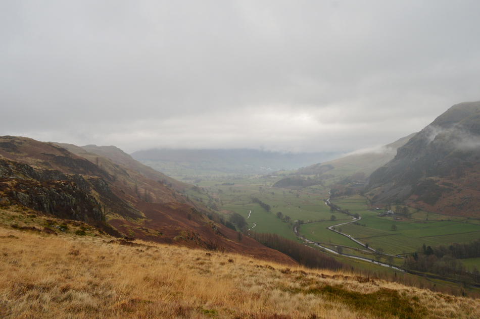
| Looking back on my descent route with Dodd Crag on the skyline. |
| You may be able to spot the Holly tree in the centre of the photograph from where I traced an almost direct descent towards the junction at the stone wall. From the valley you get a better view of that 'tier effect' with Dodd Crag seen beyond in the distance. |
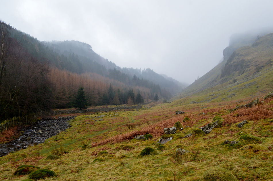 |
| The Shoulthwaite Valley. |
Just as peaceful and secluded as I remembered, time for a selfie which I later shared on my Facebook page. It's now time to cross Shoulthwaite Beck via the new wooden footbridge which was put in place recently after the last one was damaged during Storm Desmond.
I think parts of its foundations had broken away if I remember rightly. |
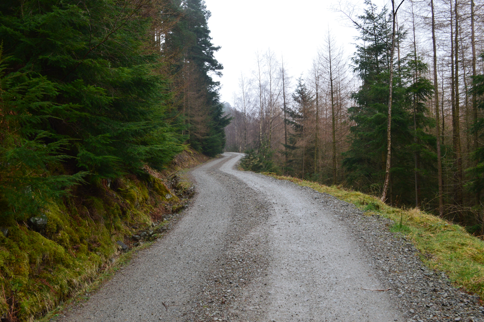 |
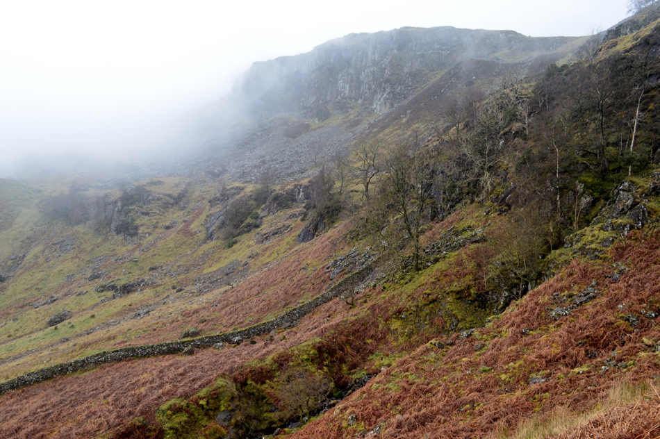
| Taking the Forestry Track to Raven Crag. |
| After crossing Shoulthwaite Beck I pass through a Deer Gate and begin the mile long walk towards Raven Crag and as the next picture demonstrates... |
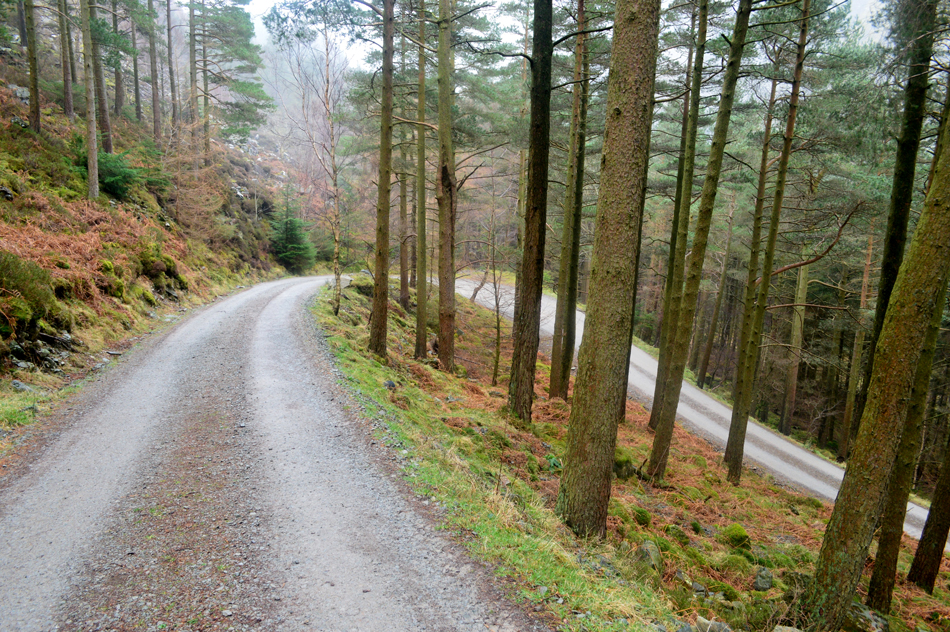 |
| Looking back on the Forestry Track. |
| ...It's quite steep and twisty in places. |
 |
| Iron Crag from the Forestry Track. |
| |
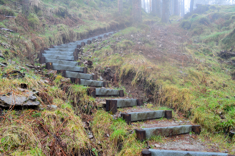 |
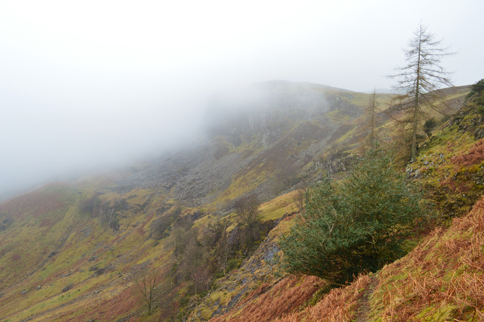
| The new path below Raven Crag summit. |
| The whole area on the north western flank of Raven Crag summit was badly damaged by storms some four years ago leaving Raven Crag almost inaccessible with the exception from the very determined and consequently the Foresty Commission has been clearing the area ever since. Now there is a brand new path from where the Deer Gate which rises steadily through cleared woodland towards the final part of the ascent where new wooden steps topped with a layer of heavy duty felt which help with the steep ascent. Further up a short section of path has been redirected to allow the woodland to return to nature which had been used as a short cut in the past before arriving at the new wooden walkway. |
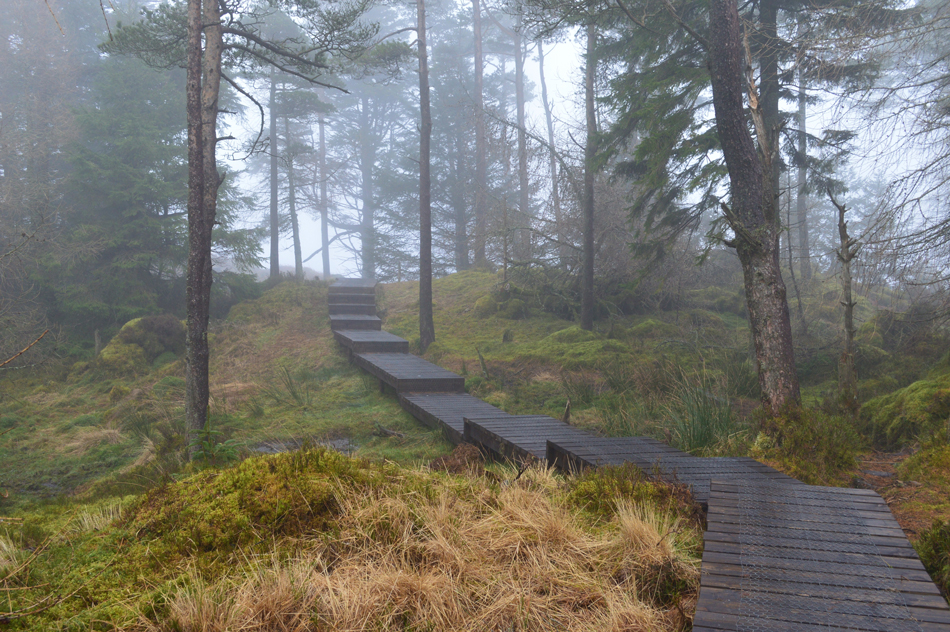 |
| The new walkway complete with a new layering of chicken wire across the surface. |
| Which certainly helped with grip on a day as wet as today, not far from the summit now where I can here lots of voices. |
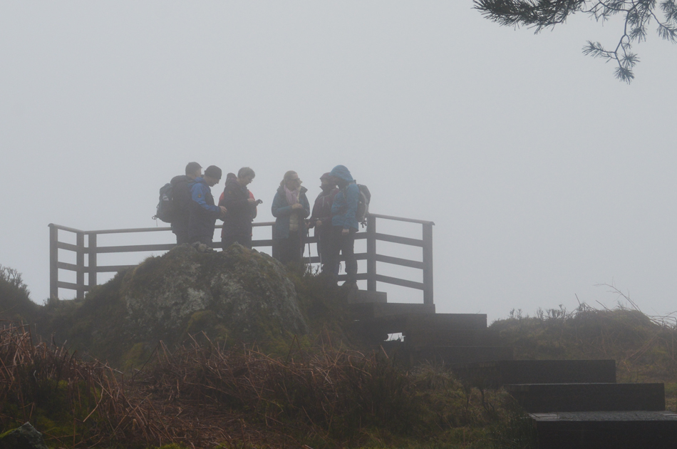 |
| Raven Crag summit. |
A group of walkers had congregated at the new viewing platform at the summit. Hi's and Hello's are shared as I glance into a wall of thick fog leaving no view at all, what a shame. It was a good time however to make some adjustments, as I am about to de-shoulder one of the group members ask would I mind taking a group photo.
It appears that the fellow is the leader of the group and couldn't help but feel disappointed that after promising great views from the summit he had let his fellow walkers down (I couldn't help but wonder had he checked the forecast prior to his promise though!) Yeah no problem; I didn't just take one photo I took around four making sure I even got their dogs attention while doing so.
We part with thank you and a smile and I left Raven Crag within minutes of reaching it. |
 |
| Descending Raven Crag. |
| The good news is it's stopped raining, the bad news is the fog appears to be getting much thicker. |
 |
| Crossing Thirlmere Dam. |
| |
 |
| Thirlmere Dam. |
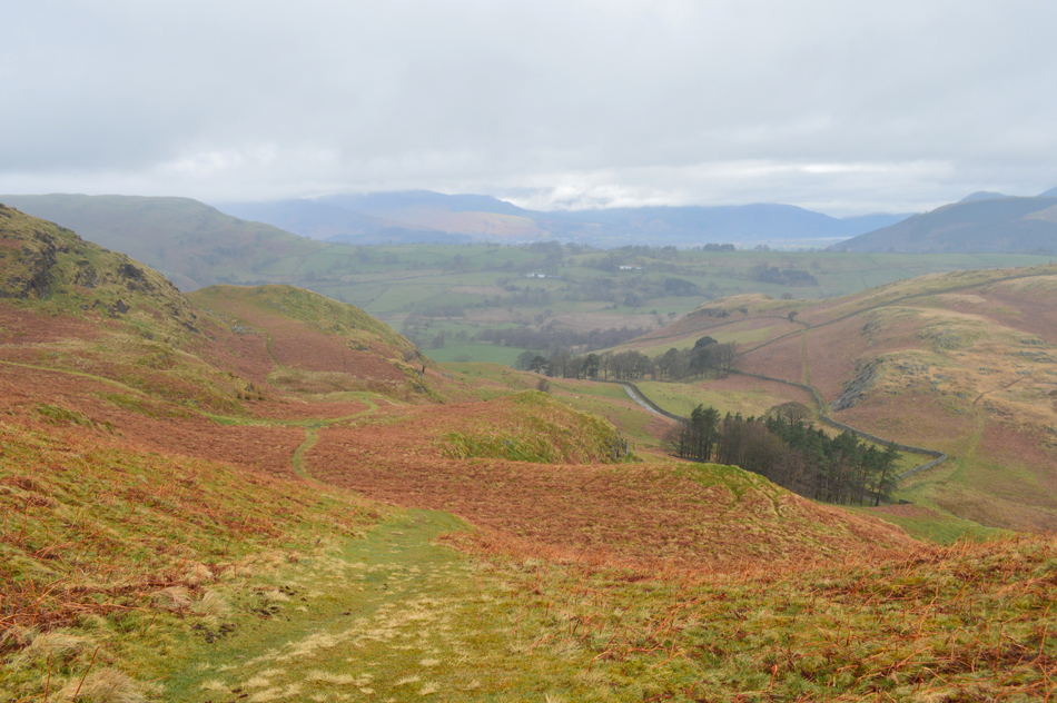
Having left the fog confined to the slopes of Raven Crag I started to make my way across Thirlmere Dam whilst tucking into a sausage roll. It was unclear just yet if both High Rigg and Low Rigg are below the fog which if they are I will take the St John's Beck route as far as St-Johns-in-the-Vale Church before heading over Low Rigg and Tewit Tarn then finally back to Castlerigg Stone Circle. |
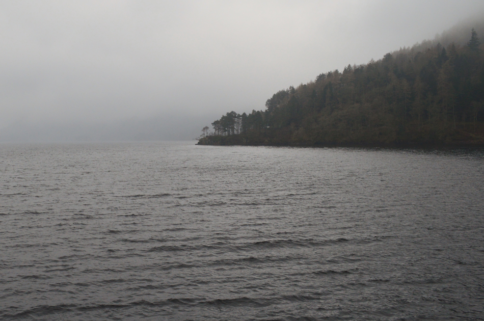 |
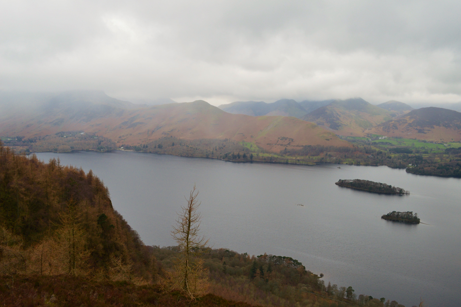
| Thirlmere Reservoir. |
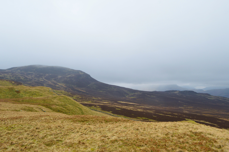
| After crossing the Dam I was able to get a full clear view of both High and Low Rigg and as it turns out they are relatively cloud free with only a little lingering fog over High Rigg summit. |
 |
| Stybarrow Dodd, Sticks Pass, Raise and Whiteside seen from Wren Crag/High Rigg. |
| It had only just gone midday and I was making great time but after a season away from long distance walks the ascent of High Rigg started to pick away at my reserves, coupled with another hydration issue having emptied the contents of my water bottle I was now starting to heat up both internally and externally! |
 |
| High Rigg from the summit of Wren Crag. |
| |
 |
| St John's-in-the-Vale from Wren Crag. |
| |
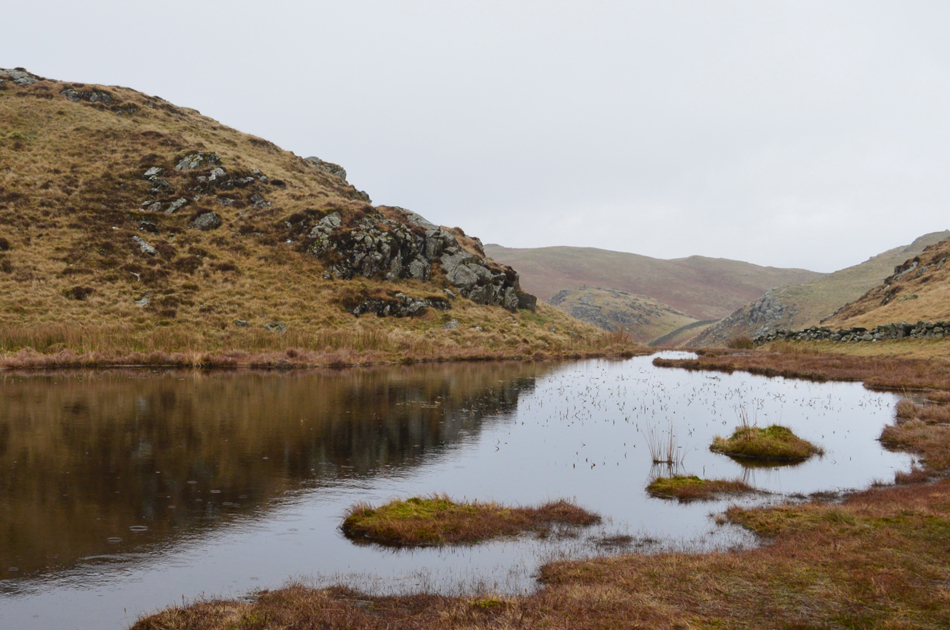 |
| Passing the un-named Tarn around half way across the ridge. |
| Always a beautiful spot even in the drizzle. |
 |
| A group of walkers all heading for the summit. |
I had already passed a solo walker who had stopped and de-shouldered at the side of the path and Hi's are exchanged, meanwhile up ahead a group of walkers are making their way towards the summit too, as it turns out their pace was a little slower than mine and I was able to pass them a few hundred yards from the summit, more Hi's are exchanged at a point when my head is starting to feel like it's at boiling point! I need a good intake of water, it's just where to find it.
I get a second wind, literally! which blew in across the summit and instantly started to cool me down, feeling positively refreshed I make my way towards the summit cairn and top out while looking back on the advancing group. It's pretty slippery as the summit bears wet rock and care was taken during the short descent which is where I passed three young teenagers also making their way towards the High Rigg. By now I'm starting to feel hungry but I know if I eat it will make me feel more dehydrated, especially when on the move, with this I decide seeing as I'm only a mile and half away from my car I'll wait until I get back. |
 |
| Descending High Rigg. |
It was during my descent did I hear the sound of gushing water which I found was coming from some kind of water meter which had a pad lock across its lid, nevertheless it flowed clear water from one side which I cupped into my hand quenching my thirst almost instantly.
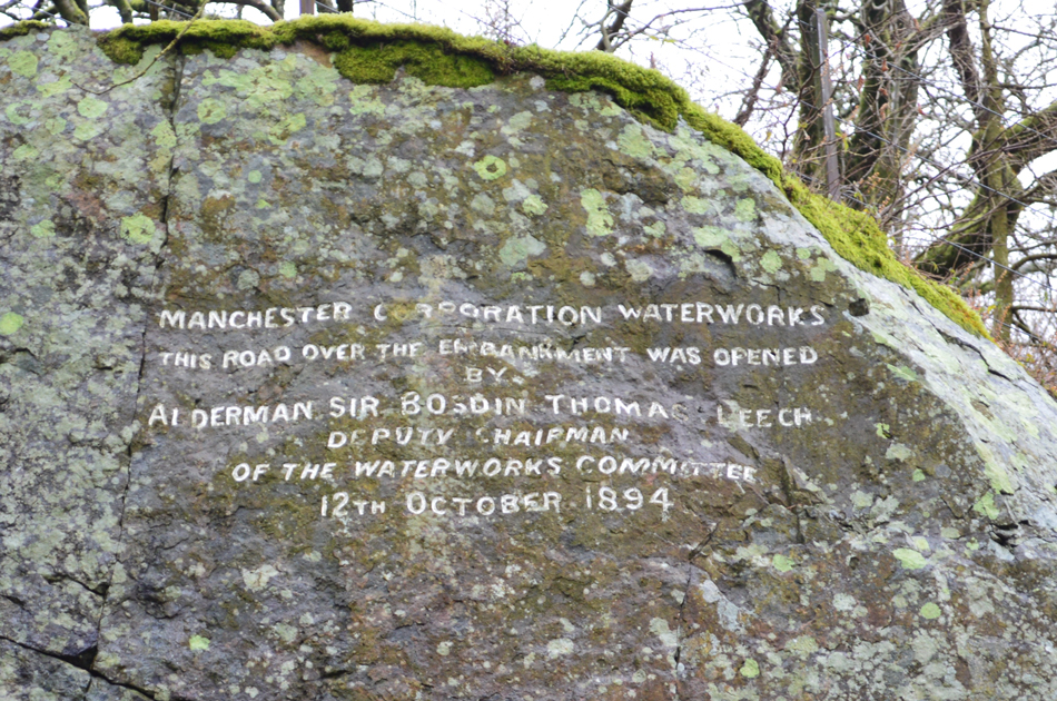
Next I wanted to pay a visit to a memorial stone which is actually marked on the Ordanance Survey maps at NY 304 772 |
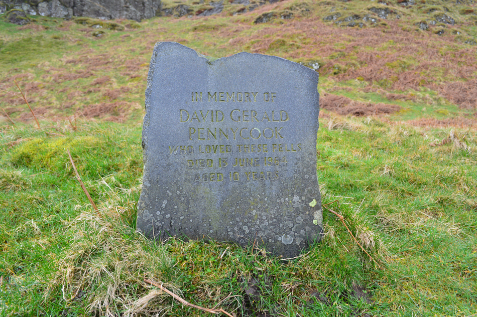 |
IN MEMORY OF
DAVID GERALD
PENNYCOOK
WHO LOVED THESE FELLS
DIED 13 JUNE 1954
AGED 10 YEARS |
| It's no wonder why, very sad indeed. |
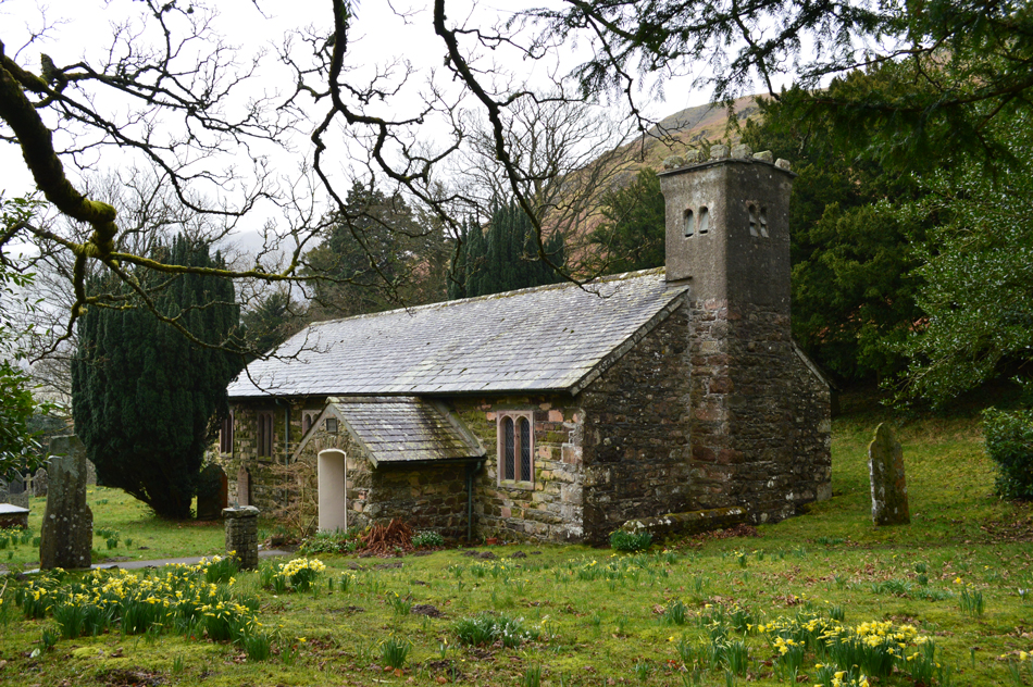 |
| St John's-in-the-Vale Church. |
| Which was looking very Spring like with the Daffodils growing in the Church Yard. |
 |
| Cloud topped Lonscale Fell and Blease Fell from Tewit Tarn. |
From St John's-in-the-Vale Church I crossed the stepped wall and started to make my way over Low Rigg when the drizzle started to turn to rain and low cloud cropped out the summits once more. I reached Tewit Tarn in good spirits feeling pleased that I had made great use of a low cloud drizzly day on the fells as I pass through a herd of sheep whilst watching the cloud meander below Skiddaw's lower slopes.
It was a slippery descent back to the road and care had to be taken so I didn't take a dive in the mud, once the road was reached I kicked both feet to the back of my boots and walked towards Naddle Bridge as views of Bleaberry Fell and Dodd Crag opened up before me, both were still below cloud and with the rain settling in for the afternoon, happen it's the last we'll see of Bleaberry Fell and Dodd Crag until tomorrow. |
|
| |
| Back to top |
 |
|