|
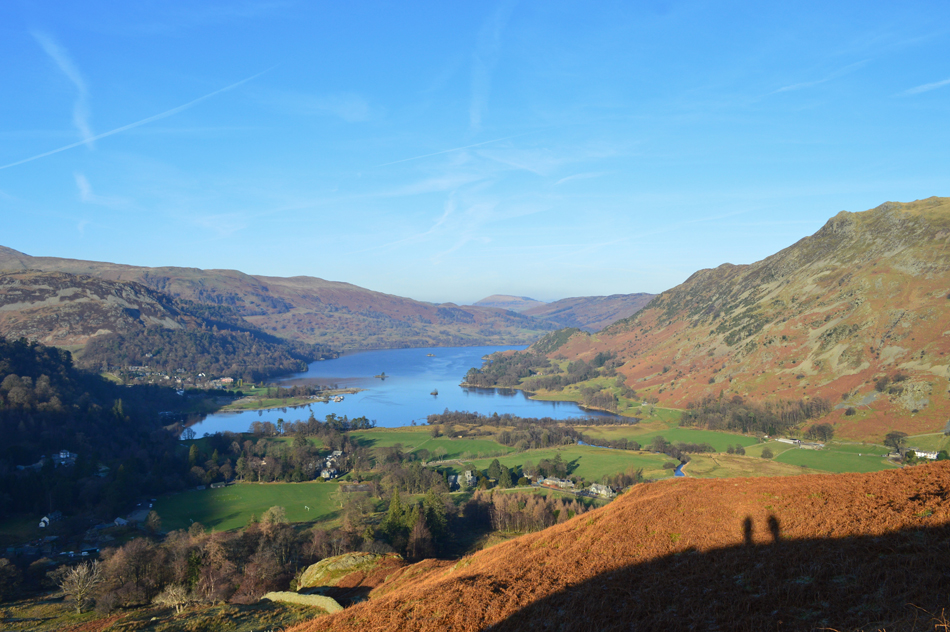
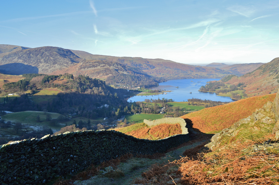
Birks, St Sunday Crag and Arnison Crag from Patterdale |
 |
 |
21st January 2017 |
 |
|
It's only been two weeks since I last walked the fells and boy how those weeks have dragged. It's January and low confidence forecasts are common which is what kept me off the fells last weekend as one grey day merged into another while the romance of Lakeland in Winter stirred my bedtime reading, it's fair to say that if you hang on long enough while battling your way through your week Lakeland will always reward you.
A few weeks ago David and I had set a date to do a walk yet with the unpredictabilty of the forecast it wasn't clear where we would be walking which normally falls down to the eleventh hour, or more precisely during a phone call around seven thirty the evening before.
If the cloud was low it was agreed that we would hit one of my Outliers walks or if high, we would hit the steep slopes of Birks and St Sunday Crag via Blind Cove, accessed from the Grisedale valley. The forecast for Saturday began to show potential and by Friday evening we had secured our high level walk, and, if the forecasters had got it right it would be under bright sunny skies starting off with a hard frost underfoot, they did get it right along with the prediction that fog would roll in mid afternoon creating one of the most dramatic days in Lakeland for those lucky enough to be above the cloud. |
|
| Wainwright Guide Book Eastern |
 |
| The Eastern Fells |
-Arnison Crag
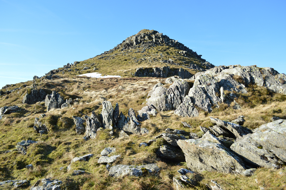
The rough fellside curving out of Deepdale and bounding the highway to Patterdale village has an attractive rocky crown, often visited for the fine view it offers of the head of Ullswater. This is Arnison Crag, a low hill with a summit worthy of a mountain. |
 |
|
|
|
| |
|
Overview |
|
|
| Ascent: |
2,781 Feet - 848 Metres |
| Wainwrights: |
3, Birks - St Sunday Crag - Arnison Crag |
| Weather: |
Dry, Bright And Sunny, Brisk Across The Summits. Highs of 4°C Lows of -2°C |
| Parking: |
Roadside Parking, Patterdale Primary School |
| Area: |
Eastern |
| Miles: |
7.4 |
| Walking With: |
David Hall |
| Ordnance Survey: |
OL5 |
| Time Taken: |
5 Hours 25 Minutes |
| Route: |
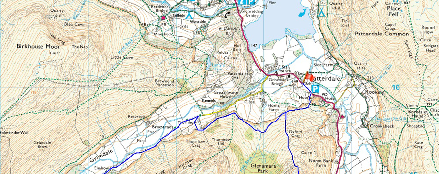
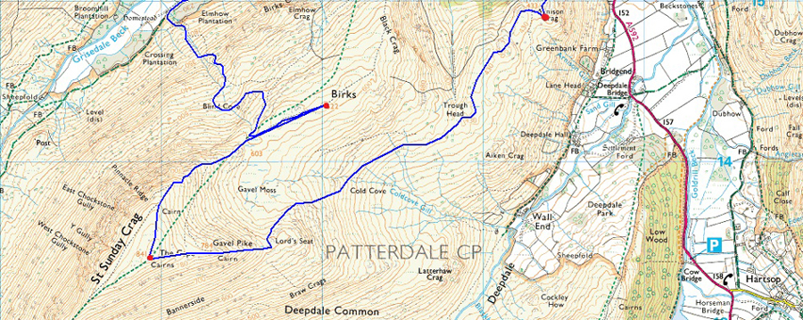
Patterdale - Glenamara Park - Grisedale - Blind Cove - Birks - St Sunday Crag - Gavel Pike -Traverse of Cold Cove - Trough Head - Arnison Crag - Patterdale |
|
| |
|
Map and Photo Gallery |
|
|
  |
| |
| |
 |
| Patterdale 08:10 -2°C |
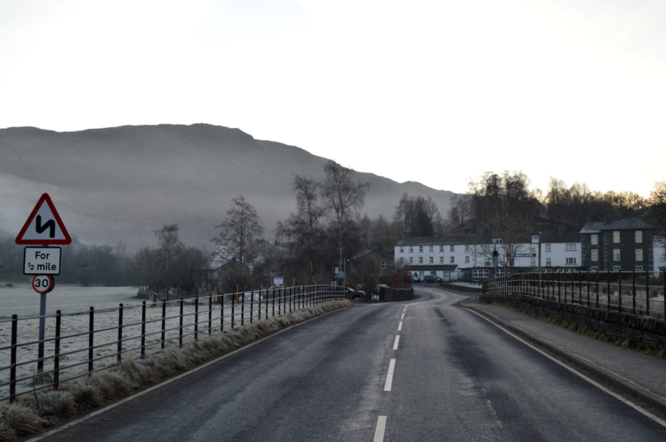
Both David and I had arranged to meet outside Patterdale Primary School at 08:30am and after a rather uneventful drive north I arrived first after driving over the Kirkstone Pass while trying to negotiate various ice patches where any run off water from the fell side had frozen over night, this continued all the way through to Patterdale finding the last mile from Hartsop the most precarious. At the bottom of the pass I slowed down as I noticed the afterglow of morning light breaching the summit of Red Screes set against a cloudless sky while a half moon was fixed directly overhead.
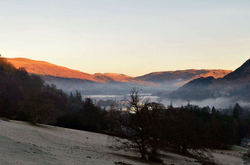
Dawn had broke by the time I arrived in Patterdale a short time later, the morning light revealed a hard frost coupled with a thin layer of mist that drifted over Ullswater south towards Brothers Water although I suspected it would have broken up once the warmth from the sun breached the valley. With my car parked I started to kit up instantly feeling the nip of the sub zero temperatures which caused the tips my fingers to feel painful. Gloves therefore and my beanie are added once my boots were tied whilst I waited for David to arrive. I was tempted to get back into the car and switch the engine on but I resisted knowing that I'd only be breaking the morning silence.
David arrives soon after and as always we greet with a handshake before David starts to kit up with much less layers than myself opting to start the walk without a hat or gloves, come to think of it, in all the time I've know David I've only ever known him to wear a warm hat once and that was on the summit of Binsey a few years back.
With both cars locked we head out in the direction of the Patterdale Hotel from where we will pick up the path through Glenamara Park and the Grisedale valley thereafter. We could have walked down the middle of the road given that no traffic had passed before we reached the Hotel car park passing a host of parked cars, all frozen solid. |
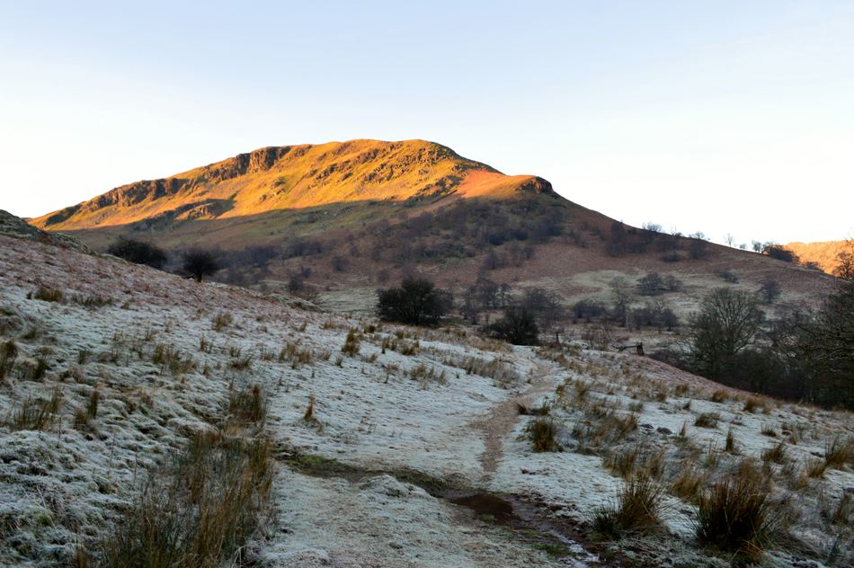 |
| Sunlight breaches Birks as we pass through Glenamara Park. |
| From the rear of the Hotel we pass through a small plantation of trees from where we pick up the footpath as we head towards the Grisedale Valley. Despite the dampness of recent days last nights hard frost had frozen any standing water meaning care had to be taken especially over stone where the ice was trickier to spot, nevertheless the frozen path was a joy to walk over as we take in the view as the sunlight begins to breach the valley. |
 |
| Morning afterglow over Watermillock Common and Gowbarrow Fell. |
| |
 |
| Views towards Dollywagon Pike, Ruthwaite Cove, Nethermost Pike and Nethermost Cove as we enter the Grisdale Valley. |
We continued along the path passing the flanks of Thornhow End where we had the choice to drop down into Grisedale or opt to continue along the narrow track towards two large sheepfolds which sat on the fell side above an old barn, we went with the latter as David told me it was his first time along here, for me it's a familiar route I tend to choose when accessing the Grisedale valley.
Hear I share a memory of how two sheep met their gory end in said Sheepfold, trapped by a fox some ten years ago when I first passed through here, it was a sight to see for the novice fell walker back in the early days. |
 |
| Dollywagon Pike and Nethermost Pike taken from Elmhow Plantation/Grisdale Valley. |
| We continue, largely in shade both with leaking noses towards Elmhow Farm from where we will begin the steep ascent on Birks via Blind Cove. |
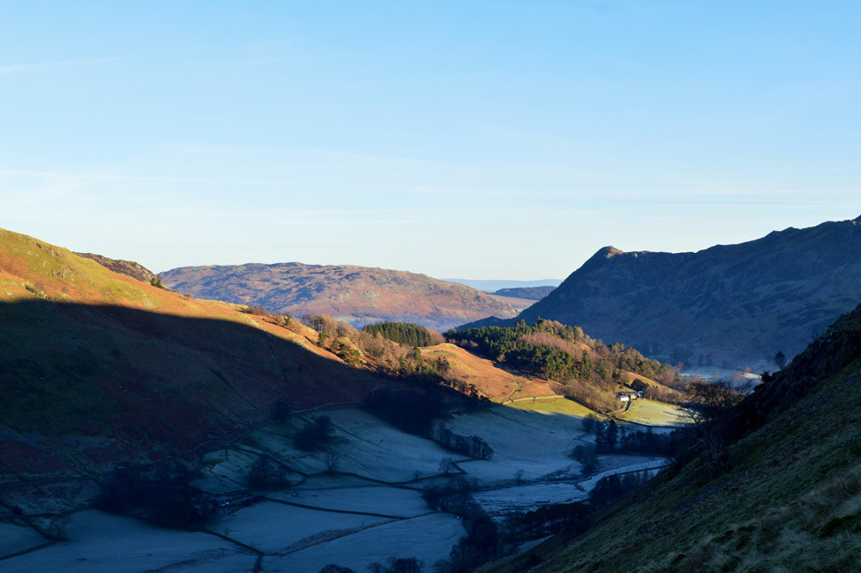 |
| Views beyond a frozen Grisedale Valley Over Keldas towards Gowbarrow Fell. |
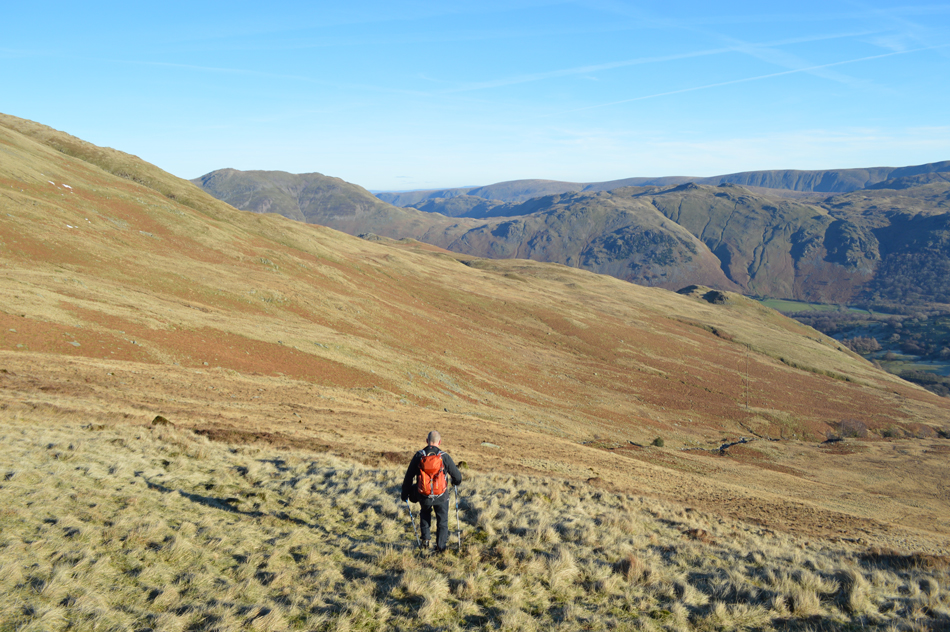
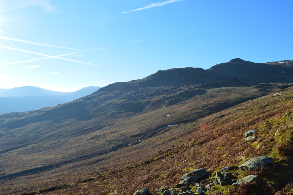
Continuing into Grisedale we pass through Elmhow Farm stepping aside to let a Landrover Pass before arriving at the end of the Plantation where the steep ascent onto Birks begins via a narrow grassy footpath alongside a nameless beck which still bore the damage from last December's storms. The path is excessively steep as shown by the gradient of the fell side in the picture, it sure was a time to knuckle down and dig deep type of ascent.
We stop to admire our views all the while peering for movement on the opposite side of the valley where a good path ascends towards Hole-in-the-Wall but only spot one walker sometime after this photo was taken.
"It's like Lingmell End all again" laughs David! There have been many an ascent where walking pole grips have meet shoulder such the steepness of the fell side as we are reminded of a past ascent of Lingmell End found at the head of the Kentmere valley.
We persevere ascending over a false summit above our heads from where Blind Cove comes into view. |
 |
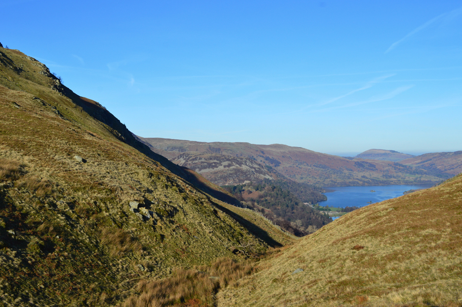
| The Grisedale Valley from Blind Cove. |
We leave a series of zigzags found on the banks of the beck seen centre right before going off to do a little exploring "fancy having a walk to where that patch of snow is" David asked, aye why not.
It was hard work over sometimes swollen ground and with no path to follow was tiring on the lungs but it was safe to say we did a loop of Blind Cove before agreeing on our exit point which took form in a steep grassy rake where hopefully a hint of brightness awaited us. |
 |
| St Sunday Crag, Nethermost Pike, Nethermost Cover East Ridge, Nethermost Cove, Striding Edge and Helvellyn. |
We emerged into glorious sunlight around the point where you see the group of walkers before agreeing to summit Birks before taking on the final ascent of St Sunday Crag.
It's been a while since I last enjoyed an 'out and back' |
 |
| Heading towards Birks summit. |
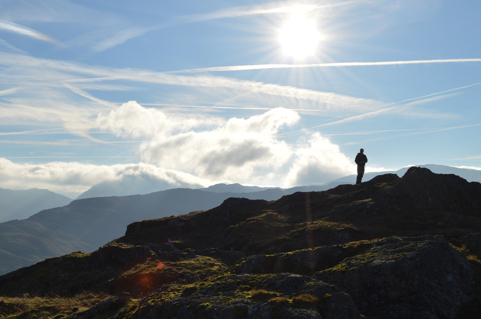
| In what appears to be in fine clarity which I might add wasn't forecasted, in fact it was meant to be quite hazy today, isn't it great when the forecasters get it wrong for all the right reasons. |
 |
| Views back towards St Sunday Crag, Gavel Pike and Lord's Seat. |
This view shows our route of descent from St Sunday Crag via Gavel Pike although we won't make it as far as Lord's Seat instead opting to descend further around its base into Cold Cove, but that's a little later.
Not far from the summit of Birks now. |
 |
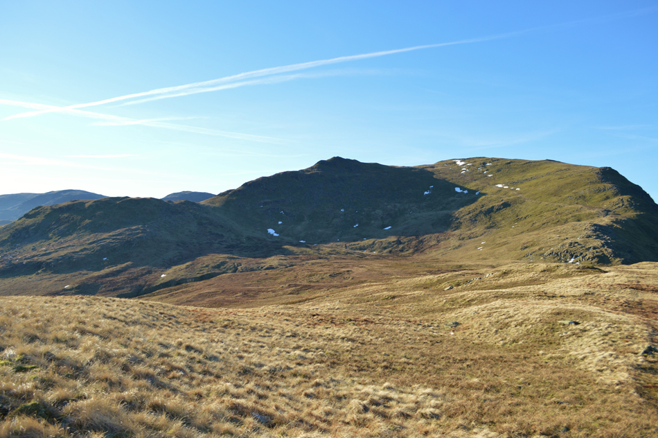
| Views towards Angletarn Pikes, Brock Crags, The Knott, Rest Dodd, Rampsgill Head, Kidsty Pike, High Street and Gray Crag from Birks summit. |
| Despite the sometimes blinding sunlight the windchill had quite a nip to it so it was while here at the summit David de-shoulders his pack and adds gloves before we retrace our steps back towards St Sunday Crag. |
 |
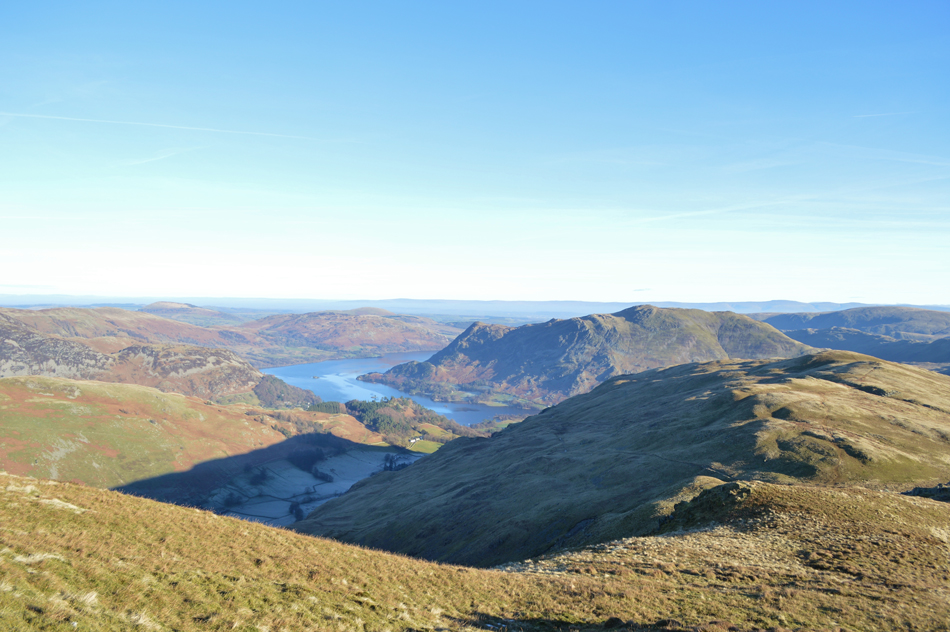
| The clairty speaks for itself with views over Birks, Glenridding Dodd, Place Fell, Gowbarrow Fell and the Mell Fells clear in the distance. |
| |
 |
| Nethermost Pike East Ridge seen with Striding Edge dominate the scenery as we head back towards St Sunday Crag. |
| |
 |
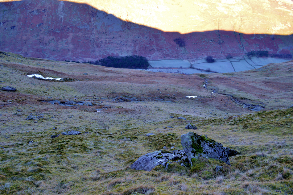
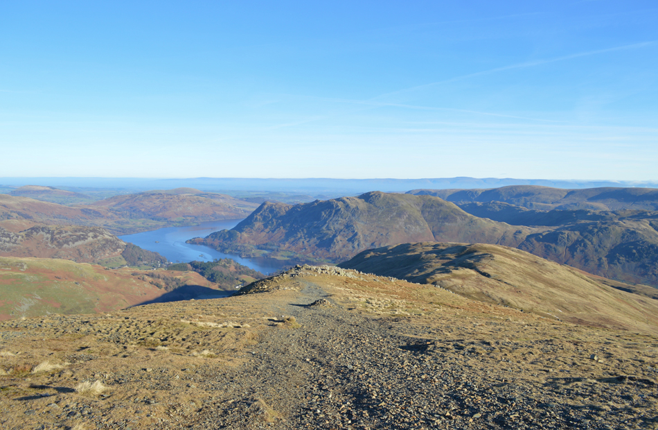
| Admiring the views over Birks and Place Fell from our ascent. |
| Blind Cove can be seen below still in shadow and will remain that way until late this afternoon by which time, this view will be below cloud with only the highest summits protruding. |
 |
| The same view taken from St Sunday familiar cairned North East ridge. |
| |
 |
| Striking views towards Striding Edge, Helvellyn and Catstye Cam from St Sunday Crag summit. |
| For those with a keen eye try and spot the walkers on High Spying How, more can be seen close to the summit. |
 |
| Cock Cove, Dollywagon Pike, The Tongue, High Crag, Ruthwaite Cove, Nethermost Pike, Nethermost Pike East ridge, Nethermost Cove, Striding Edge and Helvellyn. |
Time spent on St Sunday Crag summit was limited due to a brisk wind chill which caused exposed skin to feel numb, despite the staggeringly clear views we needed to keep moving if we wanted to keep warm.
It was soon time to leave the summit and start our descent towards Gavel Pike. |
 |
| Not before one last photo of Dove Crag and Red Screes. |
For sometime we had been keeping an eye on the cloud which appeared to be approaching from the south east of the district and by now was advancing towards the High Street and Kirkstone Fells, presumably this is likely to be the same cloud that the forecasters had predicted.
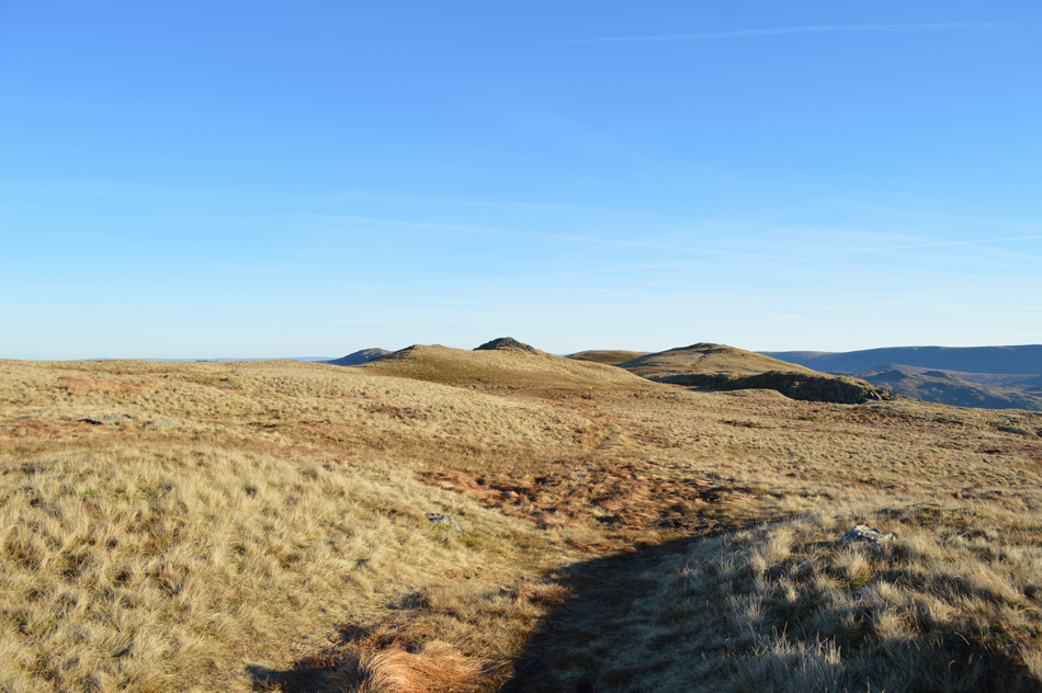
Something worth keeping our eye on as we make our way over to Gavel Pike. |
 |
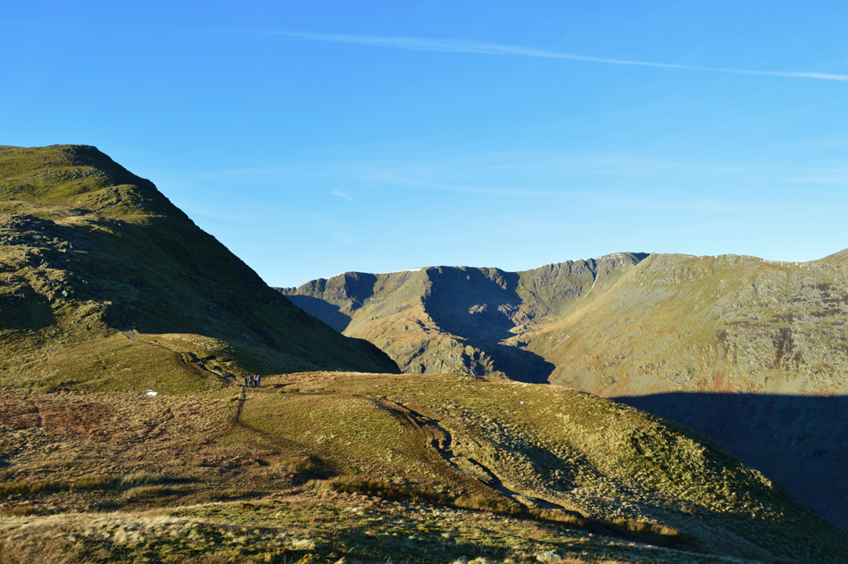
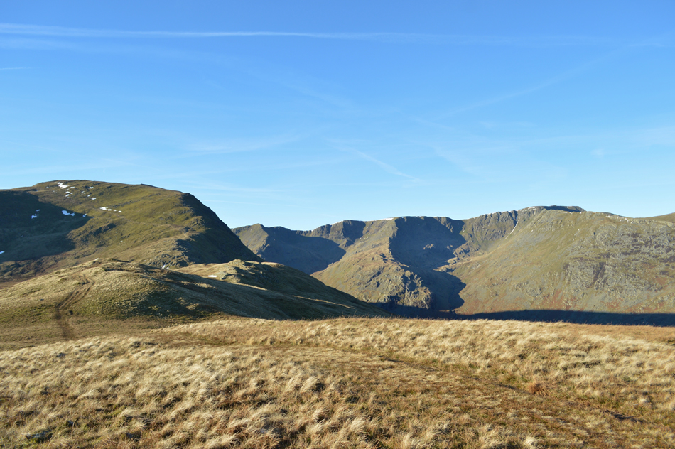
| Gavel Pike with a host of Eastern Fells in the distance. |
Gavel Pike is often known as St Sunday Crag subsidiary summit and can be found less than half a mile due east over looking the Deepdale Valley. This route towards Gavel Pike also acts as an alternative ascent/descent route back towards the summit of Birks or the Grisedale valley by means of a grassy trod found by steering left once the col is reached below. |
 |
| A quick look back on Fairfield and Cofa Pike seen over Deepdale Hause with Seat Sandal, the Langdale Pikes, Crinkles Crags, Bowfell and Esk Pike in the distance. |
| Today certainly is a day for long distant views. |
 |
| Place Fell from Gavel Pike summit cairn. |
| From the summit we descend steeply down the spine of the fell via a narrow path where the odd rock step had to be negotiated. It's during this descent we are able to plot our pathless traverse across the second cove featured in todays route, Cold Cove. |
 |
| Stopping to look back on the summit of Gavel Pike during the descent. |
| |
 |
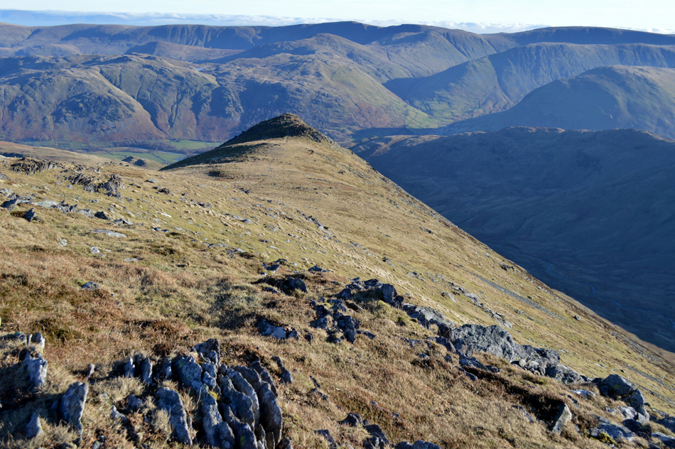
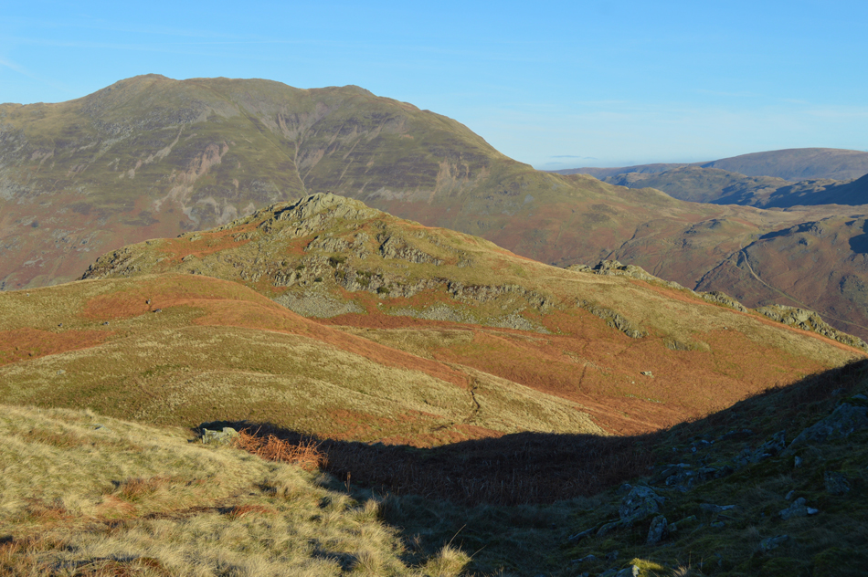
| Views over Birks, Cold Cove and Arnison Crag with Lord's Seat seen in the foreground. |
Here we rewarded with a grand view of Cold Cove and the route we will take in order to gain Arnison Crag by which can be seen beyond Trough Head in the centre of the photo.
As you can see a path continues over Lord's Seat towards the right yet our plan is to leave the path at the 'flat bit' seen below, flank left under shadow and traverse Cold Cove via a pathless route all the while trying not lose too much height, to do this we fix a bearing on objects such as boulders or patches of dead bracken, it's a simple way to navigate when met with such great conditions. |
 |
| First we trace a pathless route towards Coldcove Beck. |
| After flanking Lord's Seat we descend further into Cold Cove choosing not to use a path higher up to our right where we spot a couple walking towards Gavel Moss. instead we opt to blaze through open fell side agreeing the route while still on the move. |
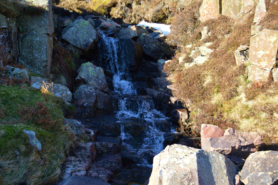 |
| Crossing Coldcove Beck. |
| Where we found this delightful waterfall which flowed over a natural rocky staircase. |
 |
| A profile of Gavel Pike and Lord's Seat seen over Cold Cove. |
| Note the group of boulders in the foreground which we had used as our 'fix points' |
 |
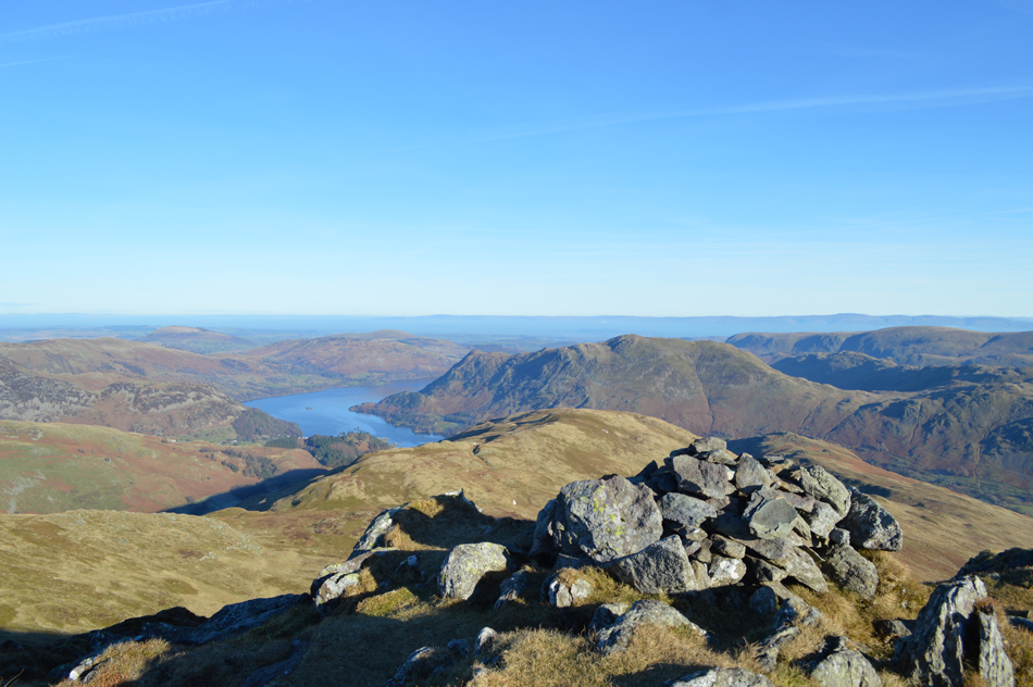
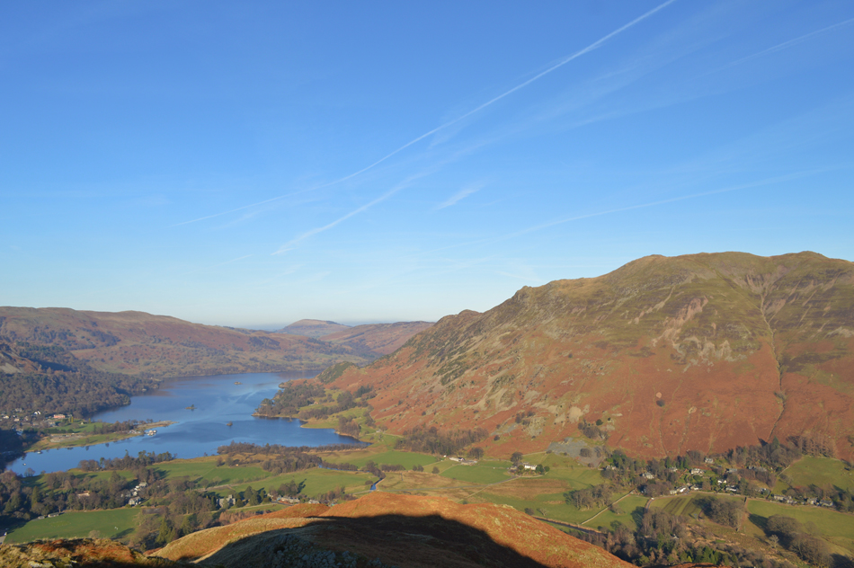
| Ullswater, Glenridding Dodd and Great Mell Fell from Trough Head. |
| |
 |
| Arnison Crag with Place Fell directly behind. |
| From Trough Head we track north east over a well worn path while taking in the views under exceptional clarity, to use the term "you could see for miles" would have been an understatement all the while being blessed with a warm sun on our backs which dare I say, made the afternoon feel very Spring like. |
 |
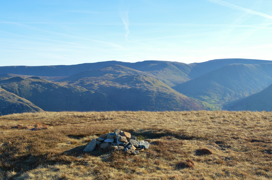
| Arnison Crag summit. |
| We soon found ourselves on the summit of Arnison Crag which we had ascended from the Deepdale side of the fell. Earlier we had spotted a couple sat around the summit cairn and half expected them to be ready to move on by the time we arrived but I guess, the views were just too good to miss "are you completing the Wainwrights the fellow asked?" nah David replies before giving the chap a brief on our route "ah that's the way we're going but in reverse" or words to that effect, by now it was 13.30pm and way too late to attempt the route but it wasn't spoke off, instead we dropped down to a craggy outcrop which over looked Ullswater and its surrounding summits before settling down for a well earned lunch. |
 |
| Lunch with a view. |
| Usually such a view would be associated with Summer and all the hustle that comes with it be it cars or bikes speeding below but today there wasn't a whisper to be heard other than the wind or a squawk from a nearby crow, pure bliss with views to boot. |
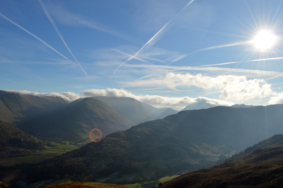 |
| Here's that approaching cloud we had been watching, slowly but surely making its way over. |
| |
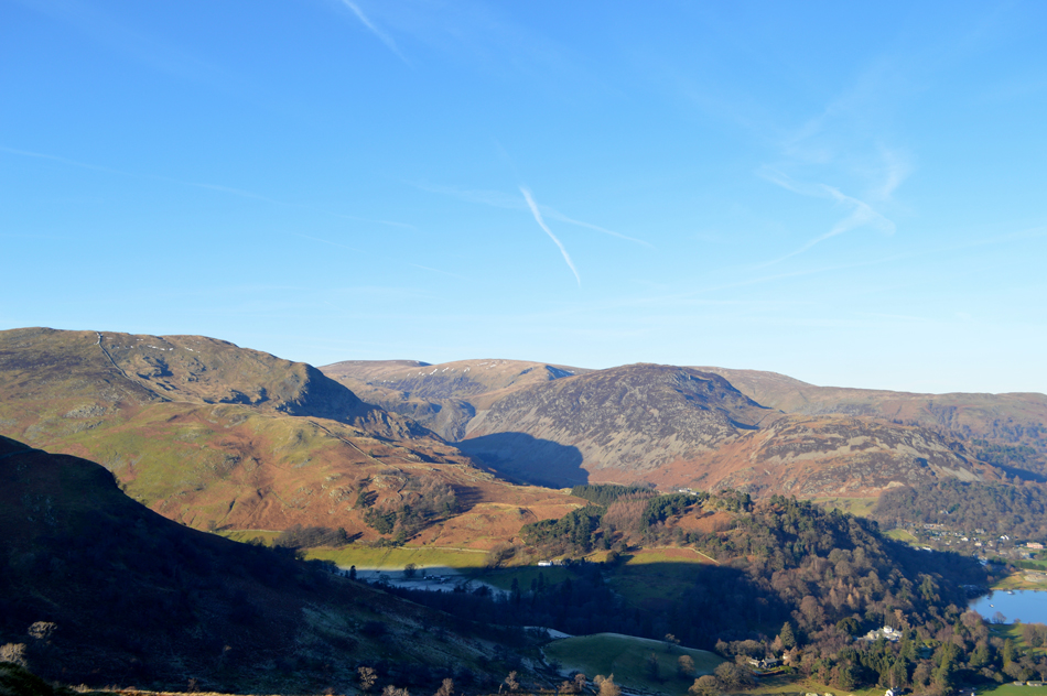 |
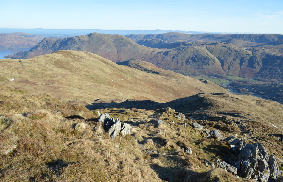
| Crystal clear views over Glenridding towards Birkhouse Moor, Glenridding Dodd, Sheffield Pike, Stybarrow Dodd and Hart Side. |
| |
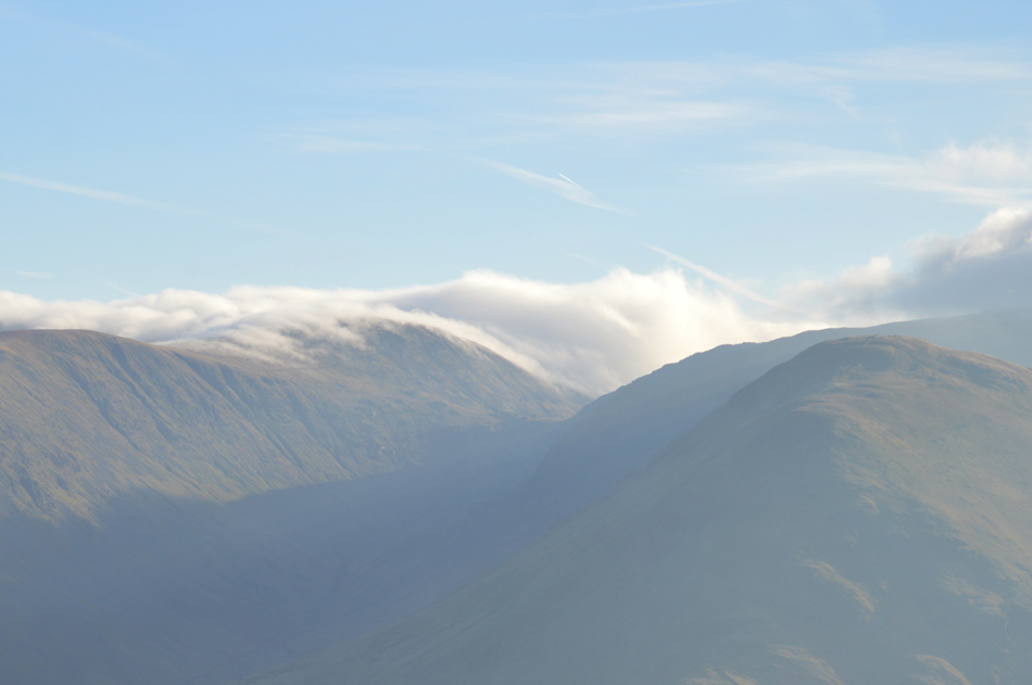 |
| It's starting to get a little murky over Caudale Moor and Red Screes now. |
| |
 |
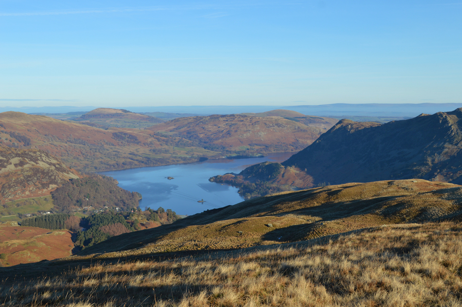
| Ullswater from the descent of Arnison Crag. |
Despite a strong sun we didn't have to wait long until the chill started to bite at finger tips and with this packs are re-shouldered before taking one last view of the advancing cloud.
With the rocky outcrop that makes up the summit left we start our descent via the familar stone wall stopping every now and again to take in the view. |
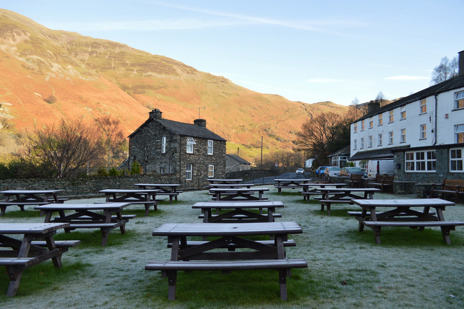 |
| Frost covered benches, Patterdale Hotel. |
| We followed the stone wall steeply passing Oxford Crag to our right before arriving back on the same path we had used to gain the Grisedale valley by a little under six hours earlier. The path remains icy as does the grass which is still covered with a heavy coating of frost as were the benches outside the hotel looking just as we left them this morning. |
 |
| Sheffield Pike and Glenridding Dodd from Patterdale. |
| It's just a short stroll from the Hotel back to the cars which are unlocked as we speak of future walks, hopefully under similar skies. With a handshake I say bye to David and set out along the Kirkstone Pass where within minutes the cloud had thickened and highlights of rain began to hit my windscreen, headlights are switched on as I knock the car down a gear while looking through my rear view mirror as Place Fell and Sheffield Pike are set alight under the blaze of an afternoon sun before nearing the top of Kirkstone Pass from where I couldn't see as far as the car in front of me, My heart sank as I drove into the cloud with just the inkiest view of Red Screes over to my right. |
|
| |
| Back to top |
 |
|