Helvellyn to Stone Arthur

3rd December 2016

I had intentions of spending this Saturday on High Street although the route was still unconfirmed, that was until I received a e-mail from David who suggested a two car walk taking in the Helvellyn Range from Swirls to Grasmere, the thought of doing a two car walk in December really appealed to me when usually such a walk is normally reserved for the Summer months.

We had what was appeared to be a green light forecast and the route was confirmed just a few days earlier on which it was agreed we would intentionally leave out Seat Sandal in favour of continuing all the way to Nab Scar which worked well with the daylight hours. Despite it only being a few weeks from my last ascent on Helvellyn from Swirls I was looking forward to taking on this fine ridge without feeling the need to scour the undergrowth something of which occupied my last ascent where I thought I had lost my mobile phone when in fact it had been found by a local man who returned it to me later that day.

The weather held with the forecasters predicting long periods of sunshine and maybe even a hint that the higher summits may protrude out of the cloud just as they had during my previous visit to Fairfield only a few weeks ago. With this and with high expectations of a perfect Winter walk it was confirmed we would meet first at the lay-by just outside Grasmere before continuing towards Swirls in the second car by which time we kind'a got the feeling the forecasters might have got this one wrong.

 
Wainwright Guide Book One
The Eastern Fells

-Helvellyn

There is some quality about Helvellyn which endears it in the memory of most people who have stood on its breezy top; although it can be a grim place indeed on a wild night, it is, as a rule, a very friendly mountain.


Overview
Ascent: 3,913 Feet - 1,192 Meters
Wainwrights: 6, Helvellyn - Nethermost Pike - Dollywagon Pike - Fairfield - Great Rigg - Stone Arthur
Weather: Feeling Very Wintery. Ovcercast, Highs of 6°C Lows of 5 °C Feels Like -7.3°C
Parking Using x2 Cars: Car Park, Swirls - Roadside Parking - A591, Outside Grasmere
Area: Eastern
Miles: 8.5
Walking With: David Hall
Ordnance Survey: OL5
Time Taken: 6 Hours 10 Minutes
Route: Swirls - Browncove Crags - Helvellyn - Nethermost Pike - High Crag - Dollywagon Pike - Grisedale Tarn - Grisedale Hause - Fairfield - Great Rigg - Stone Arthur- Greenhead Gill - Michael's Nook - A591
 

Map and Photo Gallery


Browncove Crags shortly after crossing Helvellyn Gill 8:05am 5°C

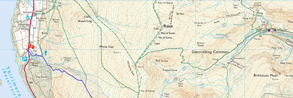
I guess the early warning signs were there for me to see as I drove north in complete darkness only arriving at the lay-by just outside Grasmere as dawn broke after driving through dense fog, although at times from Rydal I could see patches of snow on Nab Scar though momentary gaps. I hit the temporary traffic lights just outside Grasmere after being forced to switch the fog lights on as it started to sink in that maybe the bright forecast was never going to materialise. I was running about a quarter of an hour early after arranging to meet David at 07:45am and after slowing down purely through the density of the fog I pulled in the lay-by securing top spot. It was by now 07:30am and I wasn't really paying attention to any on coming traffic but soon Davids headlights approached from the direction of Dunmail Raise as he slowed down before spinning his car around behind me.

I got out of my car and greeted David with a handshake before realising that the lay-by was in actual fact clear of fog soon pointing towards Grasmere which was hidden within the density "it's the same on Dunmail Paul" David replied, it would appear we are sitting within a null although from our position from the roadside the summit of Seat Sandal could be seen leaving us thinking that the fog is localised to the valleys and maybe...the summits are completely cloud free.

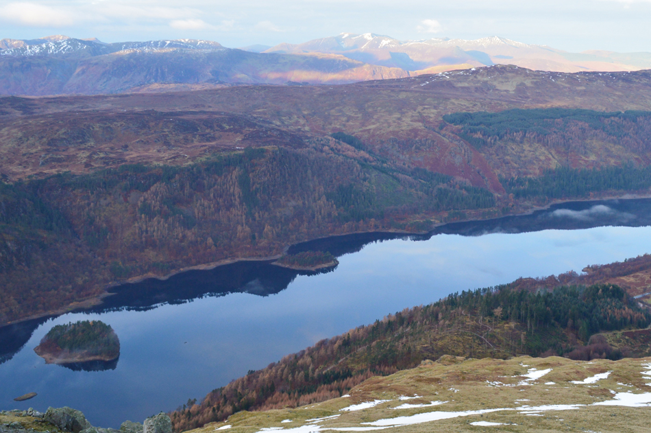
It was agreed I would leave my car here at the lay-by before David would drive us north towards Swirls so I began swapping my gear from one car to the other carefully checking that I had everything in my eagerness to get away. With my car locked and my keys secured within my pack we drove the short journey towards Swirls passing the site where the A591 collapsed into Birkside Gill this very weekend one year ago. It was noted that Thirlmere was below its usual waterline soon realising that maybe the level had been left that way in order to accommodate any extra rainfall to the extent of last Decembers storms, a simple plan of action set by United Utilities no doubt.

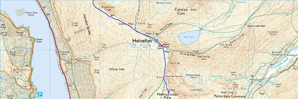
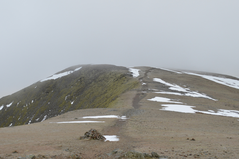
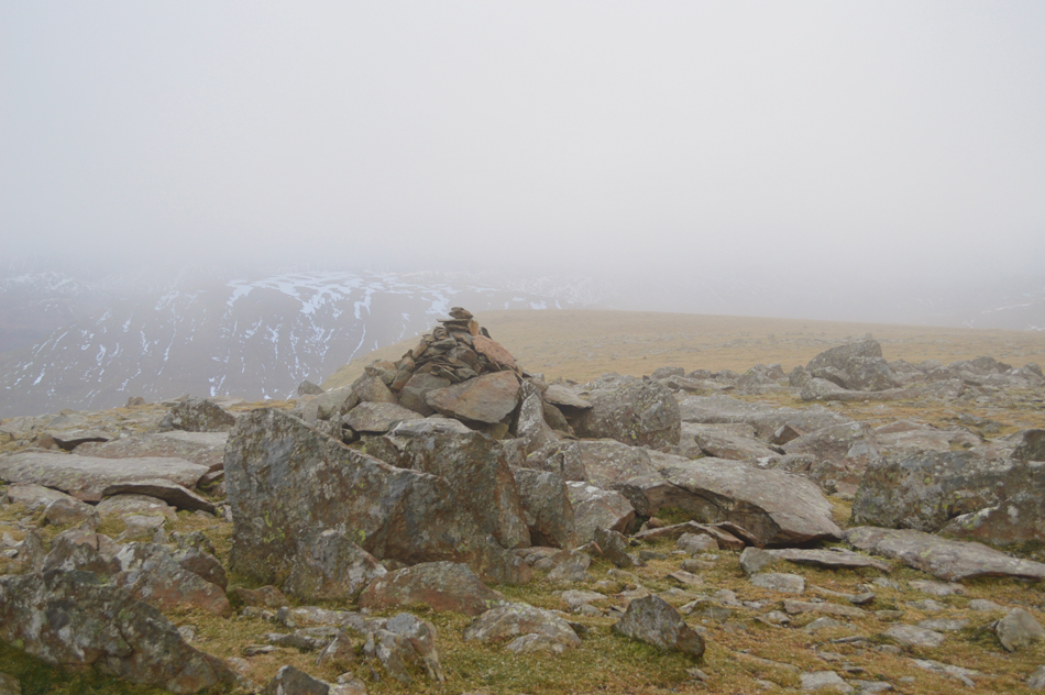
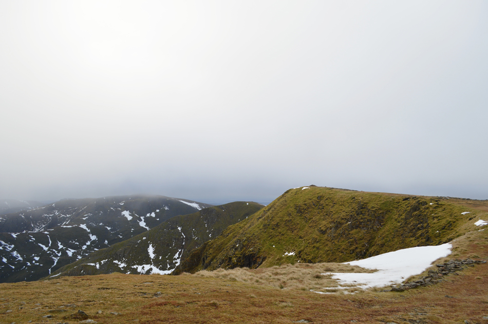
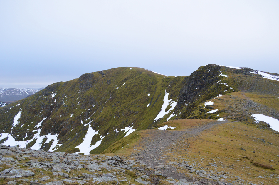
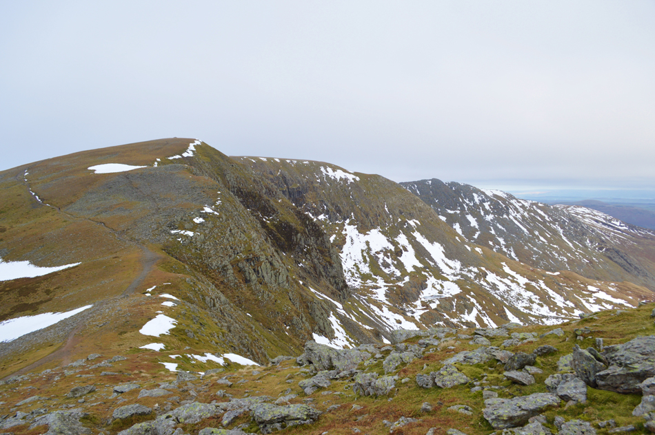
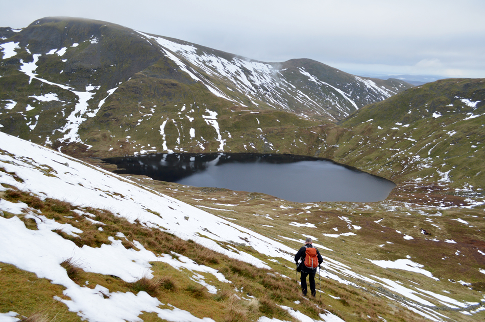
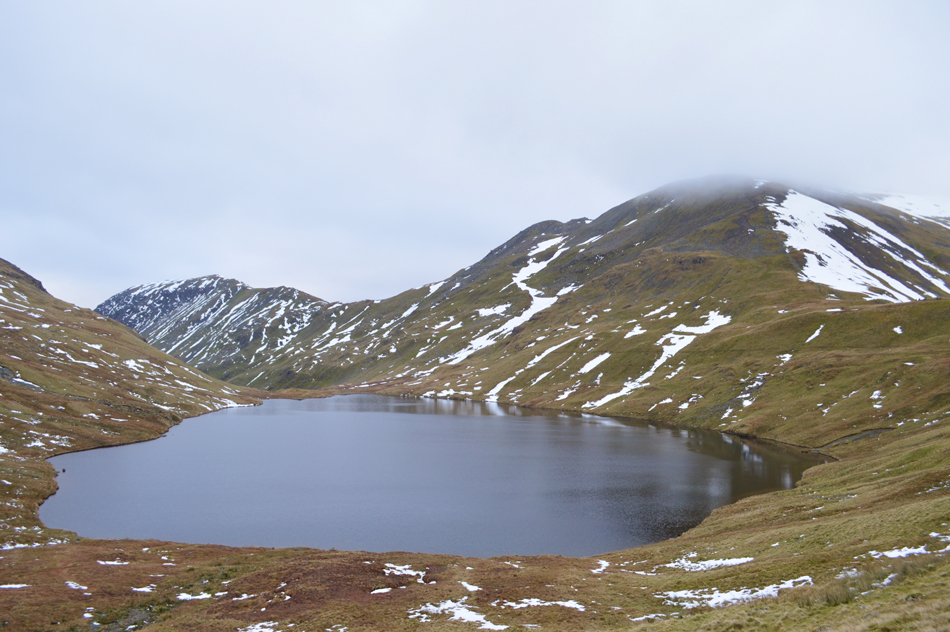
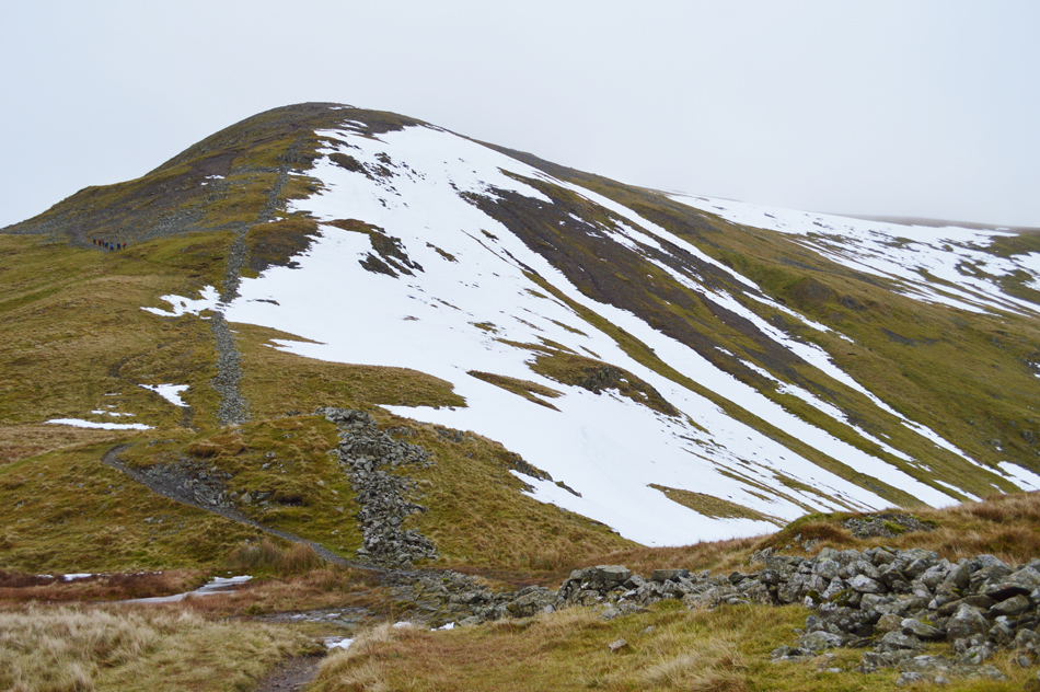
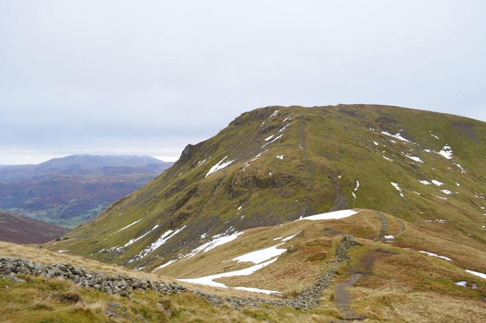
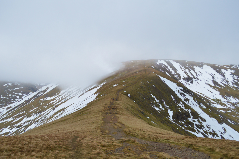
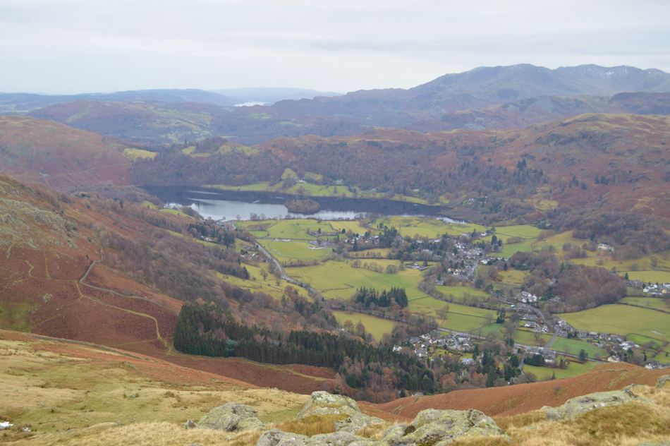
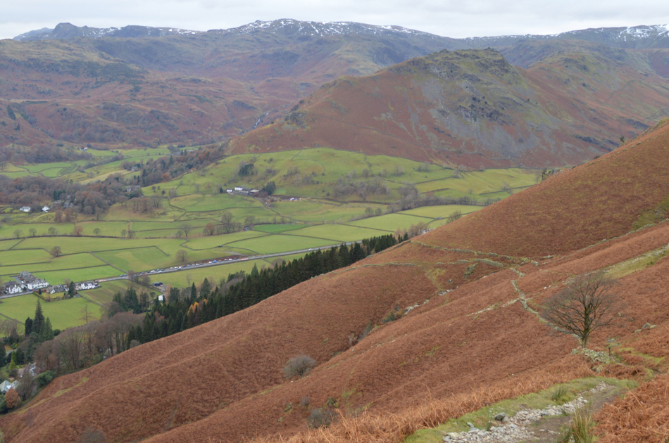
We soon arrived at an empty Swirls Car Park which is the same one where the familiar ice cream van used to park although this had become a distant memory since last December's storms. The thickest of the fog would appear to be confined to the Grasmere side of Dunmail leaving a coating of mist over St-Johns-in-the-Vale with clear views over Lonscale Fell and Skiddaw. Meanwhile behind us our route onto Browncove Crags would also appear to be clear as sparse snow patches could be seen higher up the slopes...it was at this point I untied my Ice Axe from my pack both agreeing we should leave our Crampons and Spikes packed just in case. Its pretty mild at 5°C without a breath of wind which left hats and gloves tucked away, well for now at least. David locks his car and we strike out over fresh tarmac and cross the road then through the new wooden gate into the second car park before crossing Helvellyn Gill via a narrow wooden footbridge...it was just up ahead l lost my phone, thankfully todays ascent on Browncove Crags wont be with my heart in my mouth.


Feeling hopeful as we ascend Browncove Crags.

We were both still hopeful that the weather would still pick up it still being earlier and the fact that further north over Skiddaw we could see blue skies which at times had a hint of a pink morning afterglow mixed in which left us feeling positive that any brightness was just around the corner.

Meanwhile conditions underfoot are pretty treacherous as the path had a glazing of black ice which had formed overnight meaning even careful footings usually resulted with a slip...it was agreed to stick to the frozen grass either side of the path while commenting that we were glad we were in ascent and not descent.


Views North over St-Johns-in-the-Vale, towards High Rigg, Lonscale Fell, Skiddaw and Great Calva.
The valley mist lingered long into our ascent and we commented that anyone who had taken an early walk on High Rigg this morning would have been in for a real treat.

Views over Thirlmere towards High Seat and the North Western Fells.
It would appear that the best of the sunlight is over the north western fells right now.

Hevellyn Little Man shortly after passing Browncove Crags.

We were met by cold brisk winds once we had crested the summit of Browncove Crags so much so David added his jacket although I had added my gloves much earlier but we both braved cold ears, for now that is. On reaching the stone cairns that line the route onto Helvellyn plateau we could see up ahead that in fact Helvellyn summit was below the cloud but this wasn't the case of Nethermost Pike to the south or White Side to the north.


The distant afterglow of sunlight seeping through the cloud over Morecambe Bay.
Meanwhile the cloud is appearing to drop over Nethermost Pike too.

Helvellyn peace and solitude.
We strike away from the path instead opting to gain the summit pathless over frozen ground each with leaking noses when soon the summit Trig Point appears through the cloud, however, instead of heading straight towards it we explore our views which appear to be getting more and more restricted.

Red Tarn (Helvellyn)

From the headwall we peer down through the inky murk and cast eye over Red Tarn each taking time to spot movement on the approach to both Swirral and Striding Edge(s) but spot no one.

The summit of Catstye Cam comes and goes through a thickening of cloud as do views over Birkhouse Moor but put simply...nothing stirred from the summit of Helvellyn today.


Helvellyn summit shelter.

Here David takes time out to measure the wind chill as I'm asked "what do you reckon Paul?" It's just so quiet with little to no wind I'm guessing a big fat zero.

It was -0.3°C

It wouldn't always feel so mild, if fact we don't have to wait too long until noses are streaming again.


Leaving the summit of Helvellyn.
We now head south along the ridge through the cloud towards Nethermost Pike where we pass a young solo walker and smiles and mornings are exchanged.

Helvellyn, Striding Edge and High Spying How.
While crossing the top of Nethermost Cove we spot two walkers on Striding Edge and only hoped that the rock wasn't as glazed as we found during our own ascent on Browncove Crags.

Nethermost Pike summit cairn.

Having left the path we track south east towards Nethermost Pike summit soon easing ourselves on to the rocky summit plateau after crossing patches of frozen deep snow. The cloud for now is still low and lingers around the summit again limiting our views of surrounding summits. It's during the crossing from Nethermost Pike to High Crag did we experience the wind chill and the affect it had on our already leaking noses! blimey I swore I'm only seconds away from brain freeze.

To keep spirits high our conversation turns to food...hot food!


High Crag, Dollywagon Pike and Fairfield are the first to appear once the cloud begins to lift.
 

Peering down into Ruthwaite Cove over a semi frozen Hard Tarn.
 

Dollywagon Pike seen over Ruthwaite Cove.

Our summit time on High Crag was brief to say the least as the wind drove up through the Grisedale Valley leaving the exposed ridge feeling very wintery indeed, it was here David took a second measure of the windchill which was now reporting -7.6°C although I must admit it felt much chilier than that while in the wind. With this we descend over the top of Ruthwaite Cove and soon spot the movement of two walkers who appear to be changing direction quite sporadically as if they may be lost below us on Willie Wife Moor.

We were too far away to offer any help and hoped that they found where they were heading for.


Our view back over trodden ground.
Here looking back on High Crag and Nethermost Pike during our ascent on Dollywagon Pike.

Descending Dollywagon Pike with views over Grisedale Tarn, Fairfield, Great Rigg and Seat Sandal.

Time spent at Dollywagon Pike summit was much similar to that of High Crag although we did take the time to retrace a route from a Summer expedition of both Ruthwaite Cove and Nethermost Cove from earlier this year during one of Davids Tarn Walks. We left the summit and traced towards the familiar steel pole which marks the spot for our Grisedale Tarn descent, there is a well worn 'zigzag' path further east which would only take us away from our destination at the head of Raise Beck/Grisedale Tarn.

Our descent begins steadily as the fell side disappears from view depicting just how steep it's about to get but we are both familiar with this route and start our descent, soon realising that much of the worn path is under snow which meant detouring around which was no hardship but was enough to kill conversation for now at least. From the direction of Raise Beck three walkers start their own ascent which we didn't envy knowing the concentration we had to put in during our own descent, once passed a brief conversation takes place mostly about conditions across the summits before leaving the trio to get on with the job in hand before passing a young couple with two Labradors who too, are just about to make their own ascent.

It wasn't long after the descent that David mentioned he isn't feeling too well but puts it down to the steep descent hoping that whatever he is feeling he'll be able to walk it off.


St Sunday Crag and Fairfield from Grisedale Tarn.
We're heading towards Grisedale Hause which is seen as the lowest point over on the right. Meanwhile during our descent from Dollywagon Pike we could see that a large group has just started their ascent on Fairfield.

Fairfield from Grisedale Hause.

You might just be able to spot the group on the path up on the left.

How's the stomach David? David holds his stomach and sighs...are you going to be ok I asked? Aye not to worry, but I was starting to worry but I didn't let it show, the worst thing when someone is feeling unwell is someone else asking are you ok every ten minutes.

We both plough ourselves into our Fairfield ascent.


Here looking back on Seat Sandal over Grisedale Hause.

Despite David feeling unwell we soon found ourselves looking up at the back of the large group who we had seen earlier who consisted of mainly teenagers fully equipped for a day on the fells although one or two of them were finding the ascent hard and held back a little. With the group passed I couldn't but help ask David again how he was feeling despite not hearing a peep from him; the look on his face kind'a told me he wasn't feeling any better.

With this in mind we stop short of the summit after passing a smaller group how we oddly witnessed using Ice Axes during their ascent despite the total lack of snow and ice underfoot, still 'mornings' are exchanged while we assess what happens next.


Fairfield summit.

Our initial plan was to find a spot from where we could break out lunch but as David continues to feel unwell and with this in mind we agree that instead of heading towards Nab Scar we'll shorten the walk and descend back to Grasmere via Stone Arthur instead. David apologies for having to do this but I could see that he was clearly feeling unwell, at which point I tried to cheer him up by asking him did he just want a bloody good fart!

Was that your professional opinion as a First Aider asked David?

Aye that's your lot I'm afraid.


Descending through the cloud as views open out over Great Rigg, Heron Pike, Nab Scar together with a distant Windermere.
At least the forecast hadn't put too many people off, we must of passed a dozen people between Fairfield and Great Rigg summits.

Here looking back on Fairfield, Link Hause and Hart Crag.
 

Cloud slowly starts to peel away from our ascent on Great Rigg.
Just one of many highlights taken from the day.

We're completely out of the cloud now as views open out over Heron Pike, Nab Scar and Windermere.
The good news is that David was starting to feel slightly better after taking pain killers but with this in mind we still decided it was the best option not to continue and instead descend via Stone Arthur where we had agreed to eat lunch which I was quite looking forward to because I'm really starting to feel hungry now.

Starting our descent towards Stone Arthur.
 

Lunch with a view.

We broke out lunch in an area just below Stone Arthur summit facing this delightful sheepfold as views opened out towards the Greenburn Valley, Helm Crag and Steel Feel with High Raise and Sergeant Man in the distance. It was hard not to touch on the subject of last years floods which saw many of the fields and indeed parts of the village below water during last December which extended north through the vale of Keswick affecting Braithwaite and Bassenthwaite plus Cockermouth and Carlise.

Despite being out of the wind body temperature soon cooled down and the affects of the cold soon took hold. David attempted to eat his lunch but after one sandwich he thought it was better if he kept food intake to a minimum. After lunch we re-shouldred packs and made our way towards the summit.


Grasmere from Stone Arthur summit.
 

Distant views over Helm Crag as we begin our descent.

First by following the stone wall before descending steeply besides the tree line as views open out onto the A591 and the lay-by where I left my car this morning.


Helm Crag from Michael's Nook.

It was only mid afternoon but the low light made it feel much later as we made our way, as did many others back to their cars at what can only be described as a perfect yet atmospheric day on the Lakeland fells despite a rather dodgy forecast which saw me tag along a pair of sunglasses just incase the light got to bright.

It takes time to adjust into Winter walking after spending a whole season under blue skies so when given the opportunity to walk under the glow of a Winter sun it's only human as walkers that we'd saw our right leg off if only to get onto the fells but what I realised today was it didn't matter how bright the skies are because nothing quite grips you the way it does while walking those last few yards over frozen ground as the summit trig point appears through the mist.


Back to top