|
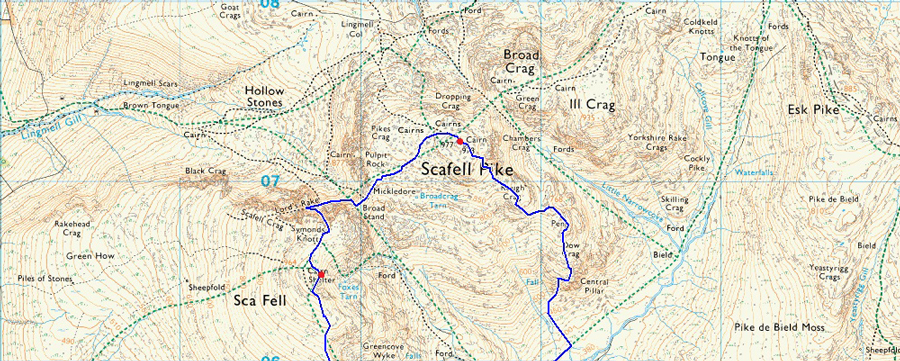
Pen, Scafell Pike and Scafell via Lord's Rake and the West Wall Traverse |
 |
 |
22nd October 2016 |
 |
|
As far as Octobers go this Autumn has been one of the driest and warmest as far as my memory serves me at a time when really the wind should be whipping up a hoolie and baring Autumn leaves from the trees when what we are really experiencing despite those brisk mornings is unseasonal mid afternoon temperatures where you can actually get away with wearing Summer attire on the fells, although take that as tongue in cheek but I guess you know what I mean.
With this I thought I'd plan maybe one of the last 'biggie' walks of 2016 before the clocks go back and everything I've mentioned above starts to fall into place. For some weeks now I had set my sights on a walk taking in Great Moss before it actually gets to damp and this weekend looked perfect for it, although I must mention at 05.20am this morning the forecast had changed and while I was brushing my teeth I was thinking of a plan B walk but I laid trust in the forecast and stuck with my guns.
The long drive to Brotherilkeld was done in complete darkness as dawn broke as I travelled over the Wrynose Pass, my headlights still illuminating the way but it was light enough to see where I was going. Twenty minutes earlier I had come to a sudden stop when a young Deer blocked the road, usually such a sighting lasts mere seconds but the Deer looked on as I fumbled around for my mobile phone to take the grainiest of photos on my phone camera, the Deer was still there but the young un had turned its head once the shot was taken, my heart was racing as I watched it disappear into the hedgerow before sticking my car back into gear and continued through towards Brotherilkeld, a perfect setting I'd say which brought me firmly back into Lakeland after only a week away. |
|
| Wainwright Guide Book Four |
 |
| The Southern Fells |
-The West Wall Traverse
The massif crags off Scafell are split asunder by the tremendous chasm of Deep Gill, which has two vertical pitches in its lower part that put the through route out of bounds for walkers, The upper half, however, although extensively stony, can be used by all and sundry without difficulty, and is linked with Lord’s Rake by a simple path across a grassy shelf.
This is the West Wall Traverse. |
 |
|
|
| |
|
Overview |
|
|
| Ascent: |
3,967 Feet - 1,209 Meters |
| Wainwrights: |
3, Scafell Pike - Scafell - Slight Side |
| Weather: |
Sunny Spells Throughout The Morning, Turning Overcast With Light Rain Over The Summits. Sunny Spells Returning PM. Highs of 14°C Lows 8°C |
| Parking: |
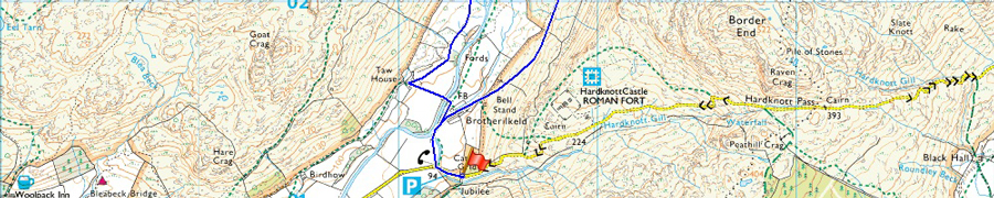
Roadside Parking, Jubilee Bridge, Hard Knott Pass |
| Area: |
Southern |
| Miles: |
10.3 |
| Walking With: |
On My Own |
| Ordnance Survey: |
OL4 |
| Time Taken: |
7 Hours 15 Minutes |
| Route: |
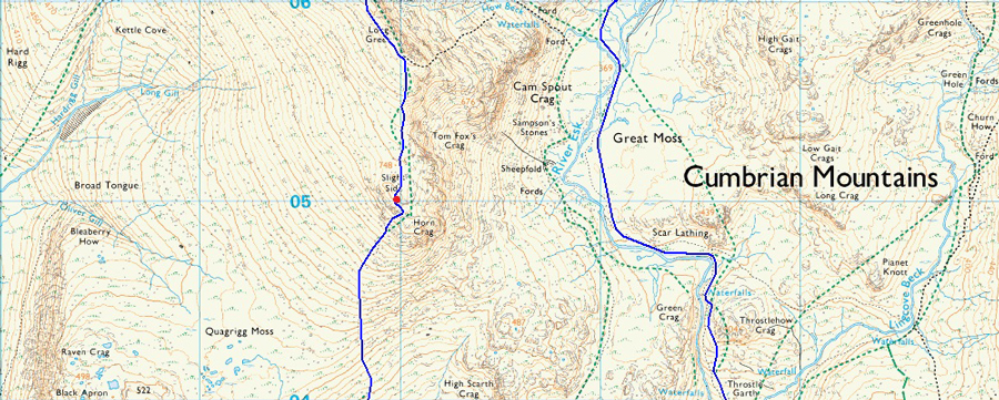
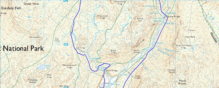
Jubilee Bridge - Brotherilkeld - Lingcove Bridge - River Esk - Pen - Rough Crag - Scafell Pike - Mickledore - Rakes Progress - Lord's Rake - West Wall Traverse - Deep Gill - Symonds Knott - Scafell - Long Green - Slight Side - Catcove Beck - Taw House - Brotherilkeld - Jubilee Bridge |
|
| |
|
Map and Photo Gallery |
|
|
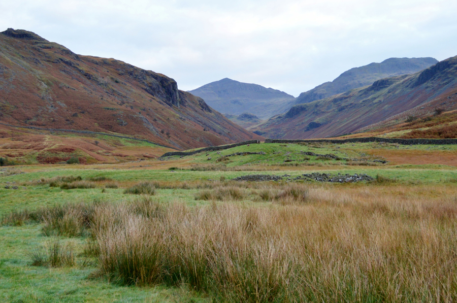 |
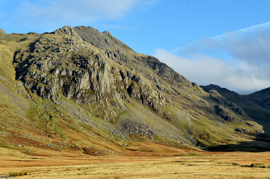
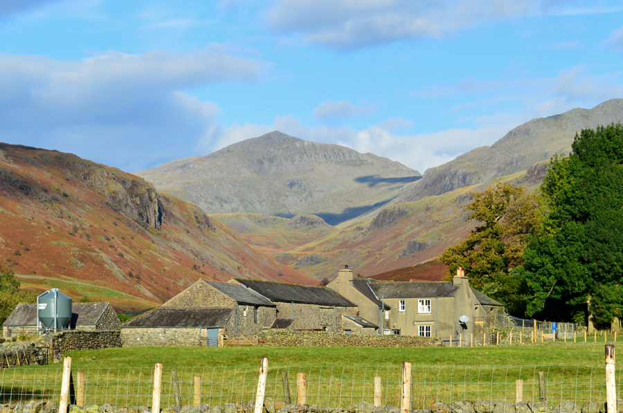
| Bowfell and Crinkle Crags taken shortly after passing through Brotherilkeld Farm 08:18am 8°C |
My heart was still adjusting to normality after travelling over the Wrynose and Hardknott Passes soon coming to a stop at Jubilee Bridge just as dawn broke minutes earlier. There was already one car parked up so I tucked my car in next to it boot facing outwards. With the sound of Hardknott Gill trickling below I kit up and use the familiar boulder to lace my boots up by.
A car travels from the direction of Eskdale which breaks the morning silence as it rattles over a cattle grid its engine racing in preparation for the challenge ahead, I lock the boot instantly forgetting that my walking poles are still inside and have to go through my pack lid to find again, this time scouring the boot to make sure I hadn't left anything behind before locking it again. I strike out leaving the car while thoughts of the forecast occupy my mind, after all, Great Moss is best enjoyed in fine weather, and if I'm truly honest, I had mixed feelings if I'd made the right walk choice.
After cautiously passing over the cattle grid myself (I hate walking over cattle grids probably more than cows do!) I pass the familiar red phone box which is missing all of its glass. Up ahead is Brotherilkeld Farm and from the farm track I can see the top of Bowfell and Crinkle Crags, both summits clear and free from cloud, although these summits aren't on todays agenda them being clear was a good sign for surrounding summits, even if I still can't see them. |
 |
| Bowfell dominates the view as I head towards Lingcove Bridge. |
| My boot toe caps lapped through the dew covered grass as I flank the summit of Hard Knott and the Yew Bank ridge to my right leaving the valley dark and in shadow, it was pretty debateable here whether to add gloves as the cold morning air bit at my fingers but I begrudgingly resisted knowing I'd only be taking them off again once I started to ascend. |
 |
| Thostle Garth, Thostlehow Crag and High Gait Crags with Bowfell still domineering the scenery. |
| My route into Great Moss will be via a prominant path which flanks Thostlehow Crag over in the left of the photo, but first I have to cross Lingcove Bridge which is where Lingcove Beck flows into the River Esk. |
 |
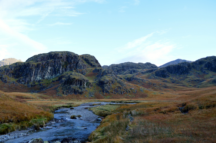
| Green Crag, Thostle Garth and Thostlehow Crag. |
My route into Great Moss via the flank of Thostlehow Crag can now be seen as the grassy path over on the left. This is where the River Esk flows through Esk Gorge via a series of dramatic waterfalls as too does Lingcove Beck whose course can seen if you follow the tree line over in the right of the photo.
Lingcove Bridge just up ahead now. |
 |
| Lingcove Bridge. |
| Perhaps one of the most iconic Packhorse Bridges in Lakeland. |
 |
| Thostlehow Crag. |
| I spent a few extra minutes besides Lingcove Bridge at times staring at the leaves that have been caught up in the swell in the deep pools. In the distance, over the sound of the water flowing together with a freshening wind I can hear the sound of birds chattering whilst beyond that, the distant rumble of a jet plane which streaks thousands of feet above into an opening blue sky, then nothing, I was in bliss. |
 |
| |
| |
 |
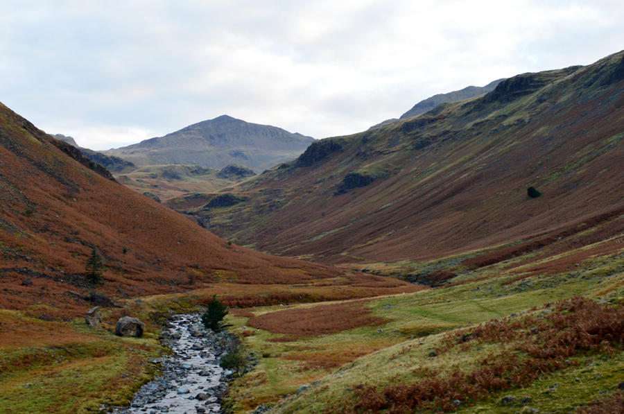
| The Scafells, Cam Spout Crag and Scar Lathing seen above Esk Gorge. |
After leaving Lingcove Bridge behind I climb steadily west flanked by Thostlehow Crag to my right as the Esk Gorge falls steeply to my left all the while being accompanied by the sound of waterfalls, having not used this path in the past nothing prepared me for the view when I reached the top of the Gorge, it was simply breath taking, come to think of it, It's a good job I'm alone today because you wouldn't have got much from me for the next half hour or so.
Sometimes it's just nice to be alone in thoughts when met with such striking scenery. |
 |
| Scar Lathing, Long Crag, Low Gait Crags and Bowfell from the banks of the Esk. |
| |
 |
| Scafell Pike, Scafell and Slight Side seen from the bend in the River Esk. |
Feeling completely awe struck I continued to follow along the banks of the River Esk before reaching the familiar bend that I have seen so many times from the summit of Slight Side and from Great Moss. This sharp left turn allows the Esk to flow around Scar Lathing and into Great Moss ibefore another sharp right turn close to the Sampsons Stones. |
 |
| |
| |
 |
| Cam Spout Crag and Scafell Pike from the bend in the River Esk. |
Earlier I had spotted three walkers who were quite a distance behind me accompanied by three dogs, because of my time spent at Lingcove Bridge they had started to make ground on me and by now, I could hear their voices carry through the valley even though I still couldn't see them I knew I wouldn't have the place to myself for long which, selfishly, I would have been sad about, I briefly think how am I going to get around this and came up with the idea to just let them pass me once they got closer.
After finding my way over swollen ground around the base of Scar Lathing I now found myself on the other side of the bend on more solid ground, behind me the voices got louder until the three chaps and their dogs came into sight, we share a wave over the bend in the river as one chap de-shoulders his pack, it would seem they had stopped to rest.
Without trying to look too ignorant, this was good news as it meant, for now, I had Great Moss to myself. |
 |
| Slight Side and Cam Spout Crag from the River Esk. |
| |
 |
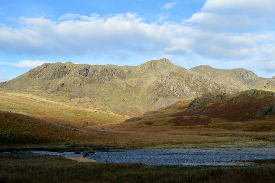
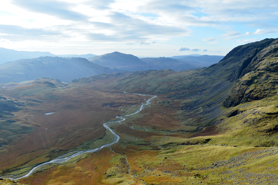
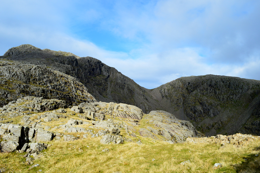
| Scafell Pike, III Crag, Pen, Esk Hause and Esk Pike from Great Moss. |
| It was quite difficult for me to put into words just how I was feeling when I took this photo, as far as walking goes you can't get more perfect than this after walking through a secluded valley in shadow before feasting your eyes upon such mountain scenery and in great weather too. For anyone who truly knows me will know what I really get from fell walking is the seclusion and because of this I like to find myself from time to time in the more remote parts of Lakeland but I also have another hidden button which is only activated upon views like this, right now I am in my element, despite life's ups and downs nothing seems to matter here, it's just you, the landscape and the elements. |
 |
| Scafell Pike, Pen/Esk Buttress with III Crag beyond. |
Right about now I'm having a sudden change of plan as my original route was to head to Esk Hause, then to collect Great End before continuing towards the Scafells but Pen right now...it's activating my button, in fact, it's pushing it like crazy.... |
 |
| Pen, III Crag, Esk Hause and Esk Pike from Great Moss. |
| Despite a lure to summit Pen I hadn't quite committed just yet as there are some key factors which may sway me as a covering of low cloud which extended as far south as the Coniston Fells was advancing, and closing in. |
 |
| Pen, Dow Crag/Esk Buttress. |
| Still not quite made my mind up... |
 |
| Pen. |
| The lure of a summit of Pen was just too much and beneath its Buttress I started the excessively steep climb along the course of a prominent grassy path. Soon however, my eye is averted to an alternative 'shelf like' route that I had seen during my ascent which can be seen to the right, after figuring that this route looked manageable I changed course and made for the base of the Buttress. |
 |
| The River Esk from the ascent of Pen via Dow Crag/Esk Buttress. |
| Once I had committed to the route I found it great fun and exhilarating in blazing my own ascent via Dow Crag, a route that I found, wasn't for the faint hearted in places as there were many a crag to scramble and not to mention just how steep my alternative route of ascent actually was, around half way, I stopped to look back on my views. |
 |
| This is Cam Spout Crag north east ridge with Slight Side in the distance. |
| This route onto Long Green/Scafell was just another alternative route I had planned for today, so many choices and so little time. |
 |
| Broad Crag and III Crag from Pen summit. |
I approached the summit from the south and had to familiarise myself with my surroundings soon realising that from the summit of Dow Crag, Pen summit lies beyond a series of false grassy summits which were quite exhausting to negotiate after the steep climb, nevertheless I made it towards the stone cairn, poles carefully balanced along side and with my trouser leg somehow, tucked into my sock, ehh, how did that get there!
It was time to relax and indeed, dress myself again after realising that certain parts of my underwear had to errm...be re-adjusted.
During the ascent I told myself that I would take a decent break while at the summit and after re-adjustments the approaching cloud kinda shortened my summit time... |
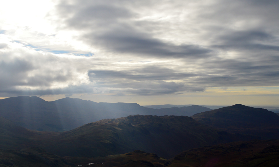 |
| The advancing cloud was now catching up on me. |
| Despite how beautiful the light was, the advancing cloud that I had spoke of ealier may have a major effect on todays plans, and because of this my break was shortened and I left the summit of Pen with the cloud trailing in from behind. |
 |
| III Crag seen over Little Narrowcove. |
| |
 |
| Scafell Pike is just up ahead while Broad Stand and Scafell is seen over on the left now in shadow. |
| |
 |
| Rough Crag, Scafell Pike, Broad Crag Col and Broad Crag seen over Little Narrowcove. |
| Feeling fit and ready for the ascent on Scafell Pike via Rough Crag I leave the summit of Pen behind and begin the short descent towards the base of Rough Crag south ridge which can be seen in the middle left of the photo. The ascent may look quite intimidating but it's no where near as difficult as it looks with shelf like 'grassy ridges' making up most of the ascent, from where the ascent of Scafell Pike is a slow dawdle away first passing the summit of Rough Crag which can be seen as the craggy outcrop which pokes out over Littlenarrow Cove half way along the ridge. |
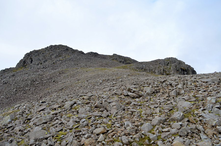 |
| Rough Crag is just ahead on the right with Scafell Pike summit just beyond. |
| It would seem that I'm now starting to lose the light, a sure indication that the cloud is advancing and getting closer now. |
 |
| Now looking down on Rough Crag with III Crag beyond. |
| I will always hold fond memories of Rough Crag and indeed III Crag as both summits were part of my two thousand ft summit challenge during Summer last year, both of which were gained from Little Narrowcove. |
 |
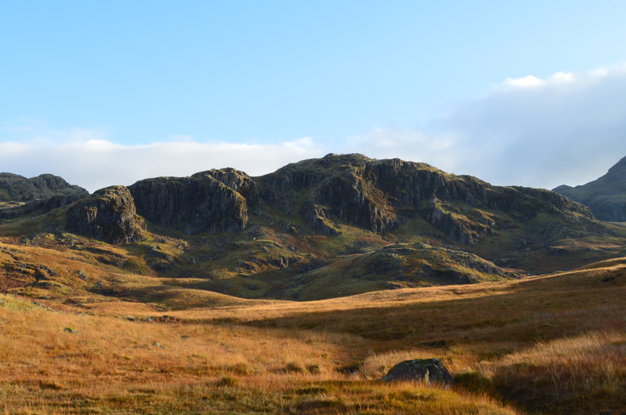
| Views back down Rough Crag South Ridge towards a distant Pen. |
| I peaked out on Rough Crag if only to take in the views and assess the cloud which was now over Bowfell and the Crinkles, soon it would reach the Scafells as it dawns on me should I continue with my original route or change it again? the options are clearly there, I guess I'll make the decision from the summit of the Scafell Pike. |
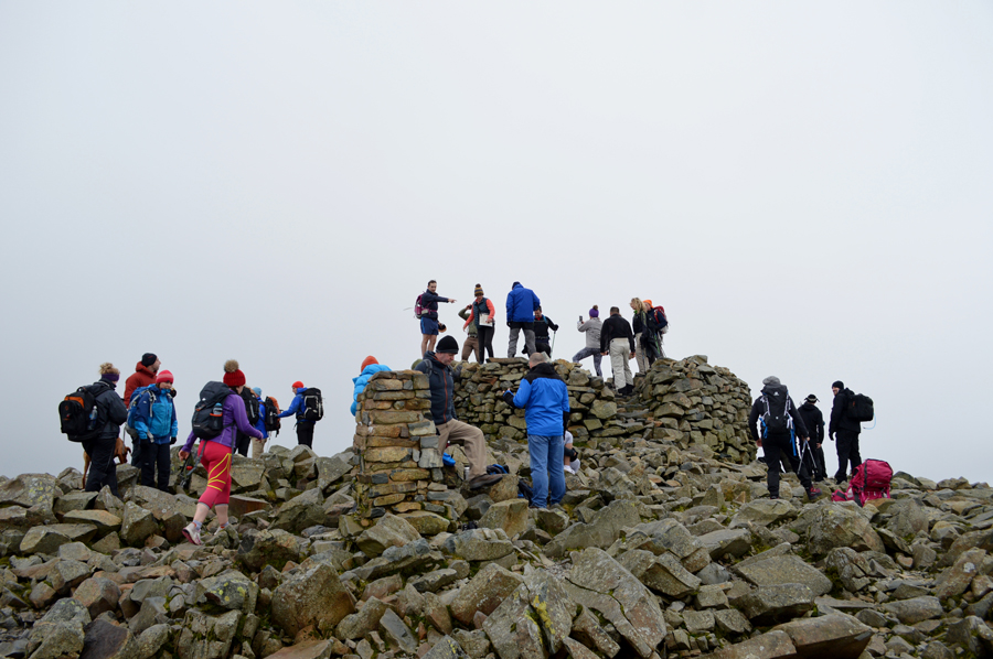 |
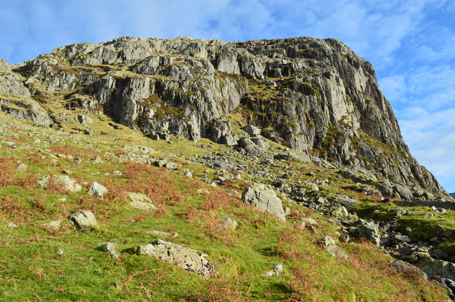
| Scafell Pike summit. |
Much like the summit of Pen I approached the summit of Scafell Pike from the south passing the Victorian shelter to my far left and I came to the conclusion that I may get the summit to myself but my mind was merely playing tricks on me as with more height gained more people appeared on the horizon.
I'm not comfortable with crowds and passed upon the chance to have a much needed rest, instead I opted to try and keep ahead of the cloud before starting my descent towards Mickledore and Lord's Rake thereafter. |
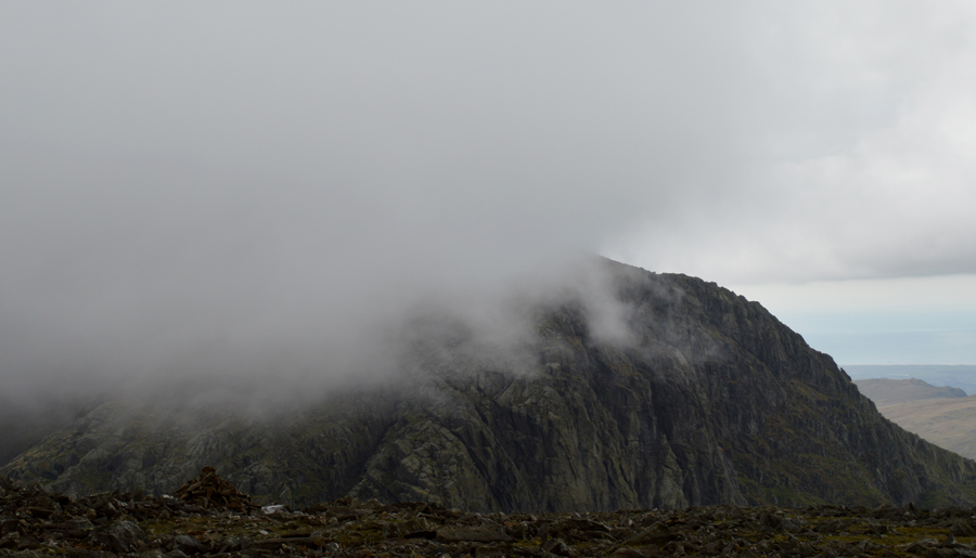 |
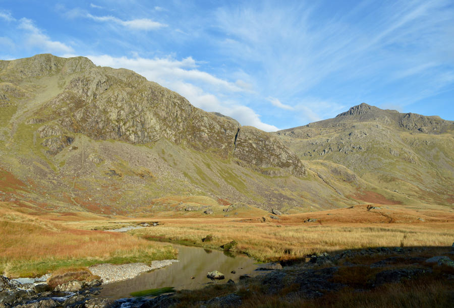
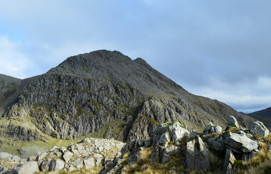
| Scafell and Broad Stand over Mickledore. |
| Sadly the cloud eventually caught me up and from the sound of some by-standers making their way towards the summit, caught them by complete surprise too . I started my descent towards Mickledore and soon it started to rain which I first thought was just 'that mist' that clings to your clothes and gets your hair wet but it tunred out to be the real thing, wet and vertical. |
 |
| Mickledore from the top of Rakes Progress. |
Mickledore was a busy place today, in fact I'd never seen it as busy which left it feeling not as sacred as it should. With this I pass the walkers head bowed and poles stretched out for the pull towards the top of the ridge from where I took this photograph, Had I noticed the sorry looking chap in the foreground I'm certain I would have asked if he was ok.
Hope so. |
 |
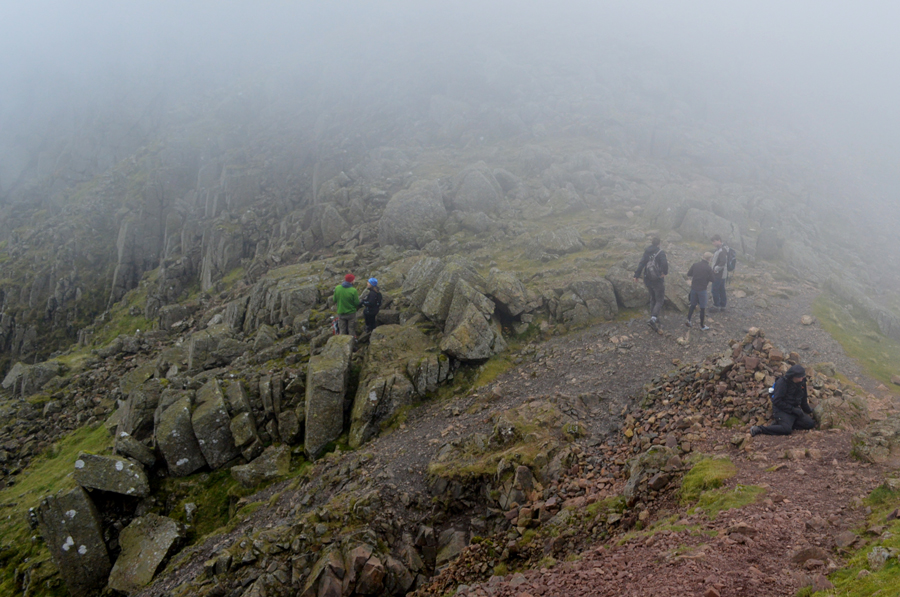
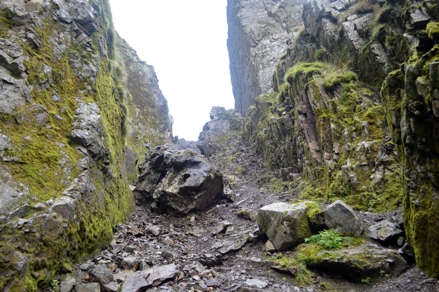
| Lord's Rake from Rakes Progress. |
For anyone unaware around the 2nd August 2015 the Chock Stone found at the top of Lord's Rake shattered/collapsed and now sits in the scree around twenty feet or so from its original position, today is my first ascent of Lord's Rake since August and I was quite interested to see what I was going to find.
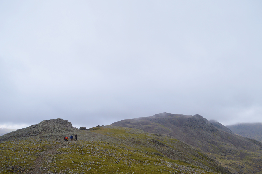
As you can see there are five walkers in the gully who are making good progress on reaching the top section of the rake, even so I leave it five minutes if only to avoid any rock fall despite the rake being given the all clear the scree is as always, very loose. |
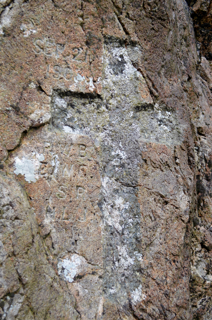 |
The 1903 Memorial Cross found at the foot of Scafell Pinnacle.
|
| It is not known exactly what happened to the four experienced climbers, they were found roped together in a scree run far below Lord’s Rake three of whom were all ready deceased by the time help arrived, the fourth member of the group died during the descent back to Wasdale Hotel. |
 |
| Almost at the top of Lord's Rake now and close to where the Chock Stone fell. |
The rain continued and had a slight affect on my ascent leaving the scree a little more vulnerable which left me trusting my footings in certain places. Up head the group had stopped to have a look around where the Chock Stone had fallen and soon they were on their way by the time I reached the same spot.
It is clear through the sheer weight of the Chock Stone that for now it isn't going anywhere, only embedding itself deeper into the scree but I certainly wouldn't like to rule out any more movement. On reaching the slab of rock it is obvious that you have to go around it and I found where it now lies is quite a steep section of the rake where firm footings are sparce, an indication of which was when I tried to take a photo once past the slab as my legs started to wobble and feel like jelly, it just paid to keep moving.
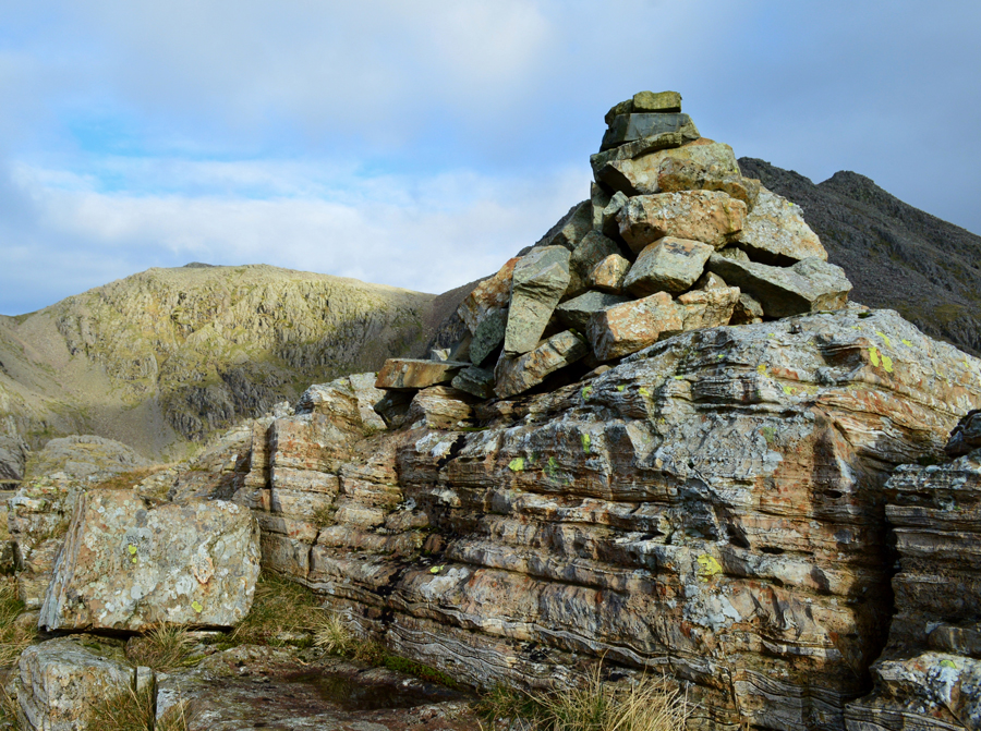
It was also noted that the Chock Stone now lies directly at the foot of the start of the West Wall Traverse, making the new postion of the Chock Stone an ideal 'cairn' well, for now that is. |
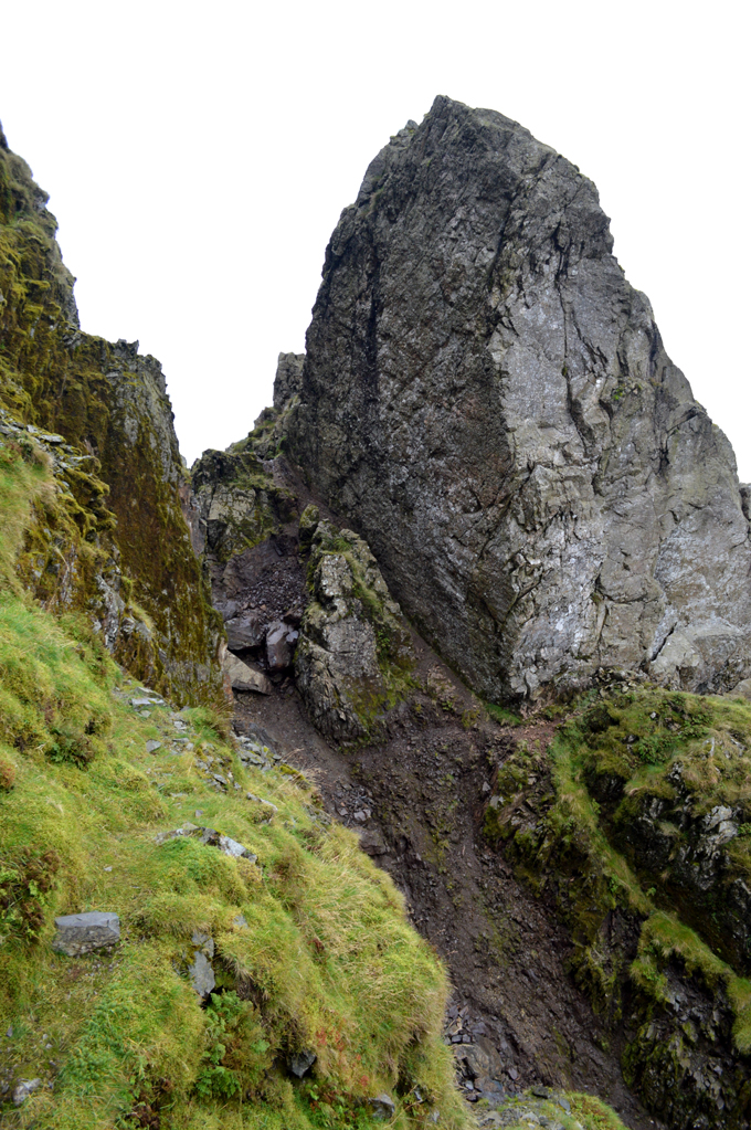 |
| Looking back at the top of Lord's Rake from the start of the West Wall Traverse. |
| The sight of which is going to take some getting used to. |
 |
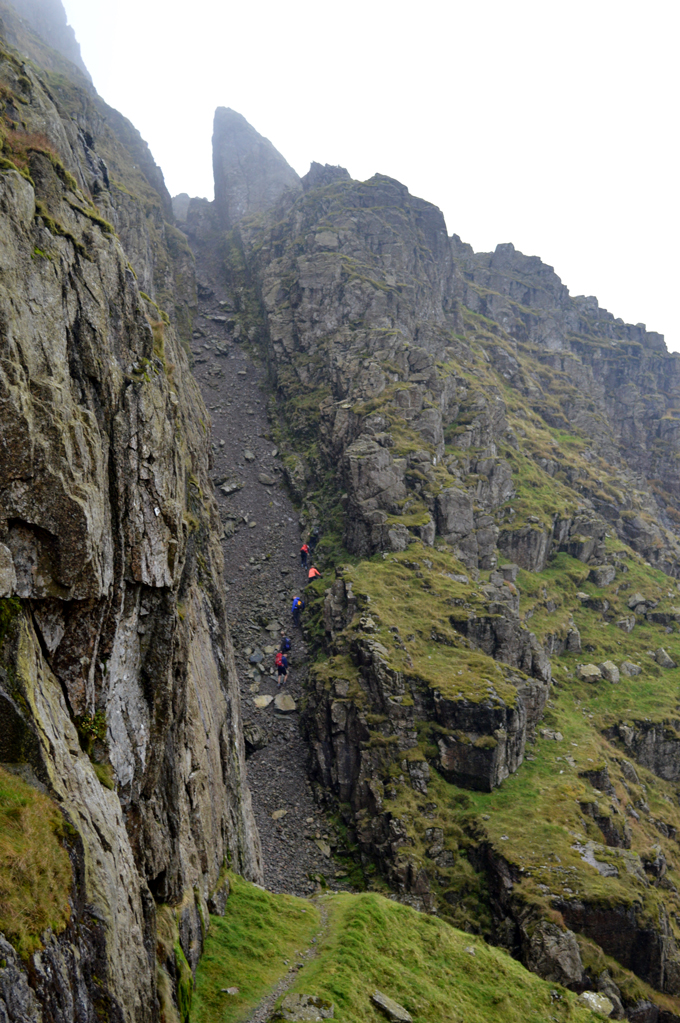
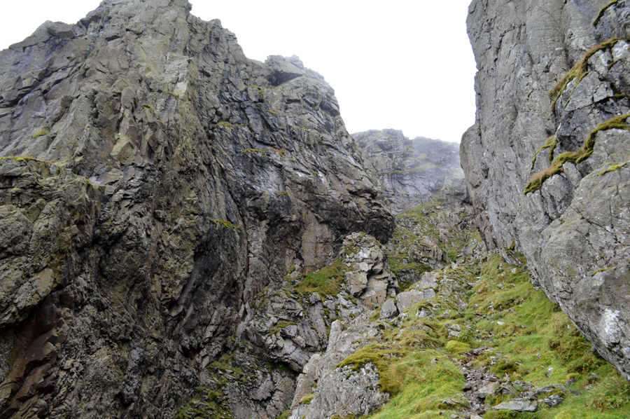
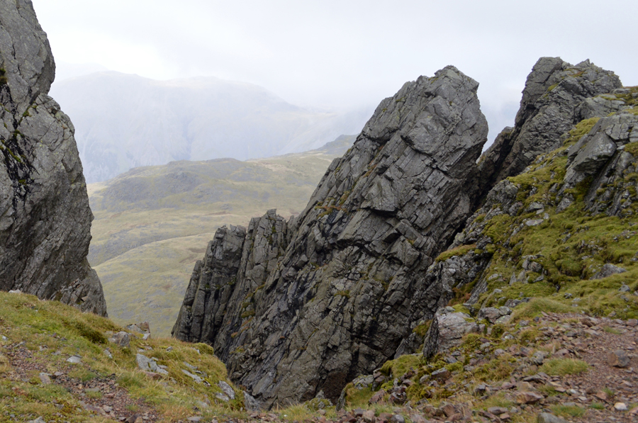
| The West Wall Traverse. |
| From the start of the traverse I pick up a prominent shelf like path which rises steeply into the mountain, there are simply no other words to describe this other than listening to ones heart beat as it palpitates inside your chest. |
 |
| The West Wall Traverse. |
| |
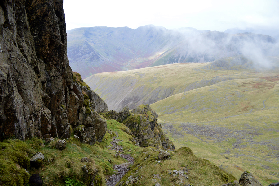 |
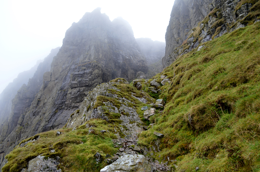
| Looking back along the grassy shelf at the end of the Travese before I start my climb into Deep Gill. |
| The views can be stunning and had it still not have been raining it was here I planned to eat lunch, I guess you can't get any further away from the crowds as this. |
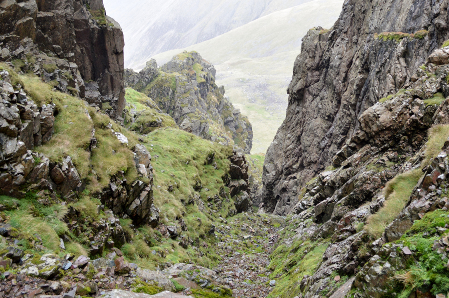 |
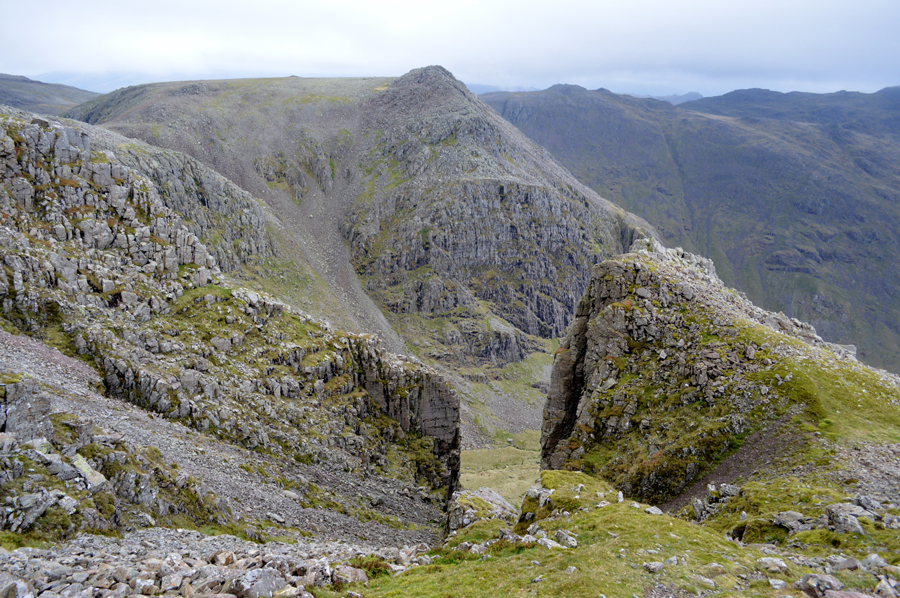
| Looking back on the West Wall Traverse and further into Deep Gill. |
| I have now left the West Wall Traverse seen over on the left and I've entered Deep Gill, here the sensation of feeling like your actually in the mountain continues where if you are like me your adrenalin has already started to kick in. |
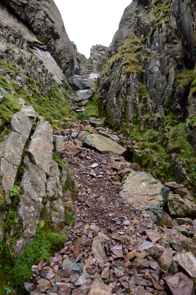 |
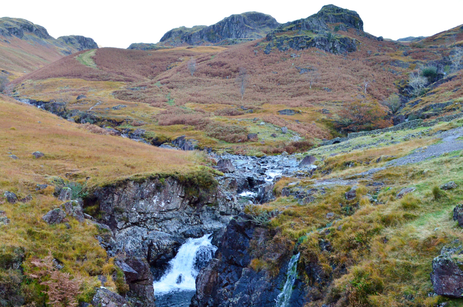
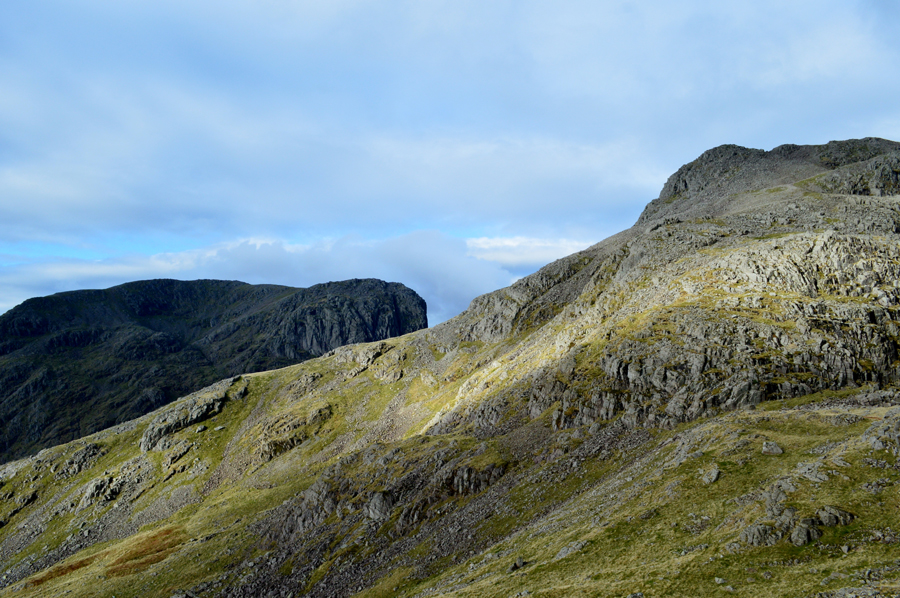
| Deep Gill. |
| The gradient of Deep Gill is slightly steeper than that of Lord's Rake with the exception that despite the scree, there are good footings all the way. Close to the head of Deep Gill Wainwright wrote that the head wall was once difficult to negotiate but had been made easier with climbers clawing at it over the years which made the two or three pitches very easy to negotiate, even when wet. |
 |
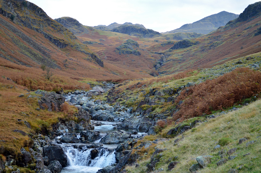
The head of Deep Gill with the Pinnacle seen centre left and the Oracle seen bottom right.
|
| Time to head over to Scafell now. |
 |
| Symonds Knott, the head of Deep Gill and Scafell Pike. |
After passing Symonds Knott I pass the group who I had seen ascending Lord's Rake who were talking about their experience quite proudly, with hi's and hello's passed I make the short ascent on Scafell by which time the rain had stopped and the cloud had cleared, although I must admit, those summit winds are starting to bite.
Once at the summit I found a father and daughter just packing up after lunch, they spoke with a Welsh accent and we all commented on the un-forecasted rain before being joined by the group seen in this photo.
I left the father and daughter and the group behind and made my way across the summit plateau which was made extremely tricky by the recent rain which had left the rock feeling very greasy underfoot so much so, each step seemed to have a controlled slide to it. When usually descending Scafell towards Slight Side I would head off via the right shoulder along Long Green but today I opted to keep in line with the summit safe in the knowledge that I knew a gravel path awaited at the end of the ridge. |
 |
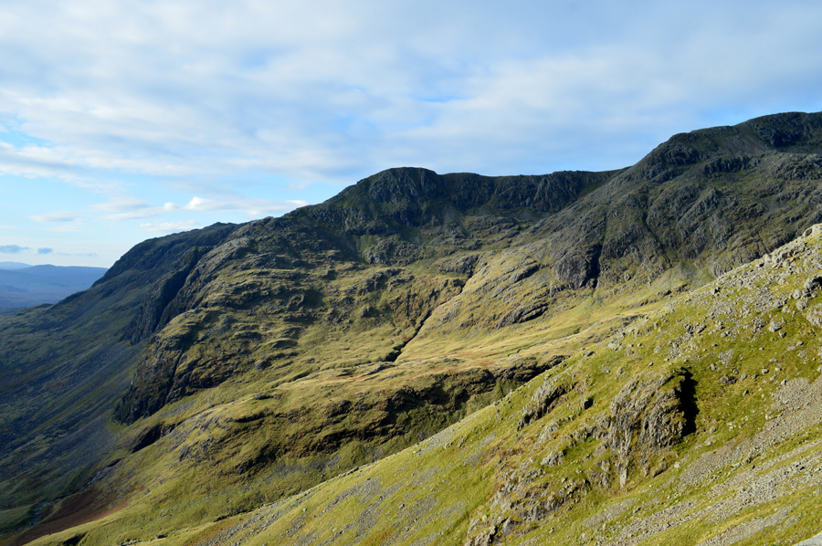
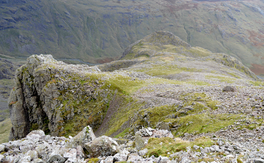
| Slight Side seen with Harter Fell in the distance. |
| Despite the fact that it had stopped raining the light was still incredibly low leaving silhouettes of distant summits, I guess this is how Autumn should look like on the fells. |
 |
| Slight Side summit. |
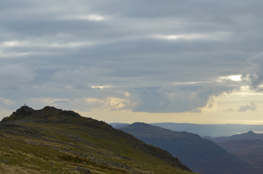
The low light had ever so slightly started to lift revealing the Autumnal colours of the wild grasses from Great How in the south to IIIgill Head towards the west. I arrived at Slight Side to find a young couple eating lunch in the rocky nook which separates the summit outcrops. With pleasantries passed I made my way towards the summit clambering over dry rock until I was able to touch the summit cairn before lowering myself down just shy of the summit cairn where I decided to break out lunch.
Over the summit wind I could here the young couples voices, not particularly what they were saying, just as noise over the wind. I cracked open the lid of my sandwich box and feasted on cold chicken flavoured rice and for afters, a meaty sausage roll bought from the petrol station last night while I was filling up, kid like I don't finish my rice because I had been looking forward to my sausage roll all morning all the while taking in the atmospheric views over the Cumbrian Coast. |
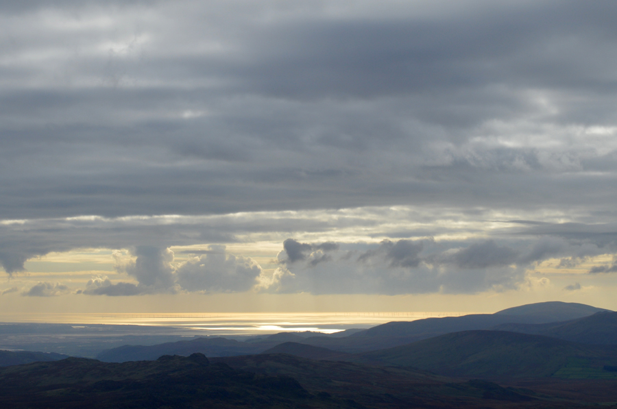 |
| Black Combe with the Irish Sea glistening beyond. |
| |
 |
| Stopping to look back on Slight Side and Scafell as I make my way towards the top of Catcove Beck. |
With lunch packed away I was soon joined at the summit by the Welsh father and daughter and we spoke briefly before I started my descent. Beyond Slight Side south ridge I can clearly make out two walkers who had just passed through a herd of grazing cattle before they clash with the low light and soon they had gone. During my descent I am passed by a young couple and hi's are exchanged once again as I too start to head for the grazing cattle.
The ground is understandably sodden even though we hadn't had rain for well over a week I'm now finding the few miles to be quite a squelchy one but my boots manage to keep my socks dry as I trace away from the prominent path and follow a more fainter 'short cut' which both head towards Catcove Beck. In hindsight I should have stuck with the prominent path I guess.
Once I had crossed the top of Catcove Gill I consult my map if only to make sure the side of the Gill I need to be on, a path that I had spotted earlier this morning from Brotherilkeld Farm yet it was proving a little more difficult once within its vicinity. I soon find my path and begin the descent via the right of the Gill but I'm drawn to the Gill itself which caused me to abandon my path and cross the Gill where I swill my boots free from mud and alike. Now on the wrong side of the Gill I begin a pathless descent where I consult the map again where it seems I'm not too far from the path which rises above Scale Bridge which is where I head to next. |
 |
| Autumn in Catcove Gill. |
| |
 |
| Scale Bridge. |
After descending Catcove Gill I soon reach Scale Bridge where I get a view of the Waterfall which was partially hidden behind a canopy of trees. From Scale Bridge I follow the track before reaching a wooden sty which I cross before arriving at Taw House Farm.
It's starting to feel quite mild again and had I not have been so close to the car I would have most certainly de-layered here. At the farm the farm dogs bark at me through a locked barn door and despite being a huge dog lover I was glad of the door, and its lock. In the distance the rumble of a quad bike brings me back to reality as I start to pass through the field towards the footbridge which crosses the River Esk for my last time today, briefly I am taken back to this morning as I crossed a meandering Esk when thoughts were of Pen where I barely got my boots wet, here the river flows fast and laps up the falling leaves from a canopy of trees overhead. |
 |
| Bowfell from Brotherikeld Farm. |
| |
 |
| Scafell Pike and Slight Side from Brotherilkeld. |
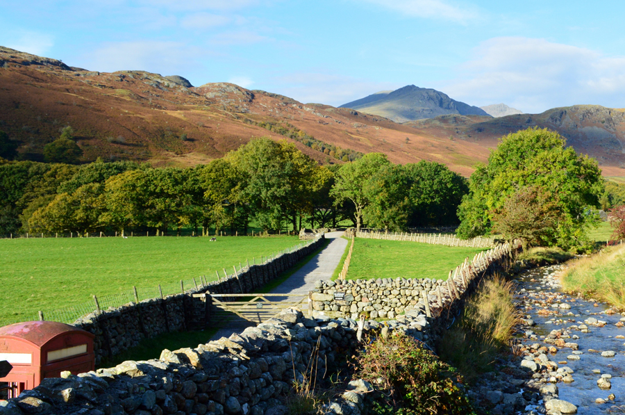
After crossing the River Esk for the final time I once again pass through Brotherilkeld Farm stopping to witness the sunlight striking through the trees still not quite believing that this is October, the month of wind and rain. Feet ache especially my right foot which is still experiencing the symptoms of plantar fasciltis which I kept under control today with anti inflammatorys and pain killers. It's fair to say that I needed this walk after taking on this years Wainwright project where I had routes set out before me, changing a route isn't particularly what walking is all about but it sure brings out the freedom side of you..
With boots back on tarmac I stroll back up to Jubilee Bridge to find a bustling car park where I start to de-layer first by taking off my jacket before placing my pack into the boot of the car. Just as I had this morning I walk over to the familiar boulder where I place my right foot before giving one end of my boot lace a good tug which resulted with a dust plume, a sure sign of a grand day out on the fells. |
 |
| The Langdale Pikes seen taken close to Fell Foot Farm. |
| |
|
| |
| Back to top |
 |
|