|
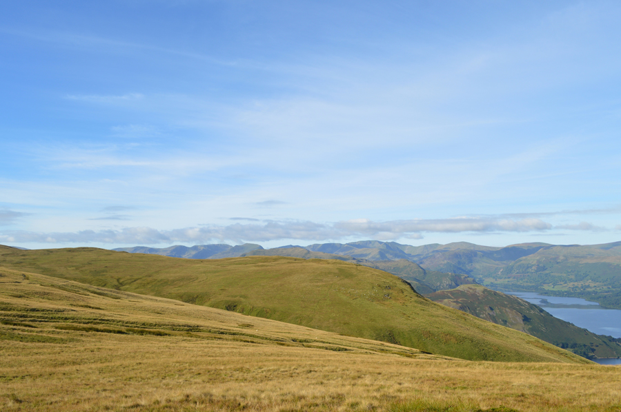
Loadpot Hill and Heughscar Hill from Rowhead |
 |
 |
17th September 2016 |
 |
|
I was asked a few weeks ago where did I want to walk once my Wainwright Project was completed and I replied with a smile commenting "I just want to walk on grass" or words to that effect. It is known fact that I have a special fondness for Great Yarlside and the mile between its summit and Harrop Pike, a bewildered wander amongst the Shap Fells when on a good day it's just you, the birds and the wild grasses, it would suit my mood just fine, in fact, Harrop Pike was the place we visited first after completing my two thousanders last year.
After completing Walk 29 during a fleeting conversation a few weeks ago; before we headed home David had mentioned that "tomorrow I might have a walk onto Loadpot Hill from Roehead" after David had mentioned this I thought "that's a bloody good alternative to Great Yarlside" as it ticked similar boxes with the exception that, we may see an extra soul or two. During walk 30 I asked David did he get out to Loadpot Hill to which he answered no, Jennifer and I went somewhere else instead, why? are you thinking...Yes I am...
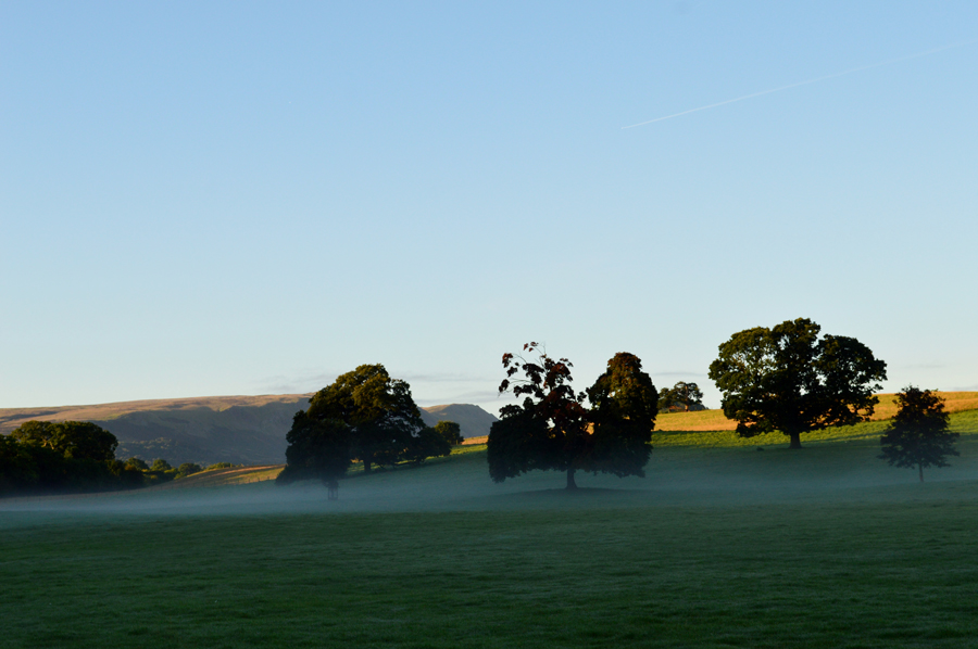
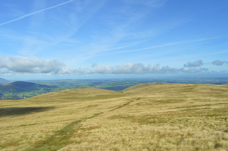
This is Loadpot Hill from Roehead, we couldn't have asked for a more perfect walking day. |
|
| Wainwright Guide Book Two |
 |
| The Far Eastern Fells |
-Loadpot Hill
Man is not the enemy, only the fox and the buzzard. Loadpot Hill is a sanctuary for all wild life. |
 |
|
|
| |
|
Overview |
|
|
| Ascent: |
2,100 Feet - 640 Meters |
| Wainwrights: |
3, Arthur's Pike - Bonscale Pike - Loadpot Hill |
| Weather: |
Warm Dry and Sunny Highs of 19°C Lows of 8°C |
| Parking: |
Parking Spaces, Rowhead |
| Area: |
Far Eastern |
| Miles: |
10.6 |
| Walking With: |
David Hall and Rod Hepplewhite |
| Ordnance Survey: |
OL5 |
| Time Taken: |
5 Hours 50 Minutes |
| Route: |
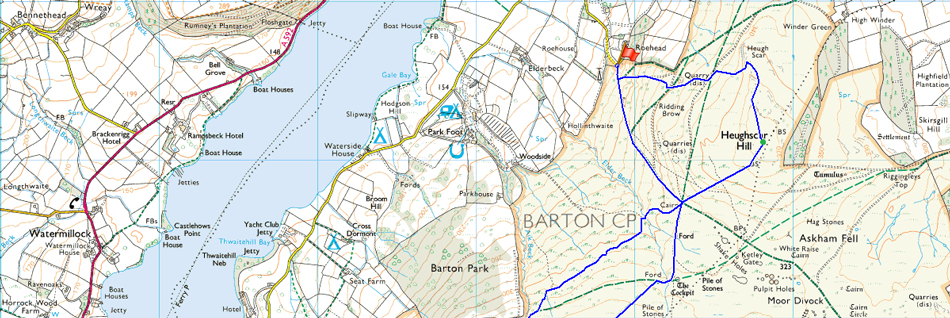
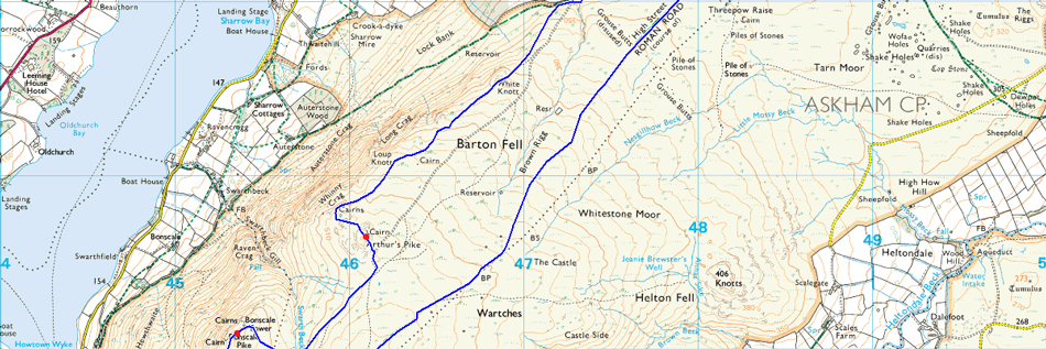
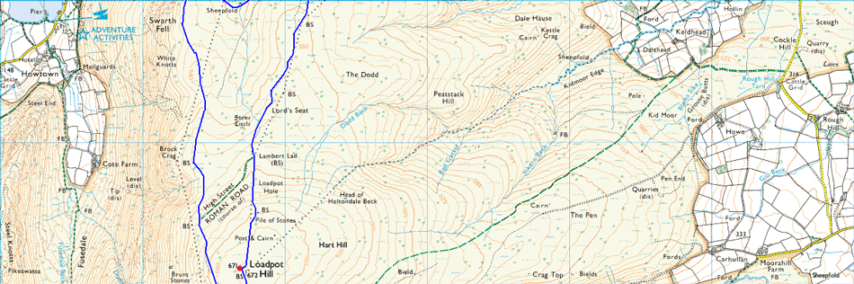
Roehead - Barton Fell - Arthur's Pike - Swarth Beck - Bonscale Pike - Lowther House Chimney - Loadpot Hill - High Street Roman Road - The Cockpit - Heughscar Hill - Heugh Scar - Roehead |
|
| |
|
Map and Photo Gallery |
|
|
 |
| Setting the scene... Arthur's Pike and Bonscale Pike seen from Dalemain Estate. |
| I couldnt resist stopping the car close to Dalemain Estate to capture this view of Arthur's Pike and Bonscale Pike as the morning mist still lingered below the tree line. |
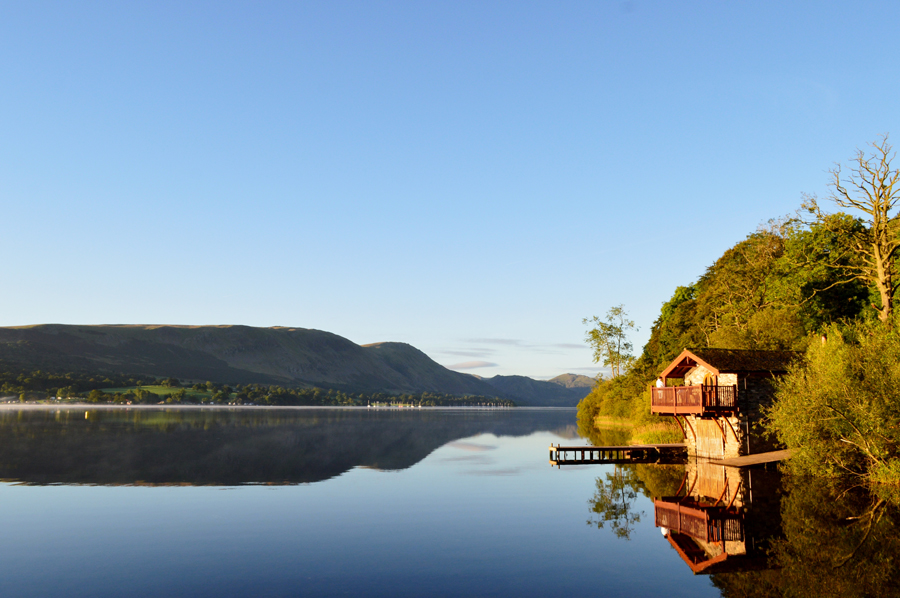 |
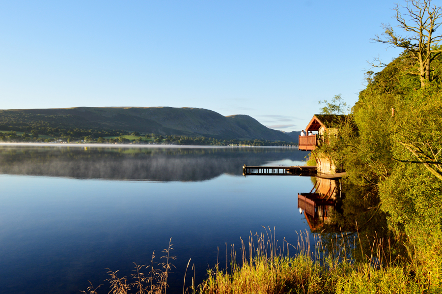
| Arthur's Pike and Bonscale Pike from The Duke of Portland Boathouse, Ullswater 07:30am. |
| Seeing as I was only meeting David and Rod at Roehead which was less than a five minute drive away at 08:00am I had time to stop off at the Duke of Portland Boathouse. |
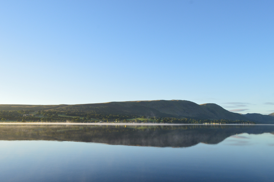 |
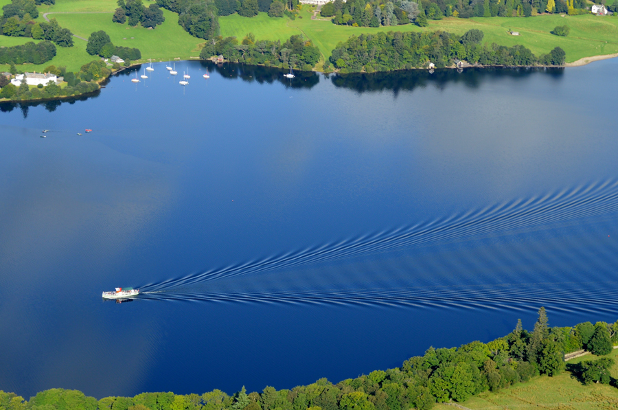
| Arthur's Pike and Bonscale Pike reflecting in the stillness of Ullswater |
| To state the obvious the surface of Ullswater was just like a mirror glass this morning, I felt so lucky to have captured the moment. |
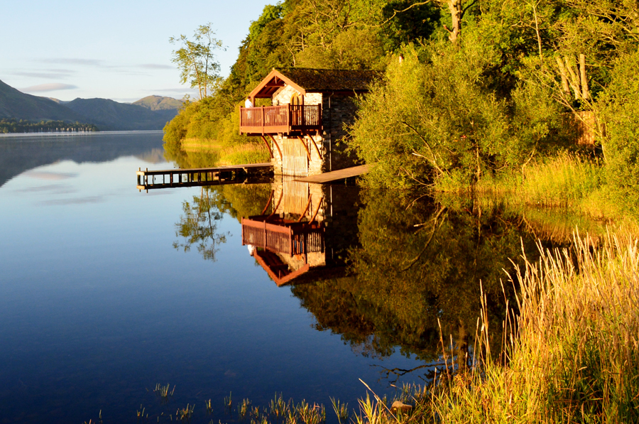 |
| The Duke of Portland Boathouse. |
| I hoped this fellow didnt mind me taking a few photos... |
 |
| The Duke of Portland Boathouse. |
| I also hoped his wife didn't mind either! |
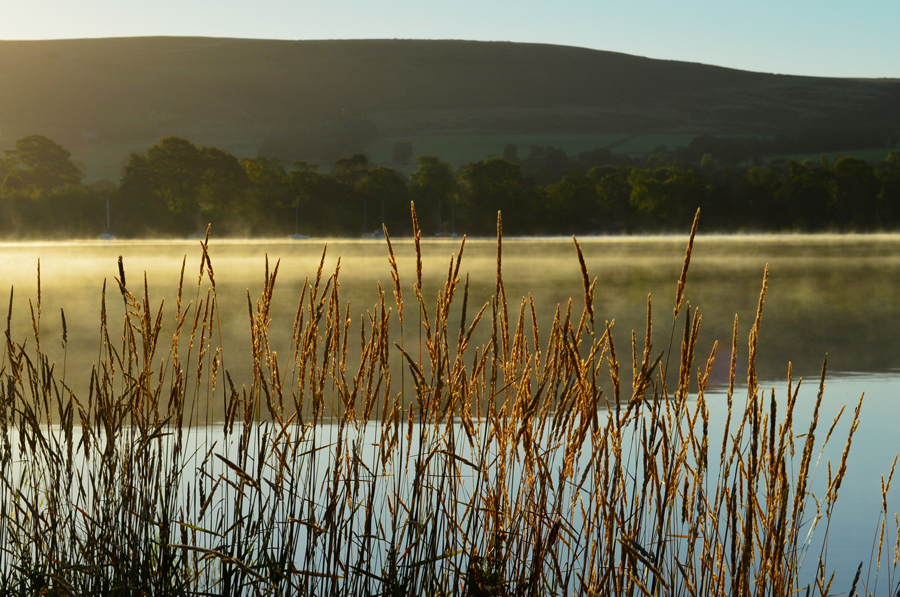 |
| Morning mist over Ullswater through the Reeds. |
| |
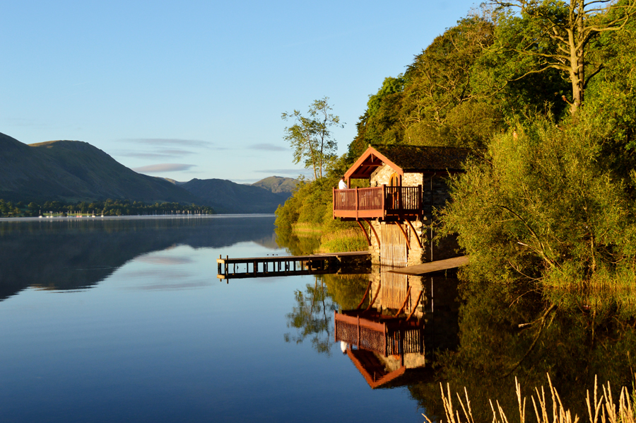 |
| The Duke of Portland Boathouse. |
| Perhaps she's gone to get the shotgun! joking aside it wasn't just me admiring the views, a local was so captivated he stopped his van at the back of my car and proceeded to take shots from his mobile phone, who could drive past this...the answer, is no one. |
 |
| Arthur's Pike from Roehead 07:50am. |
After admiring the views at the Duke of Portland Boathouse I turned my car around and drove towards Pooley Bridge and continued to admire the wonderful sunlit views over Ullswater before entering a deserted Pooley Bridge via the new bridge. After driving though the village I'm soon joined by David at the crossroads where I wave my hand briefly through the rear window before heading up Roe Head Lane.
There was already a few cars parked up by the time we had arrived, two of which looked like they had been there all night, the other, a pick up with a horsebox trailier belonged to a friendly young lass who was getting ready for a morning horse ride, we shared our mornings and commented on how well the morning looked before she galloped off, opening the gate at the top of the lane whilst still on the horses back. Soon Rod arrives and drives into the last parking space, anyone wanting to park here after, will have to do and mend with any available verges.
We greet as always with a handshake as Rod, in a serious voice goes onto say that the walk may have to be cancelled due to how bad conditions are, we laugh and continue to kit up. It's only 7°C in the shade but it actually feels cooler despite there not being a breath of wind I fold my Soft Shell into my pack, as does David and Rod safe in the knowledge that once we do get into the sunlight we're gonna feel an instant benefit. With the cars locked we too head for the gate finding a dew covered cardigan left behind on top of one of the fence posts. We pass through the gate and follow the track with sights set on the Cockpit, a Stone Circle thought to date back to the Bronze Age. |
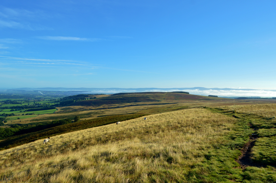 |
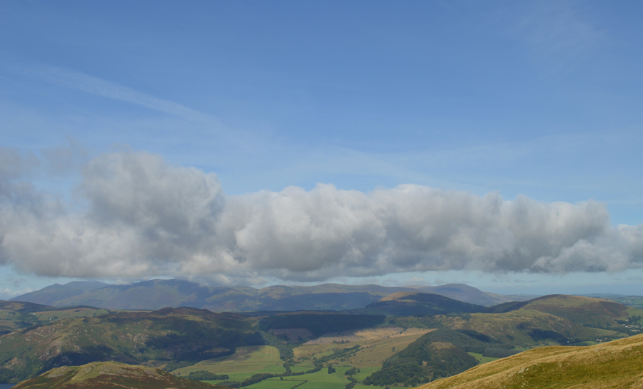
| Looking back on Heughscar Hill while beyond, the North Pennines seen peeking out above a Cloud Inversion. |
We strode out passing passing a number of paths that branched off towards Arthur's Pike all of which convey around the Cockpit Stone Circle at some point. We choose the well worn route which despite the heavy rainfall as of late was relatively firm and dry underfoot only having to avoid the odd rocks which poked out of the ground. Earlier we had been passed by a solo walker carrying a large pack on his shoulders and a equally large bag in his right hand who appeared to be "going to work" but I guess it was just his way of carrying the tent he had no doubt, stayed in overnight. He was a friendly chap and 'mornings' are shared.
The closer we got to the Cockpit Stone Circle we could hear movement and lots of it, back at Roehead we had passed a car with Outward Bound signage all over it and it would appear that the group had camped out overnight within the grounds of the Stone Circle, in all, there were about eight kids and two adults who were folding tents back into bags and such, they were too busy to look up and although it wasn't spoke of we left feeling slightly saddened that we had detoured to capture the Cockpit only to miss out.
We continued along the path opting not to join the High Street Roman Road, instead choosing to keep as close to the edge of the ridge as possible first crossing Aik Gill before a slight ascent on White Knott where we were never far away from the grand views over Ullswater. |
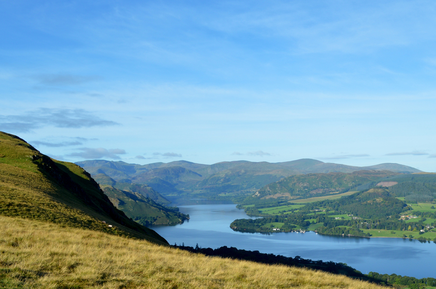 |
| Distant views over Ullswater towards a host of Eastern Fells including Dove Crag and Hart Crag, St Sunday Crag and Helvellyn and the Dodds. |
| |
 |
| Hallin Fell with a backdrop of Beda Fell, Place Fell and the Eastern Fells from the top of Whinny Crag. |
We're not too far from Arthur's Pike summit and seeing that we are in no rush to be anywhere today we stop to admire the views and soak in the tranquility more times than I care to mention.
It certainly felt good to not have to rush off to my next summit. |
 |
| Arthur's Pike summit. |
We left the ridge path at Whinny Crag and gained steady ground on Arthur's Pike summit where we could take in the ridge view all the way back towards Heughscar Hill while beyond, a cloud inversion over the North Pennines that we had been keeping our eyes on was now extending further south for some distance, to our disappointment however, a strong sun above meant taking pictures was quite difficult.
After moments spent at the summit we strike out leaving the ridge path high above Ullswater behind before beginning our descent towards the top of Swarth Beck all the while indulging in next years Outliers Project which I'm very much looking forward to starting.
Rod, who has completed the Outliers by using the same routes as Alfred Wainwright is a valuable source of information right now and I'm hoping he doesn't get abducted by aliens between now and when I start the proejct.
We press on. |
 |
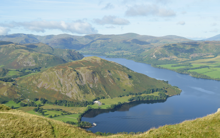
| Bonscale Fell seen over Swarth Beck. |
| Which is where we are heading next. |
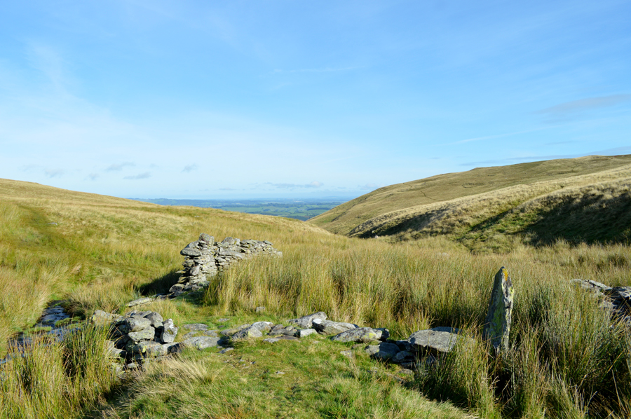 |
| The ruined sheepfold found at the top of Swarth Beck. |
I'd like to think that I had a successful crossing of Swarth Beck but the lads will tell you differently! at this point Swarth Beck is less than a foot wide where I managed to score gold in 'recovery'
If my job was to entertain, then I'm doing alright.
It's only a short walk now to Bonscale Pike summit and as expected the ground underfoot is pretty swollen. |
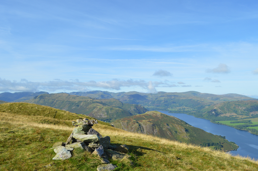 |
| Bonscale Pike summit cairn with an Eastern Fells backdrop. |
| |
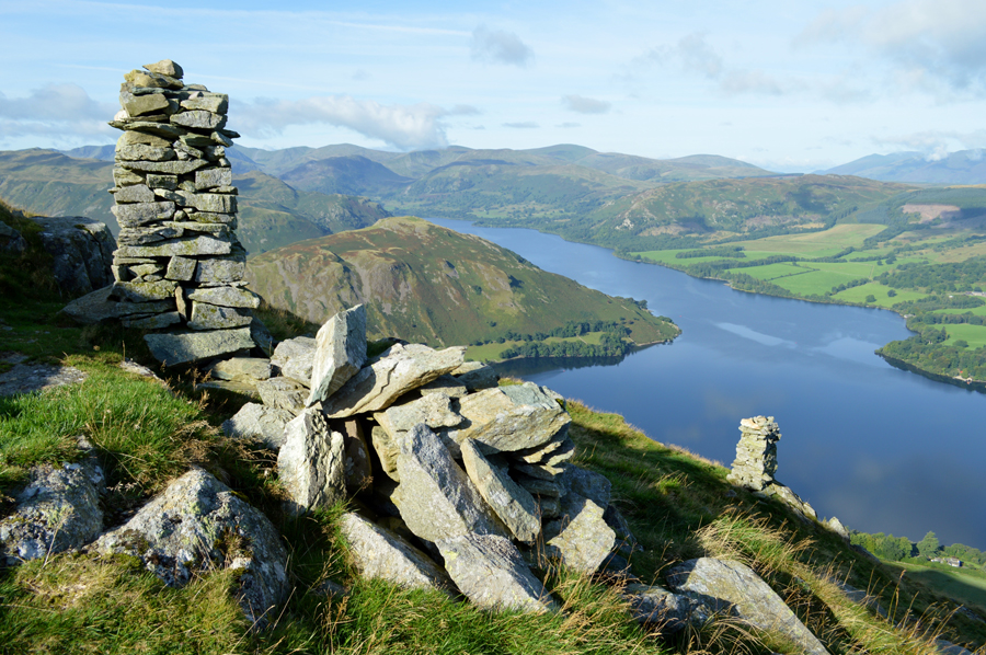 |
| Hallin Fell and Ullswater from Bonscale Towers. |
The Towers were built to indicate the excellent viewing point as Wainwright wrote that the actual summit of Bonscale Pike left him feeling unsatisfied due to the summit not being the highest ground, he also went on to say that the higher of the two stone Pillars was build by amateurs while the lower Pillar, by a craftsman.
It's quite difficult to tell the difference of craftsmanship between both Towers but what they still do to this day is provide an excellent viewing point over Ullswater and to add to this, both Towers have stood the test of time which can only be a credit to the fellow who built them.
Bonscale Pike was yet another summit where we stood to take in the breath taking views sometimes standing in silence, others contemplating future walks one of which is a walk that I have planned through the valley of Deepdale where I will gain Link Hause via Green How End, it's route clearly defined from almost three and a half mile away such the todays clarity.
Speaking of spectacular views... |
 |
| The distant hum from the 'Western Bell' |
Built by Fellows & Co in Great Yarmouth in 1934 she has served the Rivers Tamar and Yealm at Plymouth, before being transferred to the River Dart in 1980. Western Bell then moved to Hampton Court on the River Thames in 2005 before being purchased by Ullswater 'Steamers' in 2008, were she was lovingly refurbished by Ullswater Steamers and relaunched in Autumn 2010
Here silently cutting through the surface of a polished Ullswater while on route to Howtown. |
 |
| Hallin Fell and Howtown Jetty seen shortly after leaving Bonscale Pike summit. |
I'm not quite sure how much time we spent just soaking the tranquility of the place while on Boncsale Pike but it was enough time for the Western Bell to pass, then moor up alongside Howtown Jetty as seen below. |
 |
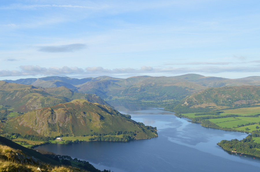
| Views over Beda Fell, Place Fell along with the Fairfield group and the Helvellyn group of fells. |
It was noted that despite the brilliant blue skies, cloud was now approching from the north and west sometimes clinging to the higher summits of Helvellyn in the east and Blencathra in the north and, even further north over High Pike which had a covering of cloud over its summit, the strange thing was the cloud seemed to form a wide circle around the Far Eastern fells leaving us feeling like we were 'within the eye' and relatively cloud free. |
 |
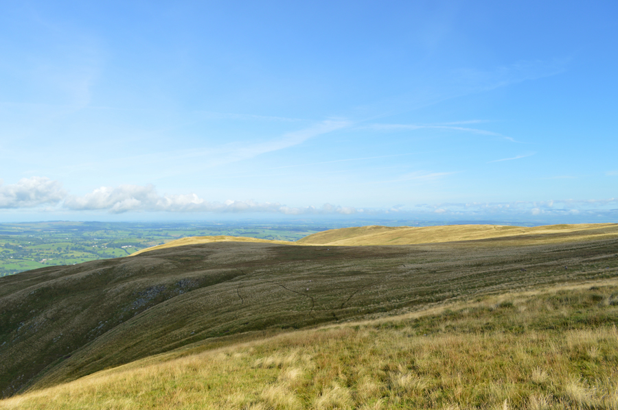
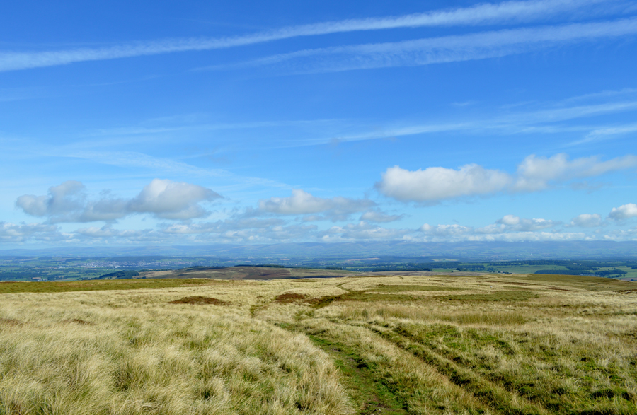
| Maintaining our grassy trod as we follow the path on the Fusedale side of Loadpot Hill summit. |
| We continue our ridge path and soon round the Western flank of Loadpot Hill summit all the while the morning sun is gaining in heat and for the first time, brows are mopped before the steady ascent is required to reach Loadpot Hill summit. It's fair to admit that after the gentle ascents to reach here, the next ten minutes or so, were perhaps the steepest we'd encountered the whole walk. |
 |
| Views north over the Mell Fells and Watermillock Common towards Blencathra. |
| The cloud was actually forecasted yet all it did was create large shadows on the fells below which was kinda fascinating to watch. |
 |
| Pausing to look back on Bonscale Pike and Arthur's Pike. |
| |
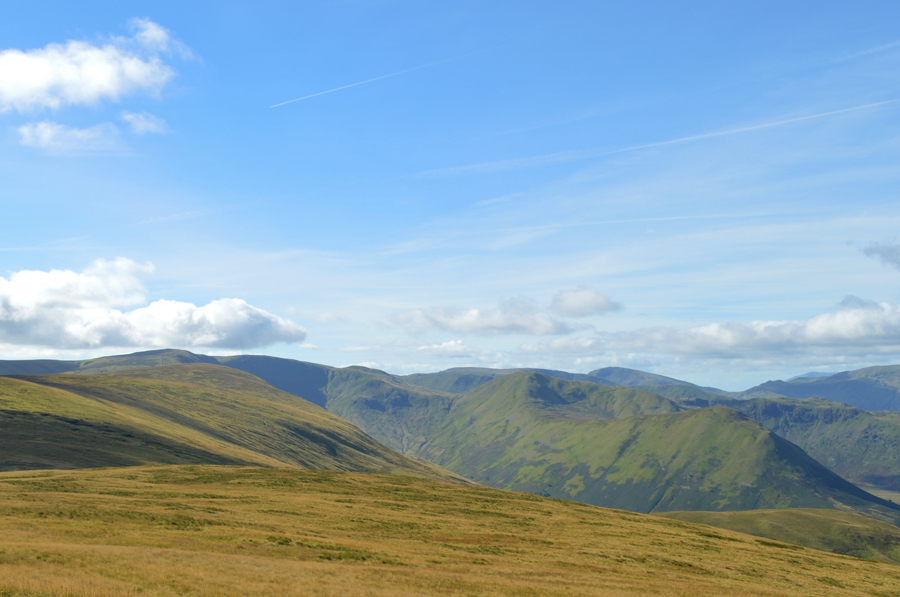 |
| Views towards Wetner Hill, High Raise, Rampsgill Head, The Knott, Rest Dodd, The Nab and Angletarn Pikes. |
| While in the distance High Street, Thornthwaite Crag, Caudale Moor, Red Screes and Little Hart Crag. We are almost at Loadpot Hill summit now as our path leaves us alongside. |
 |
| The Lowther House Chimney. |
Sadly I never got to see what the Lowther House Chimney, a former shooting lodge looked like after the wooden structure was dismantled and taken away leaving the Chimney stack which once towered the landscape much like the Haweswater Survey Pillars still do to this day, if you have time as we had today take a look around where you will see original stone flooring from the Stable on the opposite side from the Chimney. |
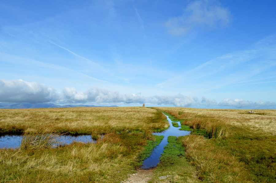 |
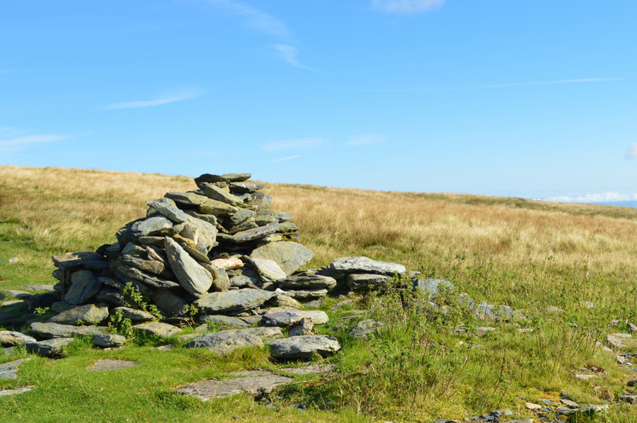
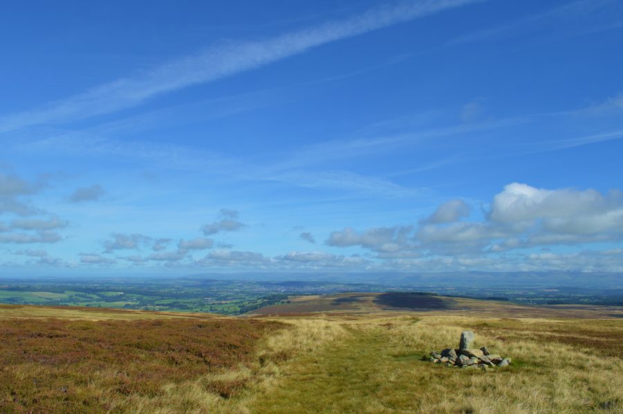
| Loadpot Hill summit Trig Point soon comes into view. |
| I have to admit, September and Autumn time is my favourite time of year when the light is really clear and the wild grasses are set alight in their Autumnal colour. |
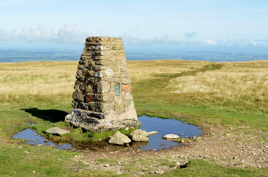 |
| Loadpot Hill summit Trig Point. |
| Have we time to stop and soak up our surroundings? |
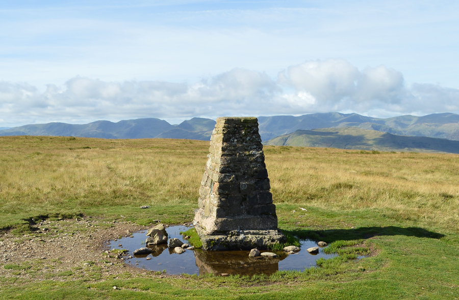 |
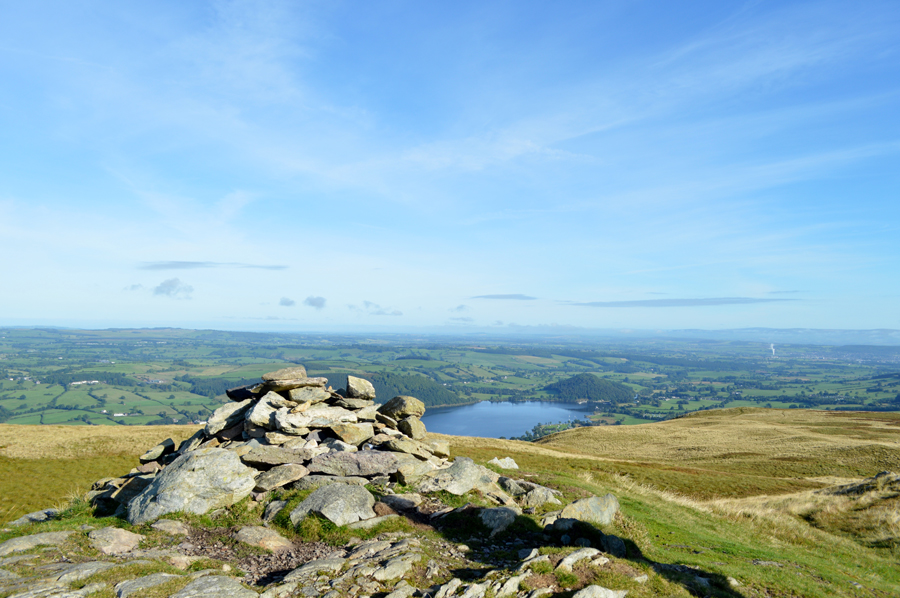
| A host of Eastern fells providing the background from Loadpot Hill summit. |
Aye, why not.
What we actually spoke of while at the summit I can't quite remember but it must have been juicy and important enough because as with our previous summits we spent the best part of fifteen minutes admiring the views, relaxing and chatting, so much so I jabbed both my walking poles into the ground at an angle and rested my backside against the handles.
Sooo relaxing. |
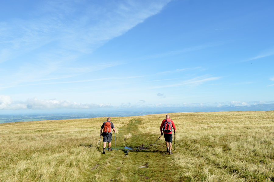 |
| I guess we best move on or it'll be nightime soon. |
| After descending Loadpot Hill summit we rejoin the High Street Roman Road now on route back towards Arthur's Pike. |
 |
| Views from our descent from Loadpot Hill over Bonscale Pike (left) and Arthur's Pike (right) with Swarth Beck inbetween. |
| Are you sure guys I can't persuade you to come to High Street with me? NO! what about Wether Hill? "come on Paul no 'out and backs' today" I guess I must do as I'm told! |
 |
| Lambert Lad. |
| |
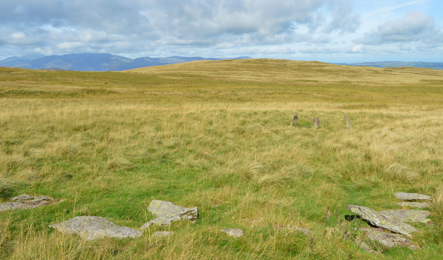 |
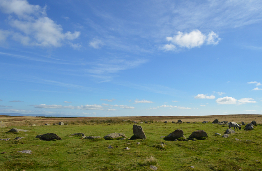
| The Stone Circle/Standing Stones found at the top of Swarth Beck (NY 457 191) |
With time on our hands we leave the Roman Road and follow a faint path towards the Stone Circle which in past times, I had trouble locating. David however, has a fine eye for such objects and keeps his eye out first sighting the three Standing Stones. As always we are left guessing what life must have been like for the people who built these objects as I wondered what gives a place the right to have a Stone Circle built on it, and what makes this site so special. |
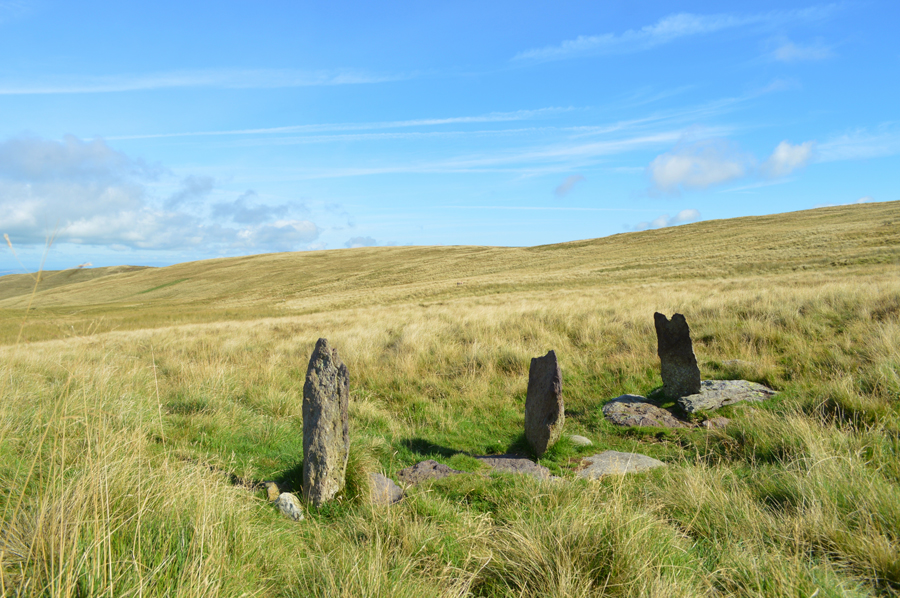 |
| The Standing Stones. |
After time out at the Stone Circle we make our way back towards the Roman Road over grassy and hummocky ground and before long we were back on the Roman Road where we are passed by an elderly gent, perhaps in his early Sseventies as we all comment "I hope I'm still walking the fells at his age"
We press on, with Arthur's Pike just up ahead, it's now time to detour from the summit path while keeping with the High Street Roman Road. |
 |
| A distant Heughscar Hill from the High Street Roman Road. |
| |
 |
| Heughscar Hill from the cairn along the High Street Roman Road. |
With the summit path of Arthur's Pike underfoot we agreed that there was no need to visit the summit again, instead opting to remain on the Roman Road until we would reach the Cockpit Stone Circle. With Arthur's Pike now to our immediate left we follow the ancient pathway which links the Roman Fort at Brougham (Brocavum) near Penrith to Ambleside (Galava) a route that I have walked myself back in June 2012 although back then, on this section of the route I was walking in torrential rain, a memory that I struggle to re-live on a day like today. |
 |
| The Cockpit Stone Circle. |
| With the descent of Arthur's Pike via the Roman Road now behind us we arrived at a deserted Cockpit Stone Circle where we managed a few moments before being joined by a fell runner who used the Stone Circle to stop and rest before she headed out in the direction of Askham. We are able to enjoy and soak up a few moments while Rod investigates the stones all the while, lunch is the topic of conversation, we all agree that once at the summit of Heughscar Hill we will find a nice quiet spot where we can look back over trodden ground. |
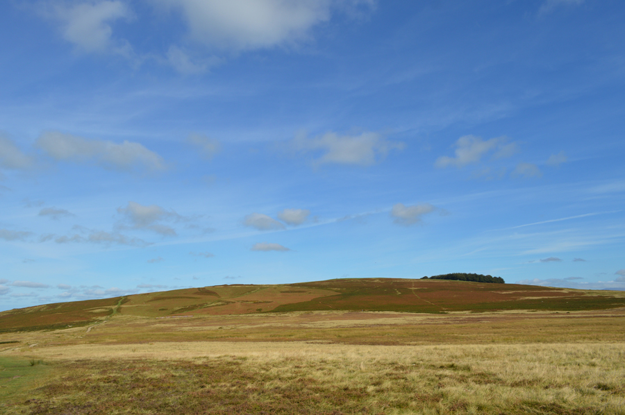 |
| Heughscar Hill. |
| Our route of ascent is seen centre left in the photo, just where the Bracken is starting to change colour. |
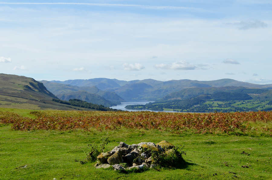 |
| Arthurs Pike, Ullswater and a host of Eastern fells from the platform that is, Heughscar Hill. |
| After leaving the Cockpit Stone Circle behind we retrace our route from this morning along the dirt track coming to a stop at two long rows of grass bails which at a guess, are used for animal bedding. Keeping slightly right we start our steady ascent via a wide kept grassy path flanked by retreating Bracken on both sides. Up ahead an elderly couple eat lunch and we could only look on with envy at their chosen lunch spot. At the summit cairn we agree to walk further to Heugh Scar, an escarpment of Limestone sittuated on the northerly edge of the summit where we would have equal views almost the length of Ullswater. |
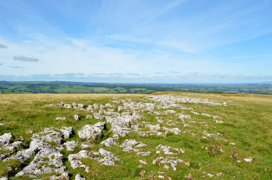 |
| First passing the Limestone pavement found not far from the summit cairn. |
| |
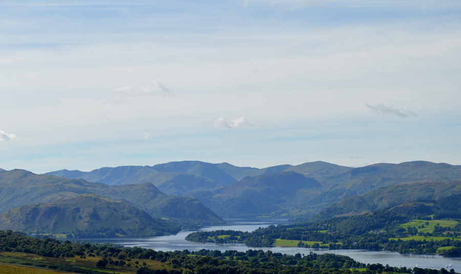 |
| Ullswater and the Eastern Fells from Heugh Scar. |
We followed the grassy summit path after diverting slightly to visit the Limestone Pavement each coming to a stop at three seperate boulders large enough to plonk our backsides down on, our views, striking.
Lunch is eaten in almost silence as we all in our own way, take in the last five hours and the moments spent on Heugh Scar, beyond an elderly lady with her grand daughter pass with a West Highland Cross Terrier who growls, I smile whilst being reminded of my own two Westies who are back home more than likely waiting for me to take them on a walk when I get back.
Without haste packs are re-shouldered before starting our short descent via the Scar taking note of the rare Limestone,then our path would lead us steeply through Bracken and finally onto a prominent grassy path above Roehead. We hadn't seen the young lass and her horse on our travels put had expected too and I wondered her route and had she had taken the same enjoyment as we had from one of Lakelands most perfect days.
Happen she had, but she was gone by the time we got back. |
|
| |
| Back to top |
 |
|