|
Portinscale to Rosthwaite via Walla Crag |
 |
 |
9th January 2016 |
 |
|
With a weak front continuing it was decided rather than go ahead with our planned respective project walks that we should plan a walk below the low cloud all the while maintaining a healthy mileage.
It was touch and go whether this walk ever went ahead at all as the forecast just got poorer and poorer right up until the final hour, David was toying with a tour of the Lord's Seat Fells when I threw in "what about Walla Crag" which kinda ticked all our boxes due to how versatile you can plan a walk all the while 'hopefully' keeping below the low cloud at the same time.
We can make it up as we go along I went on to say, there's High Rigg, Watendlath and Derwent Water or, if the weather is too bad we can always head back to Keswick via Cat Gill...
It certainly beats watching the rain run down the windows, in fact, this walk turned out so good I'd recommend it on a hot sunny day, here's Portinscale to Rosthwaite via Walla Crag, and everything in between. |
|
| Wainwright Guide Book Three |
 |
| The Central Fells |
-Walla Crag
The pleasant Vale of Keswick, surely one of earths sweetest landscapes, is surrounded by mountains of noble proportions with an inner circle of lesser fells which deserve more than the name of foothills, each having strong individual characteristics, a definite and distinctive appearance, and a natural beauty all on its own. Among these is Walla Crag. |
 |
|
|
| |
|
Overview |
|
|
| Ascent: |
2,372 Feet - 724 Meters |
| Wainwrights: |
Walla Crag |
| Weather: |
Heavy Rain Throughout The Morning Turning Overcast With Sunny Spells, Highs of 6°C Lows of 3°C |
| Parking: |
Roadside Parking, Portinscale Suspension Bridge |
| Area: |
Central |
| Miles: |
15.6 |
| Walking With: |
David Hall |
| Ordnance Survey: |
OL4 |
| Time Taken: |
7 Hours 30 Minutes |
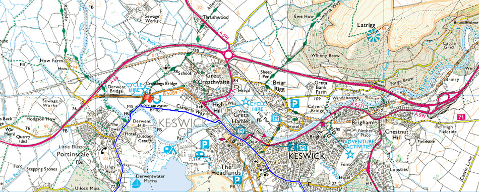
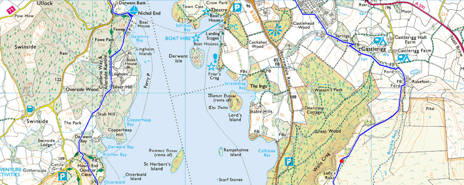
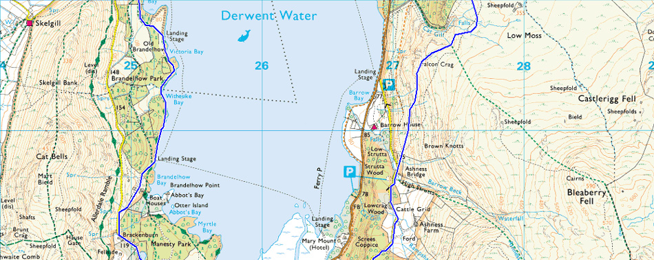
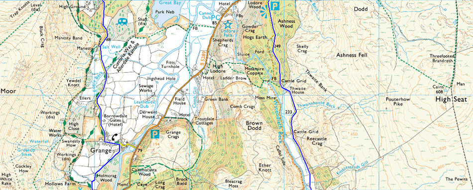
| Route: |
Portinscale – Keswick – Springs Wood – Rakefoot – Walla Crag – Top of Cat Gill – Ashness Bridge - Asheness Wood - Watendlanth - Puddingstone Bank - Rosthwaite - New Bridge - River Derwent - High Hows Wood - Low Hows Wood - Grange - Manesty - Derwent Water Lake Path - Hawes End - Fawe Park - Nicol End - Portinscale |
|
| |
|
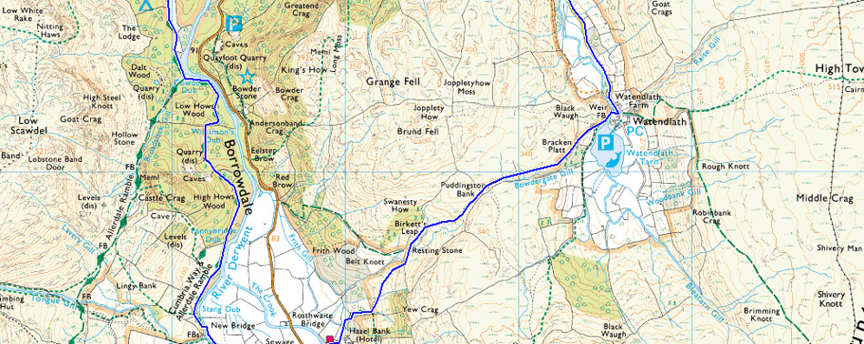
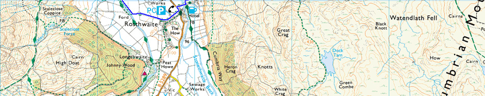
Map and Photo Gallery |
|
|
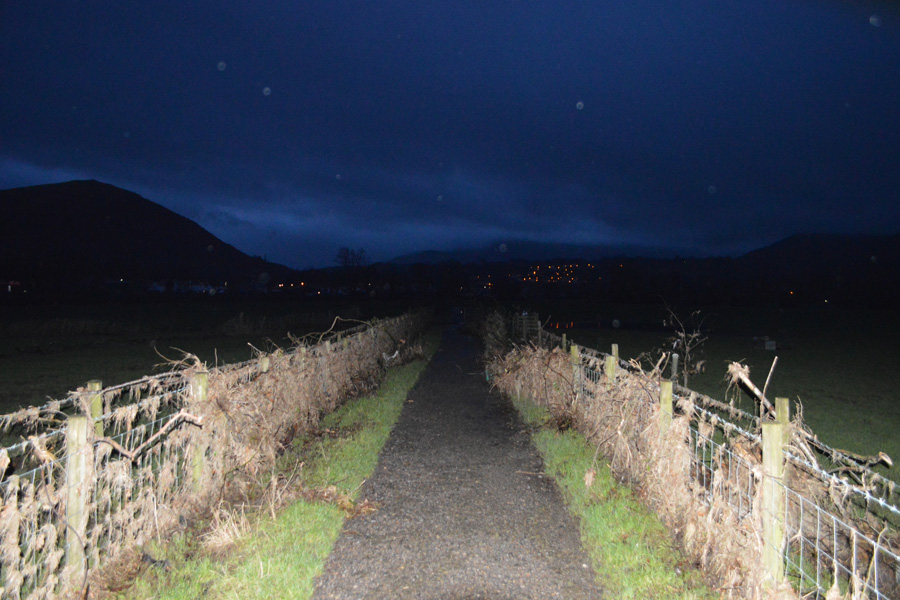 |
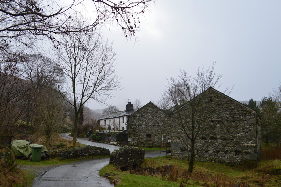
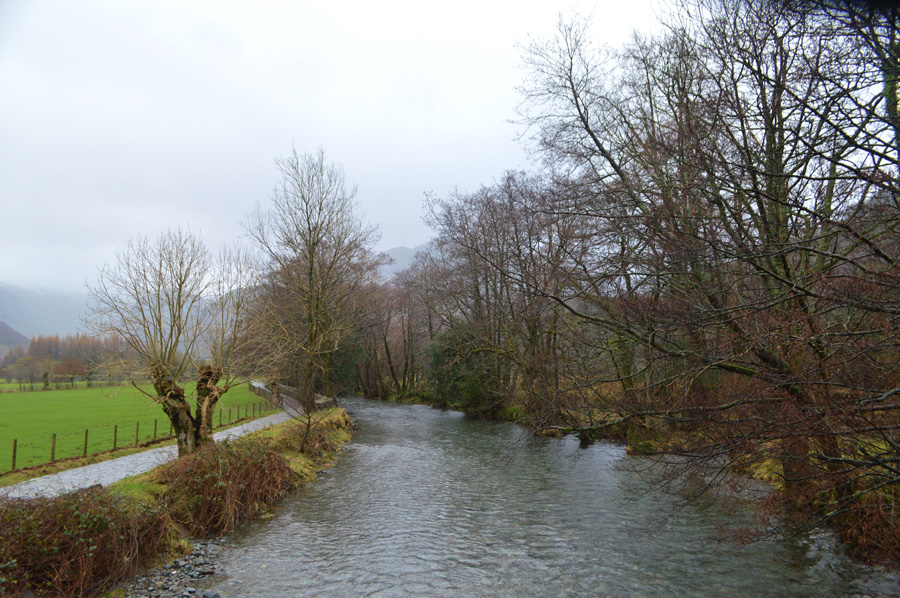
| Looking towards Keswick along The Cumbrian Way just outside Portinscale 08:00am 3°C |
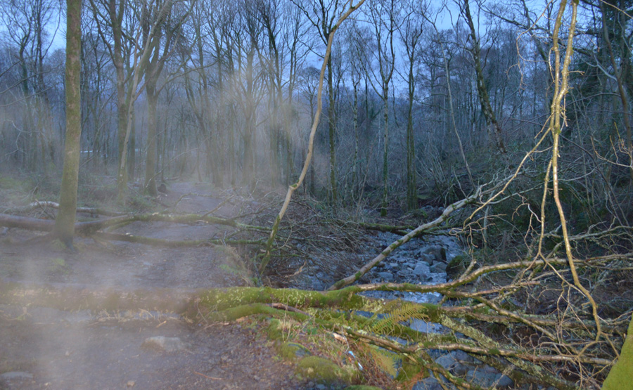
We had arranged to meet along the lane close to Portinscale suspension bridge, you know the one where the camper vans usually park. I arrived at around 07:50am to find David already there, all I had to do was turn my car around where I managed to park between a Utilities van and Davids car. The devastation left behind by Storm Desmond over a month ago now littered the lanes, pathways and fields sometimes leaving full grown trees in the middle of a field or as you can see in this photo, debris for as far as the eye can see along the Cumbrian Way between Portinscale and Keswick, despite the morning still being under the cover of darkness it wasn't hard to see how much damage there is still to clean up, you name it and it was more than likely tangled up in this wire fence from pillow cases to goal posts, nothing had escaped the flood waters, I would like to say that it's hard to imagine that this area was under three feet of water a month ago, but sadly, it isn't that hard...the devastation was everywhere we looked.
Kitted up we had left the cars at the lane...It wasn't until afterwards did I silently wonder why a Utilities van complete with trailered mini digger would be parked up on a weekend morning, now I knew why. We strike up conversation between the weather and this years plans, it was only the site of fore mentioned mangled goal post that stopped us talking, from which we would look around still finding it difficult to comprehend what happened here those few weeks ago. It was still dark as we entered Keswick but, the town was slowly coming to life. |
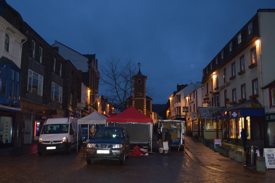 |
| Main Street, Keswick. |
The path along the Cumbrian Way lead us out over the River Greta and High Hill, an area of Keswick that was all over the news during and indeed after storm Desmond. The River Greta flows through Keswick and the High Hill area is the scene of previous flood damage during 2009 where after millions had been spent to increase defences, you may probably remember seeing the reinforced glass paneling which are part of the defences which, were breached on the 6th December but today, still lay intact although we could not see the extensive damage to Crosthwaite Road which bore the considerable brunt of the flooding.
After crossing the River Greta it was soon apparent that the terraced homes and small businesses were empty and on one occasion we could hear the noise from an industrial dryer in the one of the properties, sandbags piled on top of one another still blocked doorways for the short time use they provided. Keswick Bikes close to the mini roundabout are open and offered 50% of flood damaged bikes and stock, the closer we got to Keswick small businesses unaffected by the flooding carry on as usual, just like the paper shop we had walked past complete with early morning locals buying newspapers.
Having crossed the road at the mini roundabout we entered High Street, the setting for Keswick's most famous Market, traders here are setting up their stalls in the twilight hours, soon it will be as busy as usual but for now, its just myself and David and the odd person making their way to work.
"Hey Paul, Greggs is open'
David's light hearted comment lightens the mood as we head out for Springs Road, which is just under a mile ahead. |
 |
| Storm Damage as we pass through Springs Wood. |
The path through Springs Wood is separated by a wooded bank on one side, and on the other by Brockle Beck, the heavy rain loosened the ground and the roots gave way unearthing countless trees, some of which like these blocked the path which, was passable with care. Along the river bank it's the same story as what was once a quaint beck turned into torrent, with this the river bank was washed away, re-shaping the river and taking anything along with it.
No it's not a ghost, just my breath, sorry! |
 |
| Brockle Beck Foot Bridge found close to Rakefoot Farm. |
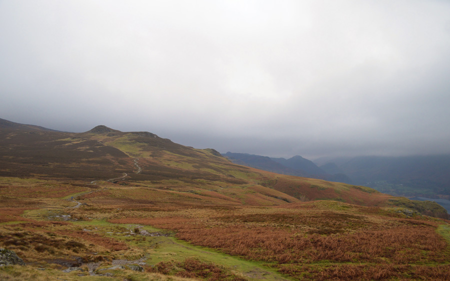
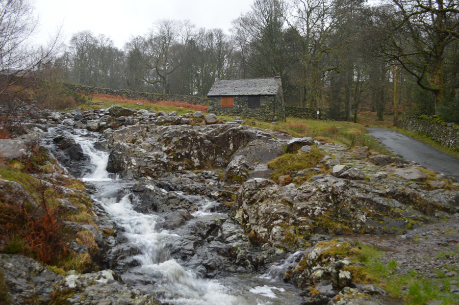
| We continued through Springs Wood emerging on the access road at Rakefoot Farm, water was pouring off nearby fields flowing over the road but not in any serious way, before walking over the footbridge we pass a flock of sheep held in by a metal gate who have all got their backsides to us on the wait for breakfast no doubt. Silage fills the nostrils as we strike out for the steady climb towards Walla Crag, all of which under the watchful eye of around half a dozen wild ponies. |
 |
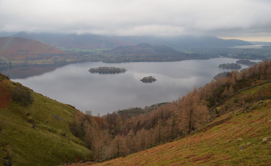
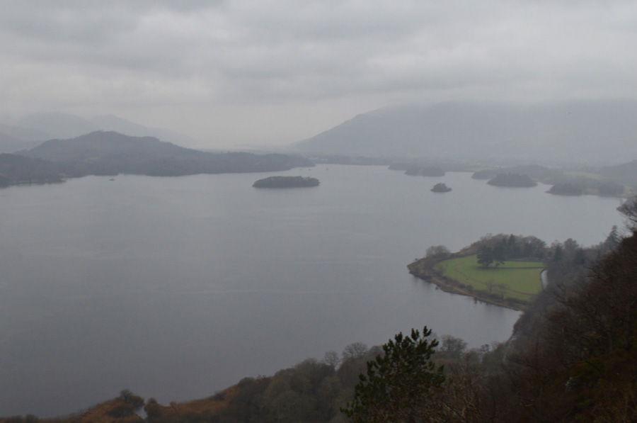
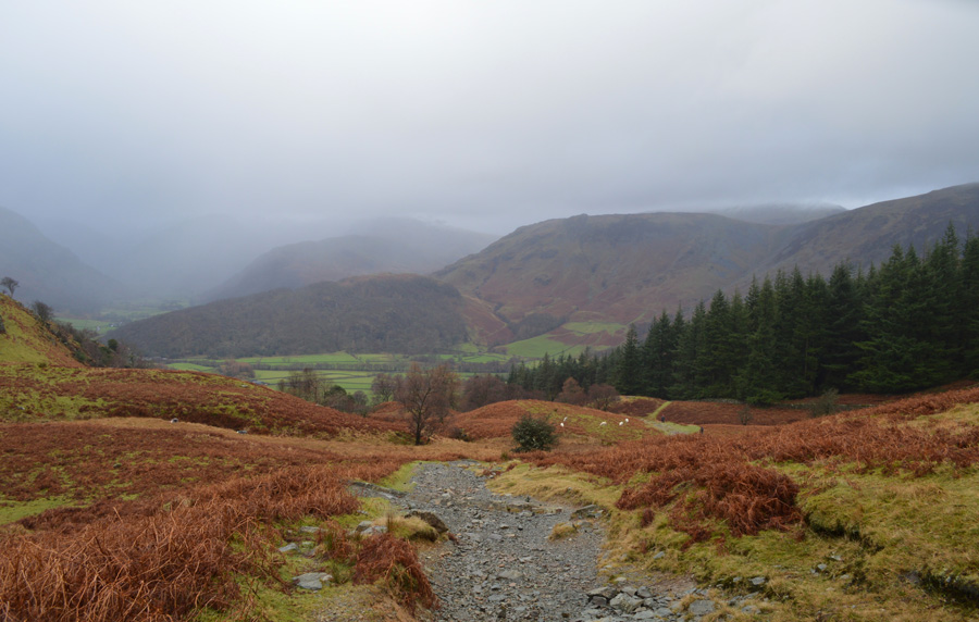
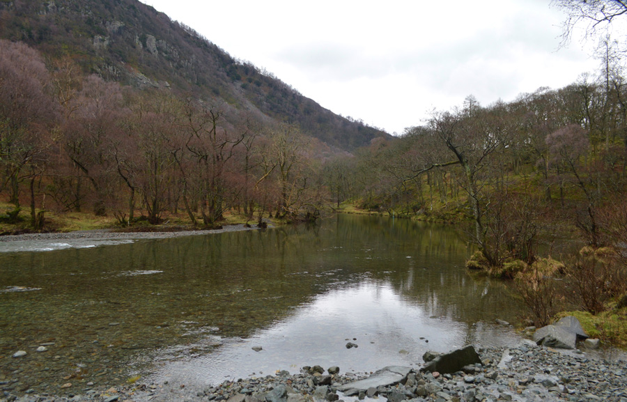
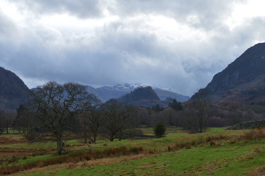
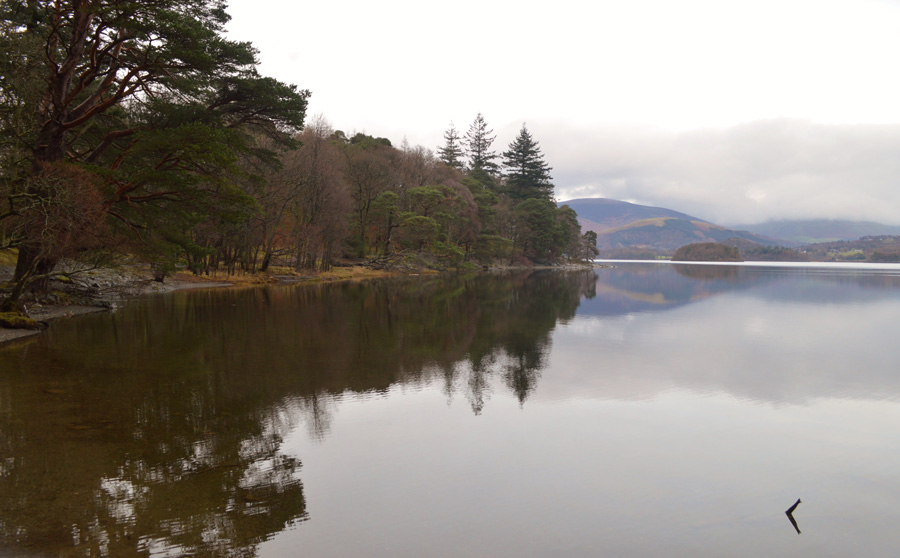
| Views over Derwent Water from Walla Crag. |
The forecasters said the rain would hold off until around mid morning as we took in our limited views over Derwent Water which looked inky black. Our views were of mainly cloud, only Latrigg and Cat Bells summits apparent, for how long we wouldn't know. A wall of cloud was approaching from the east enveloping Clough Head and The Dodds, St Johns-in-the-Vale and the likes of Raven Crag was next although as seen in this next photo, it seemed to stop dead just short of our position which showed a little promise.
Fingers crossed, it still wasn't raining yet. |
 |
| Keeping an eye on that advancing cloud. |
| We were soon joined by a woman and four dogs who instead of summiting Walla Crag, optioned to track along side the stone wall, she and her army of dogs continued along the same track we would soon use towards Ashness Bridge. |
 |
| Views over Falcon Crag (left) and Cat Gill (right) |
Spots of rain are now starting to highlight at my jacket yet despite this, the temperature is mild with a cool wind, soon we would stop while David adds an extra layer, but for now, lets see how long this rain will hold off.
We head out along the path which skirts across the top of Cat Gill. |
 |
| Derwent Water and a distant Bassenthwaite from Cat Gill. |
| There is a great path that descends Cat Gill by the stone wall you see over on the right of the photo, however, it is quite steep and I would imagine on a day like today, quite slippery too. |
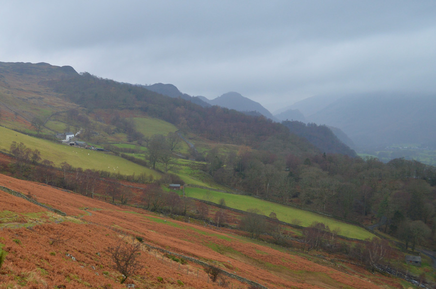 |
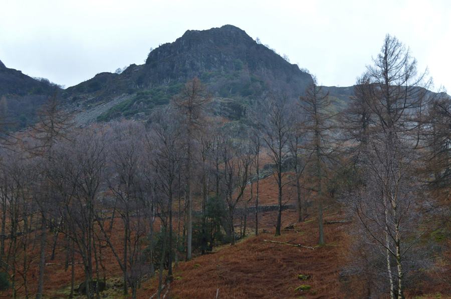
| Distant views over Ashness Farm, Kings How and Castle Crag. |
| It was not long after crossing the top of Cat Gill did the rain start to fall, firstly light and squawly turning heavier thereafter, we stop while David adds a jacket and I tie down the hood on my own, every now and again jerking my head forward in order to let the rain drain off, the predicted rains had arrived and if the forecasters are correct, it's going to last for the next two and half hours. |
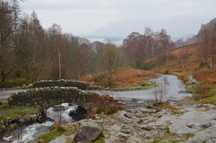 |
| Down at Ashness Bridge. |
| Descent to Ashness Bridge was done carefully due to swollen ground but thankfully we made it with only minimal slips. A guy wearing full waterproofs is passed as he mutters 'morning' as he steadily makes is way up the fell side. A young girl runs by in just shorts and T-shirt carrying only a water bottle in her right hand, we could only look on at her determination, her exposed skin, red raw.
The rain hadn't let off at all, in fact it fell heavy and steady causing conversation to drop because lets face it, it's quite difficult to chat and walk while the rain is battering down on your hood. |
 |
| Bark House Mountain Hut provides the backdrop to Barrow Beck/Ashness Bridge. |
We strike out heading steeply towards Surprise View first passing Ashness Farm along the way, behind the farm David spots a landslide that has taken out two dry stone walls narrowly missing the farm by about two hundred yards, the damage to the fell side wasn't particularly extensive on the grand scheme of things which goes to show no matter how small the landslip, in this case it was still carrying enough weight to level two stone walls fifty feet apart.
We press on, hoods fastened towards Surprise View. |
 |
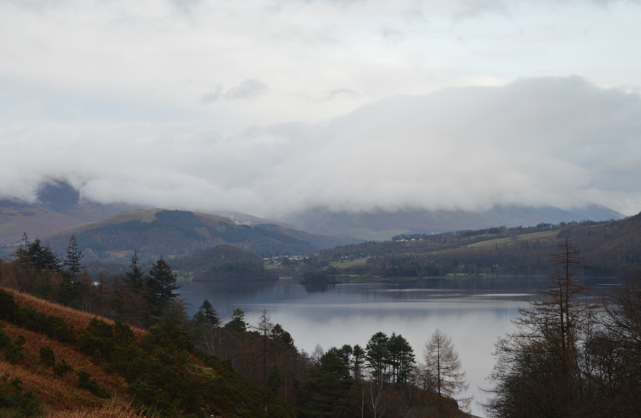
| The view from Surprise View. |
| Sadly, wasn't really living up to its name today, we both cast eye over the area of ground around Chinese Bridge which was cut off, but did survive the flooding and now appears passable, here the River Derwent burst its banks extending an already over full Derwent Water deep into Borrowdale although thankfully now, the water level is returning to normal despite the area around Great Bay still licking at its wounds. |
 |
| It was still raining... |
| As we take the road to Watendlath. |
 |
| And it was still raining... As I paused to look back at the stone barn. |
Once we were out of the shelter that Ashness Wood provided we were taking on the rain head on, helped along by a cool wind which left fingers feeling raw, we could have complained more until we spotted the young girl again who we had seen back at Ashness Bridge, her route clearly defined. Who were we to complain when the young girl thundered past us once more, so motivated she didn't even return our 'morning' good on yer lass.
Ok David, we can't complain about the rain no more! |
 |
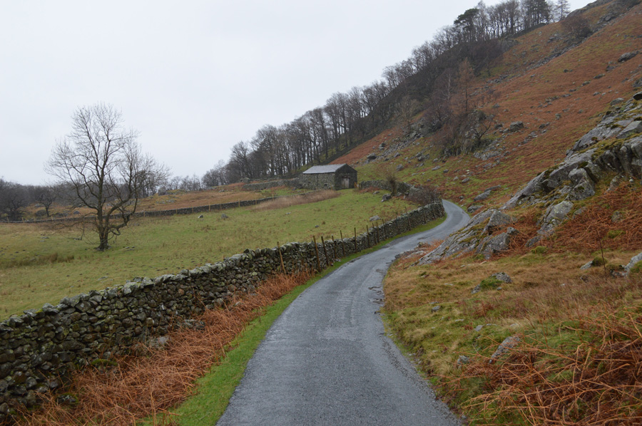
| Watendlath Farm. |
| Through the rain we trudged on until we reached Watenedlath Farm which we found deserted, |
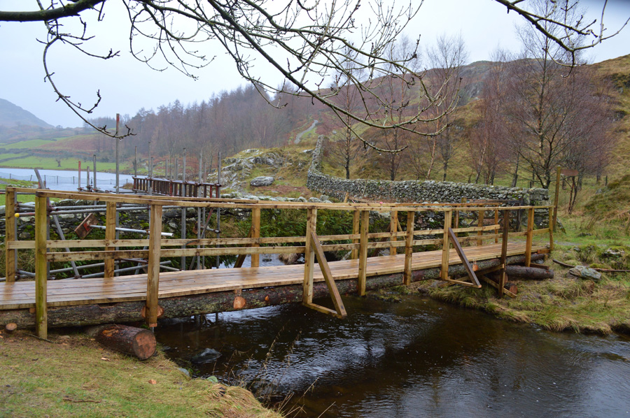 |
| Temporary bridge in replacement to the storm damaged Pack Horse Bridge at Watendlath. |
David had already seen the temporary bridge that had been constructed in replacement of the damaged Pack Horse Bridge a few weeks ago but all of this was new to me, I found it quite remarkable that the bridge was constructed in such a short space of time even though it's only for pedestrians, in a perfect world, why can't this way of thinking be rolled out across the park?
Too much red tape I guess! |
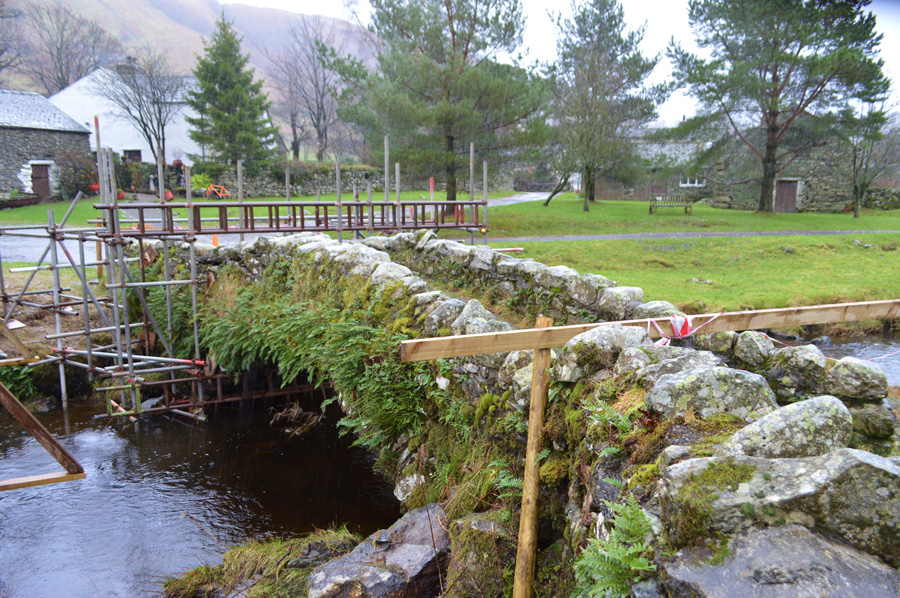 |
| Bridge repairs are already underway. |
| It would seem that both the left and right parapets structures have been weakened during the storm, put simple, how much pressure caused by the immense water flow had been put on the bridge, it simply doesn't bear thinking about, lets hope in time the bridge is rescued and returns to how it used to be, in the meantime, the wooden replacement works just fine. |
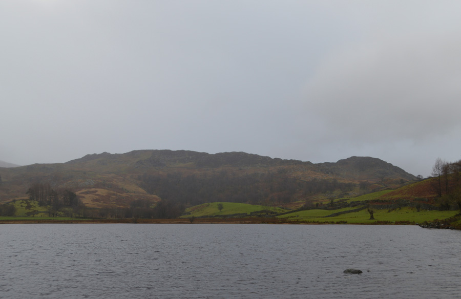 |
| Views over Watendlath Tarn towards Great Crag. |
| |
 |
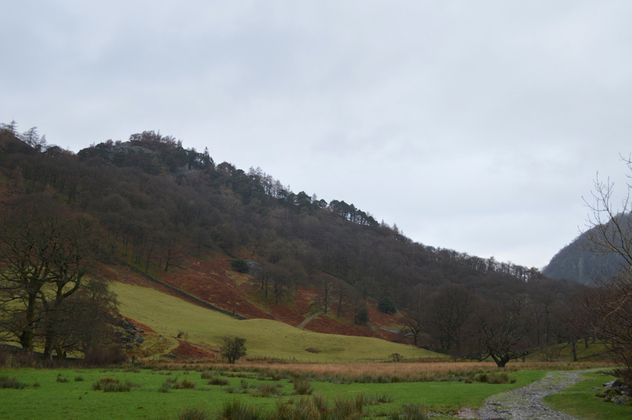
| Borrowdale views as we start our descent from the top of Puddingstone Bank. |
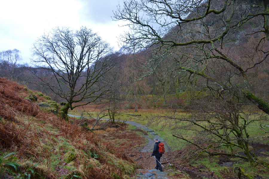
| It was only now we started to see more and more walkers heading up towards Watendlath as we took in our descent to Rosthwaite via Puddingstone Bank, despite this being a bleak rain hit January morning there were plenty of families with children enjoying a day out which was nice to see. |
 |
| Bleak is beautiful. |
| Rosthwaite is now in view, it's still raining but not as heavy as the occasional chinks of blue start to appear over our heads, could this be the clear spells as forecasted? lets hope so. |
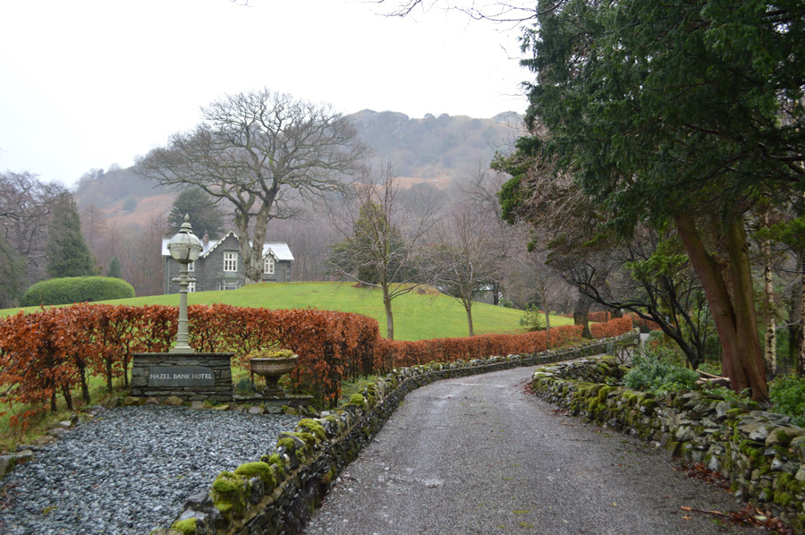 |
| Hazel Bank Hotel. |
| |
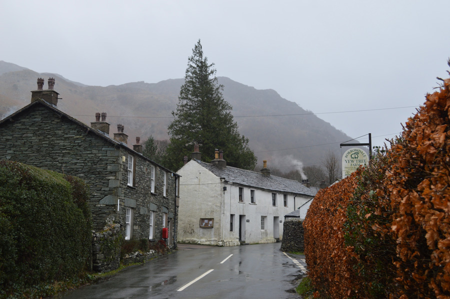 |
| Rosthwaite. |
We headed into the heart of Borrowdale best known as Rosthwaite, David reminds me of the times when the shop (seen here by the post box) was the centre attraction of the village especially during the summer months, although sadly, the shop has since been renovated into a end cottage. We turn right at the end of the hedges and head towards Yew Tree Farm from where we will pick up the Cumbrian Way again, but before all that, take a look at these cheeky chappies. |
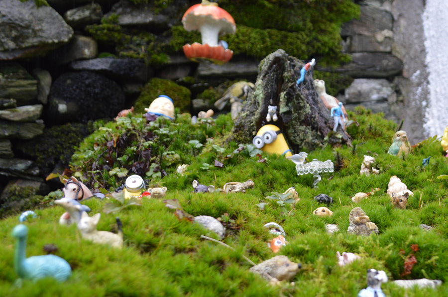 |
| Just like a page has been taken out of a childrens book. |
| We couldn't help but notice the tiny model animals, dinosaurs and dolphins! found in a large planter outside one of the cottages, I think this is great as it really sparks the imagination. |
 |
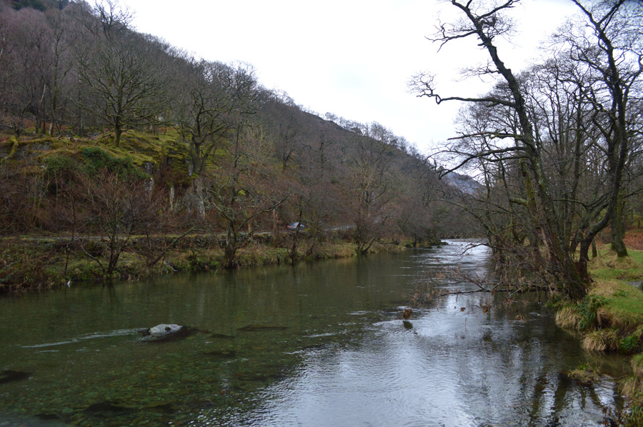
| The River Derwent from New Bridge looking back towards Rosthwaite. |
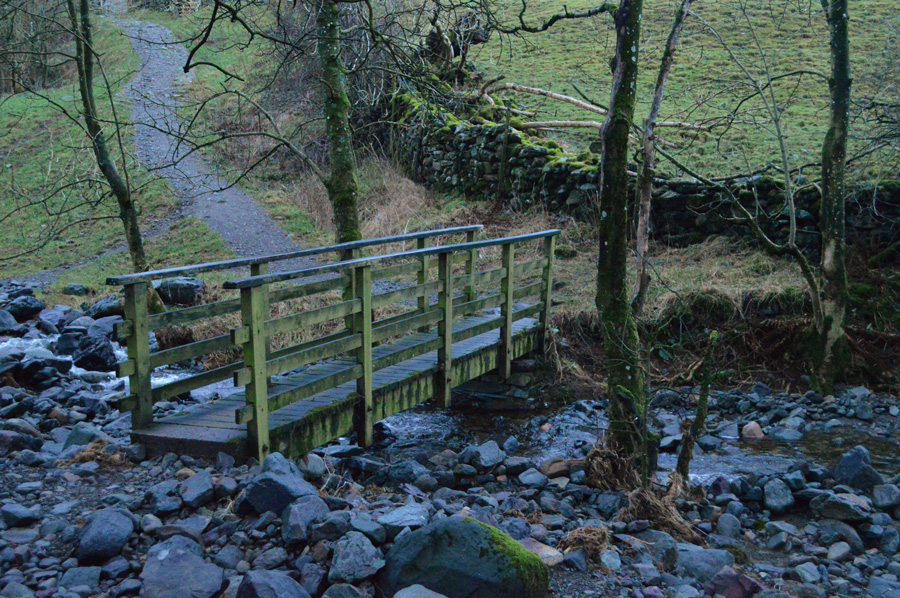
We had only passed a farmer and a woman walking her dog between Rosthwaite and New Bridge on what would be, one of Lakelands best known beauty spots, today I guess the rain has put many a folk off. On reaching New Bridge we discovered more bright orange tape indicating that although the bridge was safe to cross a notice read 'please keep off the parapets'
Once over the bridge we could see why there was a need for the safety sign as both parapets were towing outwards and out of line.
We press on towards Low Hows Wood and thoughts of lunch. |
 |
| Castle Crag from Low Hows Wood. |
We both agreed that at the next available convenient place to stop we would eat lunch, the trouble was, there wasn't anywhere to sit, with this we hunt down a lunch table which came in the form of a wet boulder for me, and a moss covered felled tree trunk for David.
It had finally stopped raining, if you looked between the gaps in the tree branches this wasn't the case as we sat to eat lunch while being peppered by rain drops that were falling from the branches above our heads, still, a nostalgic and peaceful place to eat lunch as conversation returned to full strength now that it had stopped raining.
Good times. |
 |
| High Hows Wood. |
| |
 |
| The River Derwent. |
| We again had turned to investigation mode as we made our way through both High and Low Hows Wood, noting that although at times the footpath we were on was a good two hundred yards away from the River Derwent we could still see debris that had been left behind when the River Derwent had swollen. |
 |
| The River Derwent. |
| Thankfully now, the river level has returned to normal, we are much closer to Grange now than Rosthwaite, which is where we are heading next. |
 |
| Splendid views over Nitting Haws. |
| |
 |
| Castle Crag beyond Grange cottages. |
| We were soon in the hamlet of Grange and it was here David de-layered taking off his waterproofs and jacket, I waited close to the Grange Church whilst overhead, the sun started to appear. |
 |
| Heading through Manesty. |
| It's starting to feel much milder now as we contemplate which way to head back to Portinscale, our options varied between the terrace path below Cat Bells or do we head along the Derwent Water Lake path? |
 |
| Distant views over Castle Crag towards a snow capped Glaramara. |
| |
 |
| Descending towards Brandelhow Bay. |
The Lake Path route won as we followed a narrow path towards Brandelhow Bay on the south east corner of Derwent Water, not before passing one home below High Ground that had by the narrowest of margins avoided a landslip that had taken out the properties front garden and driveway, and not to mention the stone wall on the opposite side of the road, this, when you think you are safe from flooding, but not landslip.
Our path had heavenly views over Derwent Water but also lay victim to recent flooding, at one point the channels in the path measured waist height and were at times two feet in width, extra care was taken and when we could, the path was avoided due to how unstable the ground underfoot was. |
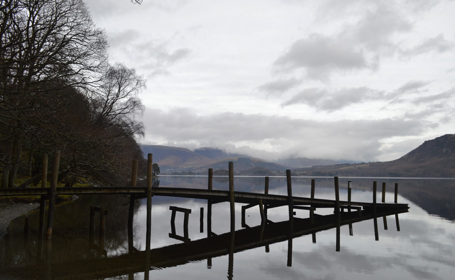 |
| Brandelhow Bay Landing Stage. |
| Here, rising flood waters have lifted the platform of its anchors leaving it wrecked and twisted. |
 |
| Brandelhow Point reflections. |
| |
 |
| Withesike Bay. |
Despite seeing a few cars that had stopped to photograph the view from the road above we had not seen any one along the Lake Path with the exception of a young man who was enjoying a run out. The sun had gone back in but at least it was light and airy, the surface of Derwent Water was calm and at times reflected Walla Crag across its surface, we both agreed despite it only being a few hours ago when we were standing on its summit, right now it felt like it could have been yesterday.
Odd I know... |
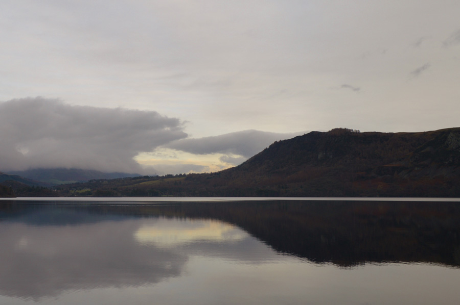 |
| Walla Crag reflections. |
| |
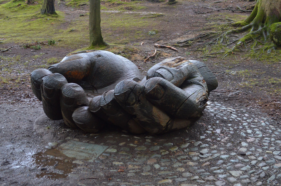 |
| The wooden hands sculpture, carved from a single oak tree to celebrate the centenary of the National Trust in the Lake District. |
Before we arrived at the carving of the Hands something happened that made us both nearly jump out of our skin and possibly greatly increased our chances of winning the lottery given the rarity of such event.
Has anyone ever heard or witnessed a tree branch naturally fall from a tree? Ok I admit the branch didn't fall off whole but I bet as I type this it is now lying on the ground, said tree was only twenty feet away as we heard this almighty creaking sound, the branch which was probably two feet in width and about twenty feet in length came to halt although the crack in the tree was clearly seen, wait for it...wait for it...
After 'the initial shock of 'dear god how close was that' we waited for the branch to come thundering down, but it didn't as I am reminded of the philosophical thought of "If a tree falls in a forest and no one is around to hear it, does it make a sound?"
Yes, if definitely does! |
 |
| Cat Bells from Outerside Wood. |
We made our way around Hawes End before views over the summit of Cat Bells distinctly stood out noting three or four people making their descents. Legs and feet were starting to feel the miles after all, it's been some weeks since both David and myself have covered a walk ten miles plus due to the conditions.
We tramp through Overside Wood from where I stopped again to take this photo of Cat Bells then through Fawe Park and Nicol End, it was fast approaching two thirty and we agreed on what a great day; despite the earlier rain it had turned out to be. At Nicol End the landing stage had been damaged and warped due to recent flooding and one small boat had sunk which was still anchored to the pier.
A large family group pass by with small children in tow, one little girl in particular holds a stick in her hand and her pink waterproofs are muddied up to her waist, she hasn't a care in the world as she kicks through puddles holding dads hand.
Who says you can't have a great day out in the rain. |
|
| |
| Back to top |
 |
|