|
Walking the Wainwrights in 30 Walks Walk 23 - The Loweswater Fells |
 |
 |
9th July 2016 |
 |
|
To bring an end to my week walking in Lakeland we had planned a walk on the Scafells but due to a poor forecast we thought we ought to play it safe and choose a remaining walk were we wasn't going to land ourselves in any trouble.
After todays walk only seven walks remain leaving fifty seven summits to collect, I'm kinda getting to the point where I need to be relying on good weather but unfortunately this is July and therefore waterproofs are required. Out of the seven walks remaining only a handful can be carried out in poor(ish) weather leaving the rest which either demand a good forecast due to safety reasons or purely because the fell in itself deserves the respect of a clear walking day.
The Loweswater fells although as fantastic as they are didn't fall into that category, but this walk isn't to be underestimated as it collects all the Loweswater Wainwrights including Fellbarrow and Low Fell. It's not very often I would intentionally plan a walk where I knew I'd take a soaking from start to finish but I guess after todays experience it really isn't so bad after all and we even got to test our waterproofs which, are never really as waterproof as it says on the packaging.
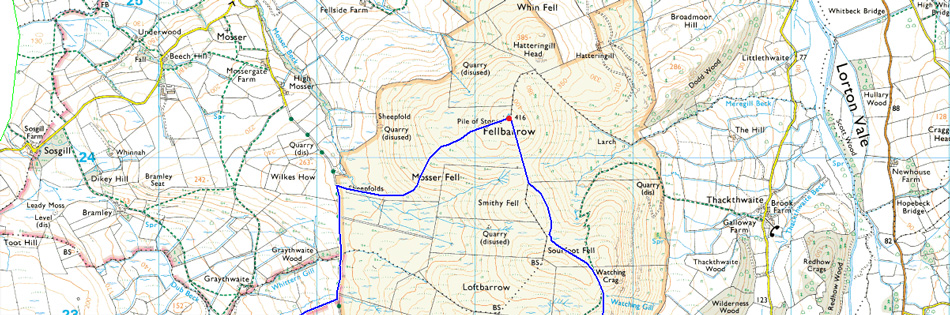
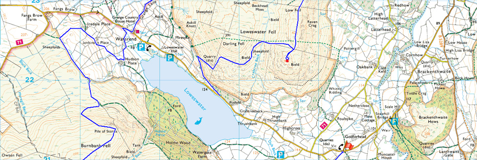
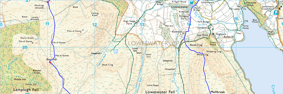
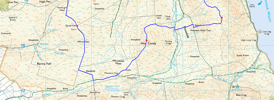
This is the complete Loweswater Fells. |
|
| Wainwright Guide Book Six |
 |
| The Western Fells |
-The Mosedale Holly Tree
A tree in the boggy wasterland of Mosedale is a feature worth noting, and the Ordance Survey must of thought so too: they have indicated it by its symbol on both 2½" and 6" maps |
 |
|
|
| |
|
Overview |
|
|
| Ascent: |
5,000 Feet - 1,525 Meters |
| Wainwrights: |
7, Mellbreak - Hen Comb - Gavel Fell - Blake Fell - Burnbank Fell - Fellbarrow - Low Fell |
| Weather: |
Heavy Persistant Rain Throughout, Strong Winds Across The Summits PM |
| Parking: |
Parking Spaces, Red Phone Box Loweswater |
| Area: |
Western |
| Miles: |
15.2 |
| Walking With: |
David Hall |
| Ordnance Survey: |
OL4 |
| Time Taken: |
8 Hours 5 Minutes 08:15am - 16:20pm |
| Route: |
Loweswater - Kirkgate Farm - White Crag - Mellbreak - Mosedale - Mosedale Beck - Hen Comb - White Oak Moss - White Oak - Gavel Fell - Fothergill Head - Blake Fell - Burnbank Fell - Jenkinson Place - Hudson Place - Grange Lane - Mosser Road - Mosser Fell - Fellbarrow - Low Fell - Crabtree Beck - Mosser Road - Loweswater Road
|
|
| |
|
Map and Photo Gallery |
|
|
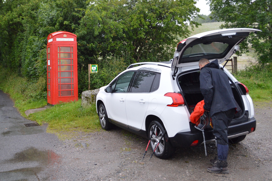 |
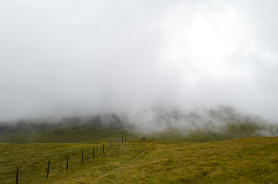
| Parking Spaces, Loweswater 08:15pm |
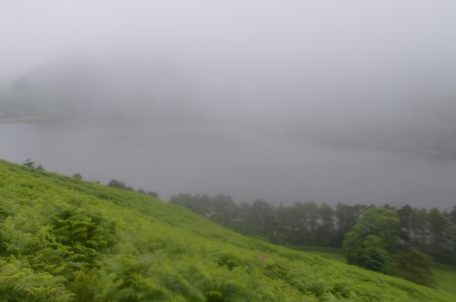
It's been a long time since I've driven through fog so thick and experienced cloud so low but these were the conditions that greeted us as we arrived in Loweswater shortly before 08:00am. As expected there wasn't another car at the car parking spaces leaving parking easy and the ground the rain that had fallen over night was evident all around, it was a pretty grim start to say the least but we knew what we were letting ourselves in for which kinda kept morale up all the way.
We had already left David's car back at the Waterend 'end' of Loweswater which meant after a tiring day we didn't have to walk the one mile back towards the village, something of which never transpired but I'll get to that later. It seemed to take forever to kit up mainly on my behalf as my car was starting to look like a walk-in wardrobe with gear all over the place and not in the place where it should be due to my busy walking schedule over the last few days, with the car eventually locked we left Loweswater in the direction of the Kirkstile Inn kitted up from head to toe in waterproofs which again I can add, are never as waterproof as it says on the packaging.
Yesterday I had walked a few miles in the Borrowdale valley and had covered quite a bit of ascent too more so if you total my previous three walks and, in the back of my mind it was playing on me on how my legs were going to cope on another walk which topped out at 5,000ft total ascent, it was something I joked about to David that if you should see me trailing behind just carry on I'll be right behind, as it turns out I managed through the day but that's isn't to say I didn't have to dig deep or go through those silent moments, both of which I experienced plenty of times under my breath, and to David's amusement. |
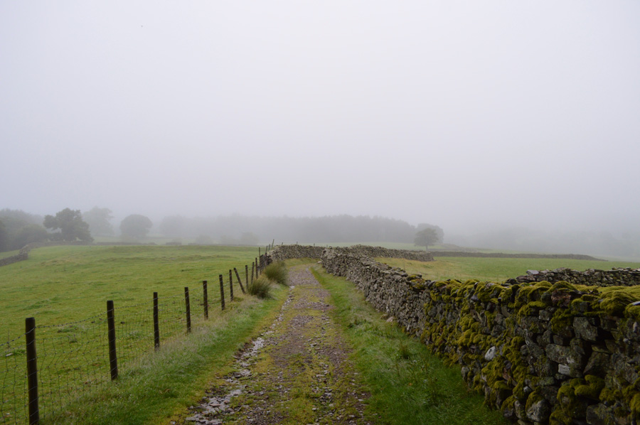 |
| One last photo between the drizzle and the rain, here looking back towards Kirkgate Farm. |
Despite the cloud being just about the roof tops this morning it's very humid and with our added layers it's starting to feel pretty unpleasant but we knew that once on the tops all this would change and we would be thankful for the extra layers, especially the gaiters. With Kirkgate Farm passed we join the lane that leads towards the foot of Mellbreak where I can already feel my thighs start to tighten up.
I don't mention it. |
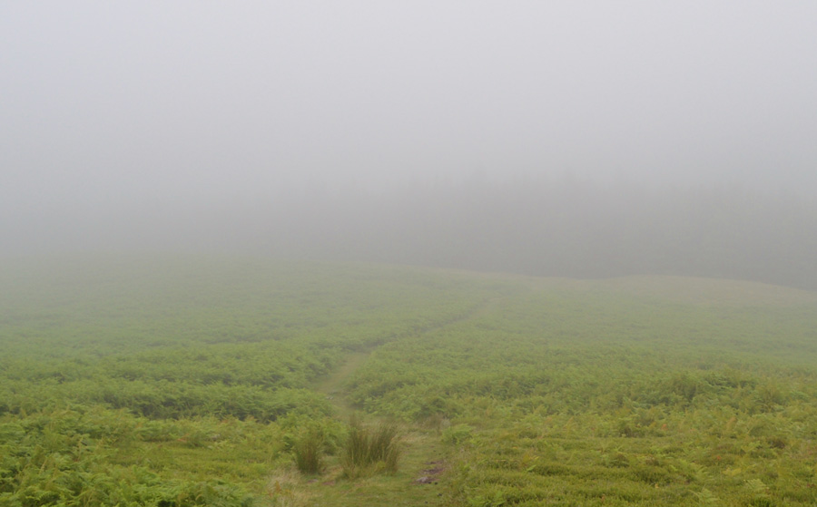 |
| The hill fog was so low. |
We pass through a wooden gate at the end of the lane and and begin a steady ascent flanked on both sides by the familiar Pines, it's still not raining just yet but the tree roots are slippery underfoot and I get caught out a few times before emerging on the other side of the track where views would normally open out over our ascent route via White Crag before topping out on Mellbreak north cairn, we kinda got our first taster of what to expect during the rest of the walk but optimism remained high, after all, right about now it's meant to be raining.
"I'll take this if it stays like this all day" |
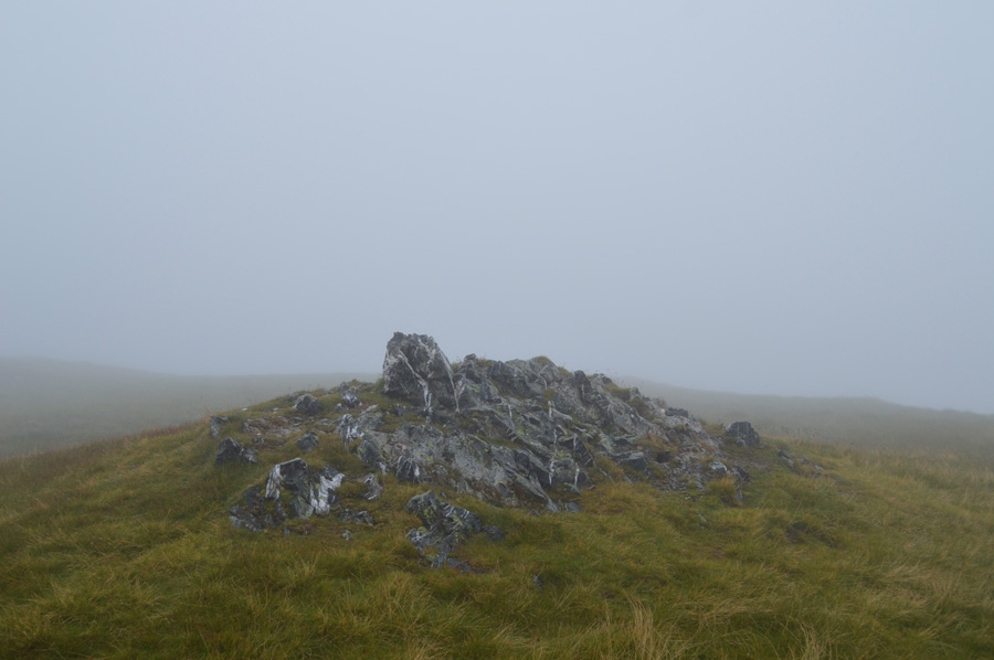 |
| Mellbreak summit. |
My thighs continued to feel the burn until they loosend up and I was able to keep pace, this I never spoke of as I took in the steady zig zags from the start of the ascent which steadily got steeper by which time it still wasn't raining and the humidly was just bonkers high, which actually helped in a strange way in that it gave my legs time to adjust into the ascent during rest stops.
We had passed the first surprise view which would have seen exceptional views of Crummock Water and beyond without even peeping around the corner for a look as visibility was getting increasingly worse, so much so it only extended to around only ten yards at times but morale remained high as we spoke about this years projects and what we had also planned for next year. We continued our ascent over wet rock and heather before arriving at the second promontory and continued to climb passing the head of Big Gully and peered down into the inky abyss
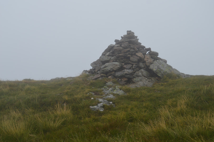
From the top of Big Gully we could almost feel the north summit cairn just ahead it was just the strange fact that we couldn't see ten feet in front of our noses but we soon arrived at a large cairn at the end of the path and headed towards Mellbreak north top summit cairn at 509' This indeed is not the true summit of Mellbreak which is found just under a mile away at the south top just three meters higher at 512'
We studied two paths that traverse across Mellbreak spine both of which vanished just yards ahead of us, we took in the slight descent sometimes having to avoid a number of boggy areas before arriving at another path which descends towards Mosedale (our intended path after summiting Mellbreak) and I kept a visual eye out for any distinctive boulders or anything for that matter which we could to secure the path but there was nothing but heather and grass.
Our path started to rise over the shoulder of the fell towards the summit and with each step forward our would be descent path into Mosedale didn't seem as good as it looked on the map the evening before, we topped on the shoulder of the summit and all that was left was the familiar single track which lead to a rocky outcrop indicating Mellbreak highest point, by which time the drizzle had turned to rain and the wind had started to pick up too leaving loud popping noises as it hit our waterproofs.
There was no summit time at all, just the few seconds needed to kneel down with the wind and rain on our backs to take a summit photo, after that and with walking poles looped around wrist we strike out for a short time south while contemplating our descent route into Mosedale, through the wind and rain we shout 'reckon the Holly Tree is just down there' pointing with our walking poles,
Which is where we headed next. |
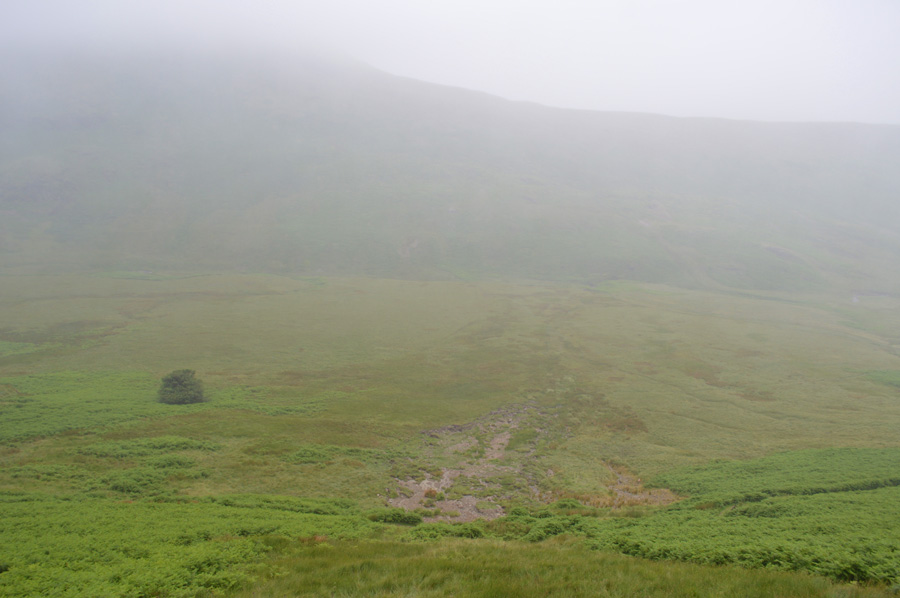 |
| Hen Comb and the Mosedale Holly Tree. |
We walked south for a short while headlong into the rain before starting our steep descent into Mosedale, the hill fog was still thick and with no real view we kept with our steep descent until the Mosedale Holly Tree came into view, not bad we thought for a guess on our location but our descent wasn't as simple as first thought as quite a bit of wet Bracken had to be blazed through first but soon options opened out over grass and through Heather.
The rain by now was sweeping through the valley in what looked likes waves and I distinctly remember saying 'look' we're sheltered at the moment by that craggy outcrop to our left, once past it the shelter would be gone and we would be in the thick of it. Of course we descended further and with this went our shelter. |
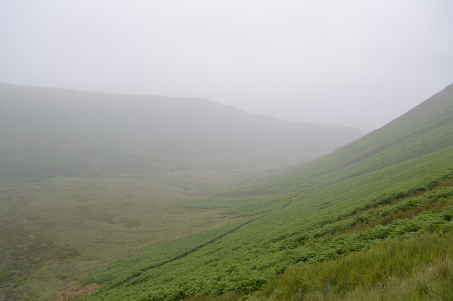 |
| Mosedale. |
We still had to cross Mosedale Beck to reach the eastern flank of Hen Comb but first we needed to negotiate a route across the valley bottom and by the looks of things any trace of a path was flooded and access to said paths had in some parts, been swept away by landslip.
We spot a route and make towards it but only as we got closer we could see this route had turned to bog, there was no use we had to just go for it making use of any high grass that we could use.
It's still pouring down with rain which oddly felt warm and at this point there was no need for gloves although by now my hands do look like I've been in the bath for too long possibly because my walking pole grips are made of hardened foam which retained water until I squeezed hard enough if only to expel the water away.
We had crossed the valley bottom and had reached Mosedale Beck at an agreed ascent point alongside Hen Comb east flank, during the crossing I had eagerly searched for a familiar fence which I knew had a prominent path by, I eventually found the tops of the fence post, the rest of the fence was entangled in a sea of Bracken which prompted a slightly different route of ascent. Mosedale Beck was in full spate and after crossing the valley bottom my right boot had started to leak in, or as David put it "the water is running straight down our gaiters and then finding its way into the boot via the lace eyelets"
I think we've just volunteered to test all the major brands out there who say there clothing is waterproof, because I too am about to prove that theory wrong! |
 |
| Hen Comb summit cairn. |
We had both agreed on a safe spot where we could cross Mosedale Beck by, a place where it would only normally require a few hop skips and a jump but today we knew we'd be getting wet, we found the narrowest part of the Beck yet because it was narrow and with the amount of recent rainfall the channel had deepened meaning our crossing would go with a hop, skip and a dunk.
Slowly I could feel the water trickle into my boot and I guess that's where I said goodbye to anything that felt remotely dry from now on! We ascend steeply sometimes with walking poles at shoulder height keeping the fence post never far from view to our right, it's a tough ascent as David leads and I follow closely behind, this ascent had been on my mind all week and I guess I had built up a mental guard for me to follow although I wouldn't be telling the whole truth if I said that I had to dig incredibly deep, even missing a step wasn't an option I just kept going.
We had reached the top of the fence which now turned north towards Little Dodd, we were still a short distance away from the ridge but spontaneously agreed on a few minutes break where I managed to catch my mid layer under my jacket, blimey, has the rain got through my jacket too? I was able to literally ring my mid layer out like it had just come out the washing machine which just goes to show even though you spend big on expensive brand name jackets and outdoor clothing, nothing is totally waterproof.
We loop hands through pole straps and continue with our ascent and before long we find ourselves on the ridge path which leads via two tiers towards Hen Comb summit by which time the wind and rain is starting to get stronger but it's no less enjoyable, after all, it's only warm rain. |
 |
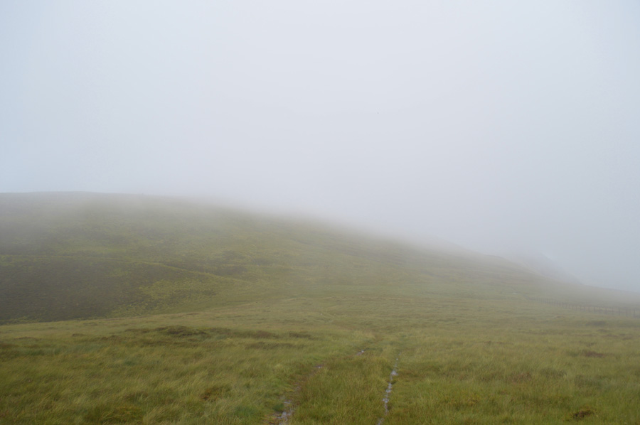
| A sudden gap in the cloud reveals Steel Brow. |
| With the descent of Hen Comb behind we pass over a wooden sty and start to make the slight ascent over Whiteoak Moss, The grassy knoll that is Floutern Cop is out there somewhere dead ahead but all we could see was a wall of cloud although for a few moments it did stop raining enabling me to fold back my hood, not before giving it a good shake that is, I'm now able to listen to the wind as it howls through the wild grasses and incredibly we spot a group of thirteen walkers heading through the upper Mosedale Valley somewhere in between Hen Comb and Mellbreak, at least I thought, we had height as an advantage despite the swell beneath our feet, down there at valley level I can only imagine it's pretty grim underfoot, but it was still nice to see we weren't the only ones out on the fells today. |
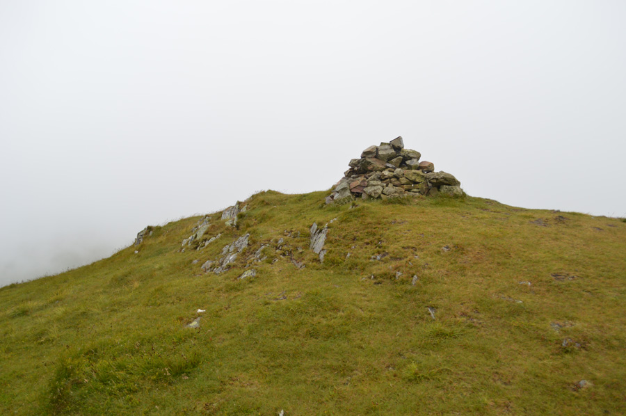 |
| Gavel Fell summit cairn. |
| After passing Floutern Cop to our right we follow a narrow path which eventually would descend towards Ennerdale, instead we tramp onwards towards a wooden gate where we trace a sharp right followed by a sharp left and another right in line with the wire fence which descends across the top of Grain Gill from where the path steadily rises towards Gavel Fell summit. It hadn't rained for the last twenty minutes or so and we were still being treated to sudden gaps in the cloud every now and again which raised hopes that maybe, just maybe the cloud might lift but this never materialised, in fact the cloud came back down and the light faded but before it did we did manage to see quite a vista between the summits and the low cloud leaving me feeling like a sandwich filler. |
 |
| Blake Fell from Fothergill Head. |
We left Gavel Fell behind and with it any hope of long distant views as the cloud once again rolled in and clung to the fell side revealing just a murky view of the route ahead at best, it had started to rain but not heavy and it was optional if hoods were lifted by which time we had decided we either got wet, or wetter.
We can see the wire fence which traces all the way towards Blake Fell summit in the middle right of the photo but a more central shortcut was found which we used to re-join with the summit path some distance further.
We had been on the go for the best part of four hours and we agreed that the shelter found on Blake Fell was probably the best shelter we would get all day. |
 |
| Blake Fell summit shelter. |
We continued to follow the fence steadily until the summit shelter came into view, we had both brought along cold rice for lunch and mine was a little spicy together with sliced tomato and assorted fruit nuts for afters for the much needed energy burst. Then of course came the time when we needed to get up by which time the rain had started to fall pushed along by a much stronger wind that we knew had been forecast, that first few moments before we shouldered took a bit of getting used to I can tell you.
Nevertheless I stood up and hooped my hands through my walking pole straps and strode out making a bearing for Burnbank Fell. |
 |
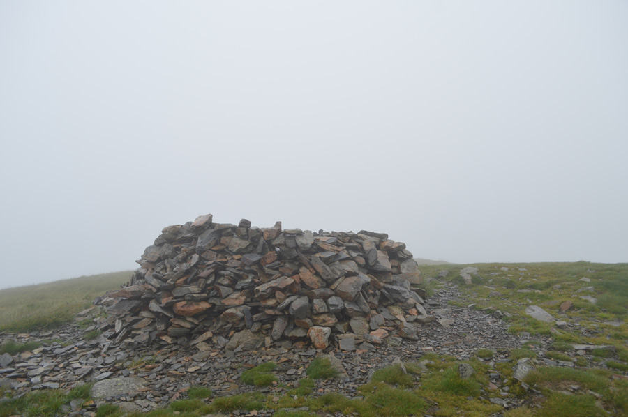
| Burnbank Fell summit cairn. |
With the wind on our backs we arrived at Burnbank Fell summit after an easy ascent over swollen ground, our conditions hadn't changed with the exception that we noticed the strong winds weren't confined to just the summits anymore and like previous summit photos, this one was also taken kneeling down with the wind behind me.
From the summit we tramp in a easterly direction and slowly began our descent first across the summit plateau before following the steep path on the northern flank of the fell which overlooked a distant Fangs Brow where morale was boosted with talk of our last two summits in Fellbarrow and Low Fell, but before hand we needed to negotiate the lanes and bridleways of Jenkins Place and Hudson Place before arriving on the Mosser Road. |
 |
| |
| |
 |
| Darling Fell and Low Fell from Waterend. |
With the descent of Burnbank Fell behind us we made a bearing towards Fangs Brow but before reaching the road we headed through a wooden gate towards Jenkinson Place followed by Hudson Place via open farm land where we encountered large herds of Cows who looked nervously on, we thought it best we give them a wide berth even if it meant tramping through streams and long grasses with bog underfoot.
After passing through Hudson Place the rain had started to fall much heavier than we had experienced all day carried along by those strengthening winds which caused us not to just throw our hoods up but to fasten them down too. We arrived on the other side of Loweswater and it was at this point David was soon going to be within a whisker of where we had left his car earlier which prompted me to ask "David I can't thank you enough for dragging you out today, but if you want to call it a day here I wouldn't blame you one bit"
"Naaa I'm good David replied, I'm not going to leave you here" |
 |
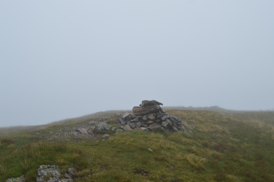
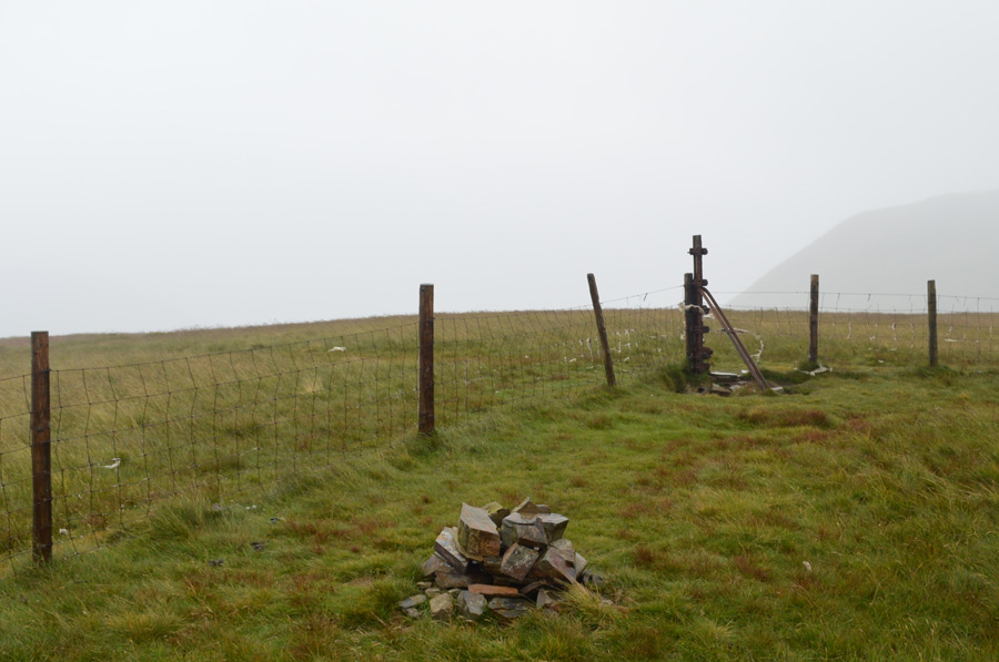
| Fellbarrow Summit Trig Point and cairn. |
The rain would ease at times but the wind was constantly (and thankfully) on our backs, we continued along Mosser Road until we arrived at the familiar farm track where we stopped to observe a herd of cows who stood just yonder off track, the cows had young calfs besides them and again we gave them a wide berth before the path progressed steadily through Bracken and onto open fell side.
It's a route I'm familiar with and we had both spoken of how we might have had to summit Fellbarrow off path as we followed the lay of the fell over wild grasses and heather before arriving at the summit Trig Point, by which time the wind was so strong it was a struggle to keep upright. |
 |
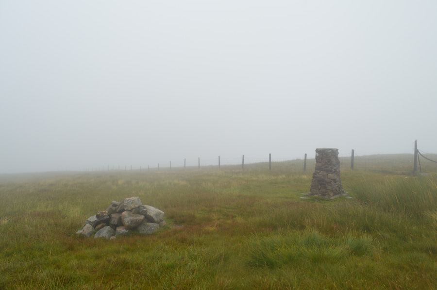
| Low Fell summit cairn. |
We didn't get the chance to speak too much between Fellbarrow summit and Low Fell due to the ever strengthening winds which at times were strong enough to bowl a man over, the only words we did manage was "glad it wasn't like this earlier" and that was it! there was no need for conversation we just needed to reach Low Fell summit, the wind tried its best to prevent us.
We outflanked both Sourfoot Fell and Smithy Fell if only to save on ascent but this didn't stop the sharp ascents found between both outliers before the final steep haul towards Low Fell where the wind almost ripped the waterproof cover off my pack several times, so much so David had to fold it away leaving my pack open to the elements which just goes to show, spending big on packs that come with waterproof covers attached are no match to mother nature when she's at her angriest.
We had previously passed our descent path back to Crabtree Beck on route to Low Fell summit and we doubled back and started to descend instantly feeling the cover that the fell side provided, it was nice to be able to talk to each other again. We crossed Crabtree Beck and followed a path sometimes through thick Bracken and rounded a route around the lower flanks of Darling Fell before dropping on a wide path just above the Loweswater End of Mosser Road. |
 |
| Loweswater. |
We had started to make our descent and each picked our own highlights from the day which despite conditions were plentiful and we both agreed that collecting all seven Loweswater Fells during the same walk was something special. This morning the agreement was to leave one car in Loweswater and the other close to Waterend, then we could drive from Waterend back to Loweswater but it was agreed that the time it would take to take all our wet gear off (in the rain) then drive back to Loweswater it would be quicker if we just made our separate ways at the bottom of Mosser Road.
During the last moments before we reached the bottom of Mosser Road it was going around in my head just how do I thank someone for joining me on such an epic tour of the Loweswater Fells in such conditions as we had today before coming to realise that when you share a common love for the fells, there was no need to thank that person other than a modest handshake, not before arranging another walk.
David strode off in the direction of Waterend and I, Loweswater on what felt like a winters afternoon only with warm rain, I had time to reflect on todays walk which I did as views of Loweswater through the hedges were left behind before thoughts turned to how I am going to effectively kit down in the rain.
I've never drove home commando before, but I guess there's a first time for everything. |
|
| |
| Back to top |
 |
|