|
Walking the Wainwrights in 30 Walks - Walk 22 Eagle Crag to Castle Crag via Greenup Edge |
 |
 |
8th July 2016 |
 |
|
Today I'm back in Lakeland this time collecting six summits within the Borrowdale Valley sometimes affectionately known as the heart of Lakeland. Despite July being the height of summer I again find myself putting trust in to a weak forecast which has blighted the Lakeland fells this week and today was no different with heavy showers predicted throughout the morning before making way for sunnier spells around lunch time.
Because my Wainwright project walks require full days on the fells starting at lunchtime just wasn't an option which meant I could either sit this one out or give my waterproofs a good test, of course the latter won.
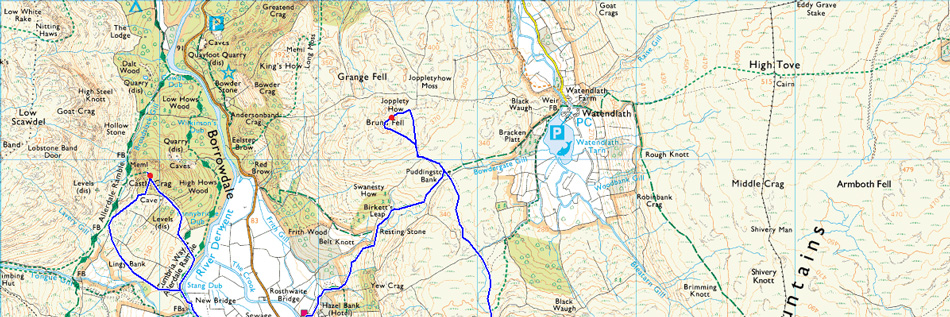
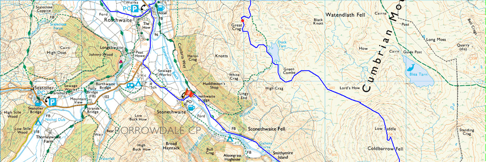
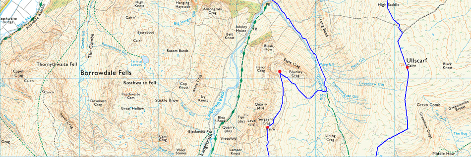
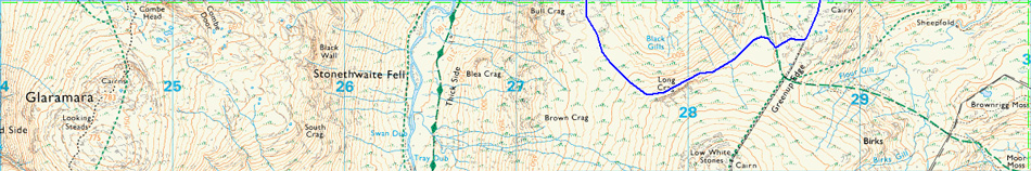
This walk starts and ends in the hamlet of Seathwaite and collects six Wainwright summits in total starting with Eagle Crag and Sergeant's Crag before navigating around the head of Greenup Gill then continuing along Greenup Edge gaining Ullscarf from where I'll descend over High Saddle and Low Saddle continuing towards Dock Tarn then collecting Great Crag which offers impressive views over the Borrowdale Valley.
After summiting Great Crag I continue north crossing the top of Puddingstone Bank and ascend easily towards Grange Fell, again offering panoramic views over the hamlets of Watendlath, Rosthwaite and Grange before descending towards Rosthwaite via Puddingstone Bank. Castle Crag marks my last summit of the day which is ascended after following the River Derwent before breaking away steeply towards my final summit, from where all that was left was to enjoy was the afternoon sunshine back to Stonethwaite. |
|
| Wainwright Guide Books Three and Six |
  |
| The Central and North Western Fells |
-Ullscarf
Of the Lakeland fells over 2,000 feet Ullscarf will generally be adjudged the most central, and it is a pity that Nature has not endowed it with a distinctive super structure worthy of the honour. If only the crags extended a thousand feet higher, and if only the summit took the shape of the Matterhorn! Instead of which the top of the fell is the dullest imaginable. The most central, perhaps but not, alas, a very distinguished pivot! |
 |
|
|
| |
|
Overview |
|
|
| Ascent: |
3,643 Feet - 1,112 Meters |
| Wainwrights: |
6, Eagle Crag - Sergeant's Crag - UIlscarf - Great Crag - Grange Fell - Eagle Crag |
| Weather: |
Heavy Rain During The Morning Turning Brighter pm, Highs of 18°C Lows of 11°C |
| Parking: |
Roadside Parking, Stonethwaite |
| Area: |
Central and North Western |
| Miles: |
14.3 |
| Walking With: |
On My Own |
| Ordnance Survey: |
OL4 |
| Time Taken: |
7 Hours 50 Minutes 08:00am - 15.50pm |
| Route: |
Stonethwaite - Greenup Gill - Eagle Crag - Sergeants Crag - Long Crag - Greenup Edge - Ullscarth - High Saddle - Low Saddle - Dock Tarn - Great Crag - Top of Puddingstone Bank - Grange Fell - Puddingstone Bank -Rosthwaite - River Derwent - New Bridge - Castle Crag Lingy Bank - River Derwent - Rosthwaite - B5289 - Stonethwaite |
|
| |
|
Map and Photo Gallery |
|
|
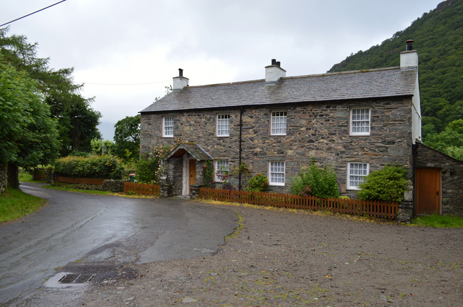 |
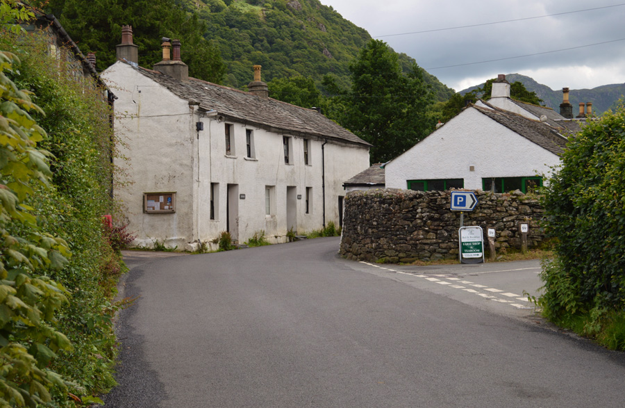
| Stonethwaite cottages 08:00am 11°C |
I had high hopes that the forecasters might have got their forecast wrong as it didn't start raining until I reached Keswick but as I drove along the Borrowdale Road towards Grange rain drops started hitting the windscreen and by the time I reached Rosthwaite the rain fell vertical and seemed to be getting heavier by the minute. I reached the junction and turned left towards Stonethwaite coming to a stop at the familiar parking spaces next to the Phone Box.
It is very rare that I would find myself kitting up in the rain and I even managed to drench my boot laces before putting them on, at one point the rain was falling so heavy I retreated back to the drivers seat where I slid my waterproof over my trousers over my shorts and then added my Gaiters over them, if only for extra proofing. At the side of the parking spaces a van is making a delivery to a local farm as I get out in between the rain burst this time finishing off kitting up under my tailgate, it takes me the best part of fifteen minutes to kit up adding my the waterproof cover over my pack, and even a handy little rain cover that wraps around my camera case which I might add, restricted camera use although with the rain so heavy I didn't bank on taking too many photos anyway.
With my car eventually locked I head out towards Stonethwaite Bridge passing pastures full of Herdwicks who shield themselves against the rain by standing as close to the stone walls, up ahead through the murk of rain and low cloud I get my first view of Eagle Crag. |
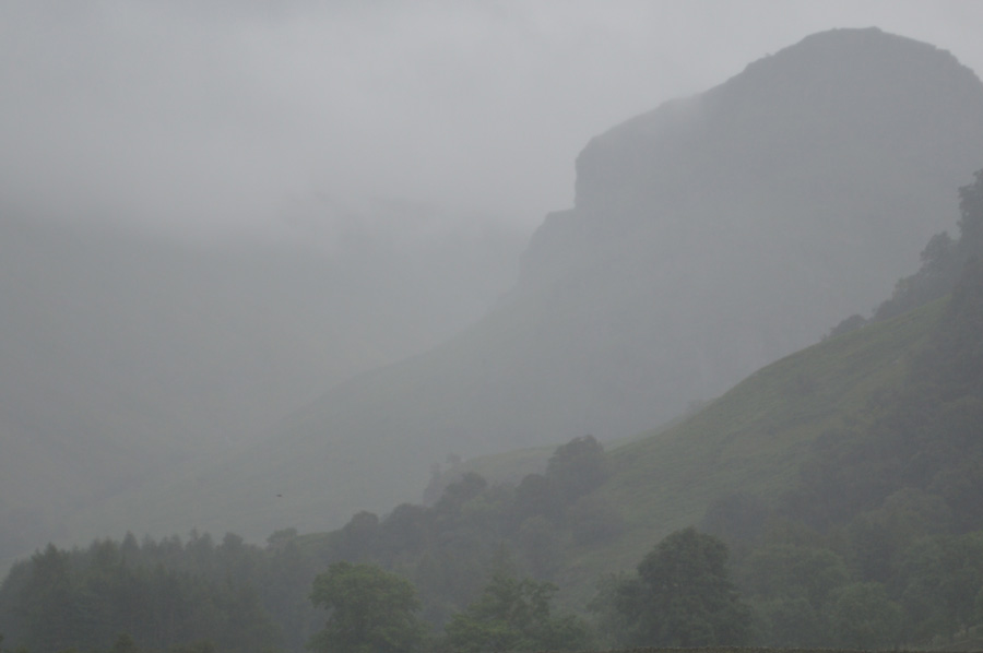 |
| Eagle Crag from Stonethwaite Bridge. |
| |
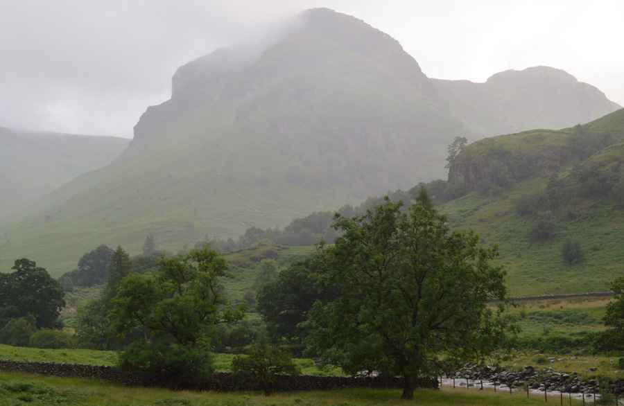 |
| Eagle Crag and Sergeant's Crag. |
After crossing Stonethwaite Bridge I turn right accompanied by the sound of Stonethwaite Beck, I follow a stone track flanked on one side by a stone wall while overhead a canopy of trees shield me from the prolonged rain. On the other side of Stonethwaite Beck the campsite at this time of year is usually full but only one hardened camper is braving the rain whose tent is looking rather misshaped, no doubt due to the heavy rain.
I leave the canopy of trees behind and keep following the stone wall as I glance up at Eagle Crag where bracken covered lower slopes, I can clearly see various routes which ascend up the nose of the fell via Bleak How and Heron Crag and remember my first visit here sometime ago where I ascended steeply straight up the nose of the fell but that was on a beautiful summers day, the contrast of which couldn't have been any more different than that of today. |
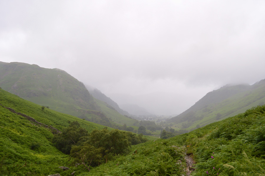 |
| Murky views back along Greenup Gill towards Stonethwaite. |
It continued to rain as the path underfoot steadily got steeper close to the point where Greenup Gill flows in Stonethwaite Beck, water by now was flowing over the top of the path which had by now started to resemble a stream, the sound of Greenup Waterfalls fell away steeply to my right drowned out the wind which was now blowing from the head of the valley, for some time I tried not to look up mainly to keep up momentum and secondly to keep the rain from my face.
I reached a point where I had now passed the mass of Eagle Crag to my right and continued towards a narrow point at Greenup Gill, it's a familiar target to aim for when ascending Eagle Crag via Greenup Gill. The path steepened but just yonder I could see the flattened ground which makes an ideal point to cross Greenup Gill, the thought of what spate the water was in was never far from mind although I reckoned I couldn't get any wetter than I was already.
I descended slightly to a spot where I am familiar with but the rocks that could be used as stepping stones were completely submerged with fast flowing water over the top, to add to this on test they were slippery too. Instead I track up stream spying what looked like a safe crossing point but found either the water too deep or the rocks too slippery, further upstream I managed to cross but I still couldn't avoid the water going over the tops of my Gaitors yet on reaching the side of the bank I thought my socks had escaped a soaking, that was until I found myself in a reedy bog that soaked my boots and socks far worse than the crossing of Greenup Gill did.
Moral was boosted incredibly by seeing a young Fox no larger than a domestic Cat with a long brown bushy tail of equal size to its body, there was no chance of a photo and upon climbing higher I looked around for it but knew it would have been long gone by now. I've only ever seen two wild Fox's in all my time as a fell walker and they have both been within half a mile of Eagle Crag. |
 |
| Sergeant's Crag from Eagle Crag summit. |
There is no denying that the ascent from Greenup Gill in order to gain Eagle Crag is without its steepness and at times I found my walking poles alongside my shoulders such the incline of the fell side, after a good twenty minutes slog and toil in the rain I found myself on the far shoulder of the fell before starting to make my way towards the summit, which was unseen due to a series of grassy outcrops. Paths do ascend over the outcrops but I always opt to go around them on the back of an already steep ascent.
A stone wall is reached which is flanked by a wire fence, it would seem that the summit is more difficult to reach from this side unlike if ascended by Bleak How where there is a path to follow, here the land owners have placed a wire fence a foot away from the stone wall but over time many a walker has bent and coiled the fence wire enough so if you duck down (pack included) you should be able to get under then climb over the wall.
Eagle Crag summit is now in sight but an area of marshy ground needs to be crossed first, even after weeks without rain I've always known this area below the summit as wet and boggy.
There was a chill in the wind by the time I reached Eagle Crag summit but at least for now it had stopped raining and I was able to take in the views through the Langstrath and Borrowdale valleys. The summit rock was starting to dry out but it still remained greasy in places so I kept below it, every now and again it would start raining again but these bursts would sometimes only last a few moments if that at all which was reassuring. From the Eagle Crag summit I start to descend towards the familiar stone wall which straddles the ridge between Eagle and Sergeant's Crag. |
 |
| Sergeant's Crag, The Langstrath Valley and Glaramamra. |
| Below the cloud at the head of the valley you might just be able to make out Rossett Pike while Bow Fell is still under cloud. For those of you who may watch Countryfile the opening scene is taken from the Langstrath Valley, sadly my helicopter is in for repairs or I would have included a similar shot. |
 |
| Langstrath. |
| |
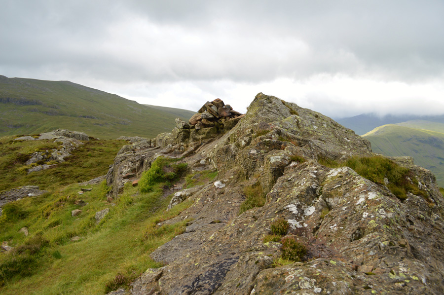 |
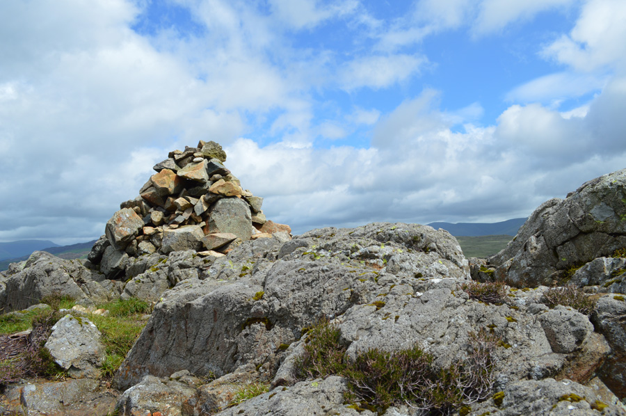
| Sergeant's Crag summit cairn. |
I follow the stone wall over boggy ground towards Sergeant's Crag summit, there is only little effort required to reach the summit yet with the rock still feeling greasy underfoot I test my footings first.
From the summit I can get a view of my route which follows the head of Greenup Gill before tracing a route towards Greenup Edge and Ullscarf but there's plenty of bog hoping to do before I get there.
I dip below the summit as highlights of sunshine trace across the valley floors before I spot a shower heading towards me, I gain enough time to reach the footings of the summit before backing myself into a crevice found just below the summit, in a strange 'boyish' kind of way it felt good to have beaten the shower in advance, it especially felt good watching it from my little sheltered spot as it moved its way across towards Greenup Edge. |
 |
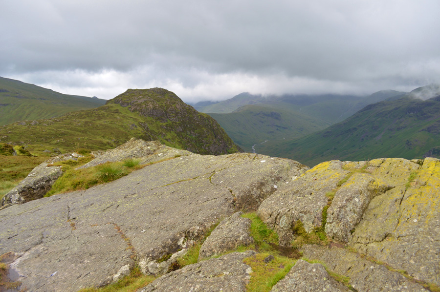
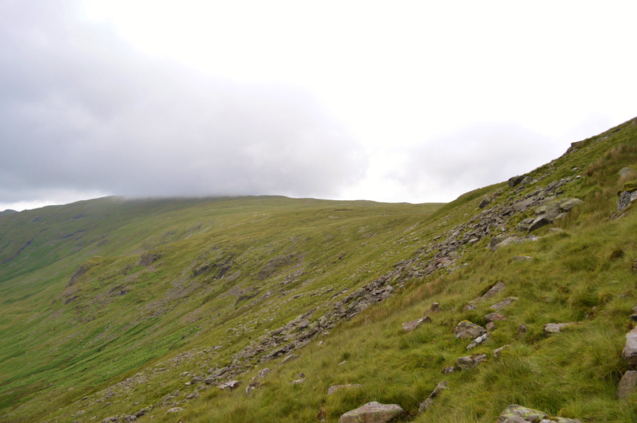
| Ahead, High Raise (Langstrath) and Long Crag. |
My route now follows along the top of Greenup Gill and towards the rocky area ahead known as Long Crag, my initial plan was to summit Long Crag which will gain me good ground on reaching Greenup Edge thereafter but instead I opt to traverse below Long Crag which will mean a sharp pull is required until I reach Greenup Edge, it may not look it in the photo but it's extremely wet and boggy between here and there.
Incidently this is the area where I first saw the wild Fox a few years ago, it was drinking from a pool of water, we stared at each other for a few seconds and I even managed to take a few photos before it trotted off right through the middle of a flock of Sheep who strangely, weren't scared off by its presence. |
 |
| Cloud still obscures Bow Fell while the sunlight breaks through over Rossett Pike and the Stake Pass. |
| |
 |
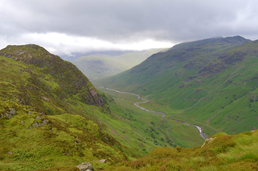
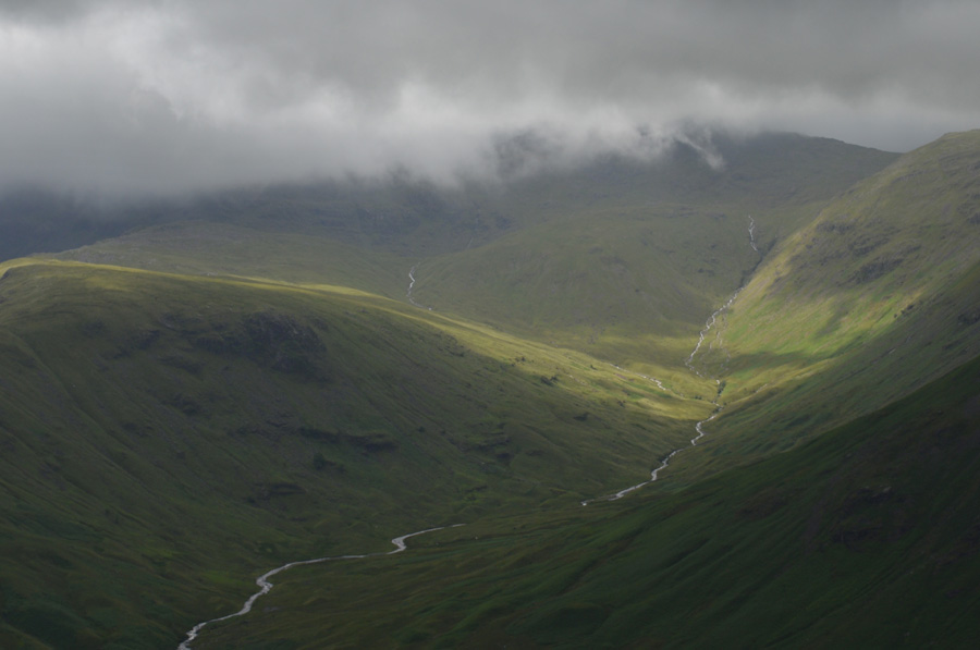
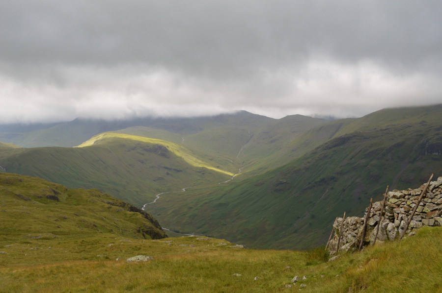
| Greenup Edge from the head of Greenup Gill. |
Having made up my mind to instead traverse below Long Crag I followed a faint singular grassy path which was easy to follow offering views into Greenup Gill and Lining Crag, ahead I still needed to gain some height which I did when the boulder field was reached up ahead, it was only a short but steep ascent with views of Low White Stones (behind me) and Ullscarf up ahead.
Greenup Edge was by far the boggiest section of the whole walk by which time my socks had semi-dried out but this wasn't to last as no sooner had I reached the path I found myself at times ankle deep in bog water causing both feet to squelch around in my boots.
To my right I had just missed two guys who by now are making an ascent on High Raise via Low White Stones who were both wearing shorts but seemed to ascend at a good pace. I finally pick up the path on Greenup Edge close to an old metal fence post which lined the path all the way to Ullscarth summit.
Greenup Edge is as expected boggy and I have no options other than to wade through the drenched mosses which eventually left my feet feeling cold, to my left I a spot a guy who's heading for the Lining Crag route back to Greenup Gill, I'm pleased it's not just me who wasn't put off by todays forecast. |
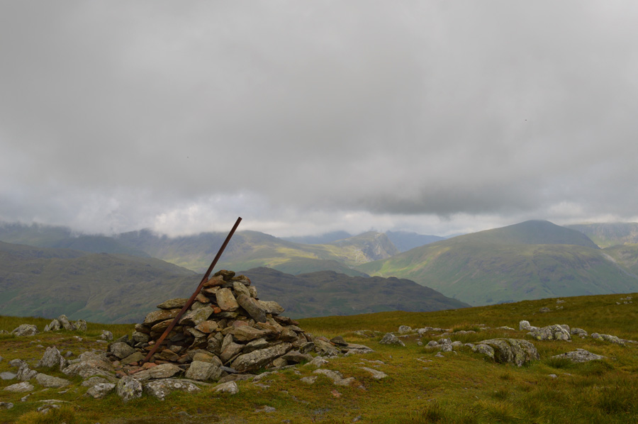 |
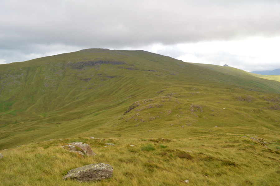
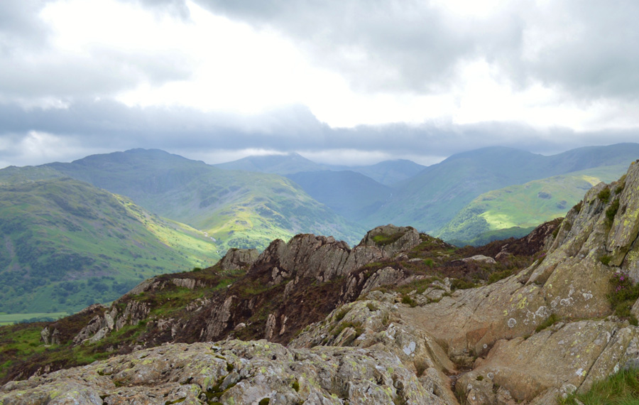
| A distant Fleetwith Pike from Ullscarth summit cairn. |
| From Greenup Edge a steady ascent is required to reach Ullscarf summit which although I never gave it much thought at the time I think ranks as one of my favorite summits. Surrounding summits are starting to be revealed as the morning cloud starts to lift away. By now I can just about make out Great Crag and I can even spot the southern tip of Dock Tarn which is were I'm heading next. |
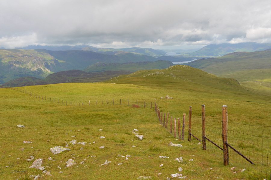 |
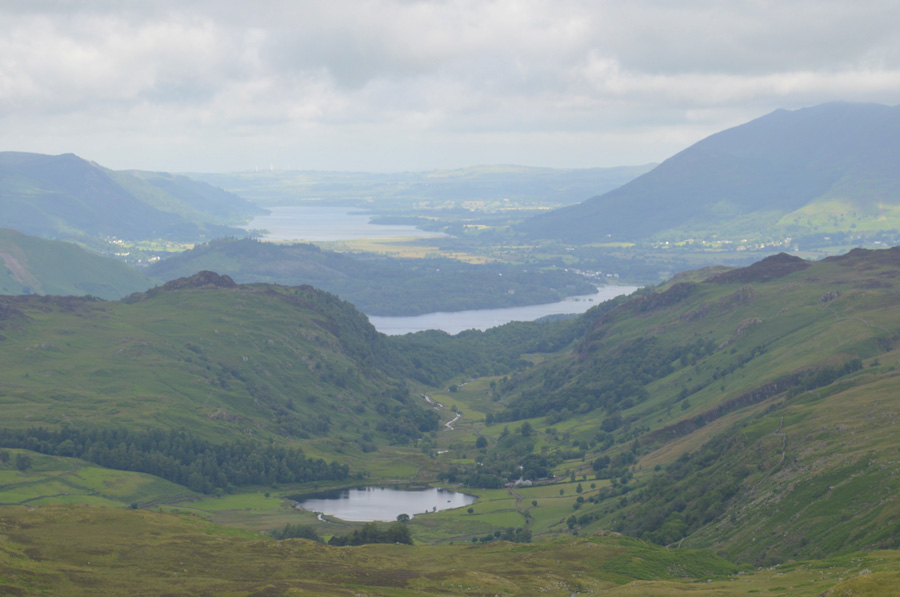
| Distant views over Skiddaw, Derwent Water and Bassenthwaite Lake High as I descend towards High Saddle. |
| Great Crag can be seen over in the middle left of the photo and to reach it my route will take me first over High Saddle as seen in the foreground, there is a singular path to follow and it's unexpectedly dry too, well for now anyway. |
 |
| Views over Blea Tarn towards Raven Crag, Clough Head, Great Rigg and Blencathra. |
| |
 |
| Distant views over Watendlath Tarn, Watendlath Beck, Derwent Water and Bassenthwaite Lake. |
| |
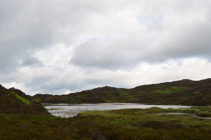 |
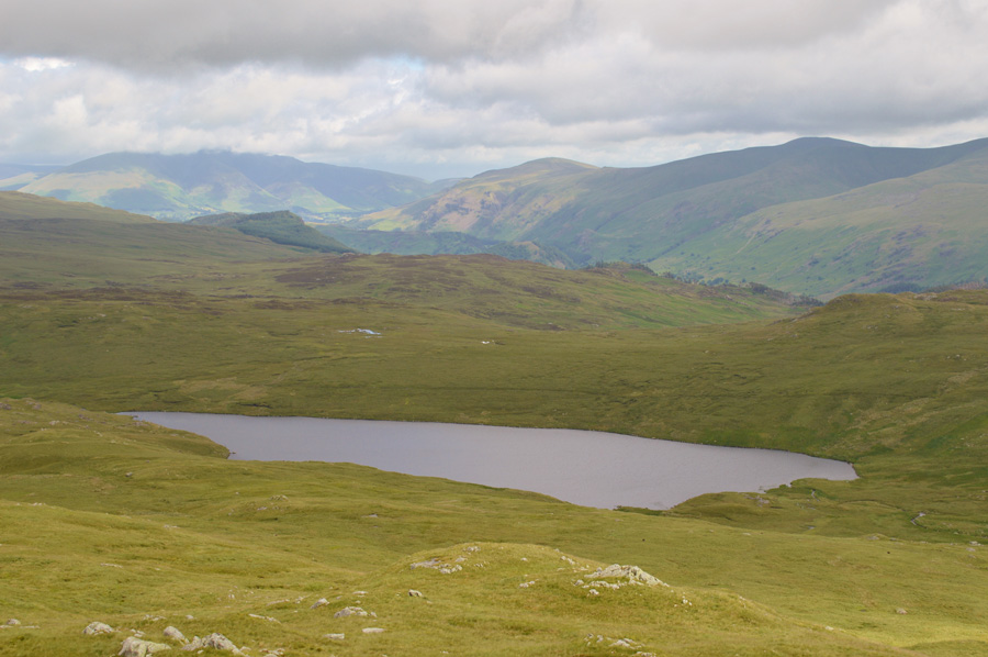
| Dock Tarn. |
The area between Low Saddle and Dock tarn is notoriously boggy and after this mornings rain had made the crossing pretty unpleasant hence my lack of photos. A singular grassy path leads much of the way towards Green Combe but this path soon disappears within the peat hags and marshland found round about half way, I had given up on trying to keep my feet dry and maintained a bearing towards Green Combe, I was only a short distance away feeling quite peeved off at having to dodge around the many bogs and hags, the sight of Green Combe was most welcoming before my right leg was submerged up to my knee in bog water, it was quite a struggle to pull it out at a time when reserves are already being tested
I soon found myself looking down on Dock Tarn, it's still quite a marshy area between Green Combe and the Dock Tarn but for now, at least the worst of the bogs are behind me. |
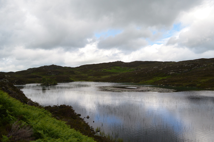 |
| Dock Tarn. |
| It felt great to be on solid ground again! |
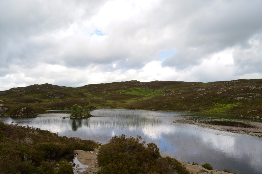 |
| Dock Tarn. |
| |
 |
| Great Crag summit. |
I followed a stoney path which was quite muddy but much easier to deal with than previous for which I was thankful for, ahead I could see a gathering on Great Crag summit by which time the sun had come back out, I left the shore path half way around Dock Tarn and started to make the easy ascent on Great Crag.
I ascend the last section of the craggy outcrop and make my way towards the north summit cairn passing the south cairn first, the only difference between both summits is just four meters and I guess it's easily confused. The group of walkers who I had seen standing at the summit from Dock Tarn are preparing to leave as I approach and nod's are exchanged before they start to descend, my summit time was kept brief due to it almost being lunch by which time I was feeling hungry, however my plan is to only eat lunch at Grange Fell which is about half an hours walk away. |
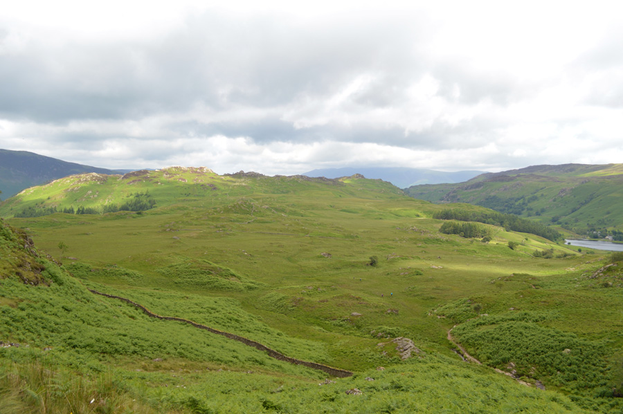 |
| Grange Fell seen over Puddingstone Bank as I descend Great Crag with a glimpse of Watendlath Tarn over on the right. |
| The group of walkers who had been sat at the summit had by now descended and are about to cross the marshy area below where wooden signs direct the walker across via a grass trod. |
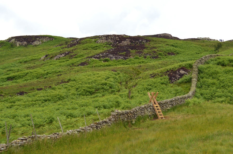 |
| Grange Fell seen after passing over the top of Puddingstone Bank. |
| The walkers are by now close to the summit just up ahead. |
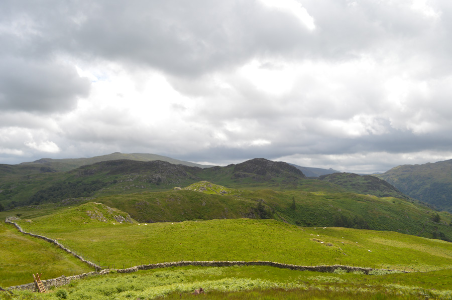 |
| Views back towards Ullscarth and Great Crag from my ascent on Grange Fell. |
| Lunch time had arrived and I was looking forward to taking my first rest of the day right about the time the sun decided to come out. |
 |
| Distant views of Rosthwaite Fell (Bessyboot) Glaramara, Great End, Esk Pike, Seathwaite Fell, Base Brown and Green Gable. |
I reached the summit of Grange Fell and said hello again to the family who I had seen back on Grange Fell who were tucking into their lunches, on the other side of the summit who I heard were heading for Castle Crag next which got my attention as I wondered would they be using the same route as myself, with their lunches packed away they re-shouldered and started to descend leaving me thinking that I was sure to see them again. Another couple had arrived who also broke out lunch by which time the sun had been over shadowed by cloud again which left a cool wind blowing.
I was a little surprised to see that a large area of heather had been on fire just below the summit, not having heard about it I can only assume it's the result of a camp fire that got out of hand. |
 |
| Descending Puddingstone Bank with views towards a distant Great End. |
| |
 |
| Here we have Rosthwaite Fell (Bessyboot) seen with Combe Head Thornythwaite Fell, Seathwaite Fell and Great End. |
Assured that there was no more rain on its way I decided that it was time to take off the waterproofs which I did after finding a large boulder to rest my gear and pack on, during summer I always wear shorts even underneath overtrousers which has zips right up to to thighs meaning I could step out of them whilst still wearing boots, I can tell you it felt good to get the owd legs back out.
The back of my jacket was still wet so I rolled it up as carefully as I could before placing it into my pack, as for my Gaiters which were in a right state they got rolled into a carrier bag and packed away, within minutes I looked and felt fresh again despite my pack being quite a bit heavier now.
I took to descent again and heard someone shout excuse me! quite loudly, it was a young chap on a mountain bike who thanked me for standing aside to let him pass, further down the path at a gate he was taking a break and we took up conversation about both our hobbies (if you can call them that) and how much the Lake District can change lives, he told me he had a Geography Degree and had spent much of his time studying in the Lake District despite coming from Liverpool we also shared a bit banter about him being a scouser at me a woollyback, it's just something two people who come from Liverpool and Wigan do.
We bid each other a good day before he opened the gate for me "might see ya again la" aye tha mite I said, laughing. |
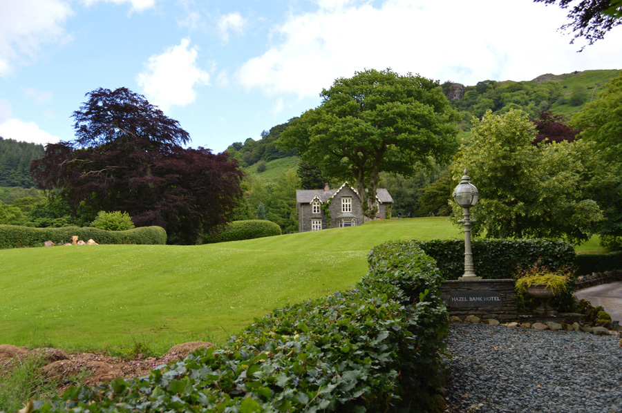 |
| Hazel Bank Hotel close to Rosthwaite. |
| |
 |
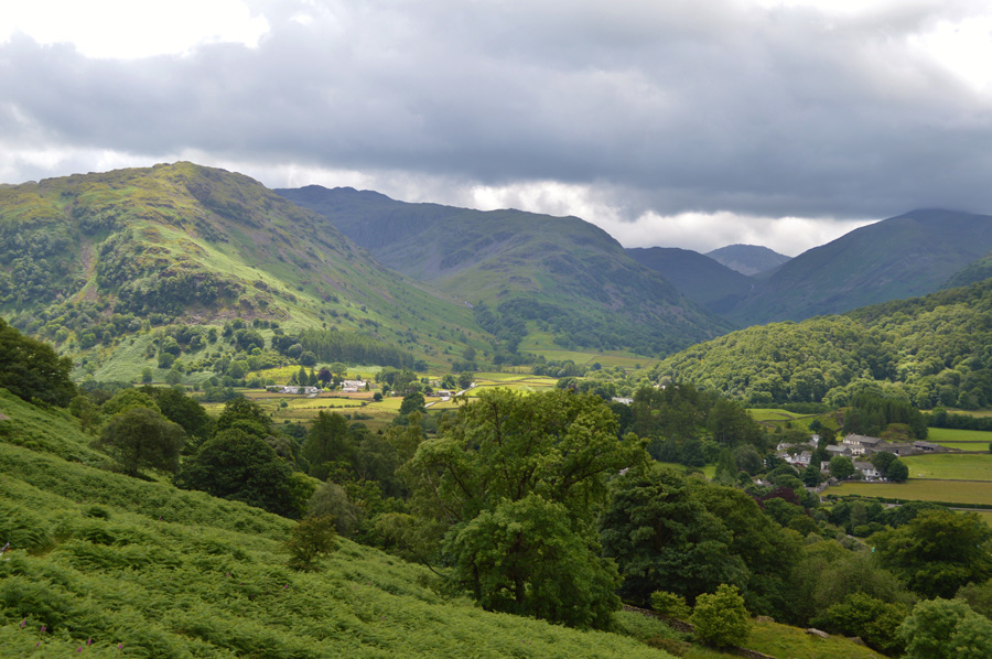
| Rosthwaite. |
| After descending Puddingstone Bank I passed Hazel Bank before crossing Stonethwaite Beck, then turned right here sign posted Yew Tree Farm Quest House and Tea Room. I pass the Tea Rooms which had a couple of people inside and one fella outside and we shared a 'how do' before I continued through the Farm towards the River Derwent as views over my final summit started to open out over the farmland. |
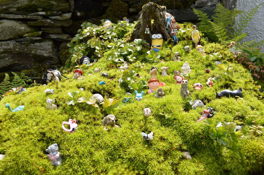 |
| A moss covered tree stump is home to many a Rosthwaite resident. |
| |
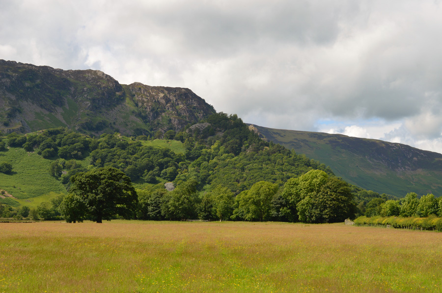 |
| Views towards a tree covered Castle Crag. |
| |
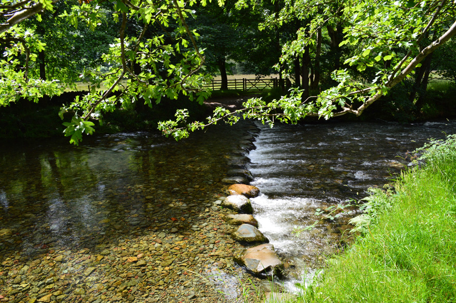 |
| River Derwent stepping stones. |
| |
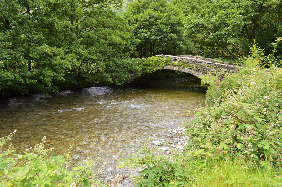 |
| New Bridge. |
| After last Decembers storms New Bridge was closed off until it had been inspected by the local Authorities and by the looks of it I think it's back open again having passed inspection. |
 |
| Castle Crag summit. |
After crossing New Bridge I followed the River Derwent first passing my Lingy Bank descent route before continuing towards the steep ascent through the trees, the path is quite steep from the start but rises quickly towards a familiar wooden sty directly below the slate zig zags, by the time I reached the sty a minute break was in order.
Just ahead a woman with a small Terrier starts her ascent through the zig zags stopping as one chap asked about her dog, I pass with hi's first passing the slate art found just below the summit before emerging through the trees as wide open views over Derwent Water and beyond open out before me. |
 |
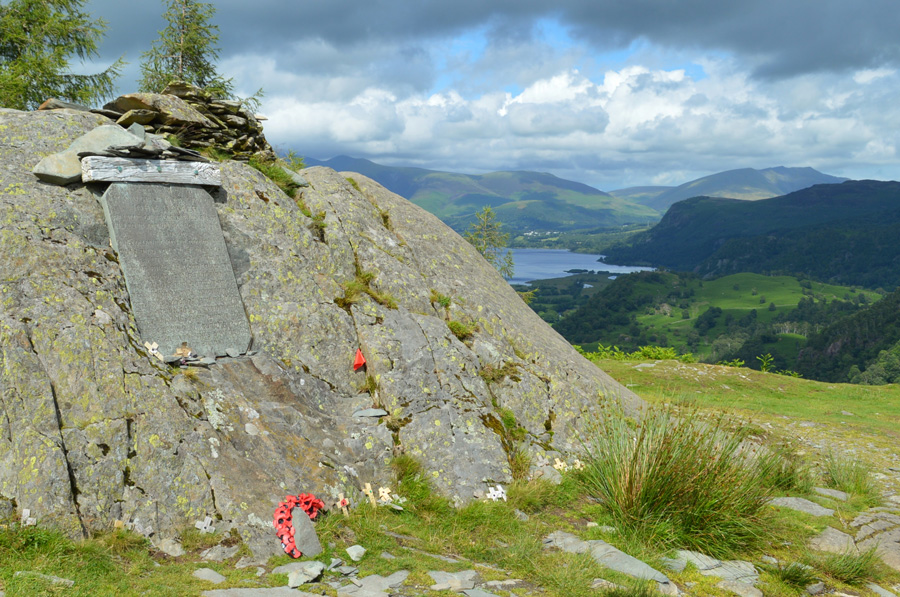
| Derwent Water, Skiddaw and Blencathra from Castle Crag summit. |
| |
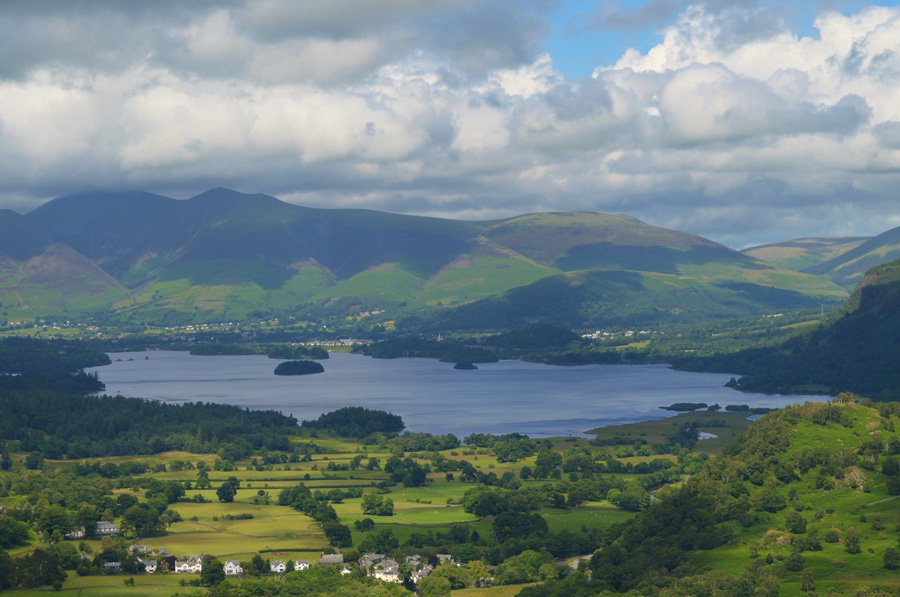 |
| And here's a close up with Grange in the foreground. |
| I left the woman taking in the views and reading the Memorial Plaque before starting my descent via the slate ziz zags which is where I bumped into the family again who I had overheard them talking about heading to Castle Crag next, I'm not sure which route they took and with them having a good fifteen minutes on me I didn't expect to see them arriving at the summit now, I can only assume they stopped off somewhere along the way or I've got legs like Usain Bolt. |
 |
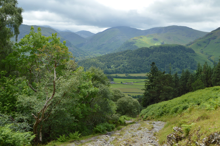
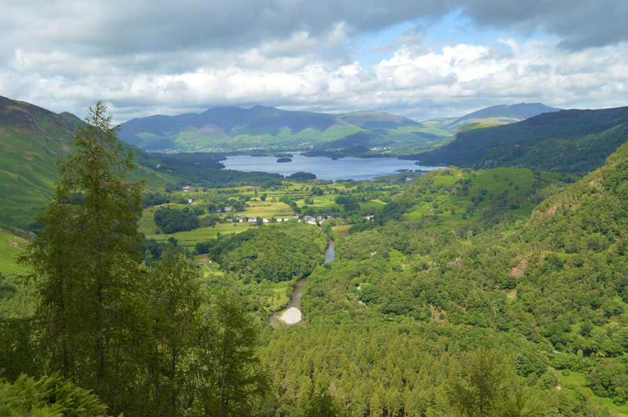
| Descending Lingy Bank into the Jaws of Borrowdale. |
| |
 |
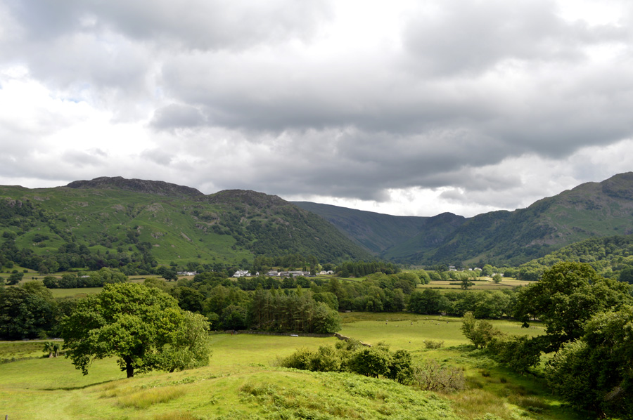
| Eagle Crag and Greenup Edge from Stonethwaite. |
After descending Lingy Bank with heart warming views over the Borrowdale Valley I retraced my route alongside the River Derwent passing families and fell runners along the way. Close to Rosthwaite a Dry Stone Waller repairs the top section of a stone wall that accompanies the path back to Rosthwaite, he is chatting to another local both with strong Cumbrian accents so much so I struggle to pick up some of the words, we smile and nod nevertheless as I pass before arriving back at the Tea Rooms where around the side, walkers and tourists enjoy tea and cake under a warm afternoon sun.
I turn right at the junction and head back to Stonethwaite passing the Scafell Hotel along the way as a gang of motor cyclists riding Choppers and Harley Davidsons slowly ride through yet as Impressive as those bikes were, they did disturb the afternoon silence but were soon on there way followed by an open top bus who thankfully gave me a wide berth along the narrow lane. With views of Rosthwaite Fell and Thornythwaite Fell I turn left and head towards the Stonethwaite village first passing Borrowdale C.E Primary school where children play on a running field at the side of the school, an old chap passes me riding a road bike but he doesn't make eye contact and returns five minutes later and does the same.
Ahead views over my first summit of the day start to open out below Stonethwaite and I tell myself to return to the same spot as I had this morning if only to reflect on what a great day I had had, it's hard to believe that on this spot eight hours earlier I could only just make out the outlines of Eagle Crag while now the only memory I have of that views is a carrier bag full of wet waterproofs. |
|
| |
| Back to top |
 |
|