|
Walking the Wainwrights in 30 Walks Walk 19 - An extended Longsleddale Circuit |
 |
 |
26th June 2016 |
 |
|
I wasn't supposed to be walking this weekend due to work and with a low confidence forecast I had kinda wrote Sunday off, that was until a weather window presented itself which had forecast a largely dry morning which would deteriorate by early afternoon, by my reckoning and, if I plan an early start I should get a good seven hours walking before the weather was forecast to turn.
Which, left me with a rather tight schedule...
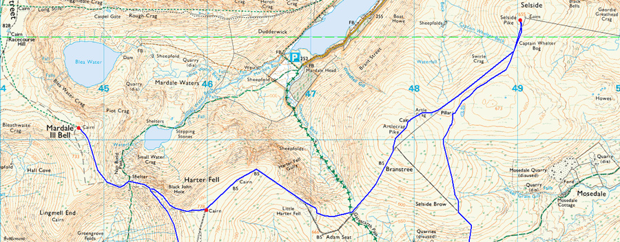
Todays walk collects eight Wainwright summits familiar to the secluded Longsleddale Valley with two further afield summits; Mardale III Bell and Selside Pike which are the result of how I mapped the routes last December for which I offer my humble apologies as both summits look like they have been Blue Tacked onto the original route which kinda left me feeling like I'd just added go faster stripes to a classic E-Type Jaguar.
I had no other choice than to go with my original plan which meant a rather arduous 'out and back' in order to gain Mardale III Bell from Harter Fell, then only to retrace my steps back to Harter Fell summit via the top of Nan Bield Pass but I had a little trick up my sleeve in order to at least take some 'ard' from arduous. I then used the time it took me to reach Selside Pike to recharge my batteries even opting to take five at the summit shelter before rejoining the original route at Selside Brow all the while trying to maintain a healthy pace before the rain arrived.
I had a seven hour window, here's how I got on. |
|
| Wainwright Guide Book Two |
 |
| The Far Eastern Fells |
-Grey Crag
There is nothing remarkable about Grey Crag, but here Lakeland may be said to start and moorland country to end, and the transition is sudden: the quite beauty gives place to romantic beauty, placid scenery to exciting. One looks east, and the heart is soothed; west, and its is stirred. |
 |
|
|
| |
|
Overview |
|
|
| Ascent: |
4,495 Feet - 1,371 Meters
|
| Wainwrights: |
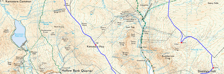
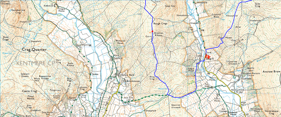
8, Shipman Knotts - Kentmere Pike - Harter Fell (Mardale) - Mardale III Bell - Branstree - Selside Pike - Grey Crag - Tarn Crag (Longsleddale) |
| Weather: |
Overcast With Sunny Spells, Cooler Than That of Late. Highs of 17°C Lows of 11°C |
| Parking: |
Sadgill, Longsleddale |
| Area: |
Far Eastern |
| Miles: |
14.5 |
| Walking With: |
On My Own |
| Ordnance Survey: |
OL5 |
| Time Taken: |
6 Hours 55 Minutes - 07:05am - 14:00pm |
| Route: |
Sadgill - Longsleddale Pass - Shipman Knotts - Kentmere Pike - Harter Fell (Mardale) - Top of Nan Bield Pass - Mardale III Bell - Top of Nan Bield Pass - Harter Fell - Top of Gatescarth Pass - Branstree - Artle Crag - Selside Pike - Selside Brow - Brownhowe Bottom - Tarn Crag (Longsleddale) - Grey Crag - Great Howe - Sadgill |
|
| |
|
Map and Photo Gallery |
|
|
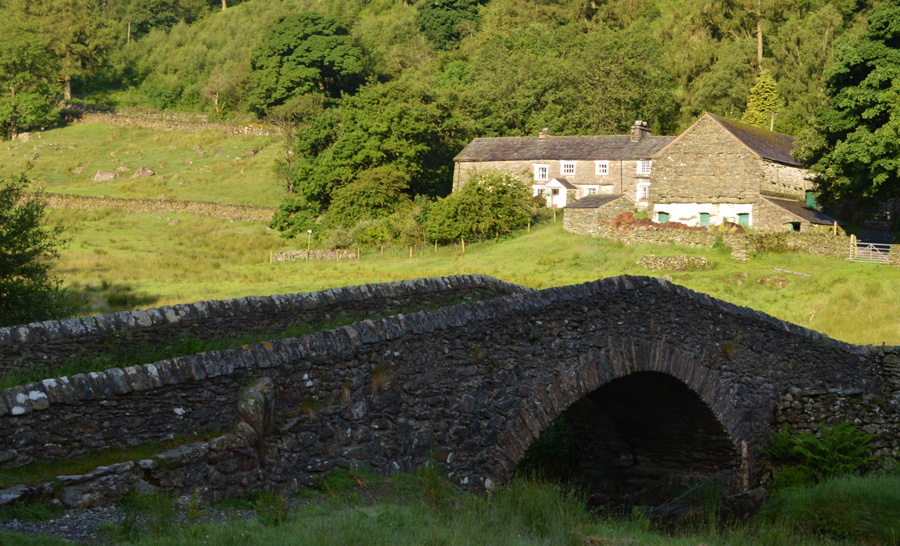 |
| Sadgill Farm from Sagill Bridge 07:05am 11°C |
The Longsleddale valley is roughly 75 miles from home and because of this I can reach Sadgill in around an hour and a half, around the same time it would take me to reach the Forest of Bowland which strangely enough is found closer to home. I had a trouble free drive but I wasn't to over enthusiastic sometimes encountering rain showers and fog for much of my journey north until I reached Jct 36 where I exited and made the short drive along the A591 before turning right sign posted Burnside and thereafter the Potter Fell Road towards Garnett Bridge.
The skies had somehow brightened as I reached the valley of Longsleddale although I still had a lengthy twenty minute drive until I would arrive at the hamlet of Sadgill, slowed further down by the over grown hedges which obscured views along the narrow and twisting lanes, I wasn't complaining though as I was still running ahead of schedule and I used the free time to go though my kit which comprised of everything waterproof should I get caught out later on.
There were only two cars parked up close to Sadgill Bridge, both of which looked like they had been there all night due to last nights rain condensation on the windows, on the other side of a stone wall close to the River Sprite two tents had been erected, their occupants still asleep judging by the lack of noise and movement, with my car backed up to one of the all nighters I kit up rolling my jacket as neatly as possible into my pack along with a pair of waterproof over-trousers to be worn underneath my shorts should I need them.
Sorry, can I just go back a sentence, just how do you neatly roll up a jacket into a pack? I'm about as good as folding a jacket as I am wrapping a Christmas present, bloody pants at it.
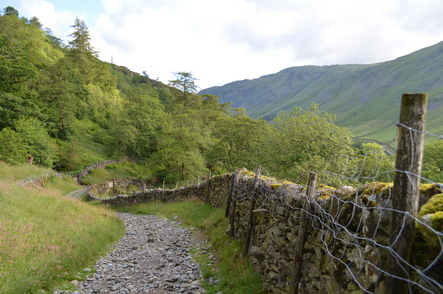
It's still early which gives me breathing time despite my schedule I want to make sure I've left nothing behind, feeling content that I have everything I lock my car and head towards the Longsleddale Pass, first passing through Sadgill Farm before I pick up the stone track which links the valleys of Longsleddale with Kentmere. |
 |
| Pausing to look back over Sadgill Wood towards a distant Buckbarrow Crag. |
| |
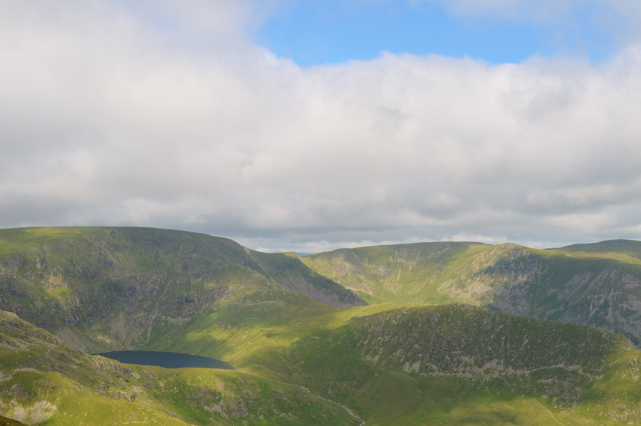
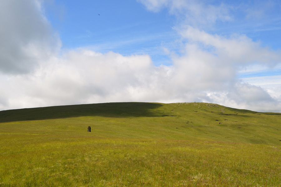
 |
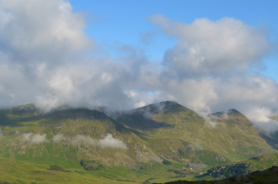
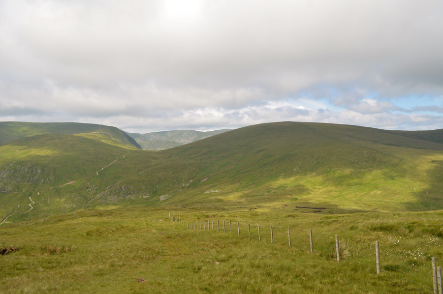
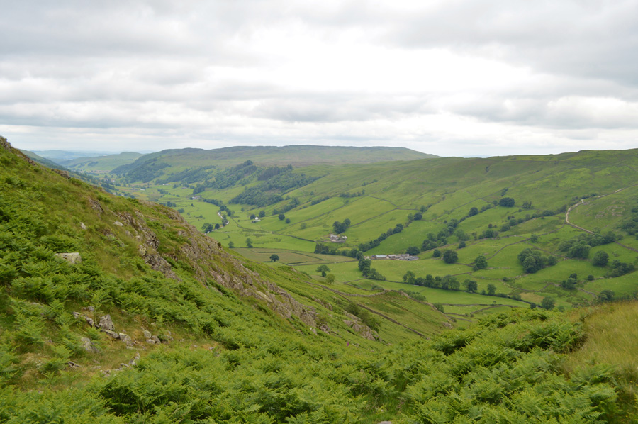
| Great Howe and Grey Crag as I start to head out of Longsleddale. |
| It's never a good idea to look back on your last summit before you have reached your first, but I just couldn't resist the morning light. |
 |
| The Longsleddale Pass. |
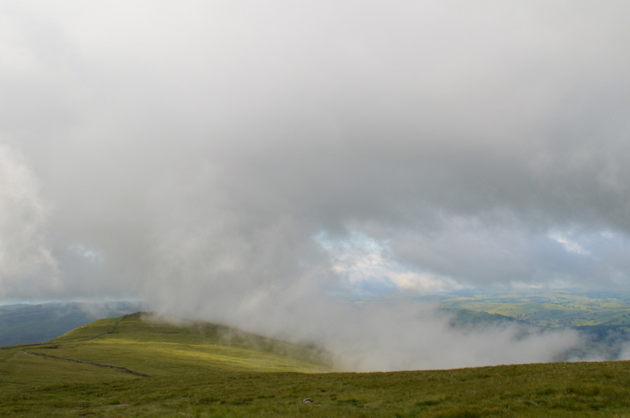
After a steady climb the Pass takes an abrupt right turn after passing through the gate, here the path steepens through a dog leg as views start to open out over Cocklaw Fell, Green Quarter and lower Kentmere, despite the generous views however, the cloud in some parts clung to the tops of the telegraph poles on the Kentmere side while over in Longsleddale, a strong sun generated a slight haze.
The contrast of light was sporadic to say the least leaving the fell side looking like a typical Lakeland morning while over the Kentmere side of the valley you could be forgiven for thinking it was a fresh October morning which created some great atmospheric views during the early stages of the walk. |
 |
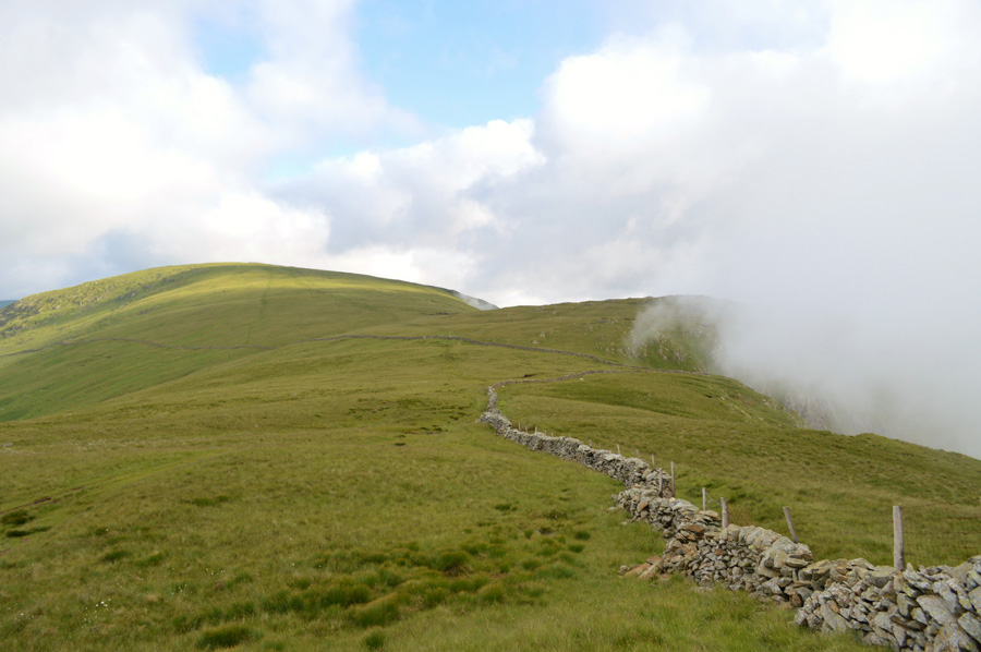
| Follow the wall all the way towards Wray Crag and Shipman Knotts summit. |
I followed the Longsleddale Pass until I reached a wooden gate which marks the top of the Pass, after the steady climb I had started to feel the heat of the morning sun but thankfully a slightly chilled breeze was met to cool things down.
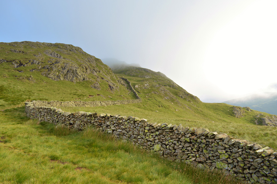
Ahead is Wray Crag and thereafter Shipman Knotts summit which can be gained from the top of the Longsleddale Pass, most would gain Shipman Knotts via Wray Crag but first a bit of bog hopping is called upon along this section of flat ground before the ascent begins. |
 |
| The morning cloud starts to lift from the summits of Yoke, III Bell and Froswick above the Kentmere Valley. |
| "Like the knuckles of a clenched fist" Alfred Wainwright. |
 |
| Shipman Knotts. |
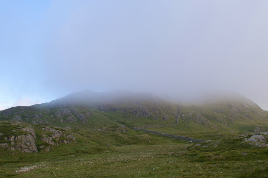
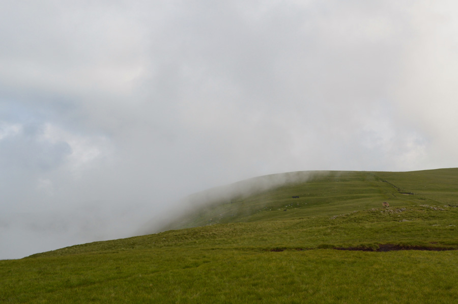
| The light had started to fade by the time I reached the shoulder of the fell, up ahead hill fog had rolled over the ridge from the Kentmere side of the ridge and had obscured the summit of Shipman Knotts but, with all that blue sky in the distance, I wasn't too worried. I press on still keeping with the stone wall while avoiding the bogs when possible. |
 |
| That's much better. |
| The sun had returned and had started to burn through the hill fog cloud, all within a matter of minutes. |
 |
| Goat Scar and Kentmere Pike from Shipman Knotts summit. |
The light was starting to get more sporadic with sharp spells of sunlight followed by low light and hill fog which crept in over the ridge from both adjoining valleys, in this shot, from the Longsleddale side.
A great time to be out on't hill. |
 |
| Looking back on Shipman Knotts as more cloud rolls over the ridge. |
| This time, from the Kentmere side, |
 |
| Kentmere Pike summit Trig Point. |
Since the cloud was playing dramatics overhead I didn't quite know what to expect as I crested Kentmere Pike summit shoulder, however as it turned out I managed to get a long distant view of the summit Trig Point just as the cloud began to lift which lifted spirits as a little uncertainty had started to creep in.
At the summit the actual Trig Point is found on the other side of the stone wall which straddles the whole ridge from Shipman Knotts to Harter Fell, here, three carefully placed stone slabs have been placed in the wall on both sides and if my memory serves me right, the top stone has a slight wobble to it.
Now on the other side of the wall I would normally take five if only to take in the views or maybe rest a while, but seeing as todays schedule is tight I thought it best to continue. |
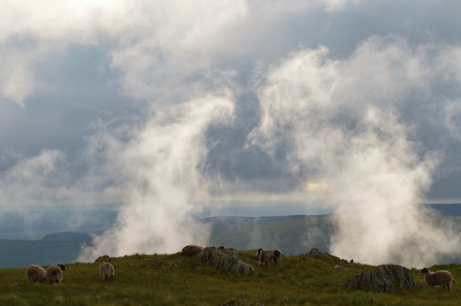 |
| Cloud rising from the Longsleddale side of the valley while unbeknown sheep graze. |
| |
 |
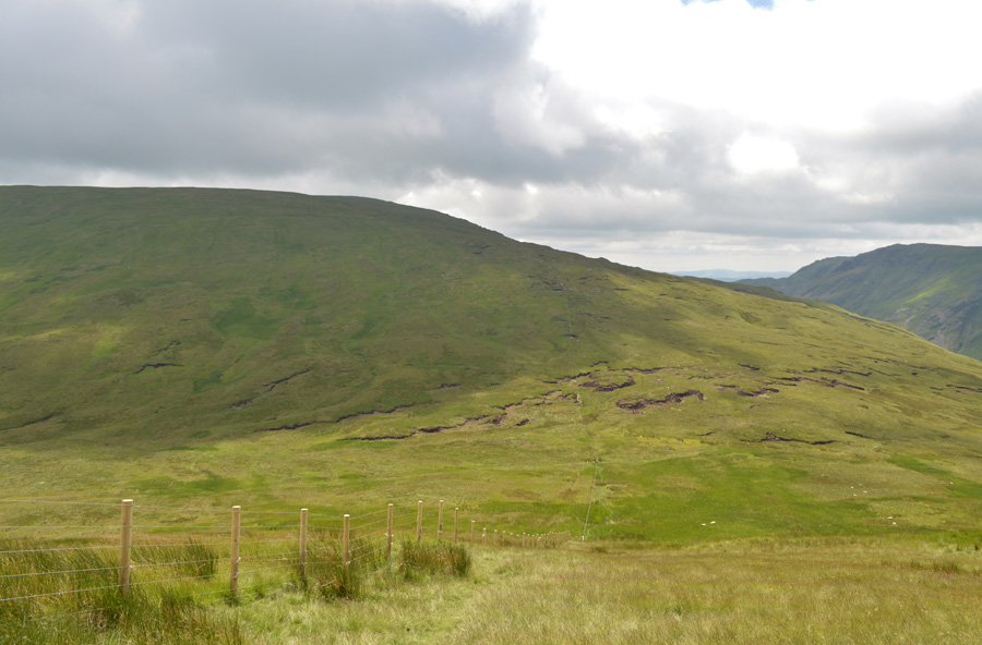
| Ahead, Brown Howe and The Knowe. |
| Despite the cloud charging up and down both my flanks the ridge was kept relativly cloud free as I took in the gentle slopes over Brown Howe towards The Knowe which is where I had an encounter with... |
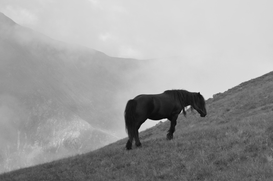 |
| Wild Kentmere ponies. |
I had spotted four ponies since leaving Kentmere Pike one of which was lying on its side while the other three grazed. The cloud by now was starting to drift over from the Kentmere valley and at times the ponies faded into the distance before the cloud broke again, by which time I was less than twenty yards away from one of the ponies, the pony that had been on its side was now standing and joined the rest of the group who understandably didn't want to bothered by the likes of me and slowly trotted off, all except for this beauty who let me get within ten feet.
By now the rest of the ponies had descended and were out of view as another bank of cloud started to roll in across the ridge, about forty yards back I had dug both my walking poles ten feet apart into the ground which had started to disappear as the cloud got thicker and thicker.
It was quite a surreal moment just standing there watching the cloud drift over the ridge while at the same time witness this one pony who wasn't too shy to say hello. |
 |
| Looking down on the the Nan Bield Pass and Mardale Ill Bell from The Knowe. |
Once I had left the ponies behind I back-tracked and found the path again, from here it was only a pleasant walk to reach the shoulder of Harter Fell known as The Knowe, here I had planned to walk towards Harter Fell summit before abruptly heading north east bound for Nan Bield Pass.
Instead, I pick up a singular track which avoids a direct summit flanking along the 'back of the fell' on the Kentmere side. Initially my view is once again obscured by drifting cloud that approached first over the III Bell ridge soon enveloping Mardale III Bell and the High Street Fells, I thought that my luck was starting to run out and that now, I would be walking in cloud for the duration. However, as the cloud passed over the upper Kentmere Valley it started to break up soon revealing my next summit of Mardale III Bell.
As far as cloud watching goes, I couldn't have asked for more atmospherics, what a fantastic morning to be out. |
 |
| Mardale III Bell and the top of the Nan Bield Pass. |
It looks like the sun is trying its best to shine through now and soon, the cloud will completely lift and disappear.
Footnote: Because I had flanked the main summit of Harter Fell there was no need to descend the whole of the ridge, only the lower section found close to the top of Nan Bield Pass, which is were I'm heading next. |
 |
| The Rough Crag ridge, The Rigg and Haweswater seen with a glimpse of Small Water. |
| |
 |
| Yoke, Rainsborrow Cove and III Bell East Ridge seen towering above Kentmere Reservoir. |
| |
 |
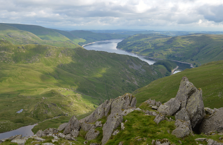
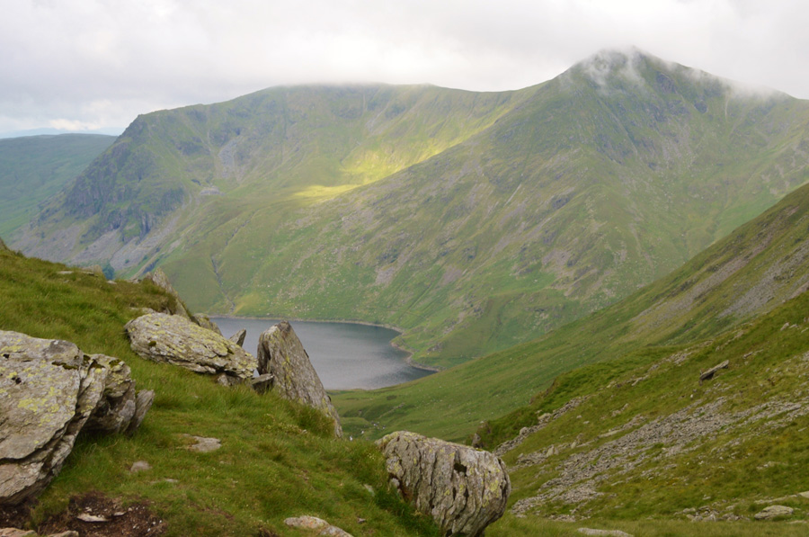
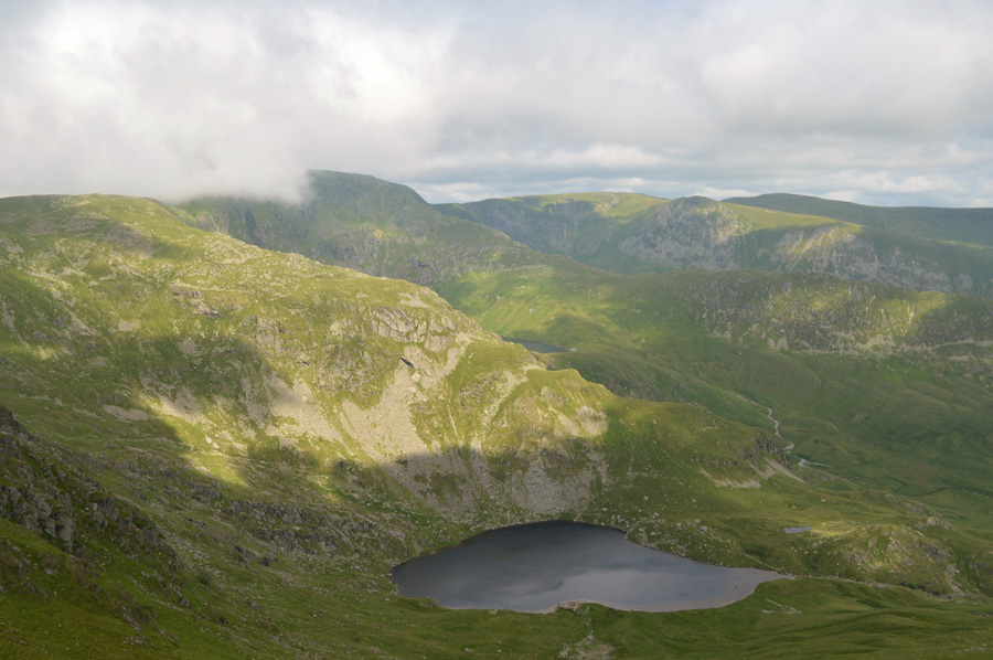
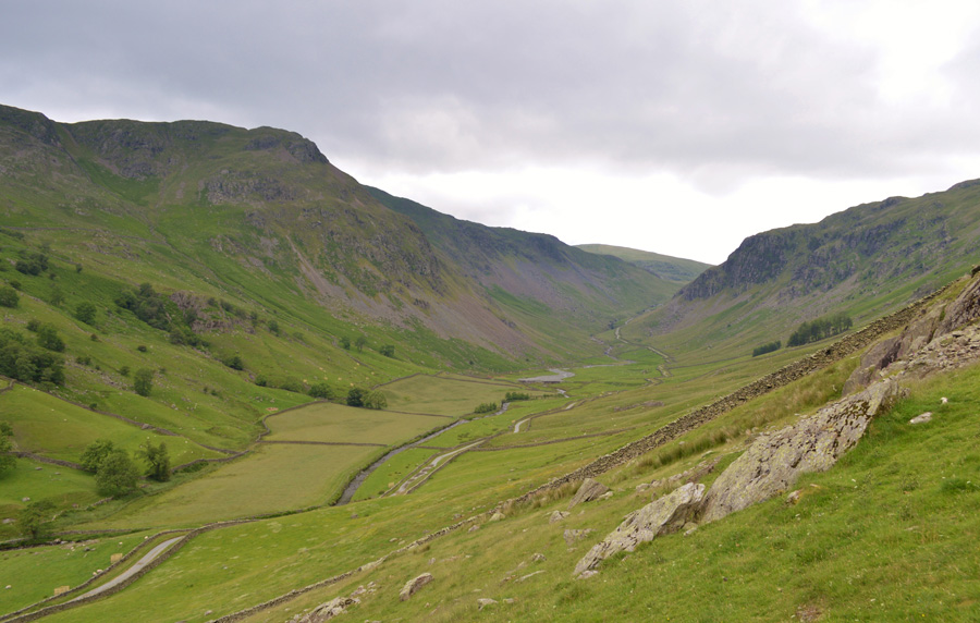
| Mardale Head seen below Small Water with Selside Pike and the Naddle Forest in the distance. |
The path that I had been following on the flank of Harter Fell summit lead me towards the top of Nan Bield Pass, I was feeling quite chuffed with myself purely because I had totally forgotten about this path and secondly because it made what would have normally been a slow descent via rock and stone a more pleasant one over smooth grass, surely this meant I was ahead of schedule which is why I stopped to admire the views looking down on the cars as they drove towards Mardale Head.
Spirits were most definitely up which set me up nicely for my Mardale III Bell 'out and back' |
 |
| Mardale III Bell summit cairn. |
| After leaving the stone shelter found at the top of Nan Bield Pass I put my concentration into the ascent on Mardale III Bell summit hardly lifting my head until the summit cairn was almost in sight which is where I spotted a chap standing close to the summit, I was only a few minutes away but he moved 'off path' back in the direction of Nan Bield Pass, I thought nothing more of it until I turned around and saw him heading back, too far away for a 'morning' I turned around and started my descent with the re-ascent of Harter Fell laying on my mind. |
 |
| Heading back towards the top of Nan Bield Pass as cloud passes over Harter Fell (Mardale) |
| |
 |
| Views over Small Water, Mardale III Bell, Piot Crag (Mardale III Bell North East Ridge) High Street and Kidsty Pike. |
| Those of you with a keen eye may just about to make out Blea Water. |
 |
| Harter Fell (Mardale) summit cairn. |
| After passing the top of Nan Bield Pass for the second time I again put my head down and ascended Harter Fell summit only stopping once to take the previous photo, I was feeling in great stead helped along by a summit cross wind which helped to cool me down. At the summit I soon spot another walker heading my way who I pass with a 'Hi' as I make my way towards Harter Fell third cairn. |
 |
| But first, here's a close up of Blea Water and High Street. |
| I scour for movement along High Street's Rough Crag ridge but spot nothing, perhaps it's too early yet. |
 |
| Haweswater from Harter Fell 'third cairn' |
| |
 |
| Views over Blea Water, High Street, Rough Crag, Kidsty Pike Rampsgill Head and High Raise (Martindale) |
| |
 |
| From the third cairm, Branstree, Selside Pike and the Gatescarth Pass below. |
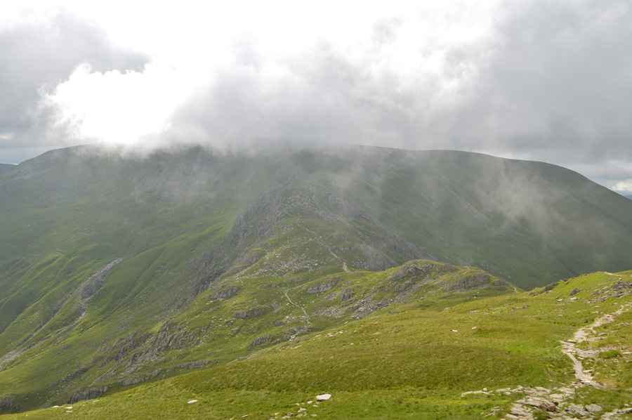
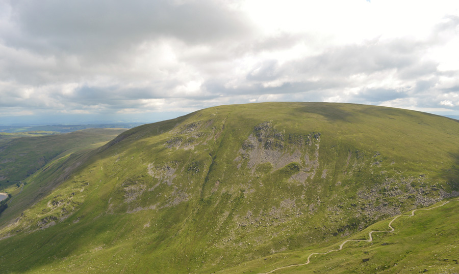
Despite wanting to stay and admire the views over Gatescarth Pass I press on towards my next summit of Branstree. Mentally I had split todays walk into four 'difficult' sections, one being the ascent on Mardale III Bell from Harter Fell and two, the re-ascent back onto Harter Fell, next is three, the ascent of Branstree from Gatescarth Pass.
Just in case you were wondering which is four, I'll get to that a little later. |
 |
| Looking back over Gatescarth Pass towards Harter Fell (Mardale) |
I had descended Harter Fell while viewing quite a few people on their way up, with Hi's and Hello's and a few mopped brows later I reached the top of the Gatescarth Pass where a young chap was re-attaching the chain to his mountain bike, he was too busy to look up and I guess my own mind was focused on gaining Branstree.
The familiar bogs close to the Pass had to be negotiated as expected which I cursed as all morning my boots had been dust swept, and now, they were choking on weed and bog water, great! heavy boots I thowt...just what I need right now. |
 |
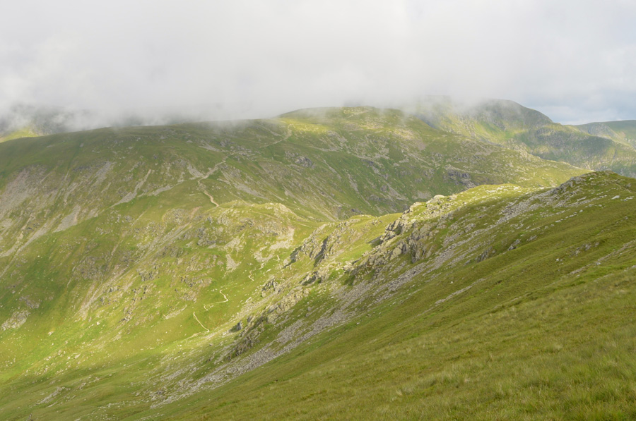
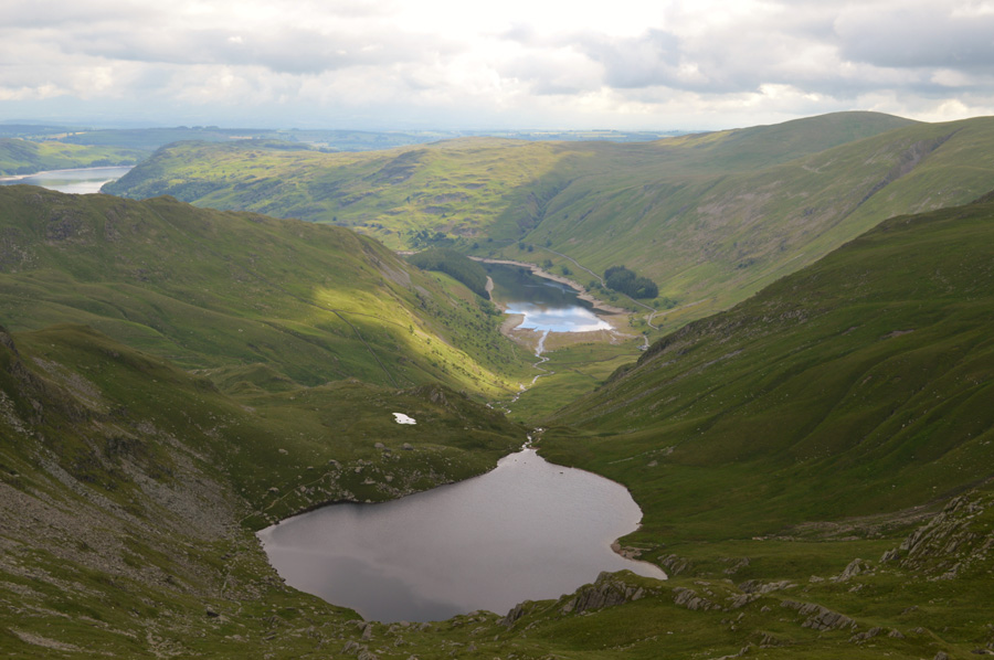
| Views along the Longsleddale Valley with Tarn Crag (Longsleddale) and Goat Scar from my ascent on Branstree. |
| |
 |
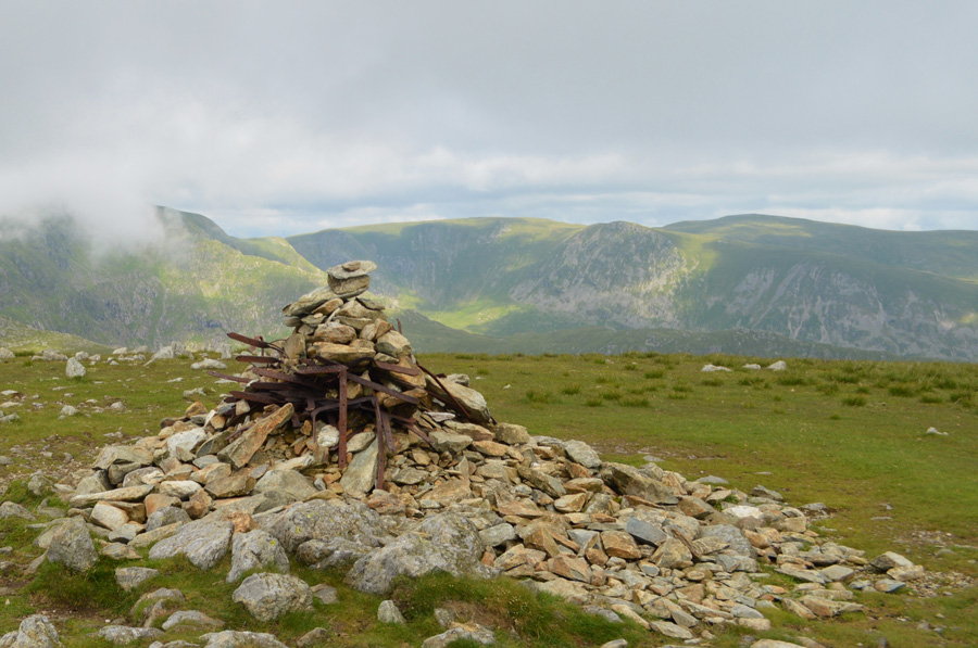
| Branstree circular Trig Point. |
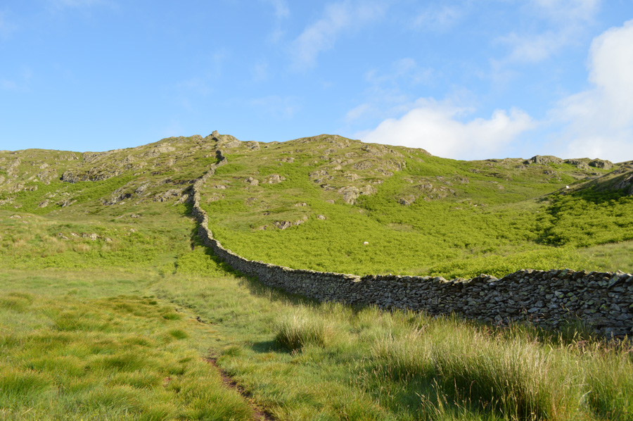
I plunged myself into the ascent, from the start I felt good but my legs soon tired as I started playing the 'next lamppost game' except on this occasion Itraded lamp post with fence post, eager to carry on I ascended through the burn until the ground evened out slightly and soon the familiar wall which straddles the summit from the Mosedale valley came into view.
With this walking poles are flared out to the side and I make my way to the familiar circular Trig Point heaving slightly under my breath. |
 |
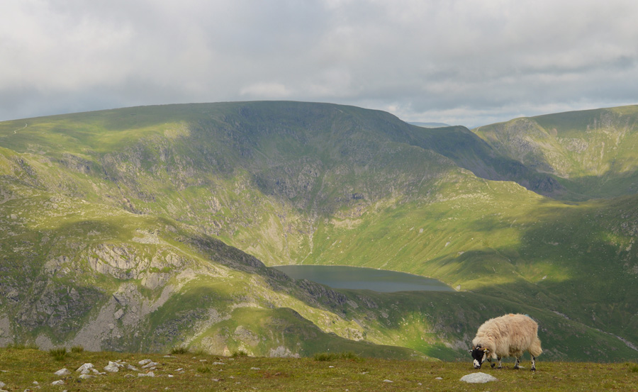
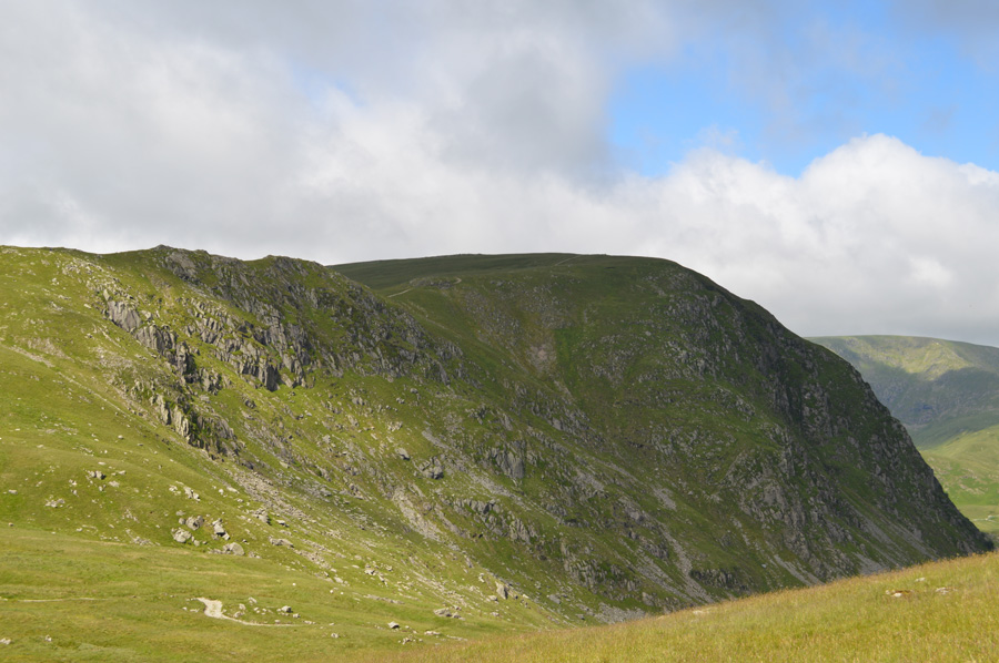
| Selside Pike from Artle Crag. |
| A large wooden post lay besides Branstree summit, left there by someone who thought it might be a good idea to mark the summit by digging it into the ground, I guess they hadn't accounted for the Lakeland winds which made short work of their efforts. The two stone cairns of Artle Crag peeped just o'yonder as I picked up the grassy trod and walked the short distance towards two of Lakelands familiar landmarks, ahead, Selside Pike. |
 |
| A distant Harter Fell (Mardale) from Selside Pike summit shelter. |
It's just under a mile of easy walking between Artle Crag and Selside Pike and I used the good ground underfoot to try and replenish reserves which worked out great although even from the slight pull onto Selside Pike summit, I don't mind admitting the burn would often return.
It was almost lunch time and I had been feeding myself snacks throughout the morning but still, the stomach growled, it just wasn't feasible to eat lunch before gaining Tarn Crag which required a steady and drawn out haul to reach its summit, with this I de-shouldered I thought I'd deserved a break anyway, even if it meant I had to wait to eat lunch. |
 |
| Back tracking towards the Survey Pillar found below Artle Crag. |
| Instead of retracing the exact same route I ascended slightly to the left of the photo which meant I would 'drop on' the Survey Pillar rather than have to ascend towards it. |
 |
| Artle Crag from the Survey Pillar. |
| |
 |
| Low Raise, Whelter Bottom and Haweswater from the Survey Pillar. |
| The main reason for specifically returning to the Survey Pillar was because it marked the point where I would go 'off path' around the eastern flank of Branstree thus avoiding a re-summit, the path maybe rough and hummocky but by my reckonings it should still save me time. |
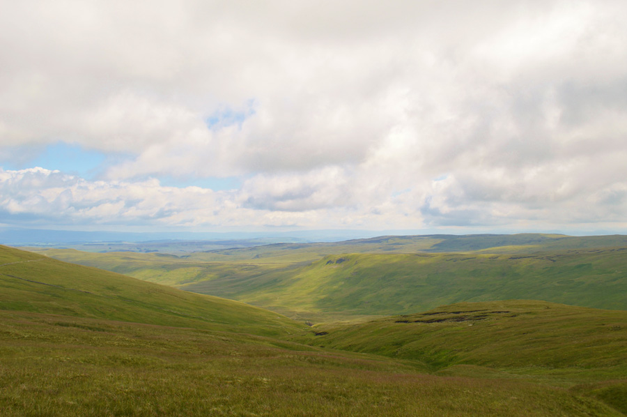 |
| Views into the Mosedale Valley towards Brunt Tongue. |
| At the time it didn't feel like I had made the right choice as I uttered the words a re-ascent on Branstree would have been much easier, but I was listening to the legs talk and not thinking rationally, yes it was slightly rough, but dry and although progress was slower than expected Steel Brow and the familiar stone wall soon came into sight as the glorious views into Mosedale did wonders to lift spirits. |
 |
| Tarn Crag (Longsleddale) from Steel Brow. |
| |
 |
| Views back over Branstree and Harter Fell (Mardale) |
| |
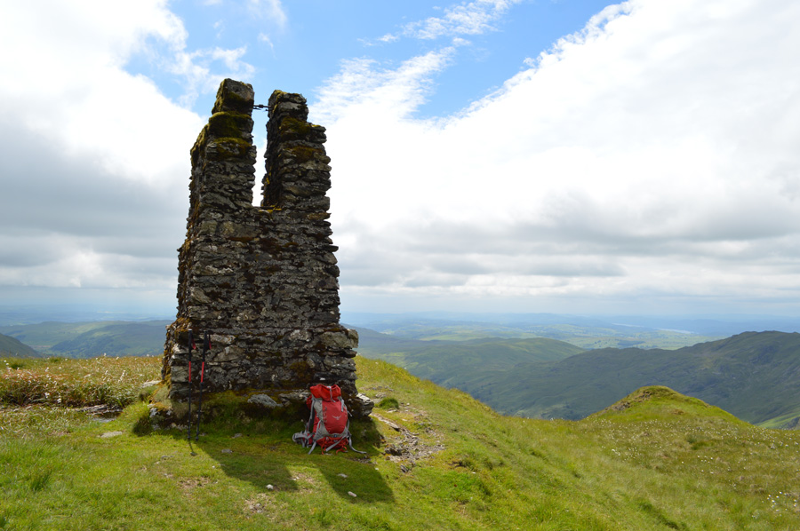 |
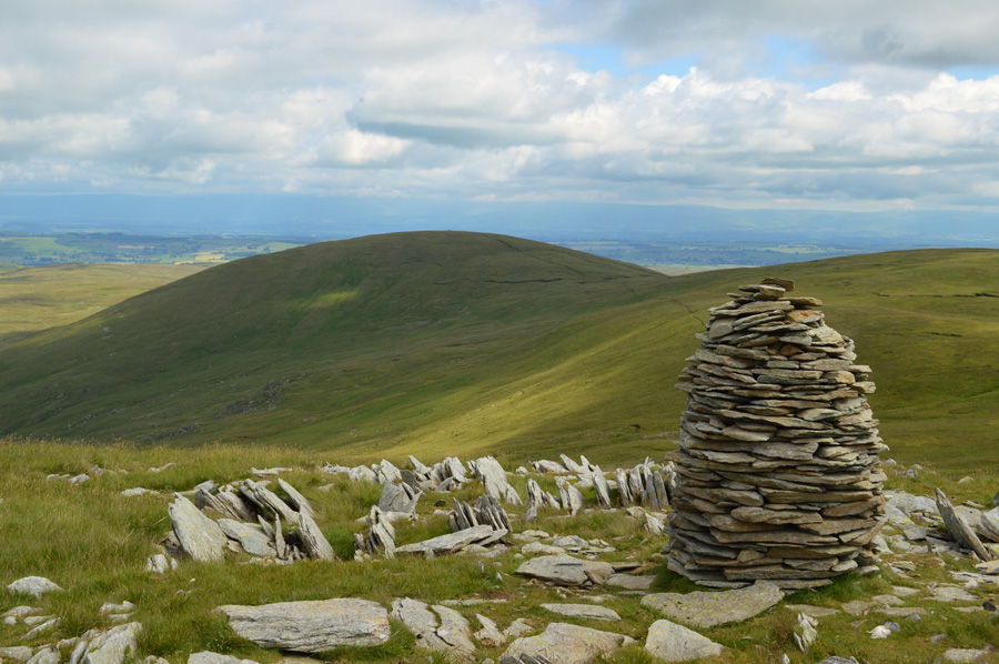
| Survey Pillar, Tarn Crag (Longsleddale) |
With the stone wall met Steel Brow I looked back up at Branstree summit feeling quite content that I had made the right route choice afterall. A hundred yards behind me a walker descends from the summit as I round the end of the stone wall where a new wire fence had been erected.
I pass the metal gate with extended views into Mosedale uttering something along the lines of 'the gateway to Mosedale' to myself...The upper ground sits shelf like above Brownhowe Bottom and retains water well and today, was no exception. To save time I stretch and jump over and through the boggy bits then climb the familiar peat hags before starting my 'mental' fourth toughie of the day.
On a good day with out previous summits the ascent on Tarn Crag feels much longer than it does on paper, for me the ascent always marks the endings of a great day on the fells and tired legs usually accompany that feeling, today was no different.
I had ascended not by the path that straddles the wire fence but a singular grassy track twenty yards into the fell although the wire fence, was never far from view. Again I had pushed myself into the ascent only stopping when the ground began to level out at which point, the Survey Point found at the summit was still out of sight which meant I wasn't quite there just yet, with poles stretched out, and possibly at the slowest pace I'd walked all day I tramped towards the highest ground until the top of the Survey Pillar came into view.
From where, it was just a short walk towards the Pillar and the summit cairn.
I call lunch. |
 |
| Grey Crag from Greycrag Tarn (Dry) |
| |
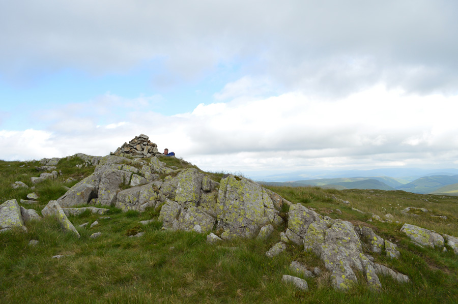 |
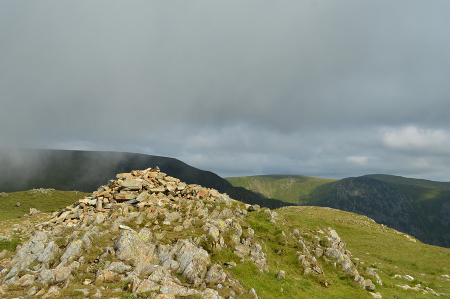
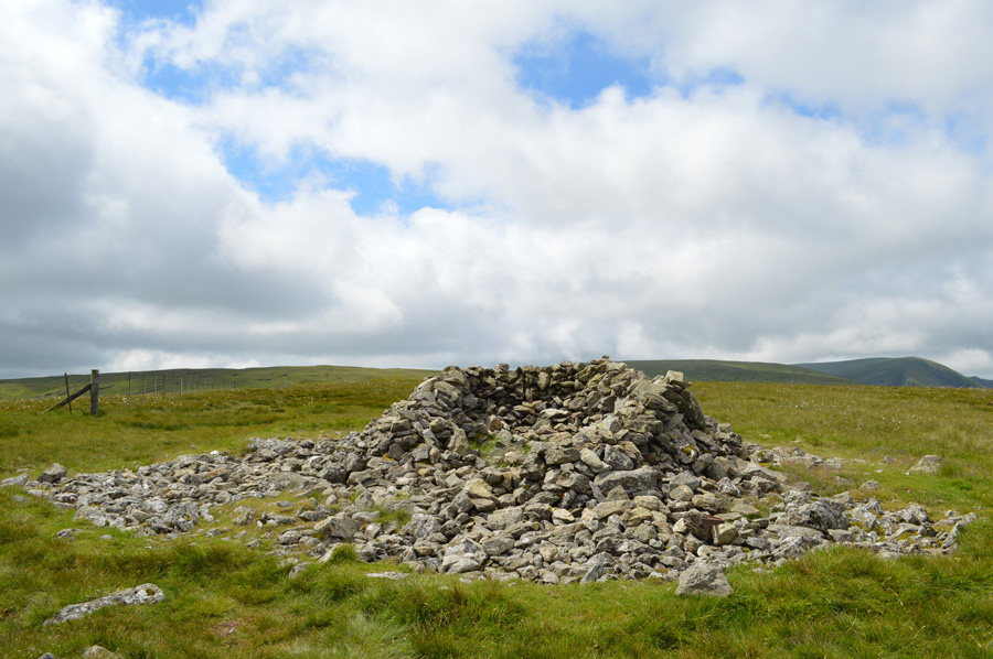
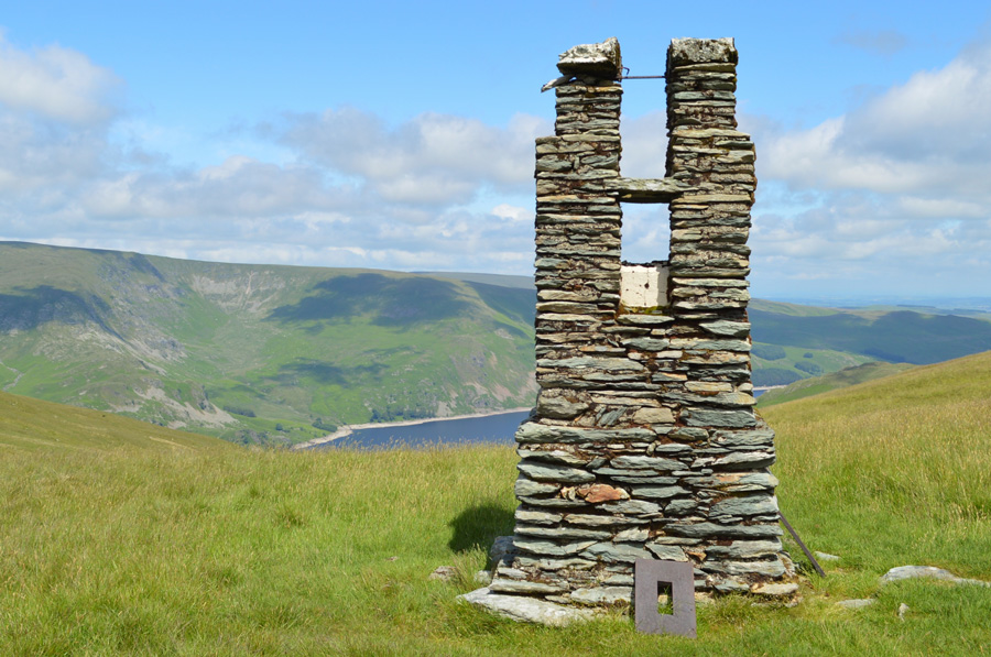
| Grey Crag summit cairn. |
A notable wind had started to build up which after lunch, caused me to roll my sleeves down. From Tarn Crag summit I had intended on making a direct descent down to Greycrag Tarn but the ridge path along the ridge tempted me otherwise choosing to give the familiar boggy tarn as much a wider berth as possible.
The crossing between Tarn Crag and Grey Crag was as expected, wet and boggy but I managed to keep both feet dry as I sighted Grey Crag stone cairn from afar, what I hadn't seen was the group of people occupying the summit.
I left Greycrag Tarn behind and opted to use a narrow path passing boot over heather and more hummocky grass until I got closer to Grey Crag summit where three guys sat and ate lunch, a few moments spent at the last and eighth summit of the day would have been nice but the guys who sat there weren't moving and to be honest I wouldn't have expected them too, we had a brief chat about how the weather felt like it was changing and how notably windy it seemed to be getting, after that, I tapped the stone cairn with the end of my walking pole, bid good day to the guys and started my descent towards Great Howe. |
 |
| Descending Great Howe with views into Longsleddale. |
| |
 |
| Goat Scar and Buckbarrow Crag as I descend towards Sadgill. |
I ummed and ayyed on how I would finally descend back into Sadgill but decided via Great Howe summit which somehow won, a route that I hadn't used before as usually I would use the path that flanks around the higher ground. From the summit I descend steeply as views first into lower Longsleddale open out under a greying sky, the descent is steep and at times the path is partially hidden by bracken yet despite this, the roof of my car appears and draws me in.
Part of the descent is via a steep gully and I can almost hear the walkers and runners chatting whilst stood at the side of their cars as the sky starts to get darker and I swear at one point there's a wisp of rain in the air carried along by the strengthening winds, am I actually about to wing it?
Once the gully is descended I continue steeply over grass and sporadic boulder, a gate is now in sight which I aim for kicking the soles of my feet around in my boots as the fell side looses gradient, I'm now only a few feet from my car and I can hear a tractor at work close to the farm which brings me back into reality. I feel pleased that I had made good time but further pleased that I completed the walk just before the rain started to fall.
I still hadn't quite finished lunch which I do whilst sat in the car pressing on the wipers every once in a while. |
|
| |
| Back to top |
 |
|