|
A Kirkstone Skyline |
 |
 |
12th March 2016 |
 |
|
I never switch off from Lakeland, it doesn't matter if I'm working or walking the dog my weekend plans are never far from thought and the days before are generally spent sorting kit and preparing myself both mentally and physically for the arduous task ahead which is something that I've got used to since completing the Lakeland two thousanders last year, I guess what I'm trying to say is you may be the fittest athlete out there but if you haven't trained your brain for what your about to put your body through your going to fail and this, I take very seriously, it's not just in the legs it's a sixty forty split between braun and matter.
Despite enjoying a great day on the fells experiencing magical cloud displays and hearing the first Skylarks of the season todays walk left a bitter after taste after I had no choice than to end the walk early due to conditions which I could do nothing about. After battling my way through the pro's and con's the con's this time won and I was left if I remember rightly descending Middle Dodd with my tail between my legs feeling bitterly disappointed, not at the forecast because that, I can do nothing about, I simply couldn't tell my brain that half way through the walk we were going home and that was the point I felt that bitter after taste, I've only called a walk off once in ten year's; I knew from memory it doesn't go down well. Anyway, now that I've put you in my world let me tell you what my initial plans were; and end with what I actually did. Todays walk would have taken in nine Wainwright summits from Hartsop Dodd to High Harstop Dodd incorporating the Kirkstone and Dovedale fells and descending back to Cow Bridge via the Hartsop above How ridge. I guess the seed was planted early due to the mist and low cloud that I passed through while I drove over the Kirkstone Pass, so much so I had to slow down to a snails pace, if only to avoid the sheep that were lying in the middle of the road. I drove past the Kirkstone Pass Inn and started my descent towards Hartsop which showed a little more promise but in the back of my mind I still wasn't entirely convinced. |
|
| Wainwright Guide Book's One and Two |
  |
| The Eastern and Far Eastern Fells |
-Red Screes
Red screes, although in the midst of high country, contrives to appear more isolated from its fellows than any other of the eastern fells. It is independent and is unsupported, not buttressed by its neighbors: to this extent, it may be said to have the purest mountain form among the eastern fells.
|
 |
|
|
| |
|
Overview |
|
|
| Ascent: |
3,130 Feet, 954 Meters |
| Wainwrights: |
4, Hartsop Dodd - Caudale Moor (Stonycove Pike) - Red Screes - Middle Dodd |
| Weather: |
Overcast to Start, Low Cloud and Drizzle. Highs of 8°C Lows of 5°C |
| Parking: |
Cow Bridge, Hartsop |
| Area: |
Eastern and Far Eastern |
| Miles: |
8.3 |
| Walking With: |
On My Own |
| Ordnance Survey: |
OL5 |
| Time Taken: |
5 Hours 50 Minutes |
| Route: |
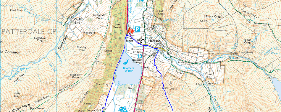
Cow Bridge - Hartsop Dodd - Caudale Moor (Stony Cove Pike) - St Raven's Edge - Kirkstone Pass Inn - Red Screes - Smallthwaite Band - Middle Dodd - Hartsop Hall - Brothers Water - Cow Bridge |
|
| |
|
Map and Photo Gallery |
|
|
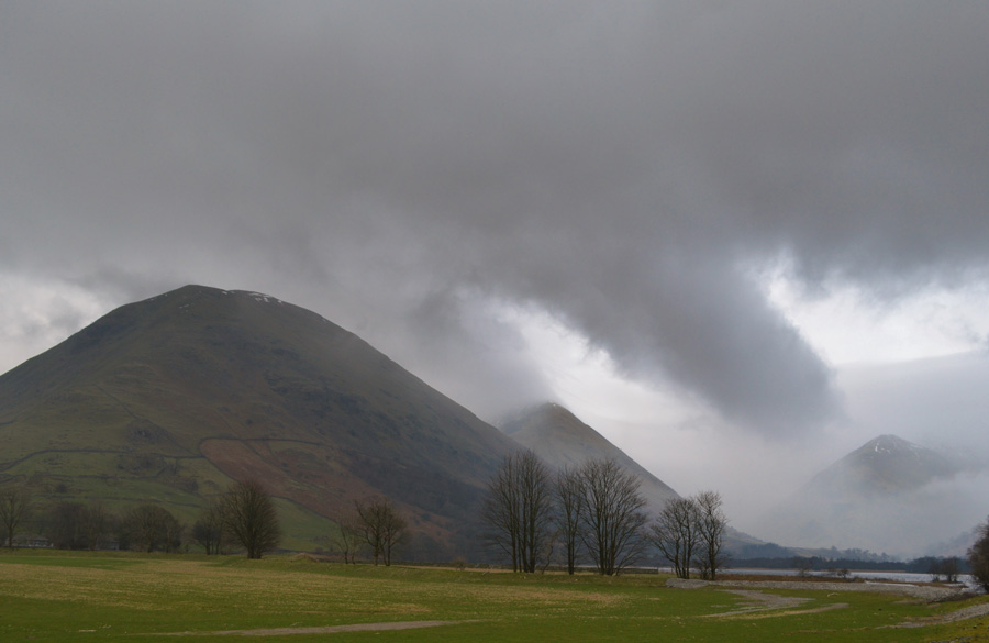 |
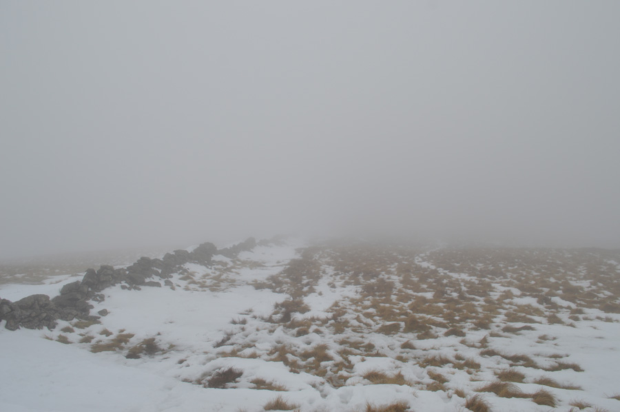
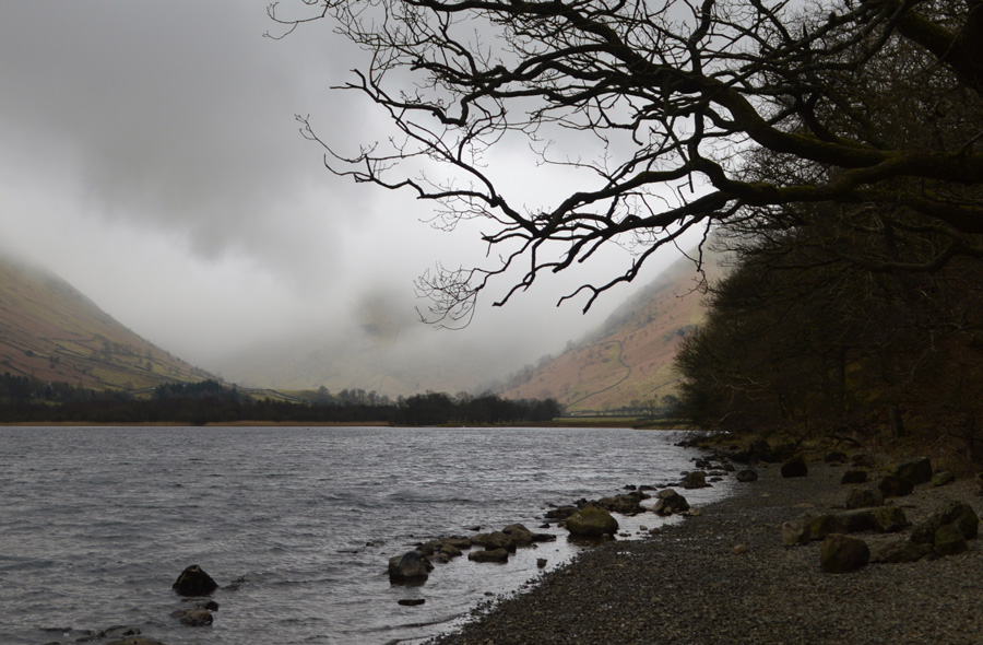
| Hartsop Dodd, Caudale Moor and Middle Dodd seen shortly after leaving Cow Bridge 07:30am 5°C |
There was no one around and I hadn't seen another car since leaving the A591 over twenty minutes earlier, I arrive at a deserted Cow Bridge car park and park with ease soon noticing that this area around Hartsop right through to Glenridding was hit badly during Storm Desmond and the debris left behind alongside Goldrill Beck is still tangled in the trees that over hang the beck some five feet above the waters surface. It's a mild morning and the still air reflects this.
I kit up behind my car as a transit van passes, the driver looks in my direction and continues his journey up the Pass, the van engine could still be heard sometime after. For the first time this winter I leave my Crampons in the boot and tuck my hat in my right jacket pocket and my gloves in the left, a packet of Haribo sweets gets tucked into my right trouser pocket, in fact I'm still feeling hungry despite eating two Bananas and a breakfast bar on my way here. Kited up I head out over Cow Bridge towards Hartsop, stopping to take this photo of Hartsop Dodd, Caudale Moor and Middle Dodd which is lost on mist.
After crossing Kirkstone Pass It's plain to see that this whole area would have been under water during the Christmas storms with more debris entangled in the metal fences some of which didn't survive and are now lying on there back with temporary fencing put up in replacement, a white pick up drives past stirring the silence once more, this time in the direction of Patterdale. |
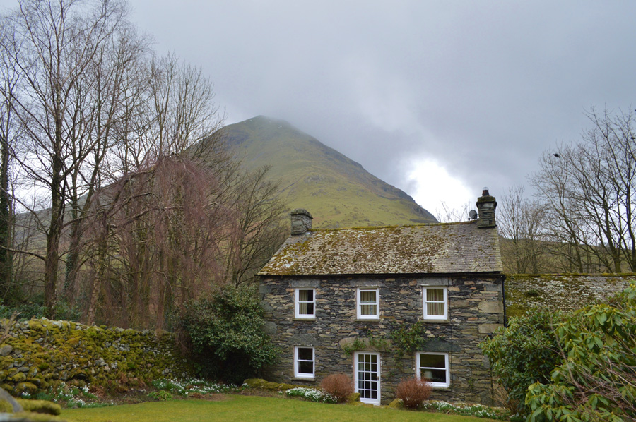 |
| Hartsop Dodd seen from Hartsop. |
| I pass through Hartsop quietly as the smell of woodsmoke fills my nostrils, it's a calming smell that I will never tire of whilst checking the chimneys to see if I can see where the smoke is coming from, it turns out it's from a cottage which sits just outside the village. I can hear dogs barking and they get louder as I approach the car park at the far end of the village, soon after I can also hear a quad bike engine which would pass me within minutes, a young farmer no older than twenty years of age nods as he drives past. |
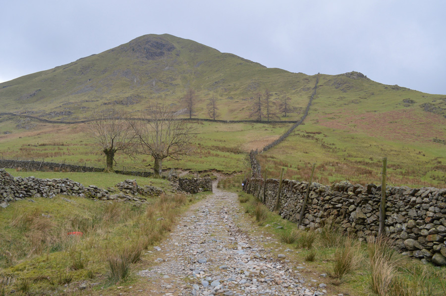 |
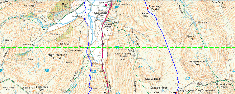
| Hartsop Dodd seen after crossing Pasture Beck. |
| I follow the stone wall steeply then turn left ascending the spine of the ridge, it's a steep one straight from the start so best get cracking. |
 |
| Views over Hartsop, Brock Crags, Angletarn Pikes and Place Fell in the distance. |
| I continue to follow the stone wall over dry ground which makes for quick progress only stopping to take this photo once the sty is reached (see where the wall heads left in the previous photo) before maintaining a good pace towards base of the ridge, phew it's feeling pretty warm and with little to no wind I'm starting to sweat quite a bit by now, where's that wind when you need it. |
 |
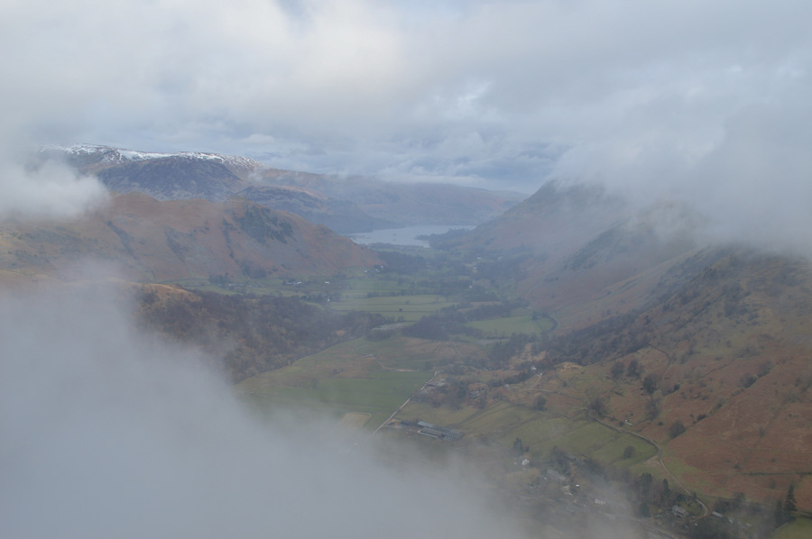
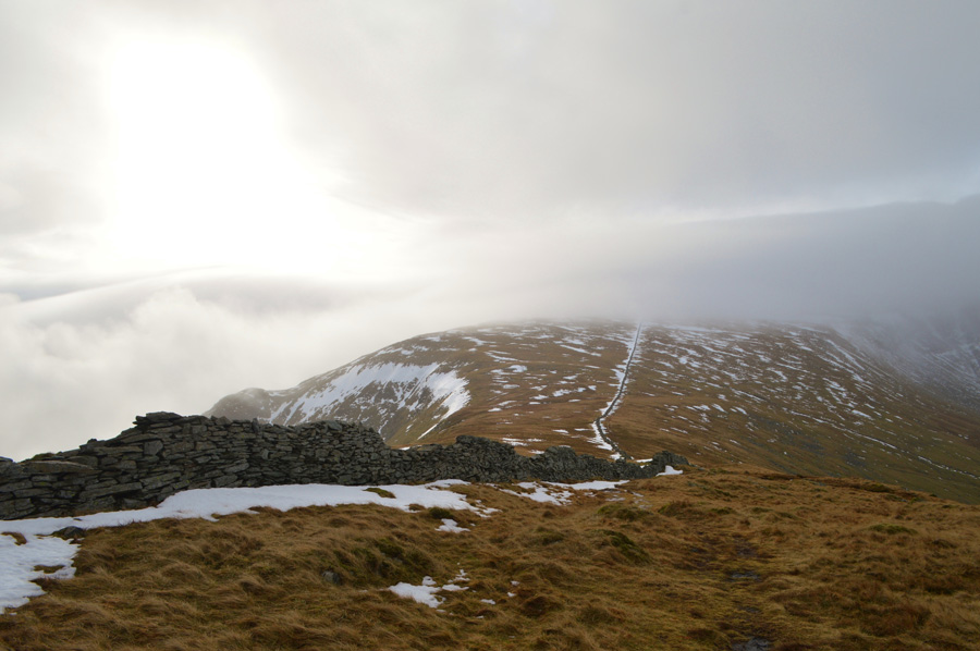
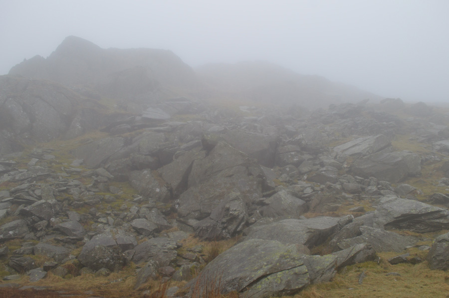
| High Hartsop Dodd and Dovedale are revealved through the low light and mist. |
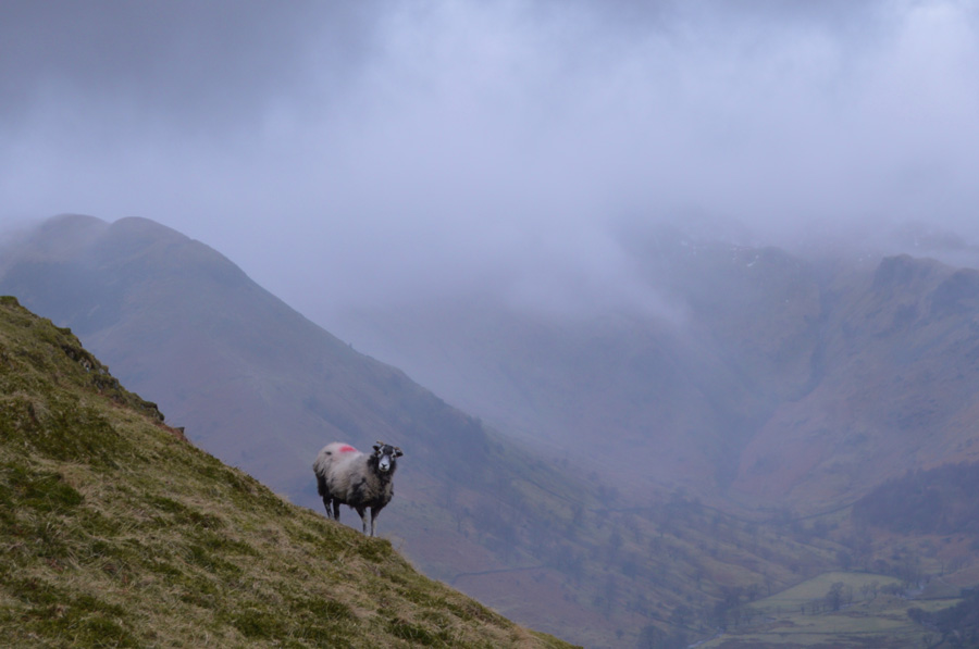
| Complimented by this chap, or girl! |
 |
| It looks like I'm about to lose my views. |
After reaching the top of the stone wall I turn left and and start the steep ascent on the ridge where I am met by patches of snow along the path, this isn't the snow line merely where snow has accumulated and drifted into hollows, it is here I get a taste of conditions for further ahead, unlike last week in Newlands where the snow was dry and sometimes compacted, here the snow is in thaw and is cumbersome to walk through and not to mention, very slippery indeed.
I progress with ascent watching the cloud display that is going on around me, soon I reach the shoulder of the fell and experience more snow which again is deep, wet and best avoided. Two distinctive metal ruined fence poles are reached confirming I'm close to the summit, through the cloud a stone wall appears and beyond through breaking cloud I can just make out the large stone cairn and the wooden post, summonus to Hartsop Dodd. |
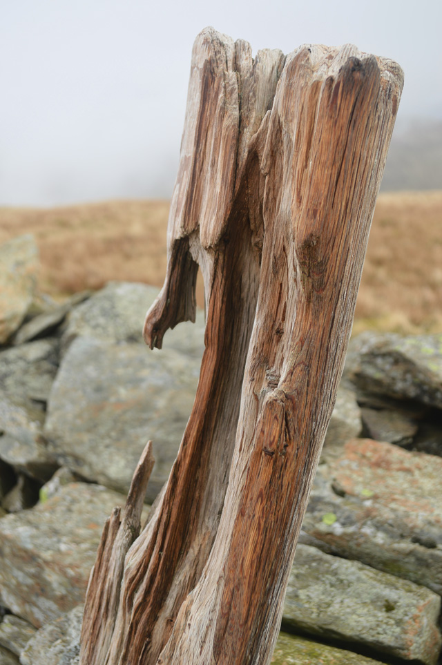 |
| Hartsop Dodd summit. |
By the time I had reached the summit it had started to drizzle slightly which I had put down to walking in cloud, even so my camera for now is going to have to be placed into its case which is in my pack, I de shoulder and make some slight adjustments while eating a handful of Haribo's, I know it's early but I'm starving.
The cloud starts to clear revealing Caudale Moor ahead and the start of the snowline, which from here it looks like no bother at all but don't hold me to that. Soon after I re shoulder and clip in my waist strap before a quick glance east towards Gray Crag, blimey just look at that cloud... |
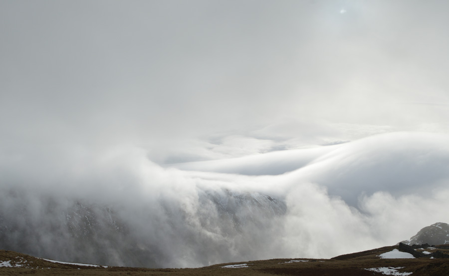 |
| Mother natures duvet. |
| |
 |
| Caudale Moor is just ahead. |
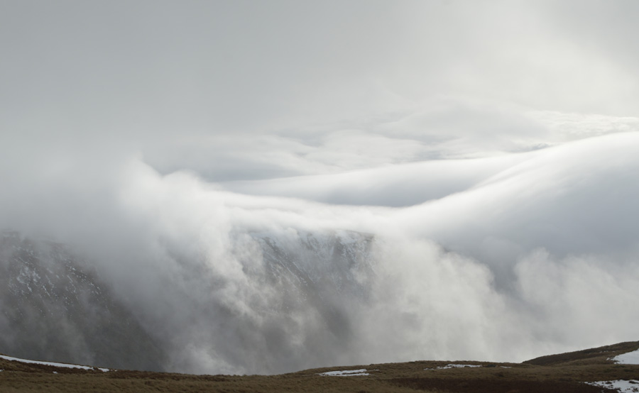
| The ridge between Hartsop Dodd and Caudale Moor is fantastic walking territory whatever the weather and today was no different, ahead the summit is out of view below the cloud as more cloud rises from the old quarry to my right all the while being accompanied by the sound of Skylarks, a sound that I have missed over the course of winter. |
 |
| Impossible to ignore. |
| |
 |
| Views back along the ridge towards Hartsop Dodd. |
| |
 |
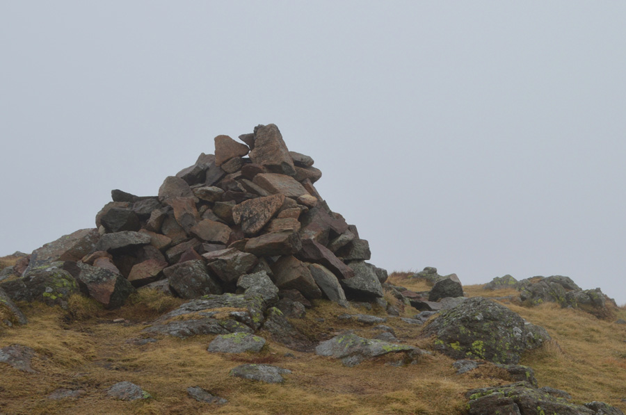
| Caudale Moor (Stonycove Pike) summit cairn. |
| Since ascending into the cloudbase conditions had started to change and to keep a maintained pace I'm forced to leave the path which at times was under two/three feet of very wet and loose snow which was starting to slow my progress and, even at these early stages into the walk alarm bells began to ring on what conditions awaited me ahead. After spotting a break in the wall I ascend the last two hundred yards pathless avoiding the snow patches were I could, arriving at the summit sometime after I found more manageable amounts of snow.
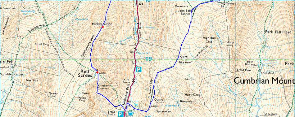
After a quick photo I start to head west keeping the stone wall to my left then right after crossing over close to John's Bell Banner, although I couldn't use the path which flanks it due to drift, the heathery summit plateau had avoidable large patches of snow and by my reckoning were best avoided, my boots had only been in the snowline for no longer than twenty minutes but were starting to leak in making my socks instantly wet, we all know that snow is wet but it does have different textures as featured in last weeks walk where we experienced fresh dry snow, this was easy to walk through and didn't leave boots or clothing wet, the snow here is in thaw leaving it very wet and slippery as I am about to find out. With slight concerns I press on. |
 |
| Heading out towards John Bell's Banner on the far west corner of Caudale Moor. |
| It had to happen, I make a school boy error and trip cartoon like over a stationary boulder falling clenched fist to the ground, by eck yer daft bugger. Soon after two walkers appear on the other side of the wall but the cloud by this time is so dense, we pass unnoticed. |
 |
| Somewhere along St Raven's Edge. |
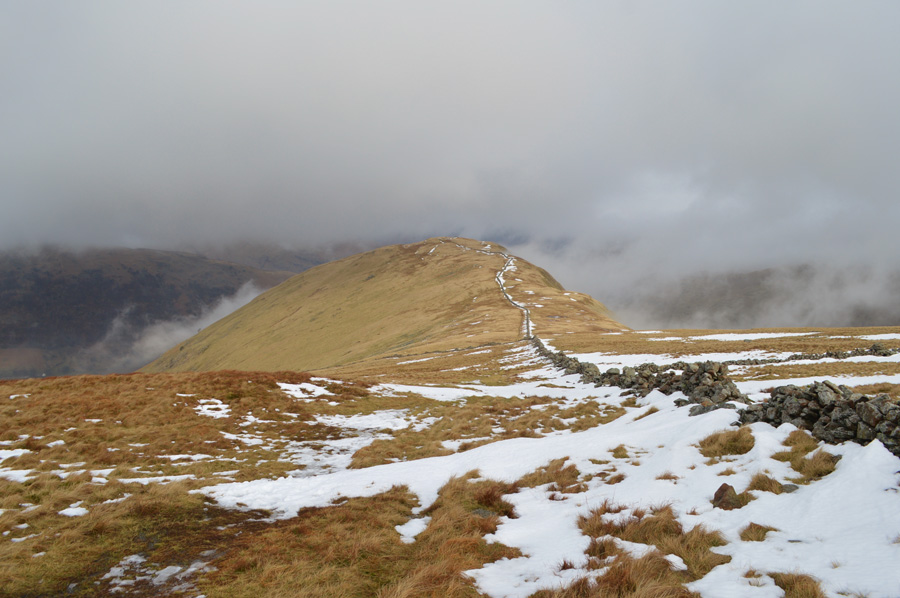
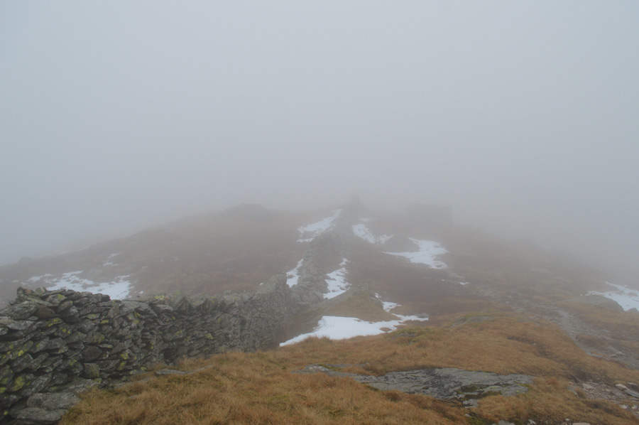
The descent of Caudale Moor is done in haste despite my eailer trip I wanted to make up for any lost time. Still large pockets of wet snow lined the descent at times making for slow progress but soon the snow thinned and became more sporadic and I was able to keep pace all the while making use of the many stepping stones found between Pike How and St Raven's Edge soon passing its summit which was marked by a large cairn. The sound of car engines greeted me and I knew despite not being able to see through the mist that I was close to the Kirkstone Pass Inn, I never gave the sound of car engines much thought but what I could hear of them, and coming from a Motor Trade background these cars sounded quite racy due to the exhaust notes and dump valves that I could hear.
It was of course the participants of the Malcolm Wilson Rally driving over the top of the Kirkstone Pass which is held on this day every year, except I'd forgot. |
 |
| The Kirkstone Pass Inn appears through the mist. |
| |
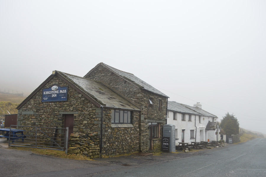 |
| The Kirkstone Pass Inn. |
| A few people had gathered with cameras to photograph the rally cars and despite my own interest I get straight back into the walk starting with my ascent on Red Screes. |
 |
| Craggy outcrops appear through the mist during my ascent. |
With the sound of the rally cars confined to background noise I begin my steep ascent on Red Screes but not before nearly questioning one bloke who had a young girl with him on the car park who was screaming 'she didn't want to go!' Have you ever thought mmm this doesn't look right and I had all intentions of asking the girl was she ok until I got closer and heard her scream 'I don't want to go daddy!'
Still, better safe than sorry.
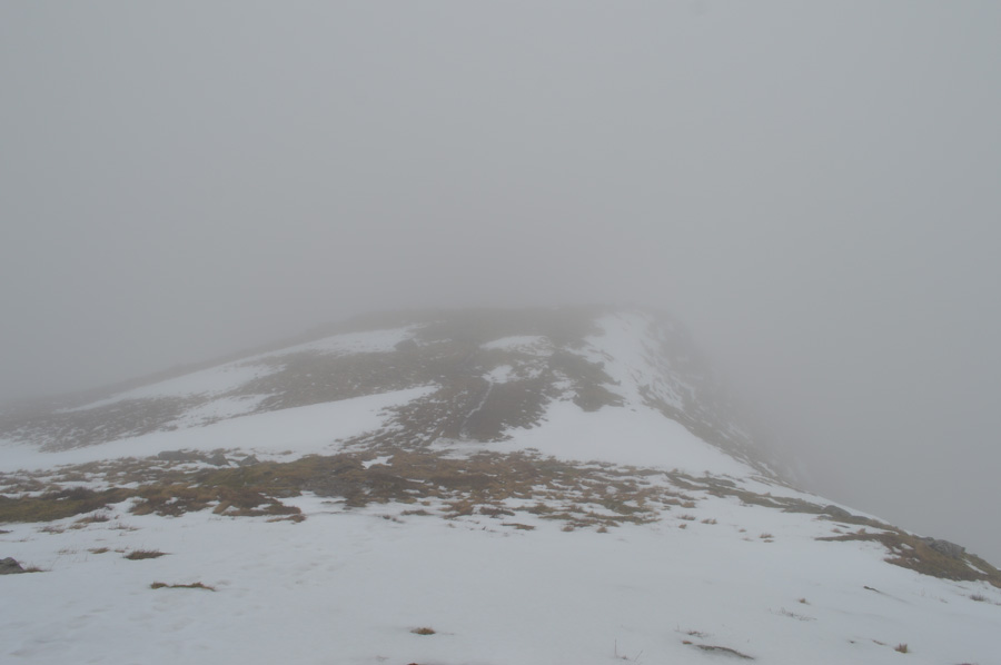
The path here is of excellent pitch and quality as I follow the stepped stones that twist and turn their way through crag and outcrop. It was somewhere during this ascent did the thought of would this walk ever get completed if I'm to experience similar conditions on Red Screes summit as I had on Caudale Moor, I didn't even want to think about it but I need to think wisely from here on in and how much the soft snow will impact on the full route, right now I'm praying that the snow I'm about to encounter might be that bit more firmer but I'm not holding out for much hope. |
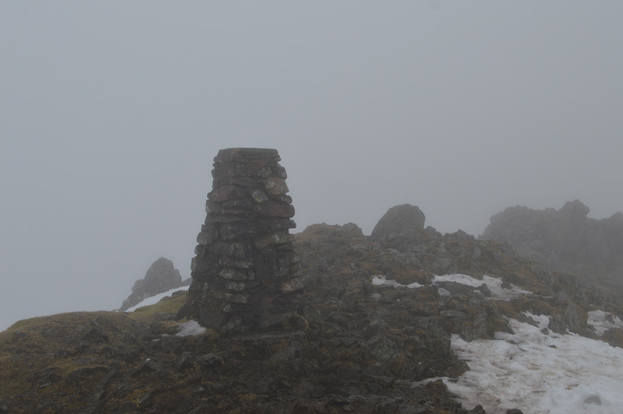 |
| Red Screes summit trig point. |
The snowline arrived at around the two thousand ft contour and was avoidable but only in small amounts, these were very similar to what I had experienced on Caudale Moor, deep, wet and slippery; and to make matters worse it had started to rain. This dipped my morale deeply and with no visibility the thought of being able to continue this walk which requires two out and backs from Middle Dodd back to The Scandale Pass and High Harstop Dodd then back to Little Hart Crag/Bakestones before continuing to summit Dove and Hart Crag (s) and Hartsop above How, the last thing I need right now is snow, rain and no visibility.
I'm going to need to do some serious thinking between here and the summit of Middle Dodd but in the back of my mind, I had already called it. |
 |
| Descending Smallthwaite Band. |
| |
 |
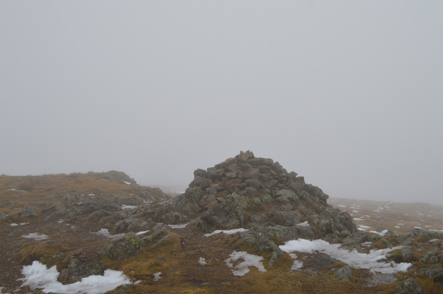
| Middle Dodd summit. |
After picking and sliding my descent over Smallthwaite Band I soon arrive at Middle Dodd summit, a stone shelter sittuated close by was deep in snow as I take hold of my sittuation. My stomach is doing loop the loops and my throat became dry, I take a look back towards Red Screes and all I can see is patches of snow which progressivly extend back into the mist which I'm unable to photograph due to being face on with the rain.
I call it, that's it this walk is over.
The bitter after taste of defeat accompanies me during my Middle Dodd descent where all I can hear is the sound of rally car engines thundering up the pass far below, the cloud clings to the fell side and the rain turns to drizzle but doesn't stop completly, soon I emerge from the cloud about two hundred meters away from Caiston Beck where I try and cast eye back on the Scandale Pass but see nothing in return, the sun breaks through the cloud momenterily and illuminates the pastures in a vivid green but it doesn't last and the low light that has been with me for much of the day returns. |
 |
| Middle Dodd from Brothers Water. |
| |
|
| |
| Back to top |
 |
|