|
Cat Bells to Dale Head |
 |
 |
27th December 2015 |
 |
|
Having thought I may have already walked my last walk of 2015 todays forecast simply could not be over looked, I had been kept busy with Christmas stuff and not to mention localised flooding here in Wigan where amber and red warnings for heavy rain were spread across the borough, thankfully we escaped the worst of it but others weren't so lucky across the town and all over Lancashire and south Cumbria.
So, as you can imagine my mind was elsewhere leaving me just a few hours to come up with todays walk, my heart swayed to a winter walk over Helvellyn but my usual starting point from Swirls is cut off and although a start from Glenridding was an option this walk over ruled it when I remembered just how good it is and what personal connections I have to this particular route.
I guess you could go so far to say that this route or one extremely similar to it is responsible for my love of fell walking today, I was a young (ish) wet behind the ears map tied around my neck novice fell walker where back then, I had a simple ridge to navigate, before a return via Newlands.
It changed my life forever, here's Cat Bells to Dale Head and my bow out to 2015 |
|
| Wainwright Guide Book Six |
 |
| The North Western Fells |
-Maiden Moor
Maiden Moor is the middle section of a very popular fellwak, starting with Catbells and ending at Honister, along the spine of the ridge forming the Newlands and Borrowdale watershed. |
 |
|
|
| |
|
Overview |
|
|
| Ascent: |
3,320 Feet - 1,013 Meters |
| Wainwrights: |
4, Cat Bells - Maiden Moor - High Spy - Dale Head |
| Weather: |
Dry and Sunny, Light Winds Across The Summits. Highs of 7°C Lows of 6°C |
| Parking: |
Roadside Parking, Gutherscale |
| Area: |
North Western |
| Miles: |
10 |
| Walking With: |
On My Own |
| Ordnance Survey: |
OL4 |
| Time Taken: |
6 Hours |
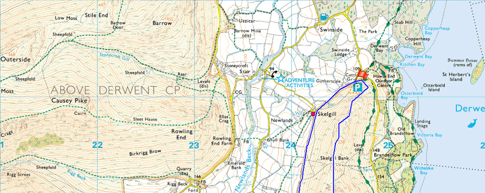
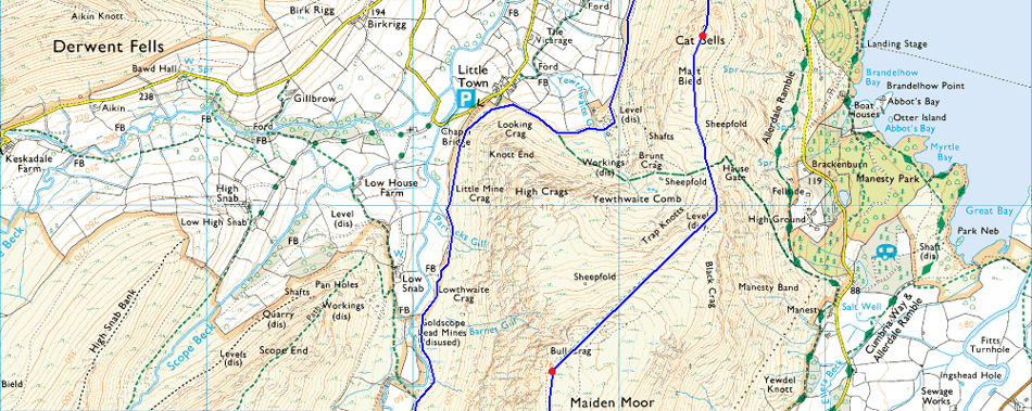
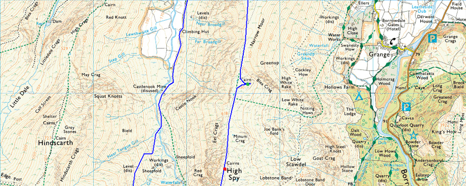
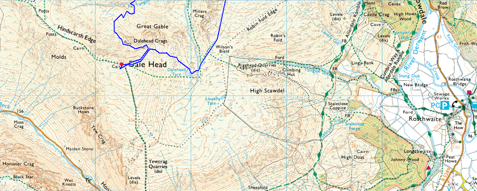
| Route: |
Gutherscale - Skelgill Bank - Cat Bells - Hause Gate - Maiden Moor - Narrow Moor - Blea Crag - High Spy - Dalehead Tarn - Dale Head - Miners Track - Newlands Valley - Above Little Town - Skelgill - Gutherscale |
|
| |
|
Map and Photo Gallery |
|
|
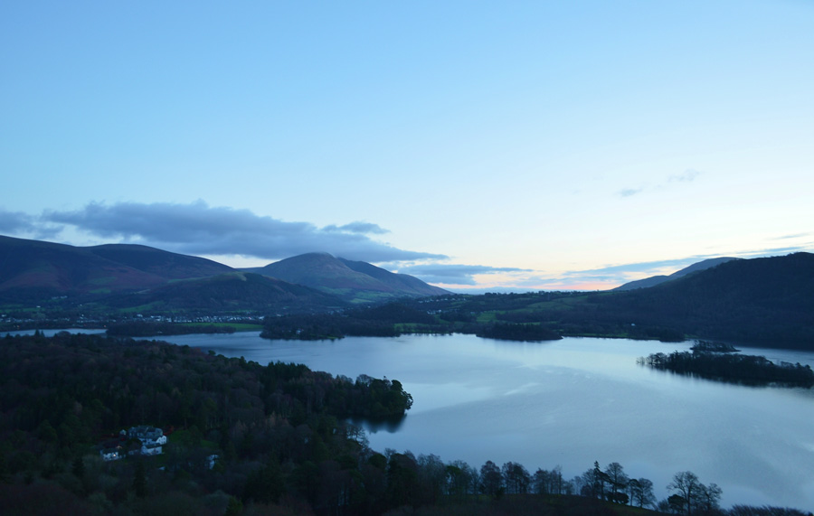 |
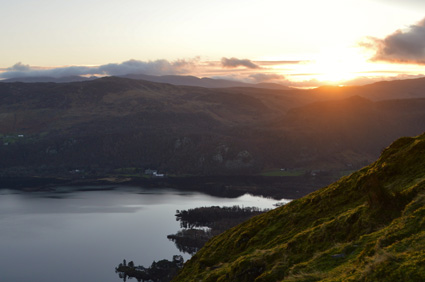
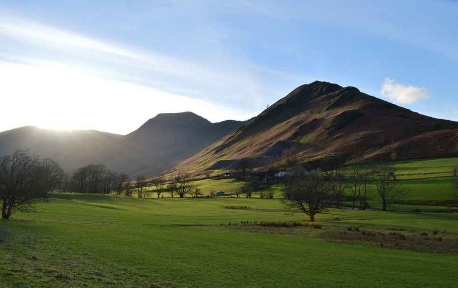
| Pre dawn views over Derwent Water 07:40am 4°C |
In my haste of wanting to get boot onto fell I had left Wigan around 05:45am which meant all of my journey north was driven under the cover of darkness before arriving at Gutherscale somewhere between twilight and dawn, two cars had already parked up one of which looked like it had been there all night, the one that I had parked next to didn't which left me guessing there's someone up ahead of me. A young lad with a Jack Russell walks down the lane which is saturated by fell run off water, branches, twigs and stones litter the lane causing the water to divert but it always finds its course again.
There is so much flowing water about I walk for a few yards boots in hand towards a grass verge where I perch one leg at time and lace up, for once I am in no hurry and my kit up feels much more organised than usual finding new procedures along the way, odd and boring I know but I was delighted.
The path is just yards away from the car and climbs steadily towards a course of zig zags which climb up the nose of the fell before reaching two craggy outcrops where a little scrambling can be found should one be in the mood for it before reaching Skelgill Bank.
Footnote: It was noted from the start of the walk at Gutherscale (with the exception of a small amount of loose stone below the main summit) that the paths are all in good order. |
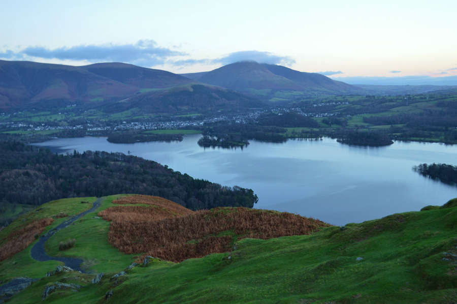 |
| Looking back down from the start of the climb with views of Derwent Water, Latrigg, Skiddaw and Blencathra. |
| |
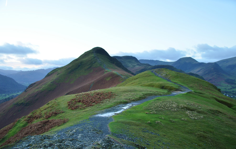 |
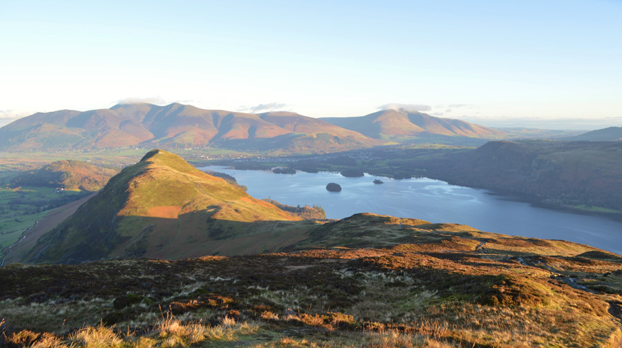
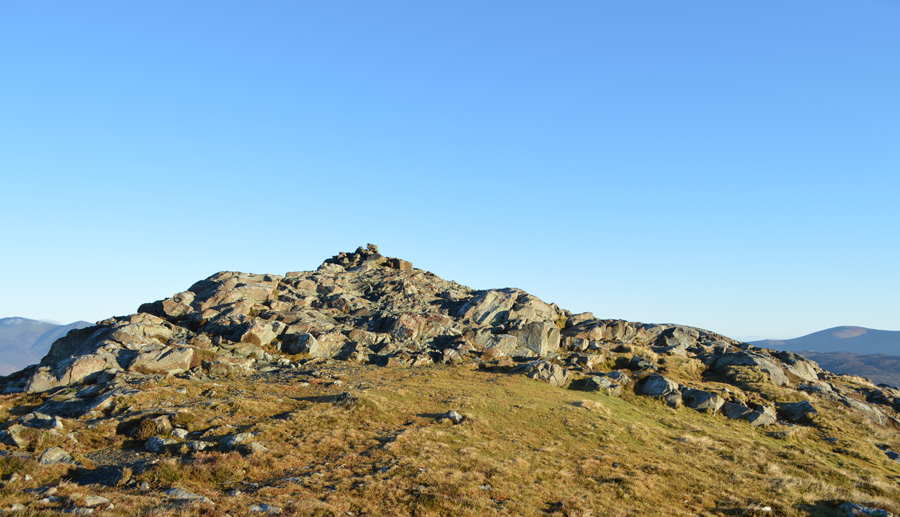
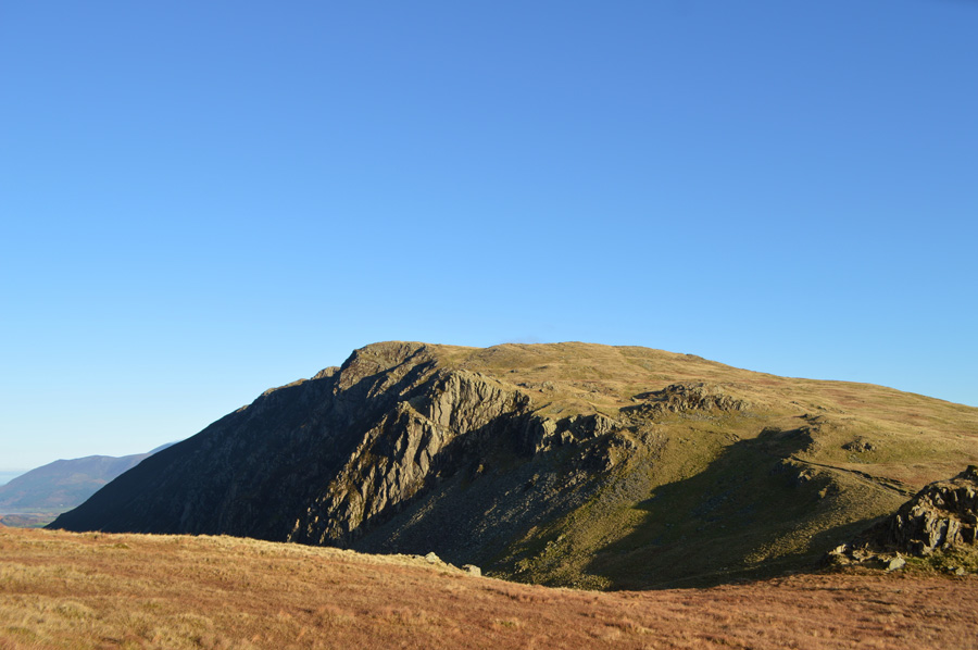
| Cat Bells from Skelgill Bank. |
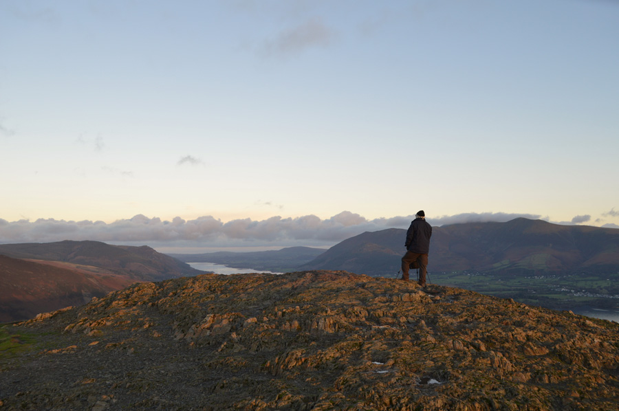
| Having topped out on Skellgil Bank my thoughts turned to the ridge ahead which always offers fantastic views along the spine of Cat Bells, up ahead I spot movement just below the summit but I cannot tell due to low light if the person is ascending or descending, either way Cat Bells is sure living up to its name as being one of the districts more popular fells. |
 |
| A truly significant moment. |
|
|
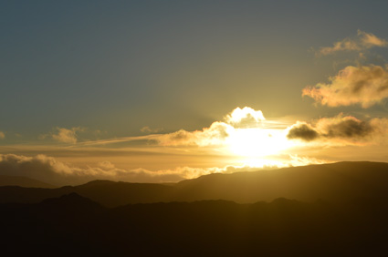 |
| Witnessing the sun breach the eastern ridge. |
|
 |
| Views over Skelgill Bank towards Skiddaw and Bassenthwaite. |
| Up ahead and below the summit I spot movement again, a silhouette of a figure that stands out between the contrast of the sunrise which is so bright it is causing my eyes to water, instantly the fell side is awash in light as the sun inches its way over the eastern ridge, a camera during such times does these special moments no justice but at least special memories can be forged, it was a truly wonderful few moments to see the wild grasses burst into colour. |
 |
| Cat Bells summit with views of Bassenthwaite and Skiddaw. |
I soon topped out at the summit and was greeted by this chap, we passed on our mornings and he asked me of my route followed by a small conversation on the recent floods, we both agreed that it felt like the sun had been away far too long which was his reason for being here with his camera and tripod.
"there's two ahead of you you know" well, that's Cat Bells for you.
The gent had spoken of two more walkers ahead of me, I scoured around but I couldn't see anyone, perhaps they were upon Maiden Moor or, had descended via Hause Gate, either way you have to get up pretty early to be the first person on Cat Bells, whatever time of year. |
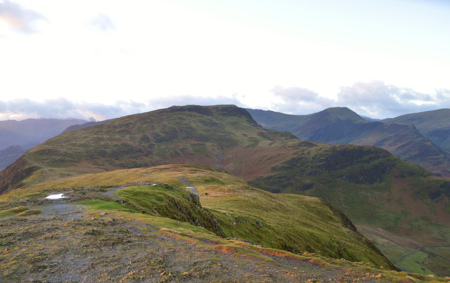 |
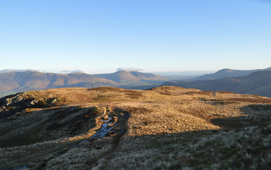
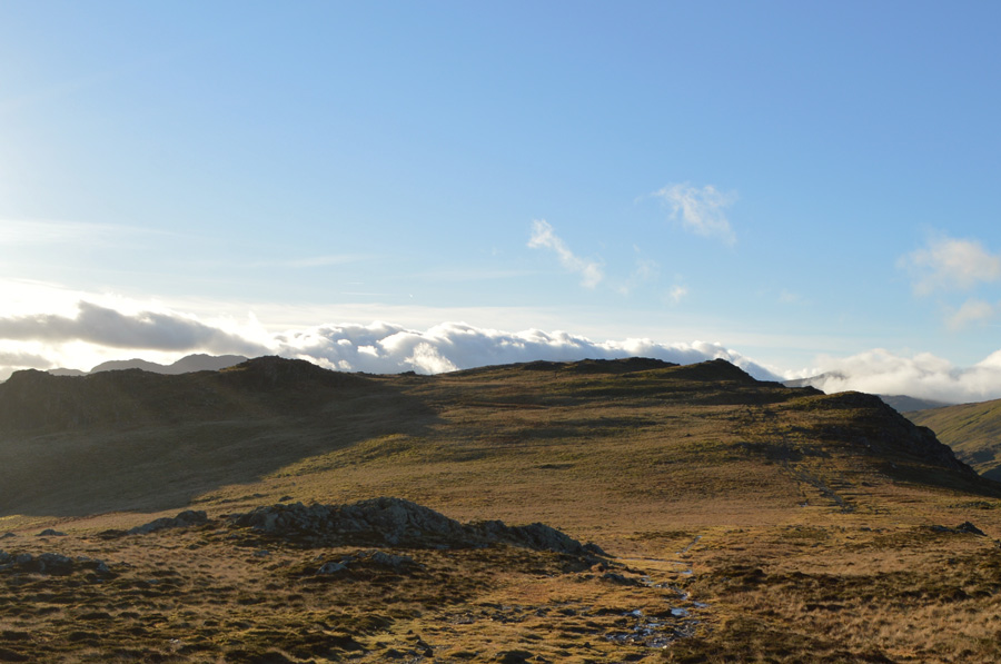
| Looking ahead over Hause Gate towards Maiden Moor and Hindscarth. |
| Next, it's a boggy ascent on Maiden Moor from Hause Gate. |
 |
| In wonderful bright light looking back over Cat Bells, Derwent Water, Skiddaw and Blencathra. |
For how much I love this route the section of path between Hause Gate and Maiden Moor has got to be one of the boggiest in the district and today was no exception, the path was in watercourse and there was no other way than to trail my own way onto the summit plateau, the sun was so strong I had no option than to keep my eyes on the ground.
Yes, your right, I had left my sunglasses in the car! Still, the sun light took my mind off the boggy bits and I was soon approaching the shoulder of the fell. |
 |
| Sun rise breaches Blencathra as a wisp of cloud clings to the summit. |
| |
 |
| Morning glory over a host the north western fells. |
| It will be lunch time before light reaches the valleys. |
 |
| Here, looking back after topping out on the shoulder of Maiden Moor. |
| I simply couldnt ask for more...well maybe my sunglasses. |
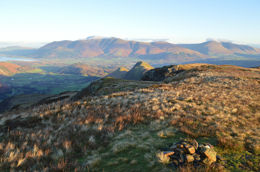 |
| Views back over Cat Bells, Skiddaw and Blencathra from Maiden Moor summit cairn. |
| I reunite my new (now slightly scared and battered) walking poles with their first summit after my last visit here during my Harry Griffin two thousanders back in summer, back then I ascended Maiden Moor from Little Town via a very steep but immensely enjoyable route over High Crags, had the grass been as dry as it was then I would have sat down to admire the fantastic views. |
 |
| Looking back over Maiden Moor, Causey Pike, Skiddaw and The Lord's Seat Fells. |
| The temperature had notably dipped as I was forced to billow warm air into cupped fist to keep my fingers from freezing in what felt like a zero windchill. A fell runner had joined me where the two paths meet along Maiden Moor's summit, we pass on our hello's before he makes across the ridge to High Spy, for me however, I plan to visit Nitting Haws summit which is found on the eastern side of the ridge between Maiden Moor and High Spy. |
 |
| Grand views over Maiden Moor as I advance on Blea Crag summit. |
| It's been a while since I felt so content on the fell that I could walk with my hands in my trouser pockets, they really are truly exceptional conditions. |
 |
| Blea Crag summit cairn. |
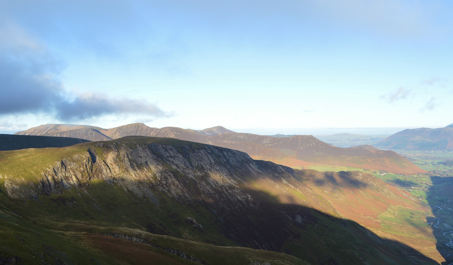
The wind was more notable along the exposed areas of the ridge such as here on Blea Crag, but it didn't matter as I found myself a nice dry rock to sit on from where I could scan Derwent and the Borrowdale valleys, it was nice to see that the water had returned to its natural coloring instead of the brown silted look, signs of the water level were evident but the carnage left behind didn't go un-noticed north of Grange. South east of my position the sun was wide eyed and getting brighter all the time making picture taking difficult.
Not that I'm complaining mind.
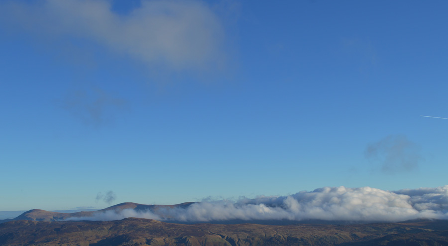
The forecasters had predicted little cloud cover over the eastern fells yet from what I can see an advancing wall of cloud is settling down along the main eastern ridge from Nab Scar to Great Dodd, Calfhow Pike will be gone soon too. Further south directly below the sun Eagle and Sergeant's Crag above the valley of Stonethwaite will soon also fall fowl to cloud as will the Gables and Kirk Fell, which are already under a duvet a white fluffy cloud.
Despite my wonderful views over the county, keeping still for too long has brought on a chill, it's time to move on towards my next summit of High Spy. |
 |
| Striding out towards High Spy. |
| No summits escaped the cloud from Borrowdale to Buttermere. |
 |
| Pausing to look back on Blea Crag. |
| |
 |
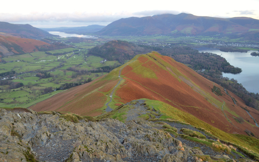
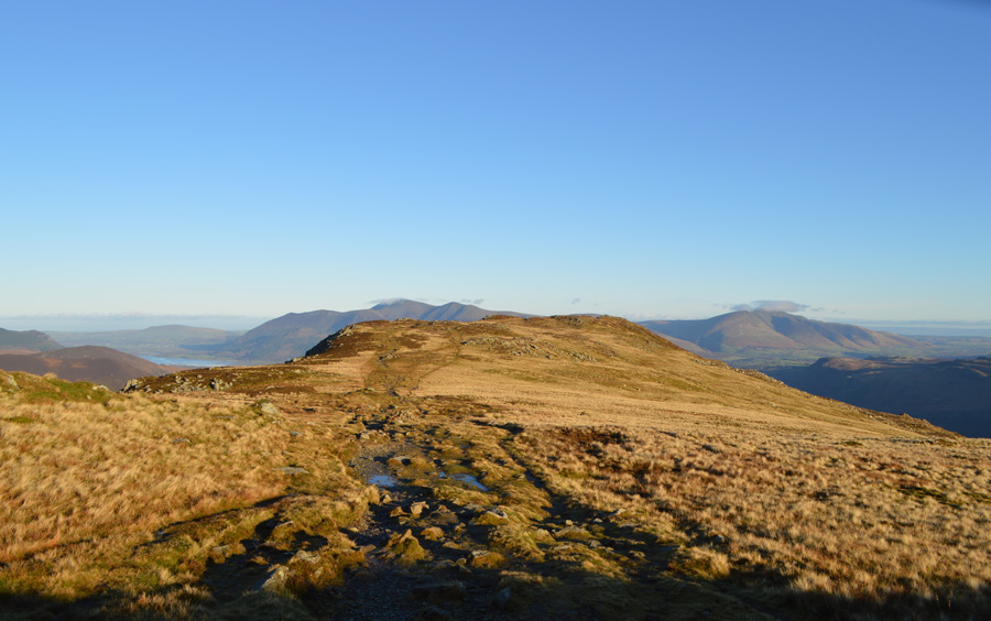
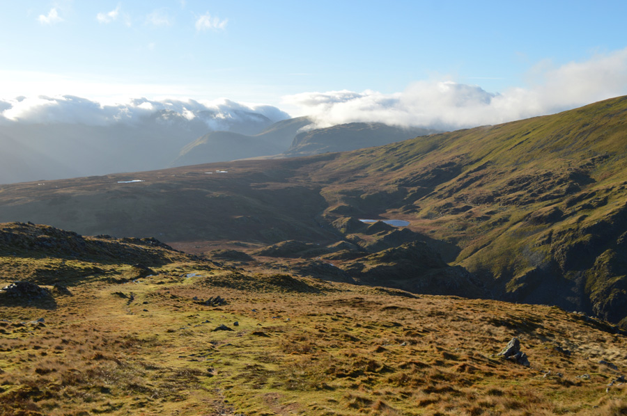
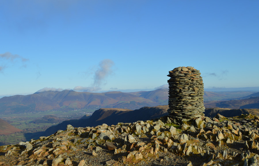
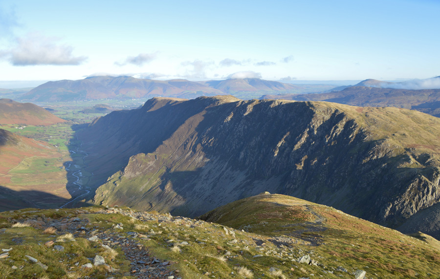
| The North Western Fells from High Spy summit. |
| From Nitting Haws you are given the choice of around three paths that cross the ridge in order to reach High Spy summit, I opted to rejoin the main path in order to look down into Newlands but a strong sun, lengthening shadows coupled with watering eyes made this difficult, this was not the case as I glanced over towards the north western fells which looked so clear and cloudless I could almost touch them, in fact it was so clear I could make out little figures on Causey Pike nearly two miles away. |
 |
| Descending High Spy south ridge towards Dalehead Tarn. |
I was out of the wind and direct sunlight which meant the walk down to Dalehead Tarn was done in a relative calm, I started to feel the warmth from the sun and soon felt at times too hot as I would take of my beanie, replacing it once the chill started to set in again. I was in great spirits, so much so I felt like I could extend the walk to one that I have planned within a walking project for 2016 but sadly, daylight hours wouldn't allow, I guess the bright sun is playing tricks on me making this December day feel like any given day in Spring.
It's still mid morning but I'm feeling a little hungry, I think I'll have another unscheduled break once I reach Dalehead Tarn. |
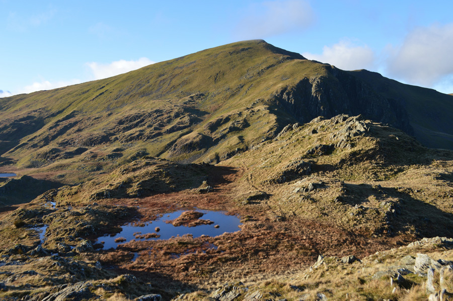 |
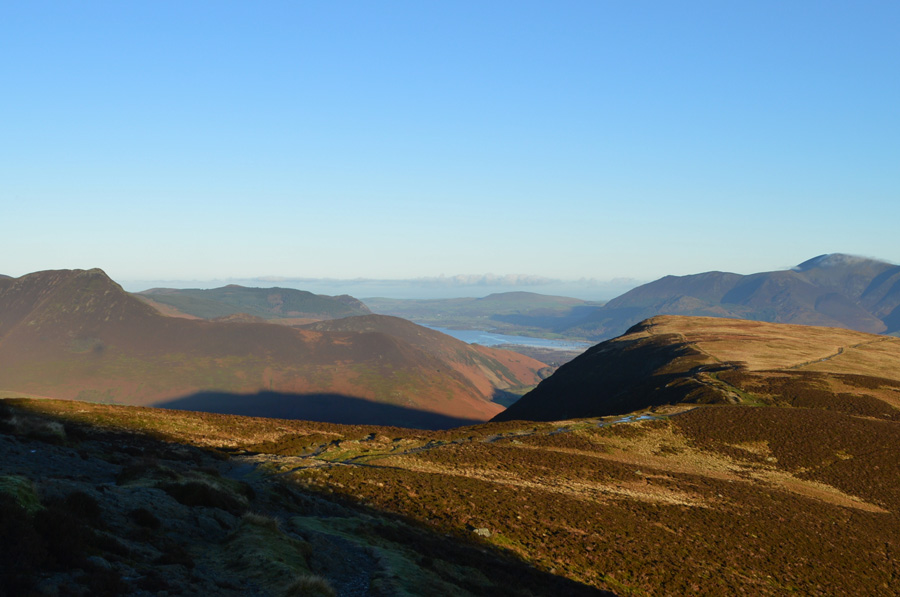
| Dale Head from my descent to Dalehead Tarn. |
| Not to be confused with the pool, Dalehead Tarn is over towards the far left of the photo. |
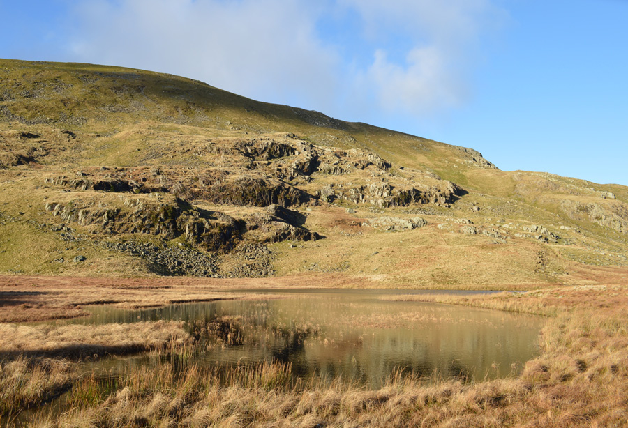 |
| Dale Head from Dalehead Tarn. |
| Looking and feeling quite remote this morning. |
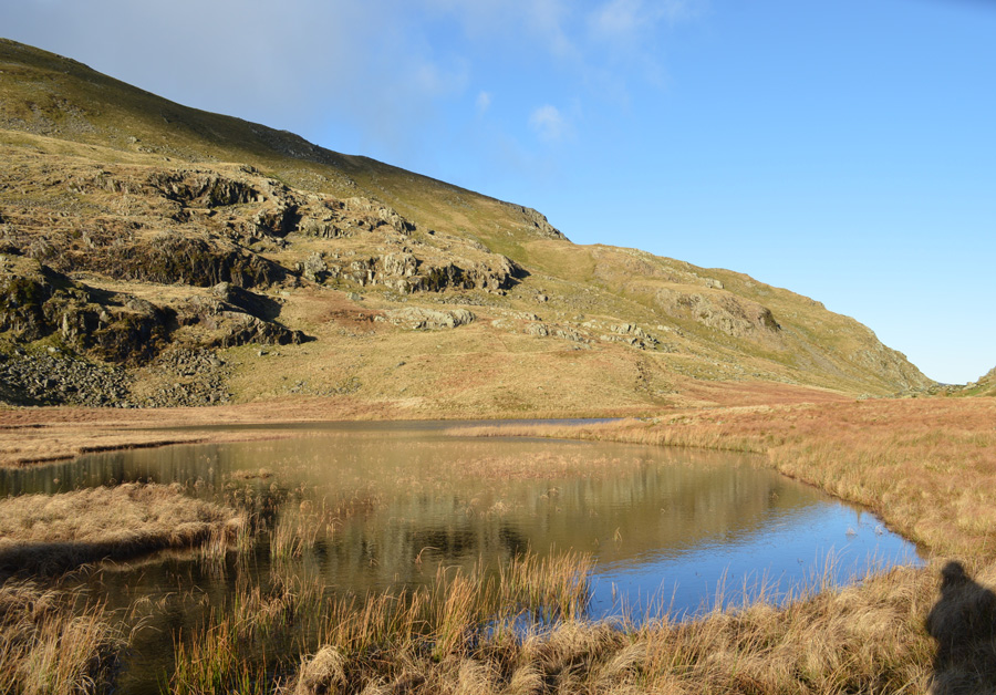 |
| With the exception of this guy. |
I have a wander around the edge of the Tarn, there isn't a whisper of wind just the warmth of the sun leaving a very remoteness feeling something of which you would never associate with Dalehead Tarn as it is a popular beauty spot, but today, I have it all to myself.
I take a walk back to the twin sheep folds which often provide shelter for not just sheep but humans too, here the grass is grazed short and large rocks have been set out out which enables walkers to enjoy the view over the Tarn. I de-shoulder taking out my lunch, its beef flavoured rice that I start to tuck into almost forgetting to leave half for when it is actually lunch, once fed I re shoulder before taking on the stepping stones from where the steep climb to Dale Head starts.
If I remember rightly, Fix the Fells were repairing the path the last time I was here in summer, hope they have managed to finish it. |
 |
| High Spy from the ascent of Dale Head |
From Dalehead Tarn the path follows a staircase of stone which I'm glad to report has been finished and hasn't been affected by recent flooding. The path is steady and steep as it twist and turns before breaching out at the foot of Dale Head northerly ridge, where a small stone cairn sits marking the start of the miners route which descends below the summit and into the Newlands Valley. The cairn is passed as I start the steep ascent trying at times to keep the sun out of my eyes, but failing as no matter how 'into the fell' I get the suns glare is never far away.
It's a steady slog and with no false summits I am soon upon the rocky summit plateau. |
 |
| Dale Head summit with views of Maiden Moor and Skiddaw. |
| |
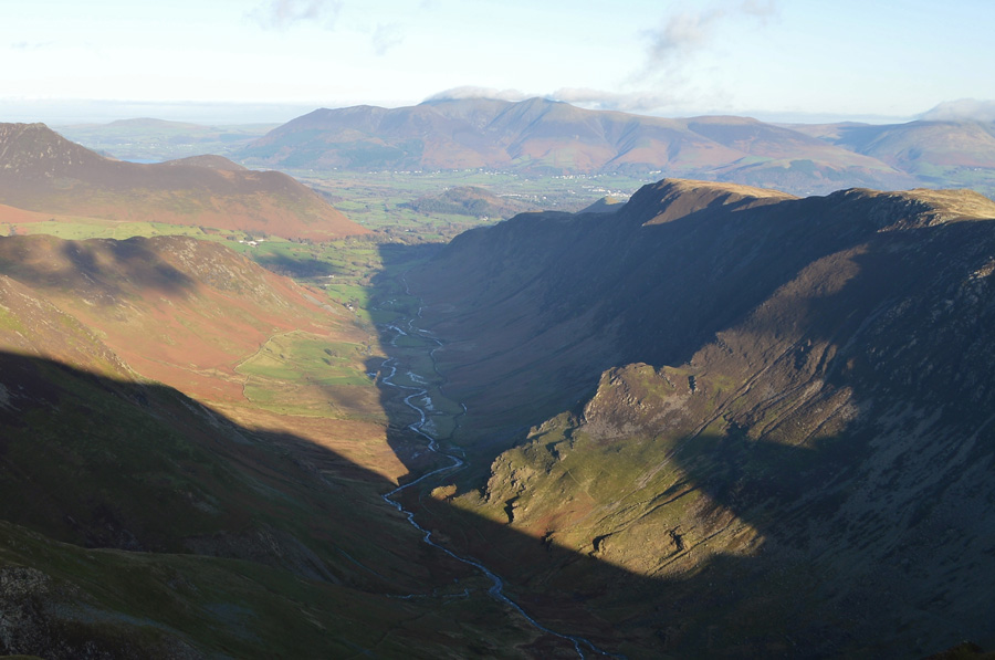 |
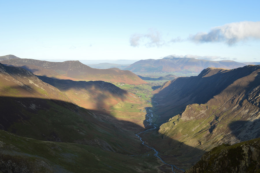
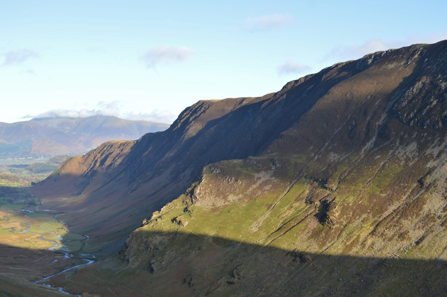
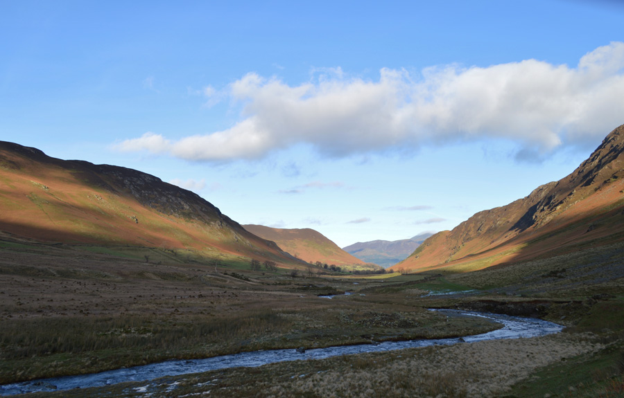
| The Newlands Valley from Dale Head summit. |
| Parts of which are still in shadow but hopefully not for long. |
 |
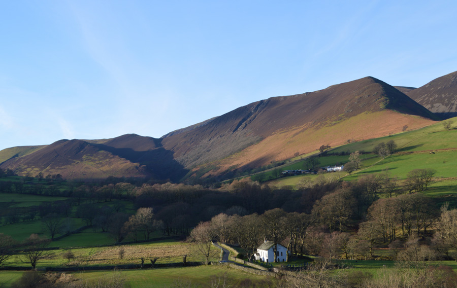
| Hindscarth descending towards Scope End. |
| The decision to include Hindscarth was toying with my plans, had I made it I would have missed out on the Newlands Valley, had I have gone for it I would have took in the delights of the High Crags to Scope End Ridge, it really was a decision I had to give a great deal of thought too but in the end I stuck to original plans. |
 |
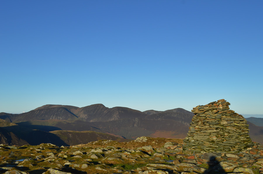
| The cloud over on the Helvellyn range is still advancing towards Clough Head. |
| Seen here, over the central ridge incorparating Bleaberry Fell, High Seat and High Tove. |
 |
| Decending Dale Head north ridge. |
I retrace my steps thankfully with the sun now on my back, I know it sounds like I don't appreciate the sun, but when it's in your eyes for the entire morning your eyes get a little fed up of watering and squinting...I walk only as far as the crag of rock seen at the end of the ridge before turning left where I will join the miners path.
Serves me right for forgetting my sunglasses I know. |
 |
| The Miners Path. |
| If any path caused me concerns today it was the miners path found on the north face of Dale Head, it would seem that the path isn't as fragile as I first thought and I can report that the path is in good order all the way to the valley floor. |
 |
| Sunlight now begins to breach the valley. |
| |
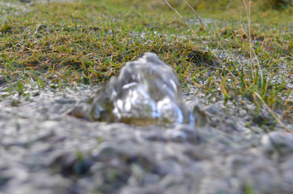 |
| The ground was oozing water everywhere. |
|
|
 |
| The moutains own way of dealing with the excess water. |
|
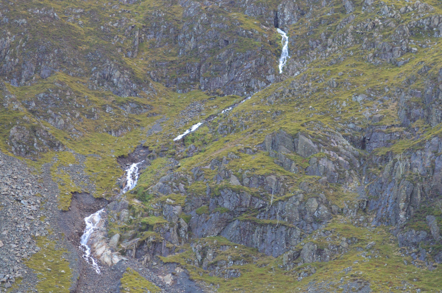 |
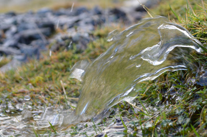
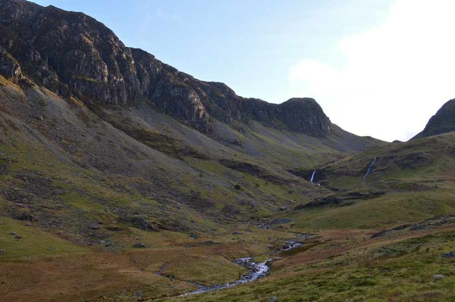
| Powerful waterfalls emerge from disused adits then seamlessly disappear back into the mountain. |
| |
 |
| The views are too impossible to ignore. |
| Especially the sight of Castle Nook, that's the steep craggy ridge seen in the right foreground found just north of High Spy summit, I'm sure not many people can claim they have gained the ridge via Castle Nook, but I know one man who has, his name is Rod Hepplewhite, hats off to you Rod. |
 |
| Looking back up towards Miners Crag before crossing a youthful Newlands Beck. |
The miners path is descended where in places it has turned into a watercourse, this is easily avoidable by sticking to a bank close to the path, once the lower zig zags are reached Far Tongue Gill is crossed, I have used this route on many occasions but I have never seen so much water coming off the fell, it normally takes one careful stride to cross the Gill, today it is almost ten feet in width and caution was key. Having crossed Far Tongue Gill the path straightens and the sound from Newlands Beck fills the ears, more so after the floods.
I make a slight navigational error incorrectly thinking that the stepping stones may have been washed away I head further up stream choosing a crossing point where I can at least use submerged rocks and where I consider the water to be at its shallowest, I cross easily making use of my gaiters, the beck not getting through to my socks in any serious way only to realise that the stepping stones are still there, it's just I couldn't see them due to their tops being barely visible over the fast flowing water, never mind I guess.
I rejoin with the valley path which is still in shadow but thankfully dry, ahead I can see the sunlight as it steadily creeps towards me, it's there I tell myself I'll finish off lunch. |
 |
| Rowling End/Causey Pike from the Newlands Valley. |
| If it wasn't the sound of Newlands Beck in full flow it was the waterfalls cascading down the fell side on both flanks that filled my ears, in parts the river banks had totally been washed away leaving in its wake unstable ground, what once was a quaint valley today was licking the wounds of Storm Desmond. Up ahead, in particular two sections of the two mile path had been subject to landslide between Far Broadgill and Near Broadgill, this is in and around the Climbing Hut area, the area around the landslide is easily avoidable although care must be taken. |
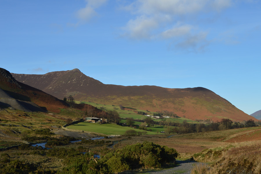 |
| Causey Pike over Low Snab Farm from my lunch spot. |
| Finding somewhere to sit was proving impossible until I found a lone boulder just large enough for myself and my pack, the views over towards Causey Pike were beginning to steal the day. |
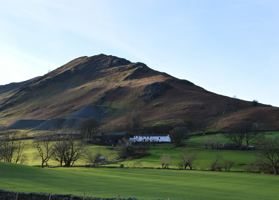 |
| Scope End over Low Snab Bank Farm. |
| It really is starting to feel like a Spring day, who would have thought that this is the end of December...not like we don't deserve a little sun mind. |
 |
| Strong winter sun over Hindscarth and Scope End. |
| |
 |
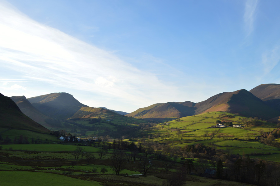
| Ard Crags and Knott Rigg under glorious afternoon sun. |
| That's Newland Church in the foreground, a very popular attraction to many a walker and tourist, but not today it would seem. |
 |
| Causey Pike, Rowling End seen with Barrow's north ridge. |
| I had said my final farewell to Newlands through striking sun, by now I was easing my way above Little Town via a grassy path that I had picked up a hundred or so yards before reaching the Hamlet, here I pass a woman and pleasantries are passed. |
 |
| Following the wall back to Gutherscale via Yewthwaite Mines. |
| The path starts to rise steadily towards the disused Yewthwaite Mines found south of Cat Bells summit, despite being back in the shade the steady climb causes some huffs and puffs as I take off my beanie in order to let the air circulate around my head. I come to the end of the track in the shadow of Yewthwaite Comb, back in 2009 the floods washed away the footbridge over Yewthwaite Gill and I wondered what was the fate of the new footbridge that had been bulit to replace the old one. |
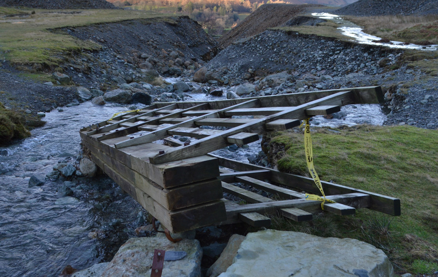 |
| Well I guess that's that question answered. |
You can see the severity of how much water came through here by looking at the rather large boulders that have been washed downstream during the storms, I guess they played a large part as to why the new bridge is now lying on its side. On a positive note however I would suspect that with the help of a JCB and some chains you could re-anchor the bridge using thicker steel mounts than what you see in the bottom of the photo although I suspect the PC Brigade wouldn't see it that way.
Crossing Yewthwaite Beck was easy on a day like today when it would seem that the beck has returned to an almost reality, although common sense and caution must be exercised when coming across obstacles like this, had the beck been in spate I would of had no option than to find an alternative way around. |
 |
| Newlands. |
Two walkers had just descended the Yewthwaite Mines path and were now about fifty yards ahead of me, they walk with pace but I soon catch them up passing on my hello as I pass. Gutherscale is just around the corner as my eyes are filled with views over Skiddaw which is now completely cloud free, I wondered what the wind was like over the summiit.
The path back to Gutherscale is passable but is in need of some serious repair, it would appear that the water during the storms has channelled gorges in great sections, some of which are up to three feet in depth and require constant care when using. I arrive at the tarmac lane that links Skelgill to Gutherscale and its still flowing with water from width to width which, I use to clean my boots with.
Ahead two large groups approach me as more hi's and hellos are passed before arriving back at my car from where I start to kit down, the time is 14:00 as I mutter, six hours, not bad considering the amount of time I have spent sitting down. My beanie is replaced by my baseball cap and my Bloc Billys are added for the journey home as I glance up at the rear view mirror, and smirk, is that bloody sun burn on your face.
I would like to take this opportunity to thank everyone who has visited Sharkeysdream over the year and indeed years, you are the sole reason why this website is here and I want to thank you all from the bottom of my heart for all your past and future visits.
Merry Christmas and a Happy New Year
Paul Sharkey |
|
| |
| Back to top |
 |
|