|
The Harry Griffin 2,000 footers Walk 25 -Pillar Rock |
 |
 |
29th August 2015 |
 |
|
Ever since I committed to taking on the two thousand footers back in January climbing Pillar Rock in order to collect all 203 summits was questionable if not impossible when one is regarded as a walker and not climber, so after months of consideration, and a little sadness I chose not to pursue Pillar Rock summit for a number of reasons but most of all honesty, I am simply not a climber, therefore Pillar Rock will remain uncollected.
Such the lure and speciality of the Rock which Harry had first climbed back in 1930 and by every imaginable route since Harry fittingly had chosen Pillar Rock to be his last two thousander, and who could blame him. My last summit has been confirmed which will hopefully see my own campaign end good willing in early September but for now the least I can do is show my oath to Pillar Rock, and indeed Harry Griffin by following his original route to the base of the Rock which somewhat differed at the start due to Harry being a member of a 'certain' rock climbing club which allowed him access by car along the Ennerdale forest track as far as Gillerwaite Farm.
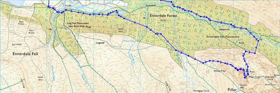
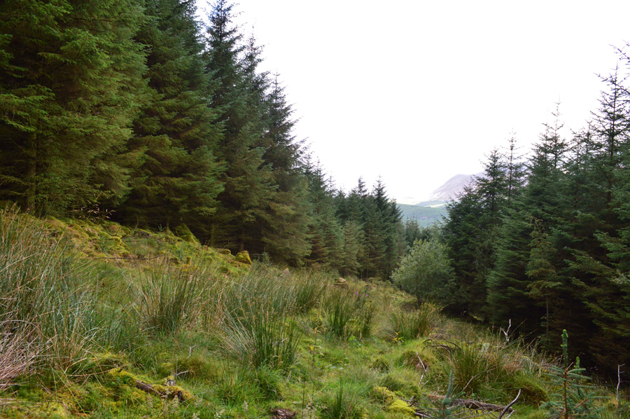
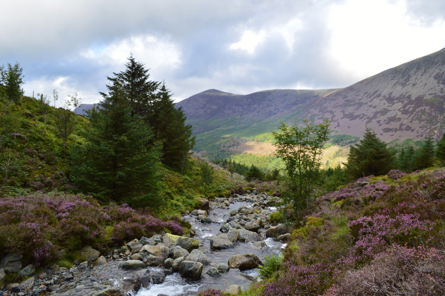
Besides Harry's advantage our routes remain the same, after crossing Irish Bridge I would head along the forest track passing Moss Dub along the way, ahead, a vigil eye is needed in order to pick up the forest track to the base of White Pike where after a steep ascent I would follow Harry by going off path just as he did by following a climbers trail to Pillar Cove which was much easier said than done...On reaching Pillar Cove Pillar Rock now commands full attention before my final descent via Pillarcove Beck all the way back to the Ennerdale Valley where the Liza is crossed once again before the long journey under afternoon sun back to Bowness Knott. |
|
| Freeman of the Hills |
 |
| 'Pillar Rock' |
| The original plan had been to climb the rock by the North West or North climb but, unpacking the equipment, one of us said to the other - I can remember which one of us - "whats the point in taking all this gear? After all, were only supposed to be peak-bagging." The others agreed and so we dumped the rope and all the gear in the back of the car and tramped on - not climbers now but walkers, although we hoped we were also mountaineers. |
| Harry Griffin |
|
|
| |
|
Overview |
|
|
| Ascent: |
2,884 Feet - 880 Meters |
| Summits Over 2,000Ft: |
No Summit Was Reached On This Walk |
| Weather: |
Overcast With Sunny Spells. Some Light Rain Showers. Highs of 18°C Lows of 15°C |
| Parking: |
Bowness Knott Car Park, Ennerdale |
| Area: |
Western |
| Miles: |
10.6 |
| Walking With: |
On My Own |
| Ordnance Survey: |
OL4 |
| Time Taken: |
5 Hours 20 Minutes |
| Route: |
Bowness Knott - Irish Bridge - Moss Dub - Ennerdale Plantations - High Beck - White Pike North West Ridge - Pillar Cove - Pillarcove Beck - River Liza - High Gillerthwaite - Low Gillerthwaite - Bowness Knott |
|
| |
|
Map and Photo Gallery |
|
|
 |
| |
| |
  |
| |
| |
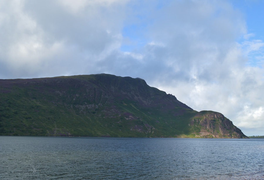 |
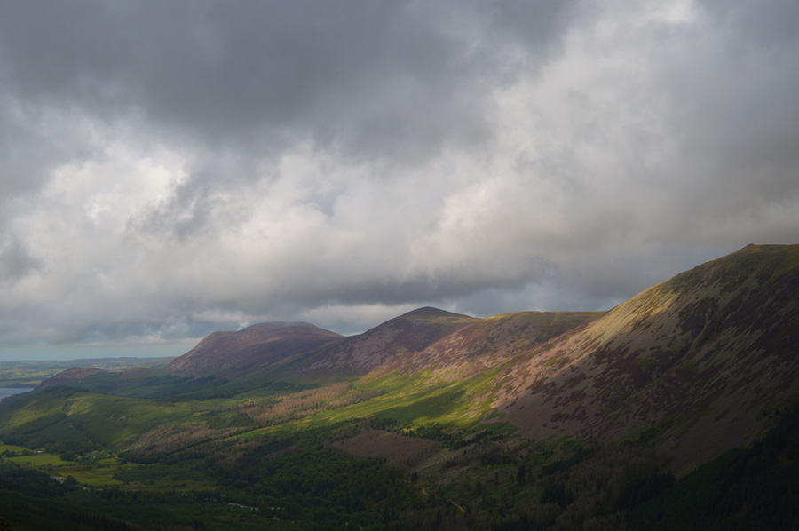
| Crag Fell and Anglers Crag seen over Ennerdale 10:10am 15°C |
I hadn't intended to walk today but tomorrow instead but just in case I had primed my kit should I change my mind which is just what I did. Its a long and tedious drive from Wigan to Ennerdale taking two and half hours covering around 140 miles each way, that's a lot of music time I can tell you. I had deliberately chose to leave home later than usual leaving time for any predicted low cloud to lift which it had by the time I reached Scales which saw clear views over Blencathra, Skiddaw, the east and the north western fells, if the theme continues further west I may get my clear views after all. By the time I had left the A66 at Cockermouth the walk started to feel more real and I soon switched back to the route ahead once Felldyke had been passed and the blue of Ennerdale Water soon came into view.
I had predicted a full car park and was right by the time I reached Bowness Knott at this later hour, with just the odd space which I secured hastily. Despite the car park being full the only people around were a small group of walkers possibly Coast to Coasters who walked by as I tied up my boot laces, for the first time this summer I throw my jacket on as it takes the edge of the cold air blowing in across the lake. |
 |
| Sun breaks through low cloud as I take on the foresty path. |
| It had been a dry night and the lake path reflected this. Having only just left the car park I was already regretting my decision to wear my jacket, yes it was a tad nippy but when the sun did shine, it brought with it, heat. Ahead just one of the walkers I will pass on route to Irish Bridge although it did take a while for me to catch and overtake this guy who spoke with a southern ascent, further ahead before reaching my crossing of the Liza I pass the group who I had spotted from the car park "blimey you're quick" said a woman who spoke with a soft Australian acsent, I passed on my good morning and smiled all the while thinking, I'm not quick, just eager. |
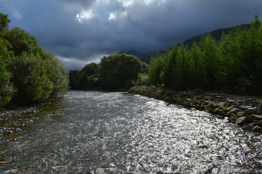 |
| Sun burst over the Liza from Irish Bridge. |
| The sun was still shining through thick cloud by the time I reached Irish Bridge where I got my first view of Pillar seen topped with a heavy bank of cloud. On reaching the bridge I would pass a couple who had strewn for some reason, wet clothing all across the concrete in order to dry...I found it a little odd that these weren't socks or even shorts for that matter but base layers and trousers just lying on the concrete...had they jus given them a spin in the Liza? possibly, even so I pass on my morning all the while keeping an eye on that cloud up ahead. |
 |
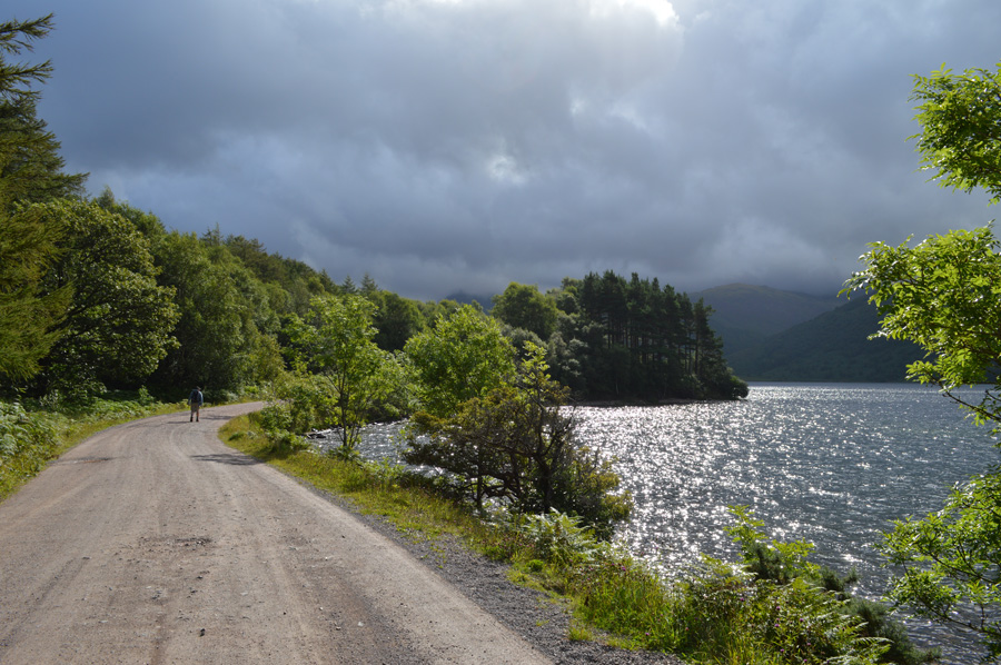
| The High Stile ridge and White Pike (R) seen from Low Gillerthwaite. |
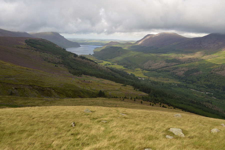
| Should luck not be on my on side today, that low cloud maybe just high enough for me to carry out my traverse into Pillar Cove from the White Pike ridge, but there's plenty of miles and walking to be had before I reach the ridge so fingers crossed for now. |
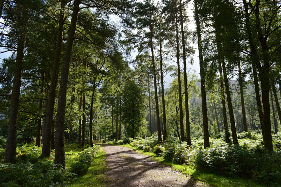 |
| Shadows and tall trees. |
| Any U2 fan may know where I stole this from. With the Liza crossed I head along the path before reaching a wooden gate/sty where I take a left turn - now on the other side of the Liza which still keeps me company to my left flank. Up ahead around a mile away I wanted to pay a visit to Moss Dub which is a small tarn found just off the main path, but between me and it is just under a mile of blissfull walking through wooded areas just like this. |
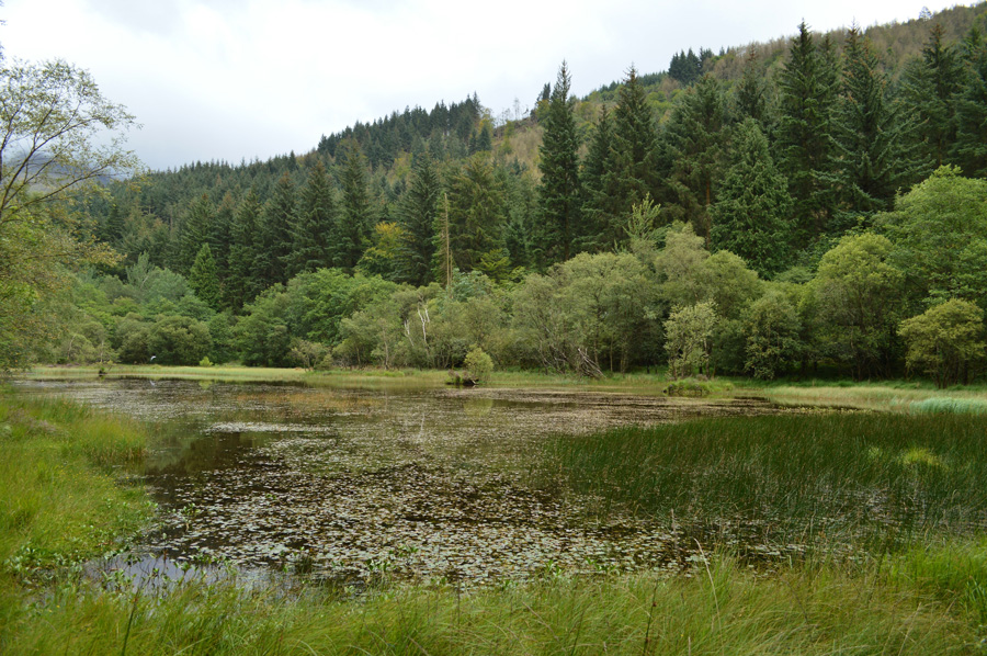 |
| Moss Dub. |
Having been in my own world for the last mile or so I almost missed the diversion path to Moss Dub, so much so I had to check my map to see if I had walked passed it, thankfully I hadn't. A single track leads off the main path where views open up across this little gem of a Lakeland tarn, sadly though even in summer the area around the tarn is very boggy which meant if you where to stand in one place for more than a few seconds you would literally start to sink. Getting close to the tarn isn't without its difficulties as thick undergrowth has to be negotiated which is where I tore a chunk of skin of my right knee resulting in lacerations and grazing, dear god all I wanted was a quick photo!
If anyone should ask, I wrestled a grizzly bear. |
 |
| Lingmell Plantations. |
A rather unflattering photo I know but this isn't to say this isn't an important one, especially when on the look out for a very narrow path into the forest. Just after the bridge is crossed where the two wooden poles stand I head right into the Lingmell Plantations.
You have to wonder how many people on the look out for this path seamlessley walk on by, it really is a difficult one to spot which is the reason for the photograph. |
 |
| Everynow and again beauty spots open up along the side of the path. |
I follow a nameless beck though a thick canopy of trees never far away from the sound of water which I find comforting. The path is steep in places and always singular passing over tree roots and large boulders which when wet, require extra care. This is the kind of place should a crazed axe men have is way with you here, all he would have to do is leave your corpse a couple of feet from the path and no one would ever find you in such the density of the forest! I'm such great company on own, so already, you've wrestled with a grizzly bear and taken on an axe man all in the space of one hour.
No wonder you walk alone. |
 |
| Looking back over swollen ground. |
I follow the path which leads me out onto the Nine Becks Walk (path) which after consulting my map is just another forestry path but, valuable height had been gained all the same, on looking at said map I should now be looking at another path which would continue through the forest to the foot of the White Pike ridge but I simply cannot find it. I back track a little along the forestry path to see if I have missed it, then retrace and walk ahead before finding myself back in the same place, ok I've done my recky and I simply cannot find it, valuable time is now to be wasted.
However all is not lost, through the thick undergrowth I can see a moss covered wall which is shown on my map too, should I follow it this would lead me to where I need to be (could this be my path) yes it could - but there was no way I was going to follow the wall in that undergrowth having tried already before being forced back yards in such the density of the forest with no path sighted, I retreat, not before almost losing my left boot and my shin in bog water.
Okay. My map shows another route around 250 yards further ahead the Nine Becks Path which I follow until the thick canopy of trees that line the path give way for an opening, it would seem I have found my alternative route to the base of White Pike, here looking back on said path having negotiated a tricky bog like ascent right about the same time the sun disappeared and it started to rain. |
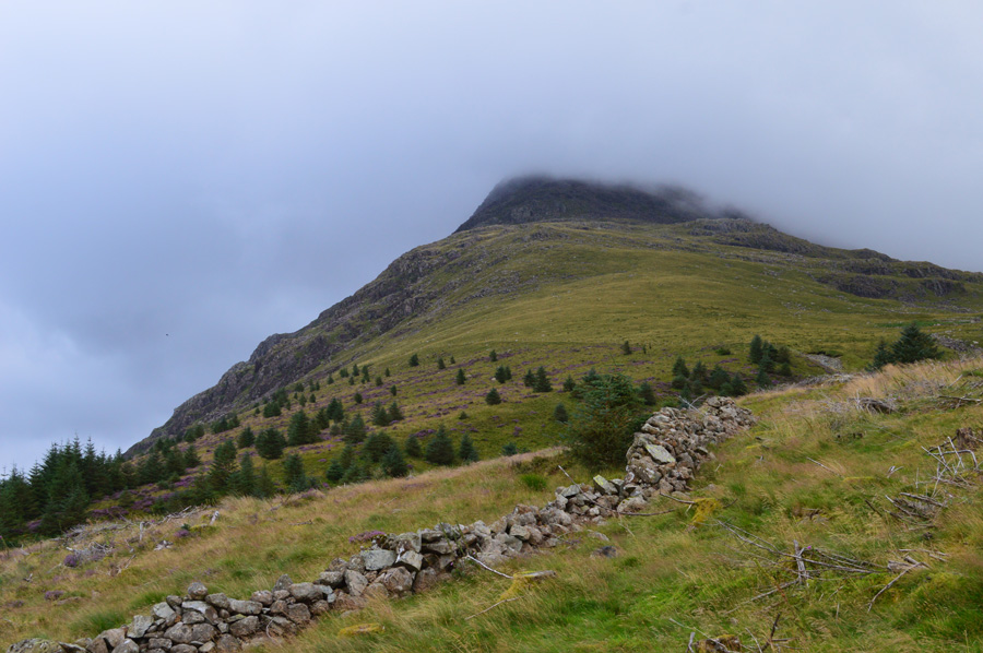 |
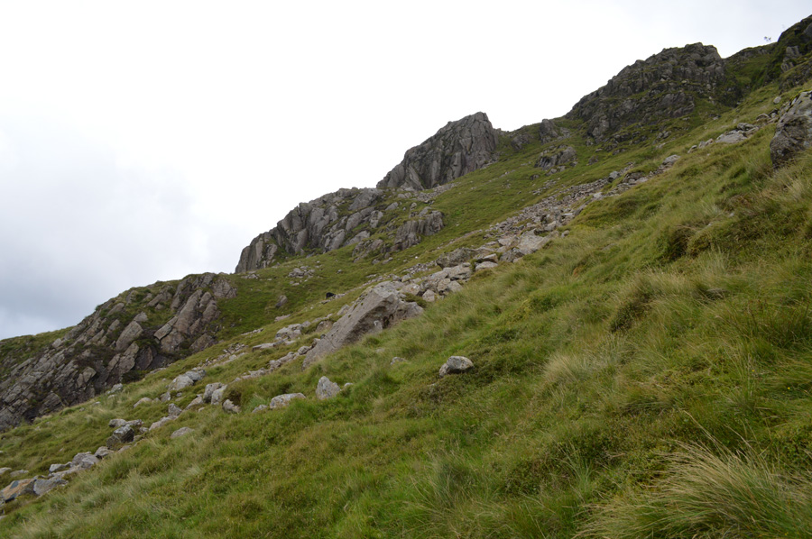
| White Pike north west ridge. |
It was still spitting by the time I reached the base of the ridge and if I'm truly honest morale had dipped slightly more so when witnessing low cloud which hung around White Pike summit. I watched and collected myself a while as the cloud came in thickly from the direction of Windgap Cove, this isn't really the best conditions to be attempting an 'off path' traverse into Pillar Cove which would start just beneath the summit of White Pike right about the same area the cloud is hanging over.
There's still time for the cloud to lift as I pull myself together and take on the steep ascent on White Pike. |
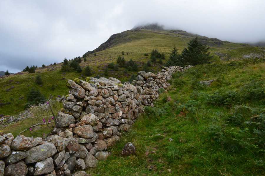 |
| White Pike. |
| Here I cross the stone wall which descends me steeply into High Beck before a steep re-ascent emerges me at the base of the ridge, an alternative path leads you around far right where High Beck Narrows and is easier to cross, but having always preferred the direct route I go with the shorter, but harder route. |
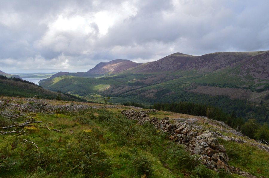 |
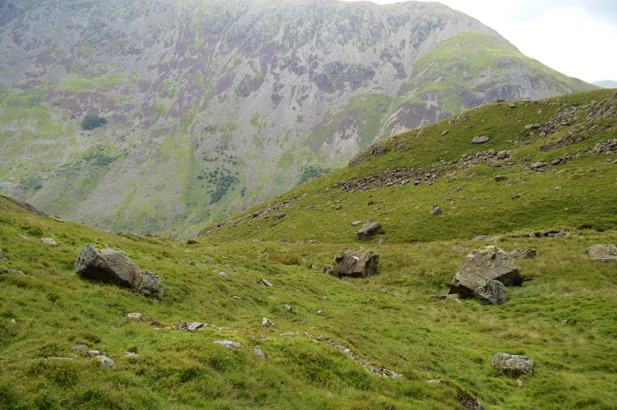
| Views back over Starling Dodd, Great Borne and Ennerdale. |
| |
 |
| Crossing High Beck. |
Wasn't without it's incident where I just about managed to keep my feet dry having negotiated a toppled wooden sleuth gate that I first thought would help me with the crossing when really, it just acted like a giant spring board! Alternatively it would have been safer to cross the river by boulder or the river bed.
I press on. |
 |
| Commanding views into the Ennerdale valley from White Pike north west ridge. |
| I think if there was any point in the walk which reminded me of what lay ahead this was that point. Having climbed the ridge and with my exit point sighted at the base of the summit I eagerly press on as the butterflies in my stomach remind me that for the next mile I would be walking along the flank of White Pike having never walked here before I could only think on what would lay ahead, and had I bitten off more than I could chew? |
 |
| Leaving the main path for 'off the path antics' |
| I had reached the base of White Pike and had chosen my route along the flank of the fell having already trained my attention to my map during the course of the last week negotiating the route will not just be down to map reading, but being a good reader of the lay of the land. |
 |
| Do I go under or over? |
Photography was the last thing on my mind feeling my heart pulsating through my chest this was about how alive one could feel when fell walking when presented by tricky crag descents and re-ascents. Two thousand feet below me I can see the safety of the Ennerdale Forestry track and on it, walkers who had stopped to picnic, I wonder had they spotted me too, I wondered further still if they had, did they think that I was lost or just crazy.
With quite a bid of bum sliding descents I was now presented with the four crags that lay ahead, for all I knew they could fall steeply into Coves or be a successful part of my traverse. I go with the lay of the land and take a heading between the third and fourth crag, in doing so will gain me height which from here, is a steady and final steep slog, should I have gone lower, which, as I neared closer I found myself at the top of a ravine which then split into two leaving an island in the middle, Ill never forget the sound of the bleating sheep which had found themselves on said island.
High ground it is. |
 |
| |
| |
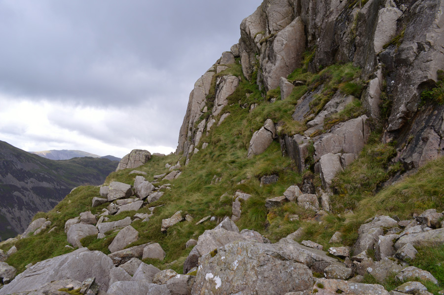 |
| Passing between the third and fourth crag brought me here. |
As exhilarating at it was finding a route between the crags successfully was a huge highlight of the traverse, I don't mind admitting that hadn't I gone with me instincts I could now be facing some very demoralising decisions. It started to rain again - this time more heavier than last, I check my map and found that I am only half way across which left a sudden gulp in my throat. With the rain falling in an almost vertical fashion I soon find myself getting soaked, the only bonus being that the side of the mountain offered protection from the advancing rain.
My camera gets tucked away and I take shelter whilst sat up on the boulder seen in the lower centre of this photo, the rain shower was heavy but thankfully didn't last too long which at least gave me some reflection time and of course, time to take in my views. |
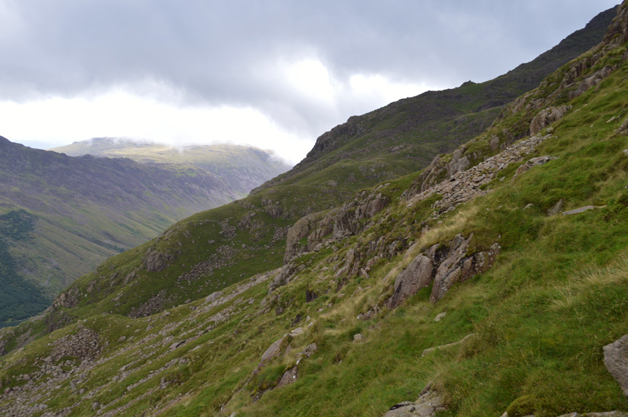 |
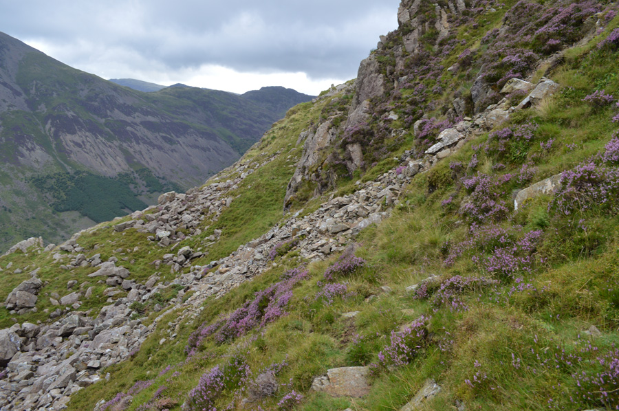
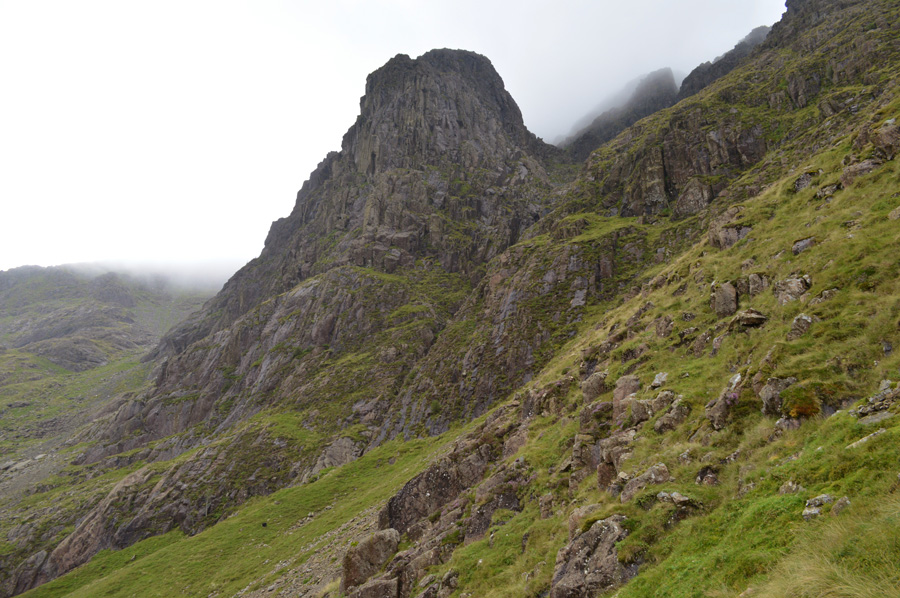
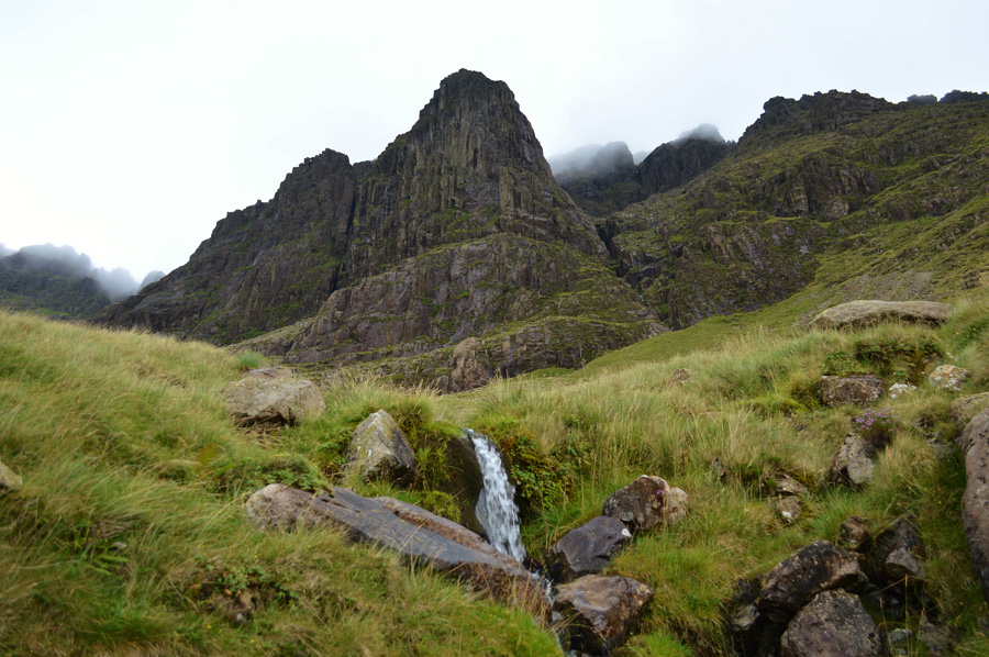
| Robinsons Cairn over Pillar Cove. |
Having negotiated the flank of White Pike I was now in Pillar territory and had been for quite some time, I feel like I have been roughed up somewhat and I guess, who could blame me, I have. With more ascents and re-ascents safely behind me I was delighted to say the least to spot Robinsons Cairn from my flank, more so as I now had been following what resembled a narrow path which left me thinking, was this a climbers path from White Pike to Pillar Rock? much like Pillar's High Level Traverse or Bow Fell's Climbers Traverse, it certainly looked too worn to be a sheep trod.
I keep with my new findings figuring that the path must lead all the way back to the White Pike ridge which I did spot in places but put it down to simple sheep trod's either way, I had found myself here with and without it as it now looks that a descent, followed by yet another re-ascent is needed in order to gain Pillar Cove which was confirmed by my first sighting Pillar Rock. |
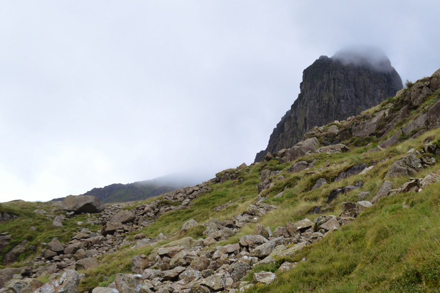 |
| A short but steep climb in needed before I find myself in Pillar Cove. |
| Pillar Rock now clearly visible. |
 |
| Stopped in my tracks with mouth watering views of Low Man with High Man behind. |
| |
 |
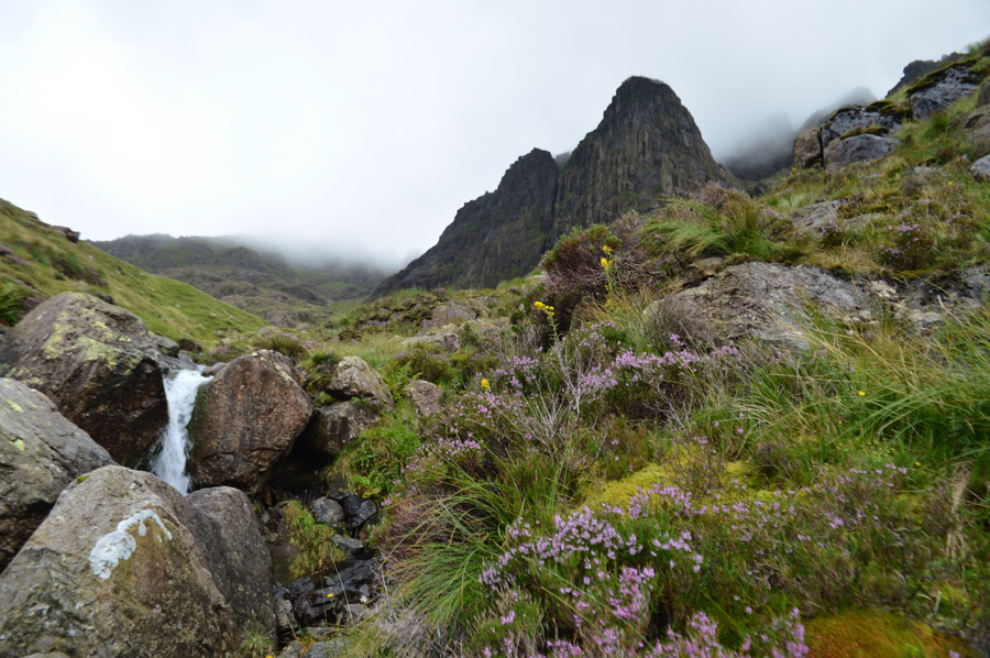
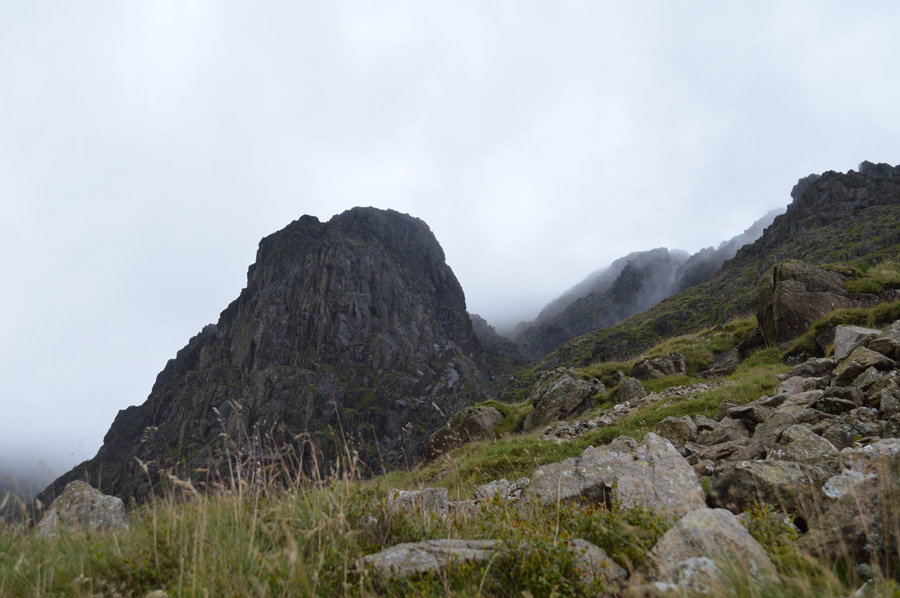
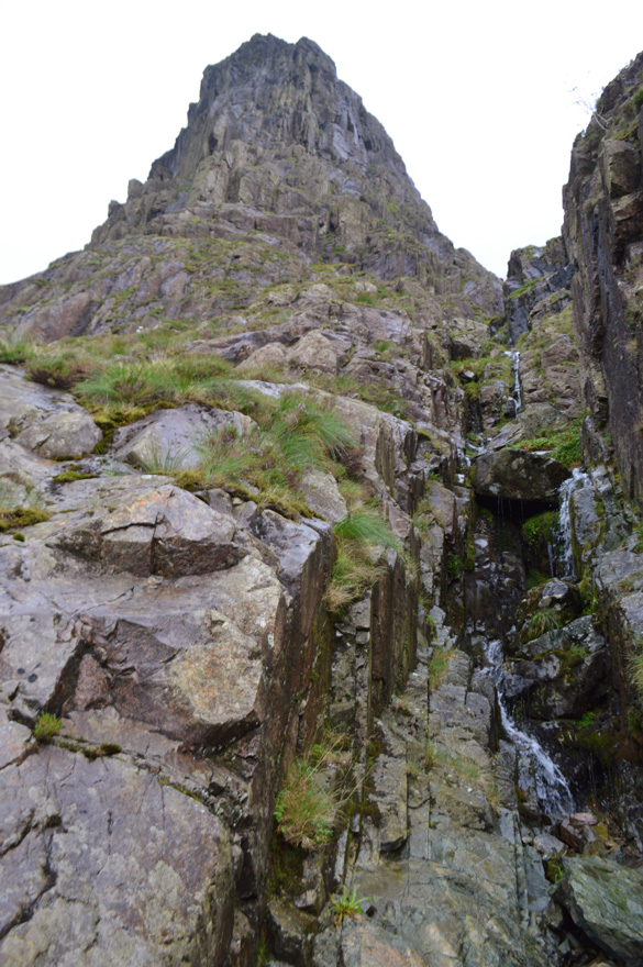
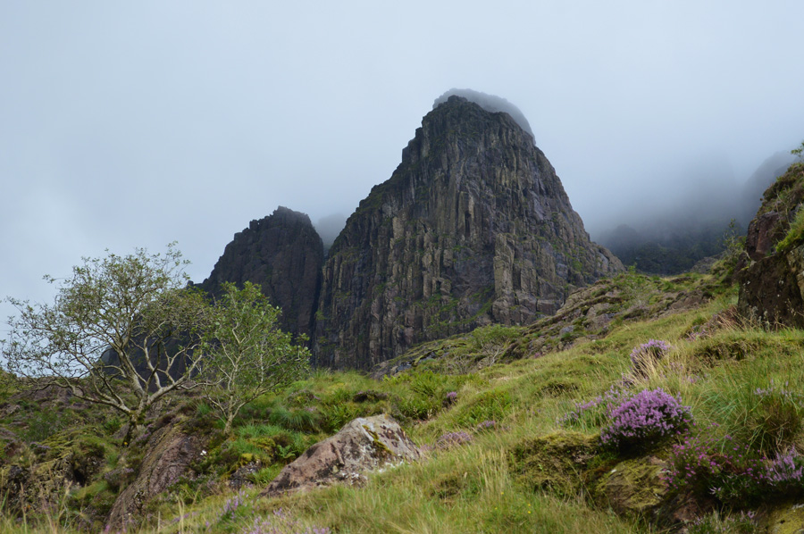
| Pillar Rock (Low Man & High Man ) over Pillar Cove. |
I climbed steeply over crag and grass before I found myself over looking the enormity of Pillar Rock, feeling over shadowed but more to the point, feeling pretty pleased with my progress into Pillar Cove finding myself in the exact position that I had planned, more rain fell but nothing could take away how I found myself here in the first place, I wouldn't recommend the route that I had chosen to the in-experienced, but I do believe I have found one of the most exhilarating 'off the path' routes in Lakeland, this is of course my own personal observation.
Even from here it's difficult to feel just how over shadowing Pillar Rock is when viewed from Pillar Cove, It simply wouldn't be enough to call it a day here, I needed to touch base with the Rock. |
 |
| Touching base close to what is known as 'The grass ledge' |
I established myself at the base of the Low Man which I greeted first with an apology to Harry 'I'm sorry, this is as far as I go' maybe one day when we meet at the pearly gates you'll shake my hand and say 'you did well enough lad'
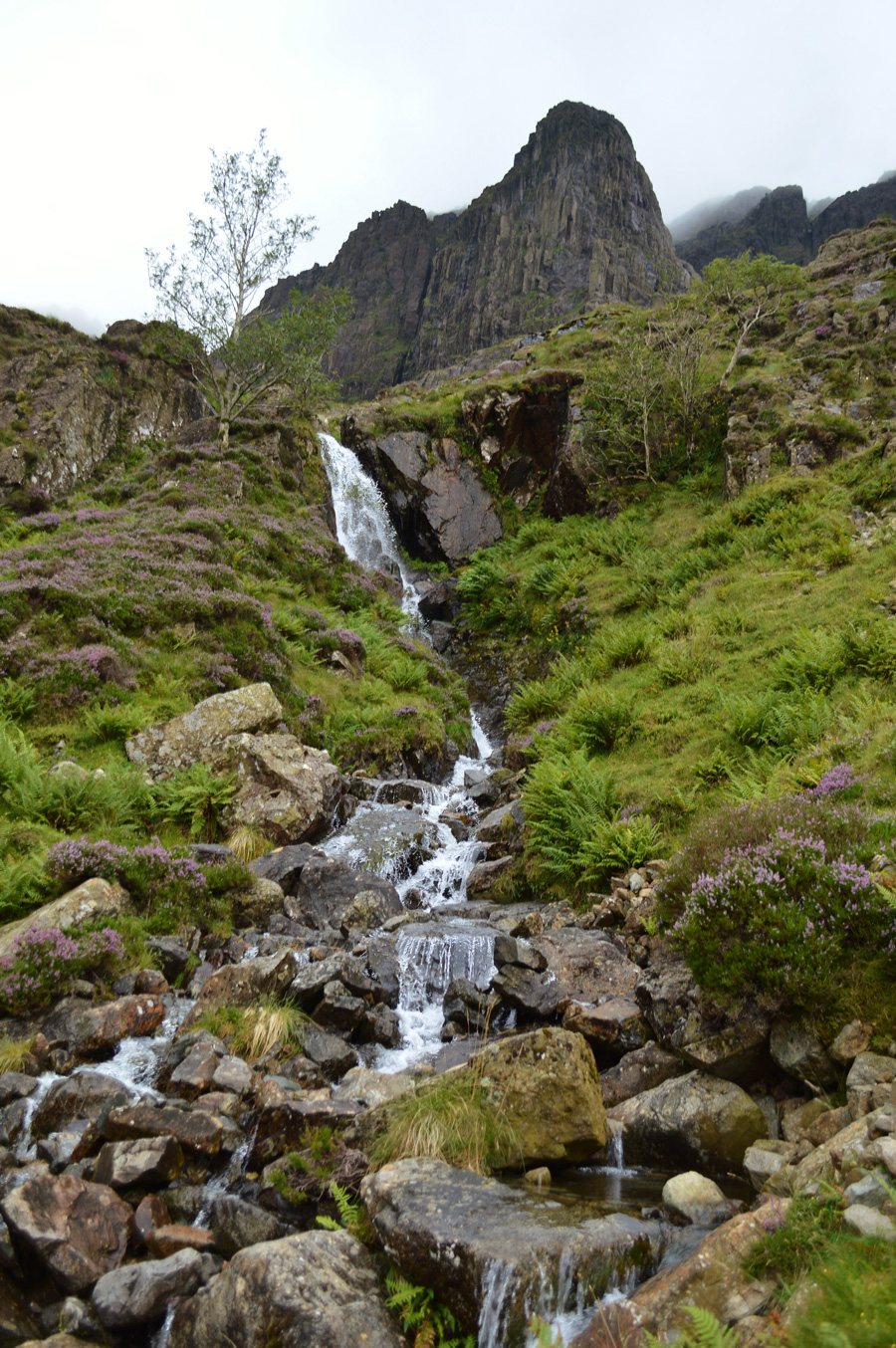
The rain continued to pour but again I seeked out shelter within the crags of the rock from where I found myself a dry boulder which would act as my dining chair. With a contributory to Pillarcove Beck behind me which fell in numerous waterfalls it was there I sat down to eat a well earned lunch, gazing over Pillar Cove just watching the rain fall...
Wait until heaven? It felt like I was already there. |
 |
| Robinsons Cairn over Pillar Cove. |
| Two separate walkers arrived at Robinsons Cairn and I wondered had they spotted me or my walking poles that I had jabbed into the ground. Over the Ennerdale Valley, High Crag dominates my view which is now cloud free, groups of walkers descend Gamlin End and the feeling is quite surreal, no one knows I'm here. |
 |
| Lunch with a view. |
| Time spent at the base of Low Man far exceeded my usual lunch time, but this wasn't just any lunch time, this was my oath to Harry and Pillar Rock but I guess, all good things (or in my case sad mixed with a little joy) had to come to an end as I planned my exit from Pillar Cove via Pillarcove Beck. |
 |
| Descending Pillar Cove. |
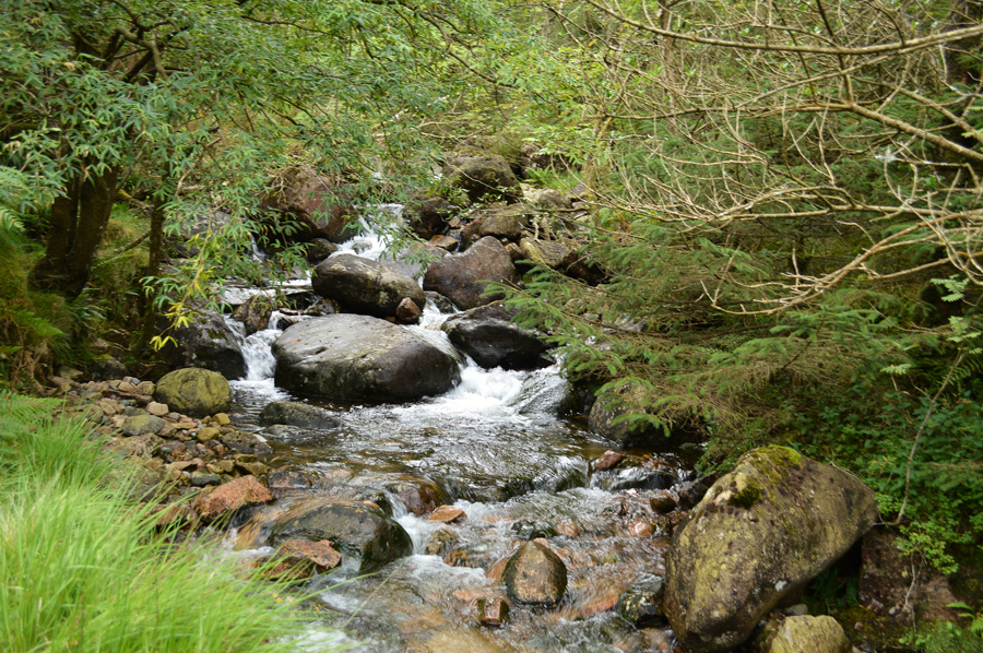
For any walker think of any Cove that springs to mind which is as grassy as Pillar Cove? There isn't many I can think of which is why it is said that you will not find scree or erosion in Pillar Cove which is testimony to how stable and sound Pillar Rock is.
I descend steeply locating the narrow path which lends its way via the course of Pillarcove Beck seen running through the centre of the photo. |
 |
| Low cloud still clings to the top of Pillar Rock as I start my descent via Pillarcove Beck. |
| Affectionately known as The Pillar Ride. |
 |
| The Pillar Ride. |
| Alfred Wainwright describes this route as "choked with boulders" he wasn't wrong but there is a good path that leads all the way into the cove which negotiates the upper boulders, straying away as I did clinging to Pillarcove Beck is hugely rewarding but one should always remember as I didn't to relocate the path afterwards as now, I have commited myself in descent via some rather slippery crags before rejoining with the path leaving me with a very wet backside, but clearly, it was worth it. |
 |
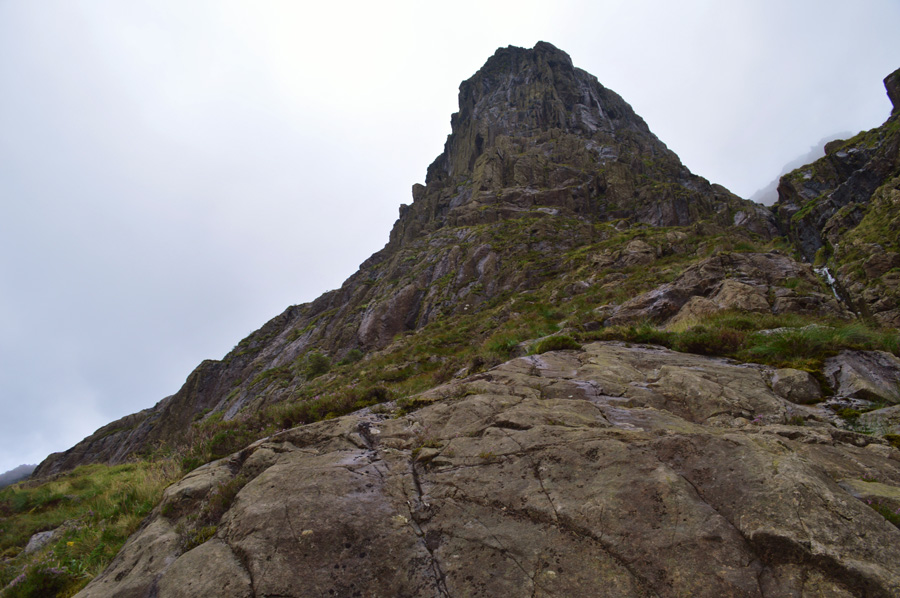
| Magnificent Pillar Rock |
| For the first time during my descent I now get eerie views of both Low Man and High Man as the cloud starts to lift. |
 |
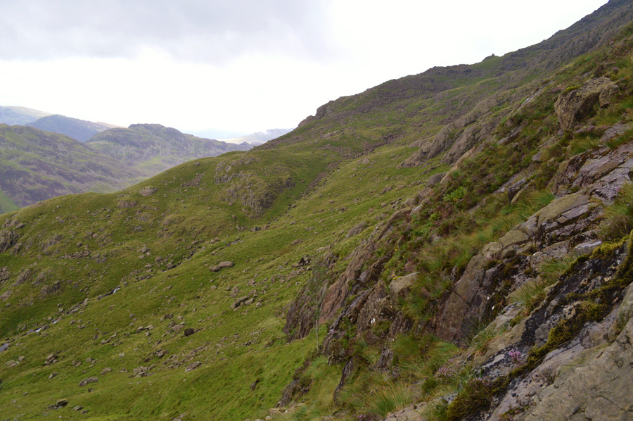
| Pillar Rock from Pillarcove Beck. |
| Here Pillar still commands attention from lower down the path, its memorising view is simply too hard to ignore. Once the tricky crags had been left behind I now find myself on a narrow stone path that zigzags all the way down to the valley floor, other options include an alternative descent back into the plantations which can be found by keeping left beneath the crag seen in the centre right of the photo which is the same route I used back in August last year. |
 |
| The Pillar Ride seen from fields of glorious heather. |
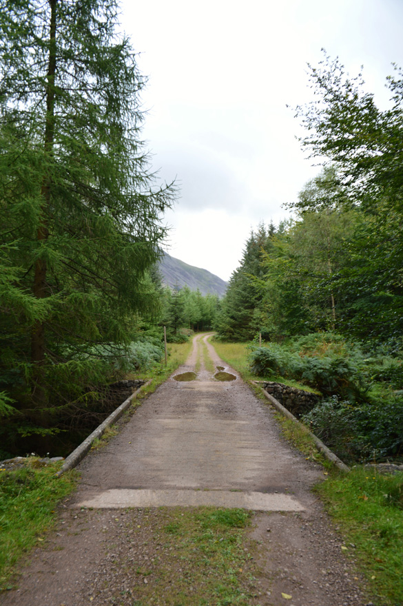
I was almost back in the valley as my path narrowed through thick Heather and young Pines, by now I was feeling pretty beaten up again as the Heather opened up the gash on my right knee causing it to bleed again, but this did nothing in taking away the last few hours, below me the forestry path is getting nearer and nearer and I am able to spot walkers walking along it and indeed, Black Sail youth hostel. The sun was back out but for how long I wouldn't know, just off the right the Centenary Bridge which was built in memory of those who fell in World War One by the Fell and Rock Climbing Club purely so, those who wanted to gain access to Pillar Rock could do so directly from the valley.
I now head for the bridge, unseen through a thick canopy of trees. |
 |
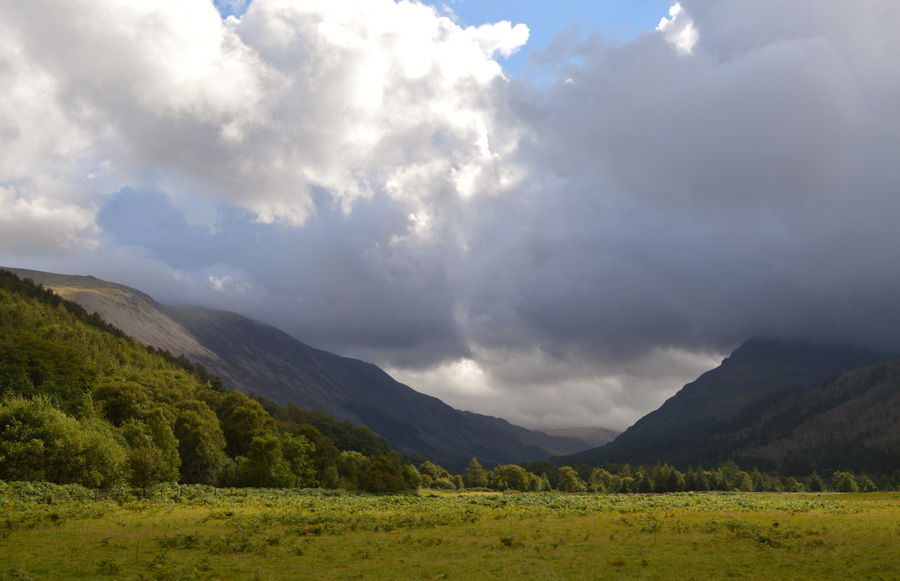
| Ennerdale. |
And I guess this is where I shall close my chapter here on Pillar Rock, even if I didn't summit it the memories left behind will remain with me for ever.
The centenary Bridge is soon crossed where I stop to read a Plaque left be hind by FRCC it reads This bridge was reconstructed in 1959 by Cumberland County Council The Fell and Rock Climbing Club of the English Lake District bore a share of the cost in memory of those of its members who fell in the World War of 1939 - 1945
Half way across the bridge I stop to take in my views beyond Black Sail youth hostel towards the Gables who are still heavily topped in cloud as is Pillar behind me, from the bridge the path rises high above where I spot more walkers predominantly all heading towards Black Sail, only one walker heads the four miles back to Bowness Knott and I tail him for much of the way losing ground at Gillerthwaite Farm where Harry back in July 77 would have left his car, it is here I take in the views and therefore plot the route I had taken along the flank of White Pike which, from down here at valley level, still looked a grand undertaking as it had felt just a few hours earlier.
Walkers and tourists are passed as I continue my march back to Bowness Knott, through the trees in the distance I spot glimpses of the walker I had been tailing, his pace has dropped enough for me to catch and overtake him as the last few miles are done under a warm afternoon sun. Every now and again the sun would get hidden behind cloud leaving taking the blue out of Ennerdale only for it to return even brighter as the sunlight dances across the waves, this cannot be photographed but forges memories of a tribute to Pillar Rock and A.H.Griffin.
Untill next time. |
|
| |
| Back to top |
 |
|