|
The Harry Griffin 2,000 footers Walk 11 -The Newlands Round |
 |
 |
8th May 2015 |
 |
|
Today I had the chance to take advantage of a fantastic weather window having only been in Lakeland just 24 hours previous despite tiredness creeping in I simply couldn't afford to sit this walk out.
Today's route takes in six two thousand foot summits around the Newlands Valley, a place that I have held with great fondness long before I could read a map. The route is very similar to that of the popular Newlands Round with the only exception being that Maiden Moor is gained by High Crags - a direct, and not to mention steep scramble from the hamlet of Little Town from where Maiden Moor is summited but not collected, only falling short as a two thousand foot summit by just thirteen feet.
From Maiden Moor the short ridge crossing to Nitting Haws is collected gaining two thousanders in a relative short time, there after High Spy is soon reached along the ridge before the descent to Dalehead Tarn from where the summit of Dale Head is steeply ascended with fantastic views over the Newlands Valley. From the summit of Dale Head Hindscarth is by-passed, its two thousander(s) will be collected on the return after a ascent, then descent of Robinson.
Today's walk ranks high in the campaign, even with muscles aching and heavy rain towards the end of the walk.
|
|
| Freeman of the Hills |
 |
| 'The Newlands Round' |
| About forty years ago I remember coming down into Newlands one evening after a similar sort of day and being so impressed by the peace and quietude of the dale that I resolved, there and then, that if I live long enough to reach my retirement age this was where I would make my home.
|
| Harry Griffin |
|
|
| |
|
Overview |
|
|
| Ascent: |
3,565 Feet - 1,087 Metres |
| Summits Over 2,000Ft: |
Nitting Haws - High Spy - Dale Head - Robinson - Hindscarth South Top - Hindscarth |
| Weather: |
Bright and sunny to start turning overcast with light rain towards late afternoon. Highs of 12°C Lows of 6°C |
| Parking: |
Church Bridge, Newlands |
| Area: |
North Western |
| Miles: |
9.7 |
| Walking With: |
On My Own |
| Ordnance Survey: |
OL4 |
| Time Taken: |
6 Hours |
| Route: |
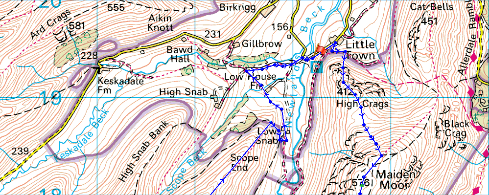
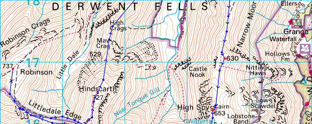
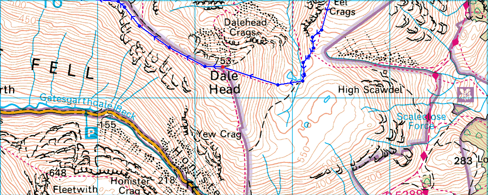
Little Town - Knott End - High Crags - Maiden Moor - Narrow Moore - Nitting Haws - High Spy - Dalehead Tarn - Dale Head - Hindscarth Edge - Littledale Edge - Robinson - Littledale Edge - Hindscarth South Top - Hindscarth - High Crags - Scope End - Low Snab - Low House Farm - Newlands Church - Little Town |
|
| |
|
Map and Photo Gallery |
|
|
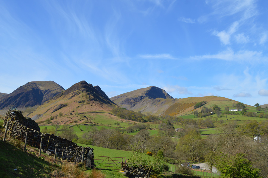 |
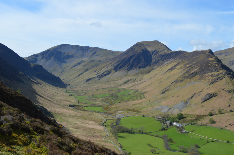
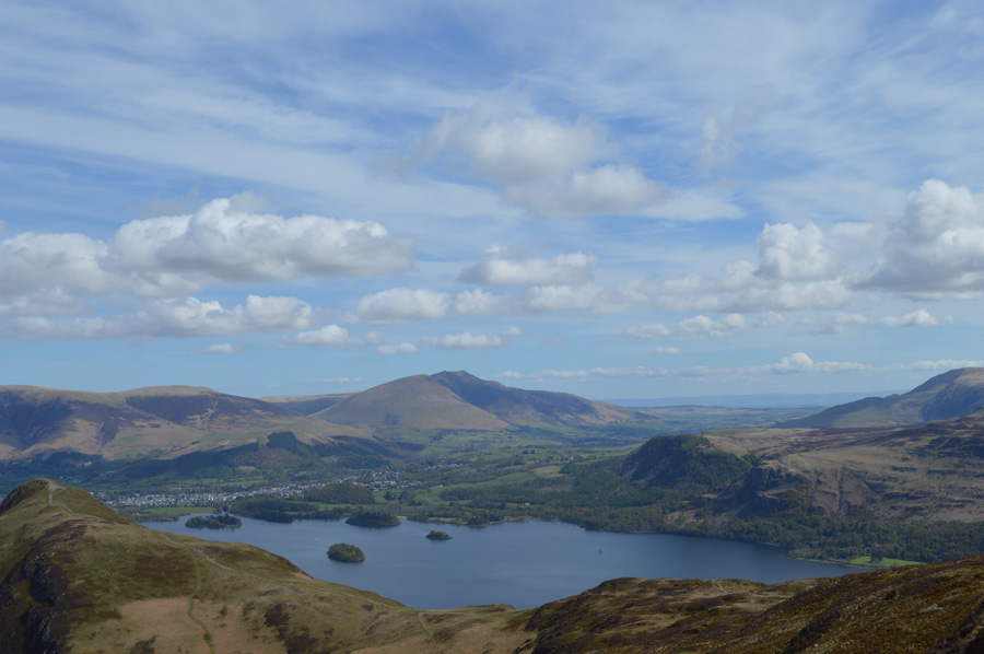
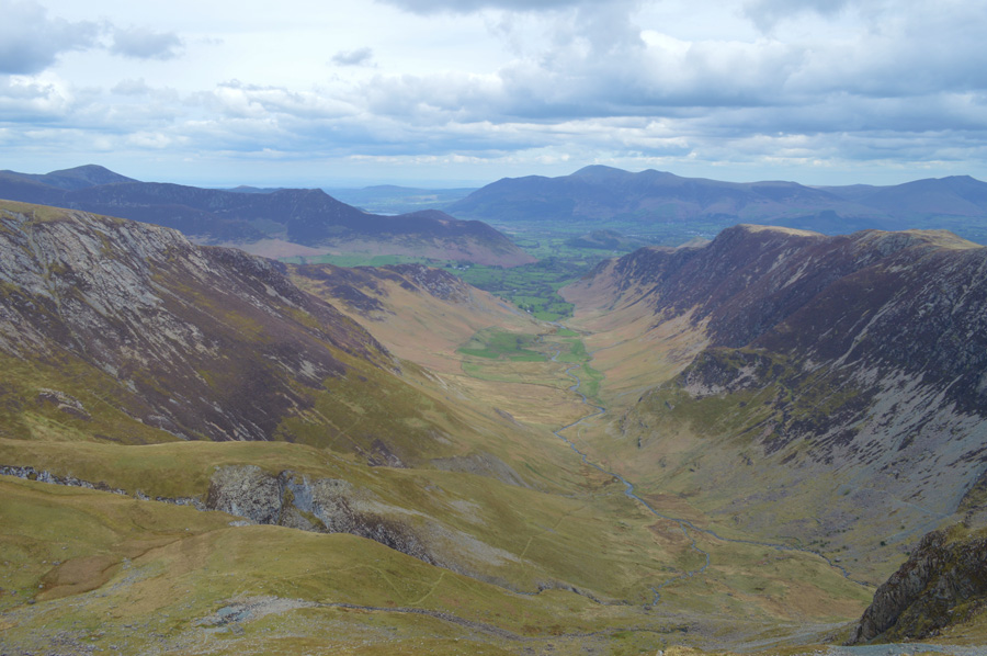
| Hindscarth, Robinson and Scope End seen from Chapel Bridge 10.00am 6°C |
I intentionally left Wigan a little later than usual for todays walk due to some pre-organised plans for later in the day which at least would see me have an extra hour in bed, but my body clock simply wouldn't allow it as an early morning dog walk saw me miss out on said lie in. Despite arriving in Newlands later than usual I was able to grab one of two last parking spots at the car park at Chapel Bridge where from the looks of things, other walkers both sides of me had also only just arrived.
We each tip our heads and make small talk after our good mornings each discovering that we all indeed, are on our own versions of the Newlands Round. I lace up behind the car while at the same time talking to the guy parked at the side of me, they were a little older than myself and told me they were heading for Cat Bells, the guys on the other side of me, Robinson's High Snab Bank, chances are somewhere along these ridges we would meet again.
It's too warm for any extra layers today but I pack my jacket in my pack anyway opting to wear shorts and sunglasses for todays trip, fitting, unlike yesterday above Hartsop. With the car locked I head steeply up hill away from Chapel Bridge towards Little Town where Knott End, and High Crag await me. |
 |
| Crytsal clear views extending over Newlands and Causey Pike. |
| |
 |
| Looking down on Little Town from my Knott End ascent. |
I was accompanied by the noise of a petrol trimmer as I tried to pick a route up Knott End from Little Town as I couldn't but help look directly at the sun as it hovered above High Crags making it impossible to spot any traces of a path which lead me to climbing directly into the fellside's shadow before I was able to depict which move I was going to make next. My pathless ascent at this stage was done in zig zags with steps of four one way then four the other such the steepness of the ascent I found this, the quickest way of gaining ground.
The small boulders were my 'lamppost' that I had to reach before passing a Rowan Tree seen in the photo, from here the climb takes on a grassy ledge affect with small rocky scrambles thrown in, I found the grassy ledges helped heaps and was soon ascending much more quickly than that of the steep fell side found below, even if the ledges were narrow. there was always an other option to help ascend by. |
 |
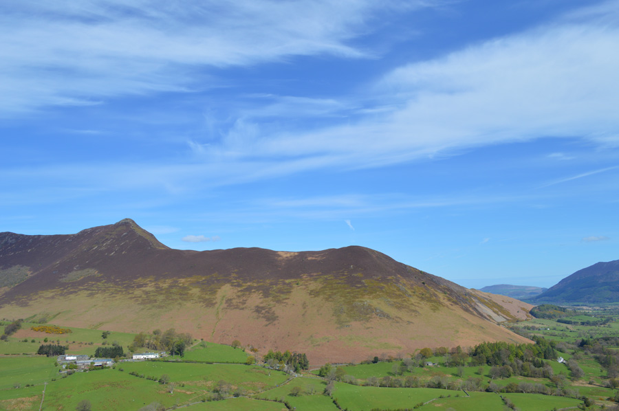
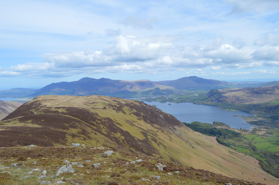
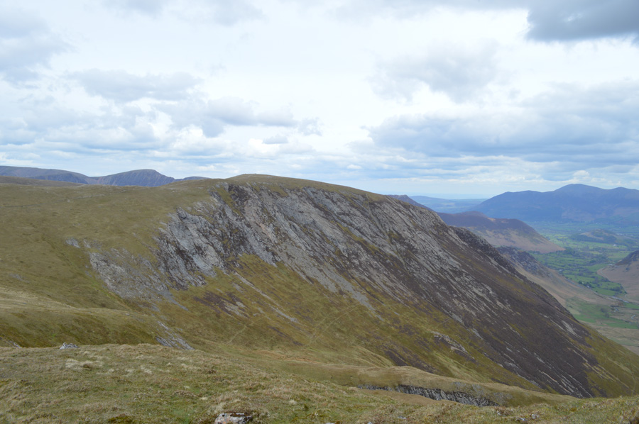
| The more industrious side of Cat Bells with the abandoned spoils of Yewthwaite mine seen in the right of the photo. |
| |
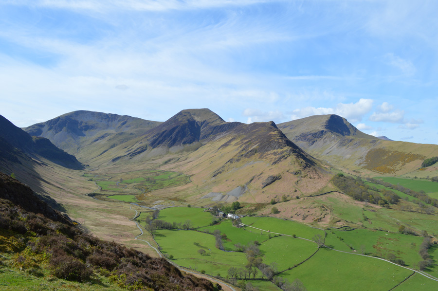 |
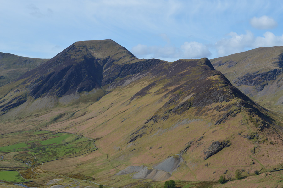
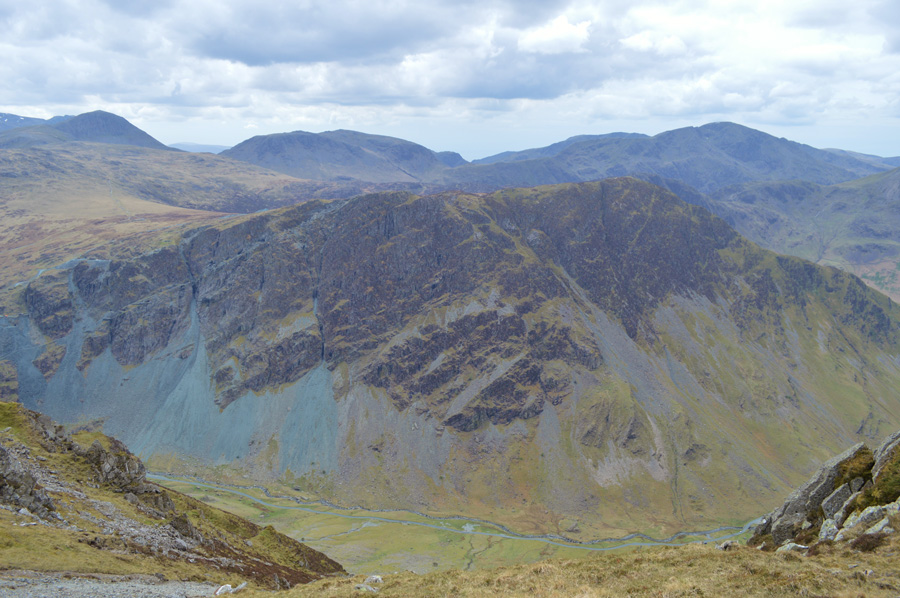
| Dale Head and Hindscarth seen towering above the Newlands Valley while Robinson can be seen in the distance. |
| After shouldering Knott End rewards for my steep ascent were plentiful as the length of the Newlands Valley unfolded before me while Hindscarth, Scope End and Robinson never failed to capture my attention as the next few photos show. |
 |
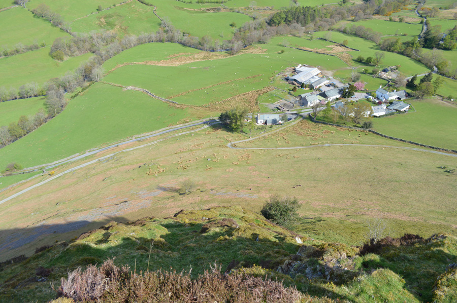
| Hindscarth seen over the Newlands Valley with Low House Farm seen below. |
| |
 |
| Hindscarth. |
| |
 |
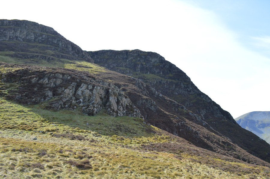
| Ascent on High Crags. |
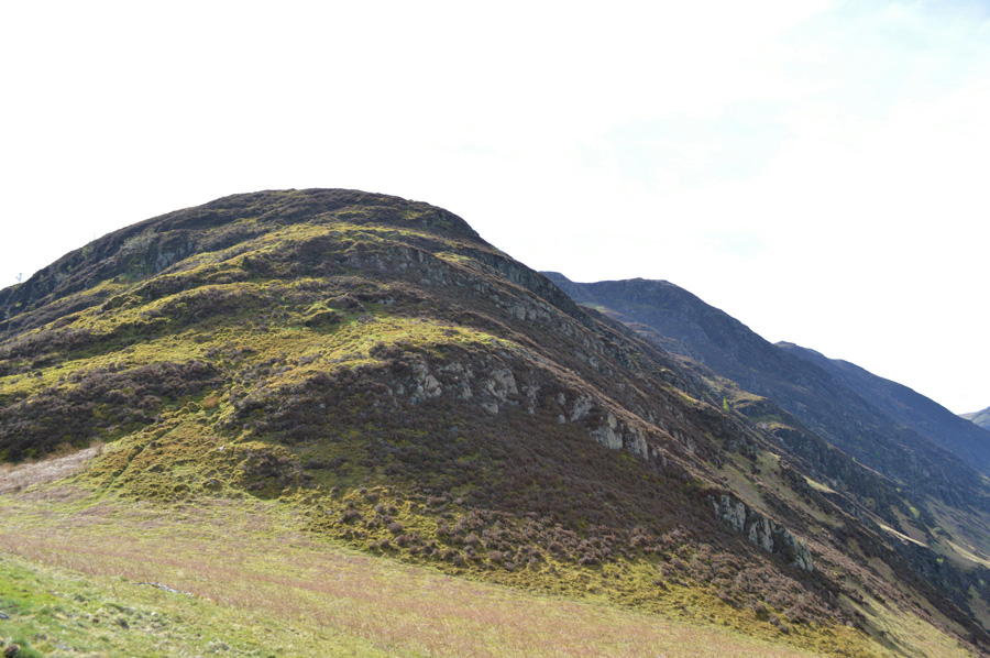
After summiting Knott End High Crag marks the next tier (s) before reaching Maiden Moor summit, from my position I am still close to half a mile away from making my Maiden Moor summit which can mean only one thing, the only way is up.
I used the word tier which explains how High Crags is made up from almost two identical steep ascents formed over heathery buttresses, the ground underfoot between the ascents was damp underfoot yet I imagine after heavy rain the ground can soon 'bog up' as faint paths are spotted around known areas.
It pays well to pick out your path as once in the heather the path all but narrows making it difficult to follow although at higher level the path is at least a pace in width which stands out predominantly from below. |
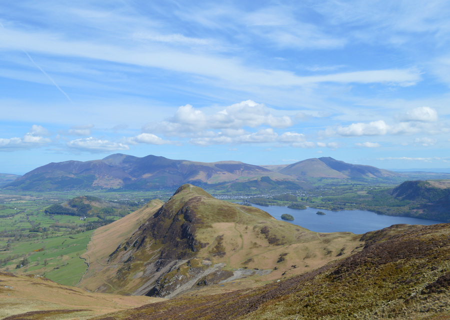 |
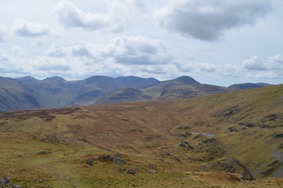
| Distant views of Skiddaw and Blencathra seen over Cat Bells and Derwent Water. |
| I get a rather unusual prospective of Cat Bells from my ascent as the deep blue waters of Derwent opens up from my ascent. Before me and in shadow the sharp and rugged Bull Crags stand out in Black Shadow beneath Maiden Moor summit, the Crags themselves are seldom seen from the ridge above yet, from my position look daunting to say the least. |
 |
| Blencathra and Walla Crag over Derwent Water. |
| |
 |
| Bull Crags now dominate my ascent. |
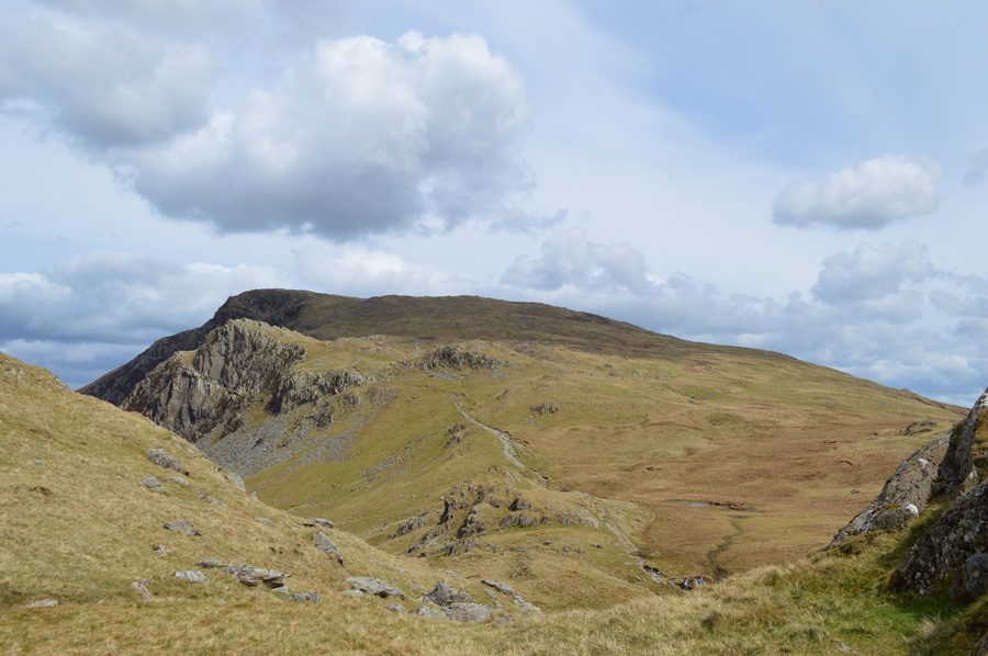
After shouldering High Crags the cliffs of Bull Crag now dominate the last part of the climb. Barnes Gill splits Bull Crag in two as I negotiate a safer less daunting ascent on Maiden Moor. My option is to follow a faint path sadly not seen in the photo steering myself beneath the cliffs by means of a steep climb onto a grassy rake before topping out at the head of Bull Crags.
The Rake is swollen, narrow and steep and does not see much sunlight at best making the last few yards a little tricky to say the least, from above blue skies await and propel me forward as I top out just a few hundred yards shy of Maiden Moor summit. |
 |
| Crossing the top of Barnes Gill towards Maiden Moor summit. |
| It was nice to walk on the level again... |
 |
| The mass of Skiddaw and Cat Bells seen from Maiden Moor summit. |
| I needn't have downed pack nor walking poles once Maiden Moor was reached even though the summit fell shy of being a two thousander but that is exactly what I did as I sat down arms over knees if not only to take in the magnificent views and of course, thank my new walking poles for helping me on my ascent, although I ponder, they've a lot to live up to from the ones they replaced. |
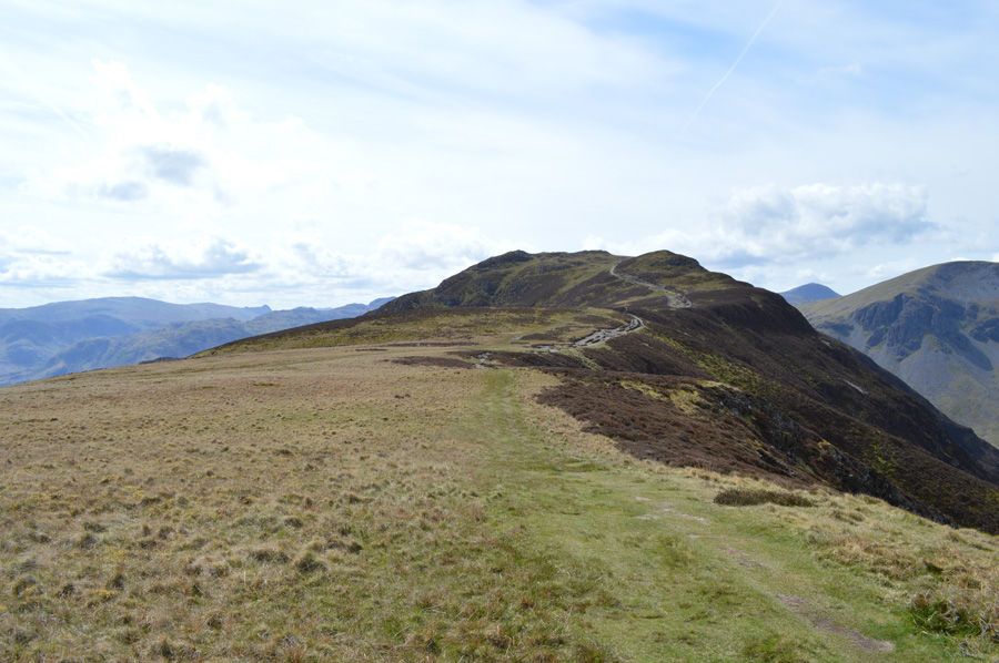 |
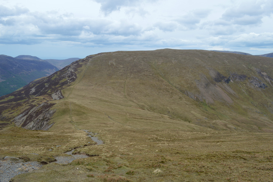
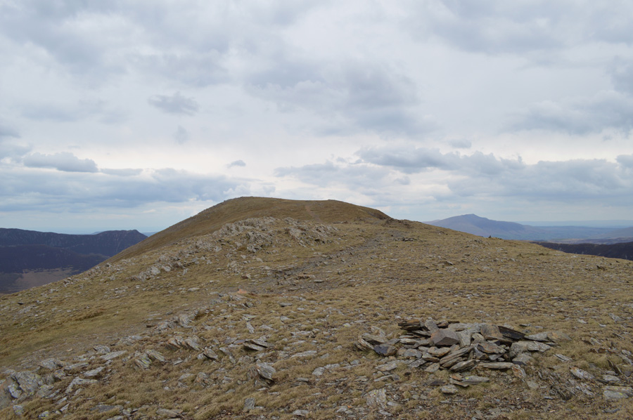
| Nitting Haws seen over Narrow Moor. |
| From the summit of Maiden Moor my walking experience would be pleasant to say the least as I take in the delightful ridge of Narrow Moor towards Nitting Haws seen as the pointed peak at the far end of the ridge. It's fair to say that most people will pass Nitting Haws summit without a thought of making the de-tour which includes myself on some occasions. |
 |
| Here, looking back over Maiden Moor and Derwent Water towards Skiddaw, Blencathra and Walla Crag. |
| |
 |
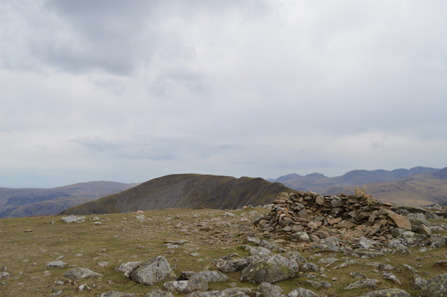
| Passing over the top of Eel Crags with High Spy summit just a short distance away. |
| I don't know why I hadn't stopped earlier but I had been carrying a stone in my right boot since topping out on Maiden Moor summit, at first I stubbornly tried to ignore it, then I'd kick my foot hoping it would dislodge and I wouldn't feel it as it somehow ended up between my toes, this was the point I pulled up at a rock and emptied my right boot out when as you can imagine, the smallest of stones fell out, that's not it I mumbled, there's got to be another one in there tapping the sole at the boot at the same time but nothing else came out, in all two walkers had smirked past me and I'd lost about ten minutes undoing and re lacing my boots, all for the tiniest of stones, but if anyone asks...it was huge! |
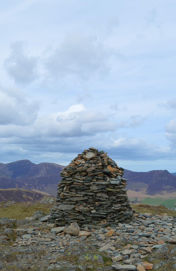 |
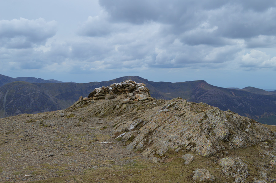
| High Spy summit cairn. |
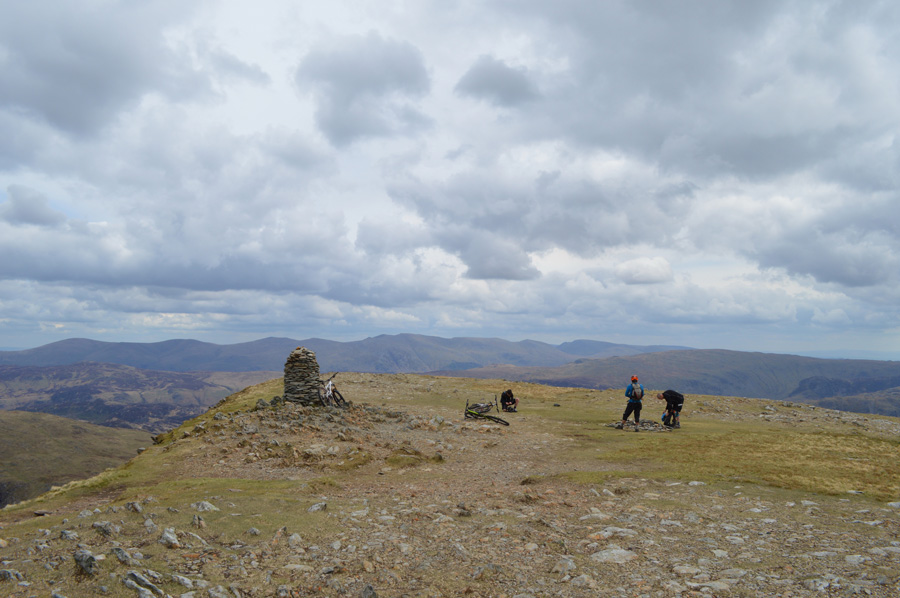
I soon arrived at High Spy impressive stone cairn right about the same time as three mountain bikers who rested their bikes on the cairn, as soon as they saw me pop my camera out they politely moved them, we had a good chat as I asked them their route which was in fact 'The Newlands Round' by mountain bike.
Shortly afterwards I was joined by one of the couples who laced up much the same time as I had back at Church Beck, we of course knew each others routes as we had touched upon it earlier, they told me that their route was just a training walk as they were heading up to the Highlands the day after for a week climbing around Fort William, 'we've packed our axes and crampons they laughed' What's the forecast I asked? How long is a piece of string he laughed? yeah fair enough, with this we parted. |
 |
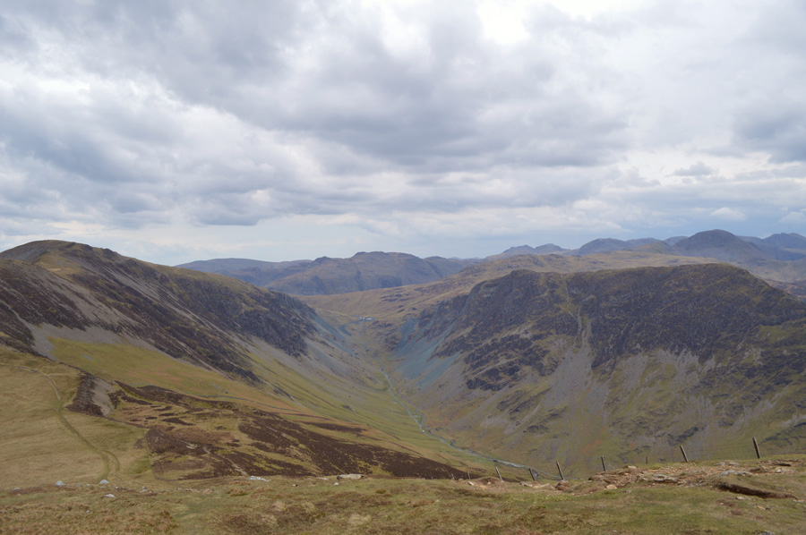
| Heading down to Dalehead Tarn with views of Bow Fell, Esk Pike, Great End, Great Gable and the distant Scafell's. |
The sun was obscured behind grey cloud for much of my descent towards Dalehead Tarn bringing with it a slight dip in temperature which left the air on the uncomfortable side of things, I thought about unpacking my jacket but persevered in the hope that the sun would return soon.
Shortly afterwards I was passed by the three mountain bikers who raced past me as I gave them a wide berth to let them pass safely, I must say these guys were as good on two wheels as I was on foot which took me back to the days when I used to race BMX's during the late eighties and early nineties, we didn't have non of this carbon back then! it was alloy or steel.
jeeez now I'm beginning to sound like an old git. |
 |
| Views over my next summit of Dale Head. |
| |
 |
| Looking back on High Spy seen shortly before arriving at Dalehead Tarn. |
| |
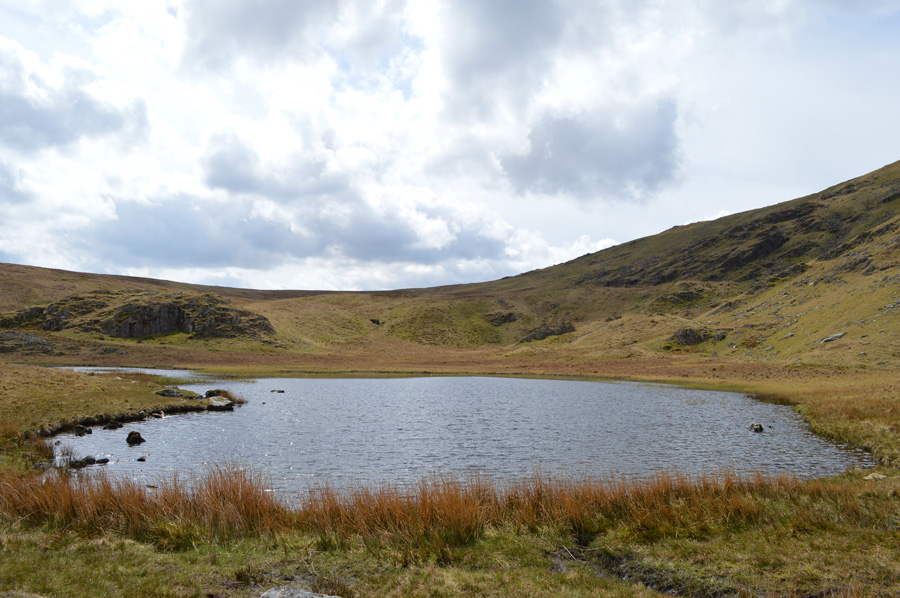 |
| Lunch time at Dalehead Tarn. |
I arrived at Dalehead Tarn much the same time as one of the walkers who had passed me whilst trying to get that enormous rock out of my boot! although by the looks of it they were ready to pack up before making their own ascent on Dale Head which left just myself to enjoy Dalehead Tarn by.
I sat on the ruined stone sheep fold with a sandwich in one hand taking in the slight gust of wind as it blew through the wild grasses, sun light sparkled off the waters surface as it gently lapped up around the grassy bank - for that one moment It seemed as if time was standing still. |
 |
| Dale Head summit cairn. |
As tempting as it was I couldn't ignore the steep climb any longer in order to gain Dale Head summit as I re shouldered and headed up the steep path which twist and winds all the way to the summit, higher up, parts of the path were still under repair by Fix the Fells who had left Heli-Bags full of large stones waiting to be grounded onto the new path.
Ahead of me the three mountain bikers were carrying their bikes up the steep path which must have been incredibly light by todays standards still must have been tough, only been made more difficult my just how humid things were turning, every now and again I would be right on their tails as we all made the summit much at the same time, the last few yards they rode and left there bikes once again, by the summit cairn.
This I didn't mind as as before they apologised and asked would I want them to remove the bikes for a photo shot, I said nahh it doesn't matter lads, well, can you take our photo which I did using one of the lads mobile phones.
Time spent at Dale Head summit was brief to say the least as before I knew it I was descending towards Hindscarth Edge. |
 |
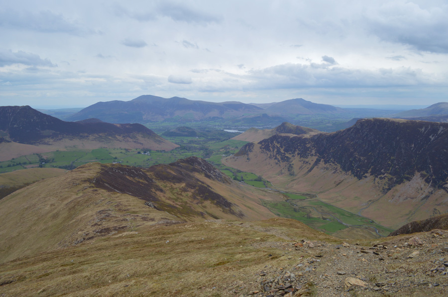
| Newlands Valley from Dale Head summit. |
| |
 |
| Fleetwith Pike, Great Gable, Kirk Fell and Pillar with the Honistor Pass far below. |
| |
 |
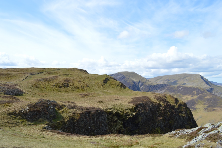
| Here, looking back on Dale Head over Hindscarth Edge. |
| After leaving Dale Head my route would now see me flank Hindscarth and head for an ascent on Robinson only to double back later and collect the two summits on Hindscarth on my way back. |
 |
| Hindscarth. |
| I seem to be losing light as the predicted showers slowly start to move in, I best pick my pace up. |
 |
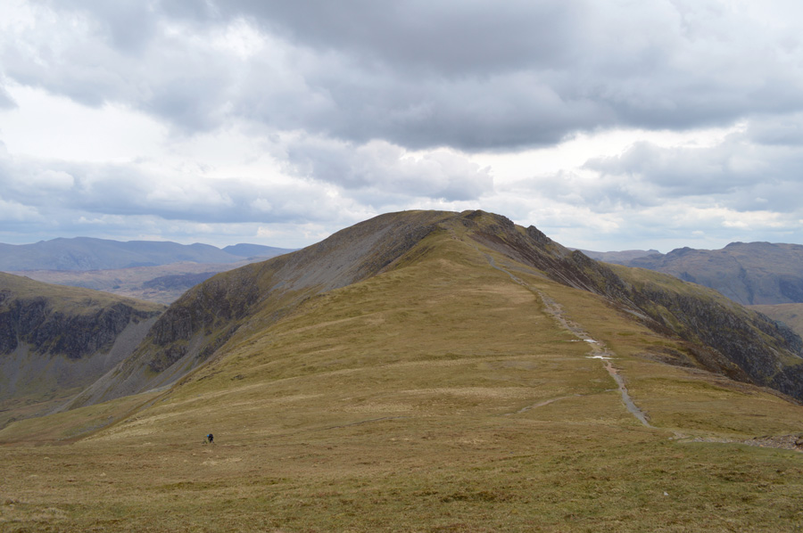
| Robinson over Littledale Head. |
| However tempting it was to be so close to collecting the two summits on Hindscarth I knew first I had to gain Robinson, it was here that over Littledale Edge that I felt that second wind kick in as I told myself I wasn't to stop walking until I reached the summit itself, this was mental torture as my thighs burned most of the last few yards before reaching the summit, however my reward for all my hard work, was the Mars Bar I had been keeping in my pack. |
 |
| Robinson summit cairn. |
| Skies darkened and I knew my time on the fells was drawing closer if I didn't want to get caught in the showers due to arrive around four o'clock, however, despite this I de-shouldered once more and found a spot behind the stone cairn out of the wind over looking Buttermere and Rannerdale Knotts where I tucked in to the Mars Bar helped down by long swigs of Robinsons fruit juice. |
 |
| Views over the Honister Pass and Fleetwith Pike from my Robinson descent. |
| |
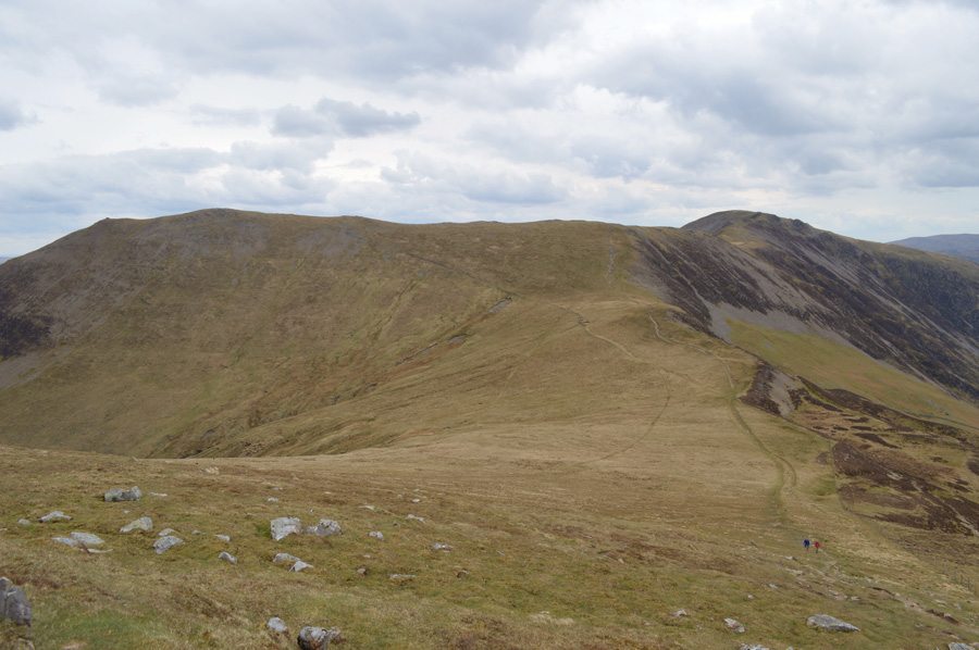 |
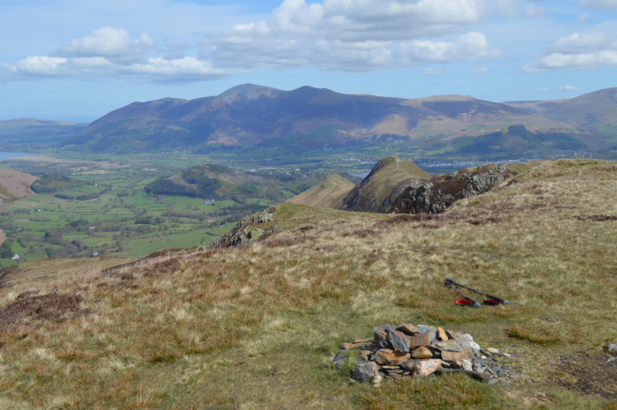
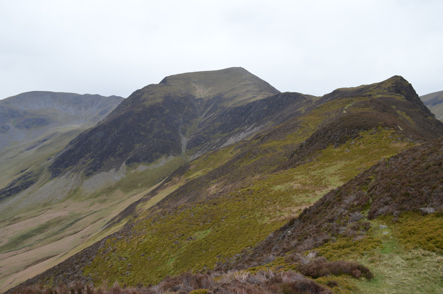
| Hindscarth and Dale Head over Littledale Edge. |
| My final two thousand summits awaited me, one of which was situated on Hindscarth's most southern ridge found close to the main footpath. |
 |
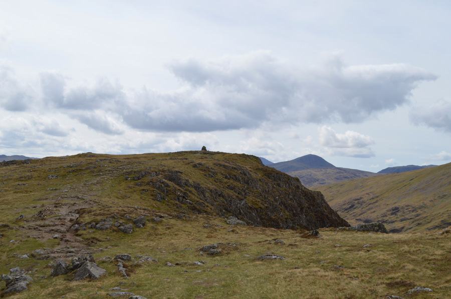
Hindscarth from the south cairn NY 214 160 |
After leaving Robinson I again traverse Littledale Edge and decided instead of making a direct attempt at obtaining the south top I would use the path that ran diagonal beneath the ridge before doubling back steeply over grassy ground which spat me out right at the south cairn.
Ahead the main and last summit of the day awaits. |
 |
| Dale Head from Hindscarth summit shelter. |
It was only a short walk from the south cairn to collect my sixth two thousander of the day, by the time I had reached the summit itself my energy levels were taking a slight dip as spots of rain fell from the sky carried by strong gusts every now and again.
The rain managed to hold off which gave me time to collect myself before starting my descent into Newlands via Scope End. |
 |
| The Scope End Ridge seen shortly after leaving Hindscarth summit. |
| It's been some years since I last used Scope End by means of descent and I had forgotten just how fantastic the last few miles of my walk would be, I just hoped this rain that was in the air held off at least until I was back at the car. |
 |
| Looking back at Hindscarth from Scope End. |
| |
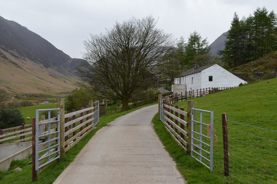 |
| Passing through Low House Farm. |
Thankfully the rain had held until I was passing through Low House Farm until it arrived cooling me down from my ridge walk over Scope End where short scrambles where needed in descent, something of which would be more enjoyed on the way up, rather than down as the rock was greasy which made progress, sometimes slow.
I pass through Low House Farm via a wooden gate marked 'public access by landowners permission' which created a rather neat short cut back to Newlands Church, from Low House Farm the rain got heavier and heavier but I was just too close to the car to be reaching for the jacket so I held out and let the rain start to soak through my midlayer and shorts. |
 |
| |
| |
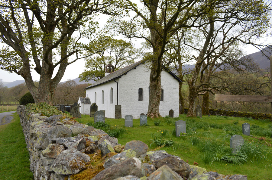 |
| Newlands Church in the rain. |
I soon find myself back at Church Bridge not before a quick stop off at Newlands Church which is normally a busy place, but not in the rain. My sunburnt hands, legs and face are now starting to get soaked through, so to is my camera as I shield it with one hand as I make my way back to the carpark where I find the same cars that I had parked in between, the fellow who was heading to Scotland tomorrow with his wife must still be on the hill yet the owners of the other car are walking down the hill from the direction of Newlands.
Bloody hell we couldn't have timed that better we all laughed, we had all set off on our separate ways only to find ourselves back at the carpark more or less at the same time, good walk they asked? aye I says. |
|
| |
| Back to top |
 |
|