 |
The Harry Griffin 2,000 footers Walk 9 -The Scafells Ridge |
 |
 |
4th May 2015 |
 |
|
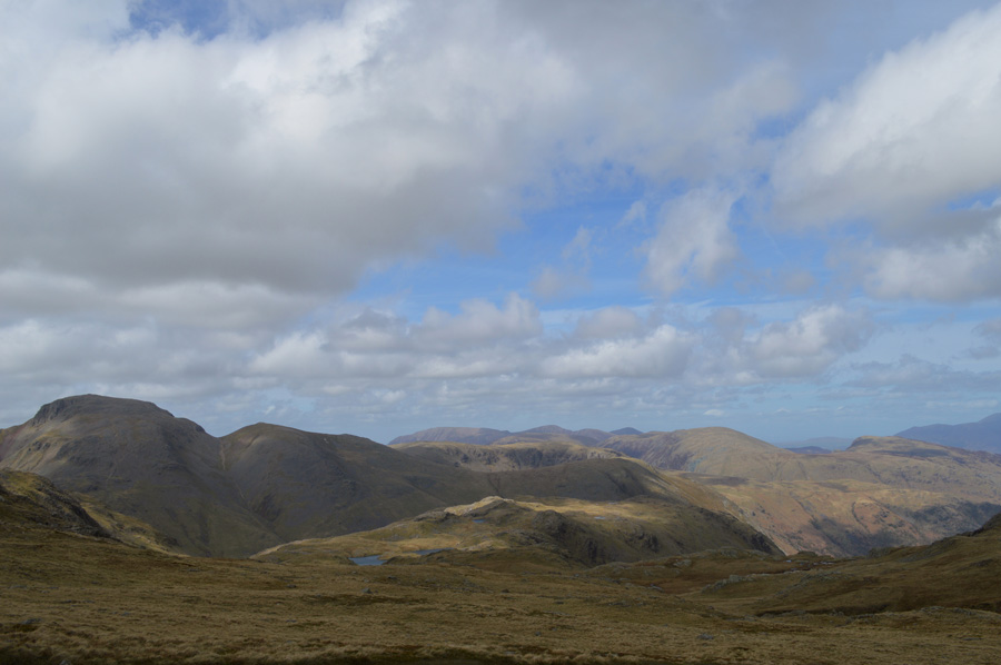
I try to make the first walk of May something special much like I did last year when I walked from Dunmail Raise to Scafell Pike, this years walk also involves the Scafells but not the summit, more so its ridge.
Today I'm celebrating my birthday which will now see me closer to fifty years of age than I was yesterday, I can't believe I just said that even if it's nine years away, it's still the truth.
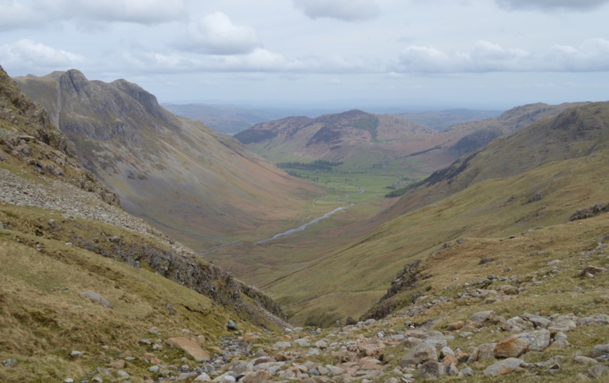
The Scafells Ridge is a walk that jumped out from my copy of Freeman of the Hills, more so because it is possibly the most exhilarating and exciting walk in the whole two thousand footer challenge, and, to add to this, it's also the most demanding walk within the whole campaign as some summits today will exceed the three thousand foot mark and not to mention some rather challenging descents and re-ascents
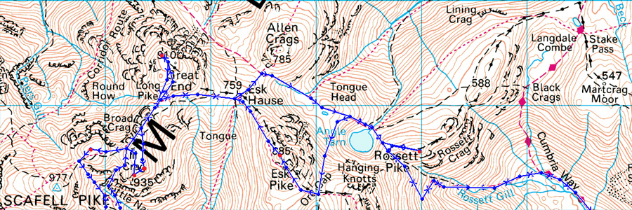
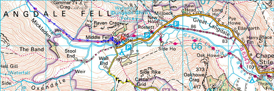
The Scafell Ridge walk starting point is Old Dungeon Ghyll Great Langdale before taking in the Mickleden valley and the steep ascent of Rossett Pike via Rossett Gill, thereafter descending Rossett Pike I would then trek north west towards Angle Tarn before ascending onto Ore Gap and Esk Pike, my second two thousander. From Esk Pike I would trace my way over Esk Hause and Calf Cove from where I would summit Great End as views start to open up over what H.Griffin describes, as the Scafell Ridge.
Once both III Crag summits have been collecting the walk now takes on the demands of gaining both Rough Crag and Pen from Little Narrowcove where the challenge of steep scree gullies are needed before collecting the respective summit of Rough Crag, yet the steep re-ascents don't end there as you are about to read.
Seeing as today is my birthday I couldn't think of a finer way to celebrate than to bring forward a walk than I had intentionally reserved towards the end of the campaign towards the end of summer as this walk as challenging as it is, deserves respect from both weather and walker as I didn't want to do it mid summer the challenge of hydration and stamina could have been a factor, although there are more walks which equal todays I feel after completion that I may have taken on my toughest challenge in my whole walking career.
|
|
| Freeman of the Hills |
 |
| 'The Scafells Ridge' |
| We looked south to the Scafells, draped in thick cloud, and then, turning round, looked briefly to the north. Suddenly the mist parted and through the hole, we could see the great bulk of Great Gable across the trough of Wasdale with the Napes Needle showing quite plainly. But the wonderful view only lasted seconds; in a moment the gap was refillied with cloud and everything looked as dreary as before. |
| Harry Griffin |
|
|
| |
|
Overview |
|
|
| Ascent: |
4,428 Feet - 1,350 Metres |
| Summits Over 2,000Ft: |
Rossett Pike - Esk Pike - Great End - III Crag North Top - III Crag - Broad Crag - Rough Crag - Pen |
| Weather: |
Overcast to start turning sunnier around midday. Strong gust in the morning, Highs of 16°C Lows of 5°C Feels like -1°C over summits |
| Parking: |
ODG, Great Langdale |
| Area: |
Southern |
| Miles: |
14 |
| Walking With: |
On my own |
| Ordnance Survey: |
OL6 |
| Time Taken: |
9 Hours 25 Minutes |
| Route: |
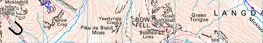
ODG - Mickleden - Rossett Gill - Rossett Pike - Angle Tarn - Ore Gap - Esk Pike - Esk Hause - Calf Cove - Great End - Ill Crag North Top - III Crag - Broad Crag - Broad Crag Col - Little Narrowcove - Rough Crag - Pen - Ill Crag South Scree - Calf Cove - Esk Hause - Angle Tarn - Rossett Gill - Mickleden - ODG |
|
| |
|
Map and Photo Gallery |
|
|
  |
| |
| |
 |
| |
| |
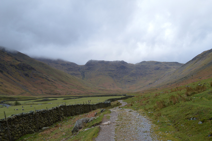 |
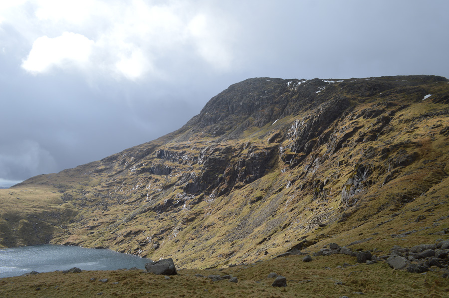
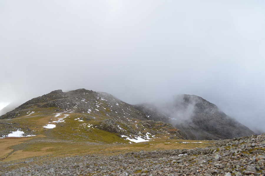
| Mickleden, Great Langdale with Rossett Pike ahead 07.05 5°C |
With a sudden switch in today's forecast I arrived in Great Langdale under the cover of dreary grey cloud which had me a little worried even though the forecasters said the cloud would lift around lunchtime by which time, I should well and truly be on the Scafell Ridge. This however was hours away as I put the worrying thought to the back of my head instead concentrarting on the task ahead, it was no use though...no matter how much I tried I couldn't shake the thought of should the cloud cover still be as intensive across the summits I may have to re-schedule for another day, this was a decision that I just could not afford to make.
I shall leave my full trust in said forecast.
I hadn't been walking long when I noticed just how strong the gusts were even here at valley level, something else that the forecasters said would drop around lunchtime, so I guess you could say I'll just have to wait and see, which as you could guess, didn't fill me with much confidence.
I had already hatched a plan B walk should the forescast not go my way, after all no point in crying over spilt milk, work with the problem they say, not against it. My plan B was a simple hike from Rossett Pike to High Raise then back over the Langdale Pikes, but for now, that's just another thought I needed to bury. |
 |
| Pike O'Stickle features dominant as it towers over the Mickleden valley. |
| |
 |
| Here, glancing back over Mickleden before I start my ascent on Rossett Pike, ahead, Side Pike and Lingmoor Fell. |
I guess you could say Mickleden didnt take too much away as I hastily passed through the valley flanked by the Langdales on one side, and The Band on the other, my concentration was taken up by that niggling plan B circulating around my head and the ever increasing wind that every once in a while howled down from the top of Rossett Gill.
I am laying to much trust in the forecast... |
 |
| Mickleden over Rossett Gill with distant views of the Langdale Pikes, and Lingmoore Fell. |
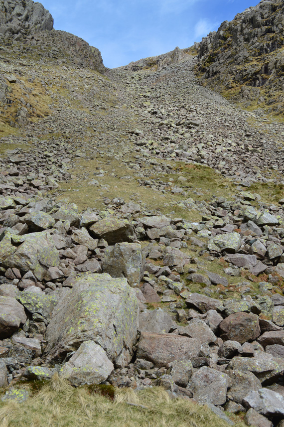
| I follow the stone track close to Rossett Gill as it twists its way up the steep fell side which at some points detours widely from the Gill where it takes on the lay on the fell side. Optional ascents by the Old Pony Track which lie further south via Green Tongue are considered for my return some hours later, but for now, all I want to do is enjoy my fell walking. |
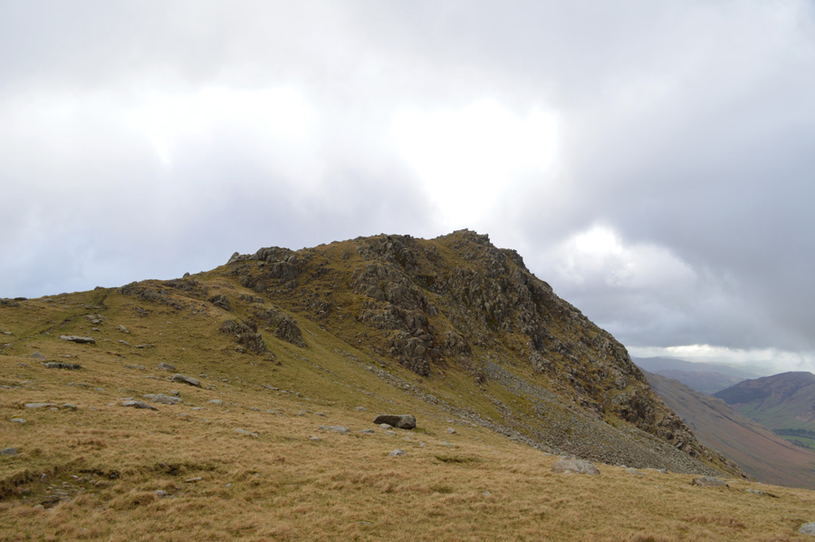 |
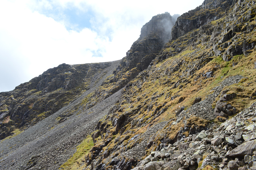
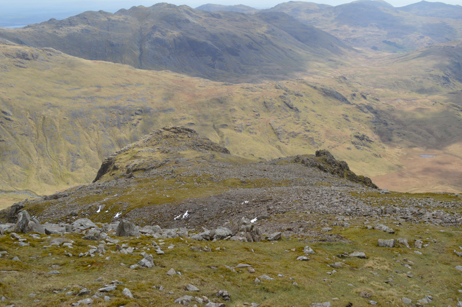
| Rossett Pike as I ground out above Rossett Gill. |
As Rossett Gill was left behind I take on the familiar conical summit of my first two thousander of the day in Rossett Pike, over the wind I here loud waterfalls as they cascade from Hanging Knotts, evidence of the previous nights heavy rainfall. Before I make my summit I spot a young lad no older than eighteen years of age sat behind the Rossett Cairn (found at the top of Rossett Gill) he shouts morning but I'm still stumbled by his presence, he wears half kit and trainers but looks in good form, I hadn't ventured far up the summit as I glanced back to see the lad had gone, well, nothing strange there I thought, that was until I looked for him from the summit where I had views back down Rossett Gill, Tongue Head, Langstrath and even afar as lower Esk Hause, where the heck did this young lad within the space of two minutes disappear too?
I was baffled. |
 |
| The Langdale Pikes from Rossett Pike ridge like summit. |
| A show of promise from the skies above greeted me as I reached Rossett Pike summit with sudden sunburst more commonly seen in Autumn rather than the end of spring, nontheless, most welcoming. |
 |
| Views of Bow Fell, The Great Slab and Hanging Knotts. |
| Every now and again the sun would shine which would light up the fell side, although by time I had the chance to focus with my camera they had gone as quickly as they came. |
 |
| Hanging Knotts (Bow Fell) from Angle Tarn (Langstrath) |
| I made the small descent to reach Angle Tarn where I stepped over the Tarns outflow by the five carefully placed large boulders, ahead of me a short ascent before diverting south west for Ore Gap and my second two thousander of the morning, Esk Pike. |
 |
| Sudden sunburts illuminate the wet cliffs on Hanging Knotts. |
| |
 |
| Heading for Ore Gap. |
I familiarise myself with the path that leads towards the top of Ore Gap which although rough, climbs steadily towards the grassy plateau between Bow Fell and Esk Pike.
Below me I spot two fell runners who have just reached the top of Rossett Gill, both of which are bent over hands on knees no doubt getting their breaths back after the steep climb, they don't go onto summit Rossett Pike, instead continue towards Esk Hause as I wonder did they spot me. |
 |
| Bow Fell from my Esk Pike ascent, the cloud makes the fell almost unrecognisable. |
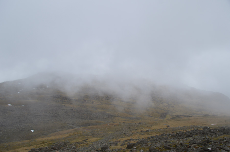
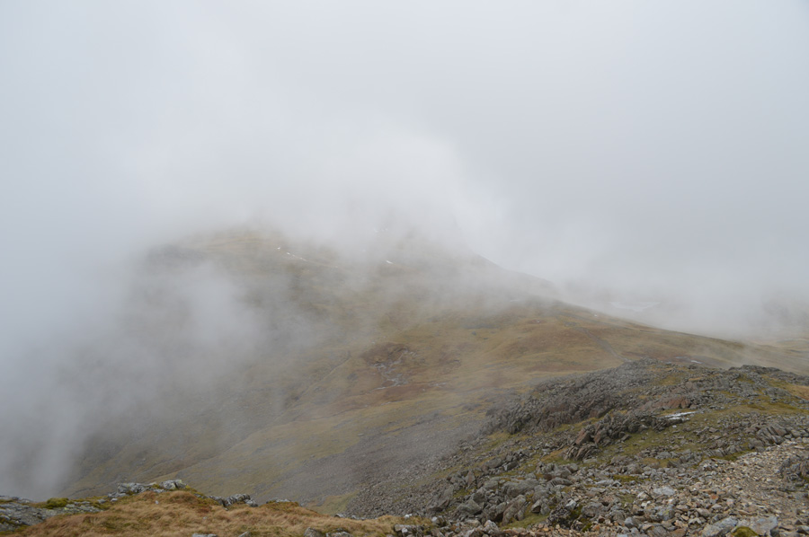
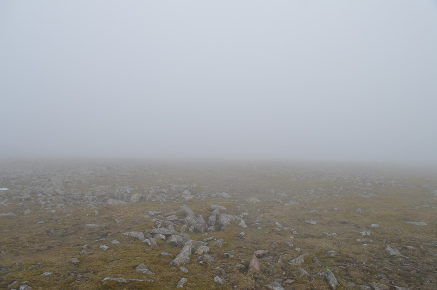
| I reach the top of Ore Gap as my path disappears into a quagmire of mud and flowing water, all of which had to be widely negotiated. It seems I have peaked out at cloud level as my view in almost every direction is obscured leaving a rather atmospheric feel about the place, not even the bulk of Bow Fell, nor the valley of Great Moss can be seen as I trace my way north towards Esk Pike summit. |
 |
| Approaching Esk Pike summit. |
The cloud shifted across Esk Pike's shoulder never revealing too much leaving me with views of around one hundred metres, other times less.The wind by the time I reached the summit was starting to get more gusty which left an over whelming feeling of if this walk would even be completed at all, wind and low cloud aren't the best combination for a walk such as todays, but I persevere.
I de-shoulder at Esk Pike summit if only to add my gloves as my hands were starting to turn red from the wind chill, all this was done sheltered behind a large cluster of boulders out of the wind where not only did I add gloves, I took time to compose myself which can work wonders and feel just as good as putting warm gloves on over cold hands.
I re-emerge from my sitting down position only to find myself completely disorientated for the briefest of seconds something of which I hadn't felt in years, it turns out I was looking through drifting cloud over Great Moss, only for it to disappear as quickly as the view found me. My pack is a few paces away as I walk over feeling the buffeting from the cold wind almost instantly, ahead my views open up again to reveal Esk Hause through a gap in the cloud.
I cast my mind back to H.Griffins own encounter on 'The Scafell Ridge' some thirty eight years ago, he had encountered almost identical conditions steering himself, and his son Robin, by compass the whole walk. |
 |
| Great End over Esk Hause. |
I pick my way towards Esk Hause where I spot a solo walker heading up Esk Pike towards me, further ahead two more walkers emerge through the cloud as they make their way towards Calf Cove, it seems, the bad weather this morning hasn't put everybody off, although my thoughts once again turn to how much longer this cloud would linger as my time before I reach the Scafell Ridge is almost running out.
I press on. |
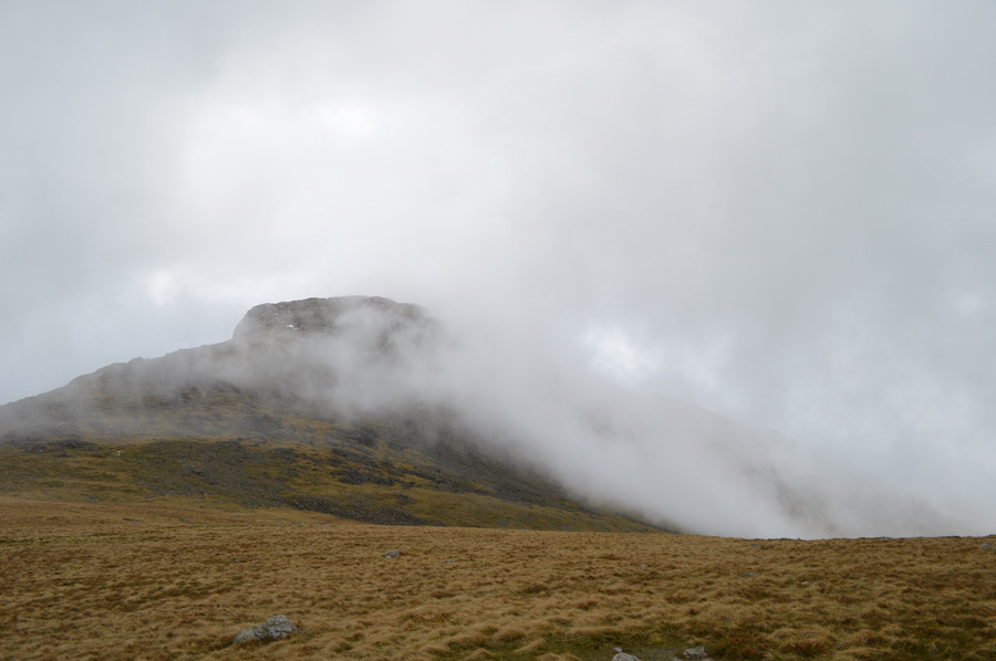 |
| Great End seen briefly before another bank of cloud rolls in. |
Determined I take on the steady ascent towards Calf Cove taking over the two walkers that I had seen from my Esk Pike descent, at the head of Calf Cove a large snow bank has formed as is clearly visible through the shifting cloud, the stone path found at its base has a heavy covering of old snow which every one seemed to side step which left me thinking it isn't just me who wants the snow to disappear, especially as we are almost in Summer now.
Another couple shelter close to a high wall of rock as I pass on my good morning before heading north for the final ascent on Great End summit, oddly this wasn't to be my last encounter with the couple. |
 |
| Esk Pike seen through a break in the cloud from my ascent on Great End. |
| |
 |
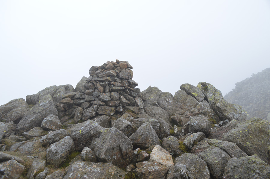
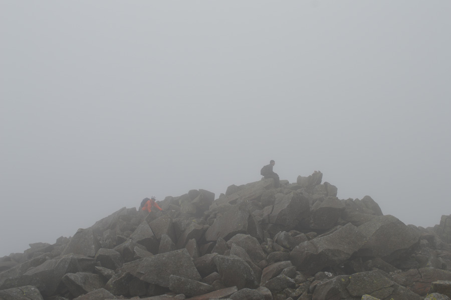
| Great End summit. |
| I trace my way from Calf Cove Col following the familiar stone cairns all the way to a deserted summit cairn, behind me voices carry through the wind as I am soon joined by three walkers and their dog, closely followed by the couple I had seen sheltering not ten minutes earlier. The guy holding the camera in the photo remarked on what a 'fine day' it was as I replied 'pardon' yes of course I replied, but subconsciously I had to disagree, more so on my ever increasing worrying thoughts on if this cloud was going to lift, I needed it to happen soon. |
 |
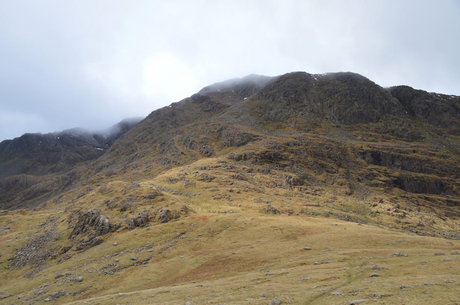
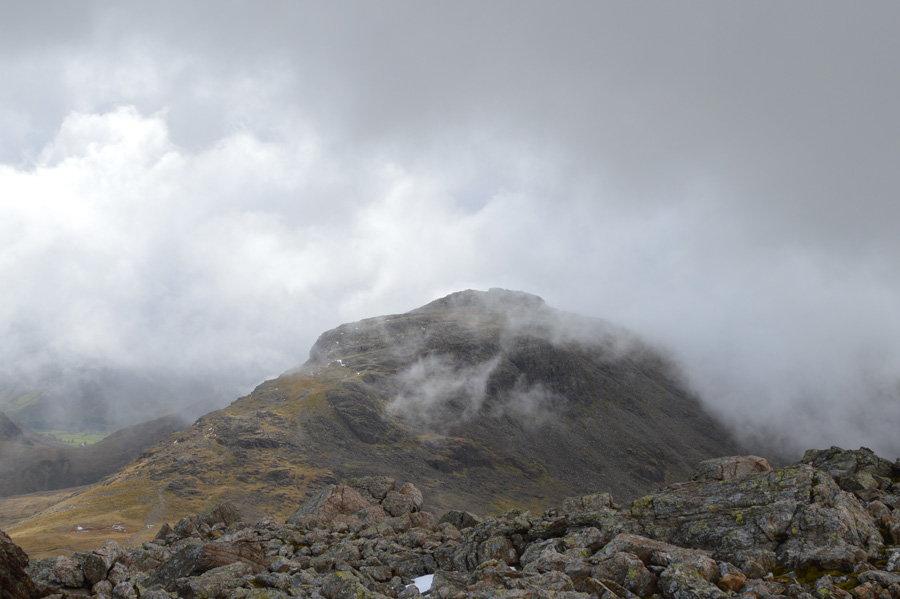
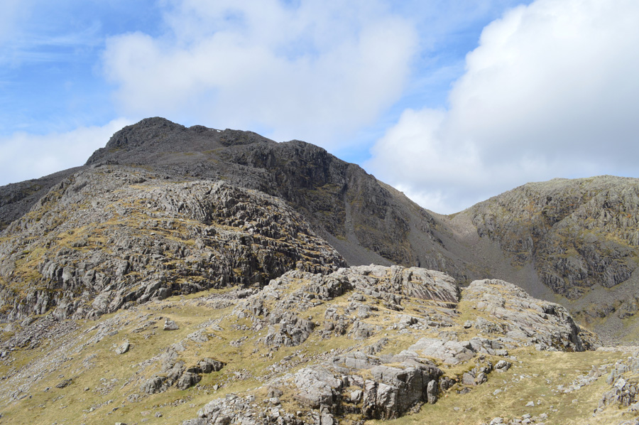
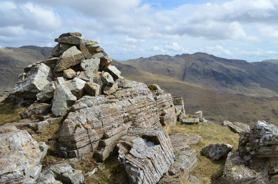
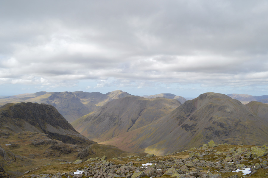
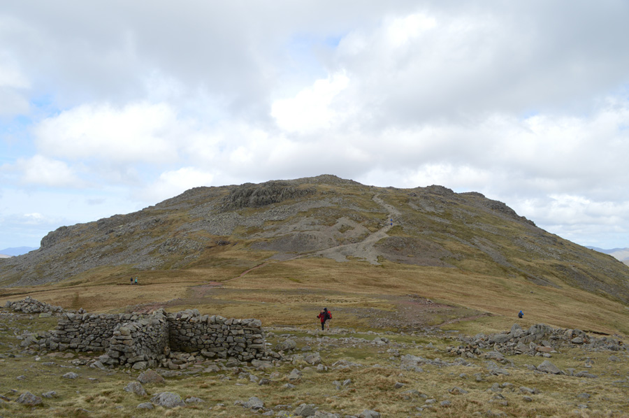
| Ill Crag and Broad Crag as I take on the Scafell Ridge. |
| The voices from the walkers still at Great End's summit carried over the wind until all that was left was silence and the sound of the wind buffeting at my jacket sleeves. By now my plan B was well out of the window as I take on the ascent on the Scafell Ridge and my fourth/fifth summits of the morning with the twin summits of Ill Crag. |
 |
| On route to Ill Crag as the cloud once again, rolls over the ridge. |
| Oddly enough the wind had subsided on route to Ill Crag leaving a calm eerie feeling across the summit plateau. |
 |
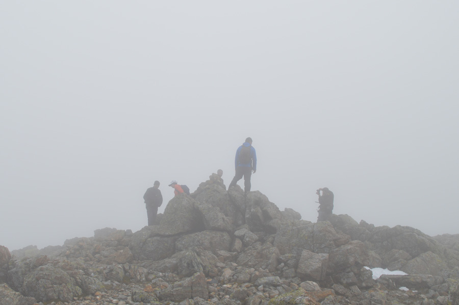
| Ill Crag north top summit cairn. |
| My first three thousander of the campaign closely followed by... |
 |
| Ill Crag main summit, my second three thousand foot summit. |
Summit time was kept brief as thoughts lay ahead on Broad Crag located just under half a mile away. I was soon joined by the couple I had seen on Great End who had followed me up both summits and was a little confused which one was the real summit, we shared a laugh about the weather as he too commented that this cloud should soon start lifting, lets hope so I replied 'are you going to the Pike' he asked, well no my route today is a little odd as I went onto explain, he hadn't heard of Rough Crag nor Pen he answered. I couldn't think any less of the couple, they were nice and we shared a good joke, where next he asked? Broad Crag is next for me, us too he replied.
I left the chap checking his G.P.S as I scurried down over boulder to meet back with the main summit path by which time had a few more walkers on it than I had left it just a short time ago, all heading for Scafell Pike no doubt. |
 |
| Broad Crag summit. |
The couple somehow managed to reach Broad Crag summit just before I did as I noticed the wind had started to pick back up again, we had a short chat before wishing each other well for the rest of the day. It was while on Broad Crag did I decide to have an early lunch and maybe wait out until the cloud would lift.
I found myself a good spot out of the wind from where I could here voices carry from the main path below me, at times so close I expected them to venture out at the summit but I guess this was the wind playing tricks on me. De-shouldred I placed my back against a large boulder and watched as the cloud drifted across the rock strewn summit plateau, at times ghostly outlines detailing distant rock formations peered through gaps in the cloud, other times there was nothing to see but a twenty yard circumference around me.
I told myself I was going to wait out the cloud but I guess anticipation to see Rough Crag and Pen from Broad Crag Col had gotten the better of me, during my early lunch I was facing north east towards Great End and hadn't seen what was unfolding behind me over Broad Crag Col. |
 |
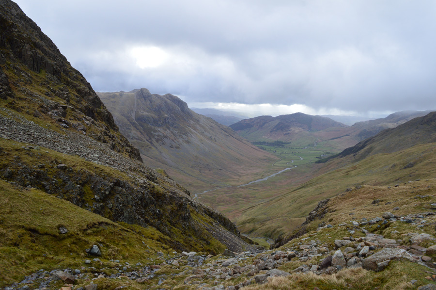
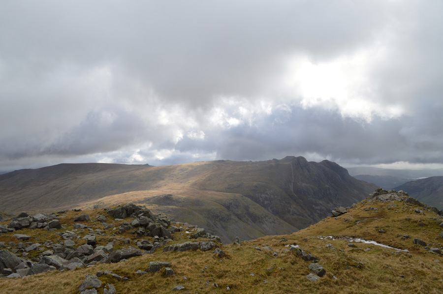
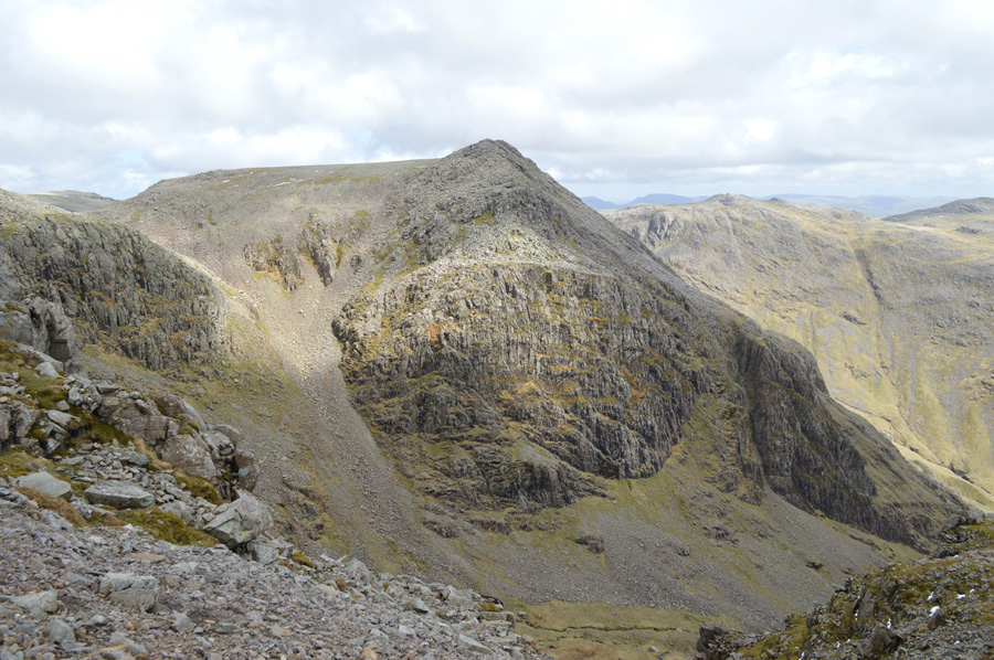
| Scafell Pike over Broad Crag Col. |
It was a truly magnificent feeling to see that the cloud had lifted over Scafell Pike and further more, was starting to open up with distant summits that I had graced not hours ealier now clearly seen.
I scurry myself down to Broad Crag col snapping photos just in case I would lose my view, but this never apertained. During my descent I cross at least half a dozen walkers either heading to or from Scafell Pike, I greet them all with a good morning but only get one in return but this cannot, and does not phase me. |
 |
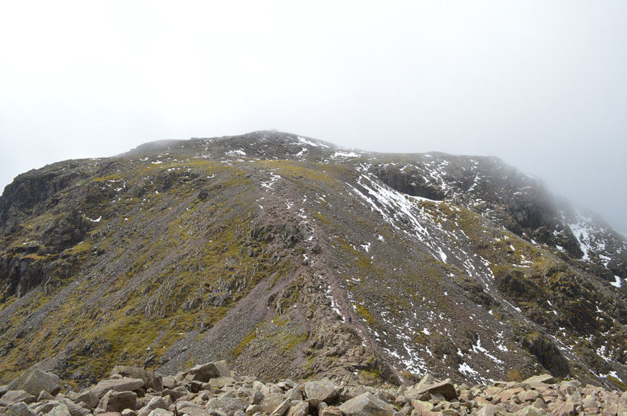
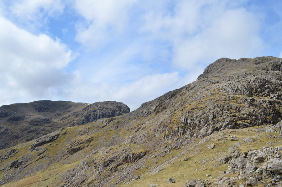
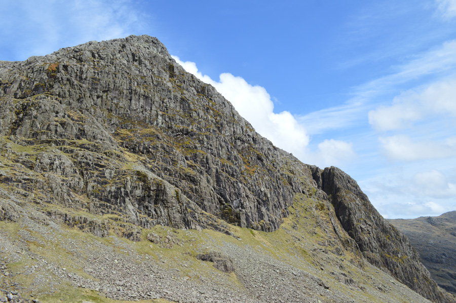
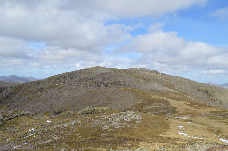
| Rough Crag summit. |
| If I wasn't following the route originally written by H.Griffin the next two hours of todays walk could have been made easier by making a summit of Scafell Pike then 'dropping on both' Rough Crag and Pen from there, but H.Griffin never did things the easy way and would have seen the summit of Scafell Pike as less direct. |
 |
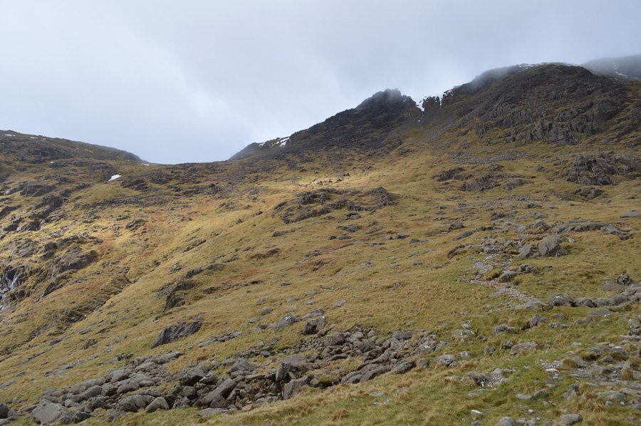
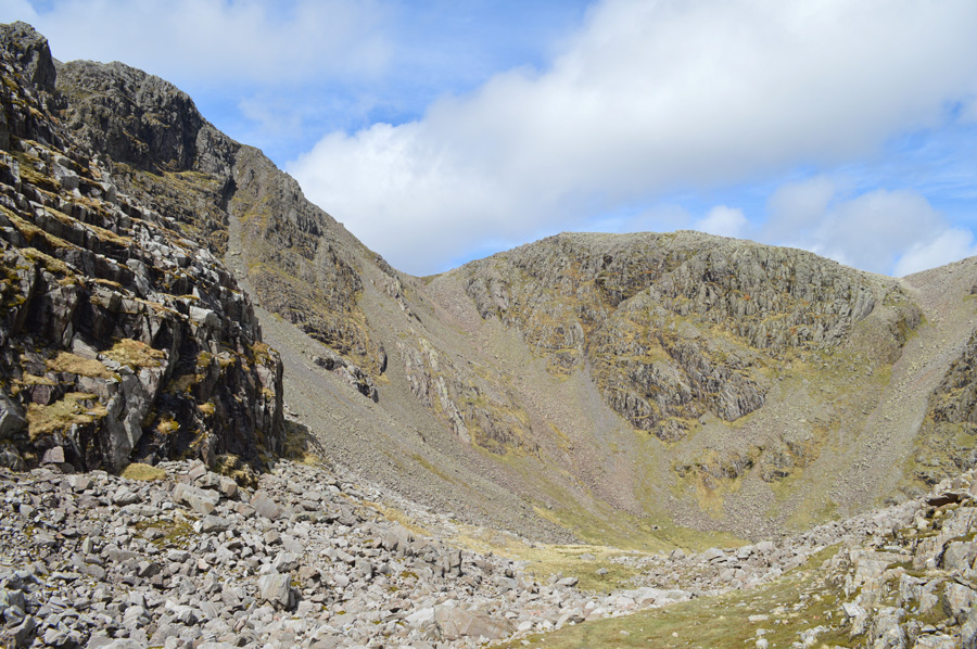
| Descending Little Narrowcove 'La'al Arra' |
| For this fell walker Little Narrowcove is a new experience which is odd considering the amount of time that I have been fell walking, I guess it can be put down to the terms often used by walkers who have ascended/descended as hellish and plain right horrible and even sadistic, well I guess I am about to find out how Little Narrowcove lives up to expectation. |
 |
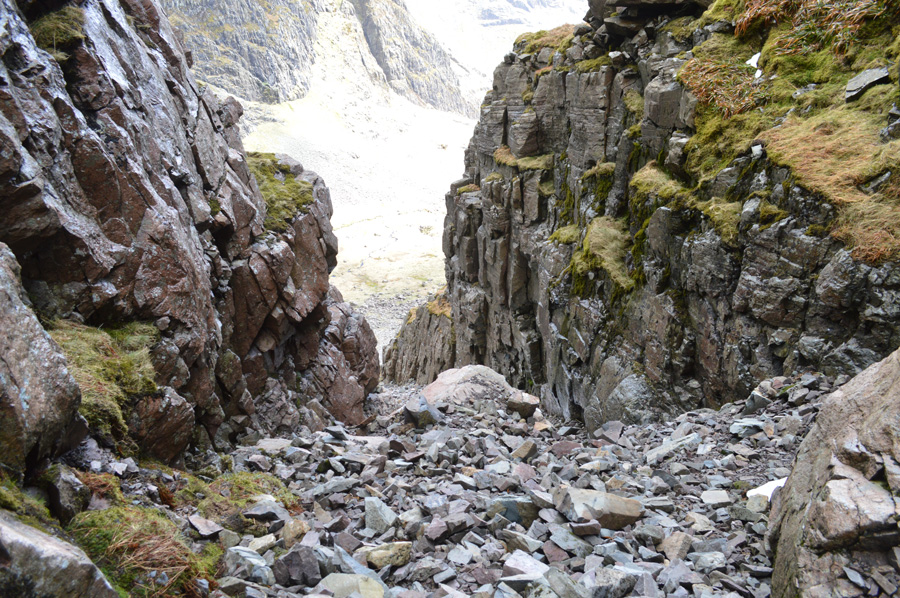
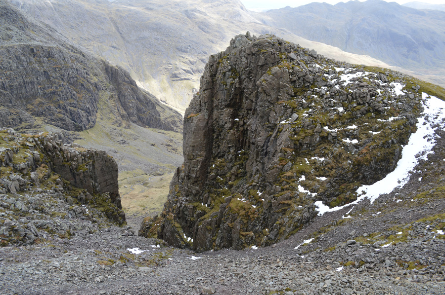
| Rough Crag and the scree gully appears from Little Narrowcove. |
I guess it's fair to say that the little time I did spend on Little Narrowcove was spent trying to stop gravity taking hold and propelling me forward against my wish all the while trying to sustain a leading slide over loose rock, 'awkward in descent' are words that I would use.
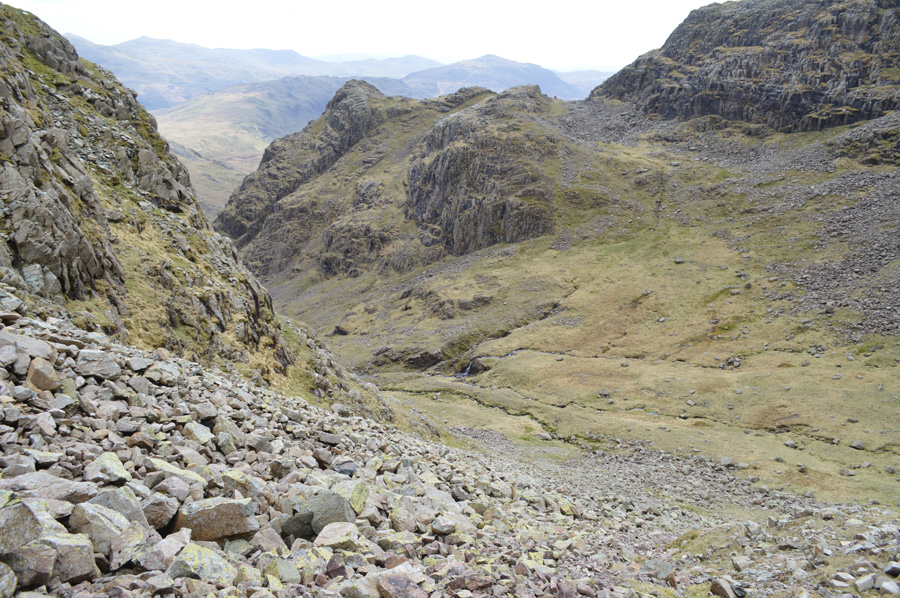
After descending approximately 550 ft into Little Narrowcove Rough Crag and its scree gully come into view. Although Harry and Robin made their way to the base of the scree my intention is to maintain a level of height so that I can keep rather than lose, my way of doing this is by keeping to precarious grassy ledges seen in the photo which really doesn't depict just how steep and narrow they really are, a decision that I had to stick to once I had committed as carrying on further down Little Narrowcove would only result in losing valuable height that I would only have to regain. |
 |
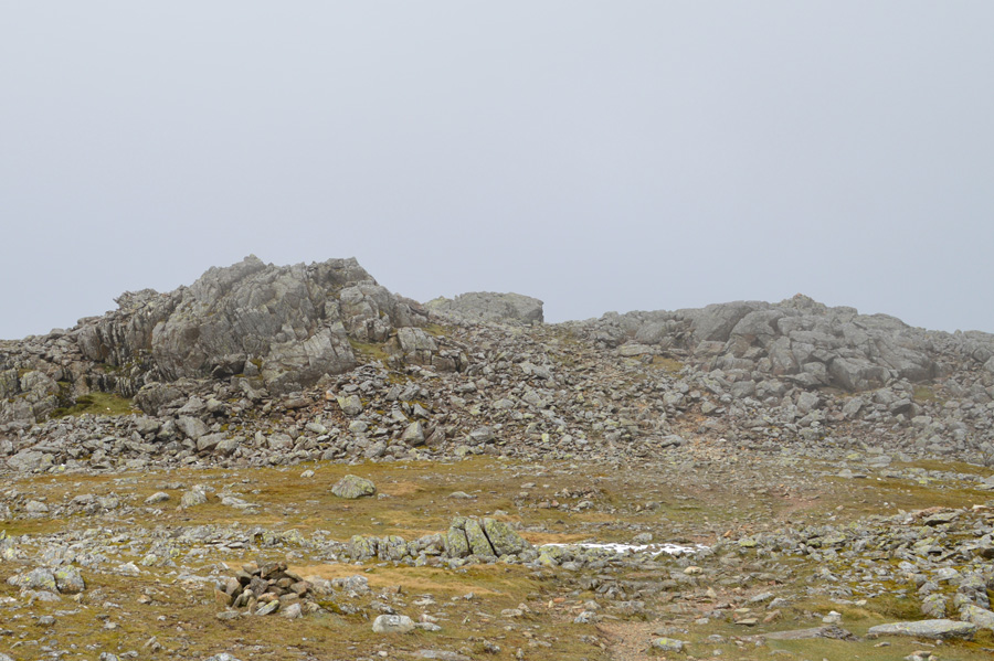
| Rough Crag from the base of the scree gully. |
After leading my way across the grassy ledges I eventually found myself looking up the steep scree gully and indeed, the intimidating Rough Crag, it is un clear although I suspect that Harry and Robin used the scree slope on the 'other side' of Rough Crag which I now find myself on the wrong side of due to maintaining the valuable height that I simply couldn't afford to lose.
The scree here (and I suspect the same on the other side of Rough Crag) was met with some of the most challenging scree climbing that I have climbed in my time as a fell walker, I shall describe this as accurately as possible.
After leaving the grass ledges behind most of which were negotiated by throwing my walking poles in the general direction that I needed to be in due to just narrow these ran I eventually left them behind where I found myself looking up on Rough Crag from the base of the scree slope. After only a few paces of ascent it became clear that the scree was, not just loose but moving beneath me in sections of three foot square diameters which meant every time I placed my walking poles in front of me the scree between myself and my poles would come down resulting in both my boots being completely submerged by scree, the scent of soil and dirt filled my nostrils as I now look for other options. |
 |
| After a careful time consuming ascent, here looking down on the scree gully. |
My next step was to keep a positive attitude, the thought of Harry and son Robin doing the exact same route spurred me on even if I somewhat lacked in pace I was slowly, but surely getting there.
Further up the scree the gully narrowed and large rocks had naturally built up on both sides made for a better purchase than the centre of the gully. |
 |
| Not far from the top of the gully. |
The further I ventured into the gully the narrower and wetter it became as black moss covered the walls and the rocks which formed at its base. Pockets of unavoidable snow were still in the gully which I used as a foot purchase, stabbing my walking poles in first to make sure what ever was beneath didn't slide once my weight was over, this worked well.
Sunlight at the top of the gully and hints of blue sky awaited me, I even managed to spy a walker cross the top without a peer down although I wondered what would he of thought had he seen me. |
 |
| Looking down on Rough Crag from the top of the scree gully. |
| I had no option but to keep with my instincts and stay right of the gully walls which spat me out on the wrong side of Rough Crag summit, for a moment I stopped to compose myself as I started a slight trace left which only resulted in me losing height rapidly after sliding down loose scree, I had no other option than to top out at the very top of the gully, then venture around to a slight descent on Rough Crag. |
 |
| My reward for the steep scree climb were breath taking views over III Crag, Bow Fell and Esk Pike. |
| |
 |
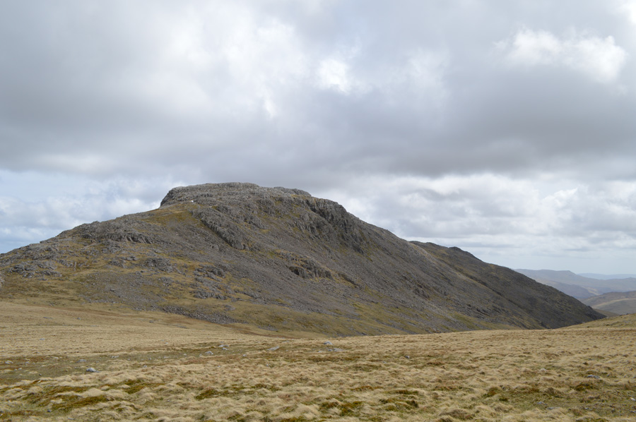
| Pen from Rough Crag. |
| Now that I had topped out on the top of the gully all that was needed was a trot round to the main summit of Rough Crag. |
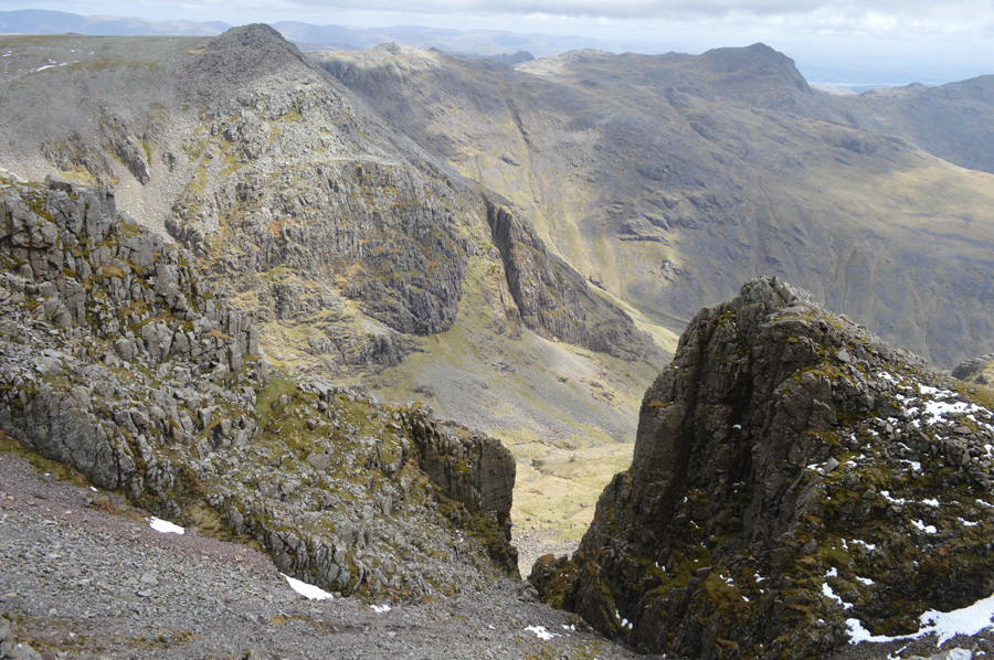
 |
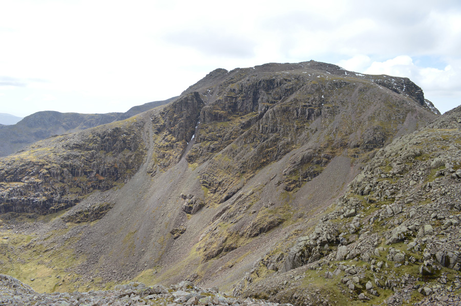
| Broad Crag and III Crag from Rough Crag summit. |
Despite the efforts it had taken to reach Rough Crag my summit time was more brief than I would have liked stopping only to adjust boot laces and pull ones trousers up, well after an ascent like that I'm surprised they weren't at the bottom of my ankles! Time taken to reach Rough Crag from Broad Crag Col was approximately 50 minutes.
Composed, I leave Rough Crag summit where I would start my descent on Pen. |
 |
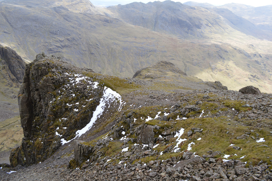
| Pen seen shortly after leaving Rough Crag. |
| I had only had the pleasure of summiting Pen once before which was enough to remind me that what looks like a gentle stroll to reach the summit is a un-kind optical illusion as between me and it - a rather steep descent is needed before gaining Pen summit, here I follow a faint grassy path which runs through boulder indicating that the top of the crags from where the descent starts, I keep 'right' along the ridge here. |
 |
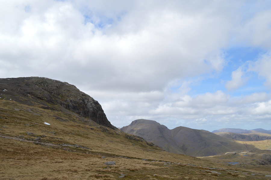
| III Crag fills the birthday boy's eyes. |
| I don't know why I sound so happy because III Crag Col seen with the steep scree running below is my route back onto the ridge. |
 |
| Scafell Pike and Scafell East Buttress seen after descending Rough Crag. |
| |
 |
| Scafell Pike, Rough Crag, Broad Crag Col, Little Narrowcove and of course Broad Crag seen shortly before arriving at Pen summit. |
| From the base of Rough Crag a short trek is all that is needed to reach Pen summit. |
 |
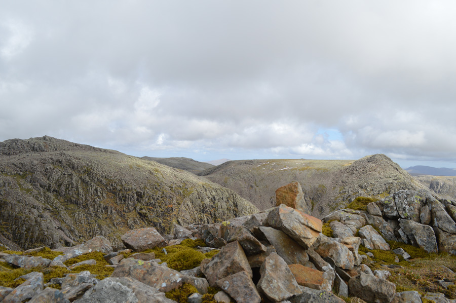
| Crinkle Crags from Pen summit cairn. |
You may notice the rock formation set within the summit stone, in fact, the whole area in between Pen and the base of Rough Crag is littered with such rock formation, formed from direct fall out from volcanic eruption and from sediment deposited by rivers and mudflows.
From Pen thoughts again turn to Little Narrowcove, only as recently as twenty four hours earlier I had decided that I would use Little Narrowcove as my route to regain the Scafell Ridge and not the steep slope found below III Crag Col, but I seem to have had a change of heart, Ill Crag Col it is. |
 |
| Descending in to Little Narrowcove. |
| With all summits collected all that was left was to reach the base of the steep scree found below III Crag seen in the far right of the photo. With views extending over Broad Crag Col I could now see masses of walkers both ascending and descending Scafell Pike which shows just how popular the Pike is on Bank Holiday which left me feeling rather happy in that I had escaped the crowds only seeing a pocket of people up until now.. |
 |
| Magnificent III Crag continues to steal the show and was a real highlight taken from the whole walk. |
| |
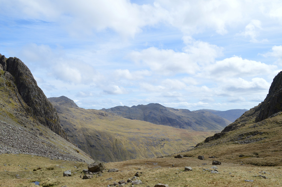 |
| Bow Fell and Crinkle Crags seen from Little Narrowcove. |
| After leaving Pen I took in the short descent over tricky swollen grassy ground before leaping over the Fords of Little Narrowcove before finding myself looking up at yet another steep scree gully before finding myself III Crag Col bound. |
 |
| Ascent on III Crag Col via the wide scree gully. |
| The base of the scree was soon reached under brilliant afternoon light, from which although steep, I make out winding narrow grass tracks that lead steeply over boulder, from the base of the scree, III Crag Col isn't visible only the ascent will reveal just how far it is to go as the fell falls away with the more height gained. |
 |
| Here, looking down the scree slope towards Pen. |
I keep with the narrow grassy paths when before I know it I'm gaining height quite quickly and I must add, enjoying it too, much more so than the torturous ascent on Rough Crag as the ground beneath my feet is stable and fills me with confidence.
Towards the top of the scree I start to run out of legs as I find my pace has almost faltered as I stab at the ground with both my walking poles, this of course is a mental matter, it's only those legs that are going to get you forward.
I pause for a moment. |
 |
| Scafell Pike seen over Little Narrowcove. |
| Rough Crag's steep scree gully seen with the patches of snow that I had earlier spoke about. Time taken from leaving Broad Crag Col to the top of III Crag Col via Rough Crag and Pen was approximately 2 hours 5 minutes. |
 |
| Broad Crag seen with Scafell Pike, as walkers continue making thier ascents. |
| |
 |
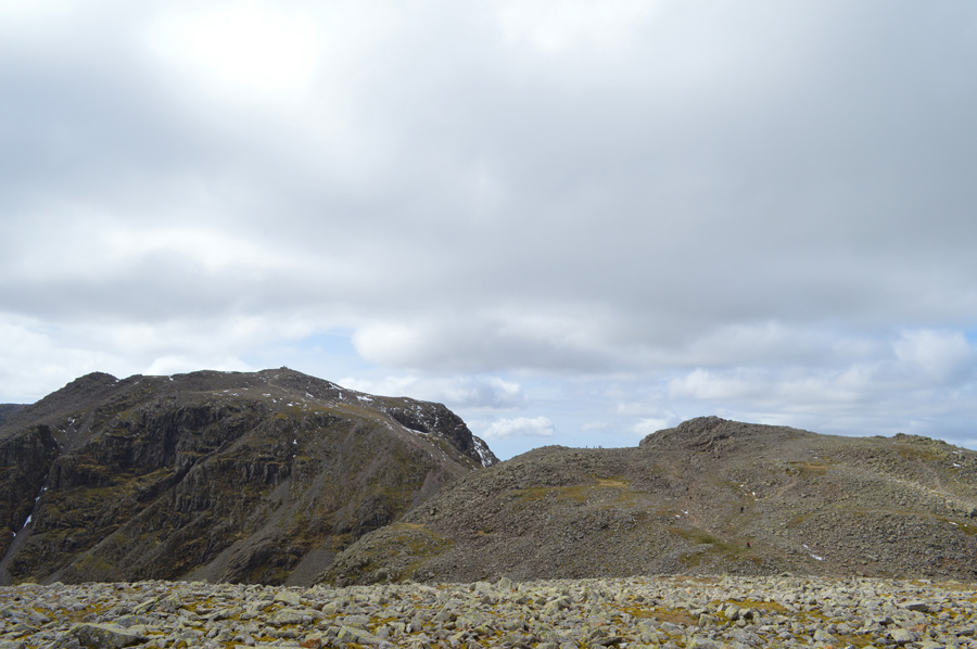
| A wide selction of fell including Lingmoor, Great Gable, Kirk Fell, Pillar, Scoat Fell and Yewbarrow. |
I traced my way back over III Crag summit towards Calf Cove Col from where I stopped to take this photo, absentmindedly I had completely forgotten about the three Satsuma's I had in the side pocket of my pack, I down pack instantly and take one out leaving another one 'primed' in my trouser pocket.
How could I have forgotten about my Satsuma's! |
 |
| Great End under fantastic afternoon light. |
It was during my descent into Calf Cove did I bump into a couple who were by the sounds of it making an ascent on Scafell Pike, the following questions however made me question how had they had made it so far.
Is that Scafell Pike? no that's Calf Cove, is that it? No that's Great End. Whats that right over there that looks like a volcano? That's Dow Crag - Coniston, seriously this conversation needs to stop.
In my best 'layman' terms' I described the route to Scafell Pike from the spot from where we were stood, no matter the silliest of questions, they asked for my help and I felt obliged to give it to them. |
 |
| Passing Esk Pike on route to Esk Hause. |
| |
 |
| Great End seen with Green and Great Gable from Esk Hause. |
| |
 |
| Distant views over the Gables towards the north western fells with Seathwaite Fell and Sprinkling Tarn seen in the foreground. |
| |
 |
| Allen Crags from the cross shelter at Esk Hause. |
I hadn't looked at my watch on purpose as I knew time was getting on with the distance back to Great Langdale and then back home would have only played on my mind, instead I bury it and claim, it is what it is.
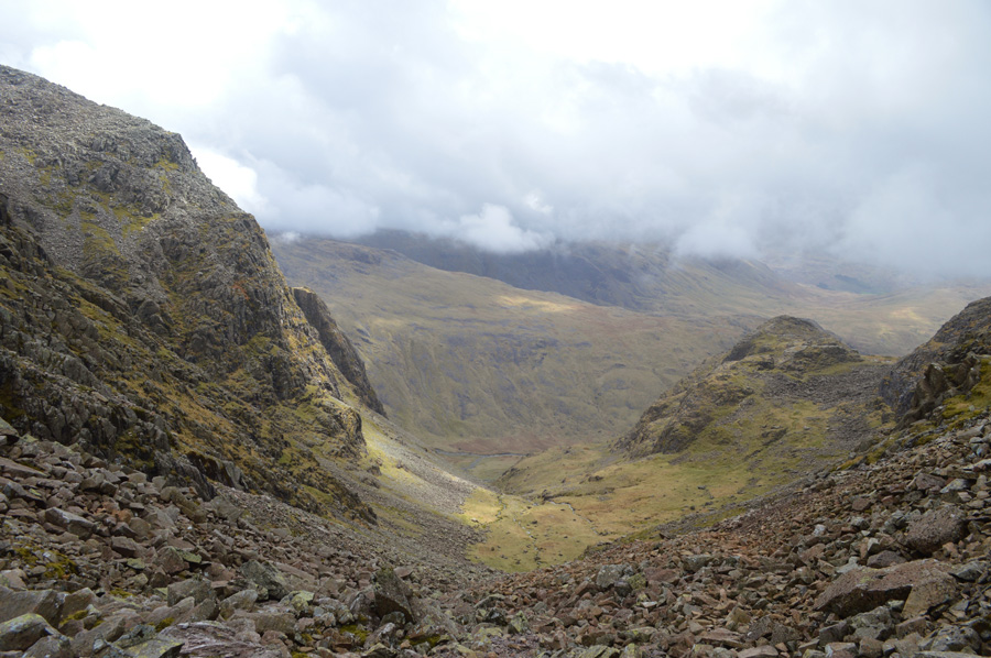
I decide that here at Esk Hause is where the walk mentally came to a close and all that is needed and to be enjoyed is the four mile walk back to Great Langdale taking in some of the two thousander summits by sight that I failed to see during my early morning ascents. Esk Hause is a mecca where all walkers meet before tending their way into adjoining valleys such as Borrowdale and Great Langdale, with tired legs I track down to lower Esk Hause where slight ascents are gained as I find second wind after second wind in both my legs and walking poles.
People stop to eat as I pass Angle Tarn some out of view enjoying their own special time in Lakeland, mine it seems is behind me until the next time which won't be too long away I can guarantee.
Rossett Cairn is reached with distant views over Mickleden and the comfort of billiard table standard grass to walk upon from where I'm sure my feet will gain many comforts from. Glancing down at the bottom of my trousers which now bare the remnants of Rough Crag scree gully as do my boots who I'm sure, will not forgive me for sometime, but I thank them for getting me through nonetheless,
As I leave Mickleden and round my way into the grand valley of Great Langdale where I sense that feeling that only after a day of walking the high fells overcome me leaving my stomach in a twist of butterflies, my mouth, my throat eager for the no doubt warm can of Diet Pepsi that awaits me at the boot of the car.
Old Dungeon Ghyll is reached as I spot people enjoying afternoon drinks on the wooden tables outside the bar as I smirk and think, I bet they can smell me from here. |
 |
| |
| |
|
| |
| Back to top |
 |
|
