|
The Harry Griffin 2,000 footers Walk 6 -Above Wrynose Pass |
 |
 |
6th April 2015 |
 |
|
After two days I find myself back on the Lakeland fells taking advantage of the Bank Holiday and not to mention the clear weather the fells have been experiencing this last couple of days. The idea to walk the five two thousanders today worked well as the route incorporated a lenient five summits covering just the six miles.
The fells above Wrynose are packed into a tight bundle yet originally this walk would also have collected Crinkle Crags. Bow Fell, Bow Fell Buttress and Hanging Knots amongst others, that was until H. Griffin had the misfortune to lock his keys in the boot of his car early one May morning back in 77 Harry then had to wait to be rescued as there was no mobile phones back then, his rescuer, an instructor from an Outdoor Pursuits Centre based in Coniston kindly drove Harry back to Ambleside where he could finally call for help, it was gone lunch time by the time he arrived back at the top of Wrynose thus leaving him no adequate time to complete his fifteen round summits, instead, this was the walk Harry went on to complete that disastrous day.
Keeping with the tradition of H.Griffins intended route this is 'Above Wrynose Pass' |
|
| Freeman of the Hills |
 |
| |
'Above Wrynose Pass'
We never noticed the ascents, being far to busy chatting and exchanging experiences. This was a short, but memorable day - not on account of my stupid negligence, although occasioned by it, but because of the companionship of old friends, mountain friendships, I decide, long ago, are the best of all. |
| Harry Griffin |
|
|
| |
|
Overview |
|
|
| Ascent: |
1,923 Feet - 586 Metres |
| Summits over 2,000 Ft: |
Cold Pike - Little Stand (Red How) - Stonesty Pike - Great Knott - Pike O'Blisco |
| Weather: |
Sunny throughout feeling very warm & humid. Highs of 15°C Lows of 5°C |
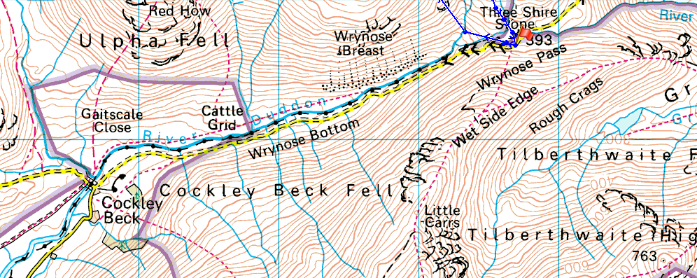
| Parking: |
Three Shire Stone, Wrynose Pass |
| Area: |
Southern |
| Miles: |
6 |
| Walking With: |
On My Own |
| Ordnance Survey: |
OL6 |
| Time Taken: |
4 Hours 40 Minutes |
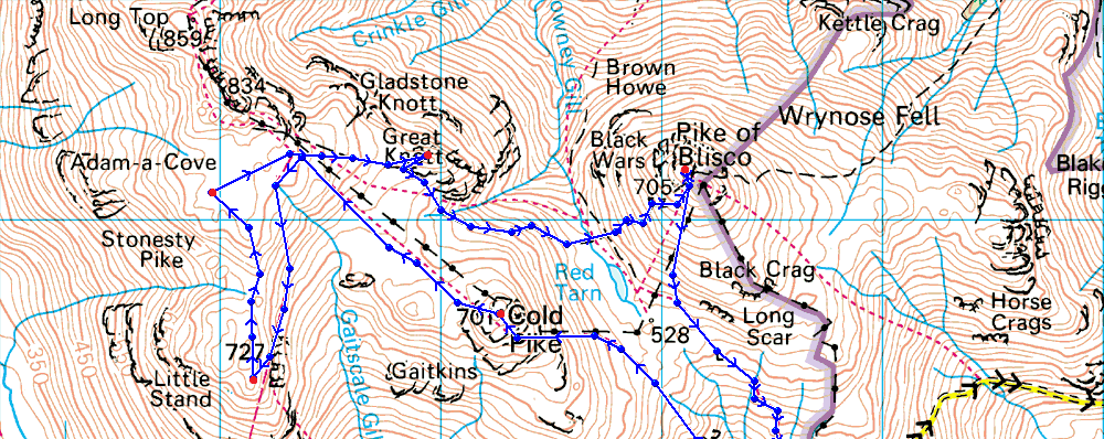
| Route: |
Wrynose Pass - Cold Pike - Little Stand (Red How) - Stonesty Pike - Great Knott - Red Tarn - Pike O'Blisco - Wrynose Pass |
|
| |
|
Map and Photo Gallery |
|
|
  |
| |
| |
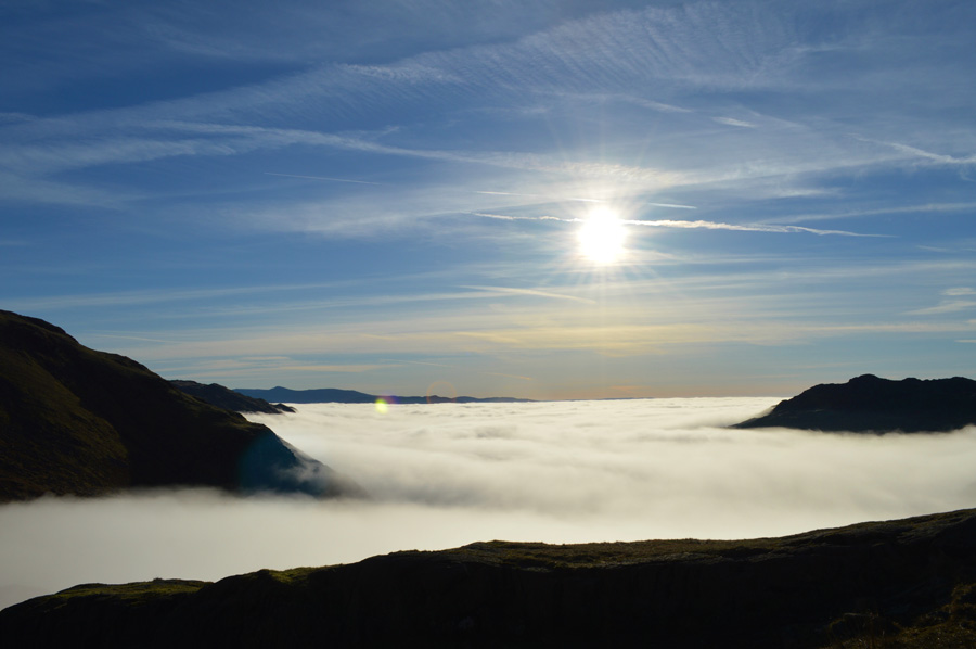 |
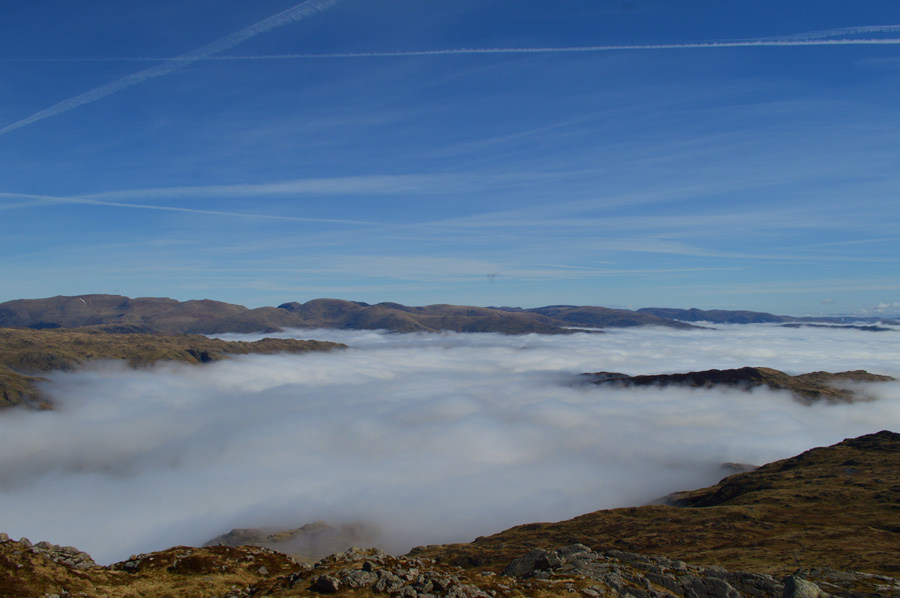
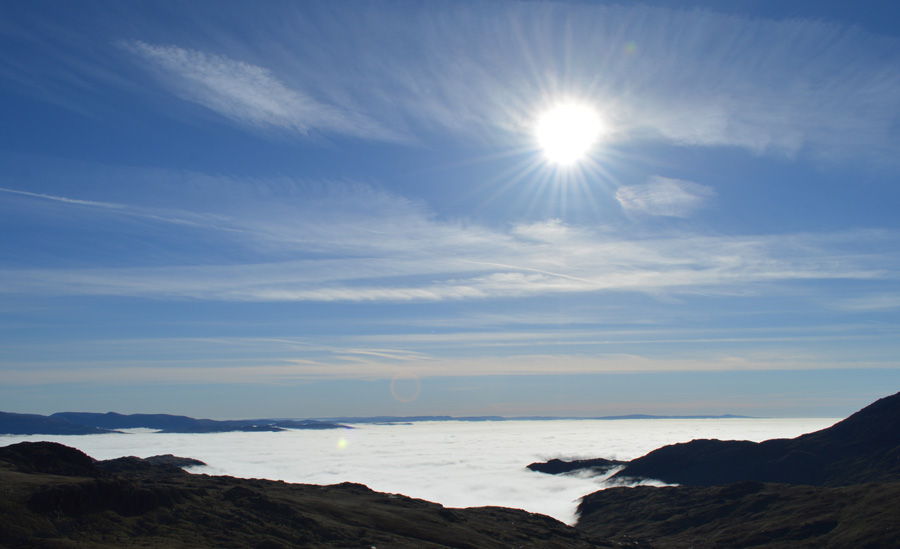
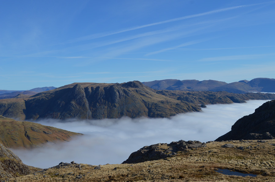
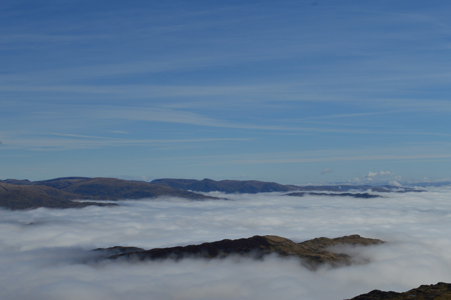
| Little Langdale cloud inversion from the top of Wrynose Pass. |
I nearly never made it to Lakeland at all given that my Father had taken a fall at home on Easter Sunday morning leaving myself & other family members tending his side in Casualty for much of the day, then after Dad's all clear I made sure he was ok before returning home sometime close to 21:00pm that evening, by which time I hadn't packed a thing for the following day so as you could well imagine the next hour or so before bedtime - was a little frantic to say the least.
My alarm went off at 6:00am and by 06.30 I was on the road heading north eating Soreen & butter for breakfast followed by large consumptions of coffee. The Bank Holiday roads were clear all be it foggy for much of my journey which didn't really bother me given the great conditions we had experienced on Kirk Fell just a couple of days earlier, so you can imagine my elation when I saw this view emerge through my rear view mirror after driving through thick fog shortly before arriving at the top of Wrynose Pass, it was most definitely a stop the car & reach for the camera moment. |
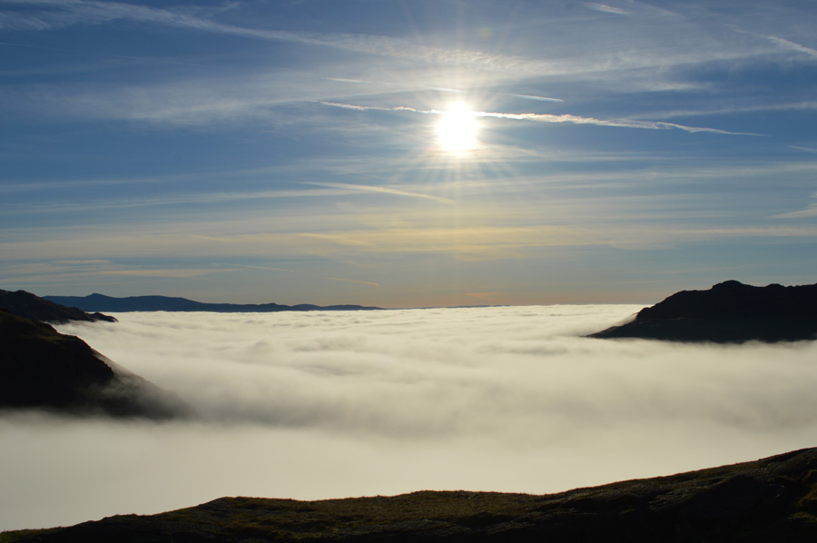 |
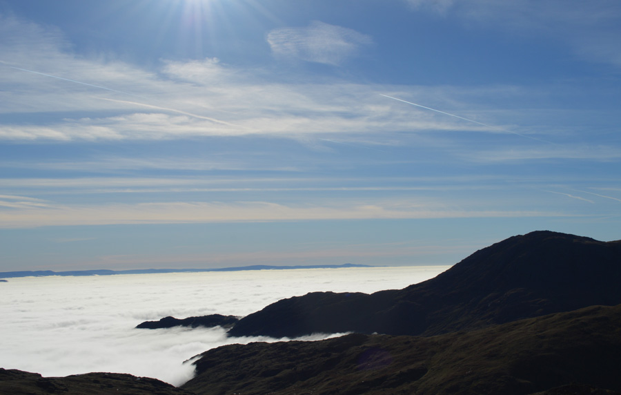
| Duvet day over Little Langdale. |
| Despite the fantastic temperature inversion I was eager to get boot onto fell at which time, liitle did I know the full extent of the inversion. |
| |
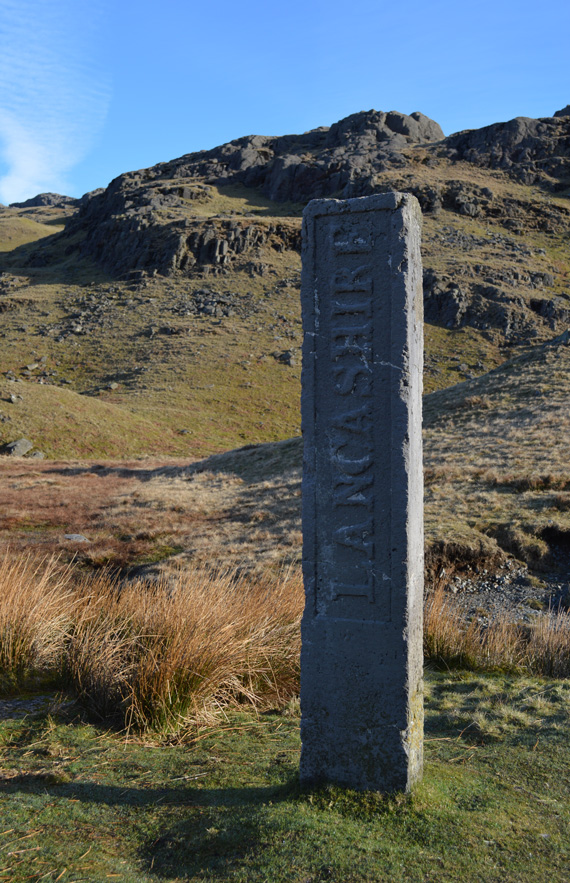 |
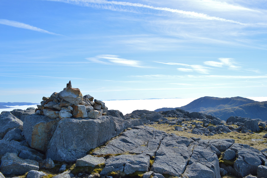
The Three Shire Stone found at the top of Wrynose Pass.
It was difficult not to park my car further back down the Pass given my extraordinary views but I knew this would be a logistical nightmare later so I carried on towards the Three Shire Stone finding a two car (which later became three) parking spot right next to the Three Shire Stone.
As soon as I opened the car door I could feel the mild morning air which infact, felt much warmer than the 5°C that the car thermometer was telling me. I quicky booted up rushing slighty due to the added time spent taking photos of the cloud inversion back over Little Langdale.
I dont know why I did it but I added the jacket without thinking, lets call it force of habit which saw me blowing out only minutes later, where I had the common sense to pack it under the lid of my pack, should I need it later.
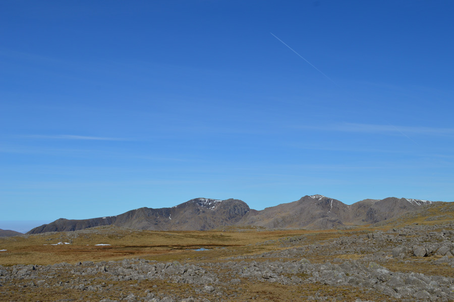
With the car locked I traced my way back on the Pass if only to get a shaded full length view of Wrynose all the way to the heights of Harter Fell whos summit was drenched in full morning glory.
Should my walk work well today, I may well find myself on Harter Fell, but this may be chancing it a little, more on that later.
The Three Shire Stone was a boundary stone that once marked the point where Lancashire, Westmoorland and Cumberland once met.
|
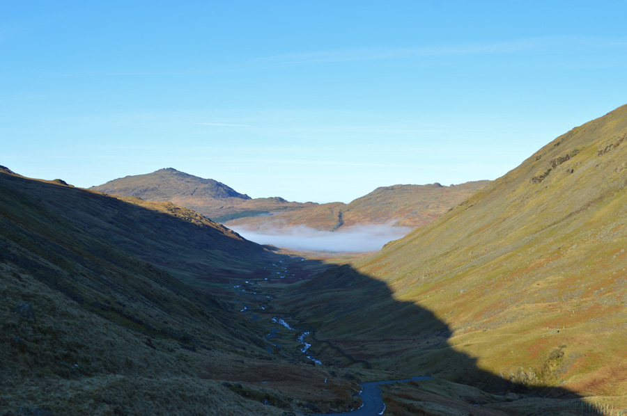 |
| Shadded views over Wrynose Pass towards Harter Fell (Eskdale) |
Despite the shade the morning was heating up rather rapidly as I took in the fine view over the Wrynose Pass to where it becomes the Hard Knott pass just beneath where the cloud lurks low.
The first fell of this mornings route is Cold Pike, a fell that I have climbed many times before but strangely enough, not from the top of Wrynose Pass. Here I scour the fell side for the remnants of a path but find nothing with the exceptions of two new looking wooden stys found a little lower than Rough Crags, below of which newly planted trees had been fenced off leaving a rather sceptical walker searching for a distinguished path that I later found that ran parallel with a new fence that camouflaged rather nicely within its surroundings.
I was soon climbing steeply after crossing Duddon Grains towards Rough Crags, on some of the ascent I drift off path to take full advantage of the lay of the fell side which, although was steep, worked well in gaining steep ground quickly. |
 |
| The view east, impossible to ignore. |
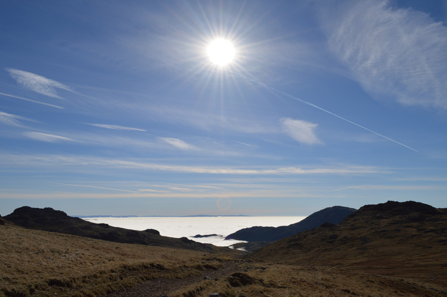
By now I had gained enough height to see what I thought to be the full extent of the cloud inversion which covered the whole of Little Langdale and extended further south over Tilberthwaite & beyond. A strong sun made hard work of the steep climb as I reached for the bite valve from my Camelbak, probably more times in the space of half an hour than I have done all winter.
A sure sign that Spring is here. |
 |
| Wetherlam & Wetherlam Edge descends into a blanket of cloud. |
| |
 |
| Pike O'Blisco over Red Tarn. |
| Still taking advantage of the lay of the fell side I soon found myself on Cold Pike's eastern flank, after a steep ascent the ground underfoot evened out over a duration of semi-dry bog before the two false spurs of Cold Pike's summit are seen, as tempting as they were & with the summit behind these false summits I follow a path around the back of the rocky outcrops before the main summit appeared |
 |
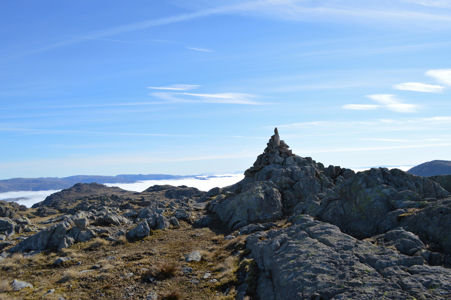
| Cold Pike summit. |
The last ascent on my first two thousander of the morning was challenged by the briefest of scrambles before arriving at its twin peaked summit both of which, confusingly to the untrained eye, hold stone cairns at their peaks.
I drift over to the higher of the two & take a few moments out, if not to take what was unfolding before me, in.
From Cold Pike summit it became clear to me that it wasn't just Great Langdale under a vale of cloud, but every valley in every direction. |
 |
| Here the valleys of Oxendale & Mickleden are both under the tempreture inversion, not even Dunmail Raise escapes some 6.5 miles away. |
| After leaving Cold Pike my intention was to stick close to Gaitscale Gill but I found this too wet and not as tempting as the view over Oxendale towards the Langdale Pikes, it was here I took out more unscheduled moments as I sat myself upon a rock just watching & listening to the silence. |
 |
| Oxendale & Pike O'Blisco over Browny Gill, beyond, the Helvellyn fells. |
| |
 |
| Here, looking back on Pike O'Blico, Cold Pike & Wetherlam. |
| I refigured my route a little not losing the route originally set by H.Griffin as I steered myself past Great Knott (of which I would summit later on my return) towards Long Top before diverting south towards my next two thousader of Little Stand (Red How) |
 |
| Little Stand (Left) seen with Stonesty Pike (Right) |
| I would soon find myself staring at the summit cairn of Stonesty Pike a couple of hundred yards west which I would collect on my return, but first, Little Stand, a summit that I hadn't stood on for quite some years. |
 |
| Little Stand (Red How) with Harter Fell (Eskdale) beyond. |
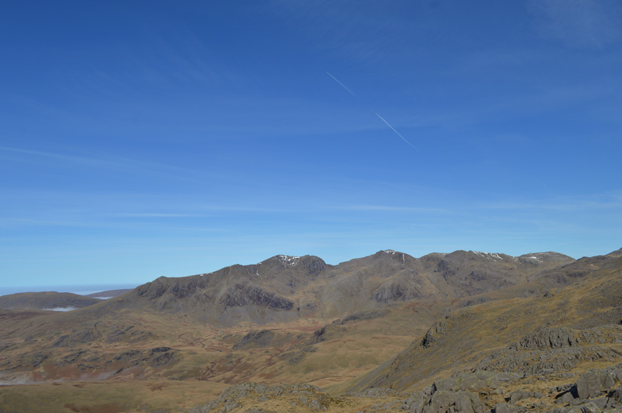
All the familiarities of Little Stand soon came flooding back more in the form of its twin peaked summit, the highest seen in the right of the photo.
It was a delightful trek across the dry wild grasses as my views soon opened up over Great Moss and the Scafells. |
 |
| Views west towards Scafell Pike, Scafell, Cam Spout Crag & Slight Side seen over Great Moss. |
| |
 |
| Little Stand (Red How) summit cairn. |
| After a short pull I soon found myself at the summit of my second two thousander of the morning. Even though I was only at my furthest point from my car it was while here on Little Stand do you get the overwhelming feeling that you are indeed, in the middle of nowhere. |
 |
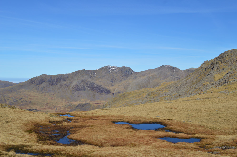
| The two un-named Tarns found close to Little Stand summit. |
| Which, refelcted the deep blue sky in an almost mirror finish. |
 |
| Further west, Hard Knott & Harter Fell (Eskdale) |
| With the cloud inversion extending beyond the Irish Sea, |
 |
| Commanding views over commading fells. |
| It was while on Little Stand's summit did I take the opportunity to carefully pick out two routes that are included in the H.Griffin two thousand ft summits, both these routes command long & exhilarating days on the Scafell range even incorporating some summits that I haven't visited before. |
 |
| A closer view of Cam Spout Crag, Scafell, Pen, Rough Crag & Scafell Pike. |
| All of which are included later on in the project. |
 |
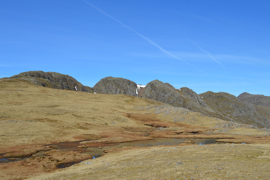
| Crinkle Crags & Stonesty Pike from Little Stand. |
I probably spent more time on Little Stand than I did on any other summit that morning as I indulge over my surrounding summits under a bright blue sky. Little Stand offers fantastic seclusion with mouth watering views over Great Moss, the Scafells & the Coniston Fells, it was hard not to pull up a rock and just take it all in, which, for the second time in less than an hour, was exactly what I did.
Incidently, that's Stonesty Pike over there who's summit creates the optical illusion that it is much higher than it actually is, especially on a clear day as I have today, it's only when you take a closer look do you realise that Crinkle Crags are (is) behind the actual summit of Stonesty Pike.
It was time to track (a familarlarity that I am getting more & more used too with my project) back to Stonesty Pike except this time I will take on the summit ridge instead of flanking it, it's only a short walk with little ascent involved so I should be there in no time. |
 |
| The Scafells from Stonesty Pikle summit. |
The sun continued to beat down during my short trek to reach Stonesty Pike summit, after a short pull I left the path I was using for a direct summit but found I needn't have as the path skirted around the summit outcrops that I needn't had gained, oh well never mind. With the summit cairn never out of sight I soon found myself at the rocky summit plateau with one single tap from my walking pole & a healthy pat from my right hand I found myself heading back towards Great Knott in good stead.
But, one more summit photo before I leave. |
 |
| Wetherlam and that sea of cloud from Stonesty Pike summit. |
| |
 |
| Extensive views over the Scafells from Ill Crag on the right to Slight Side over over on the far left. |
| |
 |
| Heading for Great Knott seen shortly after passing over the top of Gaitscale Gill. |
I was soon back on stoney ground as I made my way for Great Knott seen ahead in the photo, despite today being a Bank Holiday Monday, and, in these conditions I was surprised to say the least that I still hadn't seen a single person all morning.
Instead of using the newly laid path seen in the photo I cross & make a direct approach to Great Knott summit, the ground underfoot over towards Great Knott may look nice and dry but it was probably the wettest ground I had encountered all morning which meant at times, just the odd diversion to avoid getting the boots ankle deep. |
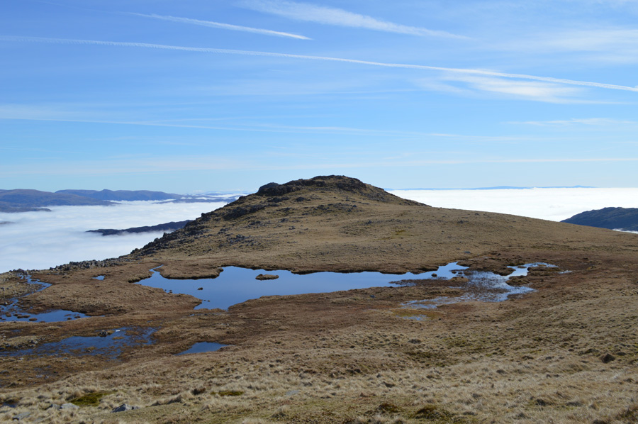 |
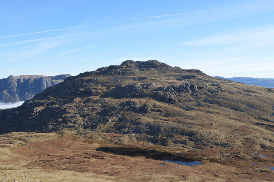
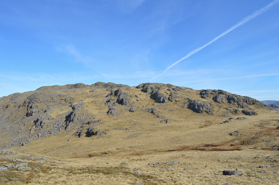
| Great Knott. |
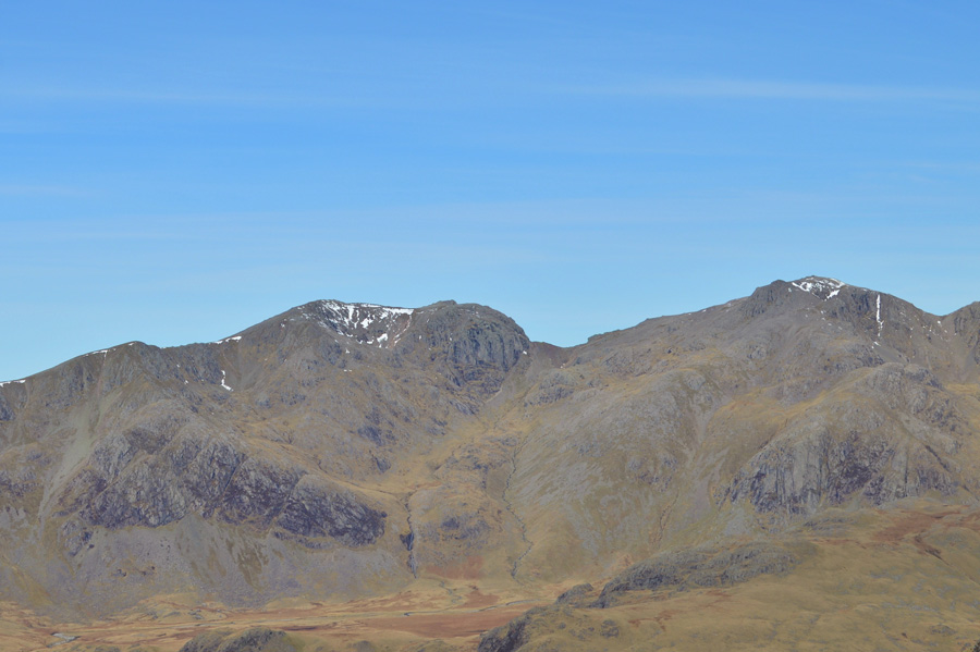
| Great Knott will be my fourth two thousander of the morning and without question the easiest to summit with hardly any gain at all. Great Knott has always been held in the highest of regards from myself which is purely a personal expression, my reason for this isn't as clear from here as it wiould be from Red Tarn later. |
 |
| Crinkle Crags & Bowfell seen from my Great Knott approach. |
| |
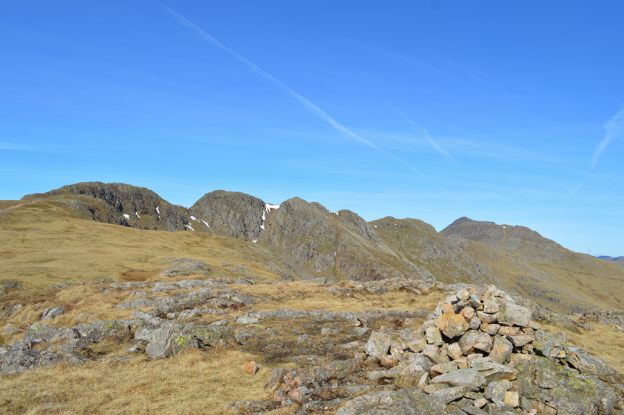 |
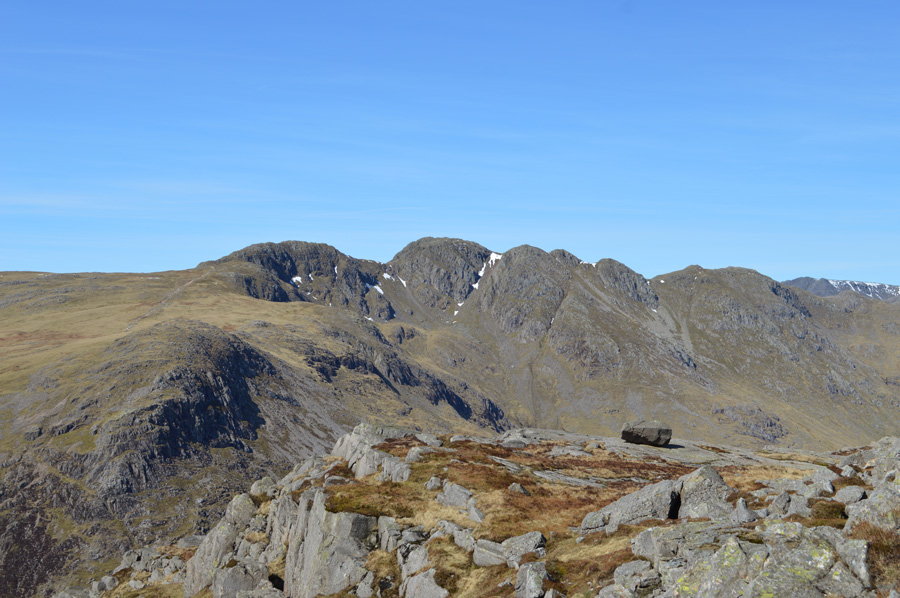
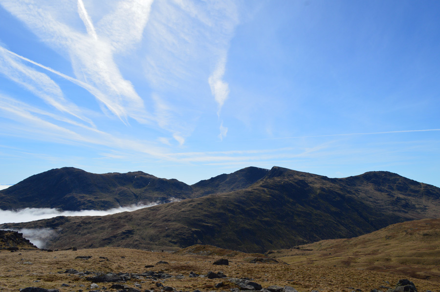
| Gladstone Knott, Crinkle Crags & Bowfell seen once again from the summit of Great Knott. |
It was the briefest of pulls did I use to gain Great Knott by where I was met by a cool breeze that blew in over the Oxendale Valley which fell away steeply below Great Knott's summit.
Around me surrounded by some of Lakelands finest and indeed popular summits yet I find myself completely on my own, not even a scour over the Crinkles reveals any form of movement.
Not that I'm complaining mind. |
 |
| Great Knott, Crinkle Crags & Bowfell. |
| I consider amongst many others of course to be one of my all time favorite views in Lakeland which was what I was speaking about a little earlier, I only wish at times Great Knott got the recognition it so much deserves much the same as I feel about Broad Crag, two great mountains over shadowed by their domineering neighbours. |
 |
| Great Carrs & Swirl How from Red Tarn. |
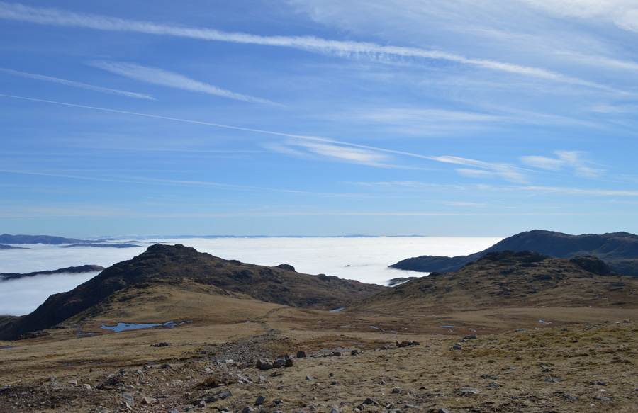
After the brief descent from Great Knott I re-joined the stone path and steered my way towards Red Tarn and my last two thousander of the day in Pike O'Blisco stopping to chat to almost every walker that I encountered, all the topic everyone would speak about was of course, the cloud inversion & just how warm the sun was.
Scores of walkers were by now heading up from Oxendale & Great Langdale some of whom spoke about turning back because they were walking in thick fog and didn't see the point of completing their walk, it was only when they topped out at the head of Browney Gill did they realise they had been ascending through the cloud inversion, all of which brought smiles to the faces who had persevered, their comeraderie showed, etched across their pink sunburnt faces.
I had been feeling pretty raring most of the morning only stopping to admire views rather than rest tired muscles as I hit the steep slopes of Cold Pike I felt my pace back off a little, I put it down to the heat of a midday sun but if I'm truly honest with myself it was probably a mix of both. |
 |
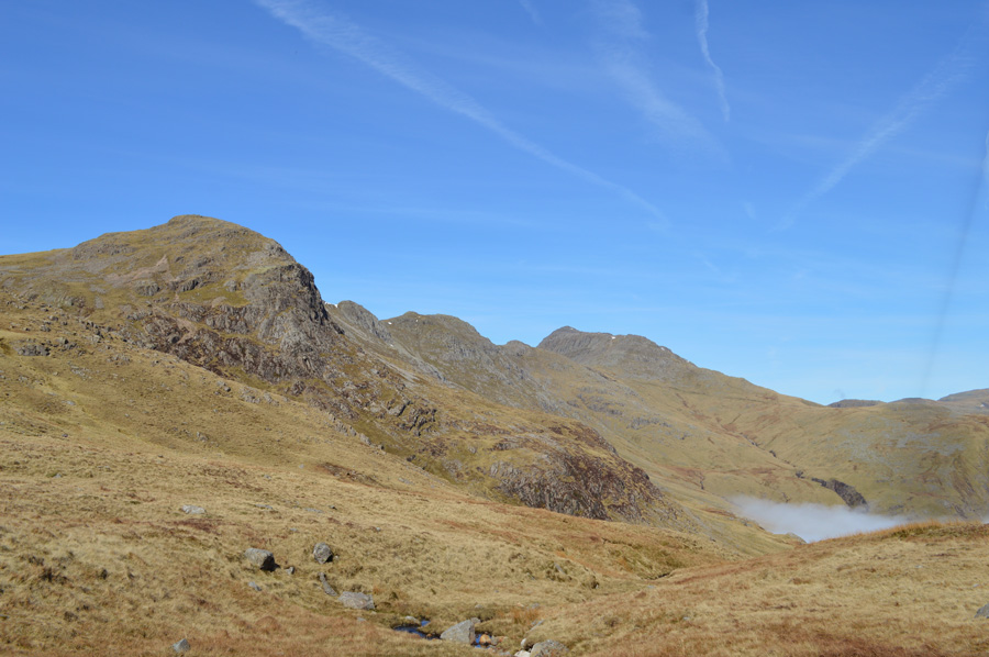
| Views over Great Knott, Crinkle Crags & Bowfell from my Pike O'Blisco ascent. |
| Note, the perched boulder in the foreground. |
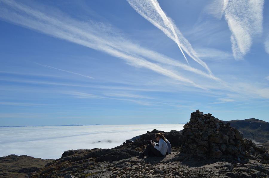 |
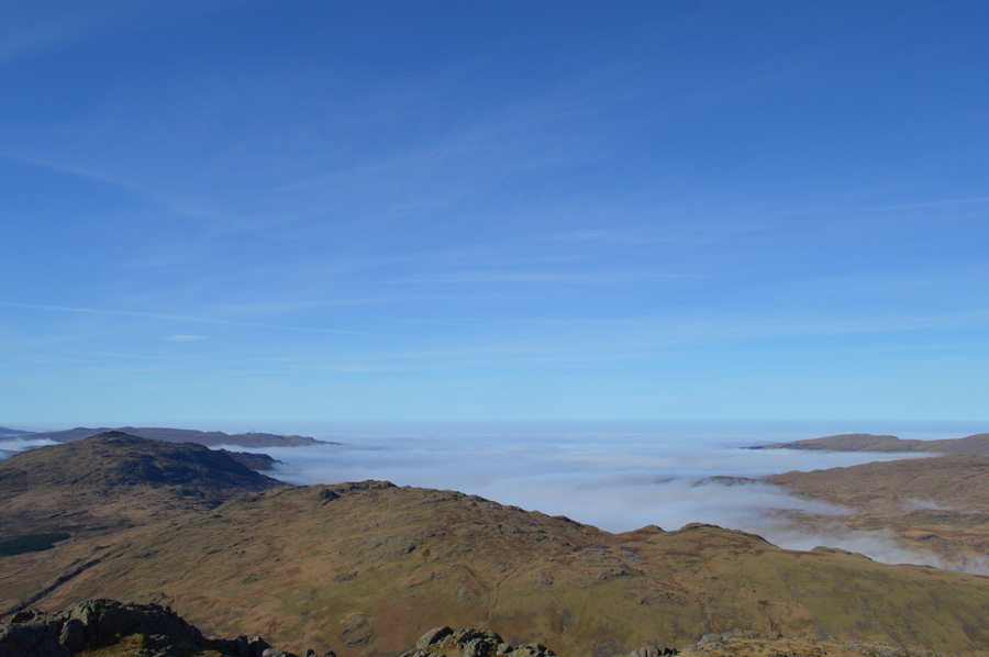
| A sea of cloud from Pike O'Blisco summit. |
I arrived at the Pike O'Blisco summit much the same time as a young couple were leaving, we shared our 'afternoons' before I again gave my last summit of the day a tap while greeting the couple with a Hi, who, mustn't have wanted to be disturbed as all I got back was a Hi.
Conversation isn't to everyone's liking and that's just fine, but me, I could have spoke all day about these views. |
 |
| Wetherlam from Pike O'Blisco subsidiary summit. |
| |
 |
| Langdale Pike's island. |
| |
 |
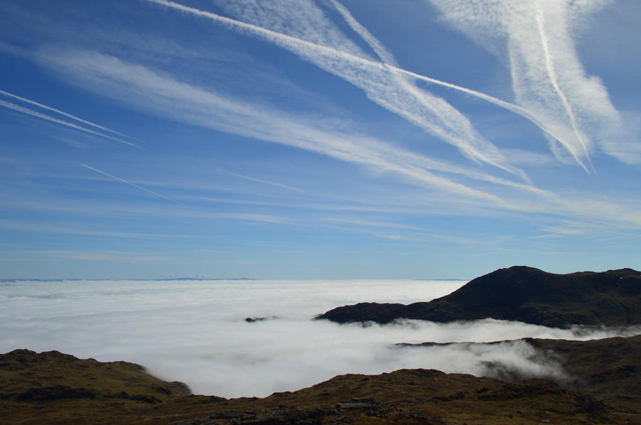
| Only Lingmoor Fell summit peaks out above the cloud inversion. |
| I could only gather that the next best place should one find him/herself right now other than my perch would be the summit of Lingmoor Fell, I wonder was anyone thinking the same about Pike O'Blisco, I did hope so... |
 |
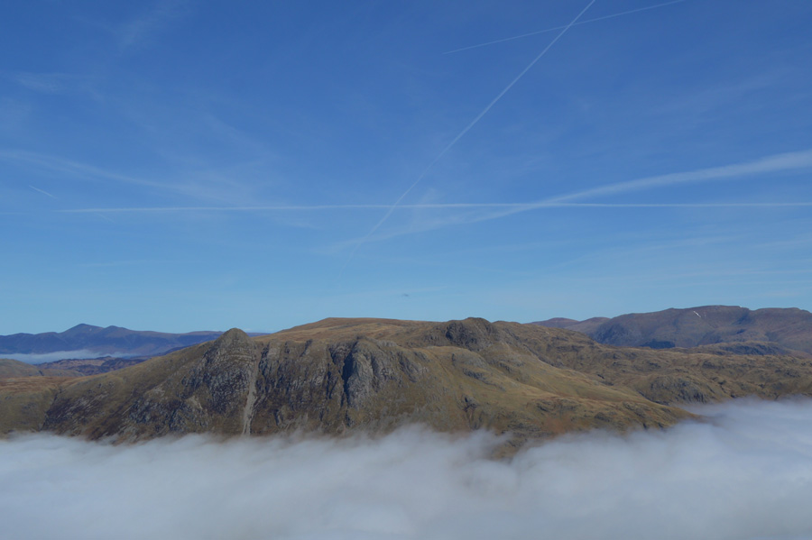
| Wet Side Edge, Great Carrs, Swirl How & Wetherlam from my Pike O'Blisco descent. |
I was fortunate enough to eat lunch while admiring my views watching the cloud roll slightly up the fell sides and valley walls, overhead the sun beat down leaving my arms and forehead a toasty brown mixed in with dried sweat, this I had missed.
The couple who were sat down on the summit made their way down in the direction of Black Crag which also tempted myself as a faint path lead through soft grasses. My route was my own as H.Griffin never explained in detail how he managed his way back to the Three Shire Stone but I figured if like me, he'd of preferred the Red Tarn route. |
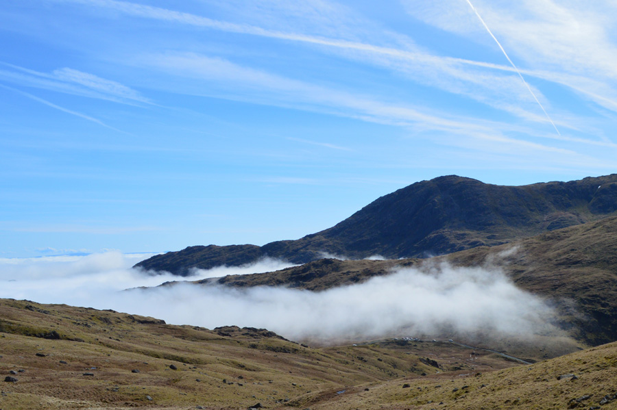 |
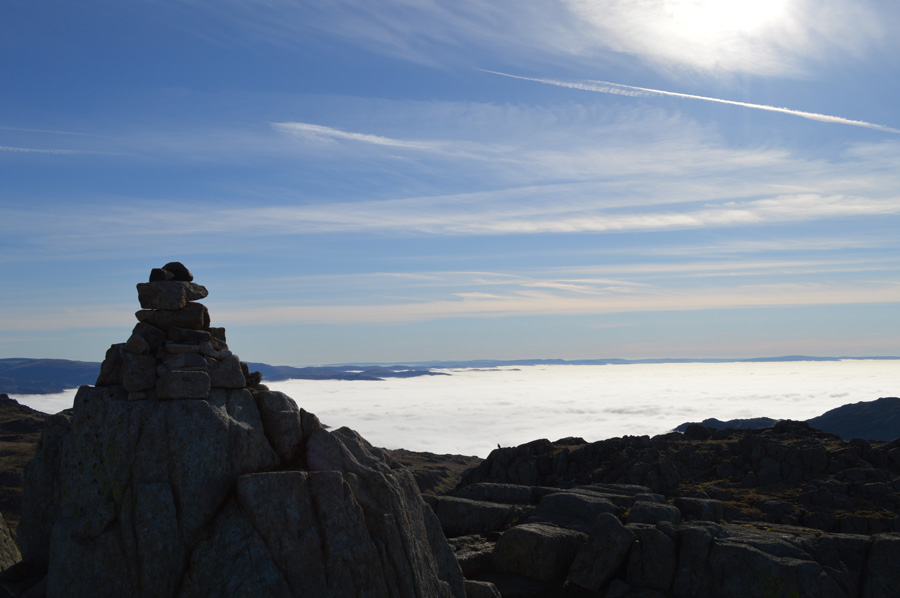
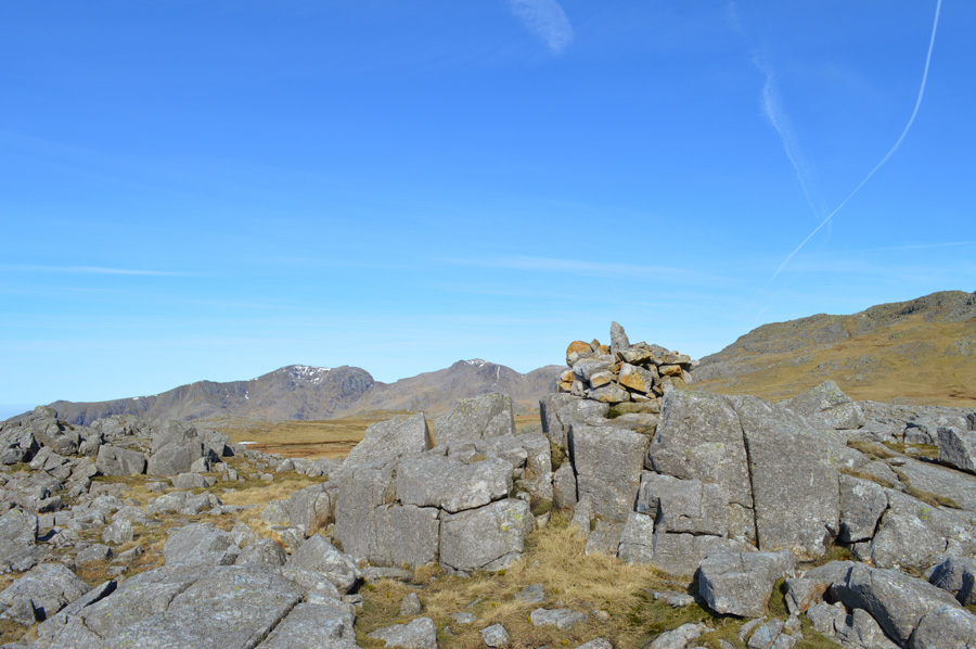
| Above Wrynose Pass. |
Instead of descending the same way I had gained the summit I took in a loose descent by first heading south, then south west before views of Red Tarn greeted me over my right shoulder, my route pathless but dry & enjoyable all the same, a few hundred yards below me walkers head towards Red Tarn and had no doubt set their goals on the Crinkles or even Bowfell.
It's still only midday as I start my descent down on Wrynose, the sound of the cars struggling up the pass fill my ears as do the roar from the groups of motorbikes all enjoying a Bank Holiday in Lakeland.
I guess I have a little spare time as my thoughts turn to a quick summit of Harter Fell which would require an excursion over the Hard Knott Pass before it suddenly dawned on me that I am needed elsewhere & that I guess, Harter Fell can wait for another day, althought to top todays walk, would take some beating. |
|
| |
| Back to top |
 |
|