|
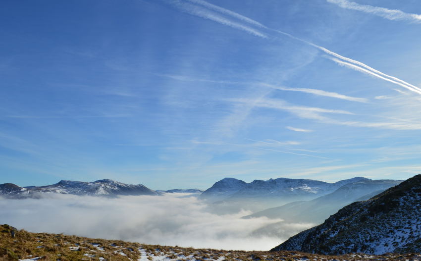
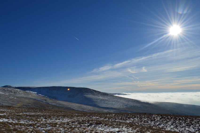
Grike, Crag Fell & Lank Rigg from Cold Fell Road |
 |
 |
7th February 2015 |
 |
|
It’s been close to four years since I last visited these particular far western fells yet no matter how hard I try I can’t come up with a valid enough reason why I left them for so long other than, well, I still simply can’t think of one. It seems odd how I can leave out the Grike Fells as I go back to July 2011 since the last time I was here I enjoyed my time spent immensely, in fact, I was still cutting my teeth as these fells where so remote both mentally & physically.
As time went on so did my fondness for fell walking during which time Grike & alike was left behind in some far western obscure world too far to reach or at times not as appealing as the wonders of the rest of the district, I guess we could say those who share my passion for fell walking all have a tiny section of Lakeland where they wished they visited more than they actually do.
It’s only after days like today when the heart rekindles a long lost relationship did I apologise as a little bit of 2011 came back to me.
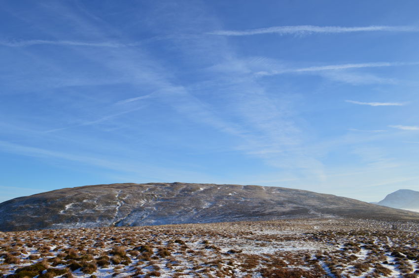
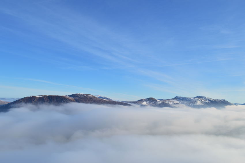
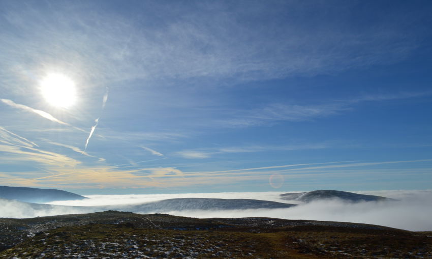
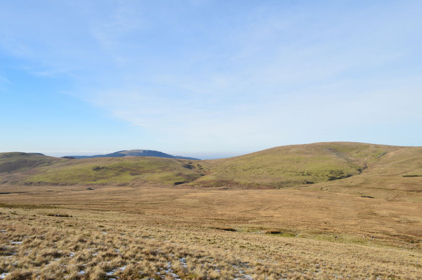
This is Grike, Crag Fell & Lank Rigg from the Cold Fell Road. |
|
| Wainwright Guidebook Seven |
 |
| The Western Fells |
-Grike:
Grike is the the beginning of Lakeland from the west. Approaching from Whitehaven an industrial belt has first to be crossed to Cleator Moor, after which follows an attractive undulating countryside watered by the Ehen, until, quite sharply Grike and Crag Fell dominate the view ahead, with a glimpse of greater fells beyond closing in the valley of Ennerdale. |
 |
|
|
| |
|
Overview |
|
|
| Ascent: |
2,010 Feet 613 Meters |
| Wainwrights: |
3, Grike – Crag Fell – Lank Rigg |
| Weather: |
Bright & Sunny Highs Of 7°C Lows Of 2°C |
| Parking: |
Roadside, Cold Fell (Blakeley Moss) |
| Area: |
Western |
| Miles: |
7.7 |
| Walking With: |
David Hall |
| Ordnance Survey: |
OL4 |
| Time Taken: |
4 Hours 50 Minutes |
| Route: |
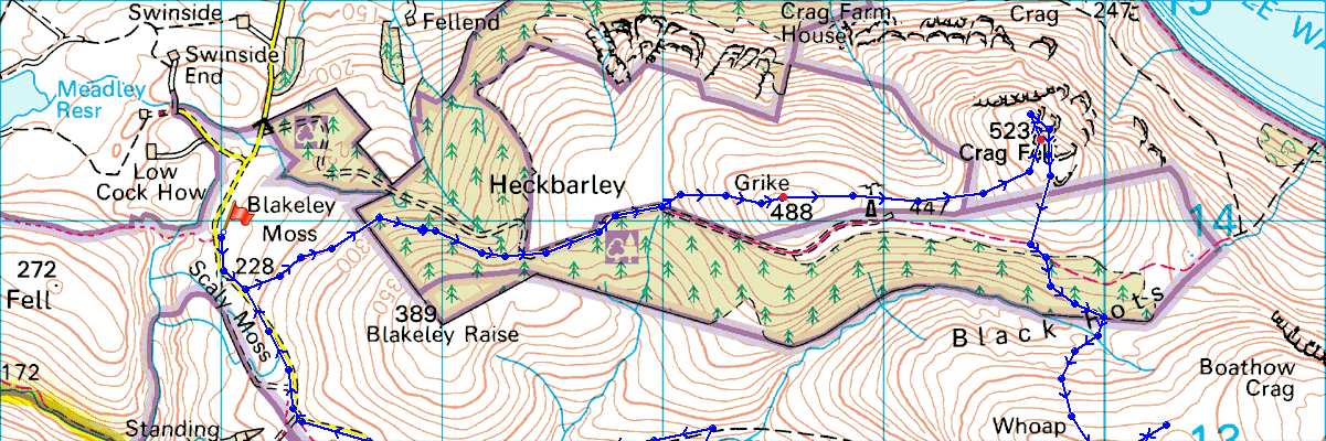
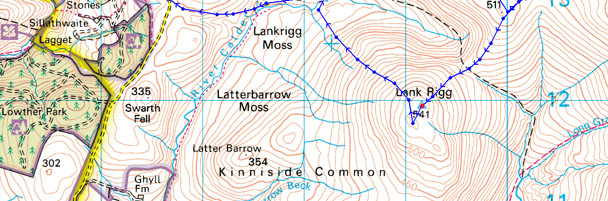
Cold Fell road – Blakeley Moss – Grike – Crag Fell – Black Pots – Whoap – Lank Rigg – Lankrigg Tarn – Lankrigg Moss – River Calder – Cold Fell road |
|
| |
|
Map and Photo Gallery |
|
|
  |
| |
| |
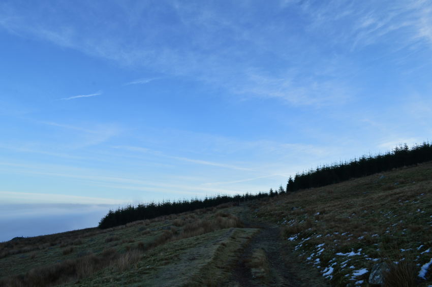 |
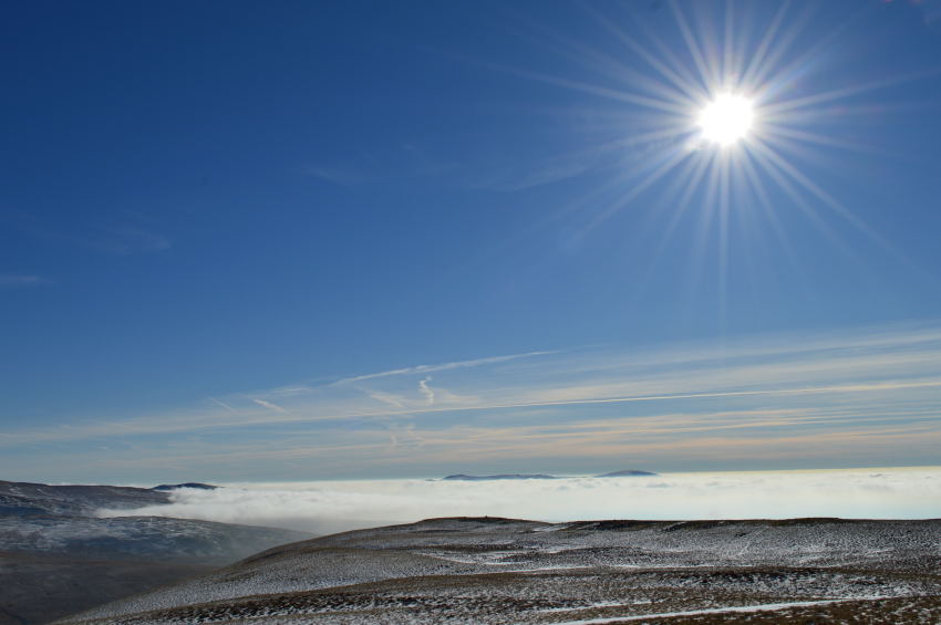
| Heading over Blakeley Moss 09:17am 3°C |
I had arranged to meet David at the church in the centre of Ennerdale Village at 08:45am yet surprisingly enough after an almost two and a half hour journey I arrived close to fifteen minutes early which gave me enough time to kit up, David soon arrived as we shared our good mornings & of course spoke of the fine forecast ahead.
I hadn’t had the pleasure of parking besides the old church as I tucked my car as close to the stone wall as possible making sure I could only get out of the drivers door.
My drive north, then west went without incident, with the exception of how little by little the sun rose a little earlier than my last drive north only last weekend. I drove through thick fog all the way up from Lancaster before it finally started to clear the closer to Penrith I got by which time, the sun was almost up.
By the the time I had reached Penruddock Blencathra’s summit was peaking out over a sea of mist which clung to her lower slopes almost enveloping the whole of Threlkeld until I passed through what I thought was valley mist soon after flanking Keswick.
The mist was confined to my rear view mirror as I concentrated on rarely un-driven roads once I had passed the town of Cockermouth before taking on the A5806 destined for Ennerdale by which time the sun was casting long shadows over the church grave stones. |
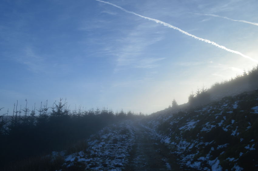 |
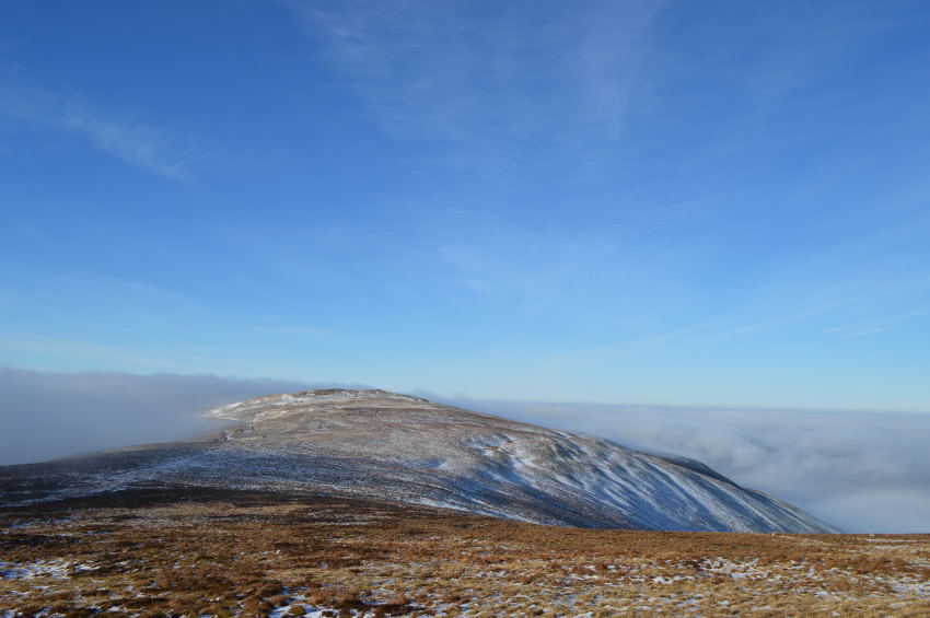
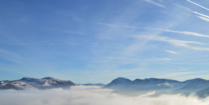
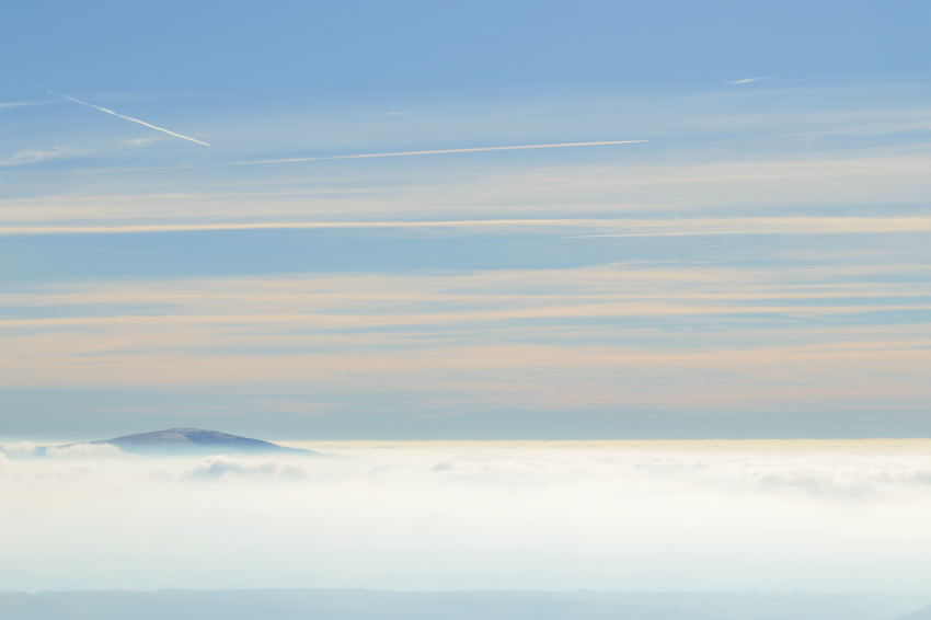
| The misty theme continues as we climb higher towards Crag Fell from Blakeley Moss. |
Instead of taking two cars the short distance to Blakeley Moss David suggested I leave my car at the church & he would drive the short distance up the Cold Fell Road, parking was made easier due to the frozen ground as David lined his car away from a rather precarious ice patch on the tarmac road, good thinking I thought.
By now it was only David who had to kit up which was done very quickly, he hummed ar’d about putting a jacket on but in the end decided to as the morning air although not below zero, was crisp enough to bellow warm air into cupped hands as demonstrated on a number of occasions, the hands in the pockets while you walk didn’t take long to adopt either, why I choose to walk like this when I had a perfectly good hat & gloves in my pack I don’t know.
Our frozen ground had been well grazed underfoot & was a joy to walk over in the early morning light yet something magical soon caught our eye with the more height we gained, as it seemed we were now walking through a mist patch which came more apparent as we topped out over the pine trees to the left of our path, it was only then did we notice that as far as our position & beyond Blake Fell a full on Cloud Inversion was creeping its way in. |
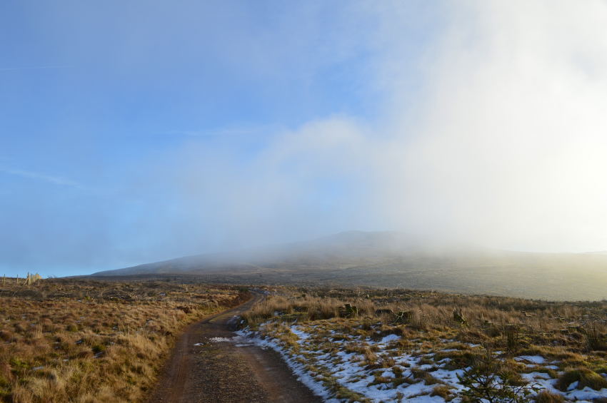 |
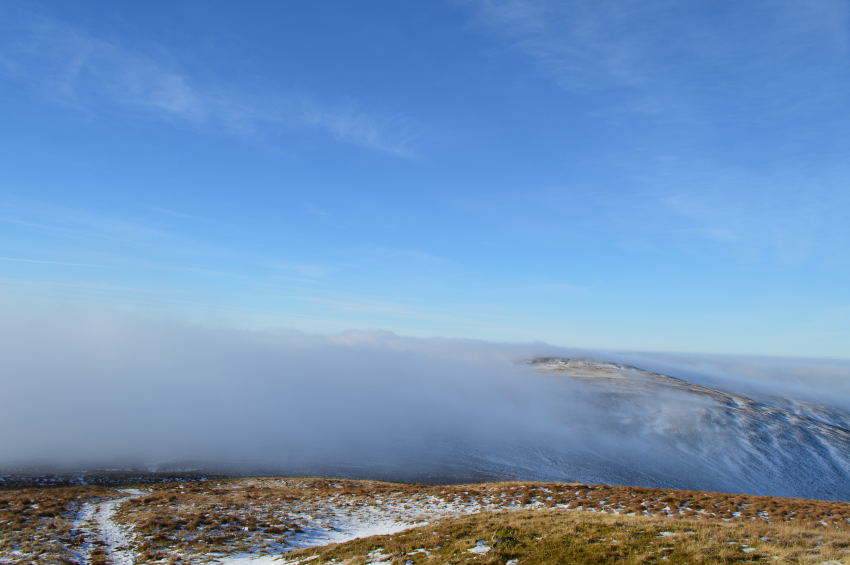
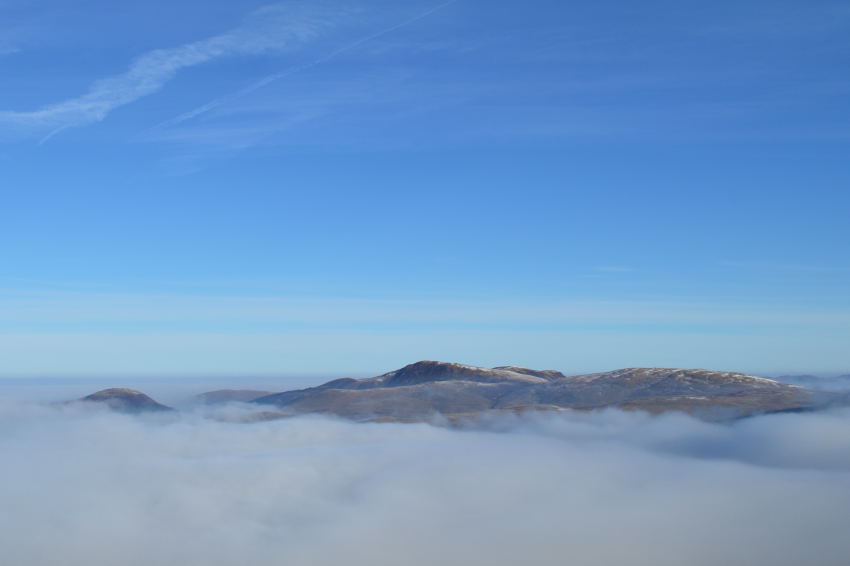
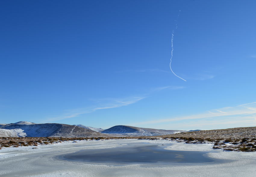
| Grike seen shortly before the inversion caught up with us. |
We were lucky enough to witness the cloud roll leaving little ‘islands summits’ over towards Lank Rigg, Whoap & further north, Blake Fell.
The Inversion would now tease its way slowly up the fell side helped along by the gentlest of winds leaving distant fells shimmering through the cloud, despite the lack of wind the inversion gained ground quicker than any walker could, by the time we had reached Crag Fell summit the cloud had started to obscure both our left & right flanks. |
 |
| A distant Pillar seen from Grike. |
| Grike was easily gained as we peered back to see two walkers in tow, they were tracing our exact footsteps & gaining ground quite quickly as we expected to see them at the summit soon after we arrived, which never seemed to materialise, I guess the views got the better of them too. |
 |
| Crag Fell from Grike. |
By the time we had reached Grike we had gained little ground on the Cloud Inversion which by now was only a couple of hundred feet below the summit yet moving along the valley quite rapidly, we figured we would make Crag Fell before the cloud would roll in over the connecting ridge.
We were almost right. |
 |
| Not long after the last photo the cloud had breached the ridge as Grike was about to be enveloped by the Inversion. |
| |
 |
| There Grike goes. |
Crag Fell summit was soon reached without the fellow walkers now lost in the cloud back on Grike. Our summit time on Crag Fell from my part was spent trying to keep the butterflies which were doing loop the loop in my stomach from reaching out, it all got a little too much.
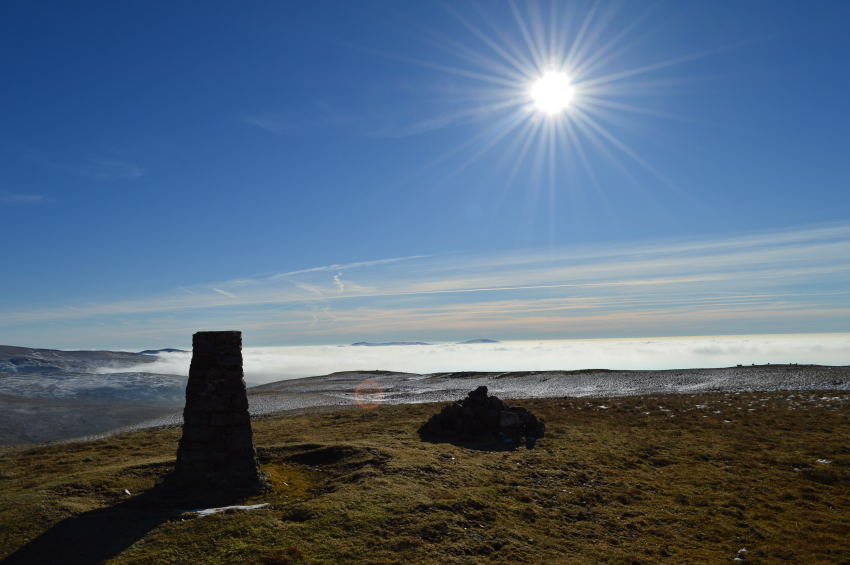
David paused to take photos of the summit shelter with a backdrop of the advancing inversion re-grouped with the Cloud Inversion that had now, swallowed the whole of the Ennerdale Valley.
We drop down off the summit for a closer look. |
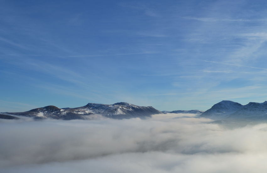 |
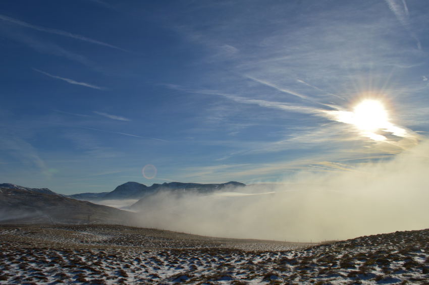
| Pillar seen with the High Stile Ridge towering about a sea of cloud beneath Ennerdale Water. |
| Seeing a sight such as this was astonishing to say the least, it really was a ‘drop your pack, hands on your hips’ type of moment as we slowly eased our eyes across the distant summits. |
 |
| The High Stile Ridge from Crag Fell. |
| Here, Herdus, Great Borne, Starling Dodd, Red Pike & High Stile all rub shoulders below the advancing cloud. |
 |
| One of the many reasons why we walk, such difficulty to add it into words… |
| |
 |
| The Inversion slowly takes captures Knock Murton before advancing towards Gavel & Blake Fell. |
| |
 |
| It’s time to leave, not before one last photo towards Pillar, Wind Gap, Black Crag, Steeple, Scoat Fell, Haycock, & finally Iron Crag. |
| The sweat we had conjured had started to freeze on our backs as we stood summit watching from our perch beneath Crag Fell summit, we knew at one point we would have to turn our backs on the Inversion perhaps in search of something more spectacular as we re-traced our steps back towards the summit. |
 |
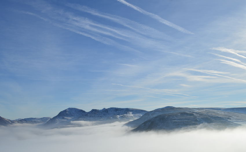
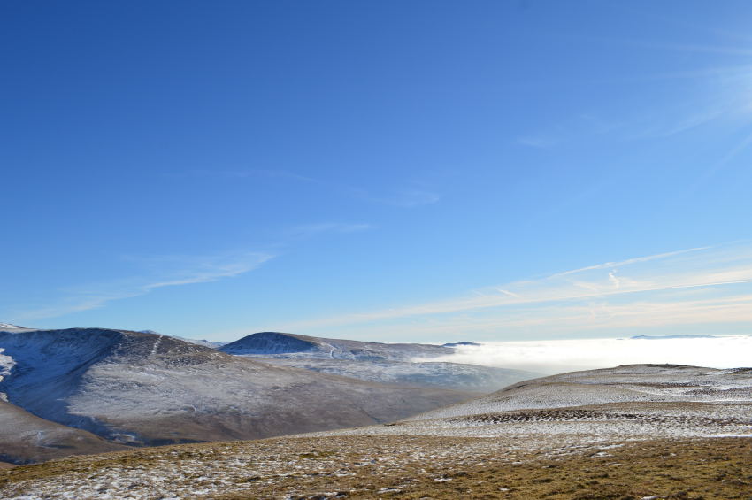
| Whoap & Lank Rigg from Crag Fell. |
The sound of distant two stroke bike engines filled our ears as we made our way steeply back to the summit, it was here David went onto to tell me that they must be coming from the Bike Circuit at Rowrah, despite the roar shattering the silence I found the sound of the engines something of a home comfort as I live within ear shot of a race circuit.
The site of Lank Rigg summit sat proud above the cloud which by now was thick & advancing further south consuming valleys along the way. It was still mid morning but the temperature was rising rather rapidly which caused the pair of us to de-layer, remember this day I said to David Saturday 7th February was the first day of 2015 which we felt comfortable to walk in just mid layers, sleeves rolled up an all…
From Crag Fell we now needed to head south before picking up the path which would lead us steeply onto Whoap, the contrast of which was staggering. |
 |
| Black Pots. |
We followed the path south which saw us steadily sink beneath the cloud where we would pick our way through Black Pots, it was less than three years ago when this area was home to dense Forest before the Forestry Commission cut the whole lot down in the name of regeneration I guess, we remarked that it might be out of our lifetime until Black Pots would ever look the same again.
I think I was almost pleased that the low cloud marred the full extent of what the Forestry Commission had left behind.
We took a direct line for Whoap summit rising steeply over snow covered ground, helped along by a crunchy purchase beneath our feet. |
 |
| The cloud is starting to clear, which, just less than the time it took me to write this sentence. |
| We quickly gained Whoap only to find ourselves heading away from the summit instead of for it, our mistake was quickly rectified as we turned heel where timing saw through the clearing cloud the distinct white stone summit cairn just a few yards away. |
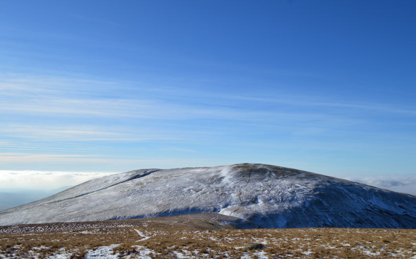 |
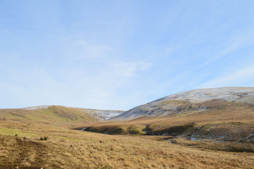
| Lank Rigg is seen shortly after leaving Whoap. |
By now the sun was back out leaving a feel of Spring in the air, all this, despite the snow underneath our boots. The short connecting ridge between Whoap & Lang Rigg was a real highlight of the day as we took in the slight descent before preparing for the short, yet sharp descent on Lank Rigg.
The views towards Caw Fell were out of this world. |
 |
| Caw Fell taken between Whoap & Lank Rigg. |
| I have always held a special fondness for Caw Fell which goes back a long way, I suppose the appeal is just how remote the fell actually is, from my vantage point, a new route is added to my mental note pad. |
 |
| Lank Rigg summit. |
| I guess we gave our walking poles a hammering while walking up Lank Rigg, for the only reason we just couldn’t wait to see what views would await us once we had gained the top, we weren’t to be disappointed. |
 |
| Caw Fell once again, this time seen with Seatallan. |
| |
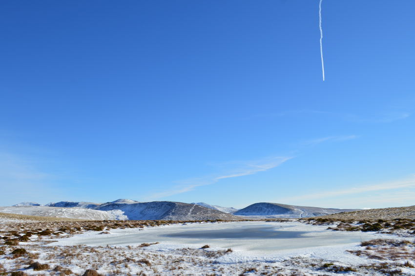 |
| Lank Rigg Tarn with Caw Fell & Seatallan in the distance. |
| After leaving the summit Trig Point behind we made for Lank Rigg Tarn, which David collected as part of his Tarn Walks. It was again one of those moments where we de-shouldered if only to take in the amazing views, in the distance an orange vapour shimmered across the Dudden Estuary, while above our heads… |
 |
| The skies were the deepest of blues |
| |
 |
| A distant Black Combe & Whitfell seen beyond Boat How. |
| |
 |
| Lank Rigg Tarn. |
| |
 |
| A close up of Black Combe from Lank Rigg. |
We had a wander over to the subsidiary summit where we stood & ate lunch all the while the sun was beating on the back of our necks, it was almost too unreal to be true to have have the white snow beneath our boots, blue skies above our heads & Cloud Inversions in every direction which stretched all the way to the Solway Firth in Scotland.
Needs must, we could have sat there all day & who could blame us but sitting still had its draw backs as the sweat now started to freeze over exposed skin.
Instead of making our way back to the Col linking Whoap with lank Rigg & leaving the valley by the River Calder we dropped off Lank Rigg’s north western slope where we would meet up with the River Calder some way up stream. |
 |
| Heading through the marsh & boggy bits before crossing the Calder. |
| |
 |
| Here, pausing to look back at Whoap (L) and Lank Rigg (R) |
Our descent was via a faint grassy path which lead us (thankfully) across frozen grassy hummocks which if you plotted well, were easily avoidable, nearer to the River Calder however our ground understandably became more marsh like as boots would sink into the ground quickly followed by a slurp as we dragged our feet from the marshy ground.
Crossing the Calder was made easy as we crossed by a section of stones placed in the river almost like steeping stones, this however wasnt enough to stop me getting my right boot submerged, I figured if this was going to be the worst thing that was going to happen to me today I’ll take it lying down. |
 |
| Dent Fell, or locally pronounced ‘Dint Fell’ |
We soon gained steady ground back towards the Cold Fell road which of course meant our walk was almost coming to an end, walks will always be remembered but this one was that bit more special, a walk that will be remembered as a spectacle of events all seamlessly rolled into one, a rare occasion if there ever was one.
We had less than half a mile until we made it back to the car, yet this time spent soaking up a warm midday sun, this walk wont just be remembered for the spectacle that Lakeland & mother nature gave us, it will also be remembered as the first time we got to roll our sleeves up in the mist of winter. |
|
| |
| Back to top |
 |
|