|
Robinson to Dale Head from Chapel Bridge |
 |
 |
27th December 2014 |
 |
|
It was Rod’s idea to start a walk from Chapel Bridge which had been planned for a few weeks now, all we needed was a clear spell which on the face of it was just what we got & was much better than the forecasters had predicted. Early during the week when the forecast looked much wetter we arranged to meet a little later giving time for the wintry showers to pass which meant we would only arrive in Newlands at the agreed meeting time of 09.30
Closer to the date however the forecast changed which meant thankfully we would be starting the walk under dry
skies although the meeting time never got switched back due to the lie in we were all looking forward too no doubt.
|
|
Wainwright Guidebook |
 |
| The North Western Fells |
Dale Head has interest for the geologist, for beneath the carpet of grass there is a fusion of the Skiddaw slates and the volcanic rock of Central Lakeland, some evidences of the joint can be seen on the actual summit. But perhaps Dale Head’s greatest triumph over its north western fellows is that it holds in its lap the only tarns of any size between Bassenthwaite and Honister, a further manifestation of the change of the underlying rock. |
 |
|
| |
|
Overview |
|
|
| Ascent: |
2,900 Feet – 884 Meters |
| Wainwrights: |
2. Robinson – Dale Head |
| Weather: |
Overcast With Some Sunny Spells, Snow Across The Summits, Highs Of 1°C
Lows Of 0°C Feels Like -5°C |
| Parking: |
Car Park, Chapel Bridge, Newlands Church |
| Area: |
North Western |
| Miles: |
8 |
| Walking With: |
David Hall & Rod Hepplewhite |
| Ordnance Survey: |
OL4 |
| Time Taken: |
5 Hours 10 Minutes |
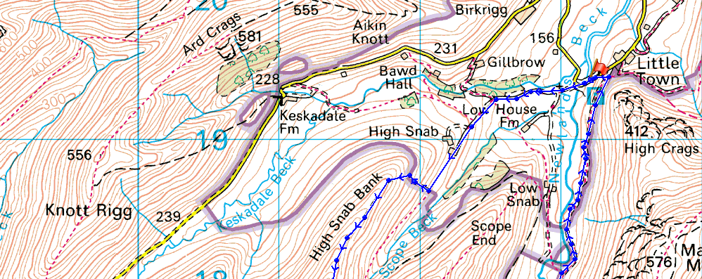
| Route: |
Chapel Bridge – Newlands Church – Low High Snab – High Snab Bank – Blea
Crags – Robinson – Littledale Edge – Hindscarth Edge – Dale Head – Miners Track –
Newlands Valley – Chapel Bridge |
|
| |
|
Map and Photo Gallery |
|
|
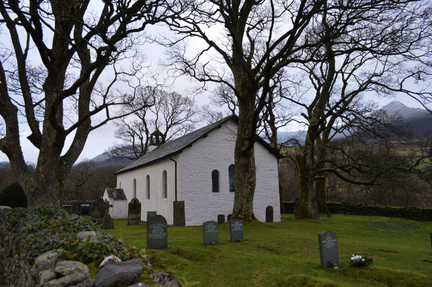 |
Passing Newlands Church 08:41am 0°C |
After leaving the A66 I first passed through a sleepy Portinscale before picking up the narrow lanes sign posted for Newlands Church, I didn’t expect to see much traffic on the road so I was a little surprised to find myself following a slow moving Mercedes who I followed all the way to Chapel Bridge where like me had also parked at the far end of the car park. Rod was already there so I reversed my car by his where we met with a smile & all the best.
Rod was wearing a pair of brand new Berghaus winter boots that his children had bought for his Christmas present, they looked much too nice to get muddy but there’s nowt like throwing them in at the deep end I suppose, especially after all this rain. Shortly afterwards David showed up & pulled his car along side mine where we shared our Good Mornings & more hand shaking before kitting up behind our cars.
It was a mild morning yet just up the valley we could see the summits of both Hindscarth & Robinson had a good dusting of snow on them so we all kitted up in full winter kit including a reluctant decision to include the crampons, well you know, we may need them we thought.
At the other side of the car park the fellow who I had followed in was also kitting up which was when I noticed the small Black Labrador sitting patiently for his owner to get under way, I remember thinking that’s the most obedient Black Lab I’ve ever seen! and, just a pup too.
With the cars all locked we crossed Chapel Bridge with a fleeting comment on just how fast Newlands Beck was flowing shortly followed by a quick stop at Newlands Church to take a few photos. |
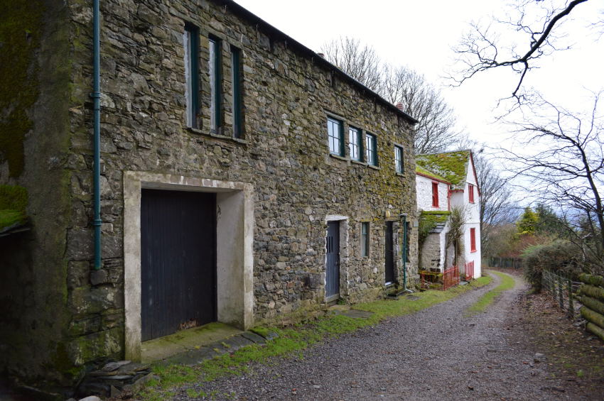 |
Low High Snab Farm. |
After passing Newlands Church we ventured a little further up the lane before making a left turn towards the rather confusing named Low High Snab Farm named so as the farm sits nestled between Robinson’s High Snab & Hindscarth’s Low Snab ridges, it sounds awkward & confusing but it isn’t really when you think about the geography. |
 |
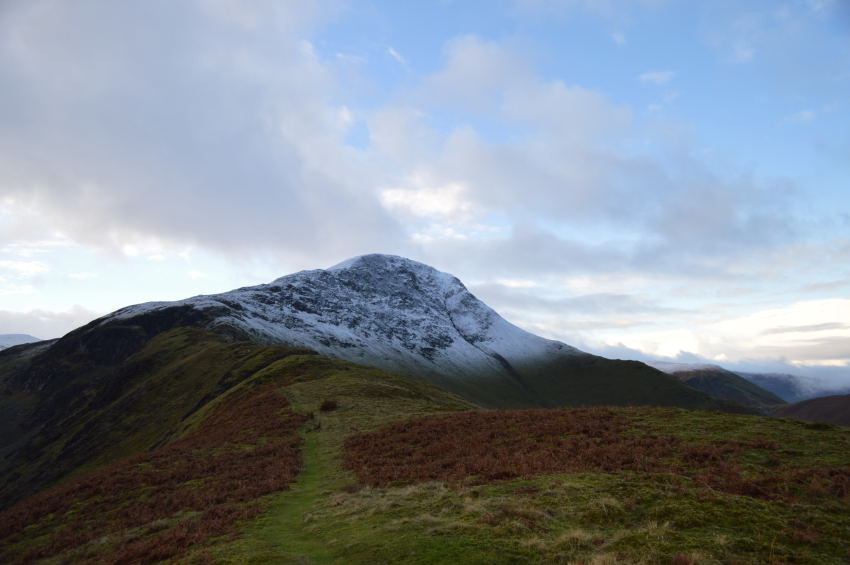
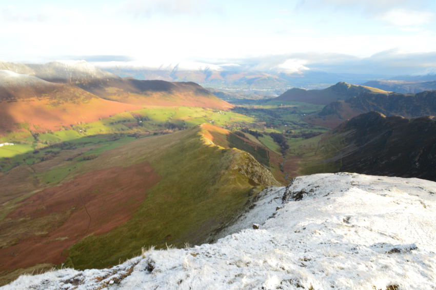
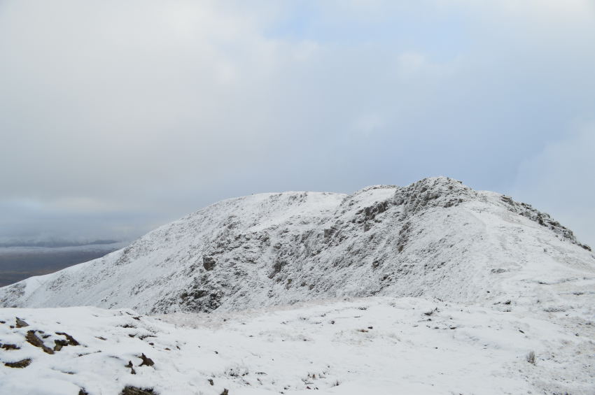
Our first summit of Robinson is on the right up ahead. |
Open fell side is soon greeted us after passing Low High Snab Farm where we picked up the grassy track that will lead us onto High Snab Bank which forms the ridge you see in the right of the picture, but first we had to gain the ridge by means of a steep pull, time to burn off some Christmas dinner I should think. |
 |
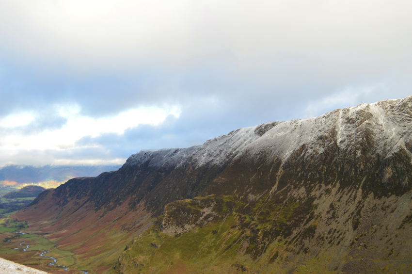
Robinson Ahead seen along High Snab Bank. |
Conversation started to flow again once we had gained High Snab Bank, it was now time to breath out & take in this wonderful ridge all the way to Blea Crag seen just below the snowline.
The light was magical maybe even a little dark but the skies above certainly showed some promise, even hints of blue with sudden sun burst which streaked across the fell side leaving a warm afterglow on everything it touched. |
 |
Wandope, Crag Hill (Eel Crag) and Sail. |
| |
 |
This time, Whiteless Pike can be seen in the far left of the photo. |
The sun as it hit the snow peaked summits was a real highlight to take away so early into the walk. |
 |
Skiddaw seen beyond a silhouetted Causey Pike. |
| |
 |
Another close up of Crag Hill (Eel Crag) and Sail. |
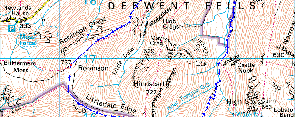
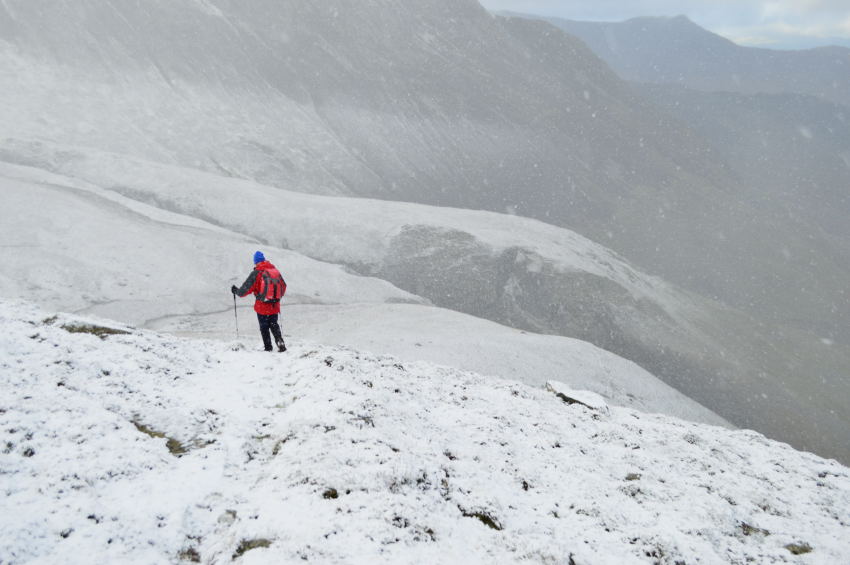
We had soon reached the snow baseline which meant we had a little ‘hands on’ scramble ahead of us in the form of the near verticle Blea Crags, but all is not lost as a clear path zigs zags it’s way up the crags, this is where knees, hands & even bums come in contact with the rock.
From the base we studied the crag for a while, well, when I say studied we chatted about, well I can’t quite remember but it wasn’t about the job in hand which saw us follow each other to different sections of the crag shortly followed by the words ‘erm, no not there’
Come on lads lets get it together, stop chatting & lets get ourselves up this crag! I think David took point as Rod & myself duly followed, from up above David shouted back ‘ice there, slippy there’.
Between conversation I think teamwork played somepart in getting up the crag. |
 |
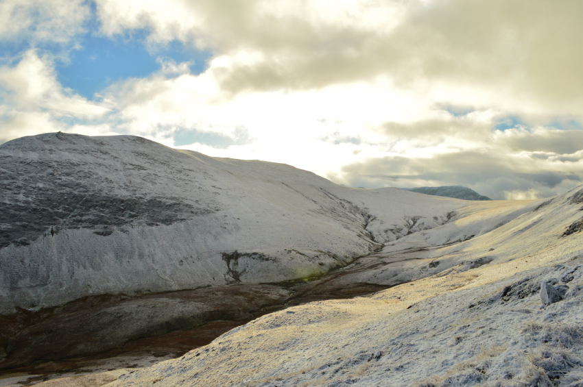
Hindscarth. |
We were about to crest the summit shoulder and was well within the snowline now which was very powdery underfoot, in terms of depth it wasn’t much more than a couple of inches and was a pleasure to walk over and didn’t cause any difficulties with the rest of our ascent. |
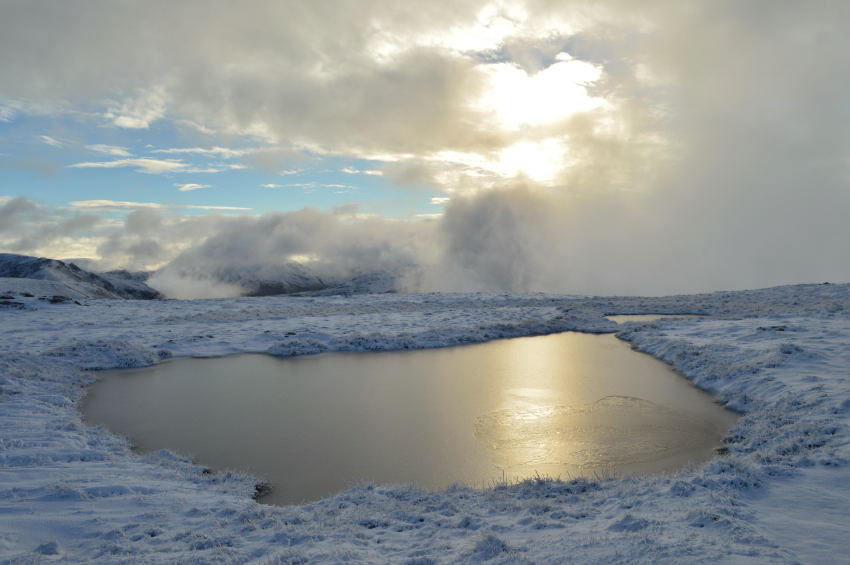 |
Frozen reflections. |
| |
 |
Here pausing as we take a look up at the summit shoulder. |
With every step forward the snow was starting to harden leaving that reassuring crunch as your boots walked over it, if you take a look in the right of the photo some parts of the fell side still had the tops of the grass pertruding from the snow such its shallow depth. |
 |
Here, looking back over High Snab Bank towards Causey Pike & Cat Bells. |
| |
 |
From our ascent, Hindscarth & Littledale. |
| |
 |
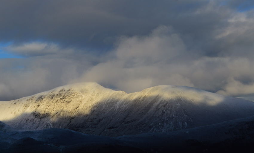
Robinson summit plateau all in white. |
It was an absolute pleasure to be able to gain Robinson summit under such fantastic winter conditions, the sky that I had spoke about earlier was clearing just nicely allowing the sun to get through creating some really mild & even warm conditions, it wasn’t to last but very uplifting & pleasant whilst it did. |
 |
Robinson summit with the summits of High Stile & Red Pike peering out of the cloud in the distance. |
| |
 |
High Stile & Red Pike (Buttermere) from Robinson summit. |
| |
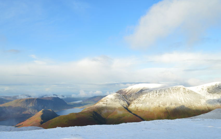 |
Wandope, Whiteside, Grasmoor, Rannerdale Knotts & Mellbreak seen from Robinson summit. |
Looking north west a host of snow capped north western fells whilst down below views extended as far as Loweswater but sadly they weren’t to last as above the vale of Buttermere the cloud like a thick blanket was starting to roll in. |
 |
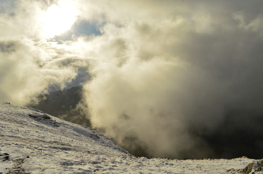
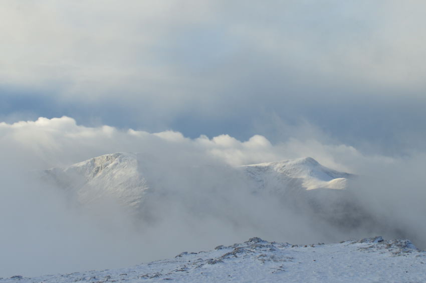
Cloud dramatics seen shortly after leaving Robinson summit. |
Yet more highlights when we witnessed this cloud that hung over the Honnister Pass obscuring anything beneath it leaving Fleetwith Pike as if it just wasn’t there.
With no wind to push the cloud along we could only assume it was the rise in temperature that had caused the cloud to suddenly start to lift, it was a slow & magical process, but we all knew what would eventually come from it, but for now, lets just enjoy it. |
 |
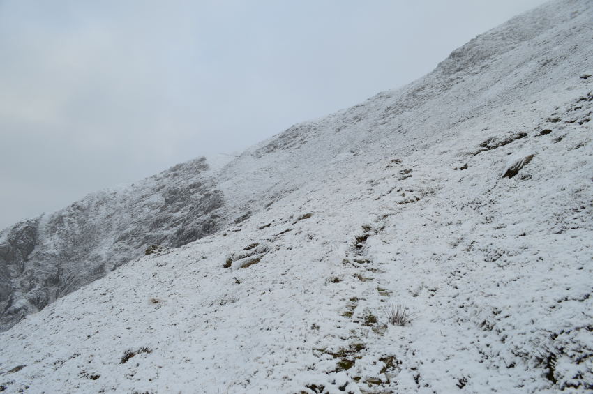
Descending Robinson for Littledale Edge as Dale Head makes a slight appearance up ahead. |
| |
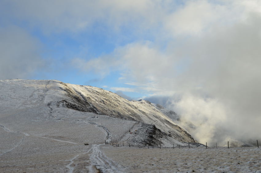 |
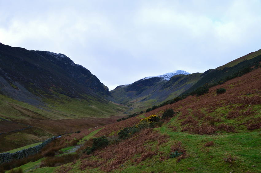
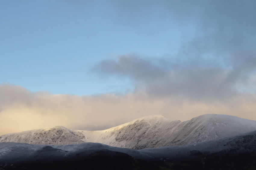
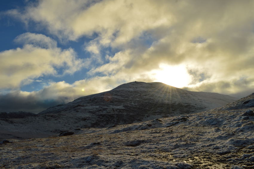
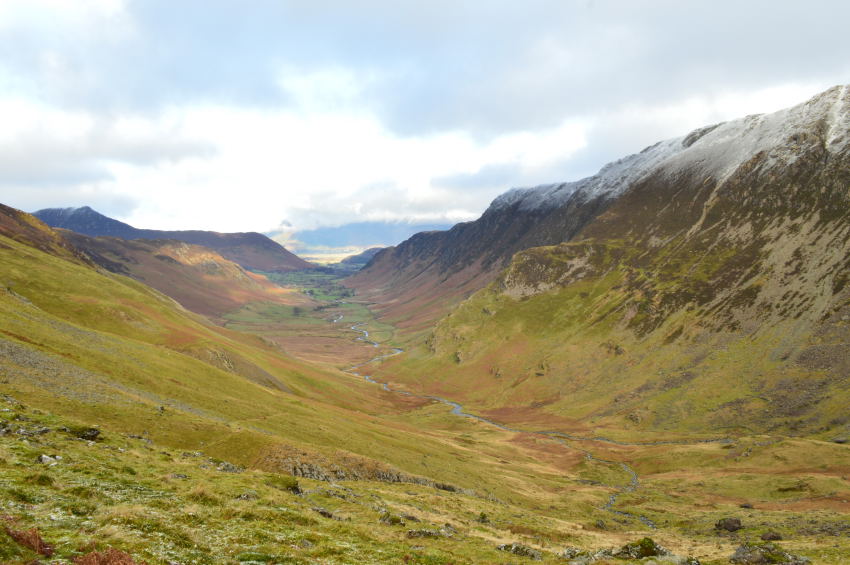
Dale Head from Littledale Edge. |
At this point it was fair to say that we didn’t really know what to expect with the cloud shenanigans, prospects of a cloud free summit once we reached Dale Head still looked quite promising.
The fellow we kitted up with who had the Black Labrador with him had just passed us along Littledale Edge, we did see a figure on Hindscarth but didn’t realise it was him until now. What we did find a little odd was how the fellow avoided the branch of path (seen left) and descended Hindcarth from higher up (seen right)
I guess a man deserves the right to have his own prerogative, this was his. |
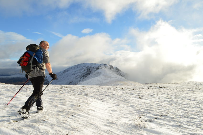 |
The man who just doesn’t feel the cold. |
David unknowingly walks in front of a photo that I was about to take while at the same time Rod & myself were adding or keeping our layers, David decides to take his off. |
 |
Rod peers into a void of nothing whilst attempting to look down on the Honister Pass, Rod then turns his attentions to Dale Head as David decides to join him. |
| |
 |
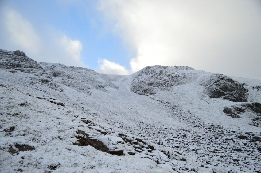
Dale Head from Littledale Edge. |
At the time we still lived in hope that we would make Dale Head in good visibility as the blue skies showed huge promise overhead, to our flanks as seen in the photo that cloud was creeping its way up the fell side towards Dale Head summit, the one question which hung on our lips was.
Would we make it in time? |
 |
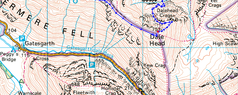
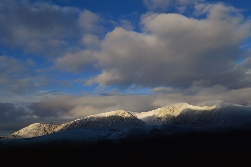
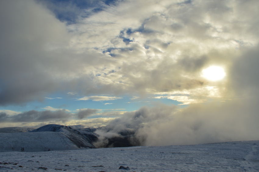
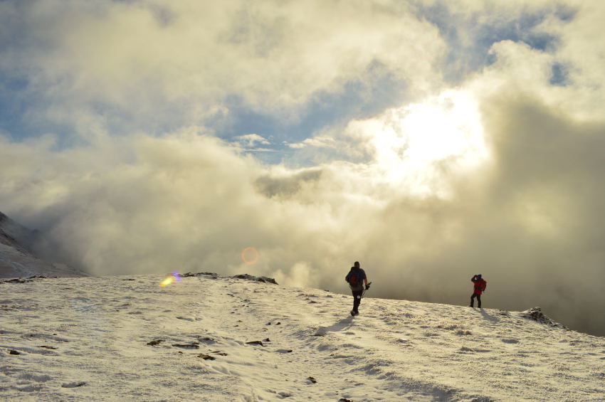
Dale Head as a sudden darkness descends. |
It was still mild and we were still in good banter but thoughts undoubtedly had turned to the fact that the cloud had beaten us, and with it, came a snow shower followed by strong gust.
The last hurdle towards the summit was done in single file, our banter had all but fizzled out as we passed a solo cherrie walker who remarked on just how good the morning had been, up until now that is, he smirked holding both hands aloft before making his way down Littledale Edge.
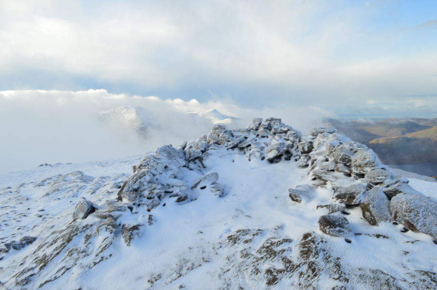
Ahead the summit cairn started appeared but someone, or something appeared to be standing on top of it? |
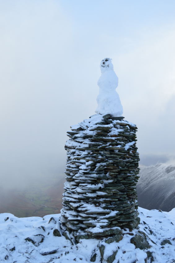 |
Dale Head summit cairn complete with smiling snowman. |
It’s a snowman, who the bloodyhell had managed to build that there, we cracked a few jokes before being joined by a couple who wanted to have their photo taken with the smiling snowman of Dale Head.
A fellow on his own with two Golden Labradors was also at the summit as he shouted over the wind ‘winter at last!’ we laughed of course referring to the fact just how cold it had gotten all in the space of a few short ten minutes, we shared a laugh as the snow shower passed. |
 |
Here, looking back on Hindscarth from Dale Head summit. |
| |
 |
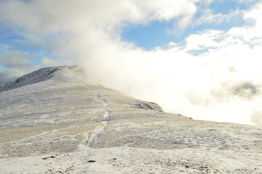
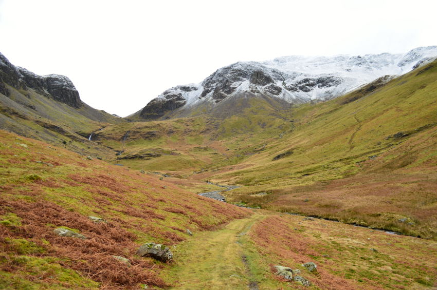
Descending Dale Head by the Old Miners Path. |
| |
 |
Where Rod led the way. |
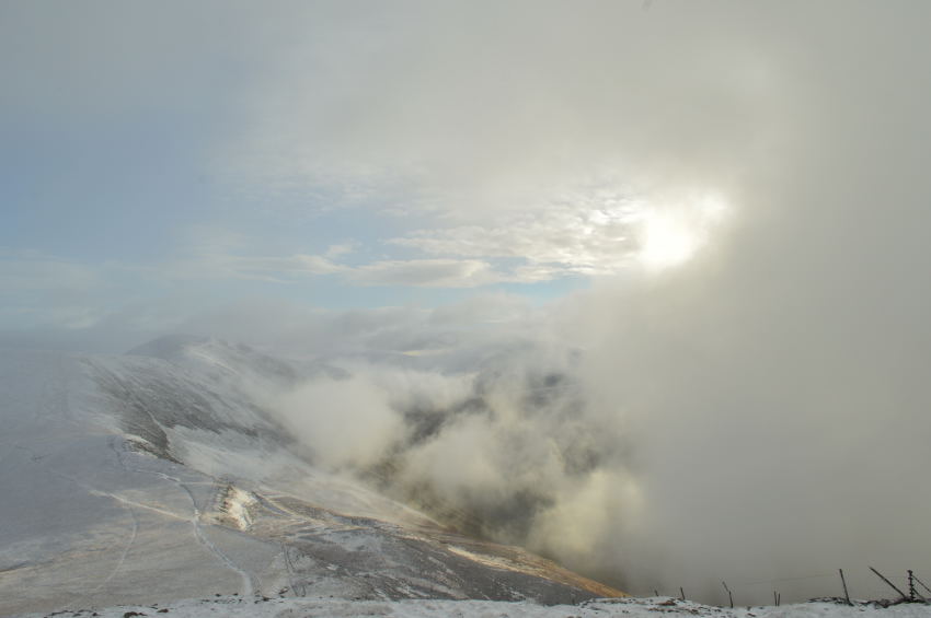
It had started to snow again as we started our initial descent of Dale Head where we were on the look out for the small stone cairn from where we would pick up the Old Miners Path, the stone cairn was spotted with a heavy coating of snow over the top of it, had the weather been any more severe or had the snow hardened this route would have been avoided, but as the snow was still powdery we took great delight descending into the Valley during the mist of yet another snow shower. |
 |
Here, looking back up along the Old Miners Track. |
We had somehow managed our descent with no wind at all which made the snow fall in a manner where it just landed on you rather than at you, yet another great highlight I took away from the descent. |
 |
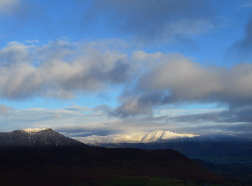
Blue skies break over Dale Head summit from the boulder field below. |
| |
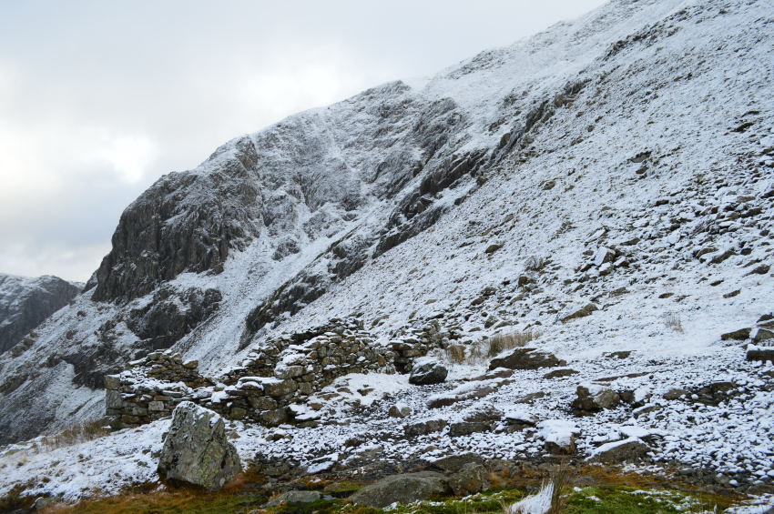 |
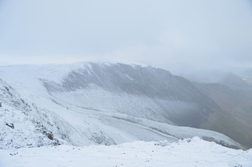
Dale Head Crags from the one of the old ruined miners buildings. |
We paused here as David spotted a large waterfall (sadly I did not capture it) coming from high above in the hollow just to the right of Dale Head Crags, it was something that none of us had seen before yet through the wet period the waterfall had gathered in strength allowing a rather large flow emerge straight from the crag itself, now at this moment in time we all put our geography hats on & came to the conclusion that it may have been an old mine adit or even a cavern where water would seep through the rock thus creating the falls. |
 |
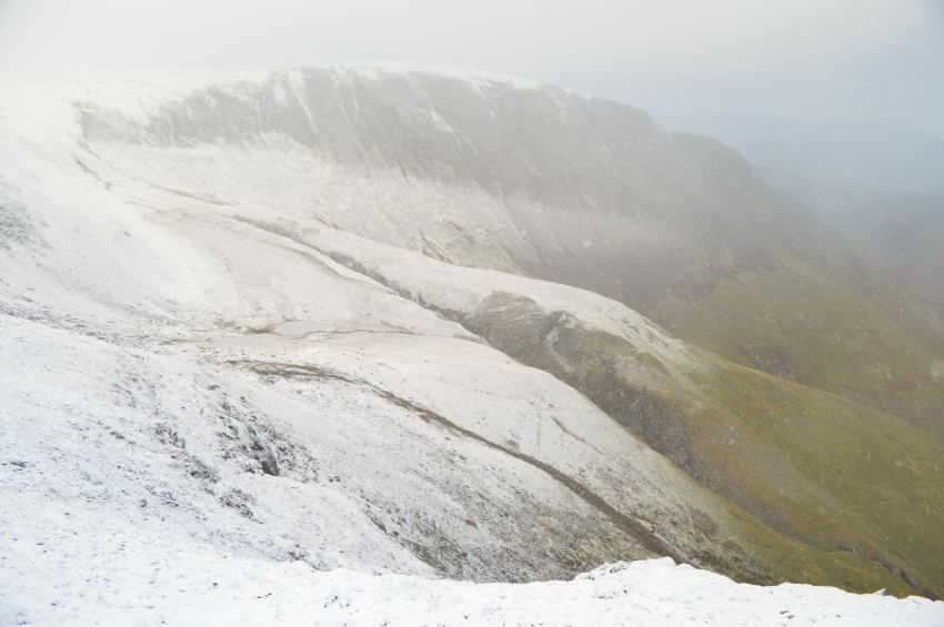
The long impressive crags of High Spy extending towards Maiden Moor & eventually High Crags. |
| |
 |
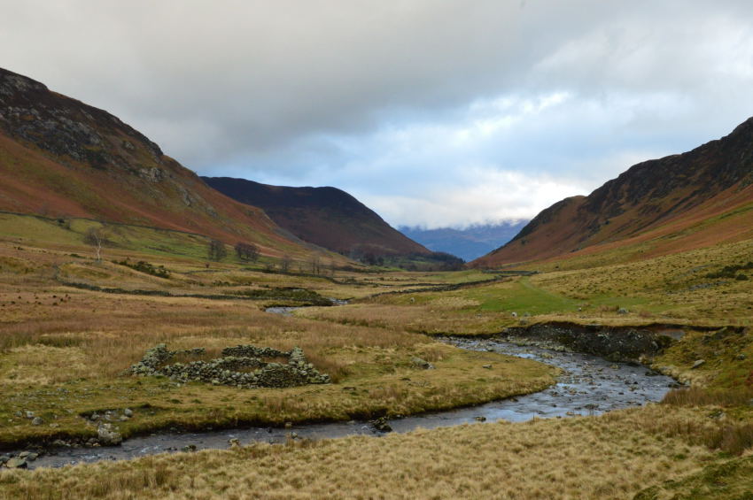
Newlands. |
Rod remembers the time he scaled Castle Nook (foreground lower right) before then going onto summit High Spy via a pathless ascent ‘it was mighty steep & something that I wont ever attempt again’ Rod laughed. My own connection possibly propelled me into the fell walker as I am today as it was here I took on Cat Bells to High Spy with a magical return via Newlands which I did as a solo novice fell walker, since then I have copied that route many times and Newlands never disappoints. |
 |
Dale Head seen shortly before our lunch stop. |
The Old Miners Path can be seen over on the right before it levels out further up the fellside before sweeping steeply left below the face of the summit. Legs were starting to get a little tired so we suggested a quick stop to re-fuel. before all that of course we had to cross Newlands Beck which was done by a series of stepping stones most of which were only just above the waterline.
We stopped to eat at a small hilt of rock yet as the ground was soaked we decided to eat upright whilst glancing back at Dale Head as the light began to fade typical of a December afternoon.
There was no question what was on everyone’s sandwiches, yes you’ve guessed it…
Turkey leftovers. |
 |
Causey Pike from Newlands & Newlands Beck. |
We still had some considerable ground to cover before reaching Chapel Bridge but Newlands accommodates this with its memories and beautiful scape. We walk and chat with our walking poles held in just the one hand. Although it’s only mid afternoon it feels much later as the light subsequently begins to fade, between moments we glance back at our view still in chat before Dale Head is swept out of view once the Climbing Hut is reached from where the cars are a little over a half mile away.
Over on the other side of the valley smoke from a fire at Low Snab Farm tickles at the lungs bringing the day to an almost end.
Me, I got to get home as I’m wanted at a Christmas family gathering where I will sit quietly with a beer in hand reflecting on Robinson & Newlands only hours earlier. |
|
| |
| Back to top |
 |
|