Loughrigg Fell & Lily Tarn from Miller Bridge

20th December 2014

I’m back in Lakeland only a day after my last trip only this time for a more gentler walk over a fell that I sadly haven’t visited since 2011 The reason for a more gentle stroll was yes, you’ve guessed it, the weather forecast which said any rain would clear by noon leaving a relatively clear afternoon so both Tim & myself took advantage of a lie in coupled with the hidden gem that is Loughrigg Fell, well that’s not strictly correct for anyone who hasn’t visited Lily Tarn who will find that’s two hidden gems in one lovely walk.


It all started at Miners Bridge around noon.


Wainwright Guidebook

The Central Fells
Anybody spending a first holiday in Ambleside cannot do better than to make an early visit to the top of Loughrigg Fell. From this elevation he will get a excellent idea of the topography of the neighbourhood, all the fells and valleys within easy reach being attractively displayed.
He will see around him a land very rich in promise – and find it even richer in fulfilment.
 

Overview
Ascent: 1,072 Feet – 327 Meters
Wainwrights: Loughrigg Fell
Weather: Overcast With Showers, Blustery Across The Summit, Highs Of 8°C, Lows Of
8°C
Parking: Miller Bridge, Ambleside
Area: Central
Miles: 5.5
Walking With: Tim Oxburgh
Ordnance Survey: OL7
Time Taken: 3 hours
Route: Miler Bridge – Rydal Water – Loughrigg Terrace – Loughrigg Fell – Lily Tarn –
Miler Bridge
 

Map and Photo Gallery


Miller Bridge.

The skies had started to clear quite nicely by the time we drove by Windermere although there was still a nip in the air, the kind of nip that could be kept at bay by a brisk walk. Parking up at Miller Bridge was understandably going to be difficult given our later arrival time, we wasn’t wrong, cars squeezed into the narrow lane which meant a bit of patience & a slight back track to where we spotted a gap some distance back.

Tim got out the passenger sear enabling me to park as close to the stone wall as possible I guess that was it, we’d taken the last available space. We laced up behind the car as couples & large groups passed us, some were just out for a stroll or taking advantage of the weather window as we were.

Besides his boots & the clothes he was wearing Tim didn’t have much kit, he decided to leave his pack in the car given the distance as I threw a loaded pack over my shoulder, further down the lane the decision did arise as to why I was carrying such a heavy pack on what can be considered to be an afternoon stroll, it’s just something I’m used to doing I guess.


“Turning Point” in Rothay Park

Created by school children Tim decided to have a closer look.


A tree obscured view of the Fairfield Horseshoe seen from the River Rothay.

The whole Fairfield Horseshoe was never far from from sight, this view was taken as we walked towards Pelter Bridge.


Red Robin.

Close to the iconic Stepping Stones we spotted this Red Robin posing for the camera, the Robin didn’t mind us humans much in fact I’m sure if I’d of held my hand out he/she would have jumped right in.


Heading towards Pelter Bridge with Nab Scar on the left & High & Low Pike on the right.

Just before we would arrive at Pelter Bridge we would hook a left to take on one of two paths that would either take around Rydal Water or past the caves on Loughrigg Fell, today we opted for the lake path as everybody else seemed to be heading for the caves.


Nab Scar over Rydal Water.

The lake path offers fantastic views over towards Nab Scar.


Rydal Water.


Dunmail Raise & Grasmere from Loughrigg Terrace.

After leaving Rydal Water Loughrigg Terrace is naturally joined by a bit of a steep pull, it was here we opted for a slight cut through which ran steeply through the bracken, this short cut was just that as we soon found ourselves on the main summit path heading towards Loughrigg Fell, here offering amazing views towards Dunmail Raise, Helm Crag see in the foreground in the left, towards the right of the photo is Seat Sandal & Stone Arthur who seem to be enjoying a hint of sun.


Seat Sandal, Stone Arthur, Heron Pike & Nab Scar seen as we start to gain a little height.


Its looking a little murky towards Crinkle Crags, Bowfell & the Langdale Pikes.

By the time we had left Loughrigg Terrace The Langdale Pikes, Crinkle Crags & Bowfell were all in view so I thought I’d wait up until we got a little higher to take some pictures, but as you can see between then & now a bank of low cloud had moved in bringing with it spots of rain scuttling my plans, but never mind, we’re close to the summit now.


Dunmail Raise from Loughrigg Fell summit.

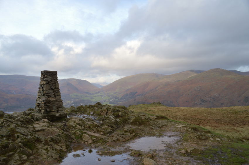
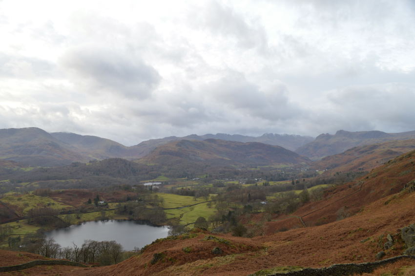
After a steep pull we were soon at the summit which surprisingly we had to ourselves for a few minutes, this was Tim’s first summit of Loughrigg Fell claiming his Wainwright count to 205 summits now, only 9 to go now which is such a nice place to find yourself, however Tim is taking it one step at a time & doesn’t seem to be in any rush to complete the big 214 anytime soon.

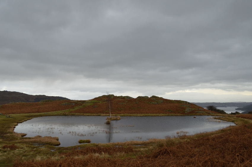
Sadly this was the only photo I managed to take as shortly afterwards a large family arrived celebrating their claim by sitting on top of the trig point, soooo there’s this guy (me) & I have a camera in my hand and you think it’s ok just to photo bomb my brief summit time by hogging the whole area.

What ever happened to politeness?

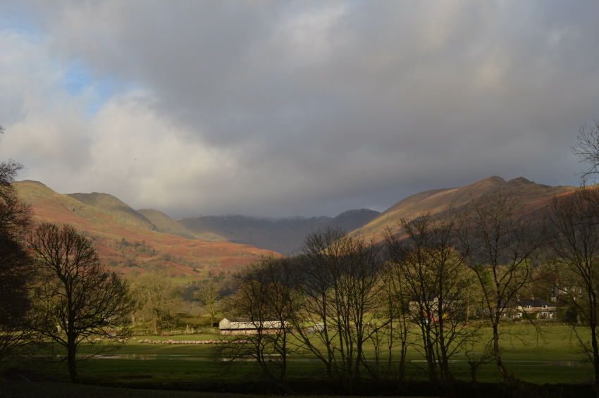
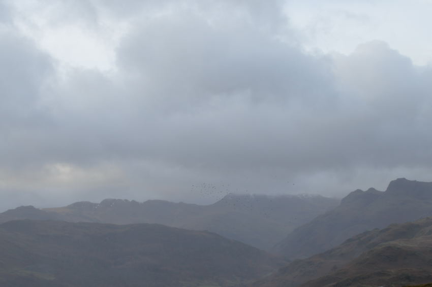
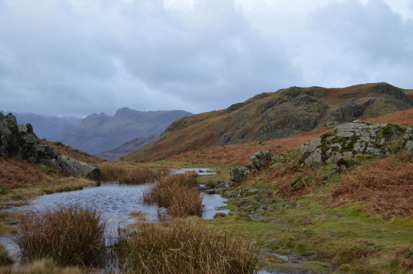
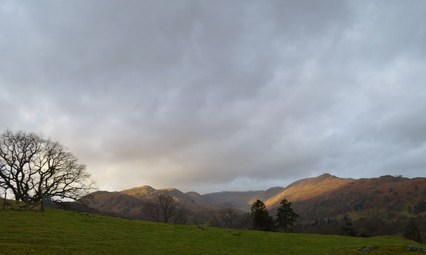
That rain cloud we had spotted over the Langdales had started to reach us leaving a few drops of rain in the air, but enough for me to put my camera back in its bag, within moments it had passed but it seemed to leave behind a different late evening light even though it was mid afternoon.

I think we can say goodbye to any hopes of sunshine from now, we press on.


Looking across the summit top.

Although today was Tim’s first summit of Loughrigg Fell it was only actually my second which prompted me to do a little exploring of the area. Lily Tarn is a place I had only associated with Loughrigg Fell but had never visited so what better timing than to change all that today.

To reach Lily Tarn head south east in the direction of Windermere, the path here is wide & easy to follow although there are many paths that lead to & from Grasmere, Rydal & Elter Water sticking centre of the fell is the best way to keep your bearing.


With views back towards the summit seen as the pointy bit centre.

We took the more obvious wider path to get to this point which is hidden through the course of the natural lie of the land in the left of the photo, to the right a much narrower path can be seen also.


Distant Langdale Pikes as we make for Lily Tarn.

Did I forget to mention it was quite wet across the summit here today, the views however took the mind from this, still, that light seems to be fading very quickly which is due to the showers that keep passing & indeed missing us by.


High Pike & Low Pike from Loughrigg Fell, Snarker Pike can be seen right.


A hazy view over Loughrigg Tarn towards Little Langdale & Lingmoor Fell.

Lingmoor Fell is never far from view due to its proximity to Loughrigg Fell. Tim had the idea to detour away from the path so we could take in the views of Loughrigg Tarn down below, I was either deep in conversation or miles away when Tim called this, good call though despite the low light.


Peaceful Lily Tarn seen with Windermere.

I can vouch for both Tim & myself when I say how surprised to see just how lovely & indeed secluded Lily Tarn is when we took our first views, Tim instantly mentioned that Lily Tarn had just made his top five of Lakeland Tarns. Me I was right behind Tim & I’m pleased that during my first visit Lily Tarn created a wonderful winters atmosphere that I took away with fond memories.


The Fairfield Horseshoe.

Time spent at Lily Tarn had to sadly come to an end, it wasn’t soon after leaving did we spot numerous dog walkers & couples out for a late afternoon stroll just before dusk was about to set in. We made our way down the fell towards Brown Head Farm & back to Miller Bridge before witnessing one last show of light before dusk finally descended over Lakeland.


Back to top