|
Ladyside Pike to Grasmoor from Hopebeck |
 |
 |
16th November 2014 |
 |
|
I guess preparation was held back for this walk, when I say preparation I don’t mean the route although that did alter slightly, what I mean is the little things, like forgetting my breakfast & dare I say forgetting to take a last minute look at the forecast which can be put down to the three hours stood in traffic the previous evening which only saw me arrive home from work close to 9pm after leaving the house at 6:30am that morning which kind of knocked my little axis out.
I arrived home come 9pm & after the greeting of a lifetime from Holly I prepared for a little down time involving an evening meal followed by a couple of beers, Paula told me she had made my sandwiches’ for the walk only for me to say that I’d already bought the cast off’s from the local garage whilst filling the car up a little over half an hour ago, I got lucky though…deep filled BLT for a quid – all of which might seem insignificant right now but it will all tie in towards the end of the walk so please, keep reading.
I went to bed early about 10.30 after myself & Holly had polished off the sandwiches Paula had made me, between now & my 5.30am alarm clock would pass literally within a blink of an eye.
In my semi awake mode I ran through the check list in my head, all that was left was to throw the gear into the back of my car not forgetting my all important travel cup of coffee (I think I would move heaven & earth if it meant I left the house without my morning cup of coffee!) So there I was waiting to leave the house with my hands & shoulders full of gear as I walked to the front door Holly bounced in front of it as if to say hey, you ain’t going nowhere before you’ve took me for our routine (before you head up the lakes you have to take me out for a walk) dogs just don’t forget do they.
I looked at my watch & thought okay Holly, I have spare quick ten minutes, I’ll take you out, down goes the gear out comes the dog lead; I’m guessing this was the point I forgot to eat breakfast which I’m putting down to a combination of rushing & the fact that I polished off two meals only seven hours ago.
It’s fair to say I’m an organised person especially when it comes to preparation which somehow had been thrown out the window this morning, I’m hoping the two hour drive to Whinlatter will help to calm things a little.
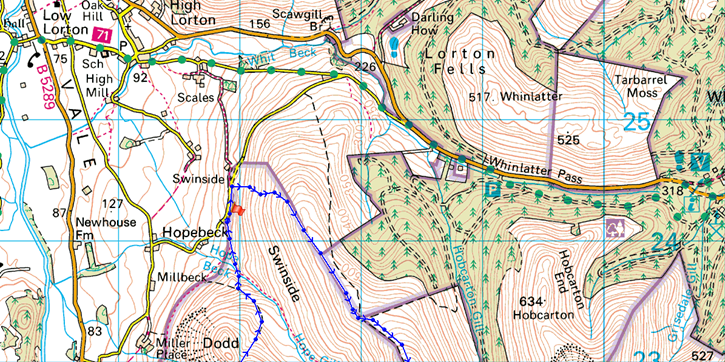
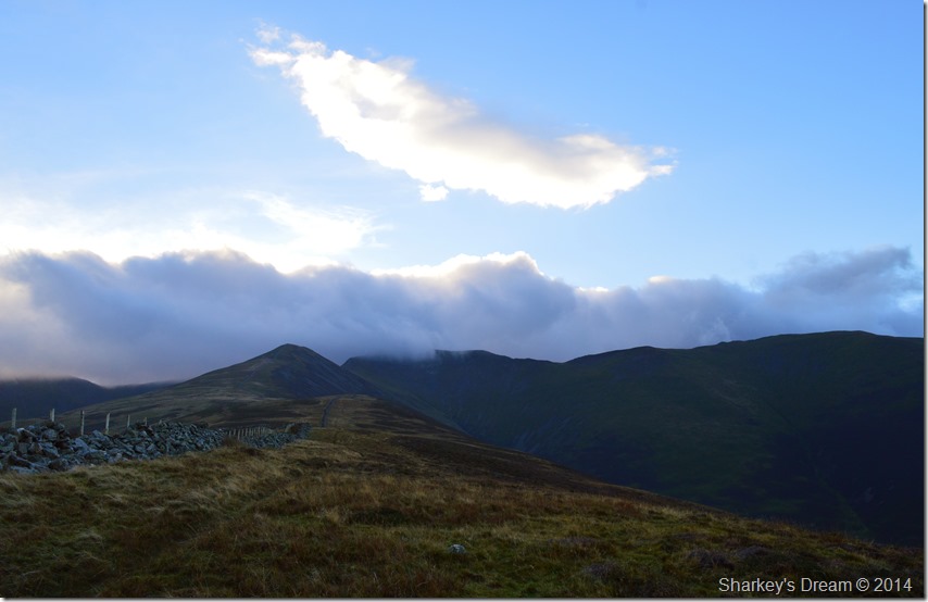
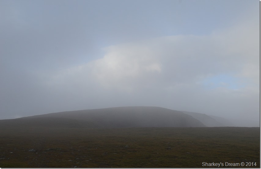
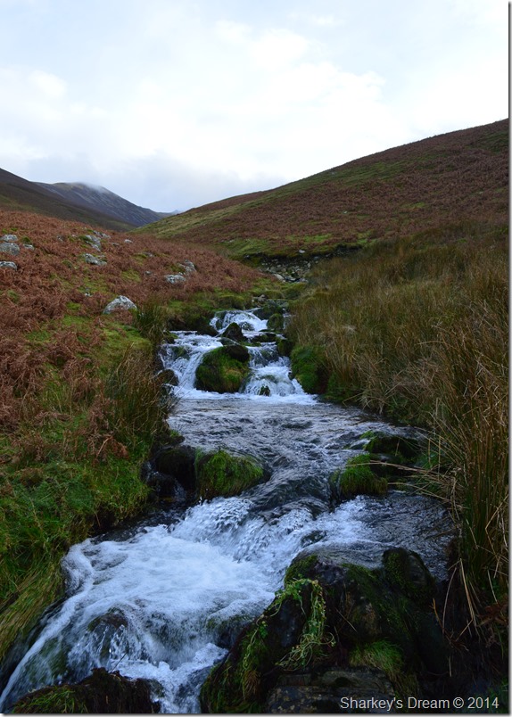
This is Grasmoor from Hope Beck. |
|
Wainwright Guidebook |
 |
| The North Western Fells |
-Hopegill Head:
A high mountain ridge leaps high like a rainbow from the woods and fields of Brackenthwaite and acres through the sky for five miles to the east, where the descending curve comes down to the village of Braithwaite. This ridge has three main summits, of which the central one (and the finest, but not the highest) is known locally as Hobcarton Pike and to the mapmakers as Hopegill Head. The supporting fell stretches far to the north, having roots in Whinlatter and the Vale of Lorton, whence the heathery flanks of Swinside rise to form the main ridge to the top peak, passing over the subsidiary Ladyside Pike (formerly Lady’s Seat) |
 |
|
| |
|
Overview |
|
|
| Ascent: |
4,288 Feet 1,307 Meters |
| Wainwrights: |
4, Hopegill Head – Grisedale Pike – Grasmoor – Whiteside |
| Weather: |
Overcast To Start With Low Cloud Across The Tops, Feeling Cold. Highs Of 10°C Lows Of 8°C Feels |
| Parking: |
Roadside Parking, Hope Beck Lorton Vale |
| Area: |
North Western |
| Miles: |
10.6 |
| Walking With: |
On my own |
| Ordnance Survey: |
OL4 |
| Time Taken: |
6 Hours 10 Minutes |
| Route: |
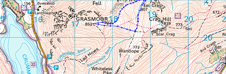
Hopebeck – Ladyside Pike North Ridge – Ladyside Pike – Hopegill Head – Grisedale Pike – Coledale Hause – Grasmoor – Coledale Hause – Hopegill Head – Sand Hill – Whiteside – Hopebeck |
|
| |
|
Map and Photo Gallery |
|
|
 |
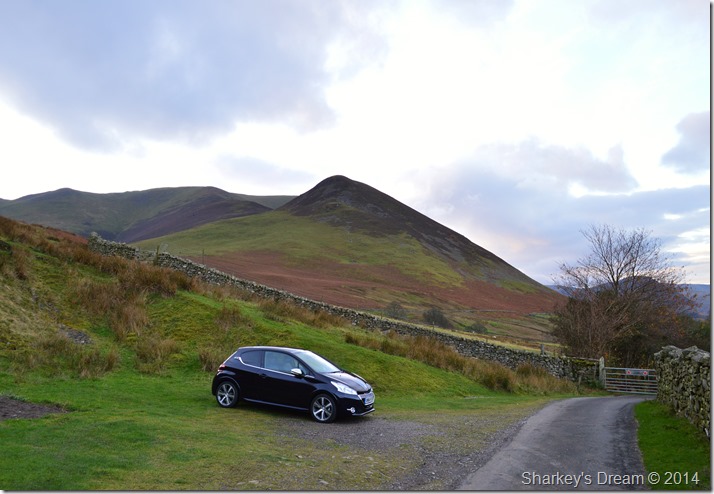
Car parking spaces close to High Swinside Farm, Whinlatter 08:05am 8°C |
I was a little behind schedule by the time I turned off the Whinlatter Pass due to a quick rest break at the Whinlatter Visitor Centre, not having been here before I hadn’t realised that the narrow lane was blocked off by two metal gates designed to keep the sheep in & any unwanted visitors out which also set me back, once High Swinside Farm had been passed I soon found the car parking spaces close to the second gate, which I didn’t have to pass through.
Ahead & beyond High Swinside lay the Whinlatter Fells here looking towards the mass of Greystones subsidiary summit of Kirk Fell.
The morning air is light with not a breath of wind down here at valley level, so much so I even wonder about throwing my jacket on which I did in the end. With the car locked I retrace my way back towards High Swinside Farm while on the look out for a break between the bracken & a path that will lead me onto Ladyside Pike north ridge. |
 |
That’s Dodd (Whinlatter) in the foreground with the Whiteside ridge in the distance. |
All of which are included into todays itinerary, but, before all that I need to find this path. Before long I start to pass High Swinside Farm, everything looks sleepy but looks could be deceiving, a track allows access to the farm to my left it was here besides a hollowed out bank to my right did I spot a path heading directly up the fell side.
I was about to give my legs & lungs the shock of their lives. |
 |
The Loweswater Fells over Lorton Vale from my steep ascent with Low Fell & Fellbarrow to the right & Mellbreak to the left. |
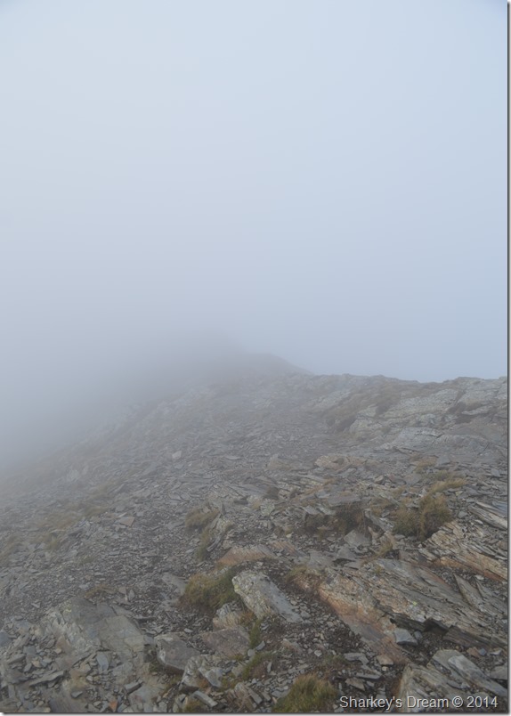
My track; wide at first followed a direct route up towards the ridge, at times the path would disappear beneath the heather where I would then have to pick my own route while at the same time trying to avoid the retreating bracken that snagged at my boots.
Thereafter I would pick the path back up while at the same time catching my breath in what seemed after only short distances, I had already passed what I would describe as piles of stones which could have been route markers I wasn’t quite sure, what I was sure of was that I was suffering & a mental adjustment had to be made to keep focused & stop these silly unscheduled rest stops. |
 |
Looking down the fell side as it falls away steeply over High Swinside Farm. |
I soon found a common denominator in the form of sheep tracks that lay horizontal across the fell side, these tracks were roughly spread out about 50ft about in terms of ascent. For anyone who’s done a bit of running & used the term ‘Till the next lamppost’ this was how I would use the sheep tracks which worked out really well – once I had gained them I would walk them for roughly twenty feet before heading back up the fell side until I reached the top of the ridge.
I can’t ever remember struggling so much so early into a walk, what doesn’t help is the fact at times my car, & High Swinside never seemed to getting any further away, this was the point I stopped looking back until I saw this beautiful sunlit cloud formation behind me… |
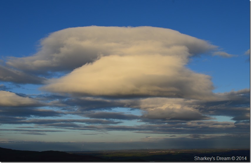 |
I named it, The Anvil. |
| |
 |
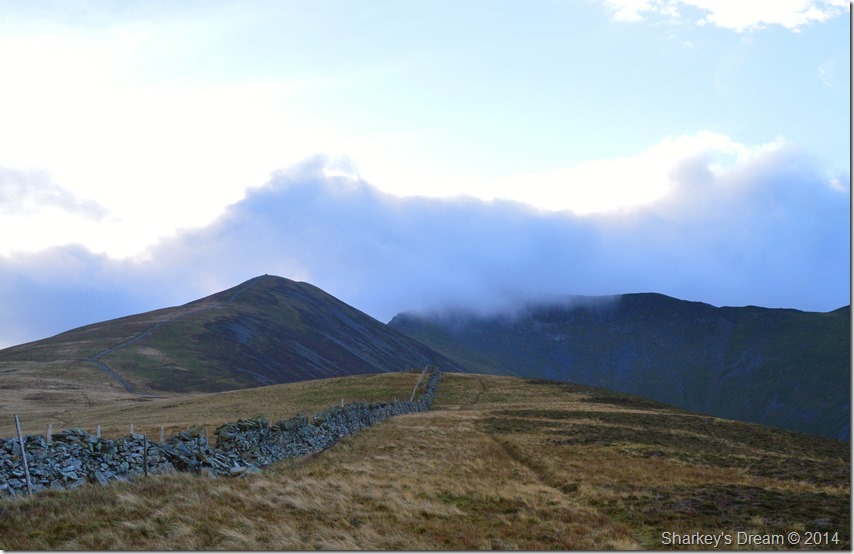
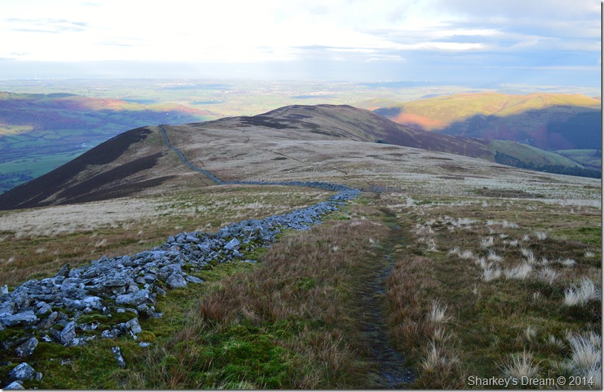
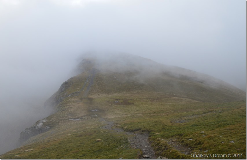
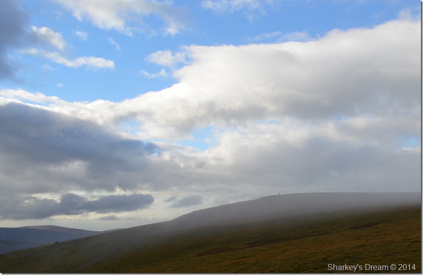
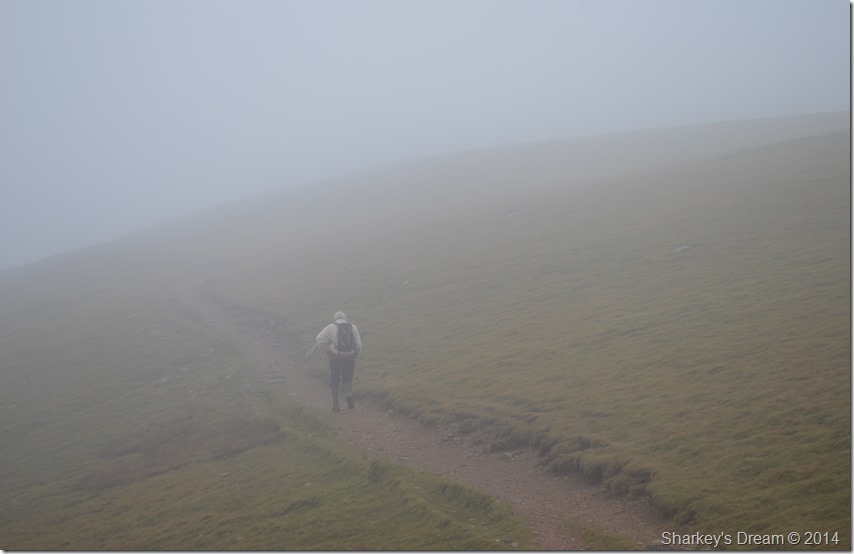
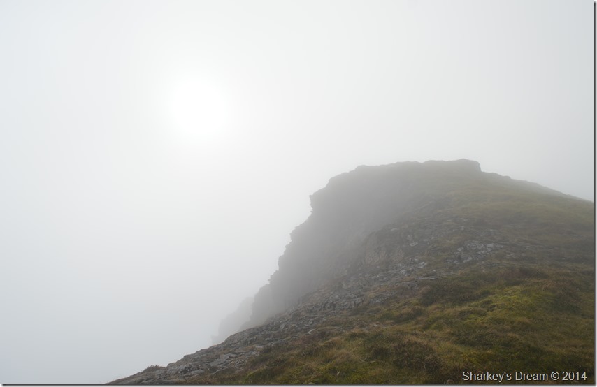
Ladyside Pike north ridge with Hopegill Head summit under cloud. |
| Once the ridge had been gained I knew all the hard work would quickly be forgotten which was exactly what happened once I the fantastic ridge walk ahead of me. Ladyside Pike was clear even in the now fading light but Hopegill Head battled with the low cloud which seemed to form as a barrier behind the Whiteside ridge. |
 |
Ladyside Pike beckons. |
My map told me to follow the path left of the wall which I had the opportunity to do while passing a break in the wall further back, I did consider it as two prominent paths lead up towards the summit, but in the end I decided to go against the flow & stick with my singular track, more options arose to cross the stone wall a further up the ridge too.
Although that steep ascent had long been forgotten I was now at the mercy of a biting wind that blew in from the summit directly at me, it’s quite difficult to describe just how good it feels when you can’t feel your face or the time you start to lose the feeling in the hands, it was all very nostalgic & is part & parcel of fell walking in the cold months of Autumn & indeed winter, my nose streamed like a tap as did my eyes but I put up with it until I reached the summit of Hopegill Head, but all that is in a little while, this truly is one fantastic ridge. |
 |
The views back along the ridge were just stunning. |
| |
 |
My only problem was… |
| |
 |
Which one did I like the best. |
| |
 |
Hopegill Head beyond the pinnacle. |
Shafts of light paraded over Hobcarton Valley sometimes exposing Grisedale Pike through gaps in the the cloud which took away summit time while at Ladyside Pike.
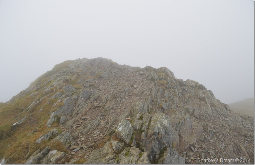
Ahead lay the spectacular slabs of almost vertical rock that form Hopegill Head summit northern aspect, the rock slab here bears resemblance to immense forced pressures leaving the naked rock feeling bare & must be treated with respect in all weathers.
During the slight descent from Ladyside Pike I experienced just how slippy this rock can be as I took a slight tumble before righting myself over a hilt of rock, looking back I saw what caused my slip, it was nothing more that a narrow length of wet rock that my walking boots could do nothing about, on any other day my boots would have coped well under such rock, but not here, this rock is as old as its neighbour, Skiddaw itself.
In the back of my mind this is where my walk route would change but all that will be revealed a little later on, so for now I enjoy my views as they came & went in anticipation of the climb ahead. |
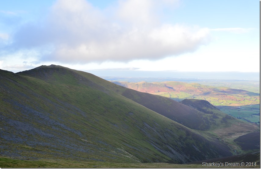 |
Whiteside seen with the Dodd ridge towering over the Hopegill Valley. |
| |
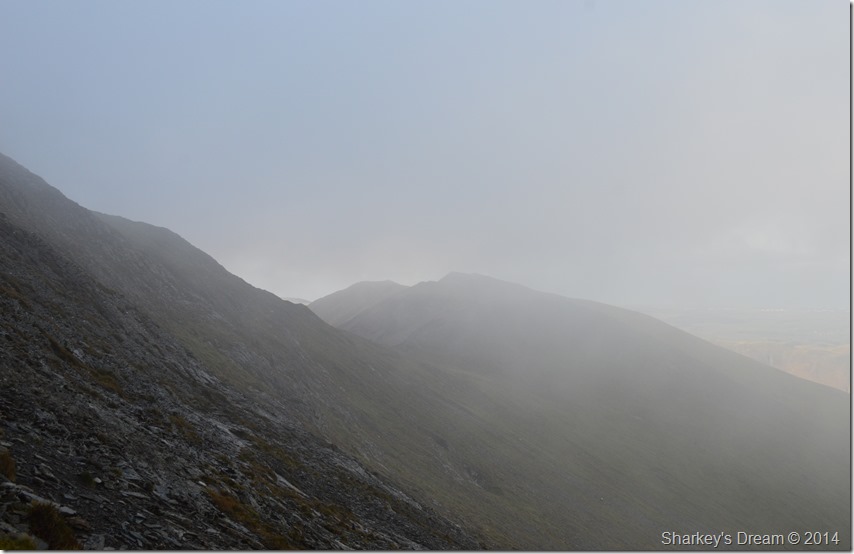 |
Minutes later, the cloud rolled back in limiting views along the Whiteside Ridge. |
Which view was a great memory I took away from the whole walk. |
 |
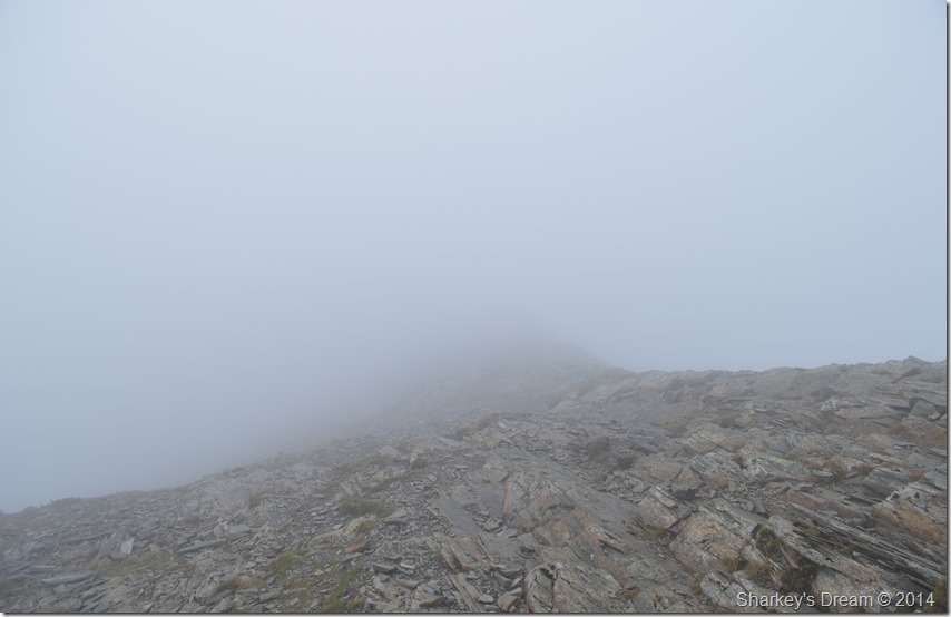
The rock slabs beneath Hopegill Head summit. |
I didn’t think I needed another test on how slippery the wet rock was here today but I got one anyway as I intentionally let my boot slide over another hilt of rock, my boot slid with precision as if I was sliding it over ice which quickly made up my mind to find the alternative path around which heads away across the right of the rock slab.
I was soon picking my alternative way up towards the summit using the slate path that lead over rock spurs, after more tests I wasn’t going to take my chances so I eyed my route by using the grassy outcrops as they provided a much firmer grip than the wet rock, after negotiating these outcrops I soon found myself at the summit which howled a biting wind.
It was here I downed pack just short of the summit cairn in a sheltered position where I adapted my hat & gloves while all around me the cloud was being pushed high above my head only every now & again it would reveal a darker kind of light through gaps in the cloud.
Hopegill Head fell away to my left flank as I took the path that divided it between Grisedale Pike & Sand Hill where I got the briefest of views. |
 |
Crossing the col over the Hobcarton Valley towards Grisedale Pike. |
| |
 |
Grisedale Pike summit. |
I continued with my ascent on Grisedale Pike through thick & sometimes fleeting cloud which never revealed anything more than forty feet ahead of me. Now the wind was hitting me side on which was a lighter alternative than full on which I had experienced while over on my Ladyside Pike ascent.
It was while on this ascent I passed my first two walkers, a fellow with his wife who had battened down their hatches so I could just see a slit through their peaks only revealing their eyes.
Morning!
At the summit I was met by three friends who had a dog with them who posed for photos before making their own way off towards Hopegill Head.
This then was followed by two more groups of three, the first of which were three lads possibly in their thirties closely followed by the second group who looked to be in their retirements but enjoying the fells in full conversation non the less.
Me, I ducked down beneath the summit to retrieve a Marathon bar, or to anyone under the age of thirty, a Snickers Bar.
I bought it to eat after my sandwiches but seeing as I had forgotten my breakfast I needed something inside me & quick. I soon left the summit with the left side of my face bearing the brunt from the wind – I was in my element as I soon caught the groups up only to take the left shortcut down to Coledale Hause, their voices becoming fainter & fainter until it was just me, the wind and my Marathon Bar.
Heaven. |
 |
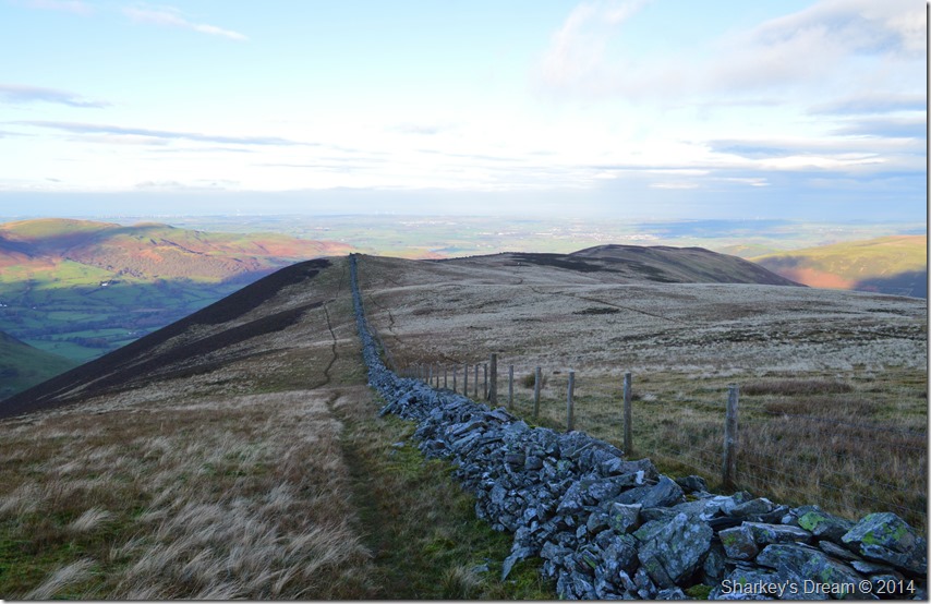
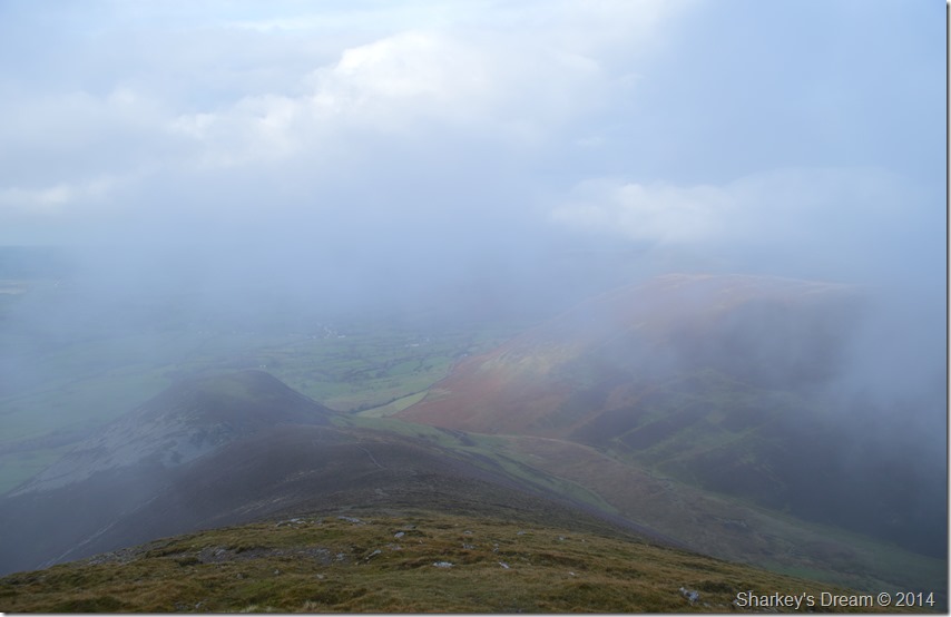
Coledale Hause. |
The wind at times had an element of rain it carried along by the gust, I of course already knew that my would be plans of a direct ascent on Eel Crag (Crag Hill) was surely out of the window given my lack of views & the slippery conditions, the fact that I couldn’t see Eel Crag let alone Grasmoor nailed my Eel Crag ascent, at this point I wondered across the Hause thinking one of two things.
Eel Crag (Crag Hill) or Grasmoor?
An ascent on Eel Crag (Crag Hill) would now effectively have to be done via the main summit path found about half a mile ahead thus making my ascent & descent by the same way, however if I choose to make an ascent on Grasmoor via the north east ridge I might be able to retrieve more highlights from the walk as it is a route I hadn’t used previously before. |
 |
Grasmoor north east ridge. |
After crossing Coledale Hause my mind had been made up to make an ascent on Grasmoor via the north east ridge which can be found after a short haul from the Hause just above a series of waterfalls.
I had soon crossed the beck which was in full spate, the sound from the waterfalls growing distant as I made my ascent, down below I heard a loud dog whistle then the sound of a dogs name which I couldn’t make out, all I knew was it seemed the dog had ran off, I remember thinking I hope it had returned to its owners after recent Lakeland events.
The climb was superb offering short zig zags over steep ground before arriving at the vast summit shoulder of Grasmoor, it was here I had momentary views back over Gasgale Gill, Whiteside & even Grasmoor’s Dove Crag arête. |
 |
Following the ridge towards Grasmoor summit. |
I followed the line of the ridge yet although my views were hampered by the cloud it was still nice to hug the rim of the ridge whilst trying not to be blown over it. After more height gained I couldn’t follow the rim any longer & made straight for the summit itself where it seems… |
 |
The cloud was about to clear. |
| |
 |
Grasmoor summit shelter. |
I arrived shortly after this chap seen in the photo who oddly enough made a point of walking around the summit shelter before heading back the way he came, as we crossed paths we passed on our good mornings.
The summit shelter was occupied by a couple eating lunch, maybe this was the reason the guy did full circle I don’t know…
The summit shelter is made up into two smaller shelters so I took residence & sat out of the wind for a while before spotting a break in the cloud & taking this next photo. |
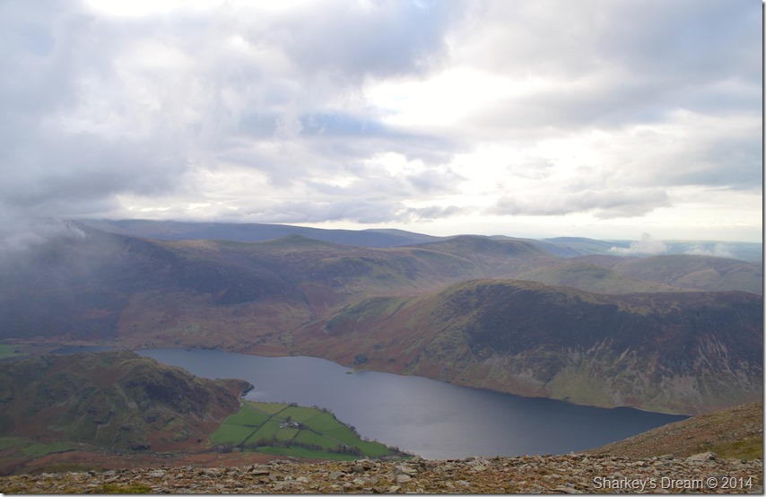 |
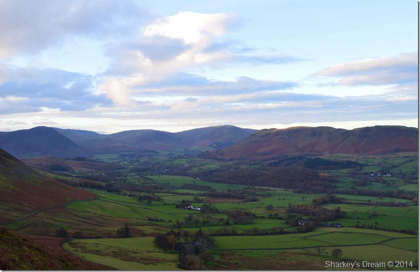
Here, over looking Crummock Water seen with Mellbreak, Starling Dodd & Great Borne in the distance, in the left of the photo is Red Pike (Buttermere) who’s summit is under cloud, meanwhile down below is Rannerdale Knotts. |
| |
 |
‘Your the first person who hasn’t ignored me’ |
I seemed to dip back in the cloud during my descent from Grasmoor summit, I was heading for the crossroads linking Grasmoor, Eel Crag with Wandope.
It was here I would pass more groups of people all heading for the summit, some of whom didn’t even lift there heads to acknowledge me, I’m pretty thick skinned when it comes to stuff like that & these days I try not to let it bother me.
I soon passed this fellow with a fleeting ‘morning’ who replied with ‘your the first person who hasn’t ignored me!’ I wasn’t that surprised & told him of my own encounters.
All that was quickly forgotten as I studied the gent during conversation, it was obvious we shared a passion for fell walking & walking in all weathers, I later found out that his name was Roger & he owned Foulsyke Cottage which is found directly below Low Fell.
We spoke about our routes & as it turned out Roger had set off from Hopebeck too, only to use the path all the way around to Whin Ben & Whiteside, considering he was well into retirement age his route was arduous & I only had admiration for him, ‘ you’ve got to while you still can’ Roger went on to say, one day you wont be able too & that’s when you’ll have the regrets.
No truer word I thought…
What’s your route back Roger asked? I told him I would descend Grasmoor before making my way back over Sand Hill & Hopegill Head, then onto Whiteside I explained. Roger then held out his hand while at the same time cupping my elbow.
Roger smiled & replied, stay safe Paul, it’s slippery.
I don’t think I’ve ever seen total camaraderie from a total stranger like that in all my time on the fells, what a truly nice fellow. |
 |
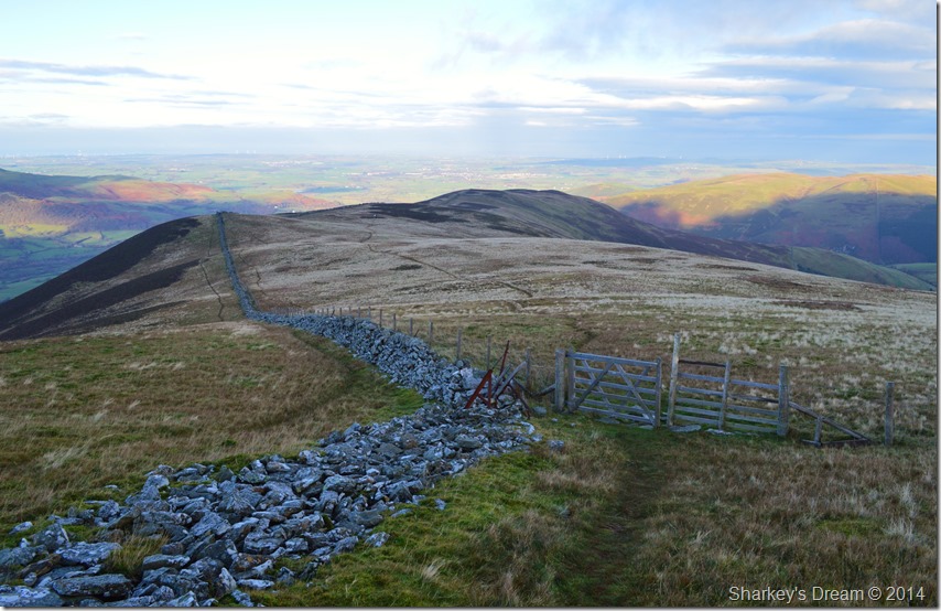
Back at Coledale Hause. |
I soon found myself back at Coledale Hause where a desolate calm had taken over, the wind had tapered to almost nothing & with the crowds now behind me making their ascents on Eel Crag (Crag Hill) & Grasmoor I seemed to have the whole place to myself, well for now anyway.
I crossed the Hause only to have my attention diverted from a group of walkers who had come up from Gasgale, the voices didn’t last long as I started to make an ascent on the lower reaches of Sand Hill.
I’ve descended Sand Hill many many times as The Coledale Horseshoe ranks high amongst my favourites, what I hadn’t realised is just how steep it is going the other way! My legs tell me to pause as my walking poles waver by my side, a sure indication that I’m getting tired.
Through the cloud a large group appears, two kids are skidding down the slopes not much older than ten years of age, I get an all-reet from one of them to which I reply ah lad. Behind the parents follow mixed within a larger group, pleasantries are passed with exceptions of one guy who clocked my camera round my neck ‘yer not gonna get much use of that’ in a rather sarcastic way.
I choose to ignore him with a vacant stare, I say vacant I think my eyebrows crossed in the middle. |
 |
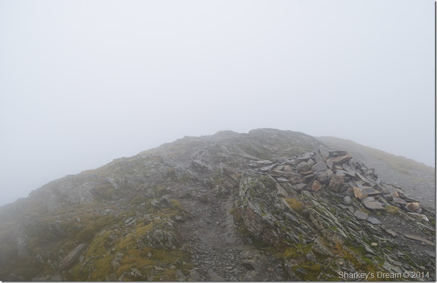
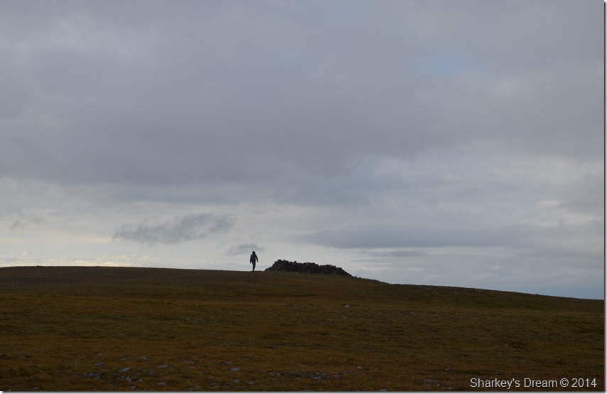
My second visit to Hopegill Head summit. |
My calf’s ached as I crossed the smooth grassy plateau of Sand Hill followed by the short haul towards Hopegill Head summit.
Through the cloud I could hear voices & was met at the summit by a fellow sporting a beard & two young woman sheltering close by, with pleasantries passed once more I top out on Hopegill Head for the second time today.
The wind had picked up again only not as strong as it was this morning, with this I turn my tail west & head for the Whiteside Ridge all the while mentally preparing for a slippery descent. |
 |
The mini arête found along the ridge just beneath Hopegill Head summit. |
Once I had tested the rock I found that it wasn’t as slippery as first anticipated which paved the way for a heart thumping eerie descent where I would link up with the main ridge. |
 |
The ridge to nowhere. |
| |
 |
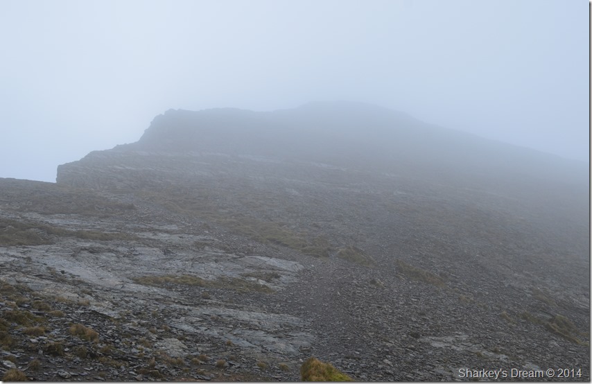
Whiteside Summit appears through the cloud. |
It was with a little sadness that I had to cross the Whiteside ridge without seeing what was ahead of me as this particular ridge ranks high amongst the best in Lakeland.
I couldn’t do nothing about my conditions so rather than work against them I worked with them & enjoyed the peace & quiet of my eerie ridge crossing in almost perfect silence.
Somewhere along the ridge I would have crossed the start of my descent route down the Dodd ridge, this was checked against my GPS which told me I had to back track along the ridge around three hundred meters before arriving at a small cairn where I found a narrow grassy path that lead away through the mist. |
 |
Descending the Dodd ridge shortly after leaving the Whiteside ridge. |
The Dodd ridge starts as a grassy plateau before quickly falling away rather steeply via a narrow path, my views had now started to open up with the more height I descended. Below the ridge Dodd summit had been in today’s plans but as time is now against me I will have to return another day, perhaps when the weather is more clearer.
Before Dodd is reached the ridge descends steeply into narrow col lined with slate & stone, before I reached the bottom of the col I took a steep slide in the mud but managed to hold it without toppling over only to look back at the section I had just skidded through feeling mighty proud that I managed to stay upright. |
 |
Hope Gill with Ladyside Pike & Hopegill Head still lost in cloud. |
After reluctantly missing out on Dodd I headed down into the frequently less visited valley of Hope Gill where I pass an old ruined sheep fold before making my way through more colourful retreating bracken to where Hope Beck flows through the centre of the valley.
By now the afternoon was turning quite pleasant as I glanced back towards a long distant view of the Whiteside ridge It was there I spotted a walker heading towards Hopegill Head blissfully unaware that up until an hour ago they wouldn’t have seen thirty foot in front of them, I paused while at the same time I think my heart just sank a little. |
 |
Hope Beck. |
I picked myself up & dusted myself down before making my way to a clearing where I would hope to cross Hope Beck, down stream looked better but this was such a nice spot I decided to take it in a while sitting down beside the bank.
I was in danger of becoming mesmerised by the flow of the water, sitting there just watching & taking the peacefulness of the valley in. By now it was almost 2pm & besides my Marathon Bar earlier I still hadn’t had anything proper to eat.
Once more I reluctantly left the scene deciding to eat my sandwiches back at the car while enjoying a hot cup of coffee that I had stored away in a flask in the boot of the my car.
I crossed Hope Beck with a stride through the water allowing it to rise to almost angle level before stretching to the opposite bank. |
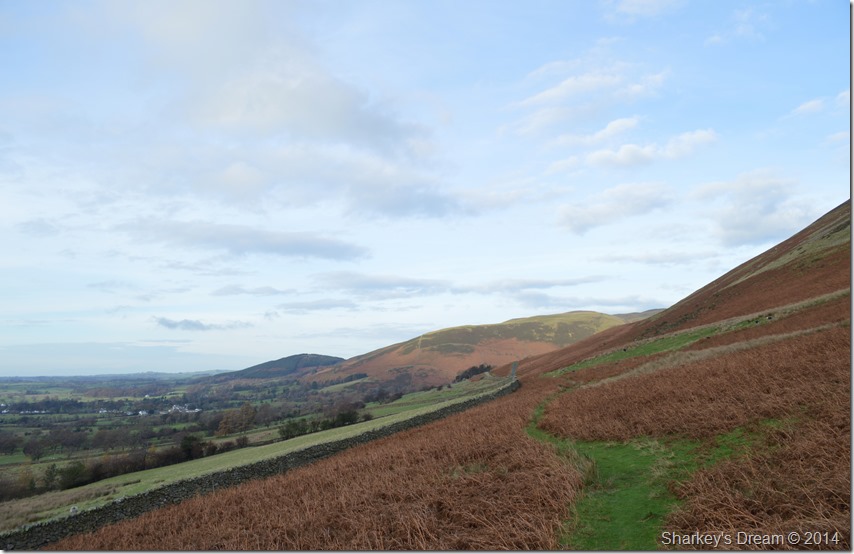 |
It was then a matter of following the stone wall a few hundred yards back to where I had left my car that morning. |
| |
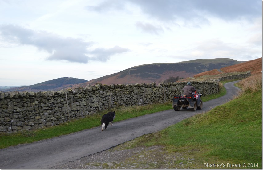 |
Bobs getaway. |
I soon arrived back at the car where I de-shouldered pack & started to pack my things away, it was only after my gear was back in the car would I start on lunch.
I unscrewed my flask leaving the cars boot open I strode away to a dry spot where I sat down to a small mug of coffee, over the space of five minutes I heard the sound of a Quad Bike getting nearer & nearer before long it had reached the gate beside the car park ‘stay there I’ll open the gate’ I said to the old woman riding the Quad Bike.
She smiled & seemed pleased she didn’t have to get off the Quad, her dog also who didn’t budge until I had opened the gate & let them through. The old woman was a local farmer & was just checking if the top gate hadn’t been left open & to give Bob, her farm dog a run out. We soon struck up conversation mainly about the weather as she went onto explain that her washing had nearly took off this morning in that wind, she had been more worried however about how dry it had been of late & how thankful she was to see some rain at last.
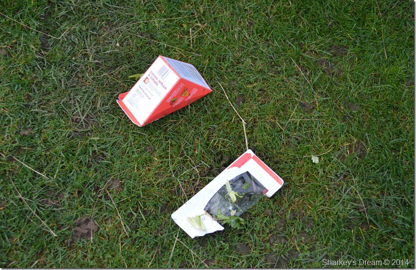
Meanwhile Bob had sheepily snook off peering towards the back of my car, I paid this no attention as we carried on our conversation, it was only then did I realise that my sandwich packet was now on the ground behind my car, Bob must have jumped into the boot & eaten them!
I just didn’t have the heart to tell him off & kept what I had seen to myself, what’s he doing behind your car the woman laughs while at the same time spotting the red sandwich packet on the ground behind my car.
Bob come here! |
 |
We need to check that top gate hasn’t been left open. |
You just couldn’t make it up could you. |
|
| |
| Back to top |
 |
|