 |
Black Sails & Wetherlam from Coniston |
 |
 |
2nd November 2014 |
 |
|
I hadn’t planned to walk today at all which is probably the reason for my mid morning arrival here in Coniston. It’s been well over seven months of consecutive working & walking so this weekend I thought I would treat myself to a well deserved Sunday morning lie in after spending the previous morning in work only to then travel to Blackpool for a family evening followed by a lazy night eating takeaway & Saturday night TV.
My plan was working out fine, that was until it came to the Sunday morning lie in…
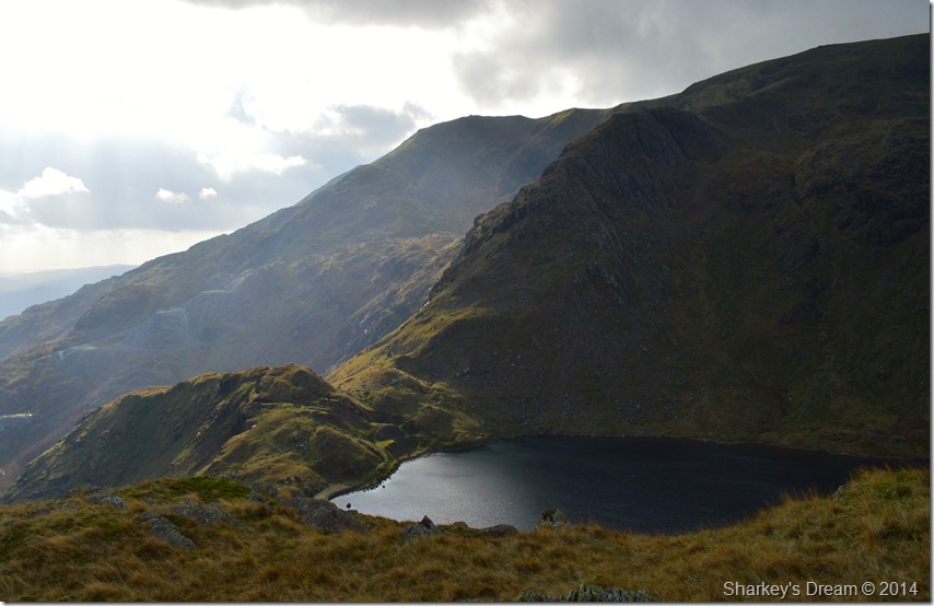
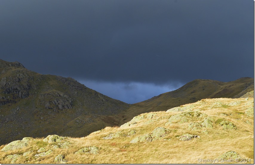
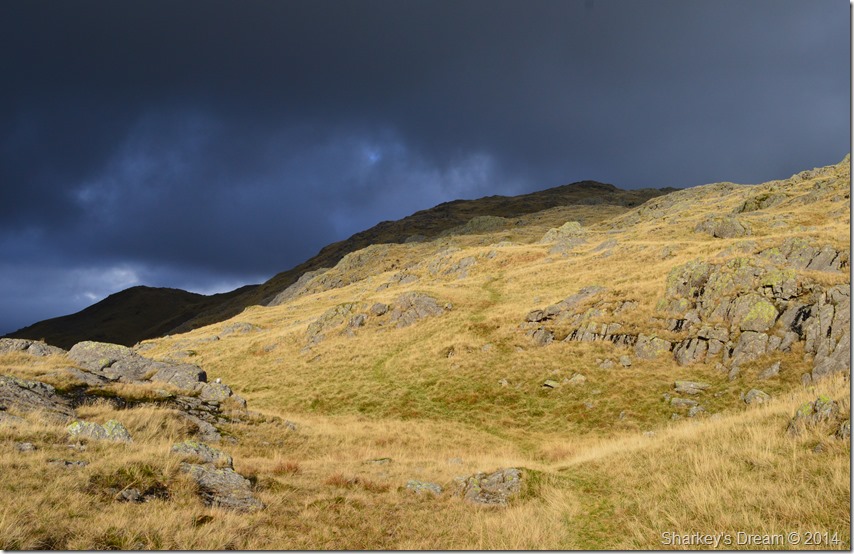
This is Black Sails & Wetherlam. |
|
Wainwright Guidebook |
 |
| The Southern Fells |
-Wetherlam:
This fine hill, however, is too vast and sturdy to be disfigured and weakened by mans feeble scratching’s of its surface, and remains today, as of old, a compelling presence to which walkers in Brathay will off turn their eager steps. |
 |
|
| |
|
Overview |
|
|
| Ascent: |
2,440 Feet – 712 Meters |
| Wainwrights: |
Wetherlam |
| Weather: |
Overcast to Start Turning Sunnier, Gust Across The Tops, Highs Of 11°C Lows Of 9°C |
| Parking: |
Roadside Parking, Ruskin Museum, Coniston |
| Area: |
Southern |
| Miles: |
7.3 |
| Walking With: |
On my own |
| Ordnance Survey: |
OL6 |
| Time Taken: |
|
| Route: |
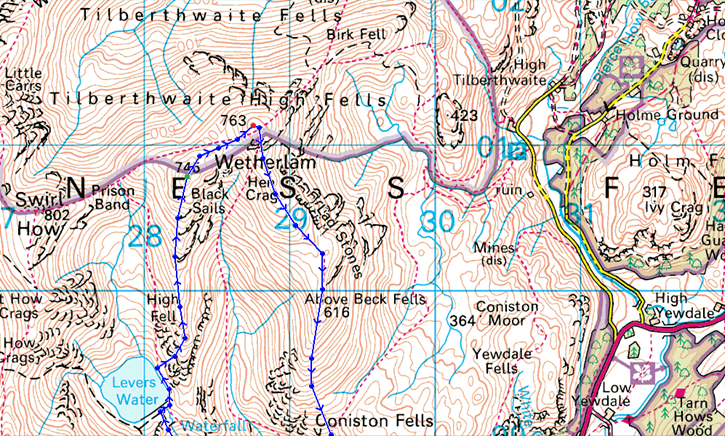
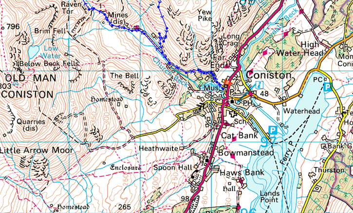
Coniston – Miners Bridge – Church Beck – Coppermines Valley – Simons Nick – Levers Water – Black Sails – Red Dell Head Moss – Wetherlam – Lad Stones – Hole Rake – Church Beck – Miners Bridge – Coniston |
|
| |
|
Map and Photo Gallery |
|
|
  |
| |
| |
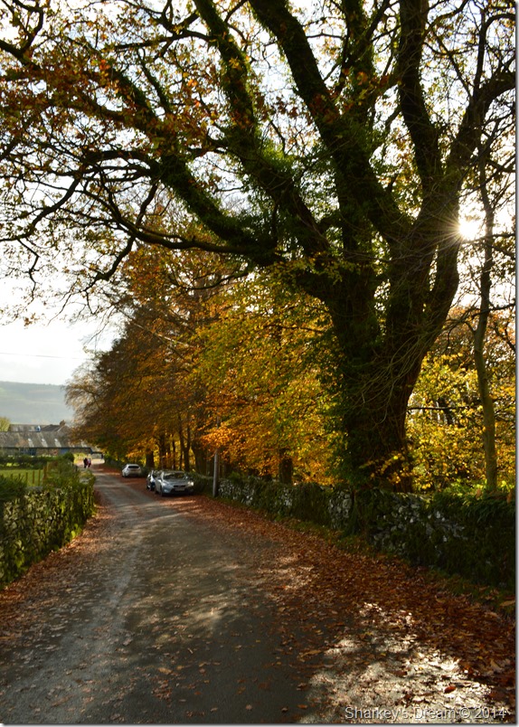 |
Roadside Parking close to the Ruskin Museum, Coniston 10:45am 9°C |
I awoke that morning just gone eight followed by a trip to the bathroom, sunlight shone in through the gaps of the blinds of the bedroom window which when I look back subconsciously must have planted the seed for today’s trip, I just didn’t know it quite yet.
Laying there I was only kidding myself, losing the battle to stay in bed I soon found myself checking the Lakeland weather report on my mobile phone which caused me to sweep the covers back whilst at same time muttering to my wife, ah think I’ll head up to Lakes.
All I had to do was throw a flask together for the journey north, not before a top up at the petrol station together with yesterdays cast off sandwiches, It could have been much worse than chicken triple.
My journey north was uneventful only slowing down as I reached Ambleside, my pace not picking up much more until I reached the outskirts of Coniston itself.
I took a right turn at the signpost for Ruskin Museum where I followed the narrow tree lined lane before coming to a stop at the side of the stone wall which hugs Church Beck before it meanders its course to Coniston Water.
The ground underfoot was awash with fallen leaves & seedlings, evidence of the high winds Cumbria & indeed much of the country had experienced recently. On the other side of the stone wall Church Beck averts my attention in full spate, this together with the brisk winds that blow through the branches above my head capturing a moment in time, then before I knew it I had locked the car & had threw my pack over my shoulder heading in the direction of Miners Bridge. |
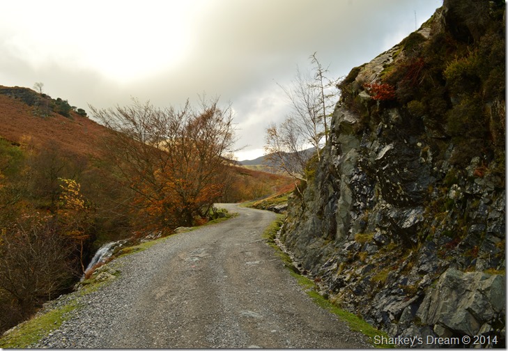 |
Heading towards Miners Bridge & Coppermines Valley. |
I soon left the tarmac road which gave away for this wide track not before passing an elderly couple who I passed on my good morning to.
Here Church Beck falls away steeply from the track seen through a thick growth of Gorse bushes & small trees all of which looked like a one gust away from looking bare & ready for winter. Through the bush sights of white dash & loud cascades dominate my flanks which left me hearing but not seeing just how much water was flowing by me. |
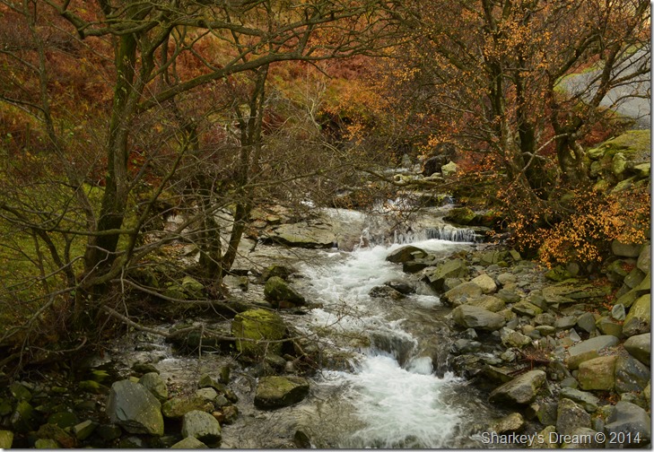 |
Church Beck from Miners Bridge. |
| |
 |
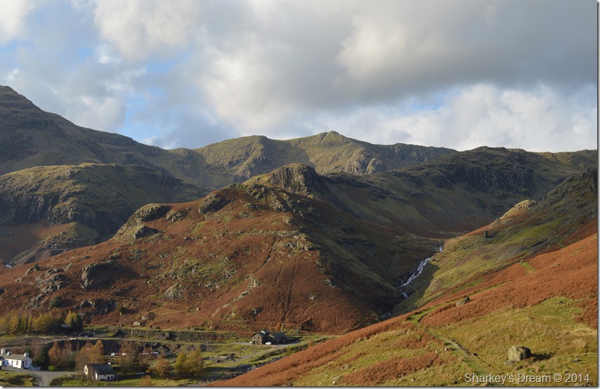
Coppermines Valley with the Black Sails ridge seen right. |
After leaving Miners Bridge behind options & routes soon opened up before me, my route today will see me pass in front of the white YHA Cottage seen below Kennel Crag where I will follow the mine track before ascending towards Levers Water by Levers Water Beck (Simon’s Nick) seen in the upper centre of the photo. |
 |
Simon’s Nick. |
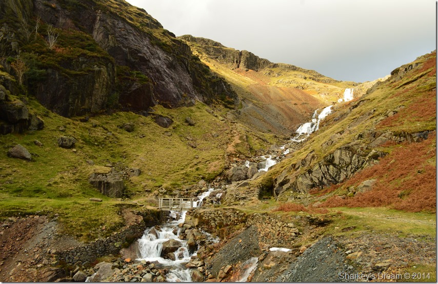
My ground was covered quickly before reaching the wooden footbridge that crosses Levers Water Beck, I could have headed up Kennel Crag flanked in the right of the photo but I guess the sound of the waterfalls drew me in. It was close to lunch & I hadn’t realised that I had left this morning without eating any form of breakfast, so after crossing the footbridge I set myself up with for the climb ahead by eating one of my sandwiches whilst sat on the boulder you see to the left of the footbridge.
Ahead my path picks away over sometimes steep stony ground as my ears are blessed once again with the hypnotic sound of cascading water which was such a bonus so early into the walk. |
 |
Here, looking back down over Coppermines Valley. |
| |
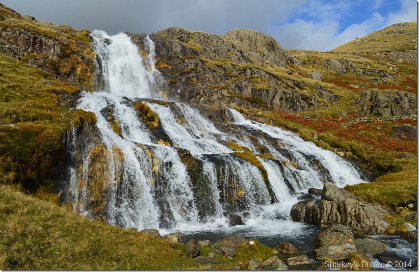 |
Levers Water (upper) Falls. |
| |
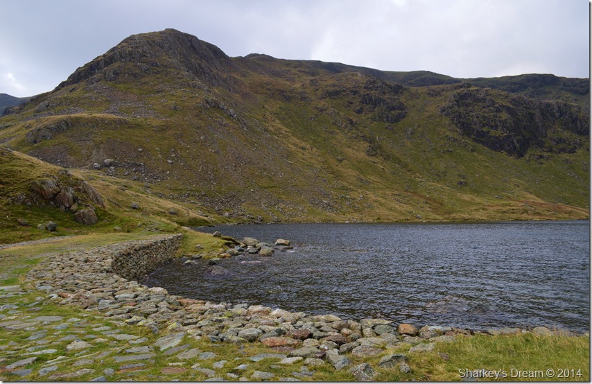 |
Raven Tor from Levers Water. |
After following the narrow path besides Lever Water Falls my track soon opened up onto a grassy broad plateau whilst my view of the Black Sails ridge was slightly obscured by the bullish features of Erin Crag, however, I spotted my path which oddly lead away from the ridge but even at so low down the ridge, I saw method in its madness.
First of all I made the school boy error of heading for the Weir full knowing just how much water was flowing which soon stopped me in my tracks once I saw the smooth crest of water over flowing a concrete hilt of rock designed to obstruct & slow down water flow, it wasn’t working.
From above the Weir I scanned the outflow spotting chance stepping stones that had hidden dangers which saw me back tracking, and back tracking.
Levers Water Beck was in full flow & ran over most of the stepping stones some of which looked too deadly for a safe crossing anyway…Further down stream I spot a narrow turn in the beck but I know from past experience that narrow usually means deep, I wasn’t wrong which saw me return to what I considered to be the next safest place to cross.
Just go for it Paul.
No. I studied the bed before throwing a couple of rocks in some of which were carried away by the fast flowing water before they hit the bottom.
I can’t remember the reason why I stopped wearing gaiters but right now I needed them good grief I thought there’s no way I’m going bare foot in that icy cold water, with this I made a dash for it as the water gushed above my boots & around my trouser bottoms.
The whole episode only lasted seconds & I even managed to stay dry thanks to my leather boots & a good shake down, it was there & then though I thought that maybe I shouldn’t have been so drawn in by the waterfalls after all.
Still, I felt good that I had made it across quickly & safely & even managed to stay dry, now I had the brilliant ridge climb ahead of me. |
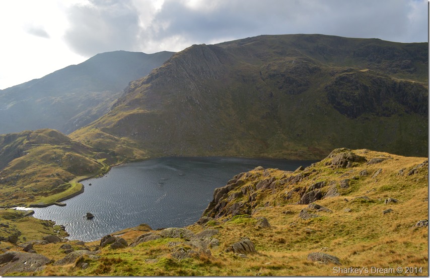 |
Views down to Levers Water, Raven Tor & Coniston Old Man from Blake How. |
I gained Erin Crag by using a grassy path that lead away from the initial steep climb of the ascent, firstly heading in a easterly direction which correcting itself in ascent by means of a short burst of flat ground followed by a series of grassy zig zags, sometimes hopping over knee high crags & boulders along the way, my thoughts turned to just how well thought out the path was & that someone a very long time ago obviously knew what they were doing when they picked & wore the path as we know it today, my ascent was a little steep in places but the mind was certainly drawn away with just how pleasant the path & how quickly the ridge was gained. |
 |
Here, looking back down the Black Sails Ridge with the Red Dell Valley seen in the left of the photo. |
| |
 |
Raven Tor & Levers Water with Coniston Old Man in the distance. |
Raven Tor ranks high amongst the Coniston Fells so much so I even planned my descent down the north east ridge but later changed my mind a little further up the ridge. |
 |
Contrast of light along the Black Sails ridge. |
One of whole highlights of the whole walk had to be the brilliant contrast of light I was experiencing during my ascent with the dark brooding cloud ahead of me mixed with a bright sun behind me which illuminated the whole ridge ahead. |
 |
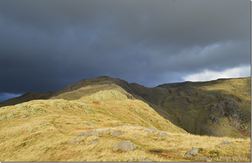
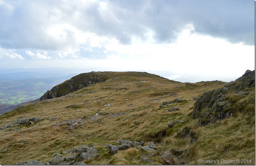
Black Sails & Wetherlam over Red Dell Head. |
It was somewhere close to this point did I change my mind & decided to include Wetherlam rather than a return via Raven Tor & Levers Water, my decision had almost been made for me. |
 |
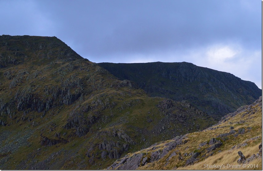
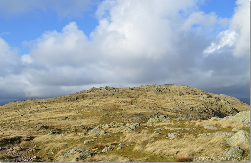
Wetherlam from the Black Sails Ridge. |
| |
 |
Swirl Hawse seen with Prison Band. |
The change in contrast continued the further I got up the ridge, as I stopped to pause to look over at Swirl Hawse a group of walkers picked their way up Prison Band bound for Swirl How seen in the left of the photo. |
 |
Magical light over Black Sails & Wetherlam. |
| |
 |
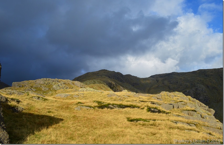
Apocalyptic views. |
At times my view was so beautiful I just had to stand there & admire it, although as dramatic as my walk was turning out dark clouds can only mean one thing, best just see what transpires over the next ten minutes. |
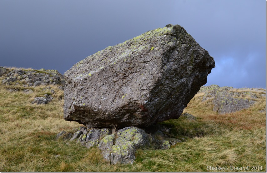 |
Erratic Boulder found between Low & High Wether Crag. |
| |
 |
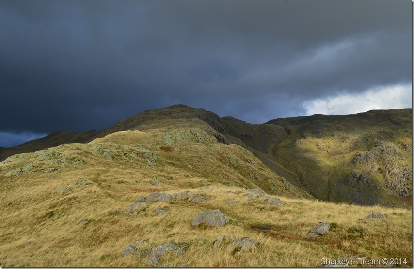
Just below the summit now as the dramatics continue. |
Further on up the ridge I soon found myself looking at the summit of Black Sails still with a healthily glaring sun behind me the darkness up ahead continues as every now & then spots of rain would hit my jacket carried along by the already strong winds I had been experiencing. My hands & ears were by now calling for comfort which came in the form of a warm beanie, It’s quite difficult to describe why I kept my hands bare, I quite liked them cold. |
 |
Prison Band, Swirl How & Great Carrs from Black Sails. |
| |
 |
Losing light shortly after leaving Black Sails summit. |
By the time I reached Black Sails summit I had lost the light that had followed me up the ridge, by now everything had turned to grey as dashes of light struggled through the clouds some of which lit up small pockets over Raven Tor & Great How Crags, nonetheless, still very memorable.
The summit is reached by means of a last push upwards towards the highest ground, not to be mistaken by following the path towards what looked like an established cairn in the direction of Wetherlam, this cairn a marker rather than a summit.
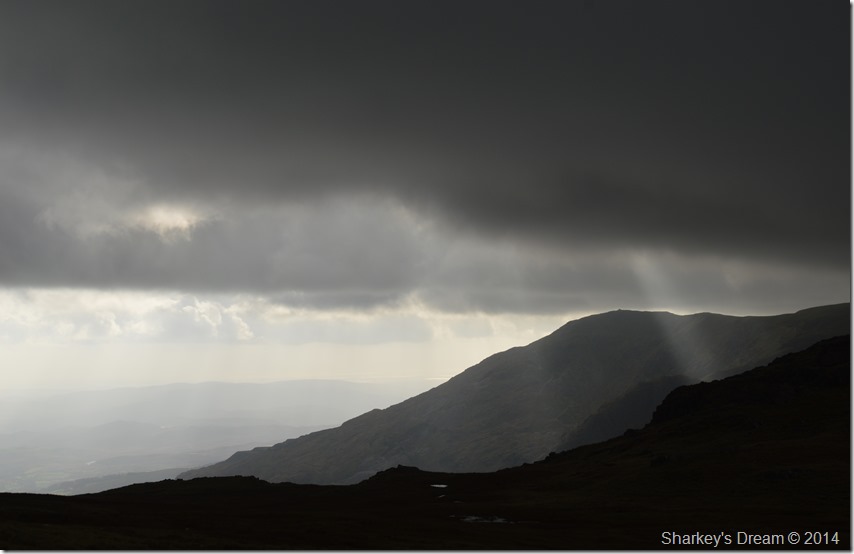
I reached the summit to find no views only those behind me towards the Old Man as shafts of light criss-crossed across the valley, over on Brim Fell I spot a group of walkers silhouetted against a dark back drop of cloud which made me ponder about the advancing rain cloud about to soak us all.
Oddly enough I & no doubt anyone else on the Coniston fells did in actual fact escape the drenching as we witnessed the band of rain keep to a narrow track as it headed through Little Langdale completely obscuring the southern fells in the process. Bowfell had completely vanished. |
 |
Coniston Old Man from Wetherlam summit. |
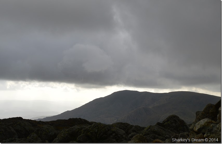
A low cloud base had started to drift in yet confine itself south of my position, meanwhile north west of me an outline of the southern fells had started to reappear leaving them in a murky faint distant afterglow as the sun light steadily started to creep back in.
I was within an arms length of Wetherlam’s summit cairn & had started to catch up on a couple who I spied whilst I was back at Black Sails summit, I deliberately slowed my pace down then detoured my ascent knowing we’d arrive at the summit together, me being me I thought I’d give them some summit time first which upon arriving at the summit myself some minutes later I found that they had already started to make their descent via Wetherlam Edge.
The wind had gained in strength & blew across the summit cutting into my hands but I was defiant at leaving them exposed, a short distance away I found myself a great shelter out of the wind where I finished the remainder of my chicken triple. |
 |
After lunch, time to start heading down across the summit plateau. |
With lunch over my view & indeed quite a lot of light had returned to the summit which cleared the way for a descent with view.
As I started to pack my things into my pack a couple appeared at the summit taking pictures of each other, it was here I overheard the woman saying they need to get out of the wind while at the same time making their way towards me, this is a great spot I said, out of the wind too.
No need to leave on our account, not at all I replied, I was leaving anyway. |
 |
After the rain, Wetherlam. |
I soon left the couple taking shelter before heading across the broad expanse of Wetherlam summit plateau in the direction of Lad Stones all under pleasant afternoon light albeit still being dashed by strong winds. |
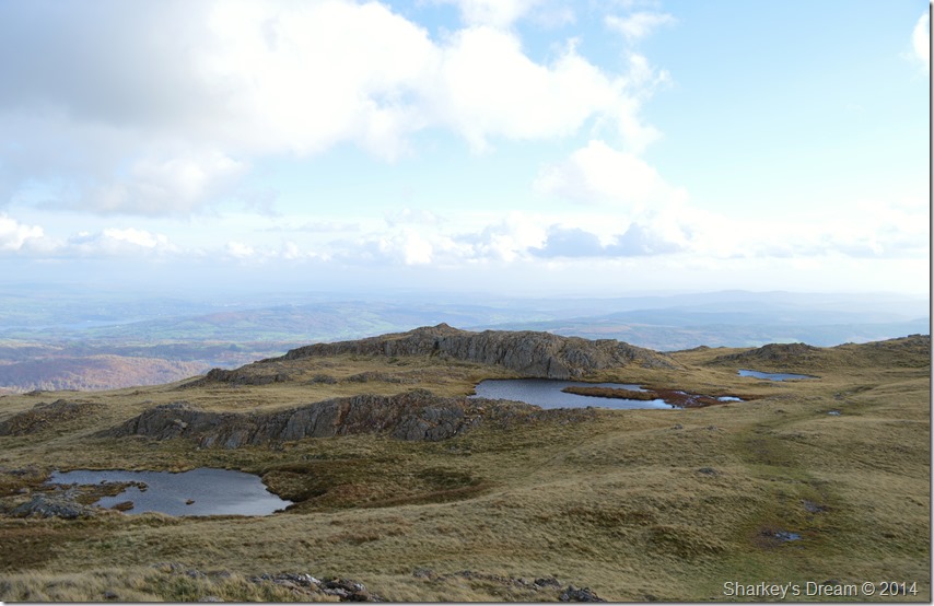 |
The three un-named Tarns at Red Gill Moss. |
| |
 |
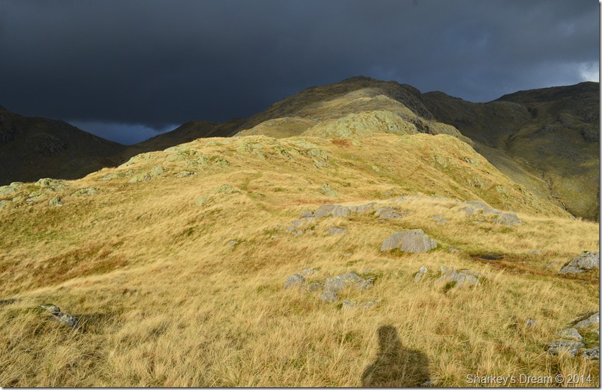
Black Sails over Red Dell Head. |
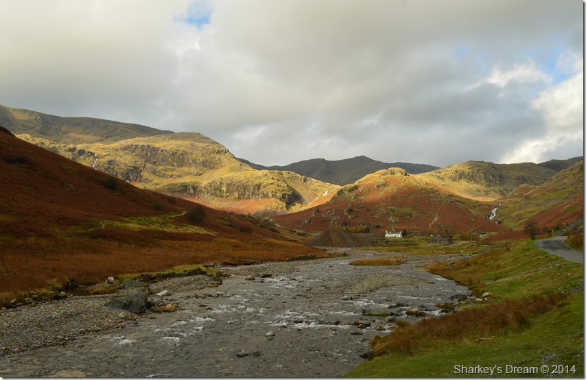
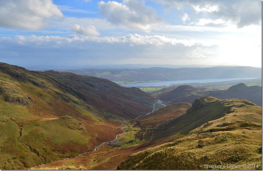
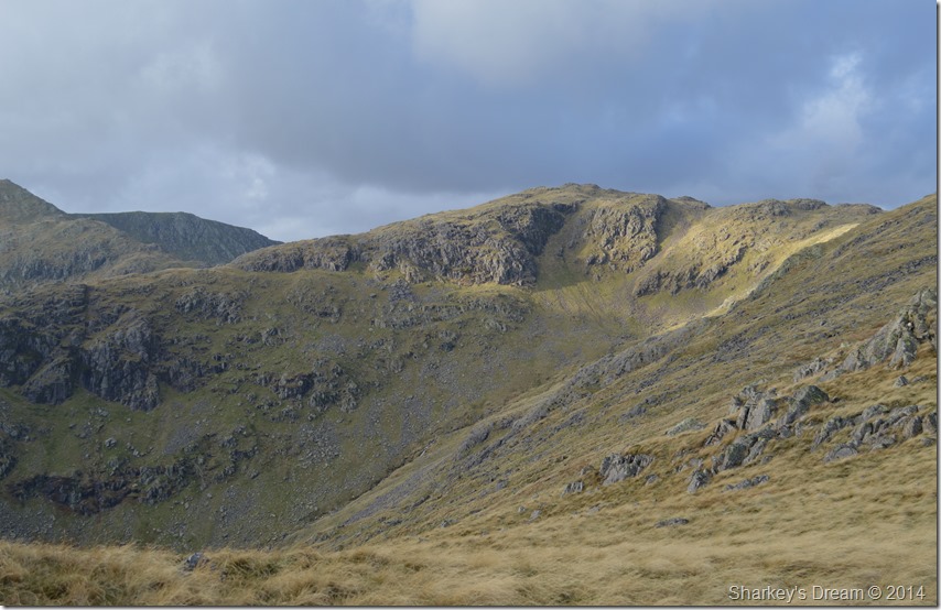
The descent from Lad Stones offers fantastic views into the Red Dell Valley & indeed a cross section of the Black Sails ridge, an area however, you might want to reserve until summer due to just how boggy the valley gets. |
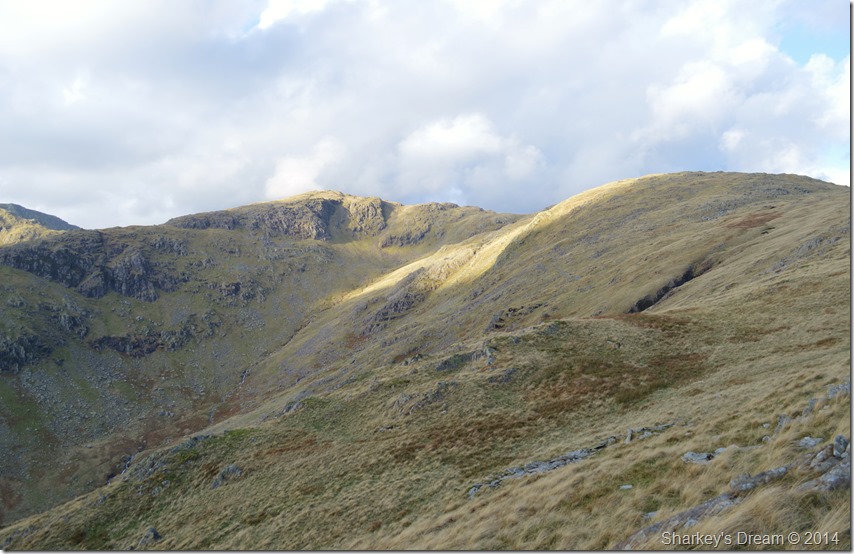 |
Black Sails & Wetherlam. |
| In this photo Black Sails can be seen with Wetherlam, together with Red Dell Head in the centre |
 |
Black Sails seen with Swirl How & a distant Great Carrs with the Red Dell Valley seen right. |
| My walk was almost over as I descended what seemed to be some of the strongest winds so far which were enough to make my eyes water. Notably the more I descended the winds subsided leaving nothing but cool sunshine as I arrived back at valley level. |
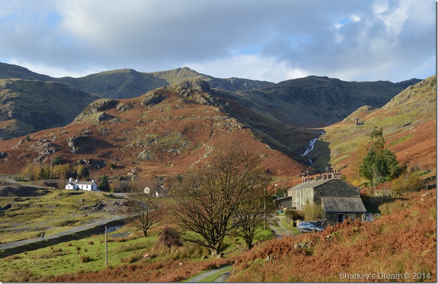 |
The Black Sails Ridge seen over the old Miners Cottages. |
| |
 |
A last show of Autumnal strength. |
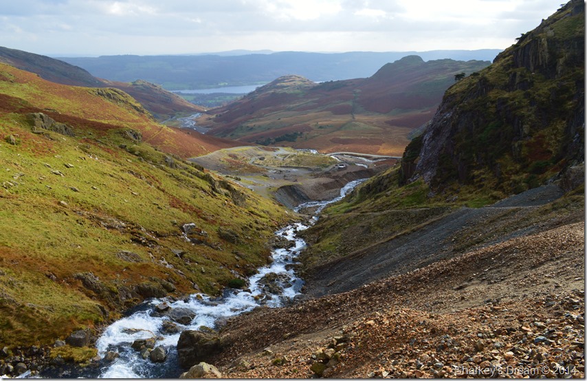
My path soon lead my back into the Coppermines Valley where walkers & tourists mixed some of whom were returning like myself to parked cars or indeed, had just left them. Instead of taking the more obvious path left from the fellside I hook a right & make where I would pass the old Miners Cottages sometimes known as ‘Irish Row’ It’s a place I hadn’t come close to only witnessing them from the road below it was here the mind wanders back to when they were occupied by the miners of Coniston who had now long gone, however it was nice to see even though the cottages had been turned into holiday lets presence remained intact & un-spoilt here in the Coppermines Valley.
I pass large groups of walkers in both directions as I head back towards my car before having the last few hundred yards to myself, it was here I smell the smoke from a nearby chimney.
I was yards away from the car by now but that smell was such a fitting end to a fantastic three and a half hours on the Coniston fells.
Who needs lie ins anyway
. |
|
| |
| Back to top |
 |
|
