 |
Great Gable & Kirk Fell from Honister Mine |
 |
 |
16th October 2014 |
 |
|
Like a lot of my walks that are pre-planned this walk was no different. A walk from Honister Mine to take in Great Gable & Kirk Fell was the main objective whilst along the way taking in Grey Knotts & Brandreth, two summits that I had only visited maybe once or twice before, my means of gaining them were by a steep pull up straight from the Honister Mine Car Park where memories came flooding back from a much earlier excursion during my novice career as a fell walker.
Gone are the light mornings until next spring, it is now the time I have to get used to driving to Lakeland under the cover of Darkness, it wont be long until what I call my 3 hours on 3 hours off walks are under way, what I am of course referring to is winter time when we barley see 6 hours of daylight.
Until then we have a couple of weeks to enjoy daylight before we set our clocks back, it’s a day like those when I will look back at walks like today with a slight hint of sadness as we wave goodbye to summer, but before all that lets enjoy what we have left before we finally close those curtains.
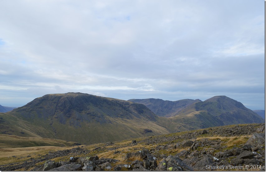
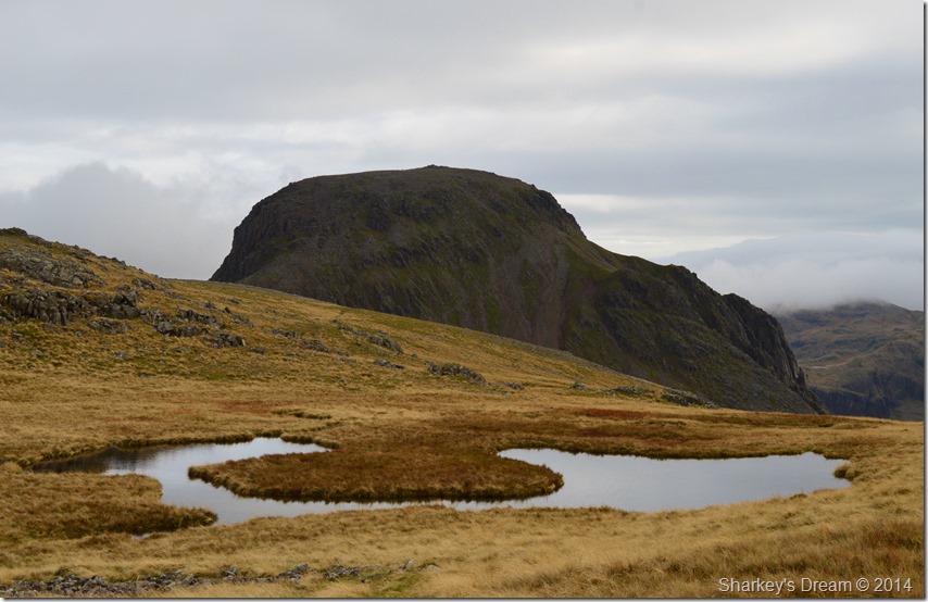
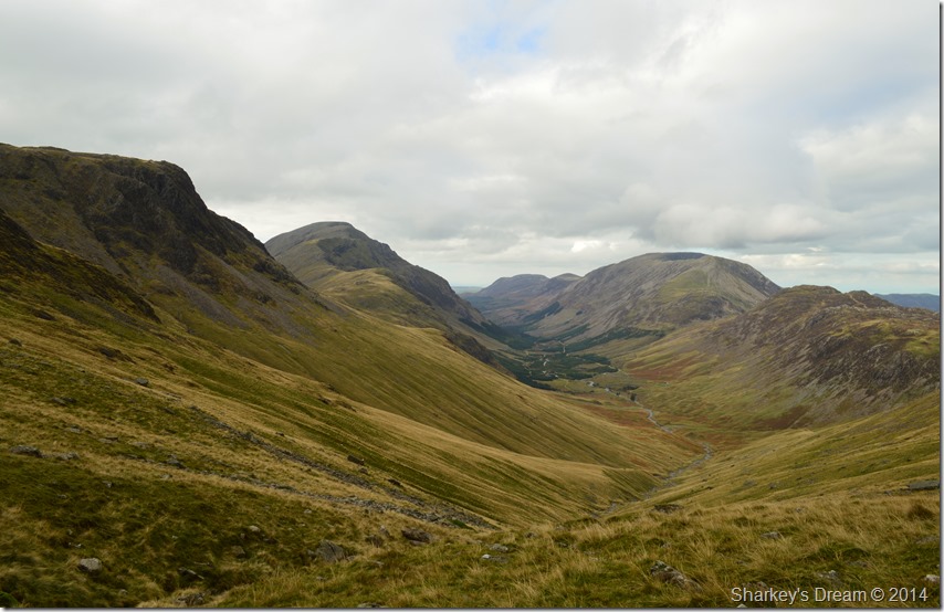
This is Great Gable and Kirk Fell from Honister Mine. |
|
Wainwright Guidebook Seven |
 |
| The Western Fells |
-Kirk Fell:
Bland the southern aspect may be, but the dark north face is very different. Here, shadowed cliffs seam the upper slopes in a long escarpment, a playground for climbers, above rough declivities that go down to the Liza in Ennerdale. Linking with Great Gable is the depression of Beck Head to the east; westwards is a counterpart in Black Sail Pass. And between is a broad undulating top, with tarns, the ruins of a wire fence, and twin summits: on the whole a rather disappointing crown for so massive a plinth. |
 |
|
| |
|
Overview |
|
|
| Ascent: |
3,600 Feet 1,098 Meters |
| Wainwrights: |
5, Grey Knotts – Brandreth – Green Gable – Great Gable – Kirk Fell |
| Summits Visited: |
6, Grey Knotts – Brandreth – Green Gable – Great Gable – Kirk Fell (North Top) Kirk Fell |
| Weather: |
Overcast With Light Showers Not Amounting to Much, Brisk Winds Across The Summits With Sunny Periods Towards The End of The Walk. Highs Of 15°C, Lows Of 10°C |
| Parking: |
Honister Slate Mine |
| Area: |
Western |
| Miles: |
9.7 |
| Walking With: |
On my own |
| Ordnance Survey: |
OL4 |
| Time Taken: |
7 hours |
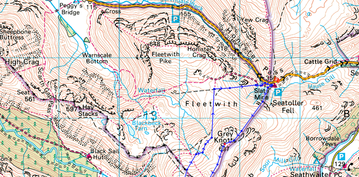
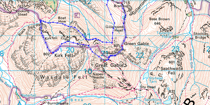
| Route: |
Honister Pass – Grey Knotts – Brandreth – Green Gable – Windy Gap – Great Gable – Beck Head – Kirk Fell (North Top) – Kirk Fell – Black Sail Pass – Kirk Fell North Traverse – Beck Head – Moses Trod – Drum House – Honister Pass |
|
| |
|
Map and Photo Gallery |
|
|
  |
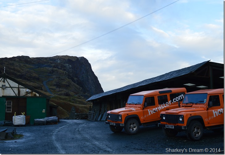 |
Fleetwith Pike & Honister Crag from Honister Mine 08:30 10°C |
I was a little behind schedule by the time I reached Honister due to getting stuck behind two lorries carrying wide loads along the A66. This meant I was trailing half an hour behind which didn’t really matter just more of an inconvenience really.
Although the sun had been up an hour already I kitted up under a mix of grey & hints of sudden blue skies only for the latter to be dashed by the strong winds that carried the clouds quickly across the morning sky.
I lace up to the sound of a generator humming away in a large shed with a dimly lit light, One of the large wooden doors is half open as I spot a worker scurrying about his morning duties. I unload £5.50 into the parking meter most of which were 50p’s which as you could imagine, left me feeling a lot lighter in more ways than one.
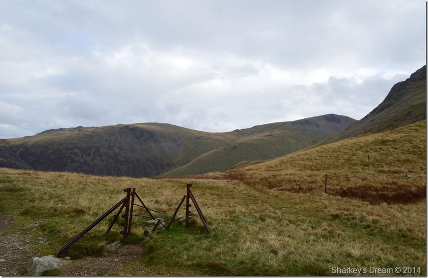
I pick up my path directly behind the car park in search of my first summit of Grey Knotts where I cross over a wooden sty which leads directly onto open fellside. |
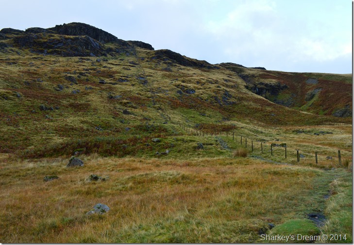 |
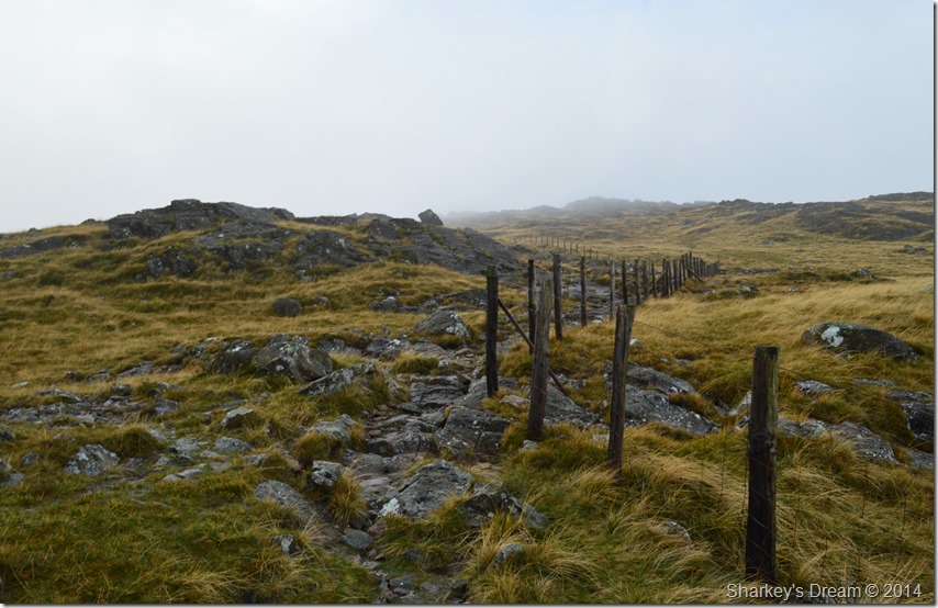
Just follow the fence. |
I have vivid memories of this path which back then the last time I was here it was under three/four feet of snow, my memory was of just how incredibly difficult it was cutting boot holes into fresh snow. They say some routes will always be remembered during which weather you undertook them under which explains why I still cant get those memories out of my head!
Despite the path being pretty steep straight from the car I was quite surprised how quickly I made my way up, even getting a good sweat on in the process.
The path is made of rock pitched steeply & at times an odd scramble is required to heave oneself up, this was made difficult by just how slippery the rock was underfoot, after the third time, I stopped counting how many times I slipped back or performed an acrobatic attempt at the splits. |
 |
Here, looking back over Honister Mine along the Honister Pass through to Borrowdale from my ascent. |
 |
In the other direction, Fleetwith Pike, Honister Crag, Dale Head & Robinson on the opposite side of the Pass. |
 |
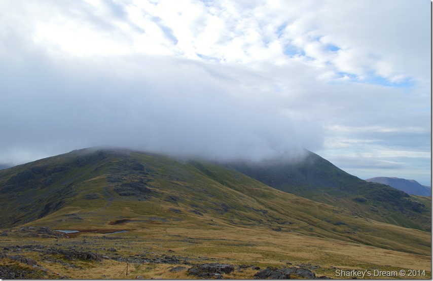
Entering the cloud at around 1,800 feet ASL |
It was around the point that I reached the first shoulder or false summit that I left any clear views behind me as I was presented with swirling cloud sometimes quite thick in places. For me personally I like to split this path up into three, the first of which is what you can see from Honister Mine, the next two sections are shorter than the first but again has that false summit feel to the ascent, the final of course is the summit. |
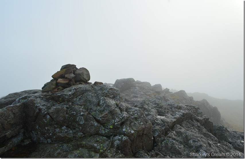 |
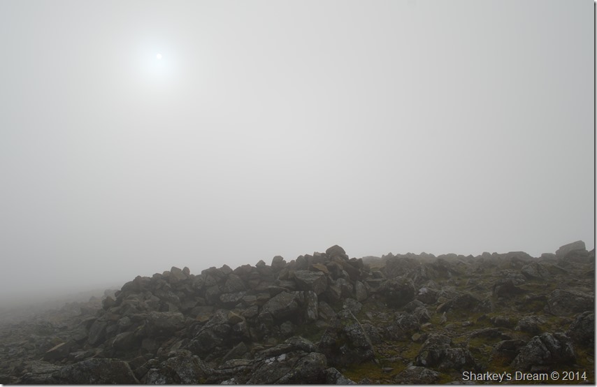
Grey Knotts summit. |
Shortly before arriving at the summit I left the wire fence & broke off right, within fifty yards or so I was at the summit which had another wire fence running south to north surrounding the summit itself, I studied the fence a while knowing full well if I walked further north I would find a sty to cross over, however I spied what seemed to be a new looking sty closer to my location south which I used to gain the summit rock.
Of course I could have just scaled the wire fence, it only being waist height but I think my ‘upper regions’ had seen quite enough activity with my attempts on doing the splits just a short while ago!
Sadly summit time was brief due to lack of visibility, however all was not lost as I spied my path which ran either side of a wire fence all the way to Brandreth. |
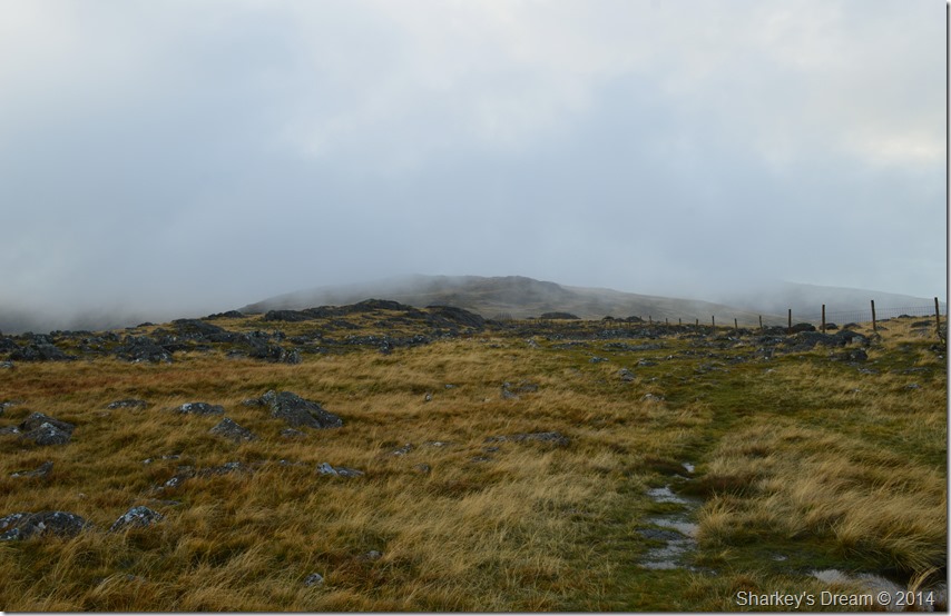 |
Brandreth is seen during a clearing in the clouds. |
Either side of the wire fence good paths can be found, I suspect they are used ‘directional’ |
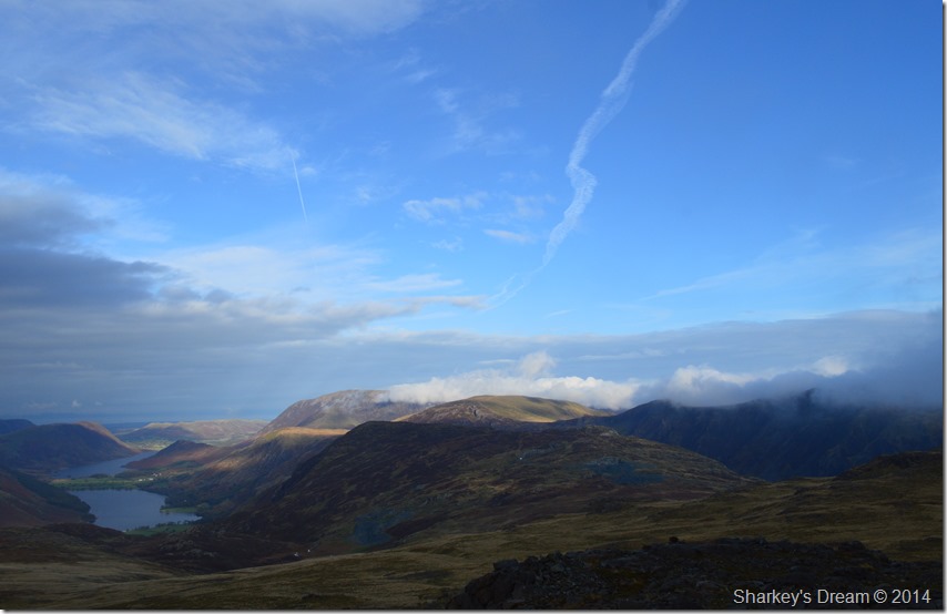 |
Here looking over Fleetwith Pike towards Robinson & Grasmoor while down below Buttermere, Crummock Water, Rannerdale Knotts & Mellbreak can be seen all the way through to the the Loweswater Fells. |
It was no use I had to down pack to take out my Hat & Gloves as the wind started to nip at my ears & fingertips, I think I had all but forgotten what it felt like to hear & feel a strong cold wind through a woolly hat.
Bliss. |
 |
Pillar, Scoat Fell Red Pike (Wasdale) in front of Brandreth summit cairn. |
Although the cloud had cleared the wind was bitterly cold, the light in contrast was amazing & atmospheric. The cloud scurried across the skies over head revealing a hint of sun only resembled by the faintest of afterglows through the thick cloud. Conditions of which are too difficult to capture with a camera but make days on the fells very remember-able . |
 |
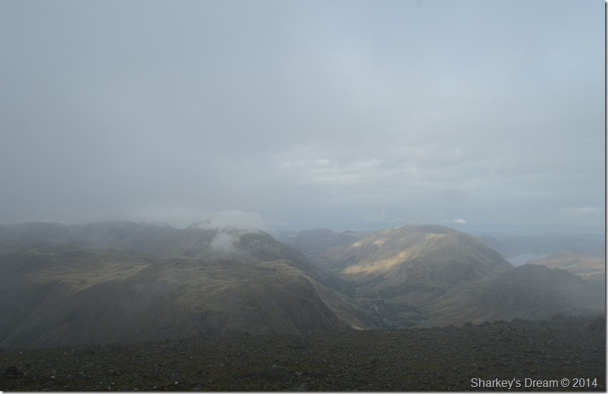
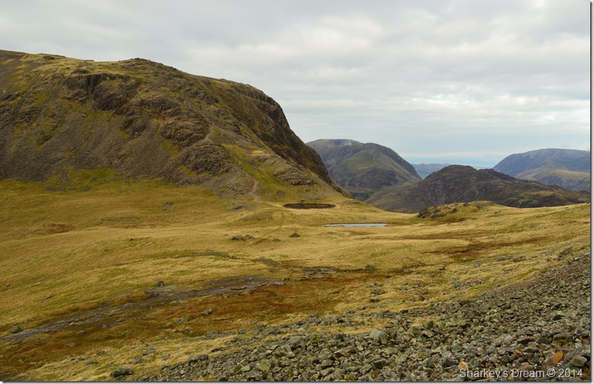
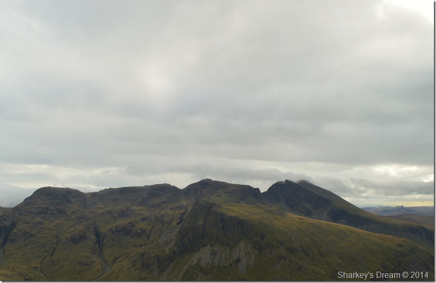
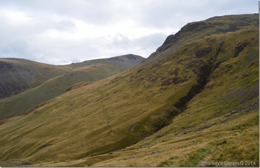
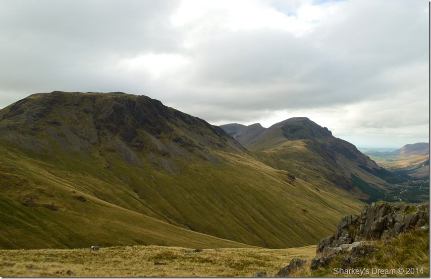
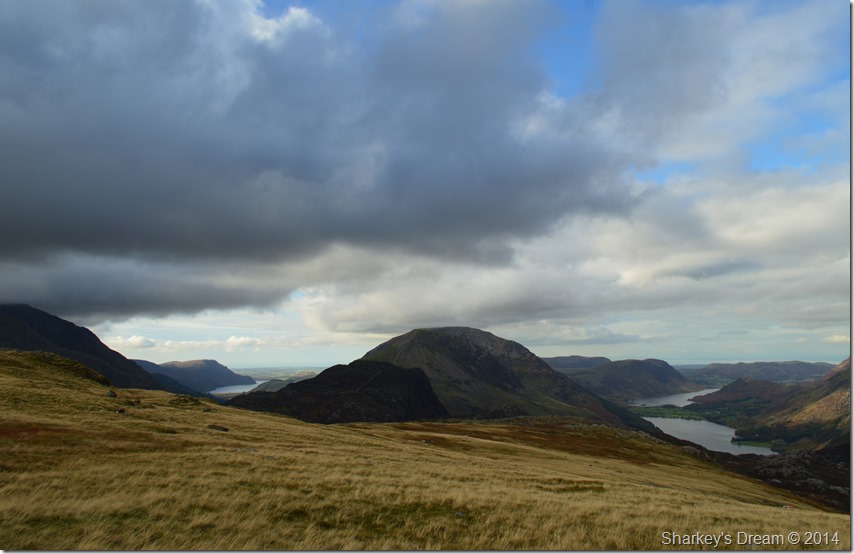
My first real view of Kirk Fell & Pillar as I descend Brandreth. |
Kirk Fell is todays main objective which will be climbed from Beck Head seen as the depression in the far left of the photo. I have climbed Kirk Fell many times & knew of a path known as the North Traverse which runs along the wide expanse of the fell in between the top of the Black Sail Pass & Beck Head. The path isn’t clear in this photo but if you keep your eye level with Beck Head & run your finger towards the top of the Black Sail Pass across Kirk Fell beneath the scree – that’s the approximate location of the North Traverse.
But, all that’s in a while yet, first I have to climb the Gables. |
 |
Green & Great Gable seen over Gillercomb Head. |
 |
Kirk Fell & Pillar seen from one of the un-named Tarns while crossing Gillercomb Head. |
 |
The spectacular hanging valley of Gillercomb seen with Base Brown to the right & the Seathwaite Valley far below. |
From Gillercomb Head I headed off into the cloud in search of Green Gable, the path here is wide & very easy to follow with large cairns lining the route. Shortly before arriving at the summit I sit out a shower in a makeshift stone shelter which could largely be described as a pile of stones, over head a pair of Ravens squawk over the noise of the wind as the rain pelted at my jacket, for those few moments everything felt quite surreal.
The shower soon passed giving me the green light to get up of my comfortable boulder on which I had perched myself upon. Through the cloud a strong sun started to penetrate my ascent towards the last few hundred yards before reaching Green Gable summit. |
 |
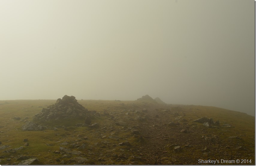
Green Gable summit shelter, as I contemplate another sit down. |
Nahh best not, my bums still numb from the last one. |
 |
Cloud mixes with sunlight as I took on my descent towards Windy Gap. |
During my descent every now & again the cloud would part revealing the large stone cairn at Windy Gap or even the vast vertical crags of Great Gable. It was at this point I resided to the fact that I wouldn’t get no clear views from here on in, then, whilst crossing Windy Gap vague glimpses of Styhead Tarn would appear revealing The Band then Great End, all within moments Styhead opened up before me as a wall of cloud waited precariously to blanket the fells once more. |
 |
A precious moment reveals Styhead Tarn, The Band & a glimpse of Great End summit. |
Moments like these don’t last long, but when they do they are highly rewarding. In great spirit I continue my climb towards Great Gable summit. |
 |
Great Gable summit complete with the FRCC Memorial Plaque. |
Climbing Great Gable in low cloud with a howling wind can be a tad intimidating & I would be lying if I told you otherwise as I familiarise myself with the crags & the little scrambles this intimidation turns to butterflies in the pit of my stomach while all around me, visibility is down to just twenty yards.
At times I would stop for a breather or to check my ascent route then press on until the summit shoulder was reached, no false summits here, just a mass of pulverised rock leading you all the way to the summit. |
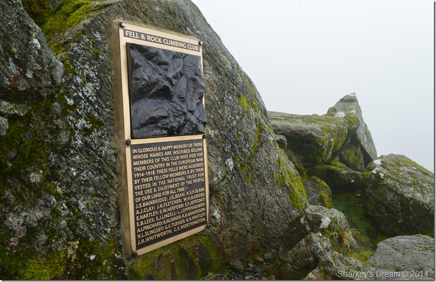 |
The New FRCC Memorial Plaque found at Great Gable summit. |
I found it odd that I experienced little wind whilst at the summit yet below & across the ridges I was reaching for hat & gloves, perhaps the calming effect that Great Gable has on mother nature.
Ashes are scattered below the Memorial together with a wooden cross with a large Poppy placed across the top, after all Great Gable is the fell that the Fell & Rock Climbing Club holds their own Remembrance Day Service here in November.
I am encircled by cloud & with not much wind to push it along I decide to bed down to see if anything transpires while at the same time leaving my own words whilst reading the Memorial Plaque. |
 |
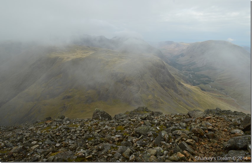
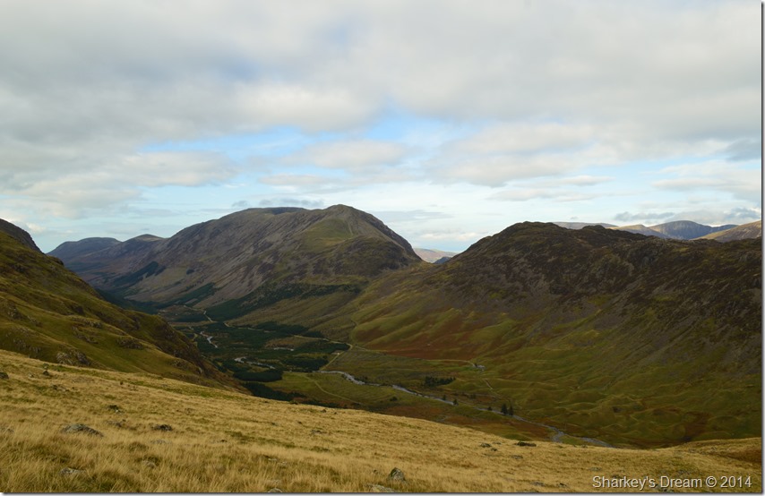
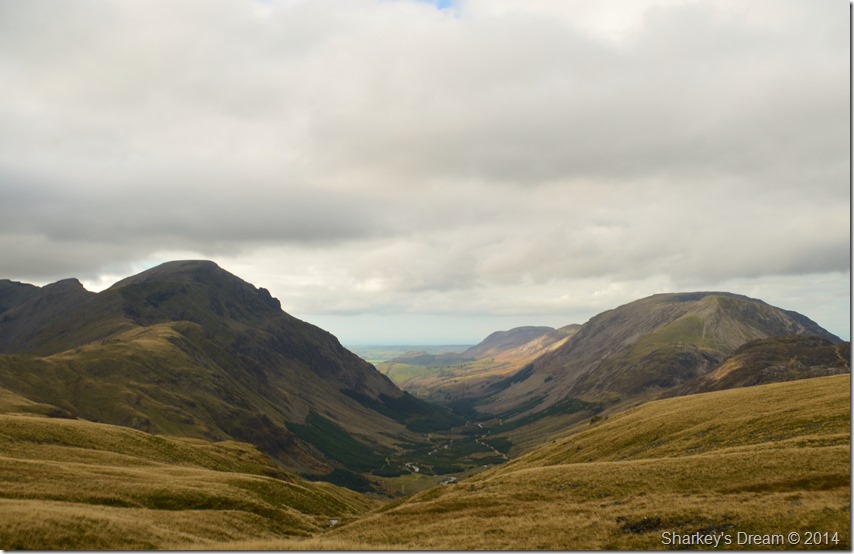
Kirk Fell & the Ennerdale Valley is revealed through the cloud. |
Every now & again the cloud would lift but not entirely although enough to aid my navigation using the stone cairns in the direction of Beck Head & Kirk Fell. I continue to sit out & wait just a few minutes longer it was here the time spent sitting out of the cloud prevailed when all of a sudden Kirk Fell & the Ennerdale Valley opened up, I quickly shouldered pack & followed the stone cairns. |
 |
Kirk Fell appears through the cloud from the start of my steep descent. |
I had an all but clear run whilst following the stone cairns before reaching the top of my descent route which when I look back makes me ponder why I would use this way down again as a much better & less awkward path lay off to the right which follows a natural ridge all the way down towards Beck Head.
I had come mentally prepared especially to take in this rough descent as I knew it would be hard on the knees & testing on the mind. From the top of the path Kirk Fell & Beck Head dominates my descent, below me my path drops away in short zig-zags where the scree was loosened by recent rain causing me to slip or slide in a controlled fashion, this only adding to the shock both my knees & ankles are now taking.
That was the good part of the path which fell away into two close-by scree runs, a large boulder field lay to my left which were about the size of footballs, but I found these unstable before reverting back to the scree. |
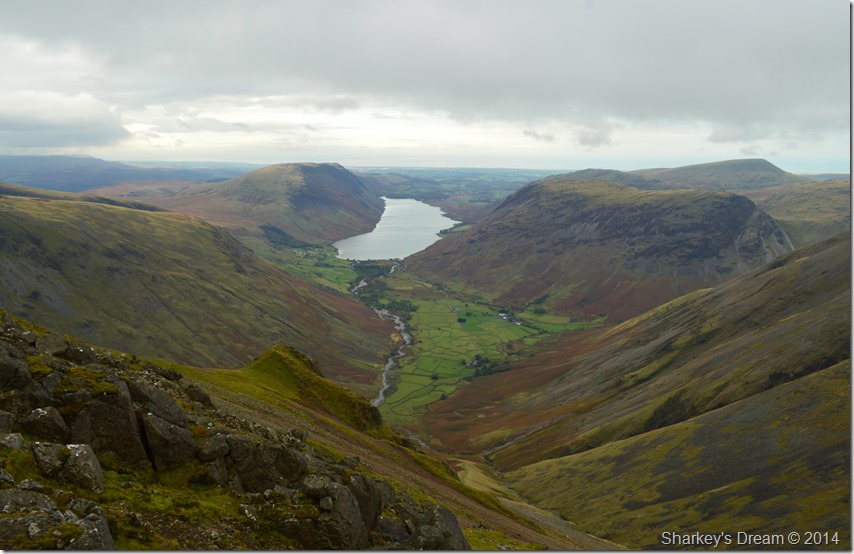 |
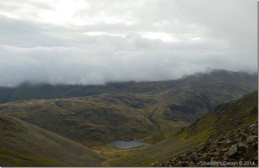
Wasdale Head seen with Illgill Head, Wast Water Seatallan & Yewbarrow from my descent. |
 |
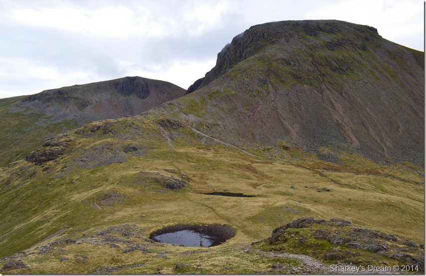
Kirk Fell & Beck Head. |
The sight of three sheep grazing close to where a large erratic boulder stood was my target which progressively got nearer & nearer although at times painfully too slow. |
 |
Rib End, Beck Head & Beck Head Tarns. |
I soon pitched down on the soft grass that Beck Head provided, without looking back I made my way to the large boulder where I de-shouldered my pack & just about readjusted almost all my gear including dropping the trousers to adjust my shorts, whilst I was at it I best pull the socks up too as they seemed to have disappeared somewhere into my boots – who if they could talk, wouldn’t be thanking me right now!
It’s close as dam it to lunch so I take out a sandwich & perch myself down much to the amazement of three of the tamest sheep I had yet to see, if anything one got so close I could touch it, I could only guess it was having a good chuckle at my descent route.
Scafell Pike is partially hidden yet I can see Lingmell & Broad Crag quite clearly, from the Mickledore Ridge up towards Scafell is all but lost beneath cloud but it shows promise, everything just looks a mucky green & brown, the crags mingle & at times I cant tell the difference between rock & grass from my perch here at Beck Head.
I try to pick out The Corridor Route starting at the top of Piers Gill which is quite distinctive even through my mucky green & brown vision, however I gave up as just like Mickledore & everything beneath it gave way to just browns & faded greens.
I couldn’t let myself sit down so with my sandwich in hand I have a wee explore over towards Beck Head Tarns, it was here I spotted the ‘better path’ that I should have used but impatiently didn’t, a few choice words crossed my mind but I certainly wasn’t going to beat myself up over it. |
 |
Green & Great Gable seen over Beck Head as I now take on Kirk Fell via Rib End. |
 |
Once again Both Gables can be seen as I approach Kirk Fell summit shoulder. |
My ascent on Kirk Fell was positively delightful via Rib End, here although the path is quite wide it in places is obstructed by solid rock so alternatively up to three different narrower paths make up the ascent.
After a steady & steep climb the rock gives way for grass which was most welcoming to the pads of my feet, it was here I felt a hint of tiredness creep in during the easy haul towards Kirk Fell secondary summit, its North Top. |
 |
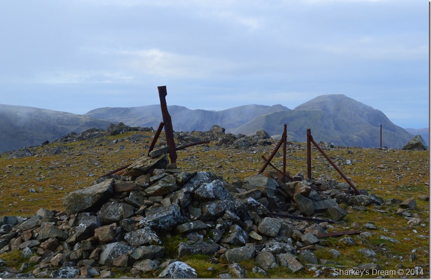
Pillar,Black Crag & Scoat Fell seen shortly after leaving Kirk Fell North Top. |
 |
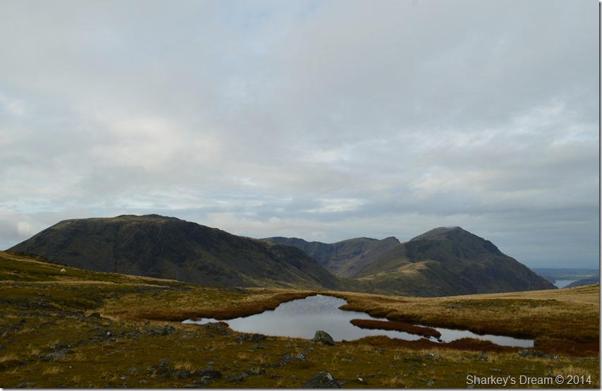
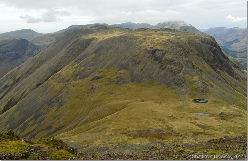
Great Gable from of one of the two Tarns that make up Kirk Fell Tarn. |
I had been really looking forward to the crossing in-between the North Top & the main summit itself which didn’t disappoint although I was left feeling a little empty for reasons unknown once I reached Kirk Fell summit.
It was here I ponder my views which are starting to break up all around me, I decided to have a sit down in the summit shelter but I didn’t stay long due to a cold wind that blew straight in at me from the south west, perhaps this was the reason which left me feeling empty I’m not too sure.
I knew my legs would have appreciated a longer stay but the wind told me otherwise which was in remarkable contrast to the little wind I had experienced on Great Gable only an hour earlier.
With this I set of & follow the old ruined fence in the direction of Kirk Fell Crags. |
 |
Broad Crag, Lingmell & Scafell Pike are now all but clear from cloud. |
 |
Fabulous views over Pillar & the High Stile Ridge. |
I follow the fence before the summit plateau narrows, keeping left here will lead you down Kirk Fell Crags, towards the right, a steep ravine that isn’t on todays itinerary.
Shortly before taking this photo I spot movement coming towards me from the direction of Kirk Fell Crags, we make for each other.
It is a local woman & we are much the similar age, I’m getting out in between school runs she explains, we share out routes before I spot a radio aerial in one of her pack pockets, Oh I’m Mountain Rescue, I’m recruiting wanna join! I explain my situation before she comments, why don’t you move here?
My only answer is I would hadn’t I have the commitments back in Wigan, but one day I will!
We part wishing well on each others day before I reach the top of Kirk Fell Crags. |
 |
Descending Kirk Fell Crags. |
Kirk Fell Crags are a great way to tackle little scrambles which was just what I had been talking about with the woman I had just been chatting too, however descending this way can be a little tricky & one mustn’t be ashamed to use ones arse to descend by.
I follow the path down naturally stopping to gain the best ground using both my walking poles in the process, unlike my descent from Great Gable the path here is prominent with lots of alternative ‘ways around’ the awkward bits.
It was here I cut my teeth with my Ice Axe & Crampons on Kirk Fell crags during winter 2012 which I immensely enjoyed, each year I try to go back but something always gets in the way like lack of snow! |
 |
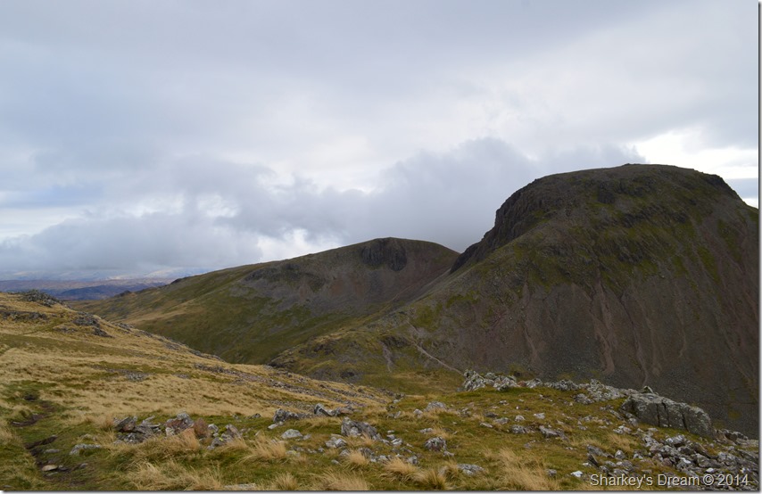
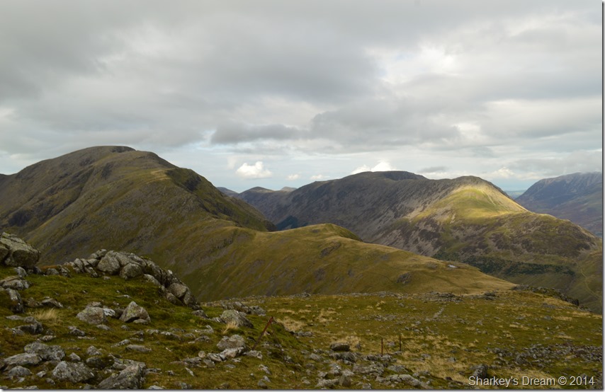
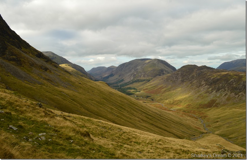
Green Gable & Brandreth viewed from the bottom of Kirk Fell Crags/Top of the Black Sail Pass. |
That’s the North Traverse path leading away around ‘the waist’ of Kirk Fell, huge anticipation follows as this is a brand new route for me. |
 |
Kirk Fell North Traverse. |
But first a little descent is needed where I would cross Baysoar Slack & Sail Beck before re-joining with the North Traverse.
It was here I felt the remnants of a passing shower overhead as large grey cloud now hung high right above Kirk Fell before being carried on by the wind, panic over. |
 |
The Ennerdale Valley with Hay Stacks & the whole High Stile Ridge incorporating High Crag, High Stile, Red Pike (Buttermere) Starling Dodd & finally Great Borne towards the end of the ridge. |
I was now on the main chunk of the North Traverse which as expected had a gentle ascent to it, the path is narrow in places & rocks that have detached from the scree above have to be negotiated. Above the North Traverse Boat How Crags dominate the crossing together with the all too familiar… |
 |
Green & Great Gables over Stone Cove. |
As you can see in the right of the picture the North Traverse passes through slight boulder fields which are easily negotiated, my next step was to figure out my route on how I will reach the bottom of Windy Gap seen here between Green & Great Gable. My objective was to make my way to a section of path around 980 feet (300 meters) below Windy Gap.
My map tells me I should follow the North Traverse back to Beck Head but my legs are telling me different as that route would involve a short ascent up via the ridge in the foreground on the photo.
After passing through the boulder field I made my way further along the traverse while trying to gain as much height as possible before making a sharp left off the traverse which would take me directly underneath the fore mentioned ridge.
My route was a little arduous due to the nature of Stone Cove most of which I had to side step in places, what I didn’t expect at such a height was just how spongy the area was which sapped at my energy levels. Directly below the crags I made for a stationary boulder which when I got closer I found a small stone cairn which told me I was following the right course.
The views from Stone Cove over into Ennerdale made up for those awkward side steps. |
 |
The Ennerdale Valley from Stone Cove. |
My of the track traverse was well rewarded. |
 |
Seen again after crossing below Windy Gap. |
 |
Kirk Fell & Pillar over Stone Cove. |
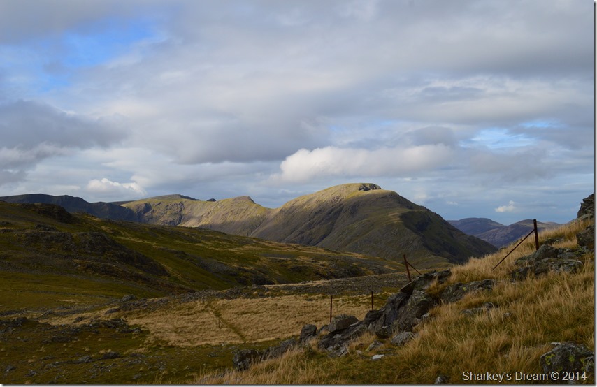
After reaching my destined path below Windy Gap I headed north west on a section of path known beautifully as Moses Trod, here my path flanks me beneath Brandreth before heading a more lenient north beneath my first summit of the day, Gray Knotts. |
 |
Kirk Fell & Pillar from Moses Trod. |
 |
The Ennerdale Valley from Moses Trod. |
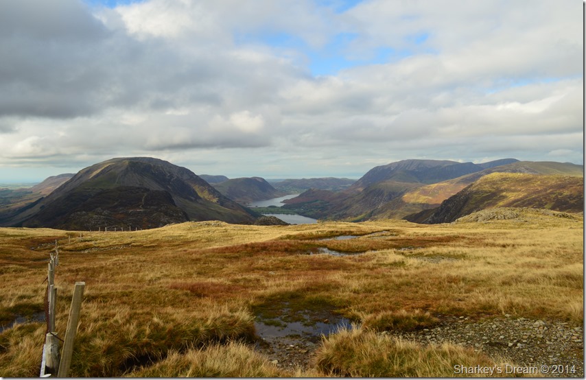 |
The Buttermere Valley from Moses Trod. |
I came to a cross roads in my path where I headed a sharp right towards a wooden stile that crossed a wire fence, behind me Great Gable summit can still be seen & so can Kirk Fell but they are disappearing slowly beneath a mix of cloud & low light. |
 |
Both the Ennerdale & Buttermere Valleys in one photo. |
Note how Ennerdale seems higher than the valley of Buttermere, the difference of which is that Ennerdale is approximately 50 feet ASL higher than that of Buttermere.
Now that’s a David Hall fact! |
 |
Descending back to Honister Mine. |
 |
Robinson seen from the top of the Honister Pass. |
Small figures descend Fleetwith Pike as a Land Rover kicks up a dust cloud making its way to the spoil heaps situated below Fleetwith Pike summit followed shortly afterwards by a large tourist bus not half full.
Although my mileage is kept relatively low in todays walk the arduous descents from Great Gable & Kirk Fell begin to show as tired muscles begin to ache, more so at the pads of my feet. My trousers show all the signs of a great day on the fells as do my boots who still haven’t forgiven me yet.
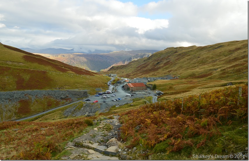
Honister is buzzing even though its midweek, lots of Mini Buses are parked on the car park as the tourist’s buy souvenirs from the mine shop, other tourist’s sip at tea on the benches outside as I walk by where it always takes me to a scene years ahead when I wonder one day, is that going to be me. |
|
| |
| Back to top |
 |
|
