|
Raven Crag & Castlerigg Stone Circle |
 |
 |
7th September 2014 |
 |
|
Today’s walk saw me team up with Shaun Church on a pre-arranged walk whilst Shaun is holidaying in Lakeland this week, I say holidaying, what I actually mean is Shaun will be spending every minute of his spare time narrowing the gap on his last remaining Wainwrights.
We arranged to first meet at the Little Chef situated on the A66 which was convenient for the both of us as Shaun was traveling from Carlisle & me, the south. We arranged to meet at around 07:45am thus giving us ample time to take the twenty or so minute journey to Castlerigg Stone Circle where we would leave our cars before taking time out to explore the stone ring, because let’s face it, no matter how many times you may or may not have visited Castlerigg, one thing for certain is you will never tire of it, nor the secluded valley of Shoulthwaite which still remains & will always be, a personal favourite valley of mine.
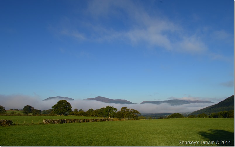
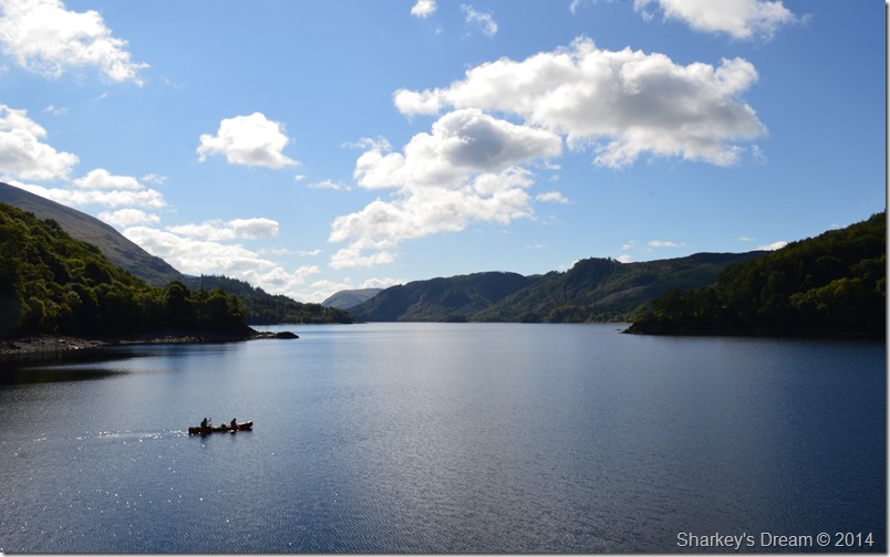
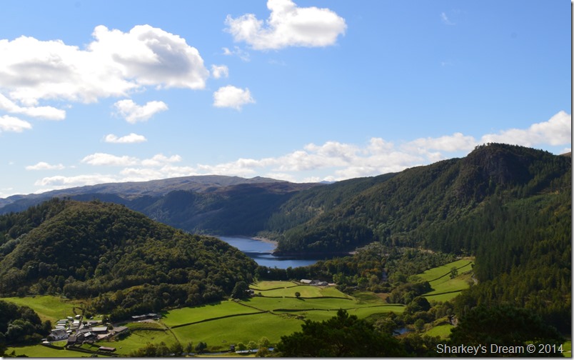
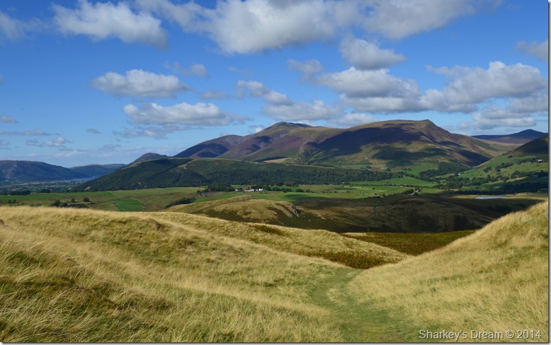
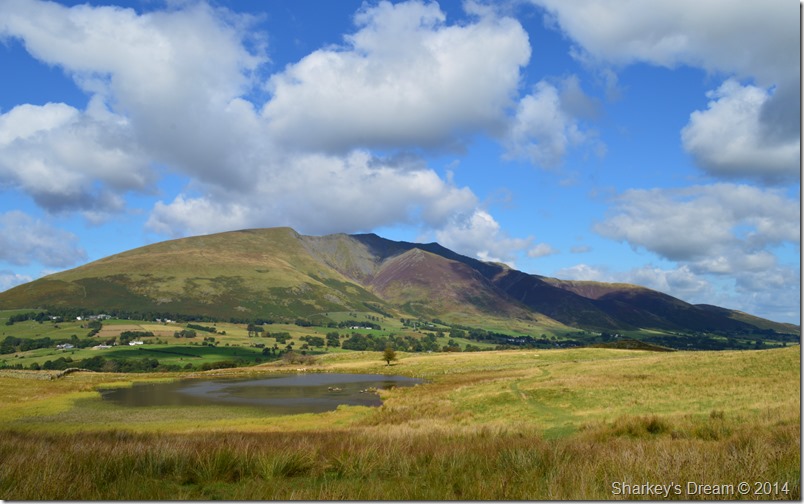
This is Raven Crag from Castlerigg Stone Circle. |
|
Wainwright GuidebookThree |
 |
| The Central Fells |
-Raven Crag:
One of the many dozens of Raven Crags, best known of all, and the subject of this chapter, is the mighty buttress of grey rock towering above the Thirlmere Dam. The vertical face of the crag, now receiving the attention of expert rock-climbers, is a truly formidable object, standing out starkly from the dense surround of plantations. |
 |
|
| |
|
Overview |
|
|
| Ascent: |
2,215 Feet – 675 Metres |
| Wainwrights: |
2, Raven Crag – High Rigg |
| Weather: |
Warm & Sunny Highs Of 19°C, Lows Of 7°C |
| Parking: |
Car Parking Spaces, Castlerigg Stone Circle |
| Area: |
Central |
| Miles: |
9.7 |
| Walking With: |
Shaun Church |
| Ordnance Survey: |
OL4 |
| Time Taken: |
7 Hours |
| Route: |
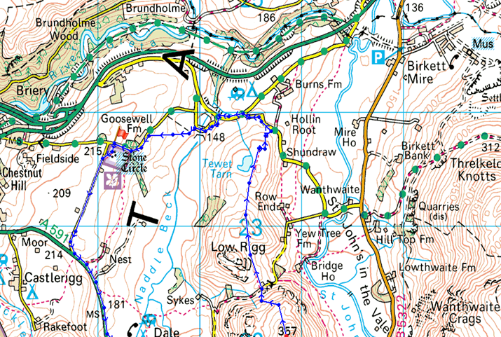
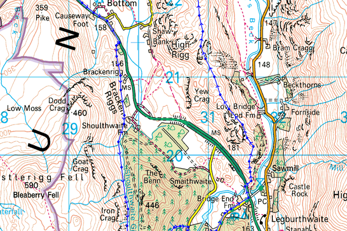
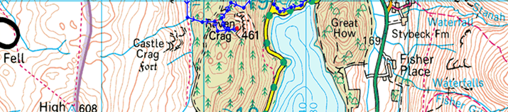
Castlerigg Stone Circle – Castle Lane – A591 – Nest Brow – Brackenrigg – Shoulthwaite – Shoulthwaite Gill – Castle Crag (fort) – Raven Crag – Thirlmere Dam – A591 – St Johns Beck – High Rigg – St Johns-in-the-Vale Church – Low Rigg – Tewit Tarn – Naddle Bridge – Goosewell Farm – Castlerigg Stone Circle |
|
| |
|
Map and Photo Gallery |
|
|
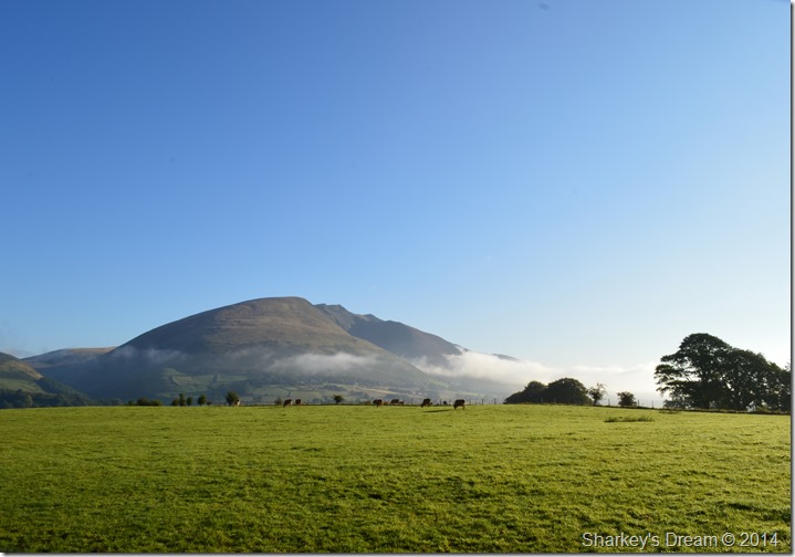 |
| Blencathra from Castlerigg 08:14am 7°C |
After a firm handshake Shaun & I were soon on our way to Castlerigg taking note of just how well that early morning light was developing along with pocketed banks of temperature inversions that lingered around the Park.
It wasn’t long before we found ourselves at Castlerigg taking care to park the cars both facing back towards the A66 ready for the great escape later once the narrow lanes here at the Castlerigg soon start to resemble Asda on Christmas Eve, yes, it really does get that busy here!
I was already wearing my boots as I kitted up back at the Little Chef given my early arrival, Shaun didn’t take long to lace up as we both locked the cars before taking a brief look at my jacket in the boot before closing it…safe in my wisdom that I needn’t pack it today such the confidence in the sky’s above. |
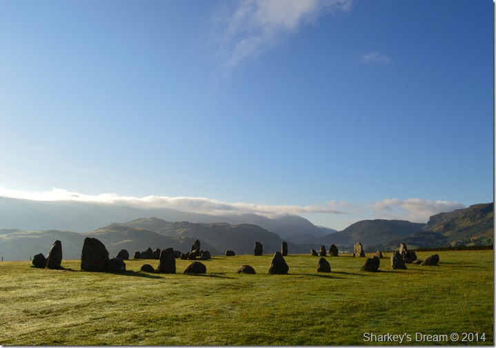 |
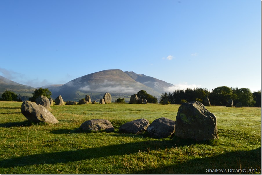
| Castlerigg Stone Circle. |
It seemed such a shame to disturb the morning dew but it couldn’t be helped as we made our way to the Stone Circle, it was only after taking this photo did I realise that a woman was standing in it, well at least we thought it was a woman, it could of been President Obama.
See if you can spot her… |
 |
| Autumn Equinox. |
| Or just playing about with the camera. |
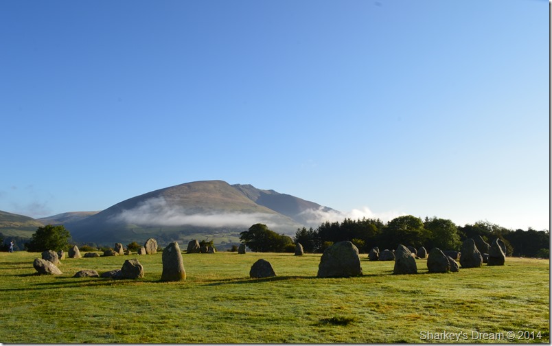 |
| Blencathra from Castlerigg Stone Circle. |
It’s hard to imagine that Castlerigg Stone Circle pre-dates Stonehenge by about 1,000 years making Castlerigg one of the oldest Stone Circles in Europe.
Although its origins are unknown Castlerigg was probably used for trading, religious ceremonies, and tribal gathering, one of the most fascinating facts about Castlerigg however concerns the largest of the stones which creates a shadow nearly a half-mile long at sunset on midsummer’s day.
By now the woman who Shaun thought was ‘possibly meditating’ had left the Stone Circle & was making her way to the step stile situated out of shot to the left of the circle, she gave us a brief wave before coming to a halt by sitting half on – half off the stone wall as if to say goodbye to the Stone Circle.
There were many moments that I took away from todays walk, being here at Castlerigg under such fantastic conditions was just one of them.
We also make our way to the stone step stile. |
 |
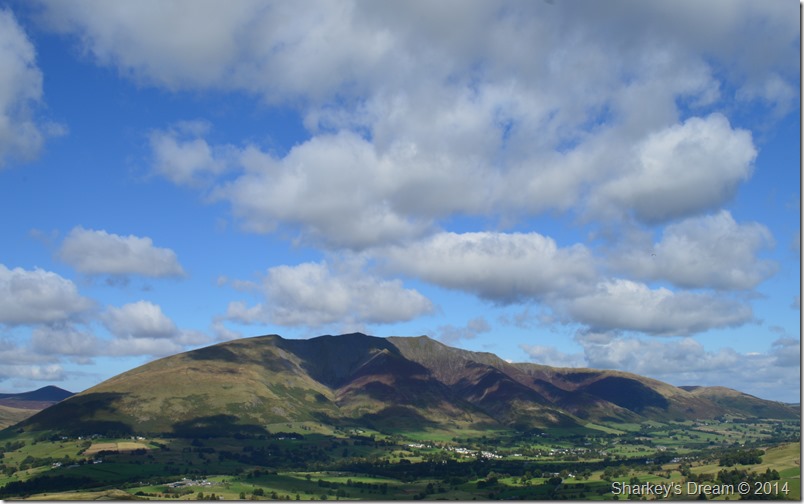
| The Coledale & Lord Seat fells taken from Castle Lane. |
We hopped over the wall to find another cloud inversion running parallel with Bassenthwaite Lake & the north western fells which was steadily starting to lift as the morning temperature began to rise.
Behind our position, the sun was still low & struggling to penetrate the low bank of cloud that hung over the Dodd & Helvellyn range making the landscape seem more surreal & extremely atmospheric. |
 |
| Here, looking back on Blencathra from Castle Lane. |
Blencathra stole the show this morning, indeed for much of the walk as we took in Castle Lane towards the A591.
With memories of Walla Crag just the week earlier, now set aback a perfect blue sky it was difficult not to imagine the huge contrast between my last walk & todays, there’s plenty of talk of an Indian Summer let’s hope today is the shape of better things to come before we finally bow out to Autumn. |
 |
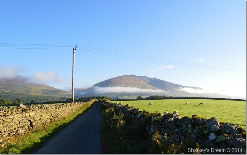
| A591 at Nest Brow. |
At the end of Castle Lane we crossed the A591 & headed for Nest Brow as the road winded its way down towards Stanah & Thirlmere, here our path is narrow so we walk & talk in single file.
As the morning progressed the A591 understandably was getting busier which meant ‘Dad Runs’ across the busy road as often the path would run out only to restart on the other side of the road where more single file natter ensued.
Much of our path was grass underfoot which meant our boot toe gaps received a generous soaking as we walked over the morning dew. Still in conversation in the back of my mind I was looking out for the wooden Sty & gate that would lead us eventually through to what I consider to be one of Lakelands hidden gems.
Best not miss that Sty then eh. |
 |
| Time to leave the A591 & hop over the wooden Sty. |
| The Sty was soon reached cloaked heavily in stinging nettles at the base so as you can imagine alot of care was taken crossing the Sty as both Shaun & myself were both in shorts. |
 |
| Heading for Shoulthwaite. |
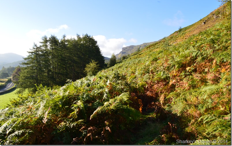
Once over the Sty we followed the path that lent its way past a pasture before heading through a gate, it was here our views opened up into a distant Shoulthwaite valley & not to mention, some of the highest & wettest bracken I have had to contend with.
‘Bigging’ Shoulthwaite up was my job as I hadn’t stopped talking about it since the day we planned the walk a couple of weeks ago, ‘you’ll love Shoulthwaite I would say to Shaun’ & indeed he would have hadn’t he found the need to completely dry out first.
I couldn’t help feel a sense of guilt after leading Shaun through the sometimes shoulder high bracken with a generous mix of brambles that snagged at our wet clothing & left blood dripping down bare legs, to keep momentum up Shaun would often here me say ‘not far now’ without any incline nor sighting that the bracken was coming to an end, here Shaun accidently dropped his camera which meant a gut wrenching search until Shaun finally found it again, then back into the abyss of the bracken, long trousers were a must, so was a raincoat, non of which we had with us.
The bracken continued for approximately one mile, still, I felt the need to keep momentum, which I did.
‘Not far now’
I think in the end Shaun wanted to stick his walking pole where the sun didn’t shine! |
 |
| High Rigg from Brackenrigg. |
| |
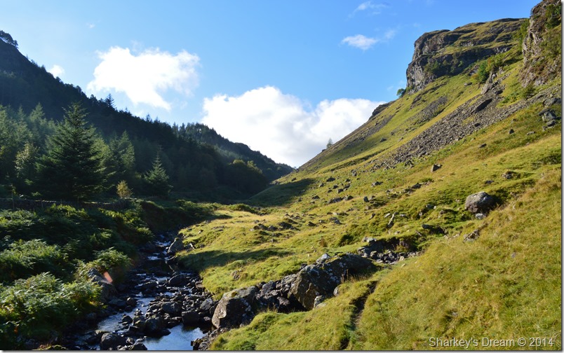 |
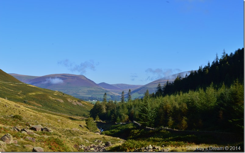
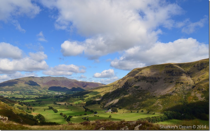
| Looking along Shoulthwaite Gill from the bridge with Iron Crag on the right and Castle Crag on the left. |
The path finally started to climb coinciding with the sound from Shoulthwaite Gill, weren’t ‘literally’ out of the woods yet as the bracken was starting to test ones patience.
Slowly but surely the bracken gave way for a single track that ran high along the gill, after a little height gained wide vistas into Shoulthwaite valley suddenly opened up, the scenery was fantastic but it was time to take a look at the battle scars that the brambles had left behind & maybe let the sun dry out the shorts, base layers & underwear.
Welcome to Shoulthwaite!
Large Pine trees scatters the east escarpment of the valley with only Castle Crag Fort seen at the valley head, to our right flank Goat & Iron crag dominate the shoulders of the fell side, ahead, a single track that ran besides a sparkling Shoulthwaite Gill almost welcomes the walker to take in the valley and take out, one of the best of the not so known Lakeland valleys.
By now, the bracken & brambles were almost a distant memory, however the wet boxer shorts still remain.
I did say almost… |
 |
| Iron Crag. |
| |
 |
| Here, looking back on Lonscale Fell & Great Calva as we start to climb. |
We were to soon leave Shoulthwaite Gill behind by the gentlest of inclines where the valley became much narrower, here the pathway ahead winds its way around large static boulders before emerging by an ruined stone sheepfold, our options remained fixed on making our way to the valley head where we would cross Shoulthwaite Gill by a stone wall which ran east to west via Mere Gill.
To our left a tall wooden Sty cut through the high deer fences which was also an option, both routes I had previously used to gain Castle Crag Fort.
What do you think Shaun? shall we cross the Gill here & follow the deer fence where eventually it would meet up with our optional stone wall route, yeah it cuts the last section out, and a nasty steep climb too from the Gill.
With this we cross Shoulthwaite Beck via placed stepping stones & made our way towards the Sty where we opt out of crossing due to a lack of path on the other side (although on closer inspection I think it was more high wet bracken that saw us not to cross) We’ll stick to ‘this side O’ fence eh’
It was a steep last pitch but manageable as we made our ascent via the ‘wrong side of the fence’ of which I wholly take the blame. By the time we could walk no further without fear of descending back down towards the Gill it was now time to cross the deer fence which by luck had a cross section of sturdy wooden stakes making up part of the structure.
We had no option other than to scale the fence at its strongest point. |
 |
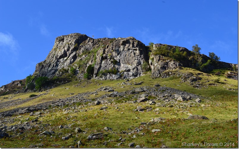
| A quick ascent on Castle Crag Fort. |
After crossing the deer fence we made our way over a recent felled area of Castle Crag, here we stuck to the highest ground if only to avoid walking through the deadwood that scattered the ground underfoot.
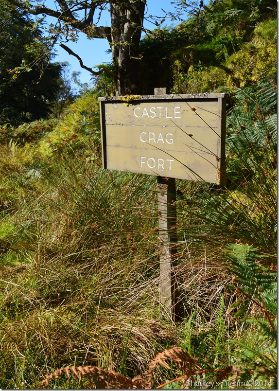
Within moments we soon came across the wooden sign at the foot of Castle Crag Fort there after picking up the footpath that lead towards the summit.
We opted for a small break but we didn’t down packs or even sit down for that matter, our views extended in a panoramic fashion but gaze was surely fixed over Shoulthwaite with the mass of the northern fells just beyond. |
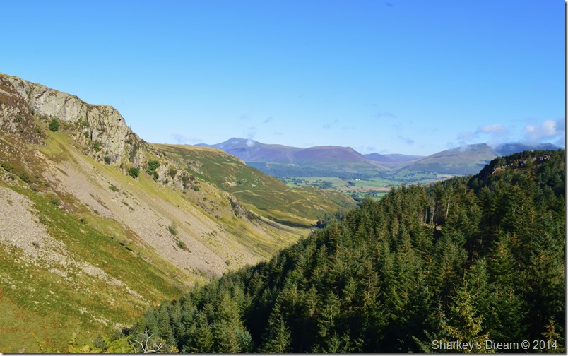 |
| Views back along the valley from Castle Crag Fort with Sippling Crag (The Benn) over on the right of the photo. |
It was great to see that uninterrupted line or ‘The Trough’ that runs from Great Calva through to Dunmail Raise sadly though, our views didn’t extend that far, for now anyway.
We speak about a possible summit on Sippling Crag seen as the tree covered summit in the foreground of the photo, Sippling Crag extends as a subsidiary summit north of Raven Crag as the views over Thirlmere more than equal those of Raven Crag.
Before we leave Castle Crag we spot numerous walkers all heading for Raven Crag summit emerge from the forestry track below, one half of me tells me they’re just like myself & Shaun, the other, my selfish half tells me the large group is about to hog Raven Crag summit just before we were due to arrive.
I keep quiet as we press on. |
 |
| Taking on the forest track towards Raven Crag. |
I note to Shaun that just over a year ago this side of the fell was inaccessible due to the large amount of trees that had blown over during a storm, today now that the debris have been cleared all that is left are the tree stumps once marking where tall Pines once stood.
Just below the summit we hear voices, then from around a corner emerges the gang of walkers we saw heading for the summit from our perch upon Castle Crag, we pass on our pleasantries & get them back in return.
With the summit in sight beyond through a batch of trees Shaun’s left foot takes a dive up to a beyond the heel, we could her the slurp as Shaun pulled his boot out, not to mention the smell that came with it.
Shaun heads for the long grass. |
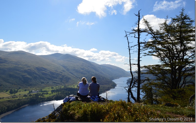 |
| All the seats were taken! |
After passing the summit cairn we dropped down below to gain the best vantage point only to realise that it, had already been taken by two very polite women who offered their view so I could take some photos, I declined, not because I didn’t want to but because it was so nice of them to offer.
Besides, there’s an equally better viewing area a little lower down. |
 |
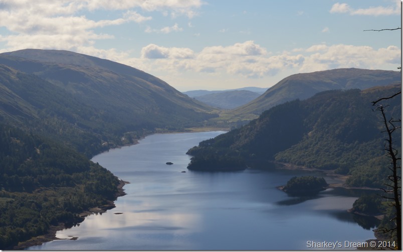
| Thirlmere seen with Raise & Brown Cove Crags above Thirlspot. |
I made my way over to a small outcrop of rock close to the edge of the summit to take a few photos, it was only after realising just how close I was did I get a little wobble fully knowing that I was stood a little too close for comfort to a vertical drop.
Shaun soon joins me as I inch my way to a safer point where we decide, even though it’s only mid morning that… |
 |
| It’s time for brunch. |
| Thirlmere Dam & Great How from our brunch spot high above Thirlmere. |
 |
| Clough Head, Calfhow Pike & Great Dodd from Raven Crag summit. |
| |
 |
| A close up of Dunmail Raise over Thirlmere from Raven Crag. |
| |
 |
| The scarred trees found on Raven Crag. |
I’m not exactly sure what happened to a number of trees that are found below & to the side of Raven Crag summit which on first inspection look like they show the scars of fire but are more than likely the results of yet another bad storm that seems to devastate the open fell side more often than any other summit as I can think of.
After saying goodbye to the two women we pick our way back up to the summit & head across the summit shoulder (Shaun giving the boggy section an extra wide berth) before taking on the path down to Thirlmere Dam.
It was here we passed more & more walkers all heading for the summit as more pleasantries are passed. During our descent we pause to look back at the impressive outcrop of crags that makes the summit of Raven Crag so imposing, enough to put the hardened rock climber off maybe…
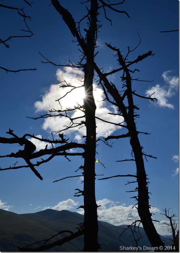
Through the trees sunburst illuminate the forest with paths of light when suddenly we heard a roar of engines before the sight of six Red Arrows all flying in V Formation passed over our heads, within seconds they were gone, the memory of which however, stayed much longer.
Shaun’s only words as we witnessed a supersonic streak of red white & blue was… can you imagine what the sight must have been like from the summit as they flew above Thirlmere.
It felt like a sucker punch as we had only left the summit not five minutes earlier.
We press on towards the Dam road. |
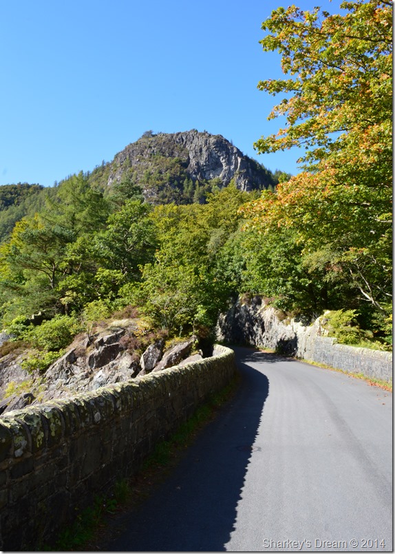 |
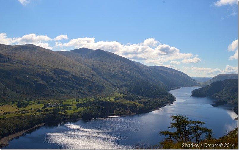
| The vertical east face of Raven Crag from Thirlmere Dam, Autumn seems just around the corner. |
| |
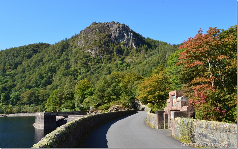 |
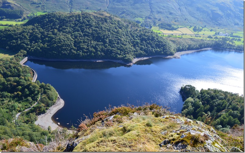
| Raven Crag seen from the Draw Off Tower & the Manchester Corporation monument. |
Shaun hadn’t crossed the Dam before so alot of time was spent exploring the structure noting the steep walls of the Dam as they disappear below the waterline on one side & vertically into the wooded area seen in the right of the photo which host the Valve Houses.
Before we had managed to cross the Dam we had the chance to witness a Vintage Triumph Car Rally which crossed Dam road one by one, it was great to see old classics like the TR5’s, TR6’s & TR7’s all of which were in concourse condition with the exception of a few valve stem oil seals that needed replacing going off the amount of blue fumes that trailed behind.
On a whole within the last half hour we had just witnessed British Engineering at its best which was just another great highlight of the day. |
 |
| I’m not sure if that’s legal in a reservoir… |
| |
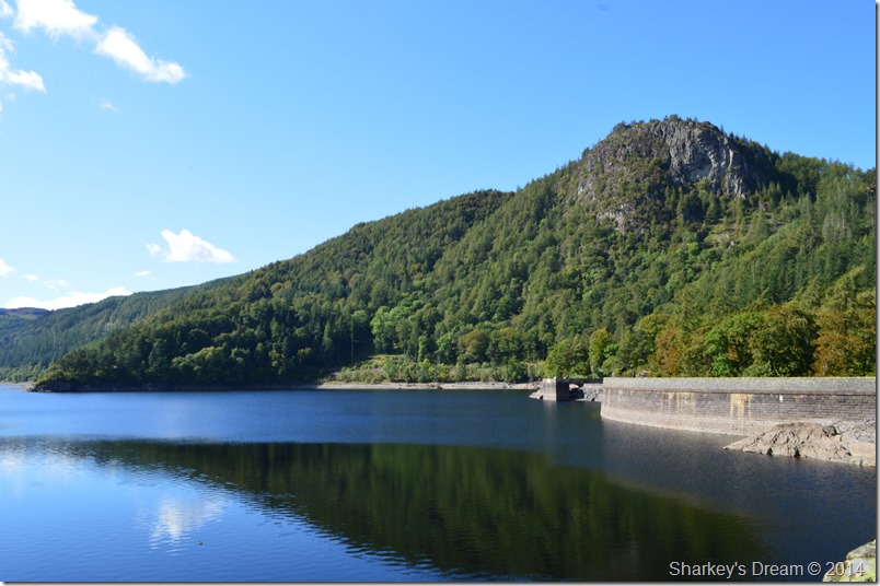 |
| Raven Crag & a rather low Thirlmere water line. |
In this photo of Raven Crag you can see the waterline against the Dam wall & just how far it has dropped during 2013/14
I’m sure the winter rains will help to top up not just Thirlmere but alot of the other lakes which are all looking incredibly low this time of year. |
 |
| Crossing the A591 close to Bridge End Farm. |
Shortly after leaving the Reservoir road behind we soon caught up with the A591 once again where we crossed the road & made for a large wooden sty situated just over a youthful St Johns Beck.
After hopping over the Sty it was time to take on High Rigg via a winding path which is largely covered by trees. It is almost midday & the sun is starting to get very hot leading us to believe that we are walking through a summer heat wave & not at the start of September, pretty unseasonable but all together perfect for the time of year.
Incidentally, that’s Raise, White Side, Helvellyn Lower Man & Helvellyn you can see in the left of the photo with Sticks Pass in the foreground. |
 |
| High Rigg & the High Rigg ridge. |
Once the height was gained we crest the ridge shoulder we soon had the summit ridge before us. High Rigg can be a little deceivable in appearance as end to end the whole ridge measures almost two miles in length.
Best get cracking then. |
 |
| Here, looking back over Bridge End, Great How, Thirlmere & Raven Crag from the Wren Crag/High Rigg. |
| |
 |
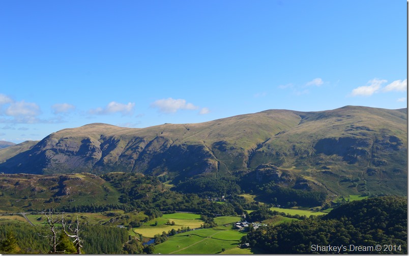
| Bram Crag (Clough Head) St Johns-in-the-Vale & Blencathra as we take in Long Band/High Rigg. |
| |
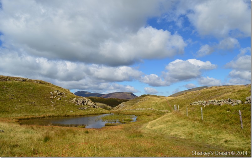 |
| Passing by this un-named idyllic tarn, not to far from the summit now. |
| At almost half way across the ridge we passed the small un-named tarn, in winter a sure place to avoid owing to just how wet & boggy this area can get, today however, we didn’t have that problem. |
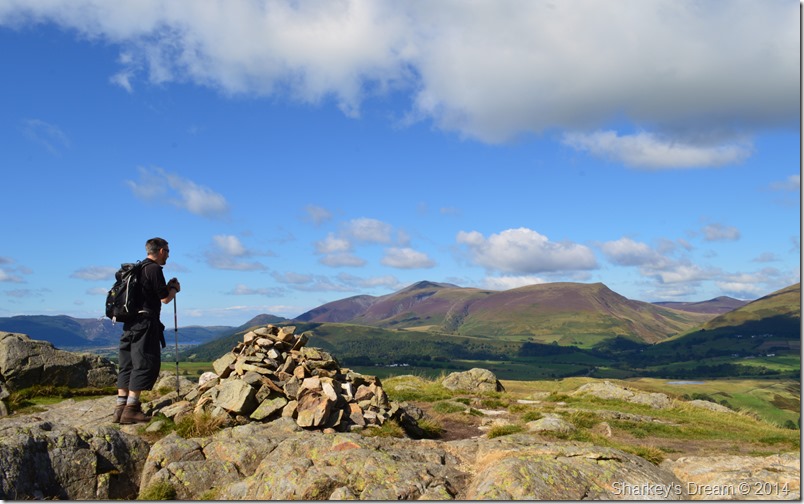 |
| Shaun admires the Skiddaw fells from High Rigg summit cairn. |
| The summit crossing isn’t without its crest that are un-avoidable & not really too tiring even after a long walk such as ours. By the time we reached the summit we joined a large group of walkers who were sat down admiring the views. Shaun & I had already spoke about our next stop which was going to be close to Tewit Tarn a little under a mile ahead. |
 |
| Distant views over Latrigg, Skiddaw & Lonscale Fell as we make our descent. |
| |
 |
| Blencathra taken during our steep descent from High Rigg. |
We took in the descent overlooking St Johns-in-the-Vale Church while superb views over Blencathra took the mind of the steep path.
After leaving our descent behind we momentarily passed the old Church where Shaun reminded me of how one Christmas Day he spent midnight mass there, I guess for us ordinary folk that would have been a spectacular event, but for a Priest such as Shaun it must have felt like all you love about life, was just under one roof.
We press on over the stone stile to take on Low Rigg. |
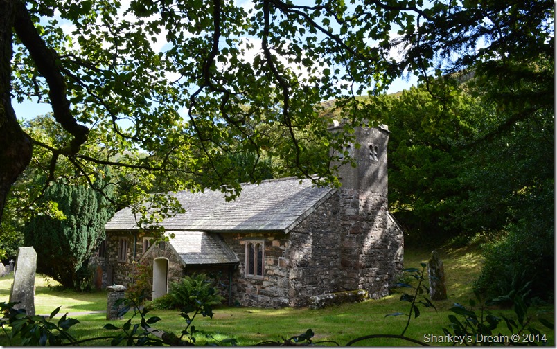 |
| St Johns-in-the-Vale Church. |
| |
 |
| Latrigg, Skiddaw & Lonscale Fell. |
| |
 |
| Blencathra from Tewit Tarn. |
| Tewit Tarn was soon reached where an outcrop of rocks seemed to have our names on them, it was here we sat down if only to take in the views over Blencathra in almost silence. |
 |
| Lonscale Fell, Skiddaw & Latrigg from Tewit Tarn. |
| |
 |
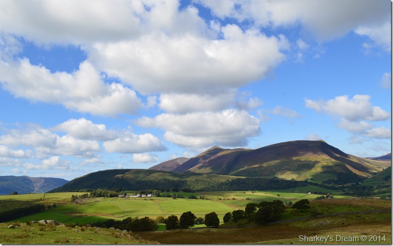
Following the footpath towards Goosewell Farm. |
Our walk was almost coming to an end after leaving Tewit Tarn before taking on the quiet lanes & crossing Naddle Bridge. It was shortly afterwards did we take a left through a wooden gate through the open fields towards Goosewell Farm, it seemed the word spectacular had one last treat in store for us as we again heard the roar from not jet, but propelled aircraft engines.
From the north flew two WW2 Avro Lancaster Bombers each boasting four Rolls Royce engines producing 1,750 horse power each. In vain I reached for my camera but such was the angle from the sun all I managed was distant silhouettes as the Bombers glided effortlessly towards Thirlmere, another treat for anyone on its satellite fells.
It’s difficult to conclude just how well todays walk went from the dew covered grass, the clear clarity of the skies or the British Engineering that shone through on what would have already been a great walk taking in all that Lakeland has to offer. |
 |
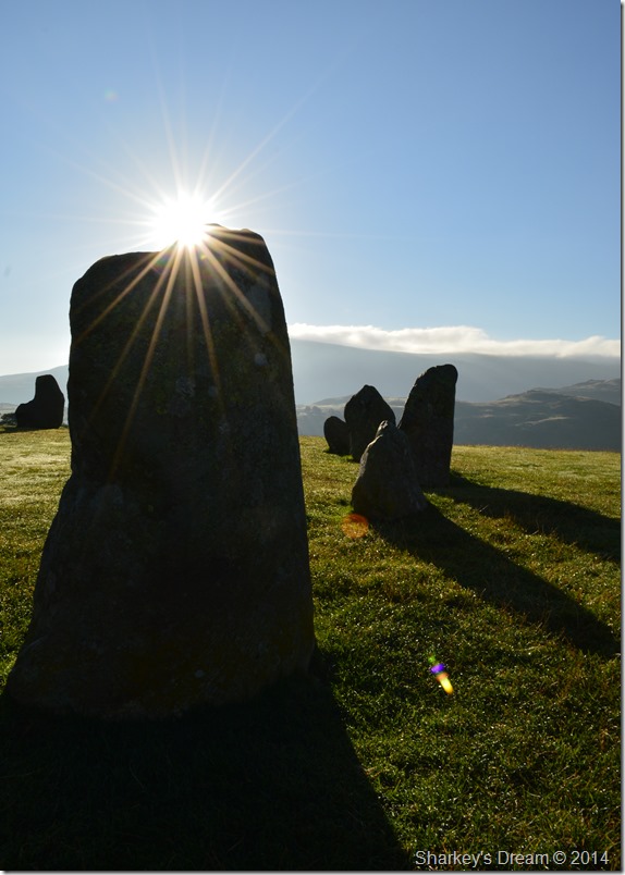
| Casting shadows with views towards Blencathra from Castlerigg Stone Circle. |
| |
|
| |
| Back to top |
 |
|