|
Mardale Ill Bell via the North Ridge |
 |
 |
24th August 2014 |
 |
|
I hadn’t planned to walk today at all, in fact, it was only when my daughter asked for a lift this morning did I realise just how nice the day was turning out, it was 10:05am.
After dropping my daughter Paige off I drove home thinking that I just couldn’t miss this bright spell, two days in a row as it happens. In my head I had already made the decision to head back north, I also knew exactly where I wanted to be.
After clearing my hasty decision with the wife I soon found myself throwing my kit in the back of the car, most of which had only just come out the night before, spare socks were rationed yet this time unlike yesterday, I didn’t make the decision to wear long trousers so out came the shorts.
By 10:35am I was steadily heading north through the Bank Holiday traffic, my journey to Mardale was only going to take me an hour & a half which by my calculations should see me arrive just gone midday. |
|
Wainwright Guidebook Two |
 |
| The Far EasternFells |
-Mardale Ill Bell
Of the many excellent climbs available from Mardale Head the direct ascent of Mardale Ill Bell ranks high, the walk being favoured by two of the finest tarns in Lakeland, each set amongst crags in wild and romantic surroundings. |
 |
|
| |
|
Overview |
|
|
| Ascent: |
2,240 Feet – 683 Meters |
| Wainwrights: |
2, Mardale Ill Bell – Harter Fell (Mardale) |
| Weather: |
Overcast & Sunny Intervals , Highs Of 18°C Lows Of 16°C |
| Parking: |
Car Park, Mardale Head |
| Area: |
Far Eastern |
| Miles: |
5.5 Mile |
| Walking With: |
On My Own |
| Ordnance Survey: |
OL5 |
| Time Taken: |
3 Hours 30 Minutes |
| Route: |
Mardale Head – Mardale Beck – Dudderwick – Blea Water – Blea Water Dam – Mardale Ill Bell north ridge – Piot Crag – Mardale Ill Bell – Nan Bield Pass – Harter Fell (Mardale) – Gatescarth Pass – Harter Fell Gully – Mardale Head |
|
| |
|
Map and Photo Gallery |
|
|
 |
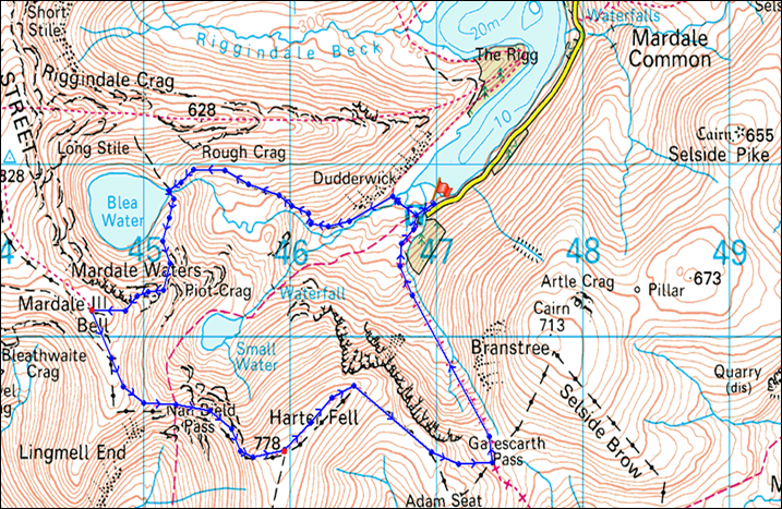
| High Street, Wood How (Island) The Rigg & Harter Fell seen from the Haweswater Road, 12:08pm 16°C |
Within what seemed no time I was driving a long the Haweswater Road questioning the fact if was I ever going to get a parking spot due to my late arrival, this however didn’t matter as I stopped the car to take this photo of my beloved High Street seen here as Rough Crag descends towards the tree covered Rigg.
Numerous cars by now were passing me & yet again I wondered where they taking the last of the available parking spaces, yet from my perch, it didn’t really matter, High Street was simply to hard to ignore. |
 |
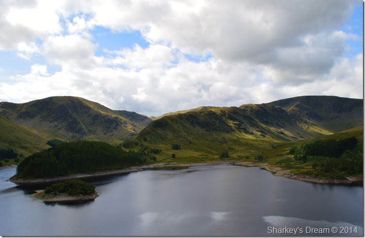
| A close up of Low Raise seen with Castle Crag Fort. |
As I set my gaze west towards Low Raise & what once was the craggy hill top incorporating Castle Crag Hill Fort seen here in the foreground of the photo.
In the year 1366 the Kendal Archers who were famously led by Captain Whelter ambushed Scottish raiders and buried them in the hollow below now aptly named, Whelter Bottom. |
 |
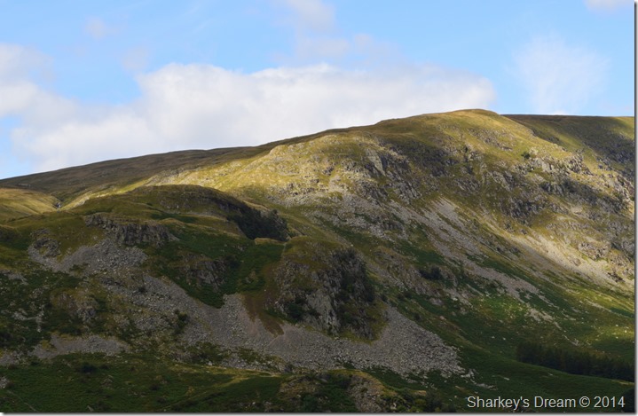
| Mardale Ill Bell (L) High Street (C) Kidsty Pike (R) & The Rigg (Foreground) |
Before getting back into the car I couldn’t resist taking this photo of High Street’s Rough Crag ridge seen here with the plantation of Conifers that densely populate The Rigg.
Okay, it’s now time to find that parking space. |
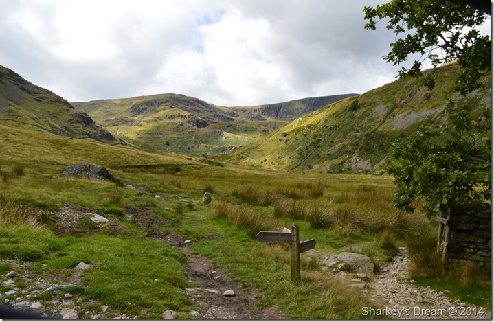 |
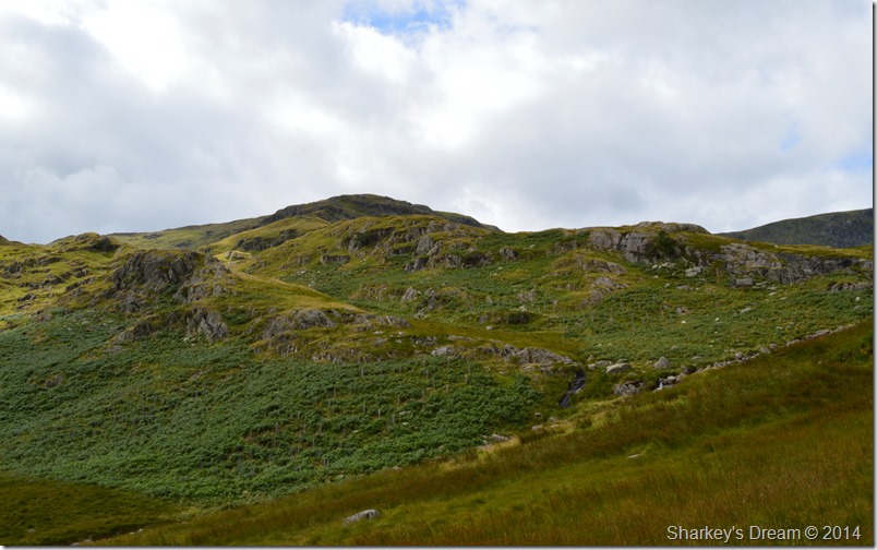
| Mardale Ill Bell seen shortly after leaving the Car Park at Mardale Head. |
I knew that parking so late into the day at Mardale Head might prove to be difficult, what I didn’t expect was to see the Car Park so full it meant like many others that I had to park back on the Haweswater Road a good few hundred metres away from the actual car park, such the popularity of the fells this Bank Holiday weekend, however, I couldn’t & indeed didn’t grumble as most of the other drivers’ camaraderie didn’t go un-noticed as like me, all they wanted to do was enjoy a day on the Mardale fells.
I soon found a parking spot formed behind a line of cars all pointing up the lake a couple of hundred metres or so from the car park. I’ve been here in Mardale when I had the whole valley to myself under the bleakest of grey monotone skies & I’ve been here when it’s busy, yet I’ve never struggled, nor had to park so far away due to such popularity of the Mardale fells today.
Only a few hours ago while hurrying around kit in hand I had the genius idea to drive in my walking boots, something that I frequently do, normally on the return journey though, today my bright idea to save time went to waste as I had clean forgot which meant my North Face mids get kicked off rather than untied.
It didn’t save much time at all, yet in my head it kinda did!
With this the car boot gets closed & the car is locked as I throw my pack over my shoulder at the same time narrowly avoiding other motorist’s intent on trying to find a parking place. My pack is loose over just the one shoulder, feeling a little claustrophobic I await until I have reached the far side of the car park where most of the mayhem is now behind me.
It is here I shoulder pack & tie down before getting caught behind two chatting ladies who eventually form a gap & let me through.
It was also the spot where I get my first view of Mardale Ill Bell. |
 |
| Mardale Ill Bell seen shortly after leaving Mardale Head car park. |
A subsequent breath of air leaves my lungs followed by a sense of relief as I fear I have just encountered a mild version of claustrophobia, all of which is left behind once I spy my route on how to reach Mardale Ill Bell’s north ridge, sadly not seen in this photo, here we are looking at the west ridge as the north ridge, together my intended route is out of sight, for now.
I take a right and follow the stone wall over looking the head of Haweswater who’s low water line is beginning to look all to familiar, a brief view of the Mardale Old Road where horse & cart once tracked confirms this.
After a short walk Mardale Beck is soon reached, this is the point for me to head left by means of the wide wooden footbridge designed to take what ever Mardale Beck can throw at it, however today, that thought is a world away as I stop to admire Harter Fell seen shortly after crossing Mardale Beck. |
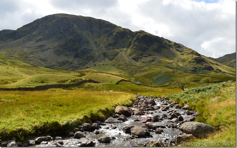 |
| Harter Fell seen from Mardale Beck. |
| The huge mass of Harter Fell forms the head of Mardale seen here under a brilliant afternoon sun, it wont be too long until I’ll be up there looking back down over Mardale Beck & my route through Dudderwick. |
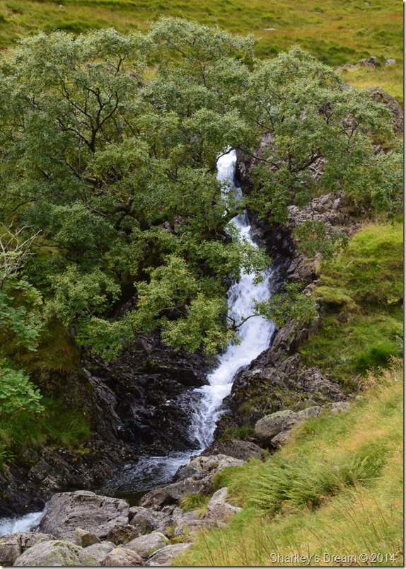 |
| Dodderwick Falls from the path. |
| Soon after crossing Mardale Beck Dodderwick Falls are reached as the sound from the gushing waterfall can be heard well before it is seen, the cover from the trees not really helping matters, still, a lovely & secluded spot to take in Mardale even when the valley is as busy as it is today, I still had the whole place to myself. |
 |
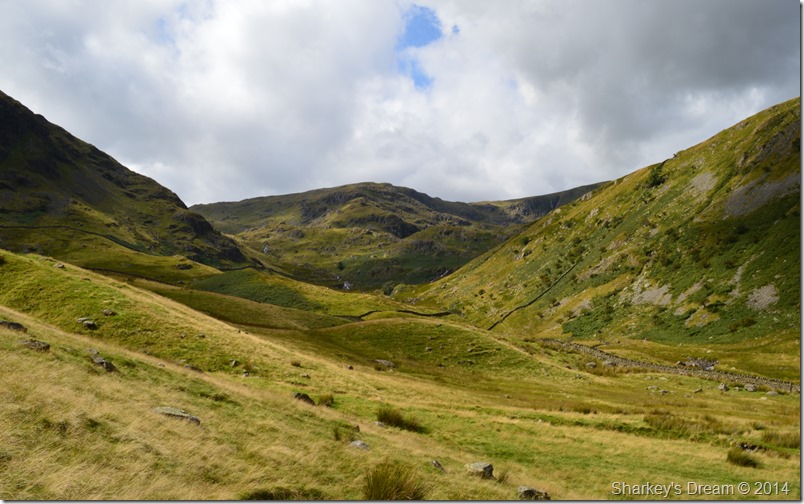
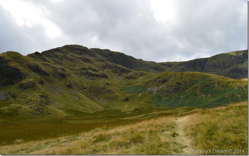
| Mardale Ill Bell seen with the east ridge. |
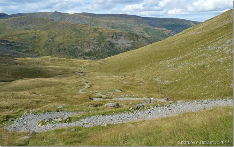
| With Swine, Heron & Eagle Crag above my right flanks I soon reach Dudderwick from where I could get my first view of Mardale Ill Bell’s east ridge, as tempting as it looks however I have to track a little further until the north ridge comes into view. |
 |
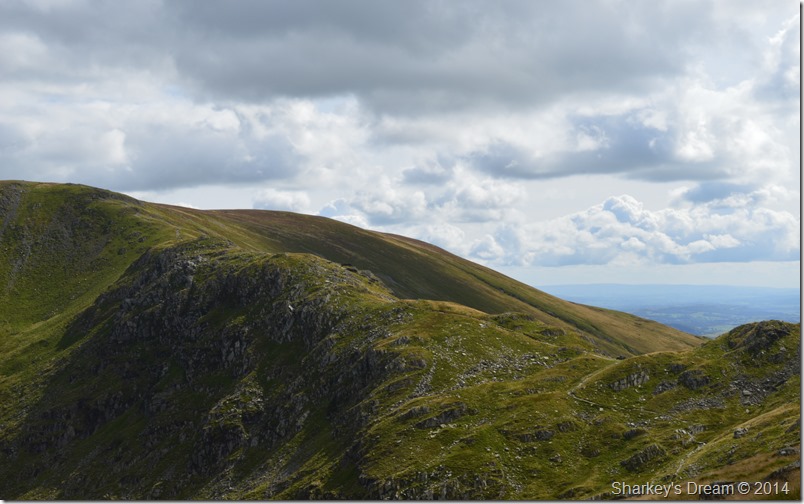
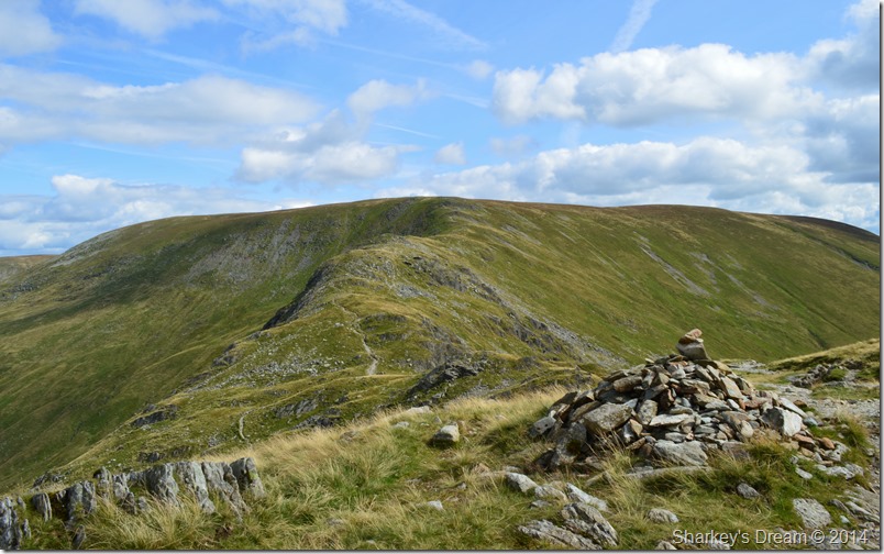
| The north ridge soon comes into view with the east ridge off to the left. |
Both the east ridge seen (L) and the north ridge (R) split from the upper reaches of Piot Crag seen in the centre, rather like a ducks foot!
I continue to climb steadily passing through a wooden sty, from here my path underfoot progressively gets much wetter as I spy feeder paths that avoid the much more boggier areas, these of course take a little time to negotiate as the paths pass through long grass, but I guess it’s much better than filling your boots with bog water!
Despite the wet conditions my eyes are averted to the north ridge which I can see much more clearly once the bulk of the east ridge is passed.
Before me, I try to pick up anything that may resemble a path from ‘this side’ of Blea Water which will connect me with the ridge but I fail in doing so. Ahead my grassy path continues staying right of Blea Water Beck. |
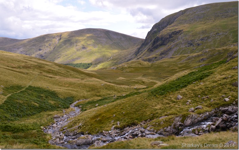 |
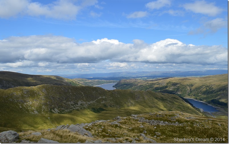
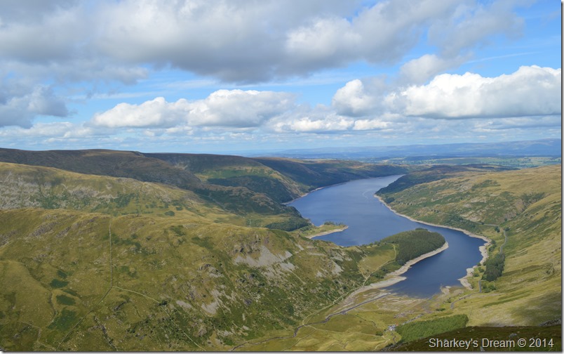
| Here, Looking back over boggy ground towards Harter Fell & Branstree from Blea Water Falls. |
| Harter Fell together with Branstree dominate my views as I look back over Mardale Head, between both Harter Fell & Branstree the Gatescarth Pass can be seen which I will traverse once Harter Fell has been summited. |
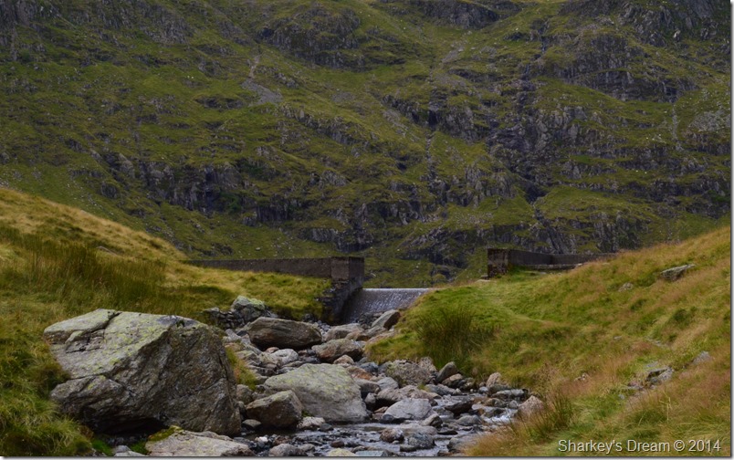 |
| Blea Water Dam. |
My path continues to rise besides Blea Water Beck until finally Blea Water Dam comes into view. For now the sun has gone in & it seems to have clouded over a little prompting me to take of my Bloc Billy sun glasses.
From high above, the Rough Crag ridge continues in an almost parallel line until the ridge starts to ascend sharply onto High Stile, the last section of the High Street Ridge. |
 |
| High Street north face taken from the shore path. |
Once the Dam was reached I scurry along the narrow shore path if not only to take in the views surrounding the corrie, here the north face of High Street looks menacing & far out of reach of the average walkers capabilities, that is not to say however, it cannot be scaled…
Not unlike Long Stile… |
 |
| The Long Stile ridge seen over Blea Water. |
| By far the gentlest approach to High Stile is via the Blea Water ascent seen here as a narrow path flanks its reaches until the ridge ahead is reached at a col near Gaspel Gate Tarn. |
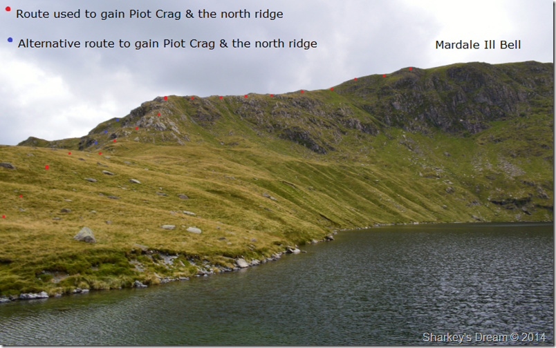 |
| In the other direction, Mardale Ill Bell north ridge. |
Before crossing the Dam I took in some exploration time on which ascent I would make the north ridge by, from the Dam a direct ascent over the rock rib seen at the base of the ridge looks far more daunting than it actually is, it was here I also picked out the alternative ‘grassy rake’ route seen to the left of the rock rib.
It’s only when you get beneath the crag do you realise that the ascent is nowhere near as daunting as first thought, in fact it looks quite fun, but more on that in a little while. |
 |
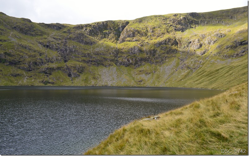
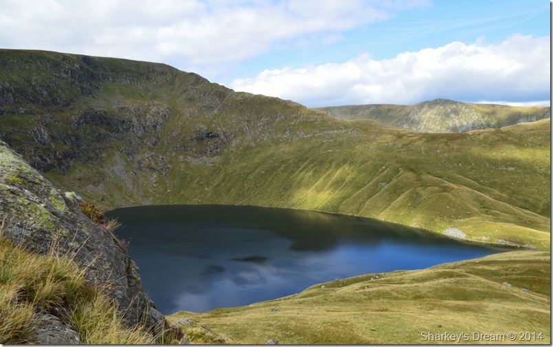
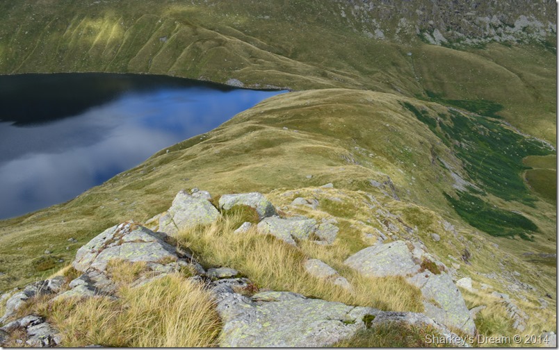
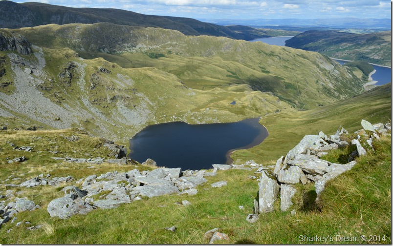
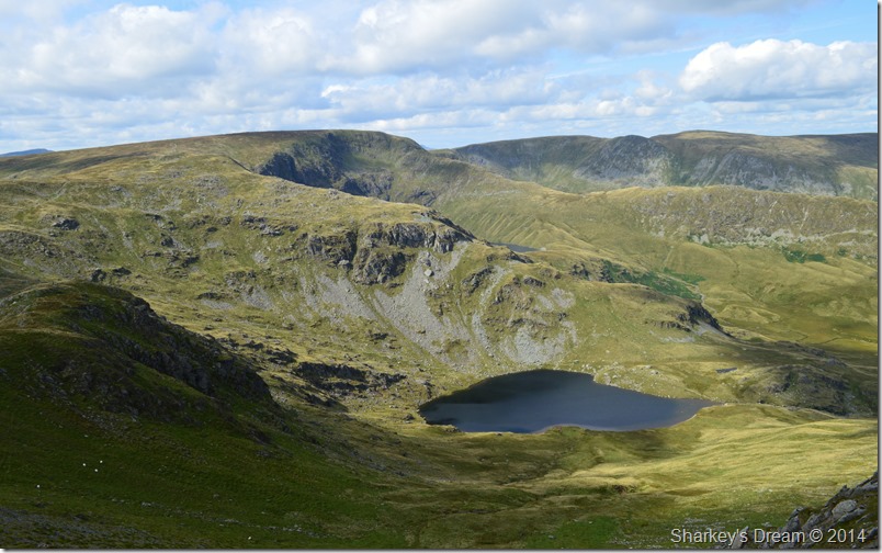
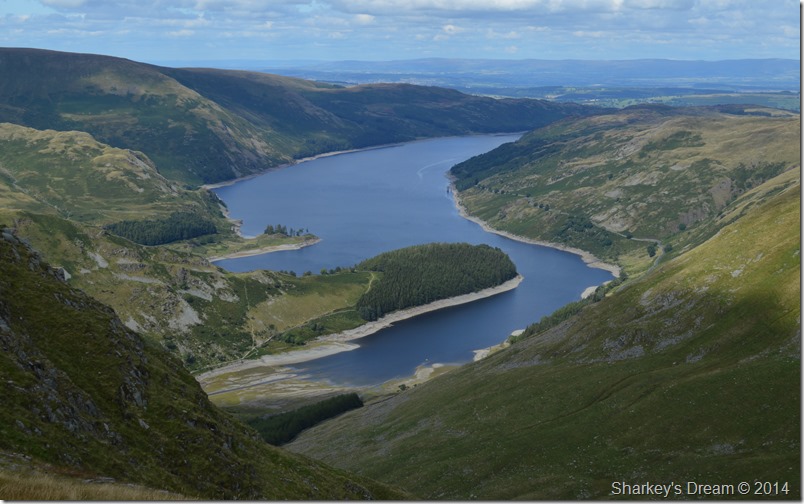
| Looking back on Blea Water from the north ridge. |
It’s only when you get up close with Blea Water do you realise why the Tarn itself is the third deepest natural body of water in the whole of Lakeland at (63 m) only Wast Water (74 m) and Lake Windermere (67 m) are deeper.
The sun illuminates Blea Water captivating me to take numerous photos as the water turned from black to deep blue within a matter of seconds. I could have sat here all day within the steep sided corrie watching the sun glance across the water, but I had a ridge to climb, & right about now I was getting pretty excited of what lay ahead. |
 |
| The alternative route around the rocky outcrops. |
| But first, a closer view of that ‘alternative route’ which flanked the steep crags via a grassy rake seen here just beyond the loose scree. |
 |
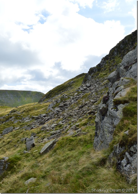
| The direct ascent starts here at the base of the crags. |
| It was at this point besides the steep base of Piot Crag did I pick up my ridge route, flaked heavily by a sudden hilt of vertical rock to my left I found an easy manoeuvre over this small rock step from where I could pick my ascent up the north ridge. |
 |
| Blea Water was simply too difficult to ignore. |
| After I scaled the rock step with three easy steps I soon found myself looking up the north ridge by means of a grassy ascent with alternative rock steps thrown in should the mood take you, behind me fell Blea Water flanked only by the steep corrie walls of Blea Water Crag & High Street’s north face. |
 |
| Mardale Head, Branstree & Selside Pike seen from the north ridge ascent. |
| Views north east saw me over look Mardale Ill Bell’s east ridge with Mardale Head, Branstree & Selside Pike beyond. The deep green area below can only confirm just how boggy Dudderwick can be, even after a dry spell without rain. |
 |
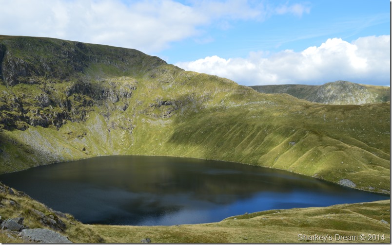
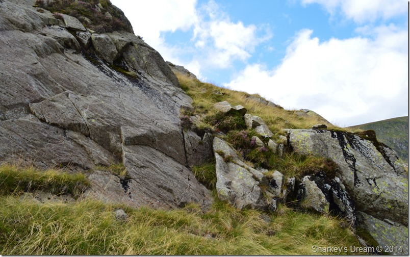
| Here, looking down from the top of Piot Crag. |
| My main ascent to gain Piot Crag was by means of the small rock shoulders mixed together with narrow grassy tracks, however, to reach the summit meant a final vertical rock climb which was a little out of my means, so here I had no other choice but to use a faint narrow grassy path that flanked this section of the ridge walk, here, after a quick look back, I track back to claim the summit of Piot Crag & more importantly, take in the view of the north ridge. |
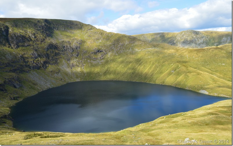 |
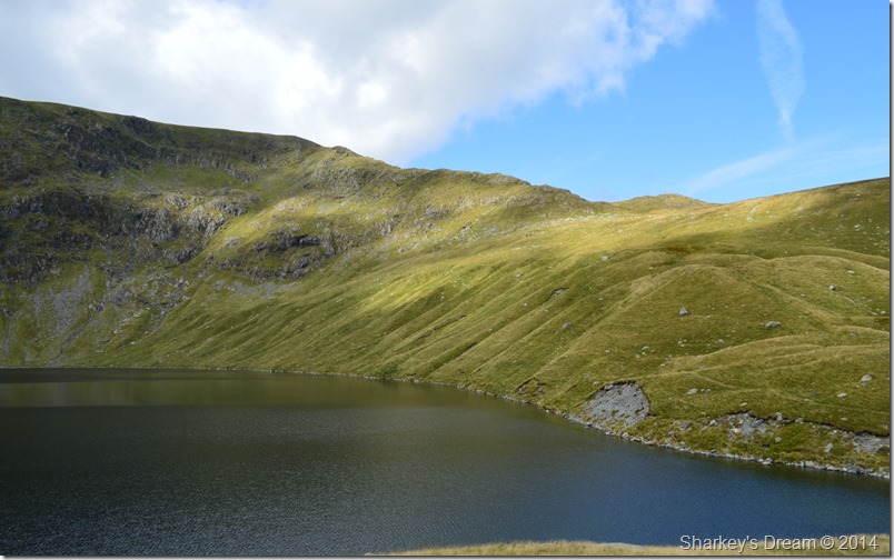
| One last look at Blea Water & High Street’s north face before I take on the connecting ridge towards the summit. |
| Before turning my back on my final views of the north ridge I couldn’t resist one last photo of Blea Tarn seen here taking on the wonderful affect of the worlds largest, & indeed deepest, teardrop. |
 |
| Mardale Head, Harter Fell, Branstree & Selside Pike with Mardale Ill Bell east ridge in the foreground. |
| |
 |
| Looking ahead towards Mardale Ill Bell summit. |
| With Piot Crag now behind me all that remained before summiting Mardale Ill Bell was to take in the final ridge ascent, from here it pays to look for a good line without losing too much ascent at the same time, the summit now is only a short walk away. |
 |
| Nan Bield Pass and the ridge to Harter Fell. |
| While crossing the final section of the ridge grand views opened out over towards the top of Nan Bield Pass together with the ridge to Harter Fell. |
 |
| Haweswater & the High Street/Rough Crag ridge. |
| |
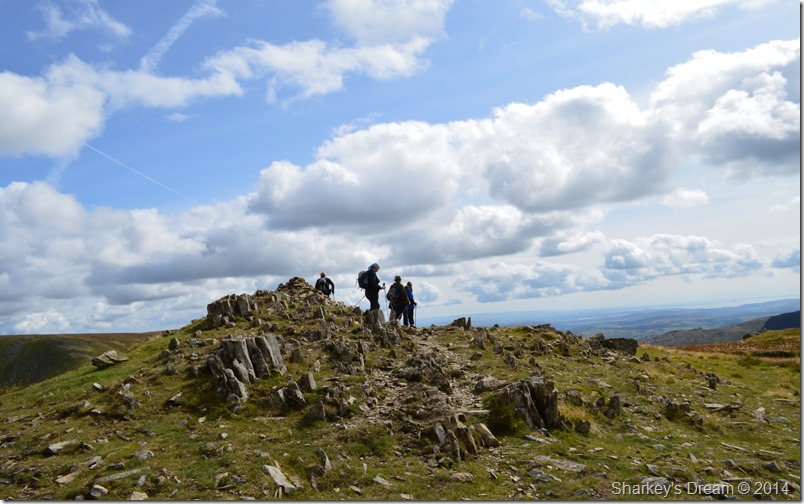 |
| Mardale Ill Bell summit. |
After taking on the last section of ridge before summiting Mardale Ill Bell I spot a familiar face seen walking away from the summit with three other walkers, I soon realise that I know these faces from Facebook as I get a quick wave from Ray ‘Raymond Greenhow’ which confirms this.
There’s not many come up over that way Paul, I thought I recognised the jacket! Ray & I greet with a firm handshake before Ray then introduces me to more familiar faces some of whom I share friends with on Facebook, after a great introduction Ray tells me it’s bait time before the gang wander off towards the summit shoulder which overlooked Blea Water, here they all down packs as Ray tells me about his epic route which started back in Hartsop at 08:00am that morning.
Without wanting to spoil their lunch I head off towards the summit, not before Gina Pennington offers me a slice of homemade chocolate flapjack, how could I refuse…thank you very much Gina it was delicious & kept me going for the rest of the afternoon.
After wishing the gang good luck with the rest of the walk I make my way to the the summit which is busy as walkers are either walking towards or away after making their own summit, some stand & chat so my own summit time was brief to say the least, with this I start the descent towards Nan Bield Pass passing more walkers along the way. |
 |
| The Ill Bell ridge taken shortly after leaving Mardale Ill Bell. |
| Shortly after leaving the summit I took this photo of the Ill Bell ridge seen here under brilliant afternoon sun, which incidentally, was back for the duration of the day. |
 |
| Harter Fell as I descend Mardale Ill Bell for the Nan Bield Pass. |
| On a personal note the ascent or descent from both Hater Fell & Mardale Ill Bell is amongst one of my favourite Lakeland paths offering fantastic views over the valleys of Mardale & Kentmere. |
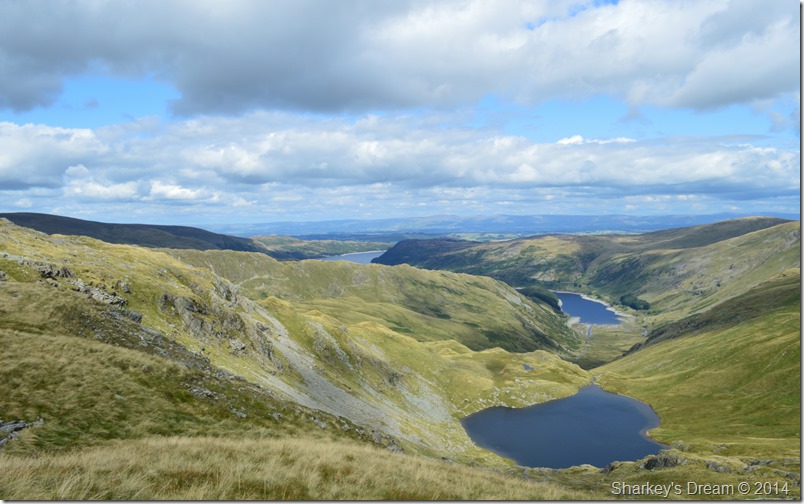 |
| Small Water, Haweswater seen with Mardale Ill Bell west & north ridge, in the background High Street Rough Crag ridge descending to the tree lined Rigg. |
| After descending the path towards the top of Nan Bield Pass I stopped to take this photo of Small Water with Hawsewater in the distance, in the left of the photo Mardale Ill Bell east ridge can be seen with its distinctive craggy rock spurs that line its ridge. |
 |
| A close up of Small Water with Mardale Ill Bell west ridge rising above. |
| |
 |
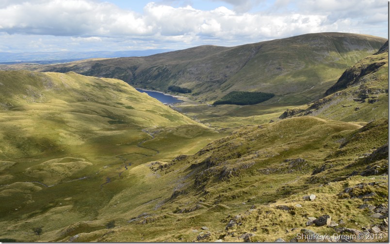
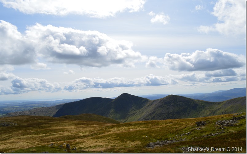
| Yoke, Ill Bell,Froswick & Lingmell End seen with Kentmere Reservoir. |
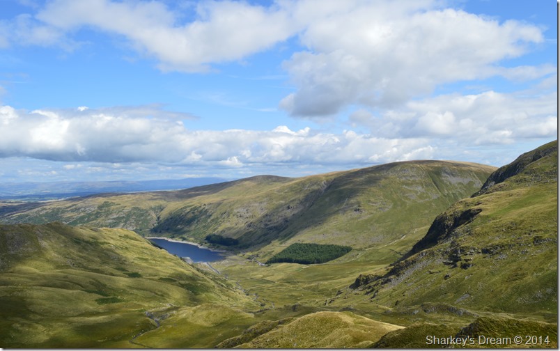
Shortly before taking on the main ascent of Harter Fell views opened out over the Kentmere Valley refreshing memories of an incredibly steep ascent on Lingmell End seen here in the right of the photo.
Above Kentmere Reservoir Yoke, Ill Bell & Froswick domineer any views west of my position. |
 |
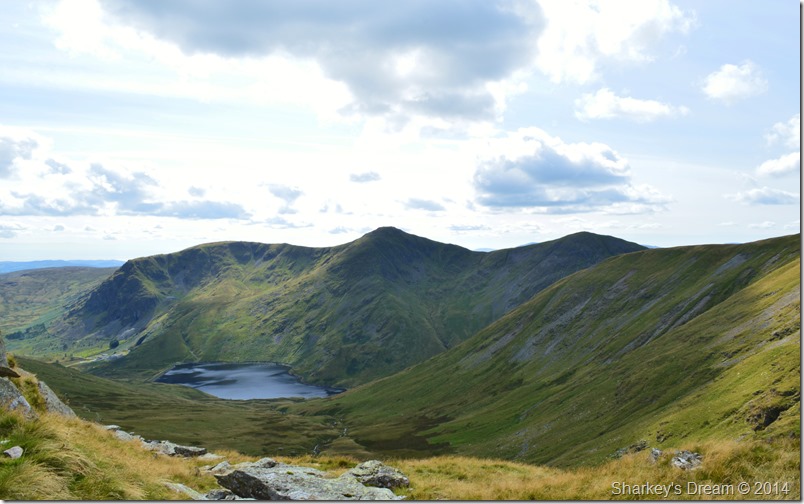
| Small Water towards Mardale Ill Bell, High Street & Kidsty Pike. |
Here, looking back over Small Water towards High Street & Mardale Ill Bell with both the east & north ridges clearly visible, in the distance Kidsty Pike can be seen with High Raise (Martindale) in the very background.
I take on the stony & sometimes steep path that will lead me all the way to Harter Fell summit, it is here I pass two walkers of whom I had a brief chat to back on Mardale Ill Bell, we pass comment once more about the clear views before I strode off once more with Harter Fell summit in sight. |
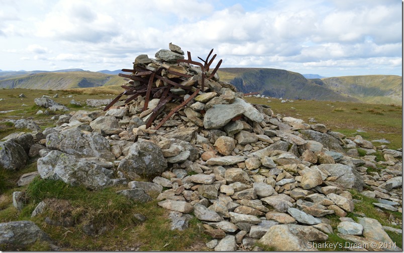 |
| Harter Fell (Mardale) summit cairn with the remains of what used to be a iron fence post & railings. |
| One of my favourite attractions to Harter Fell besides the rather odd summit cairn is the mountain does not lie to you in false summits, Harter Fell has a broad shoulder therefore once crested you are met with a flat expanse of summit plateau where due to a wire fence (see summit cairn for the old fence) if stuck too, can be used as a great navigational tool should the cloud come down, however today, I didn’t have that problem. |
 |
| Harter Fell’s broad summit plateau. |
Considering just how busy the fells were today I managed some solo summit time before spotting heads coming in the same direction as I had which seemed a little odd as I hadn’t seen them earlier, with this the stone cairn gets a tap from my walking pole before heading across the summit plateau north east, then south before a descent down to the Gatescarth Pass.
Not before wandering off the summit path to take this next photo of Mardale Ill Bell north ridge… |
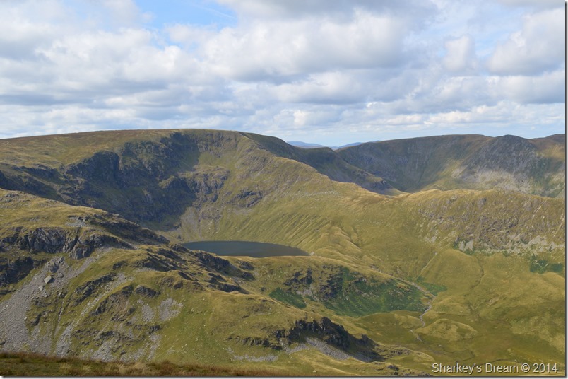 |
| A close up of Mardale Ill Bell’s north & west ridges with Blea Water & High Street. |
| Seen here flanked by bracken, which sadly wont be too long before it starts to die away for Autumn soon. |
 |
| Haweswater as seen from the third cairn, a popular spot for Wainwright enthusiast. |
| After re-joining the summit path I have a wander over to Harter Fell’s ‘third cairn’ marked on the map as BS or Boundary Stone, this spot which overlooks Mardale & Haweswater was a special location for Alfred Wainwright who chose to draw a portrait of himself sat up against a boulder, sadly said spot was overrun with walkers also admiring the views as I tip-toed my way through to take in the iconic view. |
 |
| Descending Harter Fell with Adam Seat seen at the far end of the ridge. |
| |
 |
| Grand views over Haweswater. |
| It’s not just the third cairn that had great views over Mardale, this one from from Little Hater Fell is just as inspiring! |
 |
| Taking on the zig-zags towards Gatescarth Pass. |
| With the main summit of Harter Fell now behind me I grabbed both my shoulder adjustment straps & gave each one a good even tug, with this I can now take in the zig-zag stone path with a little run which I really started to enjoy before I could start to feel my shorts coming down! you just cant take me anywhere these days! |
 |
| Descending the Gatescarth Pass under hot afternoon sun. |
| |
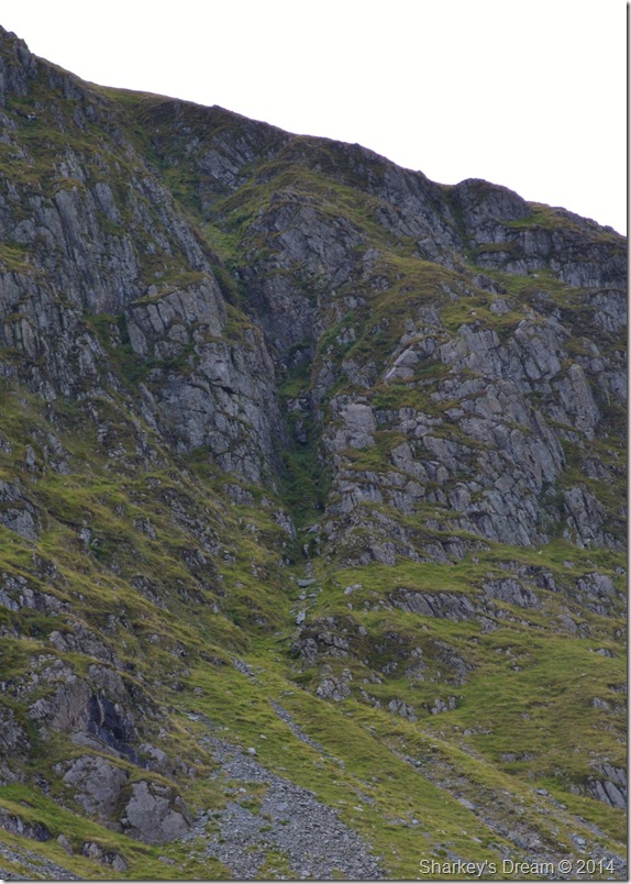 |
| A close up of Harter Fell gully. |
Today I had full intensions of gaining Harter Fell by Harter Fell Gully, that was until I was persuaded otherwise by rock climber & good friend Ian Sharples who you may remember from previous walks.
It wasn’t until it suddenly dawned on me during the drive up to Mardale just how inaccessible the gully can be after weeks spent researching various books & websites non of which gave me the answers that I needed, that was until I spoke to Ian this very morning after pulling over in a layby close to Shap.
Ian warned me of the dangers that I would face, it was there & then in that layby I knew that today, I wouldn’t be climbing the Gully after hearing Ian say that the Gully itself is excessively steep even by Ian’s own Standards.
During the following days Ian kindly sent me the information that I was looking for, even though inevitably, the information meant that it would secure my route up Mardale Ill Bell via the north ridge & not Harter Fell Gully. Here’s is a piece taken form The Fell and Rock Climbing Journal which may or may not be of some use to fellow walkers & climbers alike.
This gully is well seen from the top of Gatescarth Pass, and is indeed visible from the Mardale Valley, sloping diagonally from left to right up the face of Harter Fell, and coming out near the top of the mountain.
The first pitch is a short chock stone pitch, easily climbed on the right. There follows a considerable stretch of scree, to a biggish pitch in three sections. The right wall slightly overhangs, and on the left is a long and narrow slab with a sloping chimney between the two, The first section of the pitch id overcome by wriggling up the not very difficult chimney to a good stance. Next a move is made into the cave under the big chock stone, and a way is made up the crack between this block and a slab on the left, with considerable difficulty. Care should be taken of loose rock. The leader will probably elect to continue for a further six or eight feet up the third section of the pitch. The total height for this pitch is perhaps 70 feet, but the second man can ascend the first section (30 feet) before the leader passes the capstone. The last pitch is a short, but loose and somewhat holdless scramble up a scoop to the left of a large block.
The rock scenery is excellent & the climb is quite good difficult, marred by the friability of the rock in some places, and by loose scree at the top of the pitches.
A detailed description by W.T. Elmslie recorded in The Fell and Rock Climbing Journal who first climbed Harter Fell Gully on 30th May 1926
Two non members of The Fell and Rock Climbing Club failed to make the summit by Harter Fell Gully the same day.
I want to express my special thanks to Ian Sharples who without his help this information could not of been provided. |
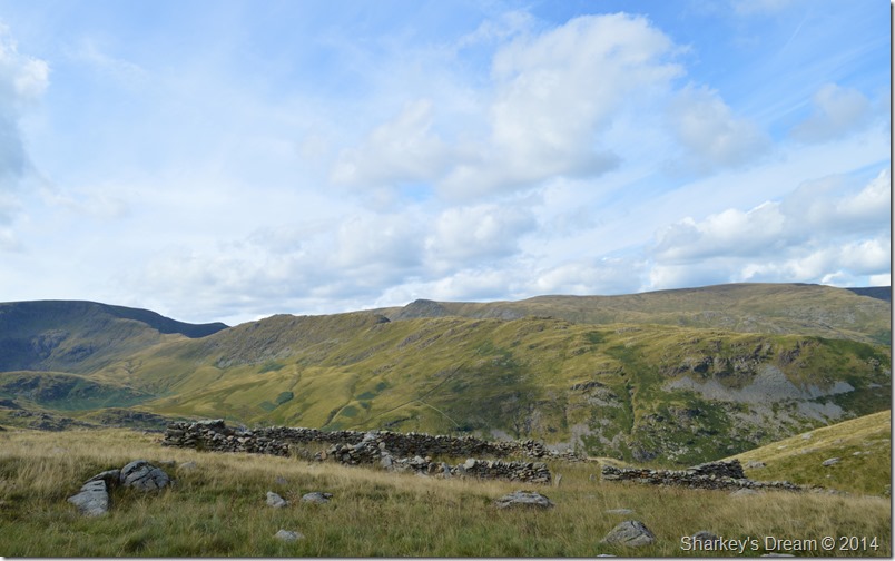 |
| High Street seen from the Sheepfold besides the Gatescarth Pass. |
| Found at the top side of the Gatescarth Pass is this large sheepfold with grand views along the High Street ridge. |
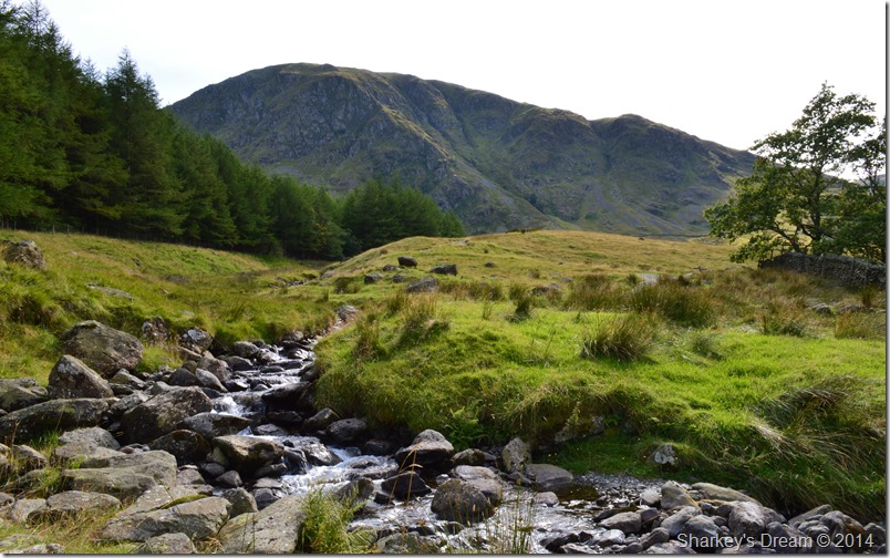 |
| Harter Fell taken from the bottom of Gatescarth Beck. |
| I knew that once the sheepfold had been passed my walk was almost over as I slowed down to an almost crawl blaming lack of traction underfoot for my slower than slow pace, I however know why I lack enthusiasm to reach the car, it’s simply because short walks on the spur of the moment rarely turn out as fantastic as this one did, all done within three and a half hours of walking bliss. |
|
| |
| Back to top |
 |
|