 |
Pillar via Pillar Cove |
 |
 |
4th August 2014 |
 |
|
Ever since I first read about an ascent on Pillar via Pillar Cove I’ve always wanted to give it a try, trouble is back then within my youth as a fell walker I deemed such a route well out of my reach but as time progressed so did the need to complete an ascent that Wainwright described as the finest way up Pillar.
I couldn’t see a more finer time to complete this challenge as now I have some time booked off work which after attending a friends wedding in Southport over the weekend it looked like Mondays weather faired best to carry out my plans.
Flanked by the finest mountains in the whole of Lakeland I can see why Ennerdale is ranked so highly with its secluded coves around the waters edges to the fine views from its satellite summits Ennerdale for me, sadly, isn’t visited as much as I would like, not after today.
It all started after a rather late arrival at Bleach Green situated at Ennerdale Water’s most westerly point. |
|
Wainwright Guidebook Seven |
 |
| The Western Fells |
-Pillar via Pillar Cove
A steep and rough, but romantic and adventurous climb in magnificent surroundings: the finest way up the mountain. Pillar Rock grips the attention throughout. |
 |
|
| |
|
Overview |
|
|
| Ascent: |
3,865 Feet – 1,178 Meters |
| Wainwrights: |
5, Pillar – Scoat Fell – Steeple – Haycock – Caw Fell |
| Weather: |
Overcast to Start Turning Sunny, Breezy Across The Summits, Highs Of 19°C Lows Of 14°C |
| Parking: |
Bleach Green, Ennerdale Bridge |
| Area: |
Western |
| Miles: |
16.2 |
| Walking With: |
On My Own |
| Ordnance Survey: |
OL5 |
| Time Taken: |
9 Hours |
| Route: |
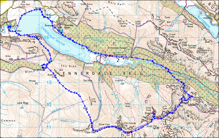
Bleach Green – Bowness – Low Gillerthwaite – High Gillerthwaite – Ennerdale Forest – Pillar Cove – Robinson’s Cairn – High Level Route – Shamrock Traverse – Pillar – Wind Gap – Black Crag (Pillar) – Scoat Fell – Steeple – Haycock – Little Gowder Crag – Caw Fell – Iron Crag – Boathow Crag – Anglers Crag – Bleach Green |
|
| |
|
Map and Photo Gallery |
|
|
 |
| |
| |
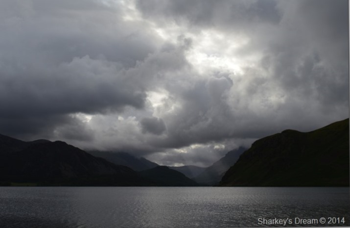 |
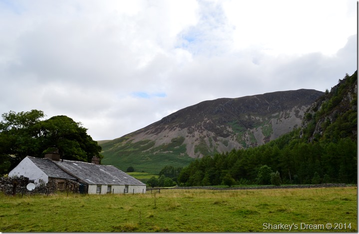
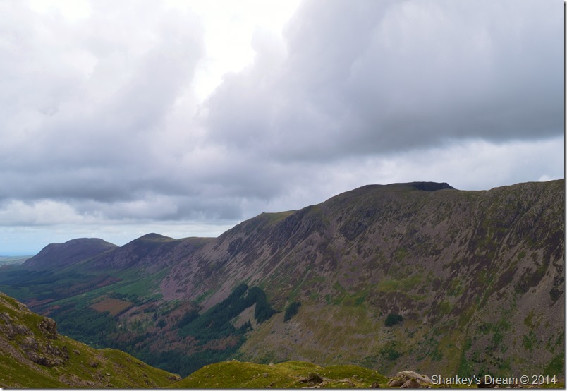
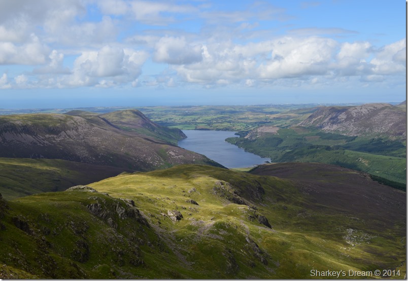
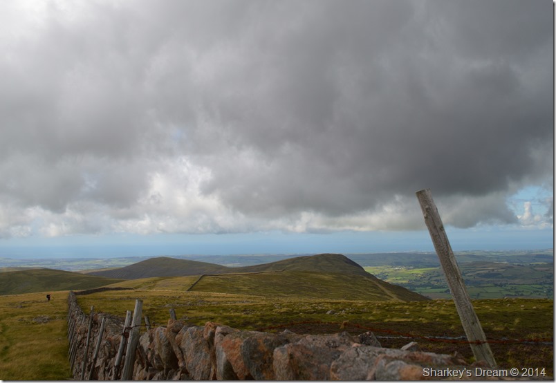
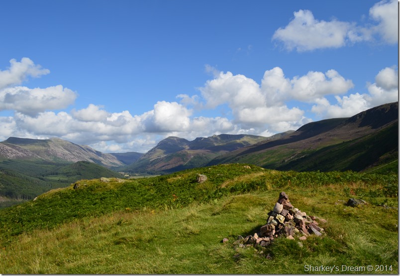
| Pillar topped by cloud over Ennerdale Water from Bleach Green 08:28am 14°C |
It hadn’t escaped my attention that the forecast had suddenly dipped twelve hours previous which can only be described as normal these days, however the forecast for the day ahead was warm & bright & faith in said forecast was pretty high.
I arrived at Bleach Green after a long & tedious drive helped only by BBC Radio Cumbria’s coverage of the 100 year Centenary marking the outbreak of the First World War where I listened to the brave men & women some of whom have since passed away talk about their life as they battled & much more to the point, lived to tell their gruesome & heroic stories.
‘After repeated shelling on the German defences we were told to go over the top by our Coronal who told us that ‘no man nor rat could survive countless hours of mortar shelling’
‘I was the only one left out of a platoon of 27 men after they opened up their machine guns on us; The Germans had dug deep & had waited for us’
I do apologise for going off subject but that Fusiliers words stuck with me for a good duration of the walk.
Bleach Green was reached as I backed my car into a parking space, underfoot things were pretty damp so I had to be careful as I balanced out of my mid shoes into my walking boots. It’s August so I stick with the shorts but the Jacket gets thrown in as a precaution because as of yet, I haven’t seen any of the predicted showers with the exception of some very dark & precarious looking cloud which gave real depth in contrast to its surrounding fells.
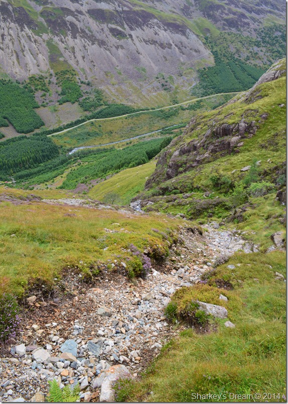
I left the car park through a wooden gate where I picked up the track that will take me around the western shores of Ennerdale Water, I had since read about the work that is being carried out by United Utilities who are restoring the natural course of Ben Gill where it will provide much needed natural gravel to the River Ehen and its rare freshwater mussels, other means of doing this is by deploying pontoons in the lake which will help with the water supply to the River Eden during periods of low flow.
As complicated as it may sound, working in scenery like this every day must have its advantages, or disadvantages but I’ll get to that towards the end of the walk. |
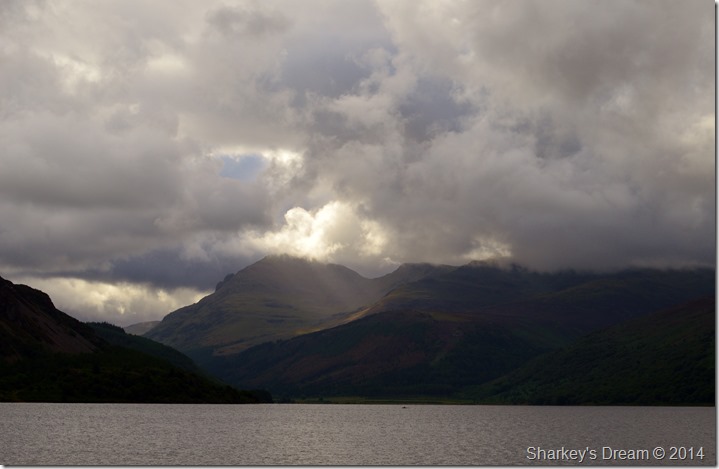 |
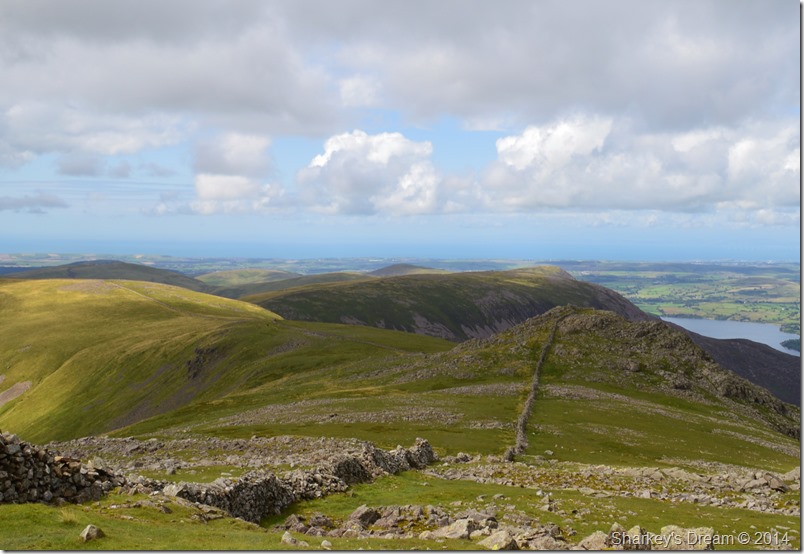
| Pillar. |
| It didn’t take too long for the summits to slowly reveal themselves as the sun broke through the morning cloud, with full zoom on my camera the distance between myself & setting foot onto fell side was approximately 6.5 miles, which, is a good walk in itself even in my own eyes, best get a move on eh! |
 |
| Passing through Bowness with Great Borne in the distance. |
After admiring the views around the western edge of the Lake by means of a gravel footpath I soon approached the more popular tourist spot of Bowness Knott where I was surprised to find only two cars on its large car park, well I say surprised after thinking that the weekend crowds have gone maybe it was local dog walkers out for a morning stroll.
I had the choice to stick with the shore path which had a fresh breeze blowing in off the water, so much so I don’t think I’d ever seen Ennerdale Water look so choppy. I choose the latter route & headed inland where I would soon pick up the more familiar path after leaving the car park behind. |
 |
| Anglers Crag. |
| If I had a favourite location to view Anglers Crag by this would be it. |
 |
| This one isn’t too bad either. |
| It was quite difficult to look over at Anglers Crag as it would be my last fell of the day to ascend, doing this would take away the concentration that had took over in my head on what lay ahead. By now the sun had started to come out & with it came welcome morning heat, all the while Pillar & Pillar Cove dominated my thoughts… |
 |
| That was until this happened… |
| |
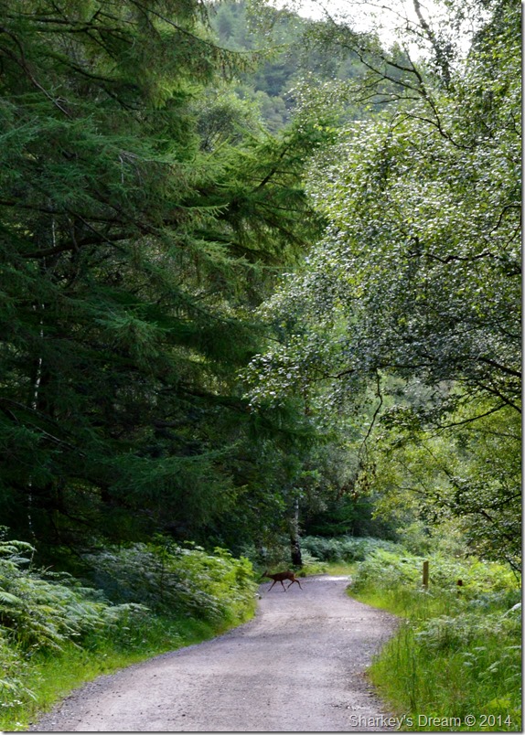 |
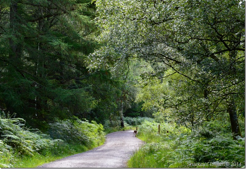
| When a young Fawn crossed my path. |
I had been walking head strong with such a pace I felt at times that I needed to catch my own breath such the anticipation to reach the Ennerdale Forest where my ascent would truly begin.
I first sighted the Fawn as an blur, an object that still hadn’t seen me, it was all split second when I reached for the camera & took three steps to my left quietly so my boots didn’t make a sound in the gravel beneath them, the Fawn then took a pause, then, with a fleeting glance gracefully disappeared back within the undergrowth.
The time was 09:16am
It sounds silly now but the sighting of the young Fawn brought me back down to earth a little, before my heart raced, I was marching headlong with only my destination in mind, thereafter, fittingly, I slowed things down a little. |
 |
| Taking time out to take a peak of a silhouetted Pillar from the River Liza/Irish Bridge. |
| |
 |
| Taking time out to take a peak of a silhouetted Pillar from the River Liza/Irish Bridge. |
| |
 |
| Lingmell Plantation from Low Gillerthwaite. |
|
 |
| Here, Pillar, Windgap Cove & the Long Crag/Steeple Ridge is seen from Low Gillerthwaite. |
It wasn’t until reaching Low Gillerthwaite did I get my first real view of Pillar, yes of course I have seen Pillar from this spot before, but, I had never been on the lookout for a path barely two feet in width that ran through a desolated forest before either.
Keep your eyes on the green Paul! |
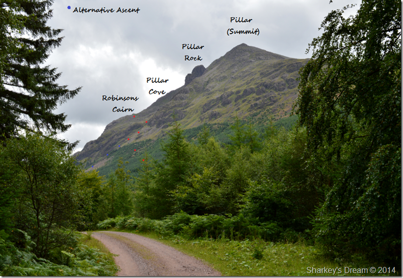 |
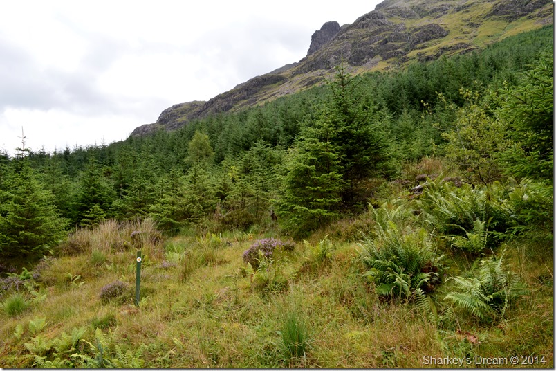
| Pillar Cove/Robinson’s Cairn route. |
I think if any sight depicted at what lay ahead it was this one, only this time I have edited my route through the Ennerdale plantation to Pillar Cove & Robinson’s Cairn in to it.
Still, I had belly wobbling knee jerking reservations that if I couldn’t find that forest path this whole route could lay in tatters, but first I had to cross… |
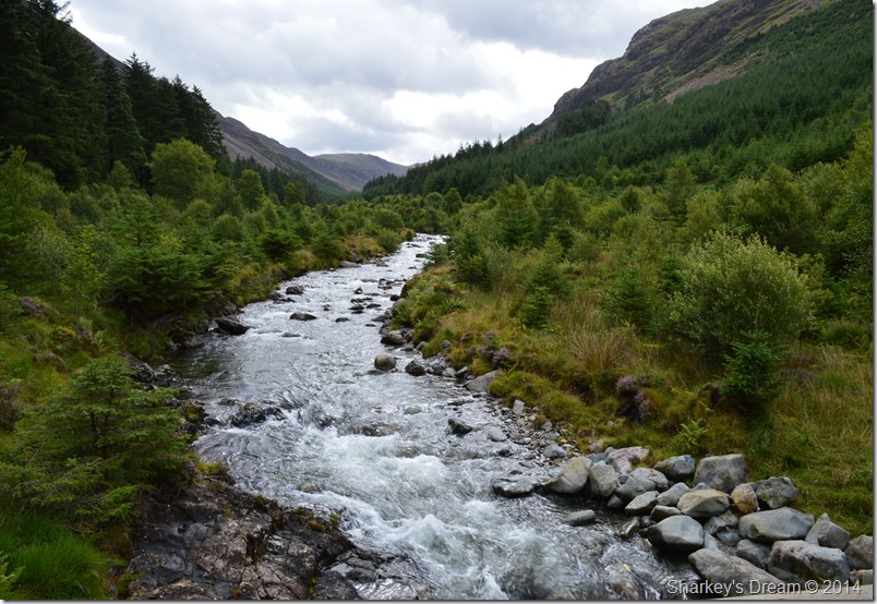 |
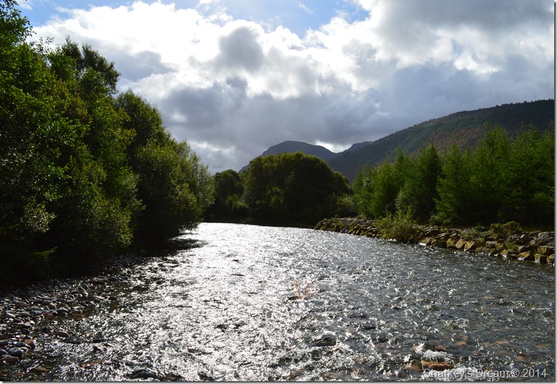
| The River Liza. |
Very close to this spot I attended my first ever wild camp back in 2005.
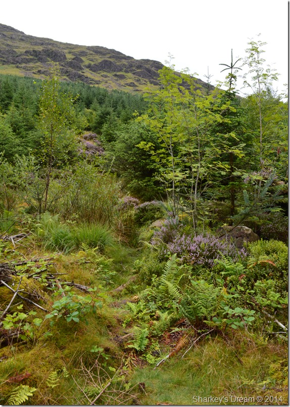
After crossing the wooden footbridge I headed left all the while looking out for a disturbance in the undergrowth (if you’ve ever walked through the Ennerdale/Lingmell Forest many paths are extremely narrow and difficult to follow)
My reservations were soon laid to rest however, when I saw this wooden marker. |
 |
| Path Marker post, |
| I’ve always deemed myself as having a good eye for a faint path, however, this is taking the biscuit a little! |
 |
| Did I mention that these forest paths were narrow & hard to spot. |
Thank goodness for the wooden marker pole eh?
It didn’t matter that the next twenty minutes were going to be very damp & soak me through to the skin, I had found my path & now I could concentrate on what lay ahead. |
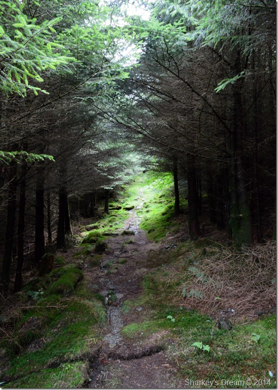 |
| The lower section of the forest path. |
Was above all else the most miserable ranging from quagmire to deadly slippery tree roots that hadn’t seen the light of day for a very long time, my pace had suddenly slowed to a crawl whilst passing through the dense & damp woodland.
But light soon came which according to my map would spit me out on a forest track to where I would pick up the higher of the two paths through the plantations. |
 |
| Exit & Entrance cairns to lower Plantations (L) Entrance to upper Plantations (R) |
| After a steep pull out of the lower plantations I soon found myself on the forestry track where after a quick dusting down (and rinse!)I spotted two thoughtfully planted cairns marking the paths to both upper & lower plantations. |
 |
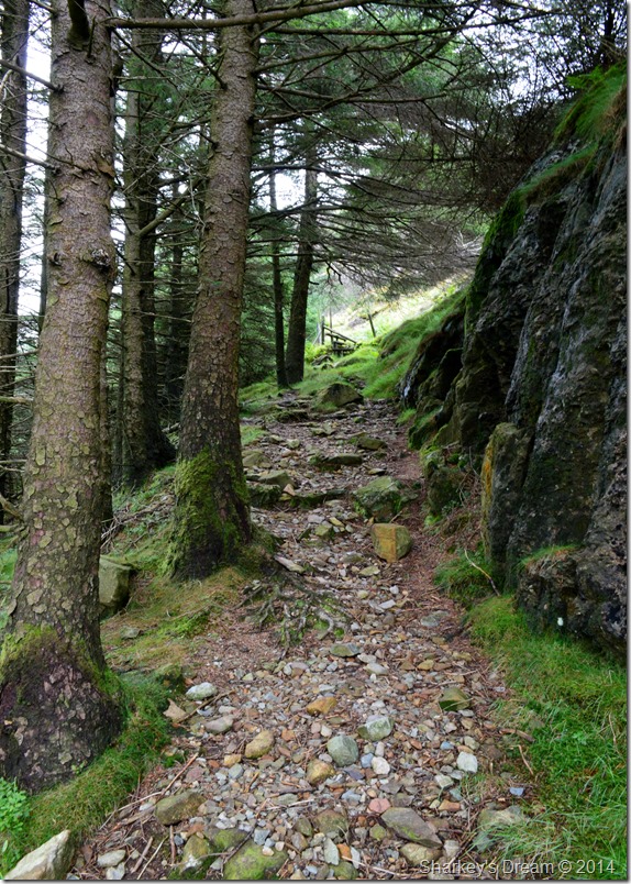
| The upper Plantations path was much more of a delight to follow. |
| After leaving the forestry track behind I began the steep haul through the second section of the plantations where it was much more airy & easier to follow. The morning air however coupled with my ascent was making things very warm & muggy yet I couldn’t take my jacket off as at times it offered protection against the pines as well as doing the obvious as keeping me dry as I passed through thigh high bracken which was still covered in lovely morning dew. |
 |
| The Sty ahead marks the exit to the upper section of the plantations. |
By the time I reached the Sty I kinda got that belly wobble just like something exciting was about to happen, I knew just over the Sty lay the dominance of Pillar Rock & of the next thirty minutes I would be in its shadow.
Nothing could have quite prepared me for the views that were about to unfold. |
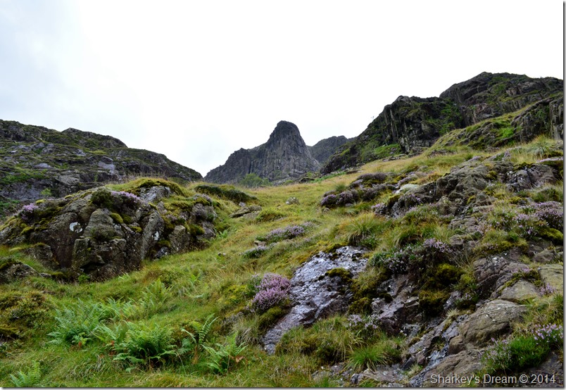 |
| Pillar Rock from the deep beneath Pillar Cove. |
After crossing the Sty I could only look on in awe at the mass of towering rock above my head, my legs were telling me to climb higher! higher! but my heart told me to wait a while.
Here after a few moments I decided to climb further up the path (left of the crags in the foreground) the path was of excellent pitch & quality but not without its steepness. |
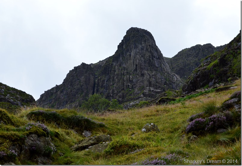 |
| From further up the path Pillar Rock seems to touble in size with every step. |
| |
 |
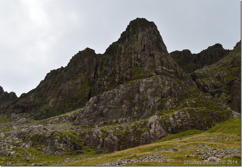
| Pillar Rock from Pillar Covebeck. |
The Rock is directly ahead and perfectly framed in trees all the way up. The Stream is nameless, but Pillarcove Beck seems appropriate.
A. Wainwright |
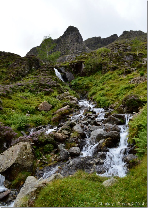 |
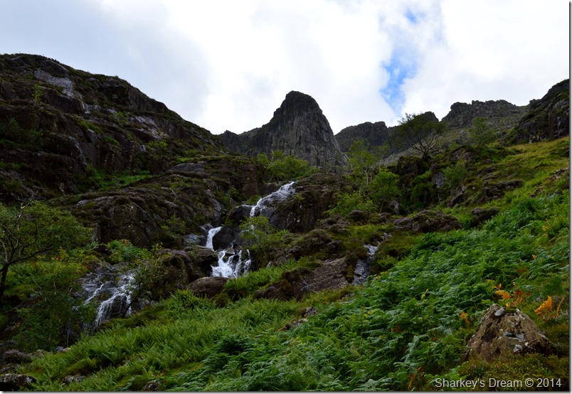
| Pillar Rock from Pillarcove Beck Falls. |
After following the steep path for some while I came to a stop at the foot of the falls where I de-shouldered my pack, there are many places in Lakeland were taking time out is important were observations, presence & views can be observed, this is one of those places.
After a few moments together with a couple of handfuls from Pillarcove Beck I re-shouldered my pack as I knew I hadn’t quite reached Pillar Cove, ahead of me lay the steepest & possibly most awkward of the ascents by means of a steep scree path with a twist in it, the twist in the path was more than apt as it meant you couldn’t see the steeper section above it but, with a little effort the top of the path was soon reached with fine views all the way down to the Valley floor. |
 |
| Here, looking back down the steep scree path. |
| |
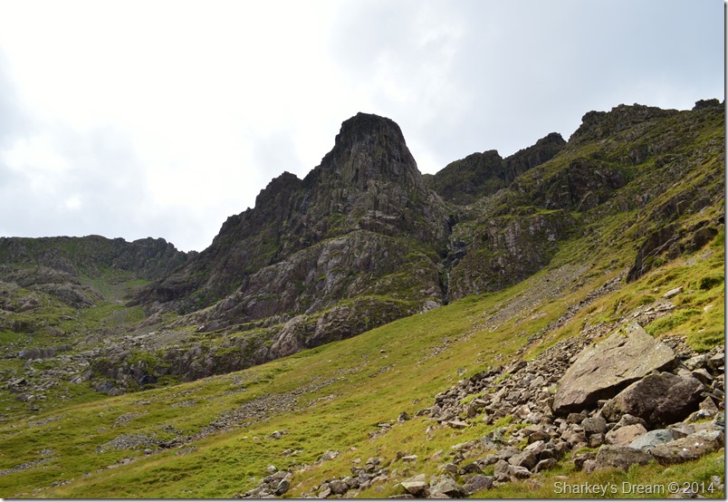 |
| Pillar Rock from Pillar Cove. |
Once I had topped out on the scree path Pillar Cove was there to present itself with Pillar Rock vastly adhering to the eye in any other direction than it so close you could reach out & touch it. However, seeing as I had left my ropes & harnesses at home! all I could do was plot my route across the grassy shelf that forms Pillar Cove towards Robinson’s Cairn which is sadly out of shot but over towards the far side of the Cove.
I plot my route. |
 |
| Under the watchful eye of Pillar Rock. |
Between 30,000-25,000 years ago when much of Scotland & Northern England were in complete ice coverage it is known that only a few summits protruded above the ice sheet including Great Gable, Bowfell, The Scafells, Pillar & Pillar Rock.
15,000 years ago the ice sheet had gone completely from the Lake District leaving behind how we recognise the Lake District fells today.
A few words taken from the book, Lake District mountain landforms by Peter Wilson. |
 |
| Here looking back on Pillar Cove as I make my way to Robinson’s Cairn. |
| I choose to keep level while at the same time trying not to lose too much height as I crossed Pillar Cove, it is said that proof on just how sound the rock of Pillar is evident in the lack of scree found in Pillar Cove. |
 |
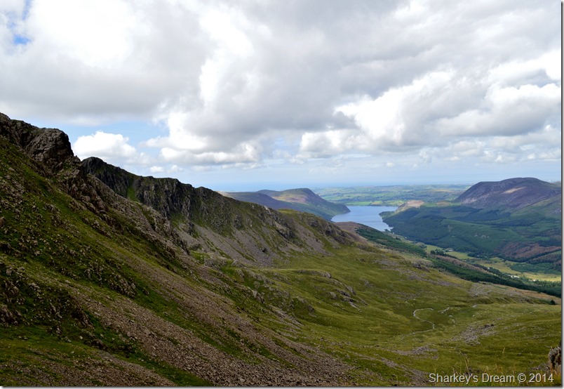
| The High Stile Ridge from Pillar Cove. |
| A vast proportion of the High Stile Ridge can be seen from Pillar Cove incorporating a Distant Great Borne, Starling Dodd, Red Pike (Buttermere) High Stile & High Crag, it’s not very often I would have this view so again, I hang about just a while to take it all in. |
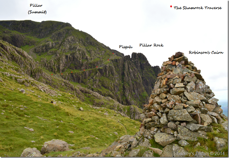 |
| Pillar & The Shamrock Traverse from Robinson’s Cairn. |
By the time I had crossed Pillar Cove & had reached Robinson’s Cairn the sun had gone in again leaving a biting wind that nipped at the sweat that had formed on the back of my base layer. Here I decided to have a five minute rest & take in a flap jack that I had packed with me.
It seemed five minutes was too much to encounter that cold wind so I hastily packed up & joined the High Level Route that would lead me to the base of the Shamrock Traverse.
Not before a taking a few photos. |
 |
| Distant Gables & Kirk Fell seen as I cast my eye back along Pillar’s High Level Route. |
| |
 |
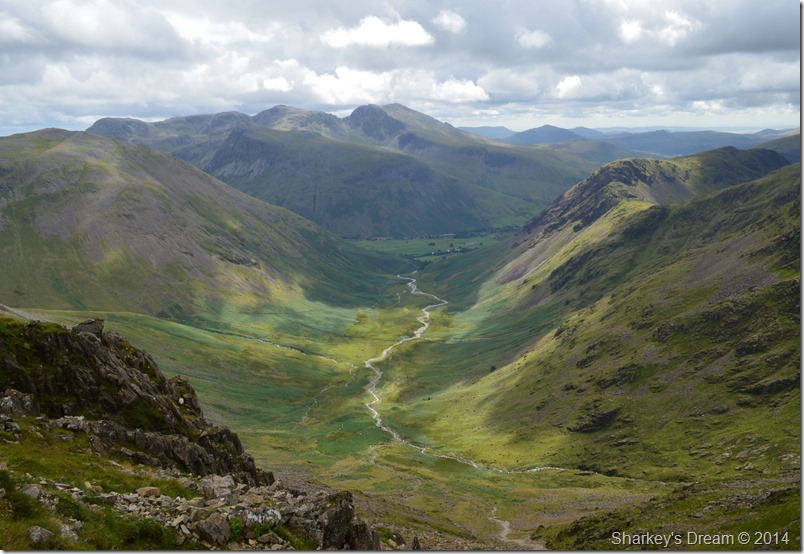
| The Gables seen dominating the head of the Ennerdale Valley. |
| Whilst over on the left Brandreth & Grey Knotts together with Fleetwith Pike with the distinctive peak of Honister Crag in the far distance. |
 |
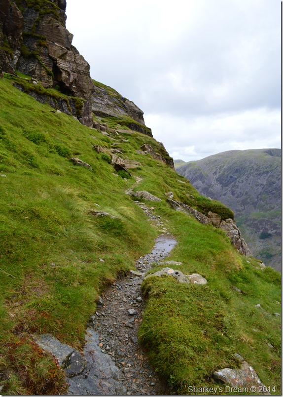
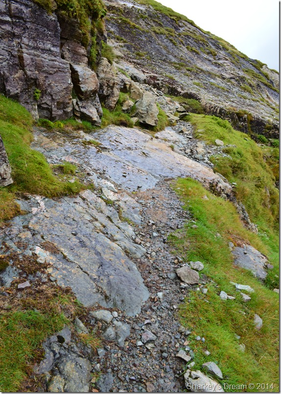
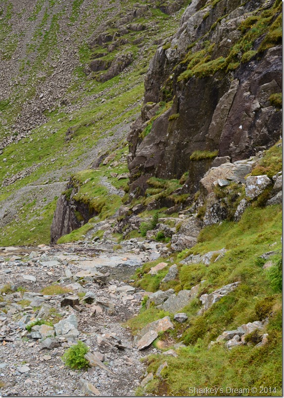
| Where the High Level Route ends & the Shamrock Traverse starts. |
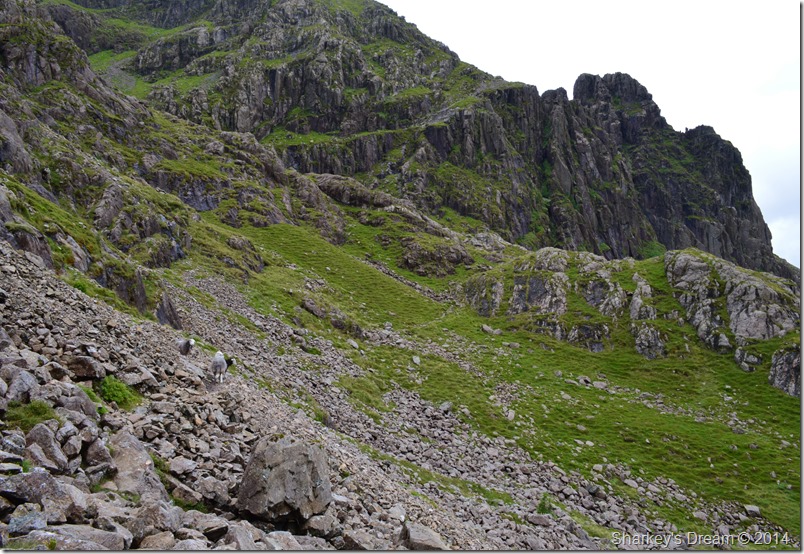
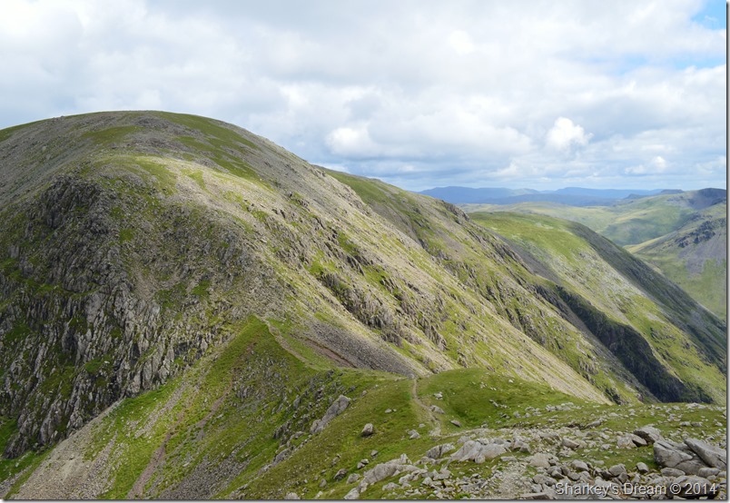
From here my walk will get a little more bumpier underfoot as I take on (and leave) the High Level Route by firstly crossing the boulder strewn path as the sheep so kindly demonstrate.
Here the path lends its way left (out of shot & behind the crags) to where the foot of the Shamrock Traverse can be found. The Traverse rises steeply over a pitch of scree that traverses in zig zag’s until a tilted grassy shelf is reached.
It’s always a good place to stop & regain ones breath back too! |
 |
| The Shamrock Traverse. |
| Best described as steep, yet away from danger. |
 |
| An unavoidable hilt of polished wet rock with a sudden drop to the right. |
Ask any walker what the worst contact underfoot would be, somewhere behind wet pine needles & wet tree routes amongst many others I’m sure you will find wet polished rock, in fact – I’m sure it will top the list at the most dangerous of them all.
Okay I apologise for the sarcasm but I really had to stop & think my way around this one & after two attempts – I un-gracefully made it across safely.
But I think a bit of wee came out…! |
 |
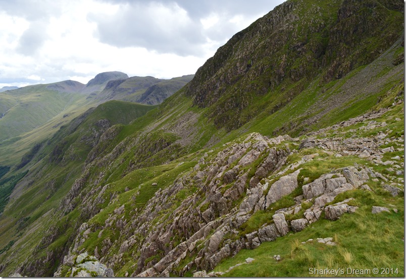
| Here, looking back down the scrambly bit. |
| |
 |
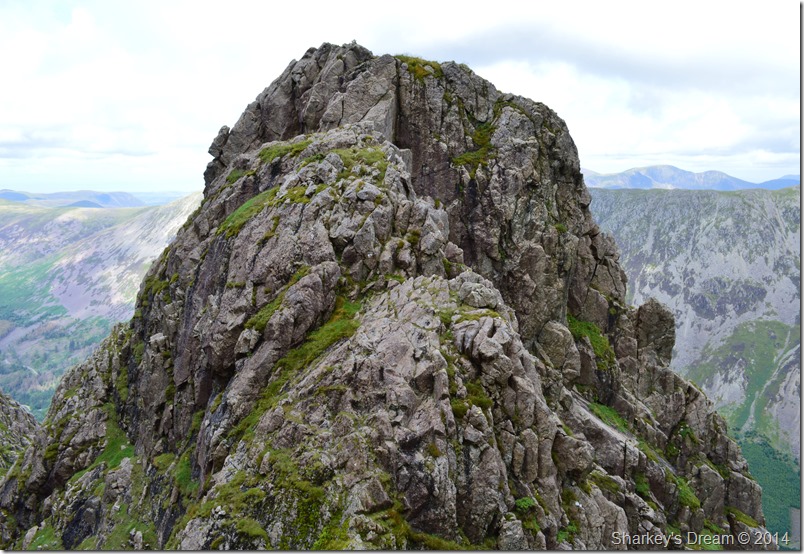
| Pillar Rock from the Shamrock Traverse. |
| |
 |
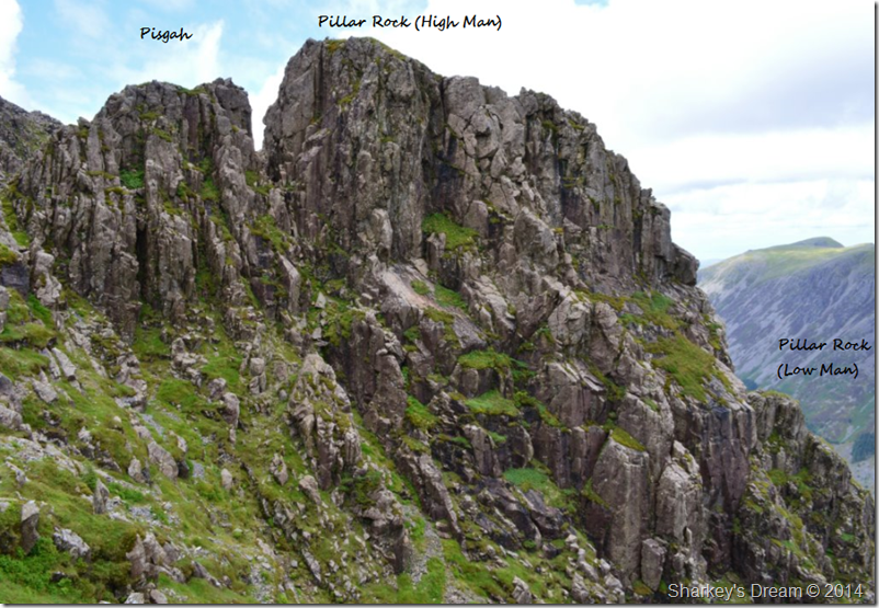
| Pisgah (Foreground) seen with Pillar Rock. |
Many rock climbers spend their time climbing Pillar Rock & I for one would very kindly pay a professional climber (in flap jacks) to take me up there.
Volunteer’s please! |
 |
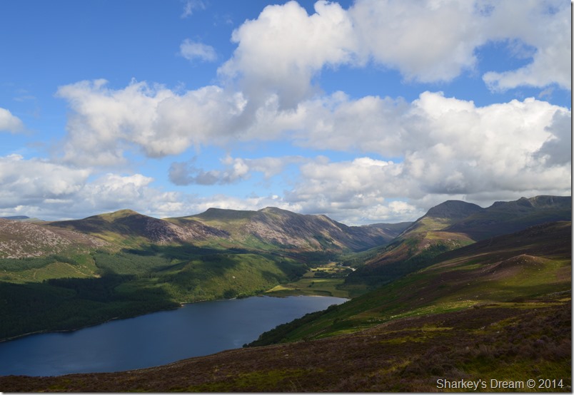
| Here, extended views over the Ennerdale Valley & the High Stile Ridge towards the Loweswater Fells. |
What the Shamrock Traverse had in steepness certainly made up in with the enigmatic views across the Ennerdale Valley, here a glimpse of Loweswater can clearly be seen.
Time for that last push towards the summit. |
 |
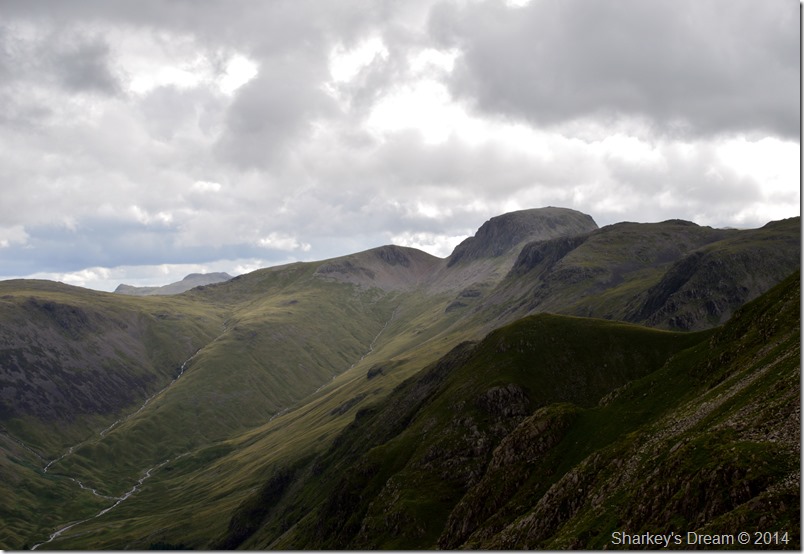
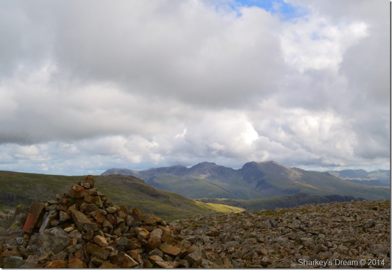
| The Gables & Scafells seen from Pillar summit. |
After topping out on the Shamrock Traverse I made the short walk over to the summit Trig Point feeling like I really had climbed a mountain that morning.
However, my solo presence is short lived as I am joined by another walker who came from the direction of Looking Stead. We instantly strike up conversation about our mornings routes & where we had been, my fellow walker is almost taken aback when I tell him where I have come from after him joking that he didn’t envy my way back to the car!
A joke was shared as we spoke of our intended routes, his was a descent via Red Pike (Wasdale) & Yewbarrow having already climbed straight up the nose of Kirk Fell then of course onto Pillar, that’s no walk in the park either I reply!
Are you heading for Scoat then? We’ll share the route then shall we?
Not before one last picture |
 |
| The Scafells from Pillar summit. |
| |
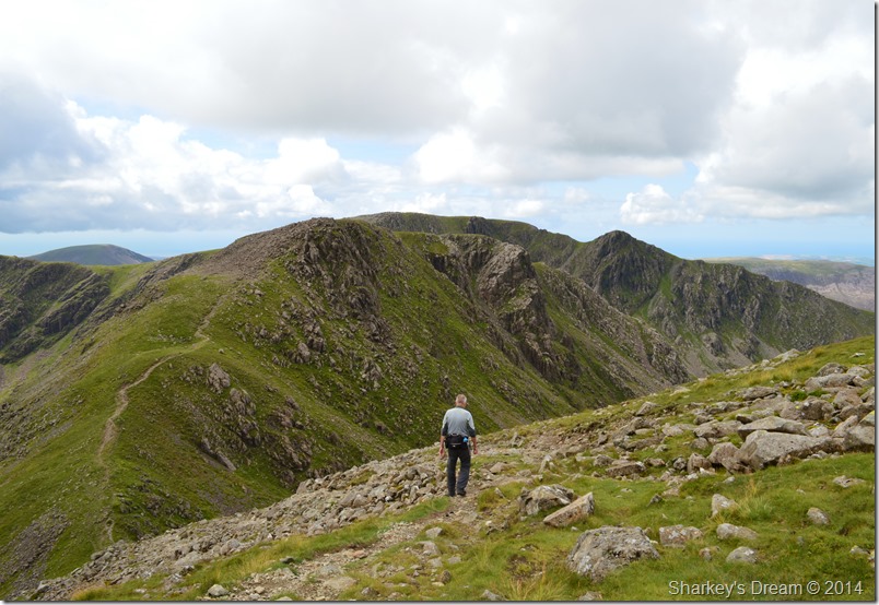 |
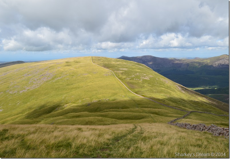
| Descending Wind Gap for Black Crag (Pillar) |
We soon found ourselves on the rough path that descends to Wind Gap, here our conversation continued where I found out that my fellow walker was from Threlkeld & was on a tour of Wainwright bagging, all within one year which is a monumental task & good on him.
I asked was he or had he been a fell runner as he had good pace with no pack (bar a waist bag) with just the one water bottle, I’m a yomper he explained, of course I’d heard of the expression & I think it puts him somewhere in between a walker & a fell runner, what ever he liked to call himself, he had good pace & was obviously fit. |
 |
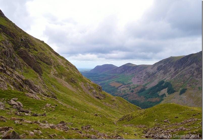
| The Mosedale Valley. |
Still in conversation we descended Wind Gap where commanding views offered up towards Red Pike (Wasdale) Kirk Fell & The Scafells. The light shone against the fell side was a real highlight whilst crossing Wind Gap.
In the other direction however… |
 |
| Windgap Cove with extending views all the way back to Crag Fell & the Cumbrian Coast. |
| I guess my route back does look a long way from here. |
 |
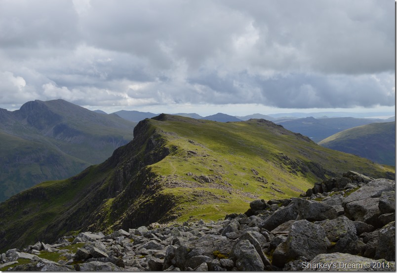
| Pillar seen over Wind Gap taken beneath the summit of Black Crag (Pillar) |
It was here I said farewell to my fellow walker after feeling I was holding him back with my picture taking, after all, It was also time to re-adjust & maybe get some lunch.
Today I’ll be dining on B.L.T sandwiches, straight from the fridge at Tesco’s. |
 |
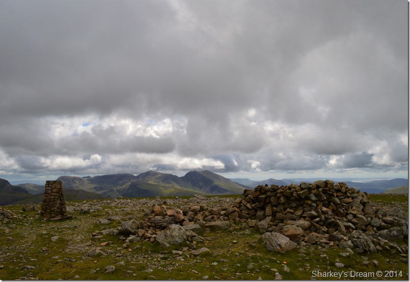
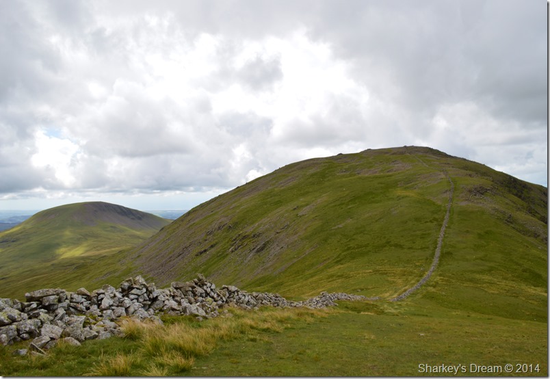
| Scoat Fell & Steeple taken from Black Crag (Pillar) |
After lunch I re-shouldered pack less the jacket which got neatly tucked away for good, although, judging by the cool wind I may have been a little hasty in doing so. A personal common phenomenon to me is Steeple & my ability to climb it once Pillar or indeed any other fell was behind me seems to get balanced within that ‘fell too far category’
The same applied here as I made my way for Scoat Fell across Mirk Cove. |
 |
| Red Pike (Wasdale) enjoying a splash of sun. |
My fellow walker was now enjoying an ascent on Red Pike, his parting words were, enjoy the rest of your walk I’ll be in on my second pint by the time you get back to the car.
My sentiments to my fellow friend are as follows, I’ll be still fell walking under baking sun whilst your on your second pint, works both ways see…
I never did get his name, nice fellow though! |
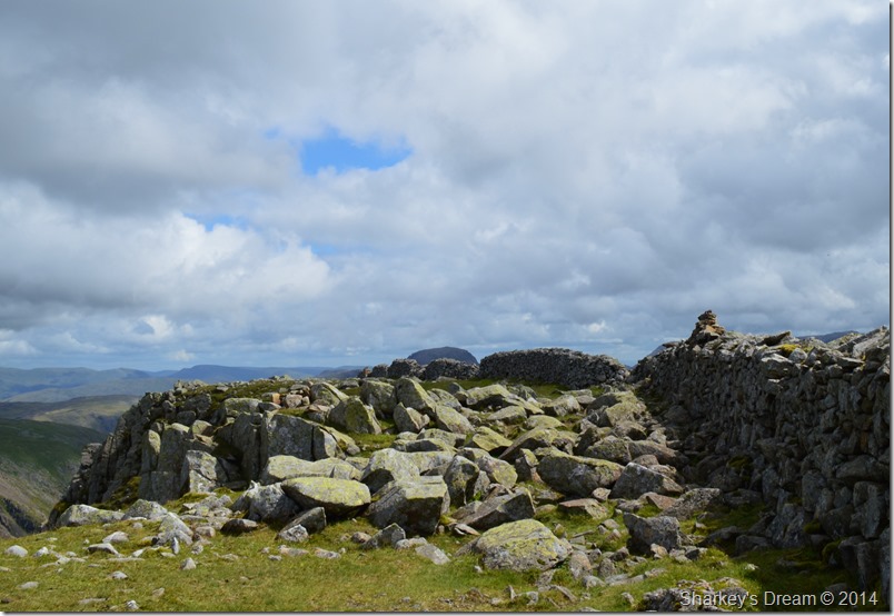 |
| Scoat Fell summit. |
Still enjoying good legs I made my way up Scoat Fell where the thoughts of my next summit of Steeple lay heavy on the mind.
Should I go for a summit or is it really a fell too far today? |
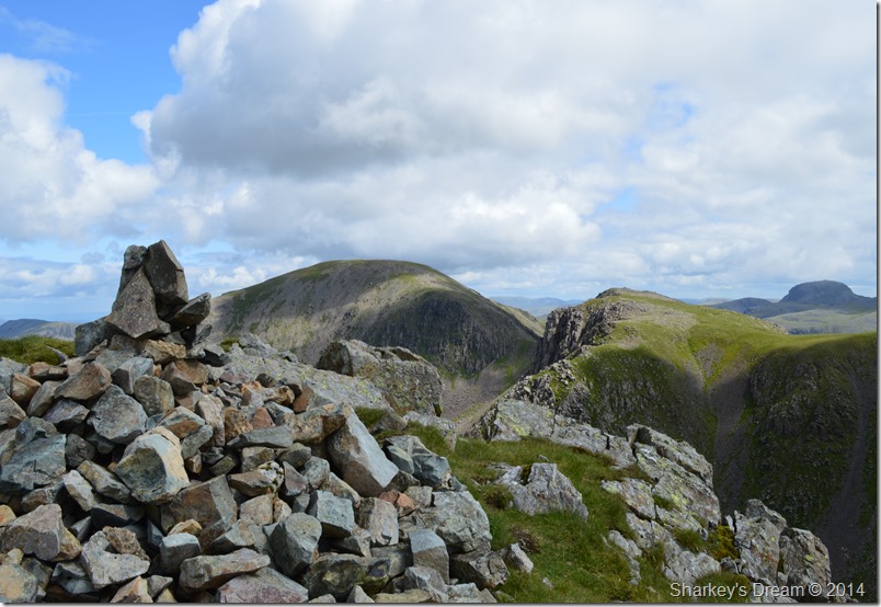 |
| Pillar seen with Black Crag (Pillar) from Steeple summit cairn. |
| By eck Paul, by the time you’ve thought about it you could have been up & down twice! |
 |
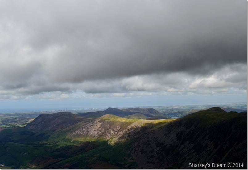
| Ennerdale Water seen over Tewit How with Crag Fell & Great Borne in the distance. |
| |
 |
| Ascent on Haycock with views over towards Seatallan. |
Back when I first penned this route I now find myself at the point where I had doubts the most on how well I would cope with this sudden depression then an ascent that rises steeply all the way to Haycock summit.
I guess the thought of which had lay on my mind & my way to tackle this is to hit it head on with all guns blazing, I first made a run at the steep slope before exhausting myself about half way up, but, by then I had covered some steep ground & all what was left was to dig deep & maybe let the walking poles help with the hard work. |
 |
Here, looking back on Scoat Fell with the Steeple/Long Crag ridge over on the left of the picture. |
| |
 |
| The Scafells seen from Haycock summit. |
| Sadly Haycock received the least summit time with just a fleeting tap from the walking pole at the summit cairn, soon after I found myself descending the rugged north western ridge towards Little Gowder Crag. |
 |
| Here, Little Gowder Crag (C) is seen with Caw Fell with Iron Crag over to the right. |
| Two paths both either side of the stone wall descend Haycock which one the walker chooses is as individual as the paths themselves, my route choice here is to descend with the wall to my left, or if ascending from the other direction I tend to use the path on the other side of the wall. |
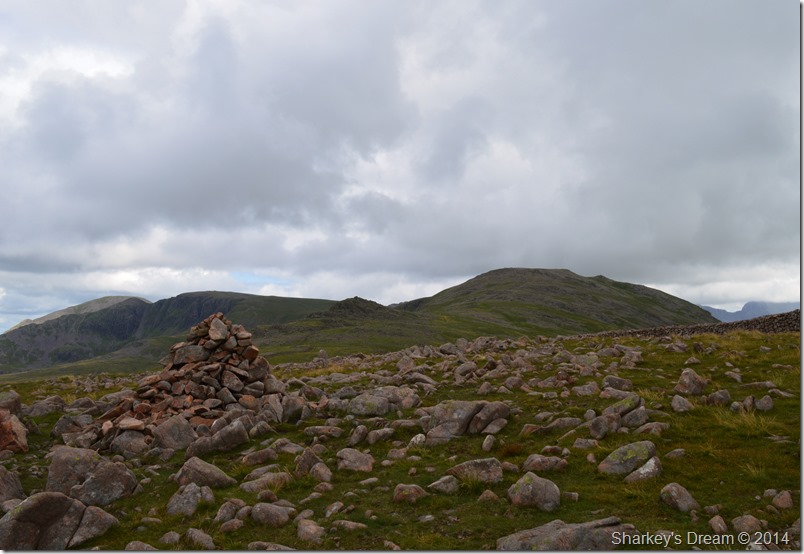 |
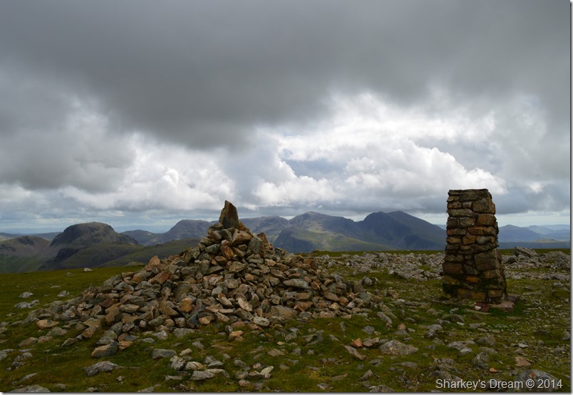
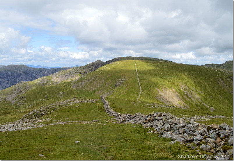
| Haycock, Steeple, Scoat Fell & Pillar seen from Caw Fell summit cairn. |
I have always held a special fondness for Caw Fell in its approach & its general remoteness away from its satellite fells. Caw Fell itself offers great opportunity to relieve sore feet as its approach especially from Haycock & undoubtedly a hard day on the fells is over a fine grassy plateau standing alone at the far westerly end of the Pillar to Haycock ridge.
After a few moments at the summit I headed north for Iron Crag, a place & a summit I had yet to grace. |
 |
| Descending Caw Fell with Silver Cove to my right flanks. |
My descent was steep & not what I had imagined sometimes having to use my walking poles to keep my balance was key.
Behind me I noticed two walkers who were gaining on me quite quickly only for them to check their map & make a descent via Bleaberry Gill seen in the left of the photo.
Once my descent had been made I had the greatest of pleasures in taking on the slight ascent on Iron Crag made all the way by the stone wall. Iron Crag has a long & undulating grassy summit plateau ideal for a pleasant stroll or if like me, when your walk after a hard day is coming to an end.
The summit cairn was reached but I soon found out to my dismay that I was on the wrong side of it to get a true summit photo of its conical stone cairn which I thought was such a shame.
With no Sty in sight I carried on my way until the summit plateau took on the leanest of gradients towards Boathow Crag. |
 |
| Here, Lank Rigg enjoys as hint of sun as Whoap remains in the shade. |
| |
 |
| Grike (L) together with Crag Fell (R) from Boathow Crag. |
Both Grike & Crag Fell were on today’s agenda, had time been on my side which sadly as the afternoon drew into early evening I had to give up their summits as the ones the that got away.
After taking this photo I soon caught up with the walker seen standing besides the wall, he was a big fellow in statute & was still looking at his phone by the time I got to him whilst looking up every now & again in that kinda lost way.
I pass on the statutory ‘yer ok’ hoping that if he was indeed lost or unsure of his location now would be the time to say, I received a ‘yes I’m fine thanks reply’ therefore ending any further need for conversation.
I looked backed once more & the guy was still looking at his phone (Phone App maybe) & still looking around in that lost fashion.
I once had my head chewed off after asking for directions, since then I will always help & if must gain confidence in my fellow walker which was nothing like what I experienced during my early walking days. Sadly I think this guys character just didn’t do asking for directions.
I press on & make my descent from Boathow Crag to an area known as Black Pots, here felled trees scatter the escarpment whilst heavy plant machinery have all but ruined the paths underfoot.
I first head away from Boathow Crag to a Sty where once stood a heavily wooded area, here I continue heading away & towards Grike because the felled trees offered no route across back through the Ennerdale Valley, shortly afterwards I soon picked up a faint path which descended me in lateral fashion high above Ennerdale Water which ran beneath a stone wall bound for Anglers Crag.
My path at times was sometimes obsolete through thigh high bracken that marred progress, the views however, made up for this. |
 |
| Early evening above Ennerdale Water looking towards Pillar & the High Stile Ridge. |
| |
 |
| Anglers Crag bound but first, a fight with the bracken. |
The faint path at times was testing, I’m not too sure if I lost patience because of tired legs or the pure fact that I turned & twisted my ankles so many times owing that I simply couldn’t see where I was putting my feet, after checking my map & G.P.S to double check that I was on the path and not some sheep track I soon came to the notion that the path had simply overgrown.
At times progress was slow, Anglers Crag seemed so close yet so far, I needed to redeem & rest which I did when I came across Red Beck that flowed from the fell side continuing down to Ennerdale Water. Here I de-shouldered & drank two handed cup full of water before a good swill about the face & neck.
It’s funny how water has all the healing powers that one needs! |
 |
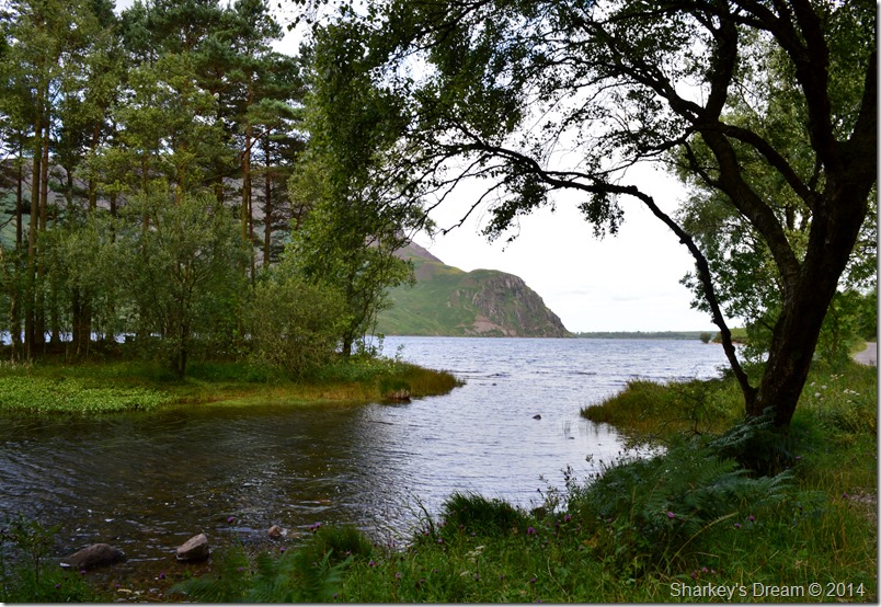
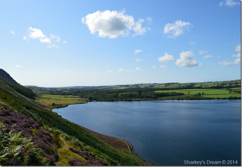
| Ennerdale Water taken beneath Anglers Crag. |
| |
 |
| Red Pike (Buttermere) seen with Pillar, Scoat Fell & Steeple from Anglers Crag summit cairn. |
| |
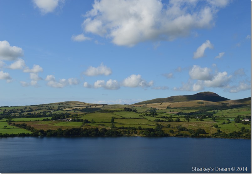 |
| Knock Murton seen across Ennerdale Water in brilliant evening clarity. |
| |
 |
| Bleach Green seen within the Trees at the far end of Ennerdale Water. |
My walk was slowly coming to an end under a brilliant late afternoon sun as I choose my descent from Anglers Crag & make my way towards the shore path where couples stroll hand in hand enjoying what’s left of the early evening sun.
Me, I look like I’ve been dragged through a bloody hedge backwards, all the tell tale signs of a fantastic day on the fells. |
|
| |
| Back to top |
 |
|
