|
Mardale Ill Bell via Lingmell End |
 |
 |
5th July 2014 |
 |
|
So many factors had got in the way of this walk which was planned all the way back in November 2013, mainly the weather. If both David & myself could cast our way back over the last year at each & every walk we did, with exceptions of the day we walked from Dunmail Raise to Scafell Pike should in actual fact, have been this walk.
This route was one of David’s ‘out of the ordinary’ walks’ a walk that would take in the beauty of the Kentmere Valley through to Kentmere Reservoir where we would then take on the mighty Lingmell End that dominates the head of the Kentmere Valley.
We knew it was going to be a tough one mind…
I’ve often gazed upon the nose of Lingmell End & uttered the words, If anyone’s stupid enough to climb that, they deserve a bloody medal.
It all started at Kentmere Church, in the heart of the Kentmere Valley. |
|
Wainwright Guidebook Two |
 |
| The Far Eastern Fells |
-Mardale Ill Bell
To the west the fell merges gently and dully into High Street, with a fringe of crag throughout on the north, and south linking high ground is a wall of steep rock, Bleathwaite Crag, bounding the silent hollow of Hall Cove, the birthplace of the River Kent. On the south also is the most pronounced shoulder of the fell, Lingmell End, thrusting far into the valley of Kentmere, and from it descends a short spur to the top of Nan Bield Pass. |
 |
|
| |
|
Overview |
|
|
| Ascent: |
3,100 Feet – 945 Meters |
| Wainwrights: |
4, Mardale lll Bell – Harter Fell (Mardale) – Kentmere Pike – Shipman Knotts |
| Weather: |
Cloudy To Start, Overcast With Some Sun, Highs of 12°C Lows of 18°C |
| Parking: |
Roadside Parking, St Cuthbert’s Church, Kentmere |
| Area: |
Far Eastern |
| Miles: |
11.3 |
| Walking With: |
David Hall |
| Ordnance Survey: |
OL5 |
| Time Taken: |
7 Hours 5 Minutes |
| Route: |
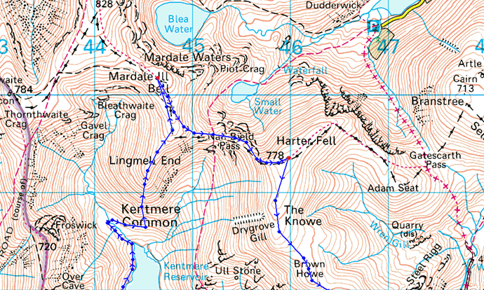
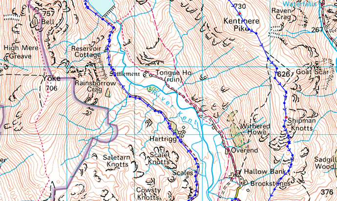
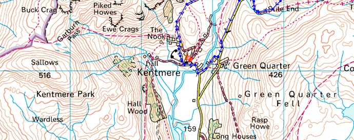
Kentmere – Hartrigg – Kentmere Reservoir – River Kent – Lingmell End – Mardale lll Bell – Nan Bield Pass – Harter Fell (Mardale) – The Knowe – Brown Howe – Kentmere Pike – Shipman Knotts – Longsleddale Pass – High Lane – Kentmere |
|
| |
|
Map and Photo Gallery |
|
|
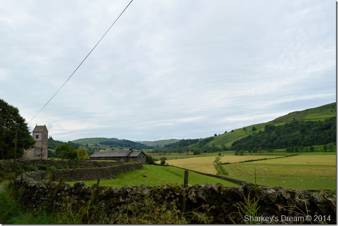 |
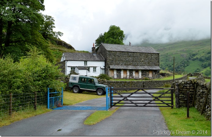
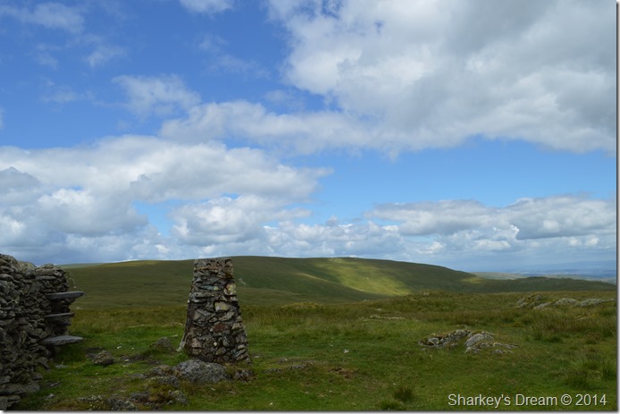
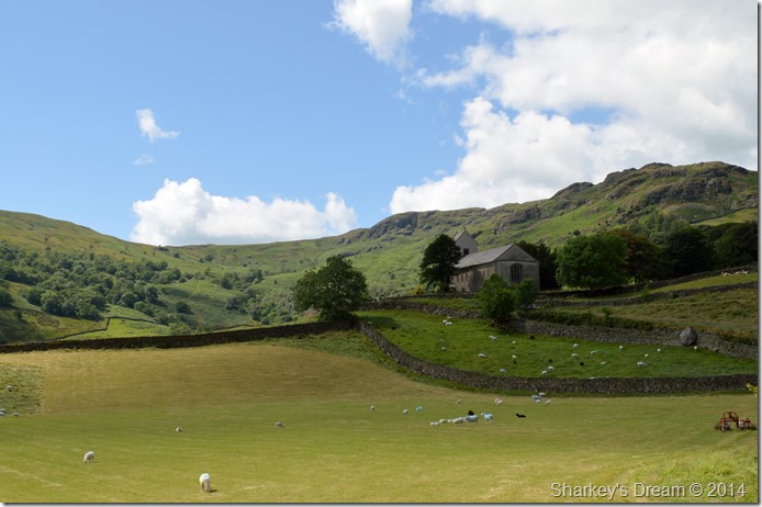
| Looking back on St Cuthbert’s Church, Kentmere 08:04am 12°C |
We had arranged to meet in Kentmere by the church at 08:00am I arrived ten minutes early to find David already there as he was taking in the views up the valley, I gave a David a quick wave through the windscreen before heading around the corner to find a spot to park the car where I found that a long wheel base mini bus had taken up the spaces of three cars by parking so in considerately, you would have to see it to be believe it.
I wound the window down as David caught up with me, the disbelieve on his face matched mine, luckily enough I managed to park the car besides the Kentmere Institute Building taking care not to sting myself on the nettles as I got out.
David was almost kitted up as all he had to do was lock his car, which just left me to do a quick change of footwear into my boots before locking the car & heading out on the quiet country lanes towards Hartrigg, deep inside Kentmere territory some one hours walk away. |
 |
| Passing Scales Farm, Kentmere. |
It had rained heavily the previous day & the evidence was all around as we never seemed to be far away from the noise of gushing water. The cloud remained relatively low but we could see a change was on its way as the light strengthened & the skies had distant blues in them.
Through the valley we heard the sound of a quad bike which reached us within no-time shattering the peace about the place although we did get a polite nod from the farmer driving.
We continued through the valley at the same time checking those skies for what was promised to be a fine day, sadly it hadn’t reached us yet.
But it’s coming… |
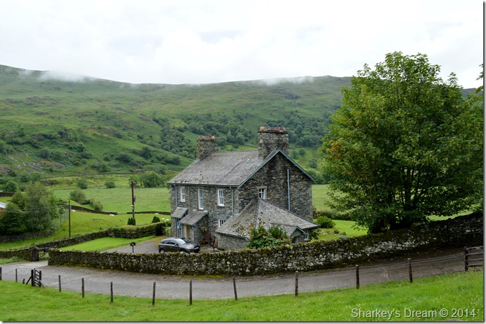 |
| Hartrigg Farm, Kentmere. |
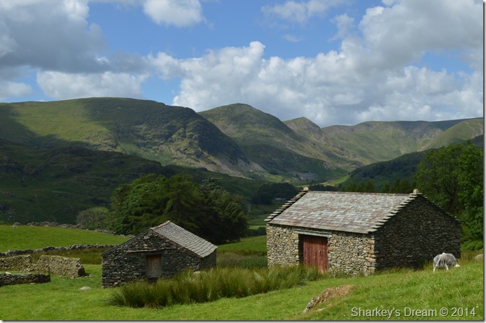
We were well & truly into the Kentmere Valley by the time we passed Hartrigg Farm where we stood a while taking in its location & surrounding country side, almost all of the farms in Lakeland are working farms & evidence of this is the clutter left behind around tatty out buildings but not here. Hartrigg is well maintained & even its out buildings match the standards of the main farm house itself which left both me & David feeling a little jealous.
Hartrigg Farm is a credit to the Valley of Kentmere & indeed all the generations who have lived there.
Time to stop day dreaming, we’d better press on eh. |
 |
| Yoke, lll Bell & Froswick as we approach The Reservoir Cottages. |
It didn’t feel like we had been walking for almost an hour when we had our first proper views of the lll Bell ridge which were tainted as the remaining cloud lifted from their summits leaving a rather cloudy grey atmosphere.
We soon passed the Reservoir Cottages (seen ahead near the spoil heap) before taking on a gentle path that navigates the base of Steel Rigg where views upon Yoke & Rainsborrow Cove dominated our left flanks.
Once the Cottages were passed we soon had our sights on Kentmere Reservoir & its fast flowing Weir which was heard long before it was seen.
Way over on the other side of the Valley we spot teams of walkers who had oddly left The Nan Bield Pass path above Kentmere Reservoir for a rather odd route beneath Smallthwaite Knotts, judging by the size of the group & the fact they were carrying full kit we could only assume that they were part of the Duke of Edinburgh scheme.
Our only assumption was that they had lost the path somewhere along the way.
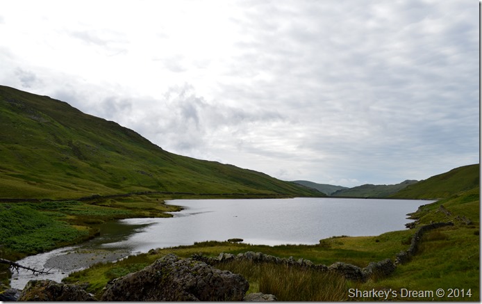
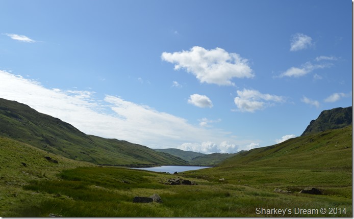
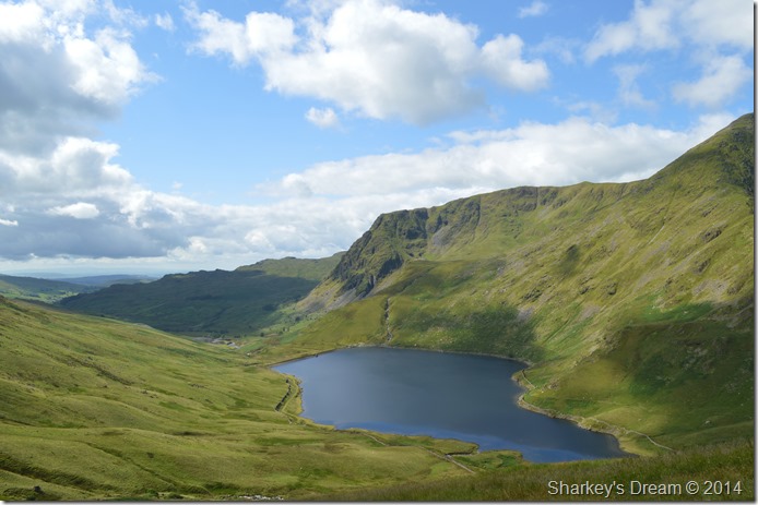
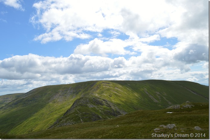
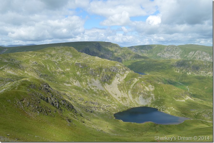
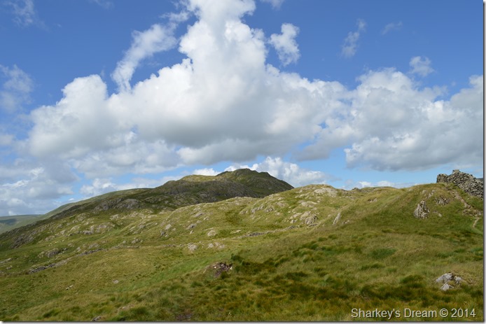
Once we reached the Reservoir we finally got to see Lingmell End directly where a route was agreed & plotted by David & myself on which way was the best to ascend. We chose to take on the contour or ‘profile’ of the fell by heading directly up its nose. |
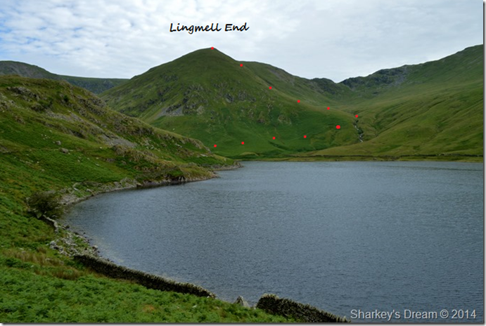 |
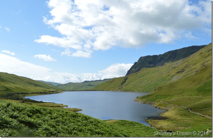
| Lingmell End & the top of The Nan Bield Pass taken from Kentmere Reservoir. |
| After leaving the Weir behind we navigated ourselves around the Reservoir whose narrow path was overcome by water still flowing from the fellside from the previous nights rainfall. |
 |
| Here looking back at Kentmere Reservoir & Dam. |
| |
 |
| A rather youthful River Kent in Full flow. |
The thought of crossing the River Kent never crossed our minds, that was until we reached the point where the Kent flows into the Reservoir. It seems the previous nights rainfall had swollen the River Kent making any crossing un-safe meaning we had to follow the River up stream & look for a safer place to cross.
Easier said than done when crossing any swollen River! |
 |
| Searching for a place to cross the River Kent. |
David strode on in search of a better & safer place to cross. On any given occasion I have been known to wade through Rivers or Becks & dry off naturally but here, the River Kent simply wouldn’t allow a safe crossing where at times the River looked shallow at one to two feet in depth, would then rise well over three feet towards the middle & far bank.
We had been walking a good while by the time we made the decision that we would simply have to wade through, David suggested we take off our socks and boots, even doing this would still get the bottom of our shorts wet but that was the best offer we had.
We both found suitable ground close to the ‘best spot’ to cross the River by where we then stripped of the socks before tying our boot laces in loops & tying them around our necks, I committed by throwing my walking poles like javelin’s over to the opposite side of the bank before lowing myself down into the freezing cold water.
The water reached knee level almost instantly but we had aimed our sights for the centre of the river where it seemed to shallow out a little towards the opposite bank, coping with the cold fast flowing water was one thing, having nothing on your feet over extremely slippery rock underfoot was another as I struggled for traction making David wait behind me much longer than we both needed of. After quite a lot of silent ouches from myself we soon found ourselves on the bank where David found a large rock to sit by & re-apply the socks & boots, at this point my feet were still in a centimetre of cold grassy water so without hesitation I de shouldered my pack & used it to sit on.
Without really noticing it seemed, the cloud had vanished & the sun had come out.
Wah hey! |
 |
| Ill Bell’s north east ridge as the sun came out. |
| With nothing to dry our feet we sat a few moments to let the sun dry them off as best we could before re-applying socks & boots, the feeling of warm socks over cold feet made the decision to cross barefoot more than worth it, after all we didn’t want to be taking on a steep climb with wet socks. |
 |
| Back tracking with Kentmere Reservoir & Rainsborrow Crag seen right. |
I took this photo shortly after shouldering pack again which just goes to show the distance we had to travel to make a safe crossing.
We followed the Kent for a short while walking through tall Grass in preparation for the Bracken we knew we had to cross before reaching the base of our ascent.
We encountered the Bracken first thigh high via a faint path that seamlessly lead to nothing where we then had to blaze a trail through ourselves.
Every now & again we would stop to admire the views which took the mind away from the fight with the Bracken. |
 |
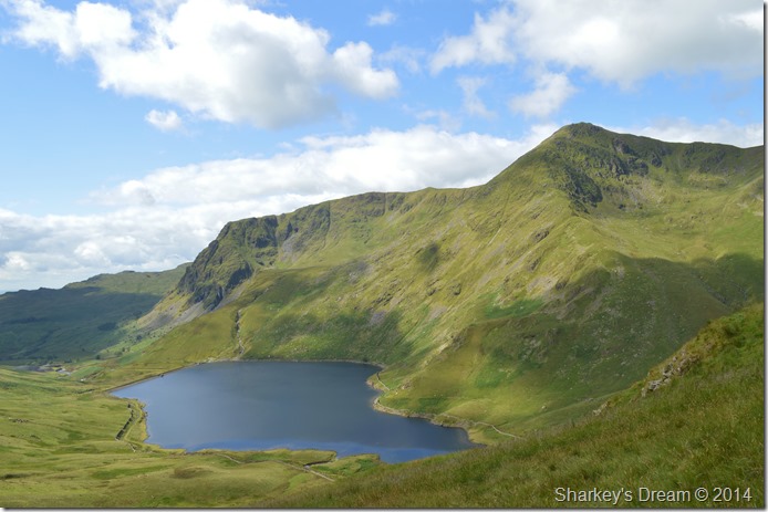
| Kentmere Reservoir seen with Yoke & Rainsborrow Cove. |
| |
 |
| Man puts out plea to find ones legs. |
| I wouldn’t say that wading through the Bracken was unpleasant because it wasn’t, it was just a means of reaching the next objective after all, however it was a little tiring & most definitely wet with also the odd hole in the ground to look out for. |
 |
| Yoke & Ill Bell seen across Kentmere Reservoir. |
| |
 |
| |
| |
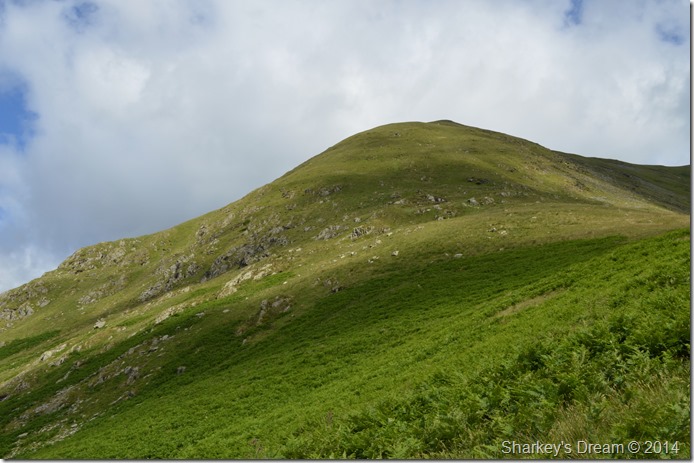 |
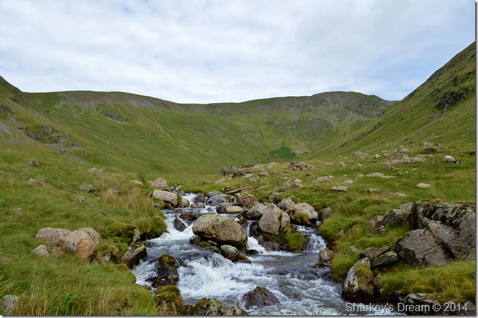
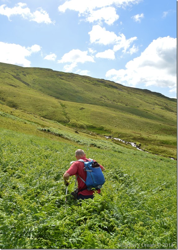
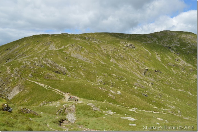
| Ascent on Lingmell End. |
After our encounter with the Bracken we soon reached the base of our ascent which looked far more daunting than what the picture might suggest.
Here we mopped brows before plotting a line up the fell on which to follow seeing as from now on, we were walking pathless.
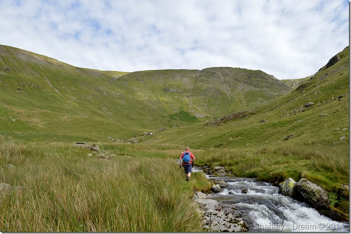
David set off in good pace closely followed by myself, negotiating the Bracken & Grasses was done once more before we settled at a low point along the ascent seen in the photo where the grass appears a lighter green.
From there the ascent took on a steepness of a new level where at times I found myself walking on my tippy toes with my walking poles high above my shoulders such the steepness of the fell side. The ascent was dotted with unseen sheep dens cut into the fell side which were a nice place to catch your breath back by, but a horrible place to get yourself out of. It seemed best to avoid such places.
Every now & again I would see David stop to catch his breath back or mop his forehead with his trademark hand towel that he keeps between shoulder & pack.
I opted for my own route should it lighten my load but it was no use, David had found the best line & I was soon back on it closely catching David up as he waited for me beneath the nose of the summit.
A joke was shared whilst we both got our breaths back before jointly arriving over the shoulder of the fell to be greeted by a smooth grassy ridge whose grasses where illuminated by a bright sun overhead.
The next two photos where taken during brief rest stops as David trundled on up ahead, I somehow failed to manage an ‘up shot or down shot’ of the ridge as the ascent/descent at times just fell below leaving nothing but a grass shelf to look up or down on.
Averting my eyes towards the Ill Bell ridge however, never failed to get my attentions… |
 |
| Yoke, Rainsborrow Cove & The Kentmere Reservoir seen from a brief rest stop along the ascent. |
| |
 |
| This time with Ill Bell & Ill Bell’s east ridge. |
| |
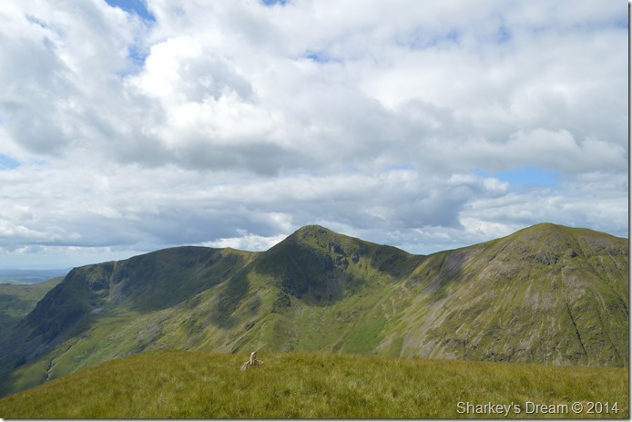 |
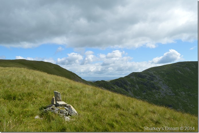
| Yoke, Ill Bell & Froswick taken from Lingmell End summit cairn. |
I didn’t expect to find a cairn at all & was delighted in doing so, here we both took a little time out to take photos & once again, get the breath back.
The views as of late have been something to talk of as David points out the top of The Wrynose Pass & a host of southern fells including the Gables & Scafells.
I however have a niggling pain at the front of my right foot in the same place where the knot from laces is located, I undo my laces to ease a little pressure & redo them this time not crossing the laces around the area but taking the laces straight up & around the back of the boot, this eases the pain but gave less support. |
 |
| The top of The Nan Bield Pass seen from Lingmoor End stone summit cairn. |
| |
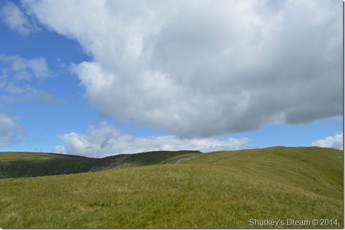 |
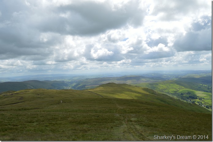
| Rewards are plentiful as we head for Mardale Ill Bell. |
| One of the whole highlights of the day for me was this short ridge walk all the way to Mardale Ill Bell which can be seen as the pointed peak in shadow up ahead. |
 |
| Here, looking back along the summit ridge of Lingmoor End towards the Ill Bell ridge. |
| The weather seemed to change as we headed for Mardale Ill Bell summit as every now & again the sun would disappear behind cloud leaving a rather cool wind about the summit tops. |
 |
| High Street taken from Mardale Ill Bell summit. |
| We had toyed with the idea of heading over to High Street whilst back down in Kentmere but sadly gave it a second glance once the ascent on Lingmell End was behind us, which I was kinda happy about as I have plans for a future walk up High Street in the not too distant future. |
 |
| Harter Fell (Mardale) seen shortly after leaving Mardale Ill Bell summit. |
We both spent a few moments taking photos from the summit & expecting really to be seeing more than just the two of us given that today is a Saturday in the middle of July we hadn’t come across anyone as of yet.
That all changed as we took in the descent towards Nan Bield Pass when we came across the Duke of Edinburgh youngsters taking a rest shortly after leaving Mardale Ill Bell summit, we pass on our Good Mornings as I find it hard to avoid in asking the leader of the group how they came to leave a perfectly good path whilst traversing above Kentmere Reservoir but, I managed to keep it in as I thought he didn’t want reminding of what could have been a genuine mistake.
But I guess, the kids didn’t let that one go either! |
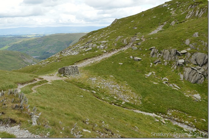 |
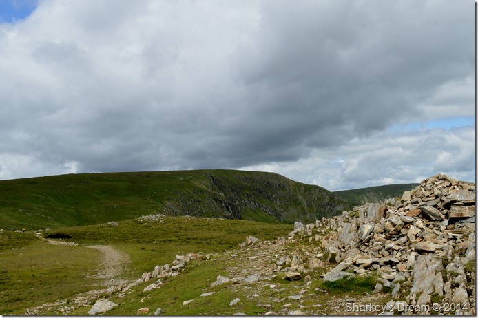
| The stone shelter found at the top of Nan Bield Pass. |
We soon found ourselves at top of Nan Bield Pass where we came across a large group of walkers huddled into the shelter, we pass on more good mornings before we take on the next ascent of the day on Harter Fell (Mardale) |
 |
| Here, looking back over the stone shelter towards Mardale Ill Bell. |
The sun came back out whilst we took on the ascent on Hater Fell (Mardale) leaving a warm feel about the summits once more, the heat would come like the flick of a light switch once the sun disappeared behind cloud as it would almost leave you reaching for an extra layer, then once it came back out again, you was too hot.
Quite a few people we crossed commented about it! |
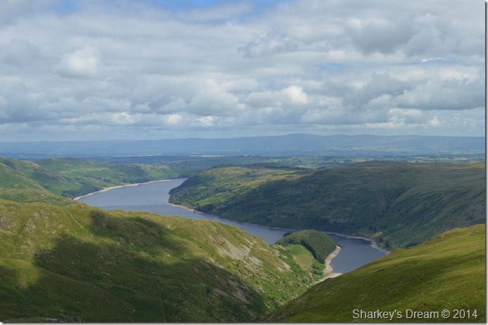 |
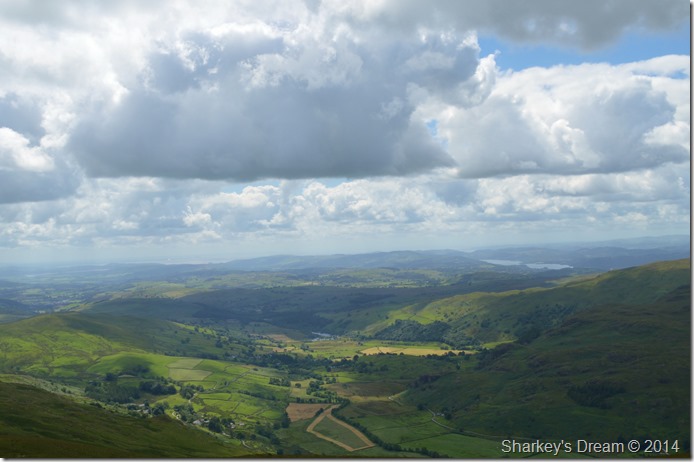
| Haweswater & High Street’s Rough Crag ridge seen as it descends to The Rigg far below. |
| |
 |
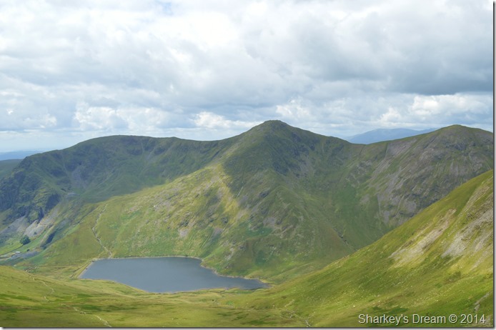
| Mardale Ill Bell’s east ridge seen with High Street & a distant Kidsty Pike (far right) from our ascent on Harter Fell (Mardale) with Small Water below. |
| With the sun came colour which illuminated Small Water magically, both David & I studied both the north & east ridge that Mardale Ill Bell has to offer which hopefully will be turned into a future walk sometime soon. |
 |
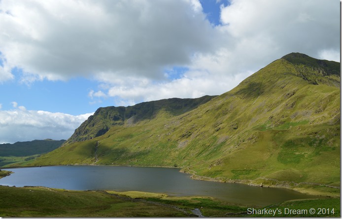
| The Ill Bell ridge seen with Lingmell End seen sharply rising from Kentmere Reservoir below. |
| Our ascent on Harter Fell was done with great stead seamlessly making towards the summit shoulder in no time at all, below us we spot a couple who are also making their way up the summit but for whatever reason, seem to be rushing. |
 |
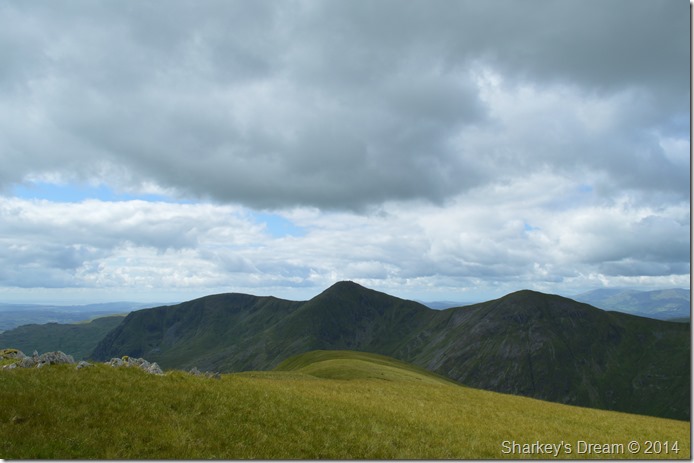
| Mardale Ill Bell, High Street & Kidsty Pike seen from Harter Fell (Mardale) summit cairn. |
By the time we arrived at the summit we were joined by a couple who were just about to leave for Kentmere Pike, we chatted briefly before the couple we had seen below us on our ascent caught us up who all passed on their pleasantries.
It was just no good, the sleeves on my Craghopper shirt had to be rolled down, sunshine or not, I had goosebumps over my arms whilst here.
Yeah I know…man up Paul! |
 |
| Looking back across Brown Howe towards Harter Fell shortly before arriving at Kentmere Pike summit. |
| |
 |
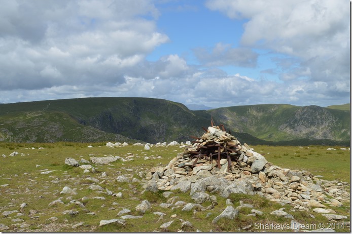
| Kentmere Pike summit Trig Point & our lunch spot. |
We had caught up with one of the couples we had spoke with back on Harter Fell by the time we reached Kentmere Pike summit who were just finishing of their lunches whilst sat on the stone slabs used to hop over the stone wall.
Sorry to disturb your lunch but would you mind if we hop over ‘sorry of course not’ the guy moved his butty box which was perched on one of the stone slabs, after making it over what ensued was nothing short of mayhem as the guy seemed to drop his lunch, its packaging & his map all within a split second ‘the maps blowing away his wife shouts’ all the while I’m handing the guy back floating bits of sandwich bags & what not back at him ‘get the map, get the map’ his wife is still shouting…
David sits down struggling to contain his laughter behind a mouthful of his own sandwich, I however feel a little guilty for perhaps ruining the guys day.
Lunch was great, in fact lunch was better than great & went on much longer than usual due splendid views only interrupted by David’s spotting of a cloud that looked like the south English coast.
Good times! |
 |
| Taking on the ridge towards Shipman Knotts. |
| After packing lunch away we shouldered packs for the last summit of the day in Shipman Knotts which when walking from the direction of Kentmere Pike is mostly downhill before a slight rise to reach the summit. |
 |
| The Kentmere Valley from above. |
| |
 |
| Shipman Knotts summit. |
| The sun cast dark shadows across the hill side taking light with it, for some reason here at the summit of Shipman Knotts it felt much colder than any of our previous summits that we had visited today, David decides to take his Weather Meter out which gave a wind speed of 19mph with a temperature of 12.1°C which is really nothing to speak of other than it did feel much cooler than that. |
 |
| Here, looking back on Shipman Knotts. |
We left the summit of Shipman Knotts by following the stone wall where we passed another couple making their own ascent at the summit.
Shortly afterwards we branched off the main path right which in essence is just a short cut back down to the Kentmere side of the Longsleddale Pass below, this was done under now scorching afternoon sun as we both commented that it had come an hour to late, but, predicted all the while. |
 |
| The Ill Bell ridge from Stile End. |
| |
 |
| This time without the zoom. |
| |
 |
| The Kentmere Valley with The Ill Bell ridge over to left & Kentmere Pike to the right. |
| After passing through Stile End we came to the Kentmere end of the Longsleddale Pass before taking a left turn towards Kentmere & its narrow lanes all lined by wooden telegraph poles. Photo opportunities looking into Kentmere were plentiful should you stop & have a look over the stone wall every now & again. |
 |
| Almost back at St Cuthbert’s Church Kentmere. |
We took in the quiet narrow lanes only stopping once in a while to have a nosey at the traditional Cottages typical to the Kentmere Valley most of who’s front doors were left open such is life & a world away to what we all know as town or city life.
It seems Kentmere is the place that time forgot, and long may it remain that way.
We crossed the River Kent for the last time before taking on the very last ascent of the day before reaching the Church where our cars were left to bake in the sun some seven hours ago. My car is parked a short walk away from David’s so we kit down separately only to re-join for one last chat at the back of David’s car where I take an impressive lean on the rear wing as David talks about our next walk planned for August.
Lets hope we don’t have to wait nearly nine months before we get that walk underway, yet if we do, lets hope it turns out half as good as todays walk. |
|
| |
| Back to top |
 |
|