|
The Rannerdale Bluebells |
 |
 |
18th May 2014 |
 |
|
May has always been a bit of a busy month for me, so much so I always try to take a few days off here & there, yet sadly this time the weather wasn’t as kind as I would of liked it to have been thus me putting off my trip to see the Rannerdale Bluebells.
Although this weekend I had work to contend with I still had the urge to visit Rannerdale before the Bluebells disappeared for another year & this time like most years, I wasn’t going to let that happen.
My route afterwards was made up as I went along…
I’m blaming what the affect of the Bluebells did to me on that on |
|
Wainwright Guidebook Six |
 |
| The North Western Fells |
-Rannerdale Knotts
Rannerdale is seen by most visitors to Buttermere – but only as a farm and a cottage and a patchwork of fields on the shore of Crummock Water: a pleasant green oasis in the lap of shaggy fells, but remarkable.
Rannerdale has a place in history as the setting of a fierce battle in which the Norman Invaders were ambushed and routed by the English in the years after the conquest.
This is Rannerdale Knotts, a mountain in miniature, and a proud one. Not even Gable has witnessed a real battle! And, what’s more, our side won!!
|
 |
|
| |
|
Overview |
|
|
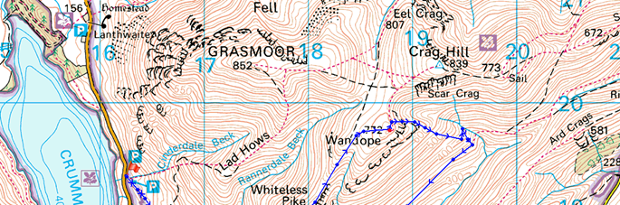
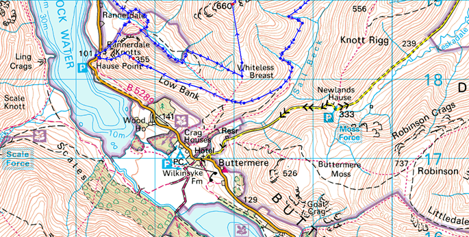
| Ascent: |
2,677 Feet, 795 Meters |
| Wainwrights: |
3, Whiteless Pike – Wandope – Rannerdale Knotts |
| Weather: |
Overcast To Start Turning Warm & Sunny, Highs Of 21°C Lows Of 12°C |
| Parking: |
Car Park, Cinderdale Common, Crummock Water |
| Area: |
North Western |
| Miles: |
7.7 |
| Walking With: |
On My Own |
| Ordnance Survey: |
OL4 |
| Time Taken: |
5 Hours 30 Minutes |
| Route: |
Cinderdale Common – Rannerdale – Squat Beck – Whiteless Breast – Whiteless Pike – Whiteless Edge – Thirdgill Head Man – Wandope – Wandope East Ridge – Track Above Sail Beck – Third Gill – Bleak Rigg – Low Bank – Rannerdale Knotts – Hause Point – Rannerdale – Cinderdale Common |
|
| |
|
Map and Photo Gallery |
|
|
  |
| |
| |
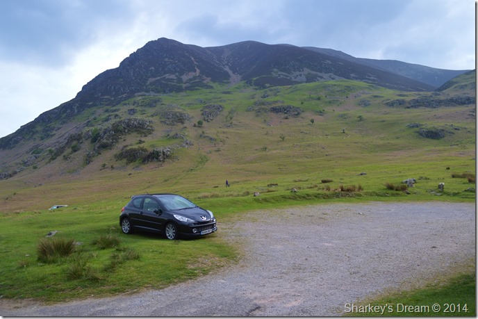 |
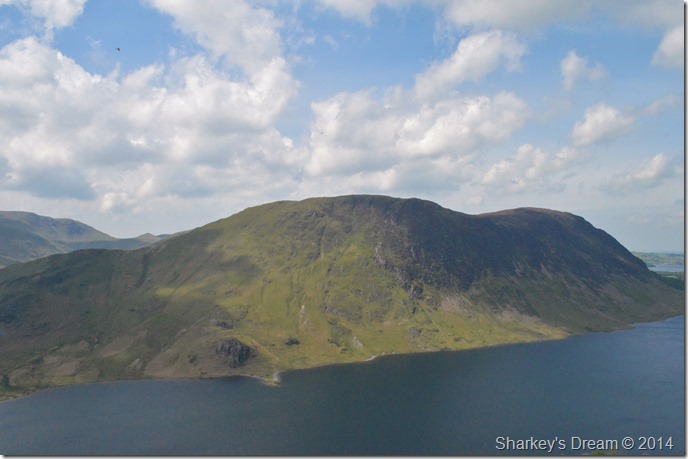
| Grasmoor from Cinderdale Car Park 07:58am 12°C |
The alarm went off at 05:10 as I fumbled around for the snooze button with just the one eye open. I had all intentions of leaving much earlier this morning which would then allow me some precious afternoon time to catch up on some chores at home, but going off my lack of enthusiasm, I knew that was never going to happen.
The drive north was un-eventful as I cloud watched through the windscreen checking out the distant deep greys that blanketed the Coniston Fells that I could see from the M6 once Lancaster had been passed. The closer I got to Lakeland the darker the clouds turned until I reached the A66 where through the morning haze a distant Grisedale Pike could be seen which kinda set the setting for anything below 800 Meters through the hazy morning light.
Things were looking up.
My route took me over the Whinlatter Pass which was almost deserted after only stopping to use the rest room at the visitor centre. The car engine cooling fan was roaring away as I arrived at Cinderdale, something that I would never normally hear, well, only after a little thrashing maybe. I picked my spot by reversing neatly up to a grassy bank before my routine grizzly bear like yawn.
It was pleasant to lace the boots up in my shorts as one knee dug into the dry ground, usually I would walk away brushing leaves away or wiping mud from my knee cap, but not this morning as my knee was as dry & dirt free & ready for a good mornings walking ahead. |
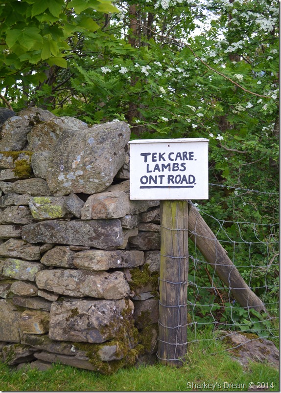 |
| You know when your in Cinderdale when you pass this sign. |
I’m almost certain there never used to be any full stops on this sign which read; Tek care lambs cars ont road
It’s only the Rannerdale lambs that can read mind, don’t go showing a book of Shakespeare to any up road, they’ll not have a clue what your doing & you’ll most probably end up with some strange looks. |
 |
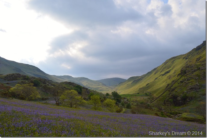
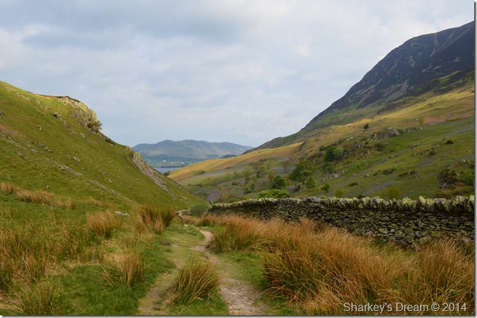
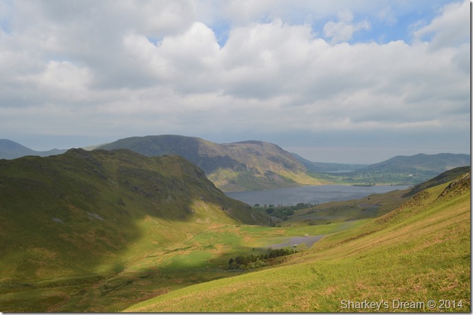
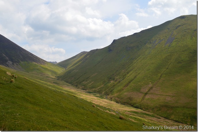
| Rannerdale Knotts from Cinderdale Common. |
| After leaving the lambs reading the Sunday papers I headed up the track towards Rannerdale Knotts from where it was quite clear, I was in for a beautiful display of wild Bluebells. |
 |
| Rannerdale Knotts from Cinderdale Common. |
A warm wind blew across the common leaving me thinking just why the hell I was wearing my jacket over my summer craghoppers shirt, once more, I had rolled my sleeves up before putting my jacket on which where by now feeling rather uncomfortable coiled up beneath my armpits.
Time to re-adapt & to question why I felt I needed to put a jacket on when its 12°C outside. |
 |
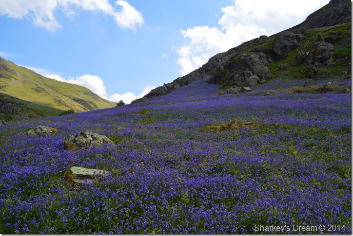
| Rannerdale. |
| The scent of the Bluebells hit me before the sight of them did, the feeling of being like a kid in a sweet shop sprang to mind as in every direction I looked across a sea of Bluebells blew like waves in the wind. |
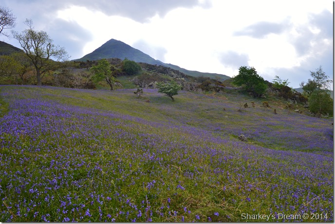 |
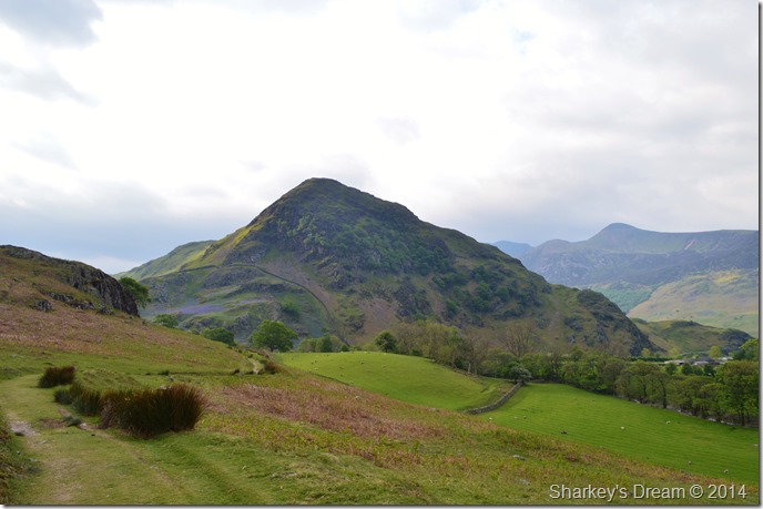
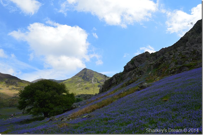
| Whiteless Pike from Rannerdale. |
| I’m not quite sure what happened from this point on as I had all intentions after leaving Rannerdale for a traverse up Mellbreak via the south ridge then return to Cinderdale via the Weirs situated on the northern shore of Mellbreak… When I look back I can categorically state that after seeing Whiteless Pike beyond the Bluebells it must have had some impact on how my route changed so dramatically. |
 |
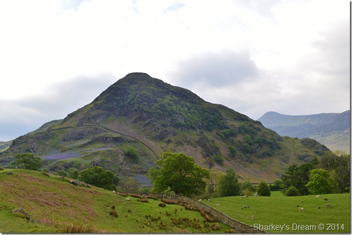
| Rannerdale Knotts. |
| |
 |
| High Rannerdale. |
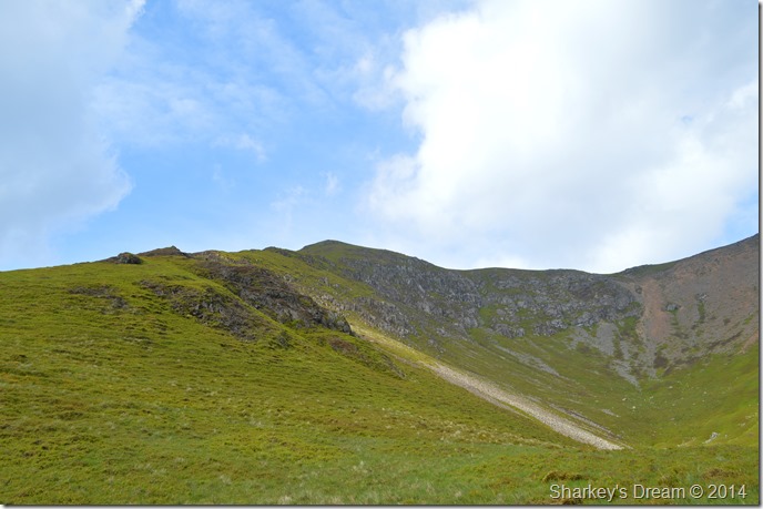
Seeing Whiteless Pike moments earlier still had a firm hold on me & without knowing I was heading through High Rannerdale for the Col seen in the centre of the photo from where I would start my Rannerdale ascent.
At this stage I hadn’t thought through the next step after Whiteless Pike would be, Grasmoor lay heavy on the mind & so did Sail but seeing as this was a ‘Sunday walk’ my mileage & accents are normally narrowed down as appose to my Saturday walks. |
 |
| Here looking back on Low Fell together with Fellbarrow from High Rannerdale. |
| Now & then the sun would come out illuminating the wild grasses as large shadows sprawled across the fell side, the wind had a strong summery gust to it which wasn’t too cold down here in the valley. |
 |
| Grasmoor & Lad Hows after crossing Squat Beck. |
I had Whiteless Pike dead to my left flank as I peered an alternative route up without reaching the Col ahead, sheep tracks ran horizontal across the side of the vastness of the hill side but they were high up & didn’t seem worth the huge energy involved to reach them.
That was until I spotted a narrow ridge like route that ran beside a ravine from where high above a more promising grassy ledge ran almost horizontal to Whiteless Breast summit. |
 |
| My alternative ascent on Whiteless Pike. |
Okay I apologise for the sheer lack of creativeness when I took this photo of my route ahead, if you look carefully the horizontal track can be seen running through the photo from left to right, the hard bit was getting there!
Here I down pack as for one awkward reason or another I’m still wearing my jacket, it comes off first as I roll it best I can into a neat fold then strap it beneath the lid of my pack, next I un-fasten the walking poles as I fear I’m going to need them. |
 |
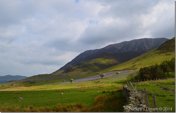
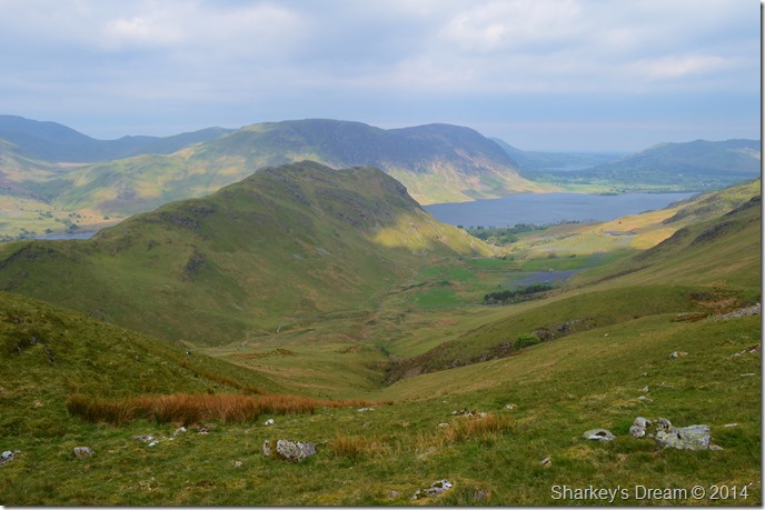
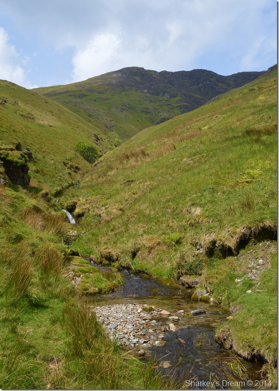
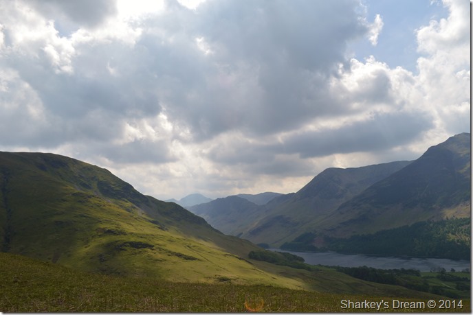
| Mellbreak & Crummock Water from the start of my ascent. |
| Before reaching my ascent I first had to cross a ‘boggy bit’ Here the ground was still sodden & gave my boots a good soaking almost to the hilt, I had no alternative other than to press on as I had already committed to my route. My intended route via Mellbreak from here just seemed like a distant memory. |
 |
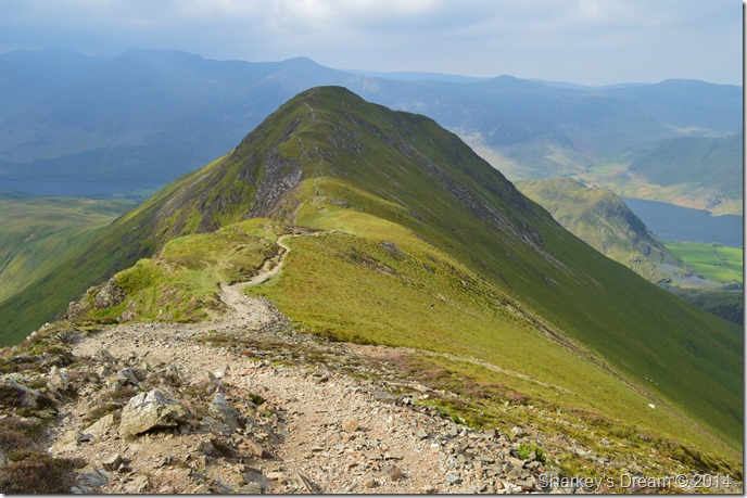
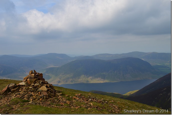
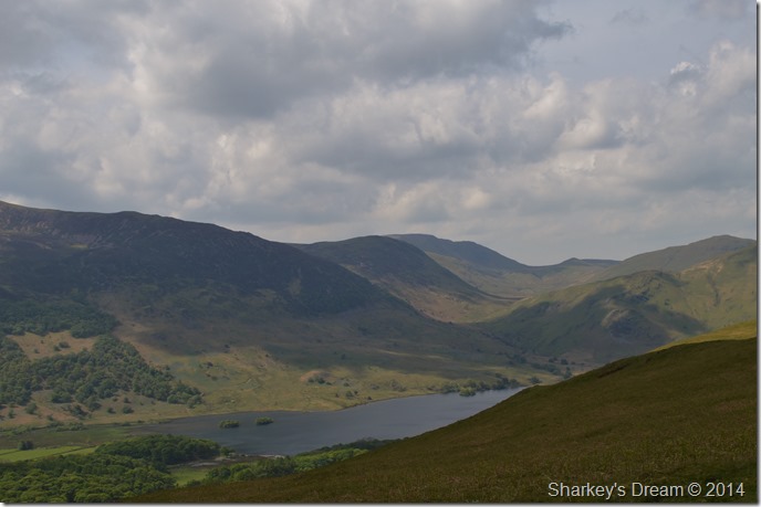
| Rannerdale Knotts, Crummock Water, Loweswater & Mellbreak from my ascent. |
| As the morning progressed I was treated to more that just the odd dapple of sun which now lit Rannerdale just magically, I found this more than enough reason to stop & take probably much more breathers than I would normally take, but with views like this I guess no one could have blamed me. |
 |
| Every now & again the sun would go in too. |
| |
 |
| A distant Sail, Ard Crags & Causey Pike seen over Sail Beck. |
| After reaching Whiteless Breast I re-joined up with the main summit path, a path that I had always descended rather than ascended. The path here is a pleasure to follow no matter which direction you are travelling in, such the pleasant ever so slightly ascent is gained once Whiteless Breast is behind you. |
 |
| Whiteless Breast with High Snockrigg appearing in the left of the photo. |
| |
 |
| Sail, Knott Rigg & Ard Crags seen above Sail Beck. |
At this point my mind was still tinkering on which route to take once I had gained Wandope further up the ridge, I toiled at the idea of summiting Sail then the steep vicious ascent on Ard Crags from the top of Rigg Beck but sadly time wouldn’t allow such a route.
I’m just going to have to keep thinking. |
 |
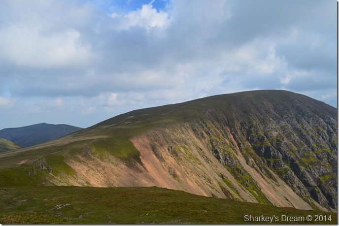
| Grasmoor & Lad Hows from Whiteless Pike summit cairn. |
| The wind had grown quite a bit once I had reached Whiteless Pike summit, so much so I contemplated downing pack & reaching for the jacket again, yet in the sun the wind was cope able so I persevered with feeling of cold all the while looking forward to the times when the sun came out & I began to feel too hot. |
 |
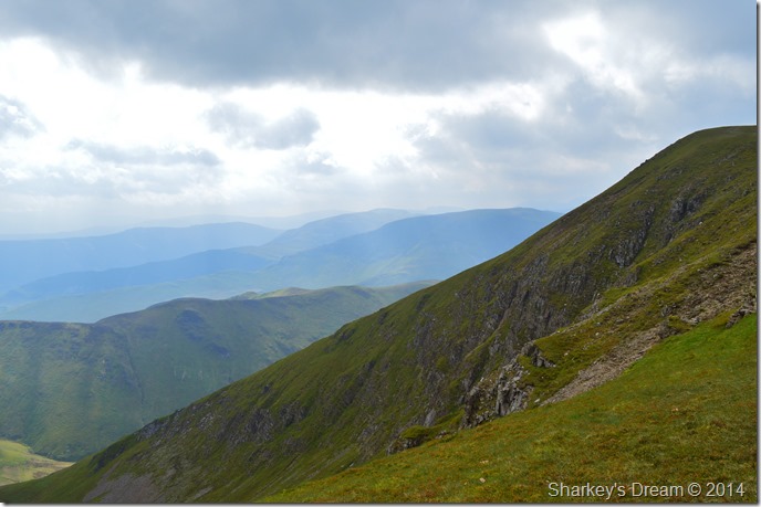
| Whiteless Edge, Wandope & Third Gill from Whiteless Pike summit. |
| |
 |
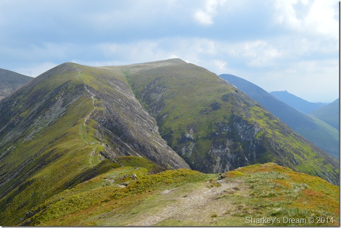
| Whiteless Pike & Whiteless Edge seen from my Wandope ascent. |
| After crossing Whiteless Edge I stopped to take this photo looking back at what seemed to be some much more promising sunshine that didn’t seem to hide behind the clouds as much. |
 |
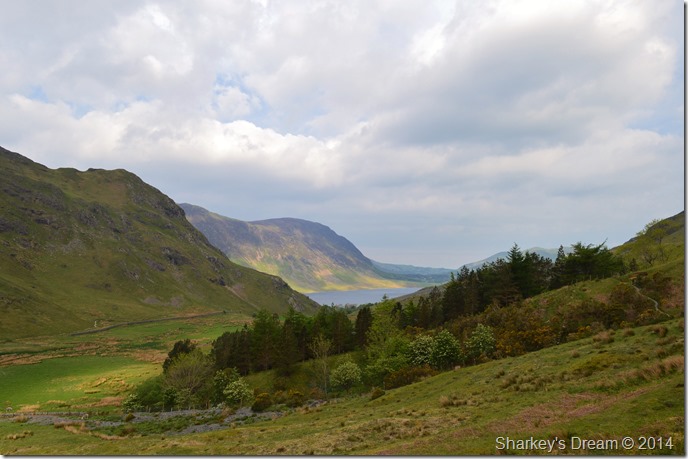
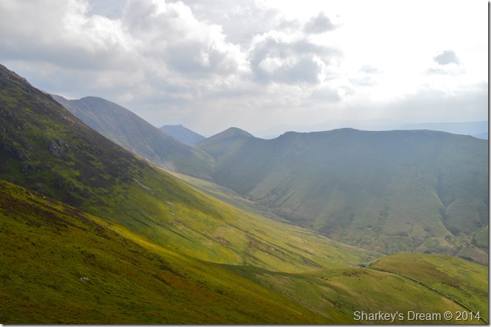
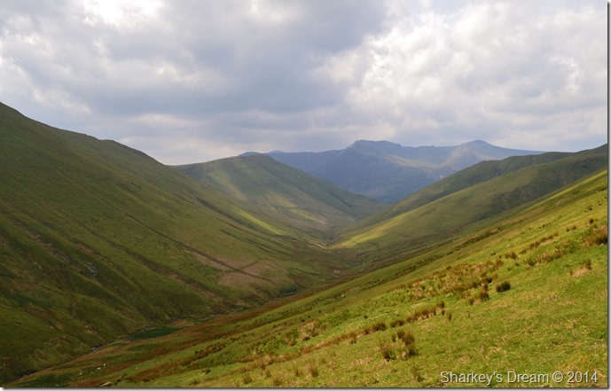
A distant Crummock Water, north western fells seen together with Mellbreak from Thirdhead Gill Man summit cairn.
|
| |
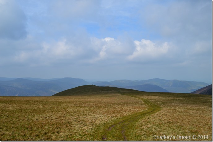 |
| Here, looking across Wandope’s grassy plateau towards Thirdjea Gill Man. |
Although I had the sunshine which was a positive delight the wind had picked up making exposed crossing such as this a little uncomfortable to walk in but not uncomfortable enough to dishevel my plans of making a summit of Eel Crag (Crag Hill) after firstly summiting Wandope.
It was no use though…that jacket had to go back on. |
 |
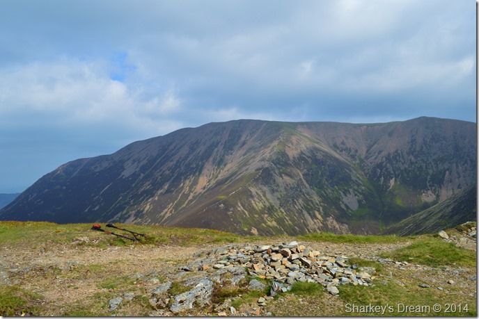
| Eel Crag (Crag Hill) from a very windy Wandope summit. |
It was no use, once more I downed pack this time to take out the jacket although this time I made sure I pulled in the hood cords making sure that the wind didn’t constantly blow my hood across my face which worked perfectly.
After some re-adjustments I was ready to take on Eel Crag (Crag Hill) via a narrow footpath that navigates the top of Addacomb Hole. |
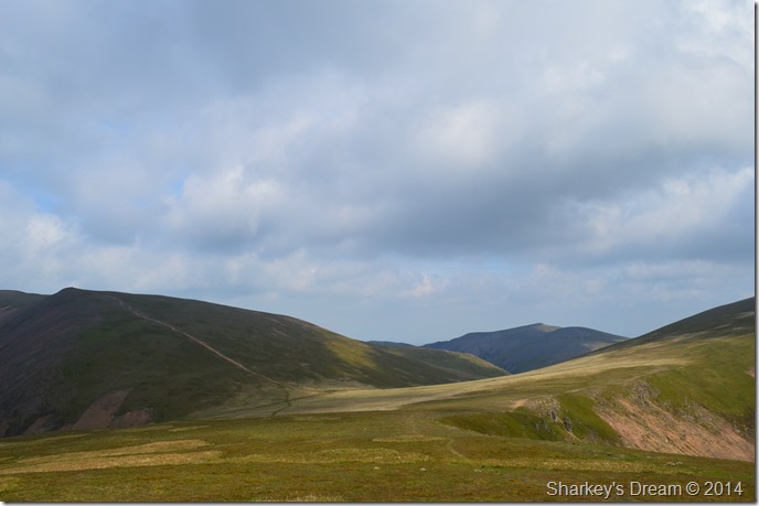 |
| Crossroads. |
| As I left Wandope I took this photo looking towards a host of more options should I change my mind if I wanted to summit Grasmoor (L) or Hopegill Head straight ahead, me, I’m going right…or I thought I was. |
 |
| Wandope east ridge from Addacomb Hole. |
The wind continued to blow quite fiercely as I joined the path to navigate Addacomb Hole, that was until I looked back in the direction of Wandope. I paused as I re-routed not only my options but just how inviting the east ridge looked, then without thinking about it I found myself heading back up the gentle slope to summit Wandope once more.
Once at the summit I checked my options on how I was going to take the steep gradient in, to my surprise I found a steep & very narrow path that descended through the bracken where every now & again sudden twist saw me turn 90° here then 90° there; all the while the walking poles were doing there job in keeping me upright through the tight narrow descent.
My only thoughts were, it’s possibly the steepest gradient I’ve used in a long while…but just look at the views. |
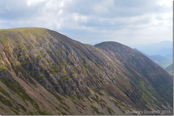 |
| Eel Crag (Crag Hill) & Sail seen across Addacomb Hole. |
| |
 |
| Wandope east ridge. |
| Within minutes of leaving Wandope summit the sun was back out & the wind had calmed down so much so that I soon found myself de-shouldering pack once more to take off the jacket not minutes after putting it back on (don’t you just hate it when that happens!) I wanted the descent to be as comfortable as possible & if this meant correcting my decision making then so be it. |
 |
| Here, looking back up the narrow ridge towards the summit. |
| |
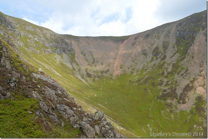 |
| Addacomb Hole. |
| Once a precarious rock step had been negotiated Addacomb Hole presented itself which was a truly awesome sight to say the least. Above me a silhouette of a figure is in the ridge that separates Eel Crag with Sail, I get a wave from the fellow (or woman) I couldn’t quite tell, the silhouetted figure gets a wave in return as I leave the narrow path a little further down to do a little exploring & maybe grab some lunch. |
 |
| Addacomb Hole. |
After all, it’s not everyday you can say that you had lunch at Addacomb Hole.
Oh and BTW…I’m on ham cheese & pickle today, the cheese a tad too dry for the summer months & where’s my satsuma’s! I forgot to pick them up, that’s where. |
 |
| Addacomb Hole seen with Wandope east ridge. |
| The camera just doesn’t do the east ridge any justice until up with the ridge itself, the more I think about it the more I think this has a classic winter route written all over it…it’s just a pity I’m a couple of months too late. |
 |
| Bearing down on Sail Beck with views of High Snockrigg, High Stile & Red Pike (Buttermere) |
| It was the kinda descent of two halves, one half of you wanted it over so you can start to feel your toes again, the other half of you just didn’t want it to end, me, I was somewhere towards the latter. |
 |
| A distant Causey Pike seen beyond Ard Crags & Knott Rigg. |
| |
 |
| Crossing Third Gill along the way as Whiteless Pike towers above. |
| |
 |
| Sail Beck. |
| I had seen the dashing Bluebells in fantastic display some of which are talking of the best they’d seen in years, followed closely by my exit through Sail Beck, a positive highlight of the whole walk. |
 |
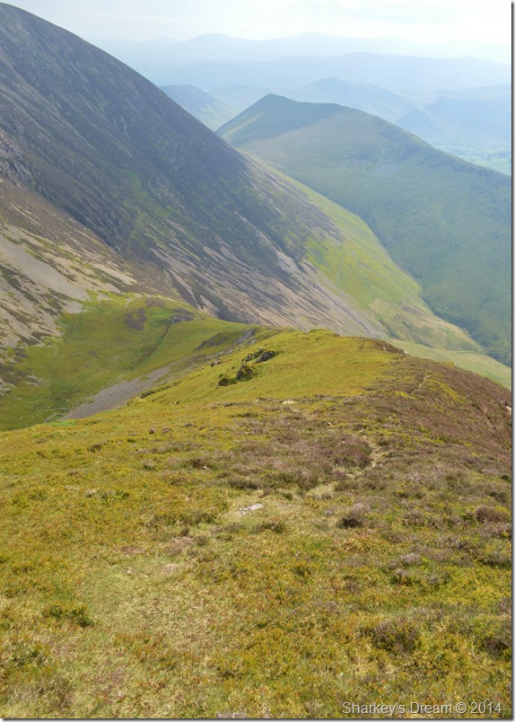
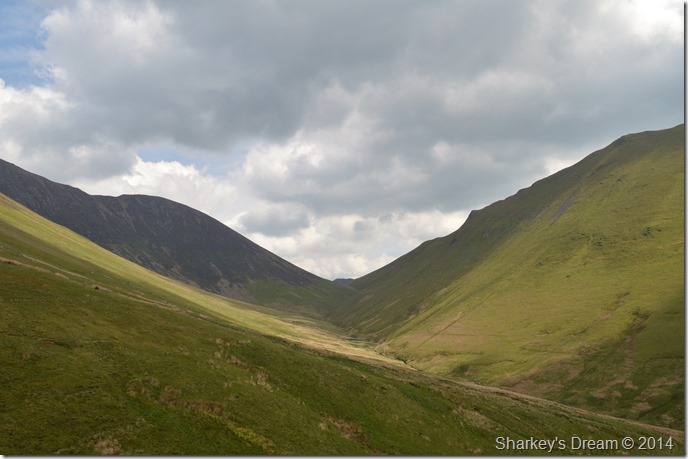
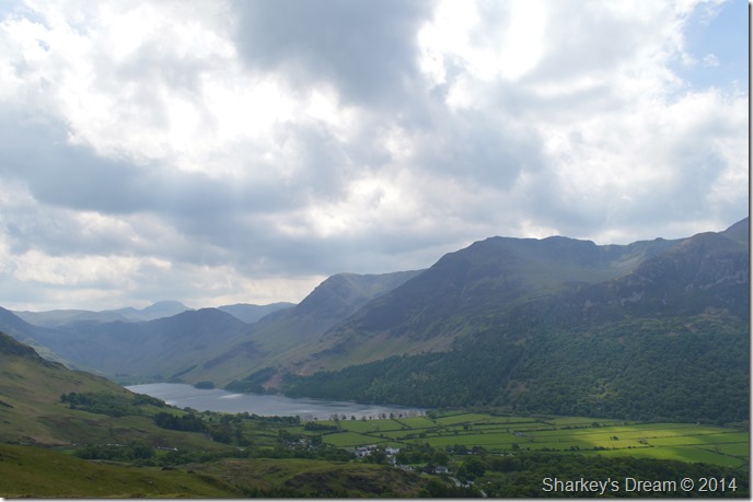
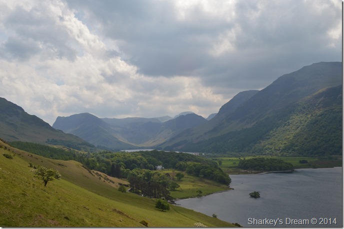
| Rannerdale from Low Bank. |
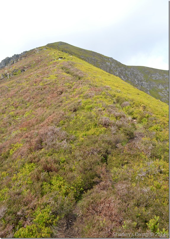
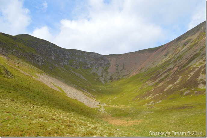
After leaving the delights of Sail Beck behind I took up a little more descent to re-join the Col I had photographed earlier that morning, ahead of me stood Rannerdale Knotts my final fell that would top of my Sunday walk.
Below me down in the valley of Rannerdale flocks of people are taking advantage of the midday sun, it was nice to see that quite a few of the visitors to Rannerdale had also chosen to take in Rannerdale Knotts after seeing the Bluebells.
Ancient & medieval thoughts crossed my mind whilst I took in the final leg of my journey, but I’ll get to that in a little while. |
 |
| Distant views over towards Mosedale, Great Borne, Floutern Kop & Gavel Fell seen far right. |
| |
 |
| Here, as I look back on High Snockrick with High Crag & a distant Hay Stacks over on the right. |
| |
 |
| High Crag, Hay Stacks & the distant Gables seen over Buttermere. |
| |
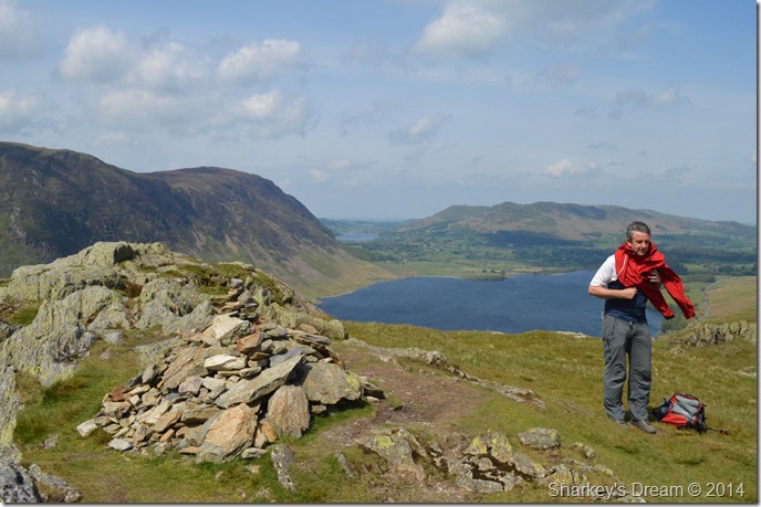 |
| Rannerdale Knotts summit with distant views of Loweswater, Low Fell & Fellbarrow. |
| Sadly my last summit of my walk came much too soon as the sun beat down over head. At the summit I am joined by this guy who un-wittingly managed to get in front of my summit shot as he layered down, we had a good chat for a while before I decided to head down passing more couple’s on their way up, all of which were mopping their brows as pleasantries on just how well the day was turning out were passed. |
 |
| Crummock Water & Mellbreak from my descent. |
| |
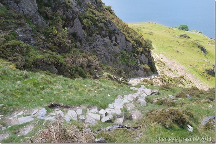 |
| The stone staircase. |
| Okay the staircase isn’t this paths official name just one I’ve adapted to this incredibly steep ascent/descent (depending upon your direction of travel) route to & from the summit, not one to be underestimated in bad weather & one certainly that will slow your summit time down to an almost crawl! |
 |
| Here looking direct into Warnscale Bottom over Buttermere. |
| |
 |
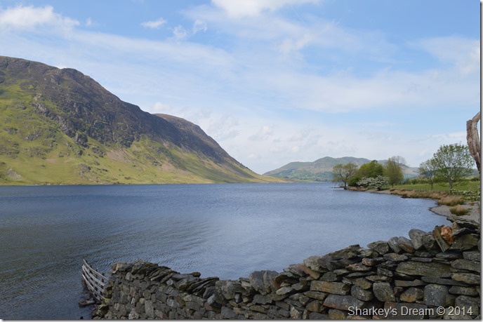
| Mellbreak & Crummock Water come into view once more close to Hause Point. |
| |
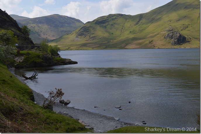 |
| Hause Point. |
With the amount of visitors that I had seen today I expected to see Hause Point awash with children paddling & mums & dads eating ice creams on the bank, so you can imagine my surprise when I stood down to the lake shore to find absolutely no one there but me.
Good times… |
 |
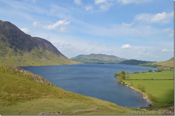
| Crummock Water, Mellbreak, Darling Fell & Low Fell from Hause Point. |
| |
 |
| Whiteless Pike as I pay one last visit to the Bluebells before heading back to the car. |
| |
 |
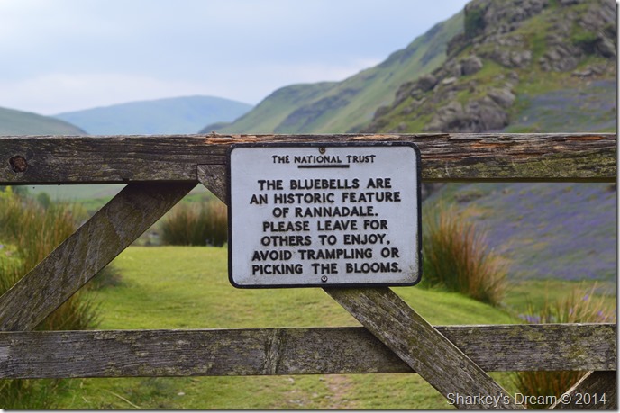
| The Rannerdale Bluebells. |
It’s sometime after 1066 and here in Rannerdale the the local warriors were commanded by the Earl Boethar, who succeeded in drawing the Normans into the side valley of Rannerdale, then routed them with a surprise attack from above and behind.
According to local tradition, the bluebells are said to have sprung from the spilt blood of the slain Norman soldiers.
‘Don’t tread on the Bluebells’ |
|
| |
| Back to top |
 |
|