|
Crinkle Crags to Pike O’Blisco via Hell Gill |
 |
 |
15th December 2013 |
 |
|
The weather played key feature in not just today’s walk but whether a walk would go ahead at all, it being so temperamental this time in of year.
It is December & yes daylight hours are scarce being so close to the shortest day an all, more so when the cloud is down. Watching the weather forecast daily is one quick way to the asylum if you ask me, this is why come these dark months I find it best to wait until 24, or even the last 12 hours before finally deciding on where or if to walk at all.
Patience is a nasty virtue to stand by, if like me when all you want to do is walk the fells, it doesn’t bode well, when half the fight is portrayed on the BBC weather page.
Lay those demons down, your time will come (easily said stamping my forty year old feet like a two year old)
It’s been a tough O’l month that weather watching. |
|
Wainwright Guidebook |
 |
| The Southern Fells |
-Crinkle Crags:
Some mountains are obviously named by reference to their physical characteristics. Crinkle Crags is one of these, and it was probably first so called by the dalesfolk to the east and around the head of Windermere, whence its lofty & serrated ridge, a succession of knobs and depressions, as aptly described by the name. These undulations seeming trivial from a distance are reviled at close range as steep buttresses and gullies above wild declivities, a scene of rugged grandeur, equalled by few others in the district.
For walkers who have already trodden the Band several times it makes a pleasant change and gives striking views of the huge Hell Gill ravine; but generally this route lacks the airiness and the views of the Band and is not to be preferred. Its one advantage is supply of running water |
 |
|
| |
|
Overview |
|
|
| Ascent: |
3,400 Feet, 1,037 Meters |
| Wainwrights: |
3, Crinkle Crags – Cold Pike – Pike O’Blisco |
| Weather: |
Overcast Turning Brighter, Clouding Over For The Remainder Of The Walk With Light Rain, High Gust Along The Tops Up To 65mph, Highs Of 8°C Lows Of 5°C Feels Like 0°C |
| Parking: |
Road Side Parking, Rossett Bridge / Old Dungeon Ghyll |
| Area: |
Southern |
| Miles: |
8.4 |
| Walking With: |
Tim Oxburgh |
| Ordnance Survey: |
OL6 |
| Time Taken: |
6 Hours 30 Minutes |
| Route: |
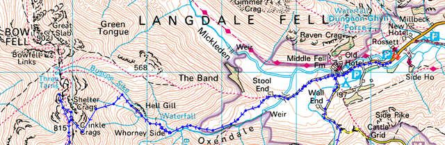
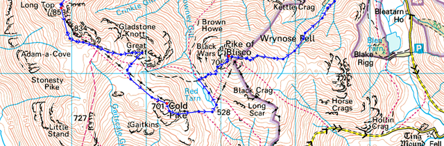
Old Dungeon Gill – Stool End Farm – Oxendale – Whorneyside Force – Hell Gill – Shelter Crags East Ridge Rake – Crinkle Crags – Great Knott – Cold Pike – Red Tarn – Pike O’Blisco – Wrynose Fell – Redacre Gill – Old Dungeon Gill |
|
| |
|
Map and Photo Gallery |
|
|
 |
| |
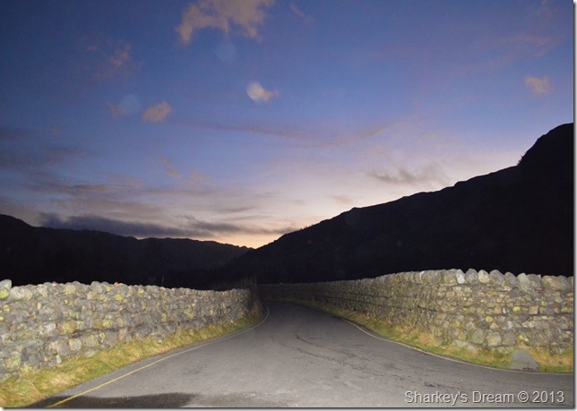
Jesus I cant see my laces, Great Langdale 07:40 5°C
The Lakeland Fells had experienced some heavy rainfall only hours previously this being the reason that much of the narrow lanes from Chapel Stile through to Great Langdale were submerged under deep standing water which was quite difficult to negotiate until almost upon them.
Progress was slow but we made it to Rossett Bridge only ten minutes later than planned, here I turned the car around before kitting up making sure I was facing the right way knowing how sometimes these roadside verges clog up very easily.
Kitting up was a little more difficult than usual due to the total pitch blackness, I thought to take out the head torch but I thought no, too much bother, in the end we kitted up behind the car, illumination came from a faint glow from the boot lamp.
Tim threw me a pack of Haribo lips & teeth which got tucked away in my map pocket, with this we slipped into the darkness bound for Stool End Farm. |
 |
| |
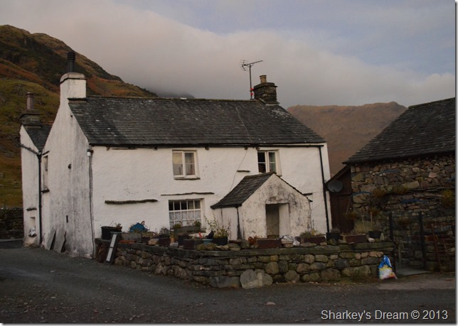
Dawn, Stool End Farm.
Gates creaked as we set the farm dogs barking while walking through the farmyard, a silent apology went out to the residents of Stool End there & then. |
 |
| |
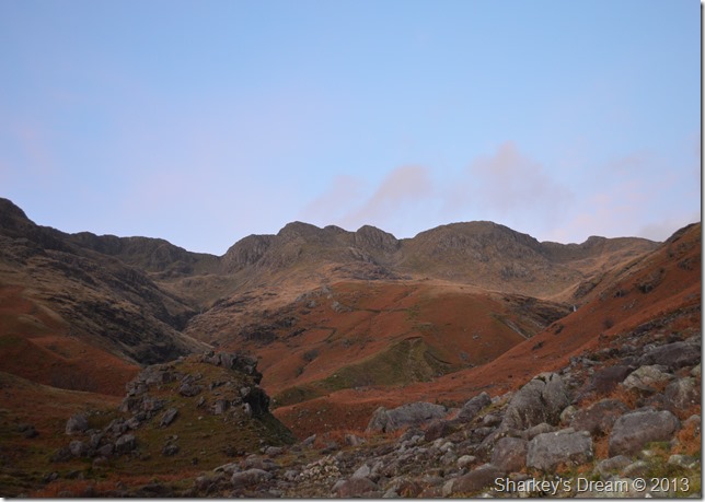
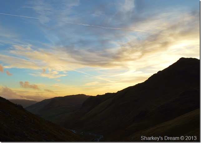
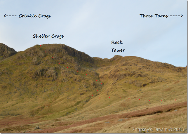
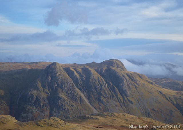
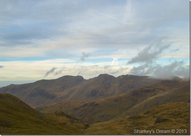
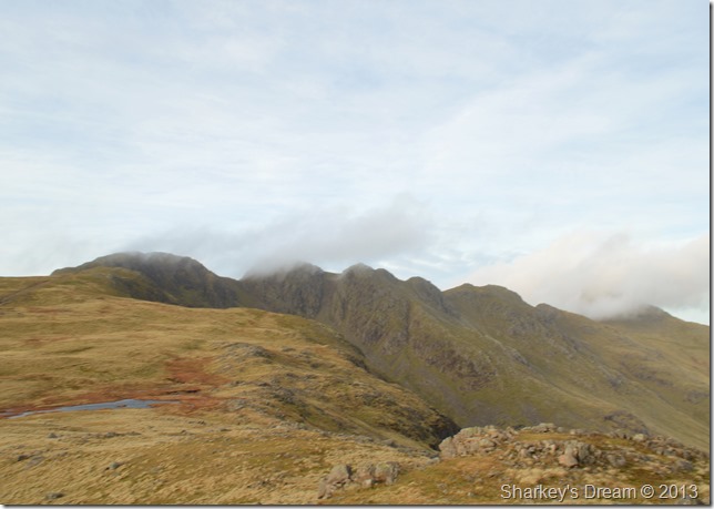
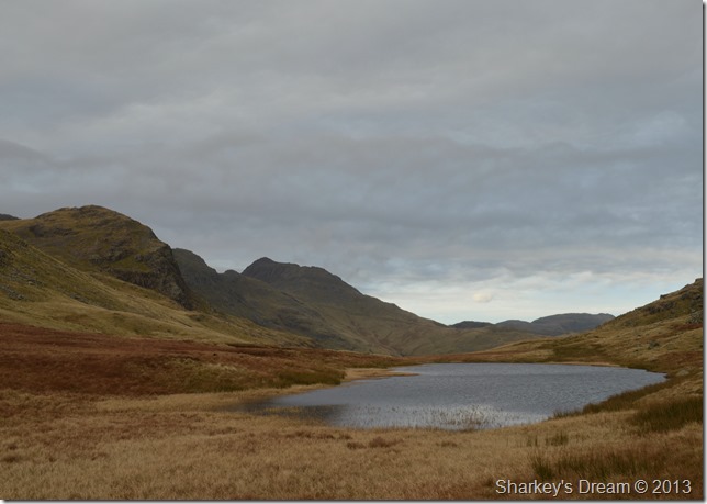
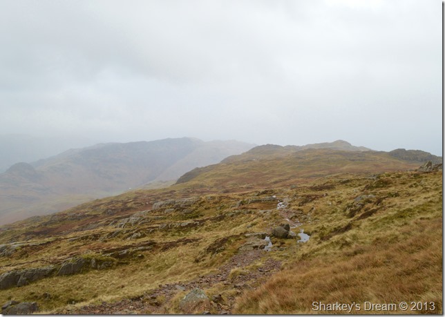
Crinkle Crags together with Crinkle Gill (L) Shelter Crags & Hell Gill far (R) taken from the Rock Tor.
I think depth & field speak volumes about this view & I don’t particularly mean about the photograph in itself; more of a ‘there’s so much to take in kinda feel’ about being here.
Hell Gill features (R) in the photo but from the valley floor you don’t get the best view so best to press on. Meanwhile the sunrise came spectacularly leaving pink & red streaks across the southern skies, all around us the cloud was breaking & lifting as far back as the Eastern Fells far behind us. |
 |
| |
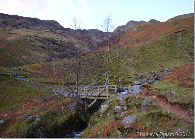
Heading for Whorneyside Force.
After we crossed the footbridge we turned right & took on the first real ascent of the morning via the grassy verge otherwise progressing as Whorneyside. For the more adventurous out here you could always keep left & take on Crinkle Gill, but that’s maybe for another day. |
 |
| |
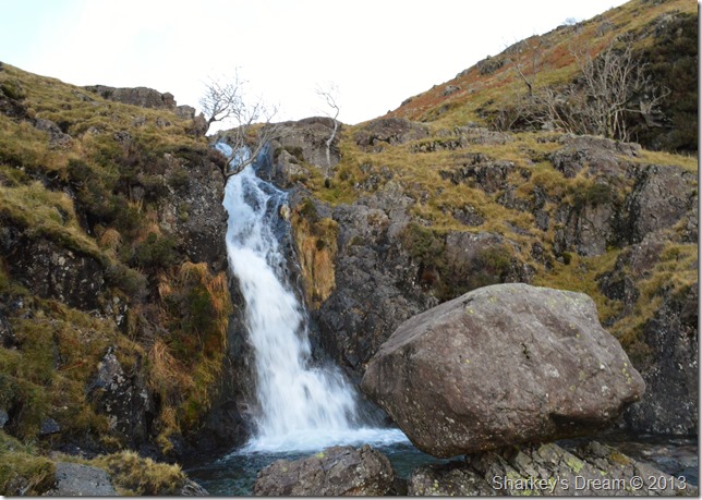
It was pretty deafening here at Whorneyside Force, the backlash of recent rainfall more than evident.
Some of you with a keen eye may have already noticed the perched boulder in the foreground…I’ll get me coat shall I… |
 |
| |
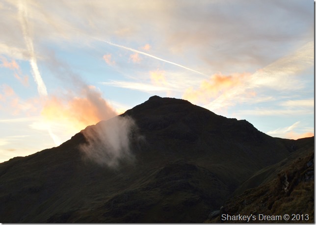
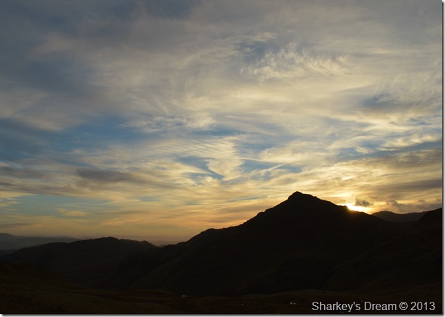
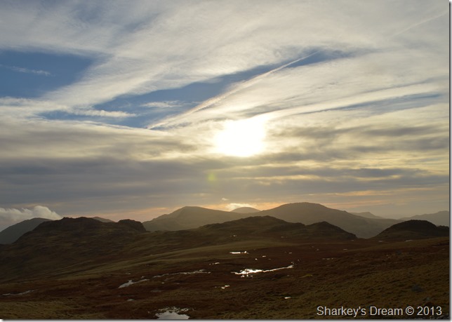
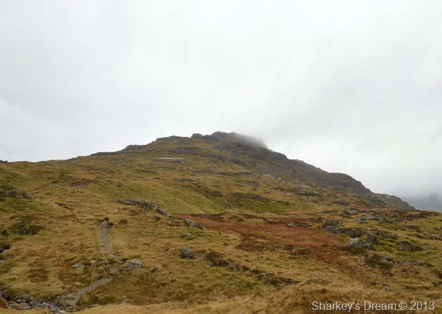
Shadows & sunrise, Pike O’Blisco sunrise.
After photographing Whorneyside Force both Tim & I turned our attentions to the brilliantly lit Pike O’Blisco together with this small pocket of cloud that seemed to have a mind of its own as it twisted in shape with an ever increasing wind, it soon dispersed but was imaginative enough to capture the gaze from these two fell walkers.. |
 |
| |
Here looking back on the sunrise over Oxendale, Pike O’Blisco & Lingmoor Fell. |
 |
| |
Flanking Hell Gill.
Topping out on Hell Gill was done by a series of rocky scrambles all of which were nothing to worry about at all with the exception of the crossing of Hell Gill where careful negotiations took place taking care not to get ones feet wet.
Although we had great light with the more ascent gained came that predicted strong wind which left exposed skin open to windburn.
Which didn’t really matter when we had views like this. |
 |
| |
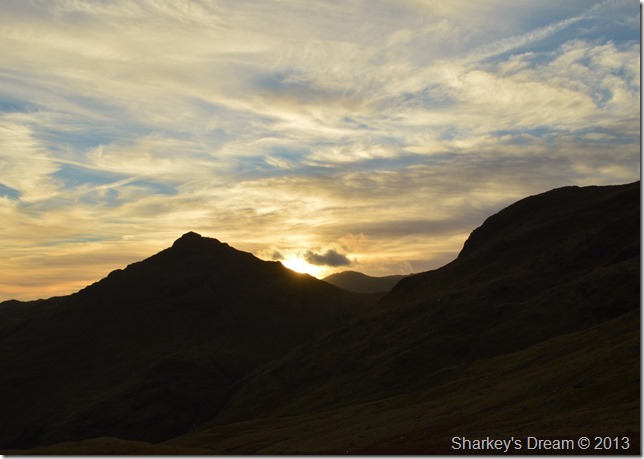
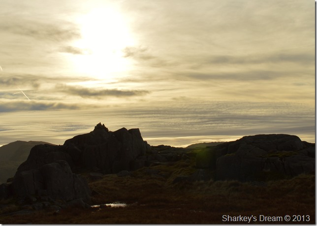
Pike O’Blisco silhouettes. |
 |
| |
This time focusing on Pike O’Blisco & Great Knott.
Tim marched ahead as I studied the sunrise, at the same time I couldn’t help but notice as Tim stared towards Shelter Crags as if he had spotted something, with this I couldn’t help but wonder what Tim was eyeing up, then I spotted it myself, but I had to catch Tim up before we could confer what we were both thinking. |
 |
| |
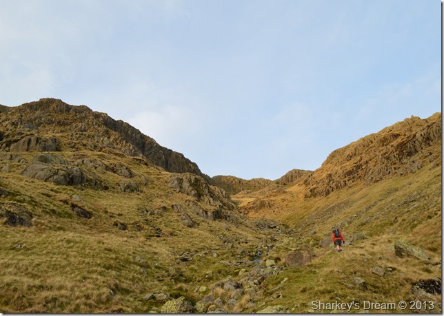
Here’s what caught Tim’s gaze.
I soon caught Tim up as he explained, have you seen that route Paul? I see it Tim but I have never seen it done nor read about it. What of course Tim was referring to was what seemed to be a natural grassy rake carved into the East face of Shelter Crags.
Shall we give it a go?
We gained as much ground as we could by sticking to the main path that flanks Hell Gill, in doing this we took as much vantage from the path before abruptly heading for the base of the rake. |
 |
| |
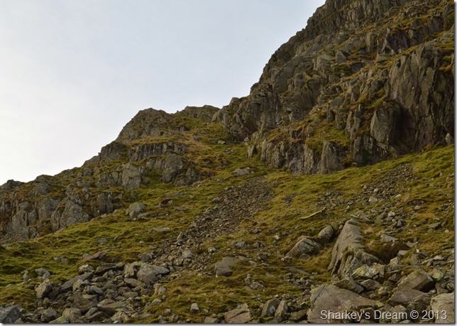
It’s a pretty steep assault from the start. |
 |
| |
The natural rake soon comes into view, both Tim & I ascend via the left of the scree before turning right when we reached this. |
 |
| |
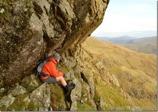
This natural rocky overhang that perched perfectly for a halfway point resting place.
Here we rested tired limbs for a wee while before completing the rest of the ascent as the rake now broadened out to a grassy steep climb which spat us out almost at the summit of Shelter Crags.
But before we headed off I took a couple more photos seeing as we had this great vantage spot. |
 |
| |
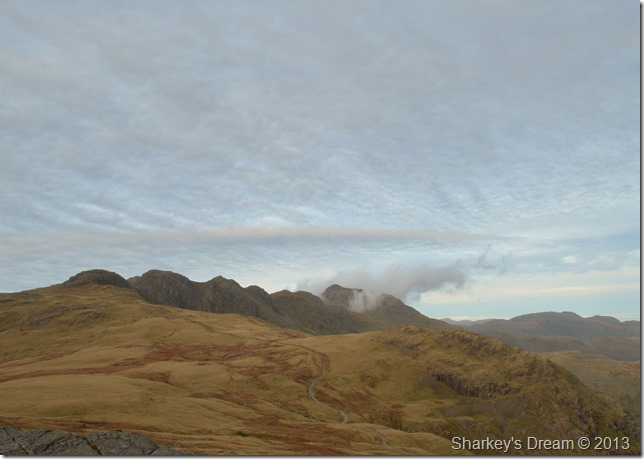
The Langdale Fells with a gulf of cloud over the Eastern fells. |
 |
| |
The Southern fells faired much better.
This rock wont climb itself, best press on. |
 |
| |
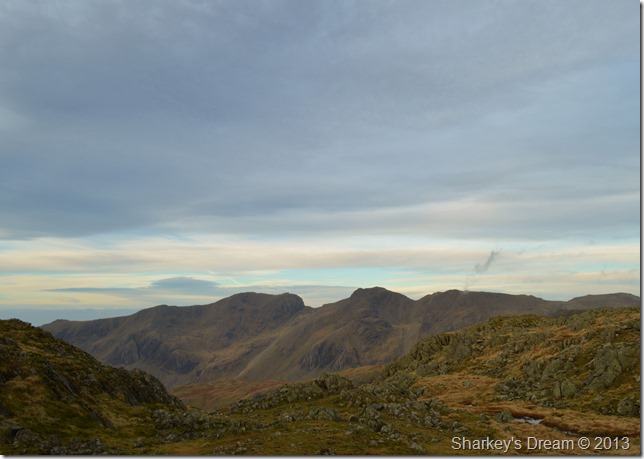
The Scafell’s together with Slight Side taken shortly after leaving Shelter Crags.
Whilst on the ascent I spoke to Tim about missing out on Three Tarns & Bowfell so here we back tracked ten minutes or so if not only to take a couple of photos.
Footnote
We had accustomed ourselves with the wind whilst on the ascent which grew in force as we crested the ridge, at times the wind was just something that was more than copeable & did not hinder the walk one bit, however whilst crossing exposed parts of the ridge the wind gusted with such force which meant great care was needed at some points, in just trying to stand up.
I did manage to photograph Three Tarns & Bowfell, but not in the best of comforts. |
 |
| |
Boots abreast, here’s Bowfell & Bowfell Links over Three Tarns from the shoulder of Shelter Crags. |
 |
| |
Seeing as we were now heading back over Shelter Crags towards Crinkle Crags I took a second photo of the Scafells, this time with Yeastyrigg Crags in the foreground. |
 |
| |
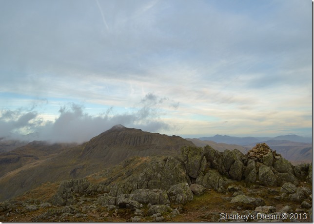
Bowfell seen from the fifth Crinkle (Gunson Knott) |
 |
| |
The alternative route avoiding the Bad Step.
The Bad Step was out of question in these winds, not to mention that although the rock across here was dry, it still was very greasy.
Apologies in advance if this shot looks out of focus & blurry, the fact being I just couldn’t hold my camera straight in the wind. |
 |
| |
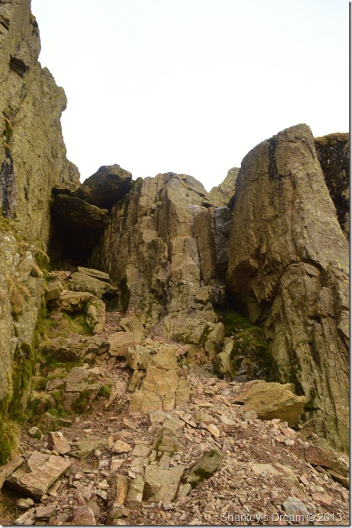
The Bad Step.
The wind was at its most fierce so time spent here was minimal, time to lose some descent & get out of this wind. |
 |
| |
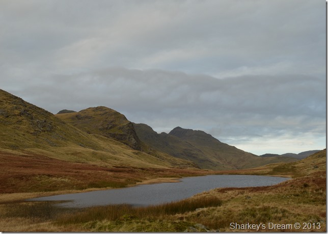
The Coniston Fells with Cold Pike, Little Stand & Stonesty Pike seen in the foreground.
It was altogether a different walk again once we descended Long Top, although we had lost the full on gust the wind remained which altogether wasn’t too bad between the crossing from The Crinkles to our next summit of Great Knott. |
 |
| |
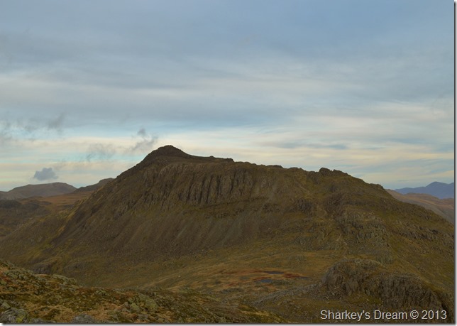
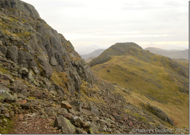
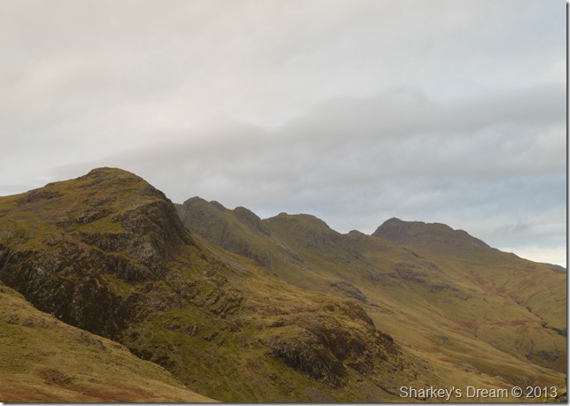
Crinkle Crags seen from Great Knott.
It has long been an ambition to make the summit of Great Knott as I consider Great Knott the fell that A.W forgot about, these are of course, in my own words.
I guess you may see the dominance of Great Knott a little further on, but for now we need to make the crossing to Tim’s 189th Wainwright, Cold Pike. |
 |
| |
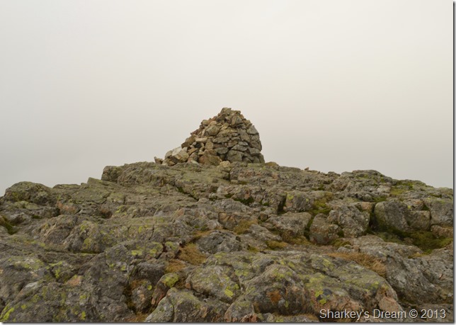
Cold Pike secondary summit cairn.
Tim marched up to his 189th, gave the summit a hearty pat then shouted through the wind, Paul it’s dinner time at the same time pointing to a sheltered area un-bufferted by the winds.
Dinner sounds good. |
 |
| |
Great Knott & Crinkle Crags seen from our lunch table.
It was nice to be out of the wind if only for a short while, but that short while gave the time for the sweat to freeze to our backs noting that shriek when re-shouldering packs.
It was now time to head down to Red Tarn. |
 |
| |
Great Knott, Crinkle Crags & Bowfell from Red Tarn. |
 |
| |
In my own humble opinion it is not Crinkle Crags, nor Bowfell that dominates this view, its the vast presence of Great Knott.
But that’s just me.
We soon found ourselves on the path that flanks Red Tarn, here we take on the last ascent of the walk by Pike O’Blisco, a fell that so much entertained us just hours earlier. |
 |
| |
Great Knott, Crinkle Crags & Bowfell as we start our ascent on Pike O’Blisco.
To the south of us the Coniston Fells were well & truly under a band of low cloud, in the same view a slow moving band of rain was heading right our way. |
 |
| |
Pike O’Blisco summit cairn with the wind & drizzle on our backs.
The drizzle caught up with us before we had time to reach the summit, we both remarked on how lucky we had been in capturing the best of the mornings weather albeit a little blustery. |
 |
| |
Descending Wrynose Fell through the cloud & drizzle.
The descent onto Wrynose Fell from Pike O’Blisco was not without the odd little hazard in the form of a few wet rock scrambles three in total some of which bum met rock. |
 |
| |
Here looking back up towards Pike O’Blisco from the Wrynose Fell ridge. |
 |
| |
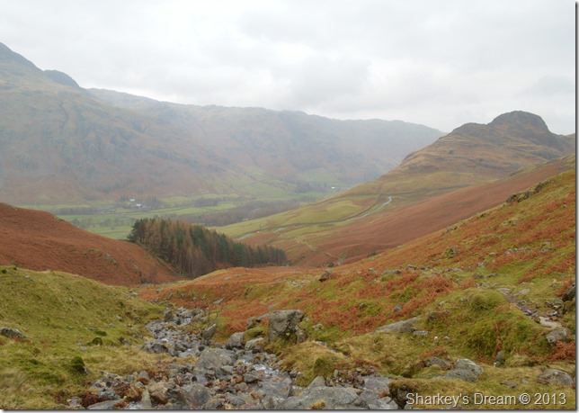
Side Pike from our Redacre Gill descent.
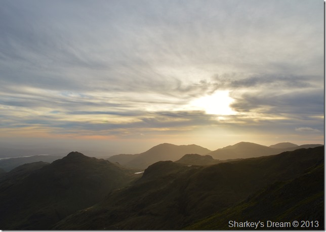
The drizzle came & went as we prepared for normality again, with wet clothing we squelched our way over tarmac through Wall End by-passing Wall End Farm & Old Dungeon Ghyll which were now lit up with an ambient after glows as the daylight started to ebb away.
A fitting end to a perfect walk in December Lakeland. |
|
| |
| Back to top |
 |
|