|
Ill Bell North East Ridge from Troutbeck |
 |
 |
31st May 2013 |
 |
|
With the dry spell continuing & a few days holiday away from work I again, am at the mercy of my hand written notebook as I carefully look out for a walk that’s going to jump out at me, non more so than this walk…Walk number 5 of said notes.
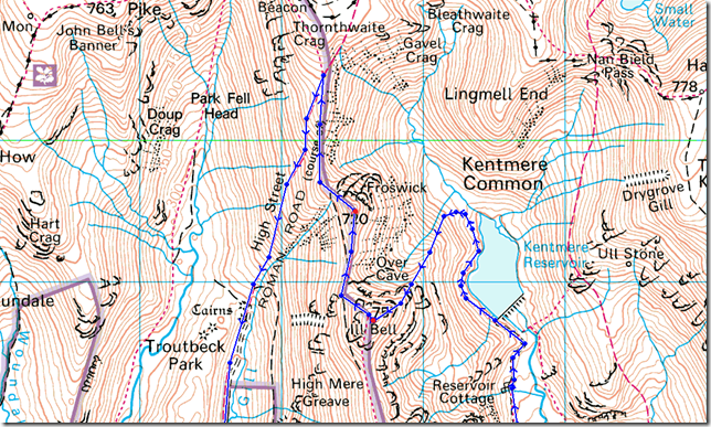
Ill Bell’s north east ridge commands upper Kentmere as its sharp like edge plunges into the watery depths of Kentmere Reservoir far below, the ridge is steep with a grassy ascent when once gained there is no cheating your way out of the steep climb ahead… its now time to get grass under finger nails.
I choose to make my starting point on the other side of the valley in Troutbeck or those more familiar; Troutbeck Bridge, which is nestled besides the apt Jesus Church Troutbeck. The walk would then take me up & over the full length of the notorious Garburn Pass…it’s a bit like Marmite that one, you either love it or loathe it…I am somewhere in between because the Garburn Pass although tricky underfoot does drop you into one of my favourite valleys of Kentmere, only then can you start to prepare yourself for the journey along the River Kent as it meanders the three mile trek to Kentmere Reservoir & the base of the north west ridge, only becoming more apparent once you round the base of a much smaller, yet strangely domineering set of crags. Now by averting your eyes left will you see the the fine steep grassy ridge before you.
A.W described the ridge as steepness be the only difficulty.
And he was right, besides the steepness you do have to contend with false summits but spectacular views into Over Cove can avert this. With Froswick & Thorthwaite Crag below & beyond lies the shimmering reservoir together with the valley of Kentmere.
It was a testing thirteen miles in 18°C heat, which at first I had trouble adjusting too as the sweat wept from my pores so early into a walk, I had to ask myself had I set todays goal a little too high. |
|
| Wainwright Guidebook |
 |
| The Far Eastern Fells |
- Ill Bell North East Ridge :
Proceed to the head of the reservoir before turning left to an obvious ridge. The rough upper slopes appear intimidating but steepness is the only difficulty. In wintry conditions this is a route for mountaineers only. |
 |
|
|
| |
|
Overview |
|
|
| Ascent: |
4,000 Feet |
| Wainwrights: |
2, Ill Bell – Froswick |
| Weather: |
Dry Hot & Sunny, Overcast At Times , Little To No Wind, Highs Of 22°C Lows Of 10°C |
| Parking: |
Parking Spaces, Troutbeck Bridge (F.O.C) |
| Area: |
Far Eastern |
| Miles: |
13 |
| Walking With: |
On my own |
| Ordnance Survey: |
OL7 |
| Time Taken: |
6Hrs 45Mins |
| Route: |
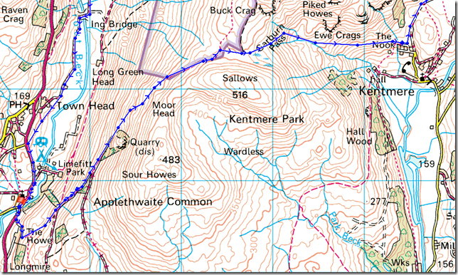
Church Bridge – Garburn Pass – The Nook – Scales – Hartrigg – Kentmere Reservoir – Ill Bell North East Ridge – Ill Bell – Froswick – Scots Rake – Troutbeck Park – Hag Gill – Ing Bridge – Ing Lane – Truss Lane – Troutbeck – Church Bridge |
|
| |
|
Map and Photo Gallery |
|
|
 |
| |
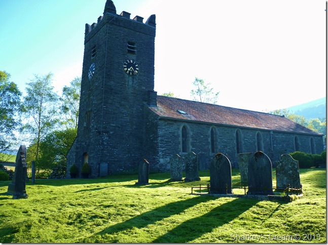
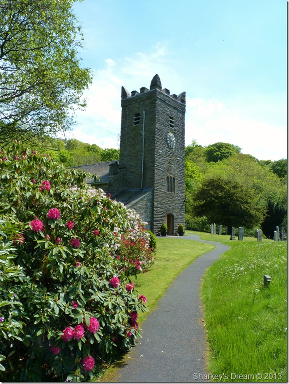
Jesus Church Troutbeck (Troutbeck Church) 07:24 10°C
Long shadows cast over the gravestones within the grounds of Troutbeck Church. Minutes earlier I was at Church Bridge CP arranging my attire & for the second week running, my jacket gets left in the car.
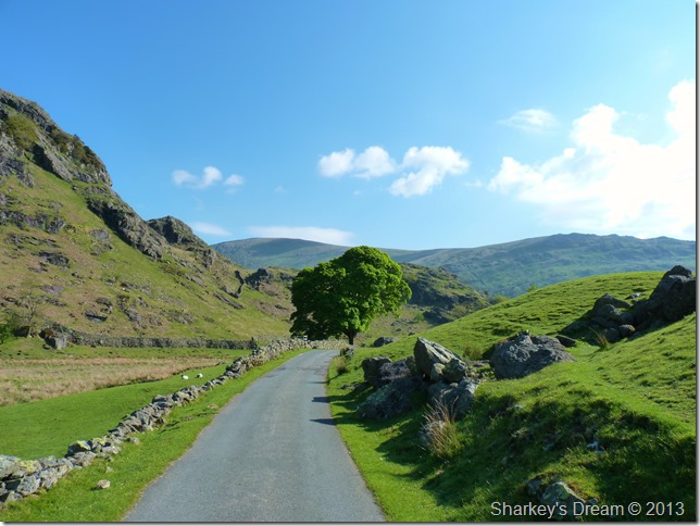
The early morning air is warm & fresh & rapidly rising, there is no doubt about it todays walk is going to be a warm one. I leave the churchyard turning right in shorts & short sleeves towards the Troutbeck end of the Garburn Pass. |
 |
| |
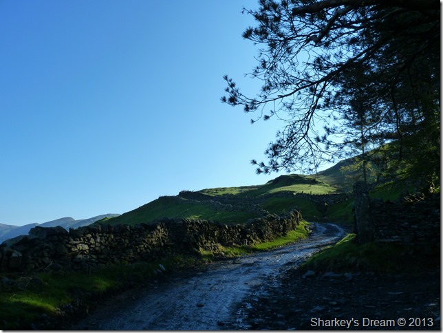
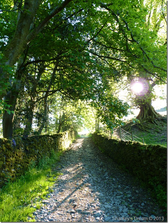
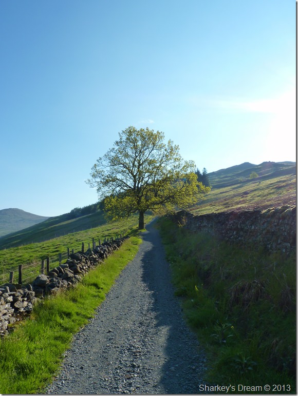
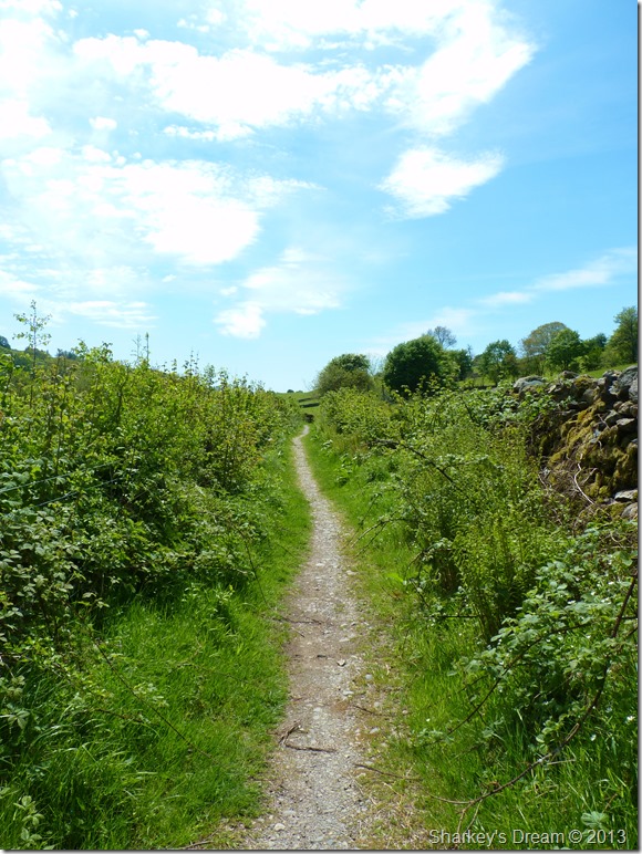
Sunburst through the trees along the early stages of the Garburn Pass.
I wind up the track taking in little ascent, ahead the track takes an abrupt left turn onto open fell side but that is a little while away yet, here I pop open one of six Satsuma’s that I handily packed in the side pockets of my pack, I figure I’m going to need all the hydration I can take on todays walk. |
 |
| |
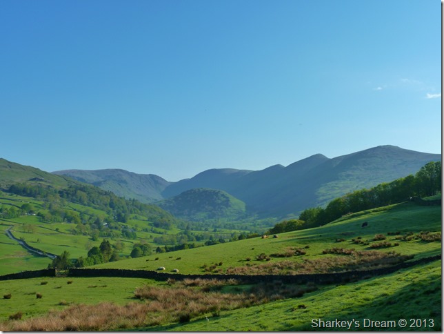
The Troutbeck Valley with the Ill Bell ridge domineering the flanks over on the right.
The depression seen centre is that of the top of the Kirkstone Pass with Red Screes further left. Still in shade & in the foreground is Troutbeck Tongue, it really is a beautiful morning. |
 |
| |
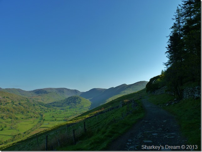
The Garburn Pass.
I’ve still a while to go before I reach the top of the Pass & start my descent into Kentmere, in terms of how long that will take me its around just over a mile & a half & will take me around half an hour to reach it. |
 |
| |
It was nice to take in the delights of the valley whilst walking in the morning shade. |
 |
| |
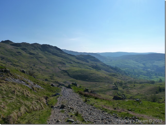
Descending into Kentmere via The Garburn Pass.
Here you can see the paths line of descent as it winds its way back into the village of Kentmere, it is also the place The Garburn Pass takes on a new meaning of ‘rough underfoot’ It is here I meet the first people of the day, a woman with her Golden Labrador shortly followed by another woman map-case tied around neck.
With legs still fresh I take on the path knowing that shortly I shall be in the wonderful valley of Kentmere…so stop that bloody complaining would you. |
 |
| |
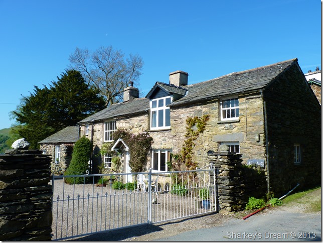
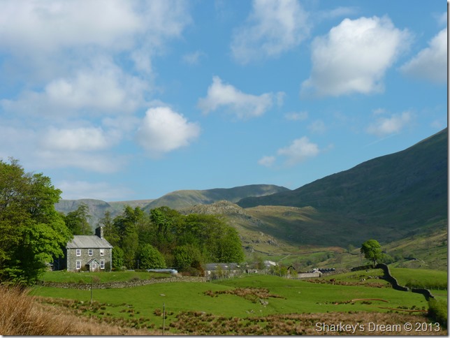
Found at the bottom (or top depending which direction you are travelling) is Nook Cottage which is now a Tea Room.
Looks very inviting, I wonder if they do cold pints of water? |
 |
| |
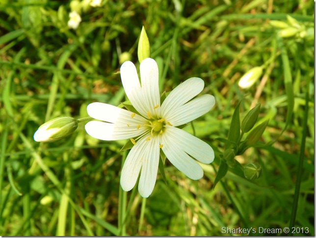
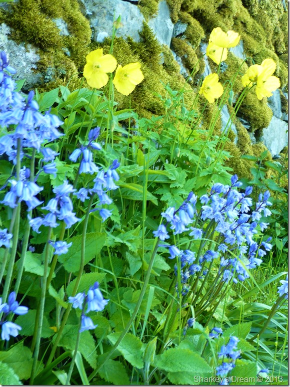
Kentmere Bluebells. |
 |
| |
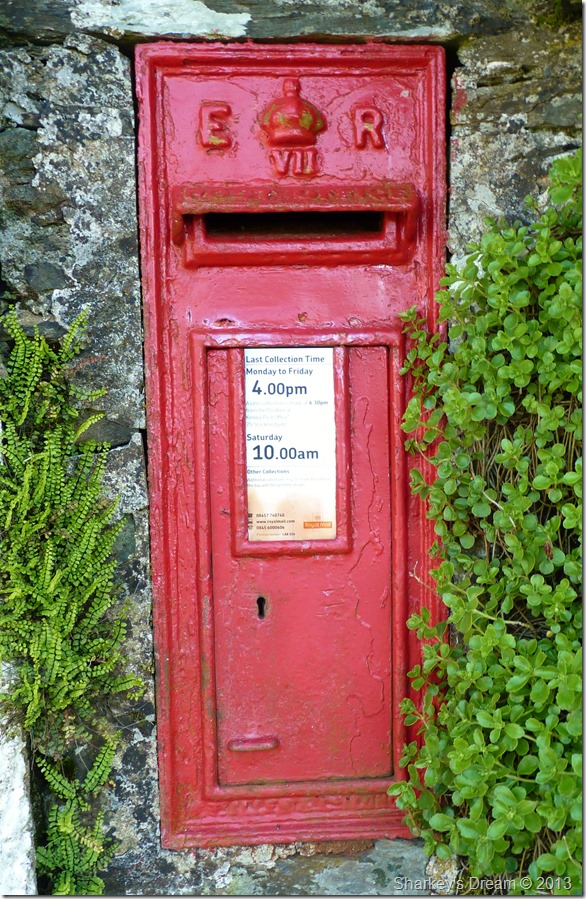
The Post Box built into the wall at Bridge End House dates back to 1905
The first Post Office to open in Kentmere was in the Temperance Hotel (now Bridge
End House) in 1910. Before that the mail was delivered by the redoubtable Mrs Mary
Walker who for twenty years was one of the postmen/women working out of
Staveley. She is said to have walked 33,000 miles delivering mail in Kentmere.
Taken from ‘Kentmere Memories’ |
 |
| |
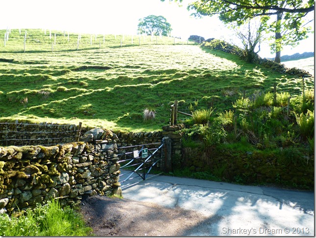
I’m just minutes away from the centre of the village, here I take a left through this metal gate sign posted ‘Hartrigg’ |
 |
| |
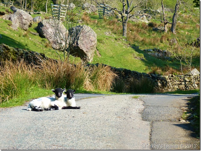
Kentmere cuties. |
 |
| |
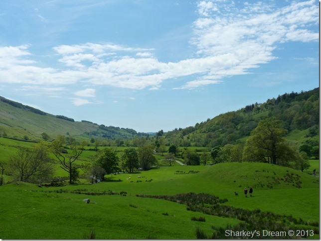
En route to Scales/Hartrigg…Did I mention just how beautiful this morning was? |
 |
| |
Approaching upper Kentmere as I pass Hartrigg Farm. |
 |
| |
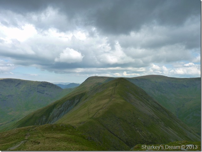
The Ill Bell Ridge now dominates my left flanks with Ill Bell (second summit along the ridge) not revealing too much of the north east ridge through the haze.
Ahead, at the upper end of the valley is the section in between Thornthwaite Crag & Mardale Ill Bell traversing left to right, far right is the dominance of Lingmell End, which surly deserves more recognition than the mountain gets.
I am still a trek away from Kentmere Reservoir so I press on through the morning heat devouring yet more juicy Satsuma’s. |
 |
| |
Yoke & Rainsborrow Cove as I pass Kentmere Cottages below the spoil heaps.
Surely Yoke is best seen from within the valley. |
 |
| |
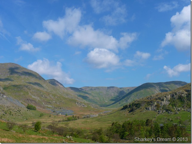
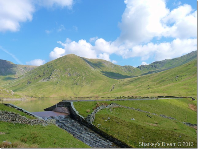
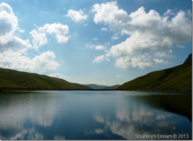
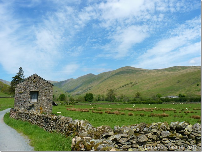
Lingmell End with a very peaceful Kentmere Reservoir taken from its Weir. |
 |
| |
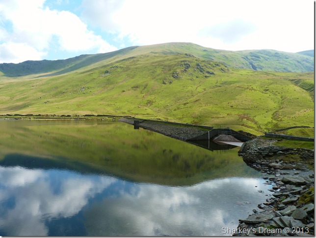
Reflections from Kentmere Dam, here looking towards Harter Fell (Mardale) with a distant Kentmere Pike beyond.
It was time to have a wee rest before I took on the north west ridge, so here I treat myself to some sandwiches figuring to myself that I am about to need all the energy I can get.
Still the sun beats down. |
 |
| |
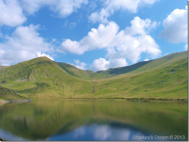
More reflections across the reservoir, this time looking directly up towards the top of Nan Bield Pass, a route I was only on seven weeks ago, back then this whole area was under a foot of snow as I had to resort to cutting steps in the snow in order to reach the top of the Pass (seen centre at the lowest point) |
 |
| |
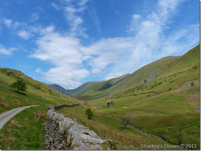
Navigating Kentmere Reservoir in order to reach the base of the ridge.
The crags you see in the left of the picture are the ones I spoke about at the beginning of this blog, here you can choose to go over them as a faint path rises steeply away from the reservoir, or you can choose to go around them & take on the ridge from the very base as I did. |
 |
| |
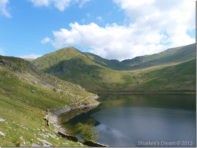
In which case offering fine views over Kentmere Reservoir Dam & beyond. |
 |
| |
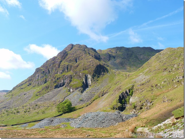
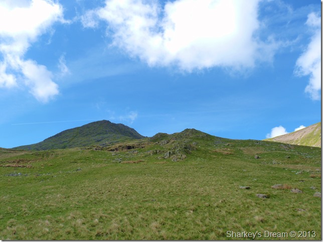
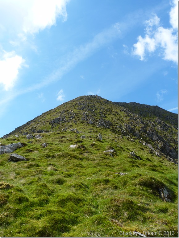
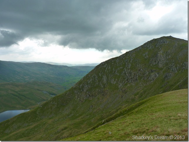
Taken from the base of the north east ridge.
I’ll be the first to admit that the task ahead doesn’t ooze that much appeal from the base of the ridge – so its best to knuckle down & start with the steep ascent from upon you will get that ridge appeal no matter how steep it looks. |
 |
| |
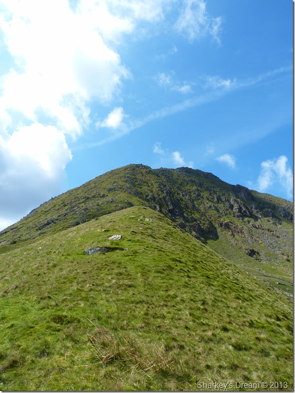
As more ascent is gained the ridge takes on its true effect.
Footnote
The depression ahead is mis-conceiving, here looking like you may have to lose in descent only having to gain more ascent on already tiring limbs, this is not so as the depression is merely a small grassy ridge with slight ascent over a faint path. |
 |
| |
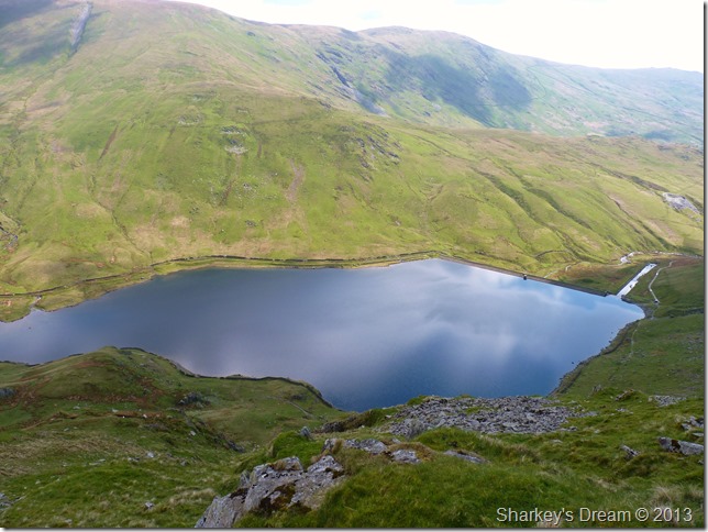
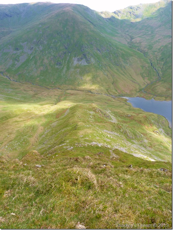
Here, looking down on a shimmering Kentmere Reservoir. |
 |
| |
The views up the ridge were just as grand. |
 |
| |
The ones down weren’t too bad either, here looking down the spine of the north east ridge. |
 |
| |
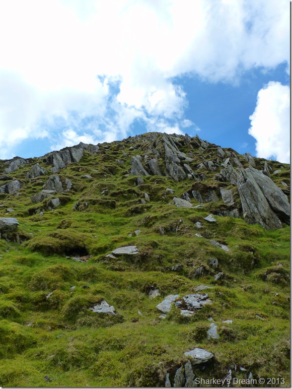
For the sadistic in you.
Do not be fooled into thinking that just because the ridge’s ascent is mostly covered in grass that you will not have to use your hands & knees during the ascent…and your bum & elbows too.
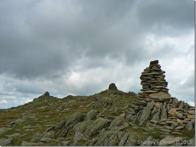
The last part of the ascent is possibly the most enjoyable as limbs become accustomed to sharp ascent, here the upper last reaches are gained over sprawling boulder field (loose) before the sight of in my case, two out of three of the summit cairns take on the horizon.
You are not just met with these splendid & mighty cairns but that of accomplishment also…in retrospect one can only mutter that in my most recent weeks I have scaled both Catstye Cam via its very own north west ridge & to add to that my Skew Gill scramble only last week…non of which come close to just how steeply satisfying this ascent was. |
 |
| |
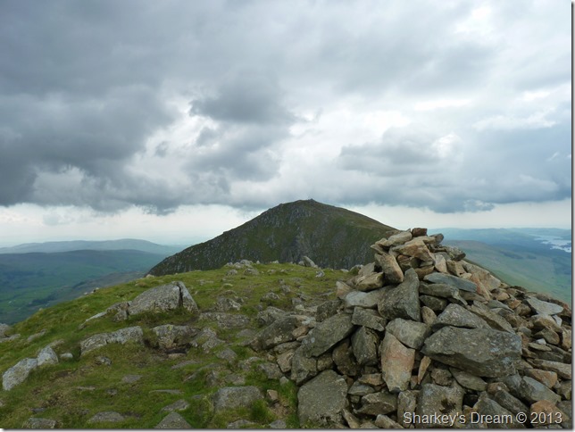
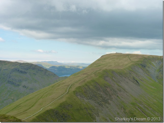
Ill Bell’s three distinctive summit cairns.
I ponder around the summit for a moment, an excuse just to catch my breath back before I take on the descent/ascent across the ridge to Froswick. Here I spot walkers coming in the direction from Yoke & also Froswick…all heading my way.
It hadn’t gone un-noticed (well it had) that cloud had gathered overhead blocking out the suns rays…with this the sweat that has enveloped my body starts to cool rapidly…this giving great comfort, although I did take the necessary hydration up until now (and more) a gooey skin has now formed across my lips.
I wander back over to the main cairn & sort myself out…this being a wipe across the lips with my sleeve, a slurp form my hydration pack & a pull up of my shorts.
Fixed…I leave the summit for Froswick. |
 |
| |
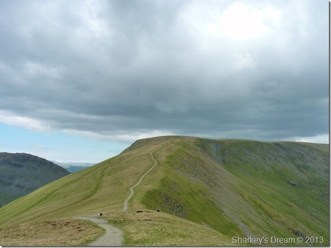
More cloud gathers as I take on the ridge towards Froswick. |
 |
| |
The best uninterrupted profile of Ill Bell north east ridge from the traverse across to Froswick, it was just a shame the weather had decided to cloud over. |
 |
| |
More on that profile as I start my ascent on Froswick. |
 |
| |
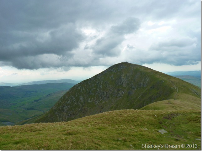
Ill Bell from sister summit Froswick. |
 |
| |
Thornthwaite Crag from Froswick summit.
There is a little glimpse of hope that the sun is returning as I leave the summit of Froswick for Scots Rake (the grassy path seen furthest left) but there is a little descent between me & it so I get on with reaching the path down there. Here my stomach rumbles yearning for more food, I leave it to rumble as my plans are only to stop on reaching the top of Scots Rake.
Best get down, hungry work this is… |
 |
| |
Thorthwaite Crag ahead but sadly not my destination.
I near the top of the main path where I hook an abrupt left to join Scots Rake, it his here the belly grumbles are laid to rest & I can catch up with the text messages I had received whilst on the ascent on Ill Bell’s north east ridge. |
 |
| |
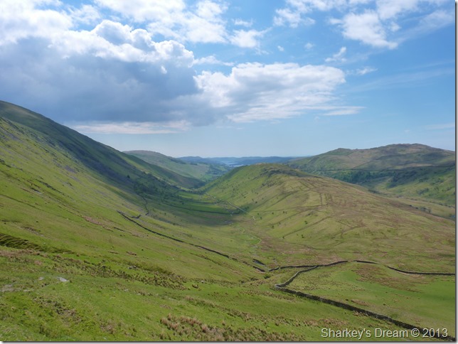
Troutbeck Tongue & Troutbeck valley as I descend Scots Rake.
This is what I call taking in the best of the two valleys, not just two valleys but two of my favourite, a reason why I penned the walk from Troutbeck & the very same reason that my feet are starting to hurt!
A succession of Mountain Bikes & its riders line a part of the descent, the path is narrow as they have stopped to rest on a steep part of it…I’m sorry one of the riders says you’ll have to de-tour around if you don’t mind… I joke about not having the choice to… As I pass one of the riders, a female proceeds to ask me a question ‘I don’t suppose you…’ this as I try not to break my neck-still negotiating the bikes, legs & packs…
Did, did he just ignore you then? one of riders pucks up.
Well observed I mutter to myself…
Now writing this I now know that I myself, is turning into my very own Victor Meldrew.
I don’t bloody believe it. |
 |
| |
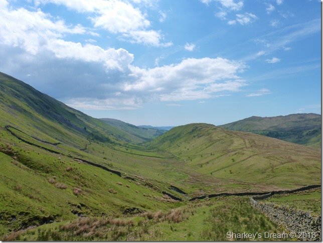
Troutbeck Tongue as I near the base of the path.
This I consider to be one of thee finest Lakeland valleys in the whole of the district, not only this a fine exit route back into Troutbeck but the path I am about to use is also accompanied by Hag Gill, where upon reaching it I shall down pack…remove sunglasses & proceed to drink cold water from cupped hand, nicely finishing off with a quick swill over my face & neck.
It doesn’t get much better than that or does it? |
 |
| |
Here looking back somewhat refreshed towards the head of the valley Thresthwaite Mouth with the Ill Bell ridge running along the right flank. |
 |
| |
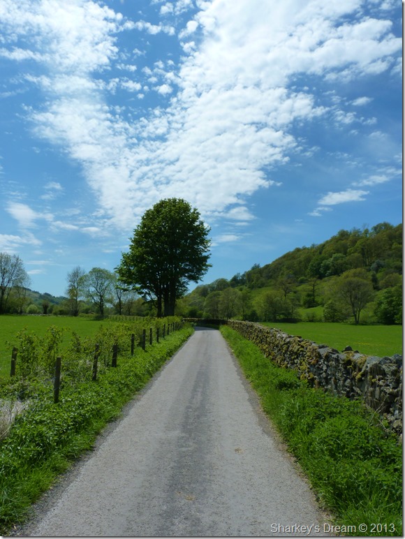
Troutbeck Perfections.
With Troutbeck Tongue behind me I head for Ing Lane, a glimpse of Ing Lane can be seen in the middle of this photo, again a much favoured part of the whole walk was along this narrow farm track. |
 |
| |
Ing Lane under scorching afternoon sun. |
 |
| |
The Ill Bell ridge from the end of Ing Lane.
It was now time to leave Ing Lane for the much narrower Truss Lane, creating a short cut if you will which also avoids the traffic along the busy Kirkstone Pass road.
Truss Lane is a narrow track which heads of left after passing this old farm building, it can be mistaken for a dead-end or even private property but sure enough, it is a well & established track. |
 |
| |
Truss Lane.
Sadly today I am not pushing through wild flowers but more so over grown nettles & alike, there were some exceptions which made the diversion worth the while. |
 |
| |
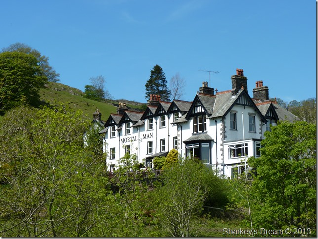
The Mortal Man Townend.
As I came to the end of Truss Lane I was met by quite alot of traffic in both directions along the Kirkstone Pass, so rather than dice with the traffic – Instead I carried on a little further up the track sign posted Town End & the Mortal Man, upon reaching the next junction I will take a left & head back to Troutbeck Church via Bridle Path & grass meadow. |
 |
| |
Back at Troutbeck Church.
I enter the grounds of the Churchyard were I am met by a stone mason re-carving the name on a much older headstone, he chips away & doesn’t see me walk past.
On the other side of the yard an elderly woman sheers away at the overgrown grass of a dear departed friend.
I am at the end of my walk, but it is not over just yet. I just needed to get back to Church Bridge to enjoy it. |
 |
| |
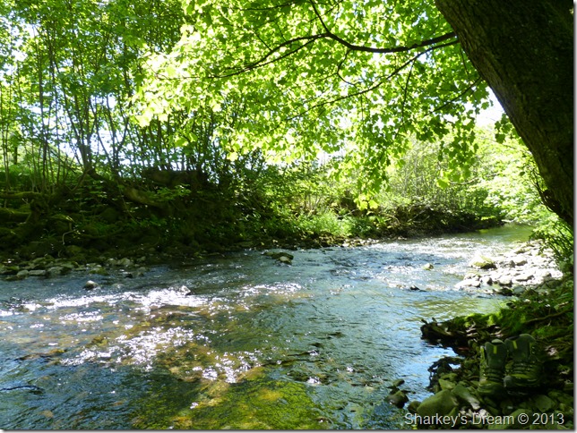
Troutbeck Beck Church Bridge.
During my walk on this fine summers day I promised myself that I would finish off the remainder of my sandwiches whilst my bare feet relax in the cold yet refreshing Troutbeck Beck.
My feet are a sight for sore eyes but take great comfort as the cold flowing water ease their pain. Dragon Flies dance across the water as midges swarm in their hundreds, all the while the sun breaks through glistening on top as the waters flows.
I sit there in that shade while once more I wipe the goo away from chapped lips, muttering this is the life, this is Lakeland…and that damn water is brutally freezing my toes off.
Until next time. |
|
| |
| Back to top |
 |
|