 |
Raven Crag & Armboth Fell |
 |
 |
13th October 2012 |
 |
|
This walk is the result of an email between two friends over two weeks ago. Stuart is well into completing his Wainwright’s – with a matter of sixty six fells remaining, Stuart decided to hit Lakeland’s central ridge & tag me along, in this I had no say in the fells in question which due to my circumstances right now I duly gave the route absolutely no thought at all. This is great but it did leave me at 5:30am before Stuart arrived hastily trying to put the summits Stuart had in mind together, for the first time since I have walked the fells, I left the whole itinerary to Stuart.
I simply was along for the ride it seemed, but don’t forget to pack the gators Paul, this is after all the Central ridge, deemed to be the boggiest place in the whole of Lakeland.
This left me puzzled (just ask Stuart) all I knew that Raven Crag & Armboth Fell were just two summit tops that Stuart needed to tick off, so following in the wake of Stuarts boots is just what I did.
Seems odd & trust me it was, but I cant thank Stuart enough for inviting me along & listening to past events & letting me get things of my chest, friends do that which despite the showers, the god awful bogs & the wet socks from not twenty minutes in, this walk turned out to be another fantastic day in Lakeland, even if we did have to cut the route slightly short, want to know why?
Please read on…. |
|
Wainwright Guidebook |
 |
| The Central Fells |
Dedicated to the eager explorers of the fells. THE DOGS OF LAKELAND.
Of the many dozens of Raven Crags in Lakeland, best known of all, and the subject of this chapter, is the mighty buttress of grey rock towering above the Thirlmere Dam. The vertical face of the crag, now receiving the attention of rock-climbers, is a truly formidable object, standing out starkly from a dense surround of plantations. |
 |
|
| |
|
Overview |
|
|
| Ascent: |
1,800 Feet, 548 Metres |
| Wainwrights: |
2, Armboth Fell & Raven Crag |
| Weather: |
Dry & Bright With Moderate Showers, Highs Of 10°C Lows Of 2° |
| Parking: |
Roadside, Armboth |
| Area: |
Central |
| Miles: |
7.5 |
| Walking With: |
Stuart Greig |
| Ordnance Survey: |
OL4 |
| Time Taken: |
4 hr 35 minutes |
| Route: |
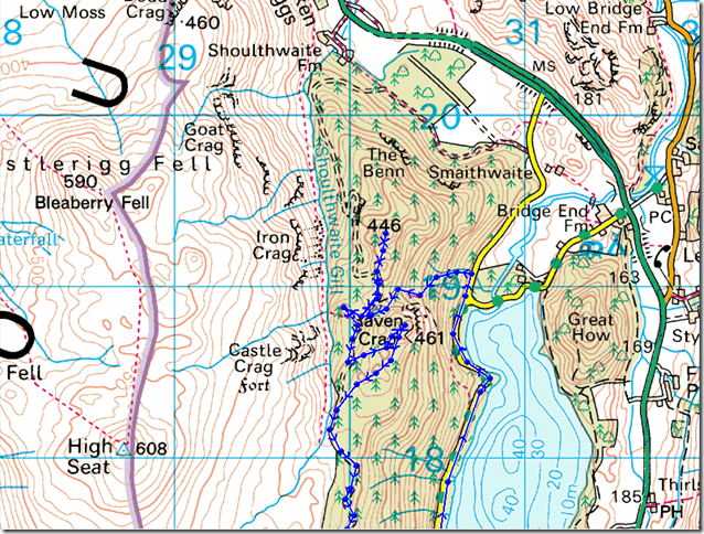
Armboth – Lake Path – Forest Track to Raven Crag – Sippling Crag (The Benn) – Raven Crag- Castle Crag (Fort) Forest Track – Armboth Fell – Fisher Gill – Armboth |
|
| |
|
Map and Photo Gallery |
|
|
  |
| |
| |
 |
| |
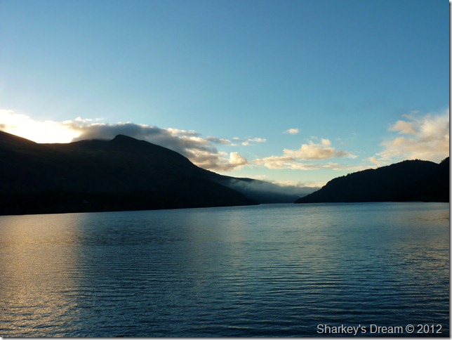
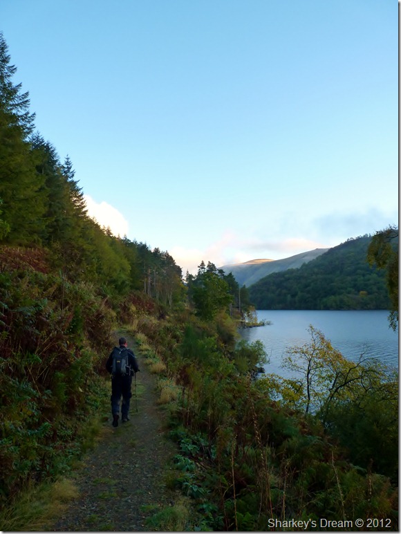
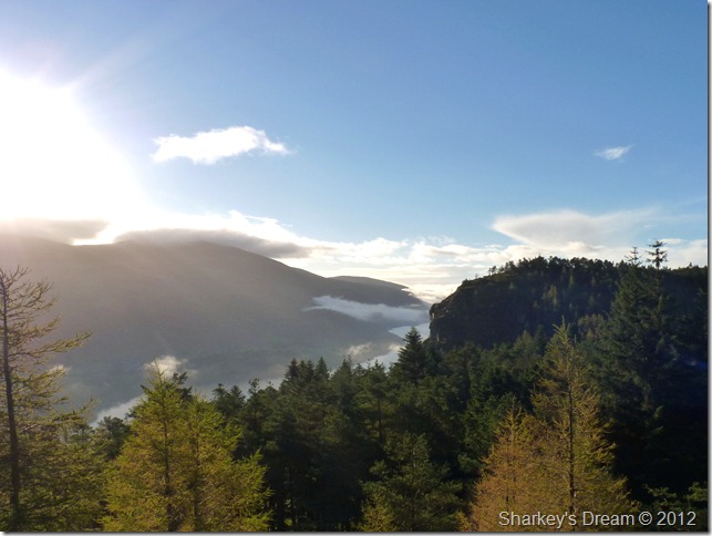
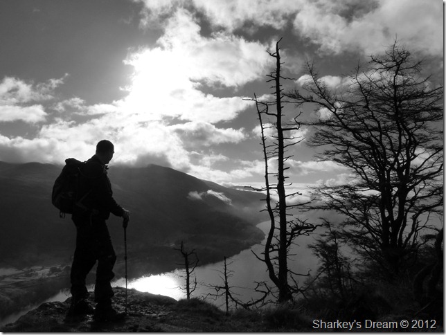
Sunrise over Thirlmere, 7:55am 2°C
The sun has just rose & the prospects of any showers predicted seem a million miles away, for now that is. Stuart & I kit up along the sunlit shores of Thirlmere in the long gone settlement that was Armboth, sunk beneath the waves when Thrilmere reservoir was constructed sometime during the 1880’s.
There’s a slight chill as the morning air escapes the lungs of two walkers hastily scurrying to put more layers on, well I do anyway, Stuart right now is de-layering, I see too much naked flesh as I catch a glimpse of the semi-naked Lonewalker.
What’s he doing!
A wooden gatepost is my fitting room as I balance out of my North Face mid’s for the sturdy yet leaky Soloman’s.
On goes my Rab softshell, tucked tightly into my walking trousers & on goes the jacket, next its the Gortex Gators, something I rarely use except on occasions such as the central ridge, oh & walking in snow.
With the tailgate closed we set off for the Lake path & the north west corner of Thirlmere Dam, with the Gators bound beneath my knees, I now feel positively tucked in as a seven year old by my mother as I think to myself, I’m sure this is the reason I rarely use the damn things!
We press on. |
 |
| |
The Lake path.
This a path I haven’t used before so the walk already had that new feel to it. A Pointer commanded by whistles greats us with you’ve guessed it, a point by its sturdy tail, we don’t catch glimpse of the owners for a few moments as the dog fittingly waits its next command, by whistle that is, as we round a bend in the path two women walk towards us, oh’ that’s what’s he found, he normally brings it back to us in his mouth the woman says.
Stuart’s wit precedes him ‘he’s not gonna fit me in his mouth’ We depart laughing.
The path became less obscure as we neared the Dam wall so it was here we rise back on the Lake road & take in the last hundred yards or so until we reach out path & Raven Crag bound.
Its a steep one which takes the breath out of the pair of us. |
 |
| |
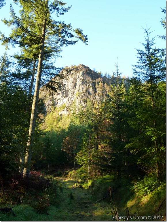
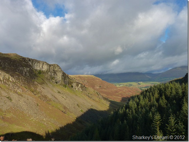
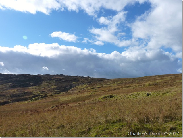
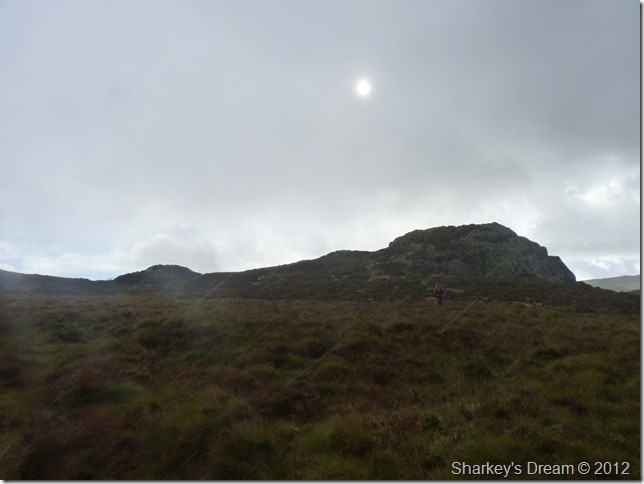
Raven Crag seen as we cross one of the many forest tracks.
It’s a steep pull up this solitary fell, it was here I de-layer so with reminiscence of last week in Lakeland, it was off with the jackets & up with the sleeves.
On the back of this walk Stuart is carrying the remains of his man-flu, he choose this route fittingly & not anything more strenuous, the guy coughs & splutters his way up the steep ascent & I cant help but feel slightly sorry for the bloke.
We take our minds off from the steep ascent & discuss Stuart’s next ‘big venture’ it really doesn’t get any bigger than this http://www.lonewalker.walkingplaces.co.uk/lejog/
I can only sit back & admire the guy as I try to add my input on Stuarts nutrition along this epic journey, can you believe that Stuart doesn’t like Pot Noodles! |
 |
| |
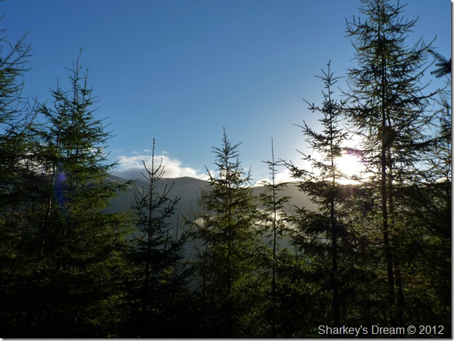
Through the pines.
We discuss on which way we should tackle our next summit, Stuart has in mind Sippling Crag (The Benn) which lies shy north of Raven Crag, so which do we summit first? |
 |
| |
Sippling Crag gets the vote.
In order to reach Sippling Crag we used the forest track & the col in between Raven Crag & Sippling Crag if only for the shortest of whiles.
Stuart spots a path through the trees which was easy to follow should you be in search of your next Birkett. |
 |
| |
Stunning views greet us at the top of Sippling Crag. |
 |
| |
Looking north we have Blencathra over High Rigg. |
 |
| |
And east, we have Clough Head, Calfhow Pike, Great Dodd & Watsons Dodd. |
 |
| |
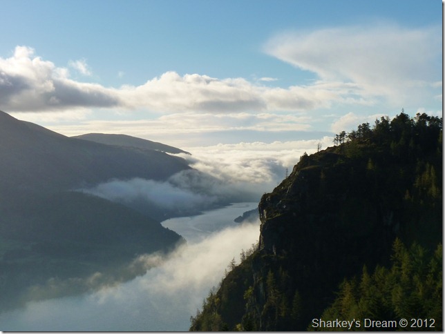
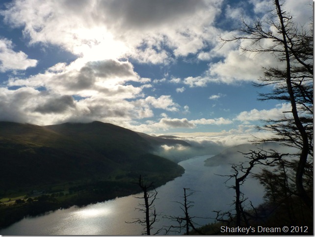
A magnificent inversion heads up the lake from central Lakeland from Sippling Crag summit.
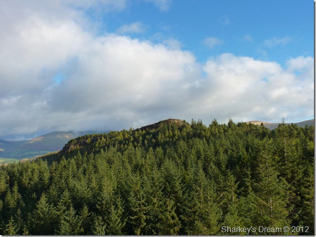
This alike Raven Crag (R) is possibly one of the best viewing platforms in Lakeland & was reached with less time & effort than much more of the loftier summits, it really was a treat to be on this tiny Birkett summit top.
It was time to retreat & make our way back through the woodland & re-locate with the forest track, reaching Raven Crag however nearly proved neon impossible & not to mention impassable. |
 |
| |
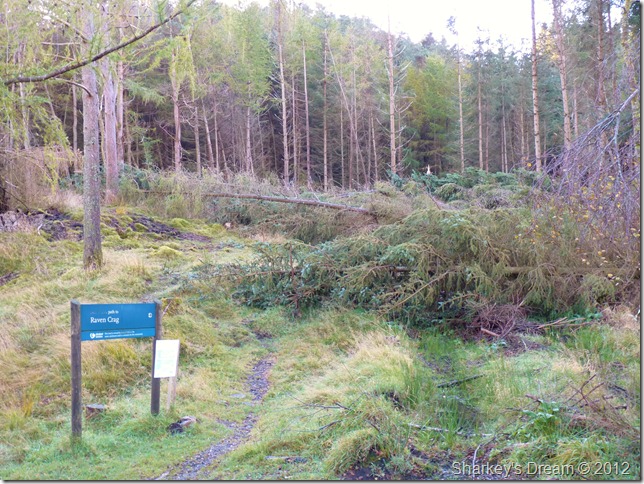
The permissive path to Raven Crag lay under dozens of felled trees, blown over by recent storms.
We had read the warning signs on our ascent but choose to ignore them ‘as you do’ we hadn’t prepared ourselves for what we saw next, it was devastation on a wide scale & something I hadn’t witnessed in Lakeland before. |
 |
| |
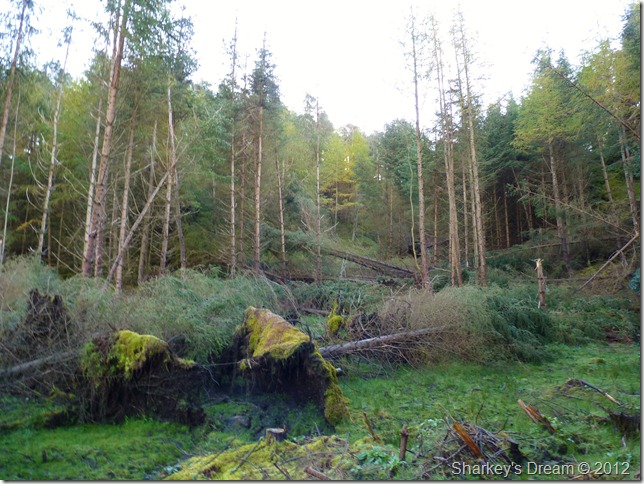
The power of the storms had toppled the pines like they were matchsticks as the path lay directly through the centre of the photo. |
 |
| |
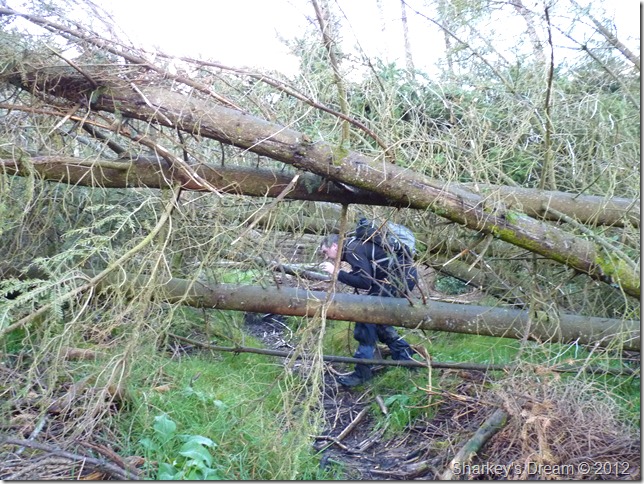
We did give it a try to no-avail, our packs snagged under the debris & hopping over the fallen trees with the branches sticking out doesn’t bare thinking about, its a good job we both already have children is all I can say!
Stuart reluctantly gives in & has to say that he’s given up on reaching the summit of Raven Crag, I’m gutted for the bloke as Raven Crag was a must today, me however is down but not fallen as I have other routes in mind, with this we head west a couple of hundred yards & take in our next Birkett of the morning, Castle Crag (Fort) |
 |
| |
Castle Crag Fort (Shoulthwaite Fort)
Described by Wainwright as un-interesting & I guess it is, non-the-less it is a Birkett & Stuart wants to claim it, the views from this solitary outcrop of rock are simply amazing & it was no-wonder it was once used as a Hill Fort. |
 |
| |
The hidden & splendid valley of Shoulthwaite from Castle Crag (Hill Fort) summit.
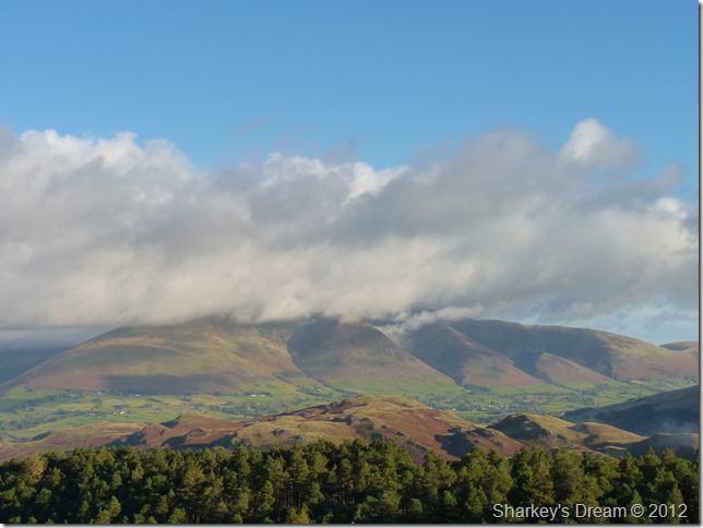
Sadly Skiddaw remains breached with thick cloud that slowly makes its way south towards us, its most certainly worth keeping an eye on.
Incidentally, that’s Iron Crag on the left of the ridge & thoughts of a visit sometime soon look promising. |
 |
| |
Sippling Crag (The Benn) from Castle Crag (Hill Fort)
After a few photos it was time to retreat back to the forest track & a rather long walk until we reach the ridge bound for High Tove, but I still hadn’t given up on reaching Raven Crag just yet. |
 |
| |
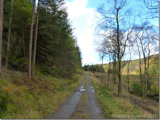
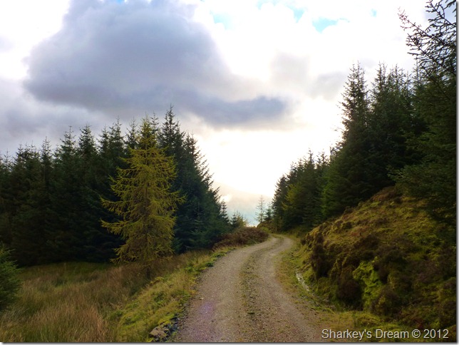
The forest track.
With Stuart still carrying the burden on not being able to reach Raven Crag I try & scout ahead through the trees on the left looking for a way up the steep fell side, after a short while I spot a less obvious path & call Stuart, lets give this one five minutes. |
 |
| |
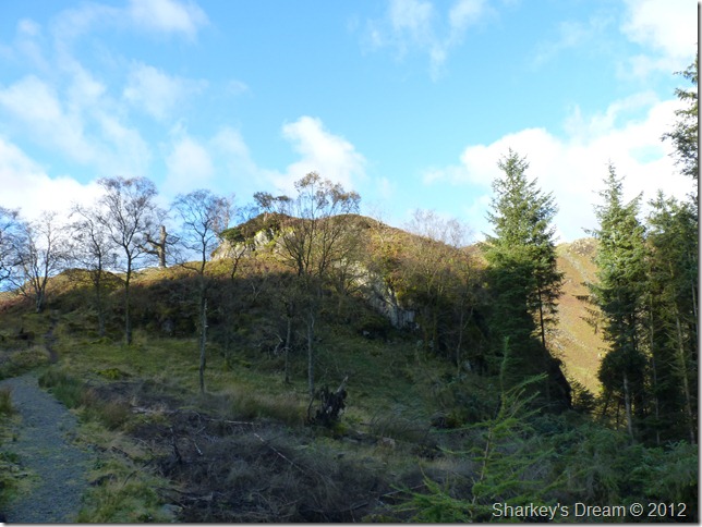
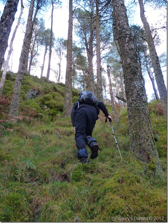
I quote the American explorer Robert-Edwin-Peary.
If there isn’t a way, find a way.
I’m not too sure if Stuart agrees, its another steep one, non-the-less summit bound, Stuart coughs his way up as I’m feeling slightly apologetic with every cough Stuart emits, within moments of taking the photos we are walking towards the summit & Stuart thanks me duly.
I could only imagine Stuart sitting there the same evening knowing that Raven Crag had gotten away, its a gut wrenching feeling, I know because I have been there, I didn’t want that to happen to Stuart. |
 |
| |
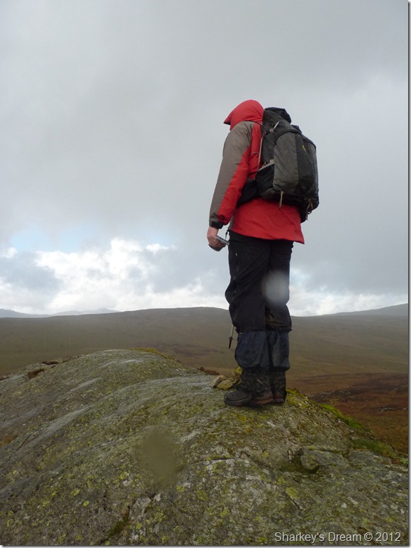
Stuart looking down on Thirlmere & the surrounding fells from Raven Crag summit.
Time for a quick rest & a few photos before we head back down to the forest path once more. |
 |
| |
Equally fitting views of the inversion from Raven Crag summit. |
 |
| |
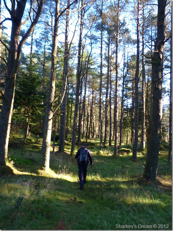
The forest track.
We made our way along the track along the tune of Stuart literally coughing his guts up, I could see that Stuart was trying his damdest to hide it, sadly it was soon becoming relevant that the walk could possibly be shortened.
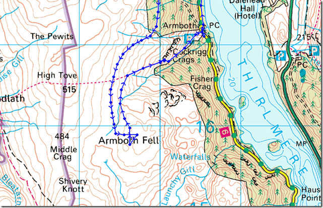
We press on along the track which was a great ease as the past two hours had been met by two equally gruelling ascents. The track is very pleasant in places with exceptional views over central Lakeland, our pace despite Stuarts aliments was quick to say the least & the track soon developed into a section of dense sometimes impassable woodland, it was here the gps’s came out as there wasn’t too much the eye could get a fix on. |
 |
| |
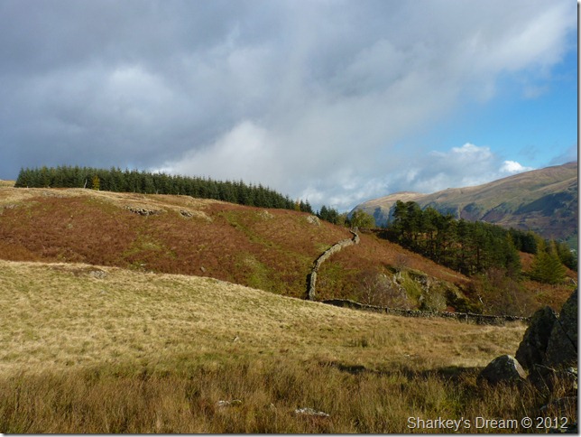
Looking back on ground covered & at the point where we emerged from the trees, we followed the wall as a guide until we crossed Middlesteads Gill, it was here we decided on a small rest stop before the matter of crossings the wet bogs came to hand. |
 |
| |
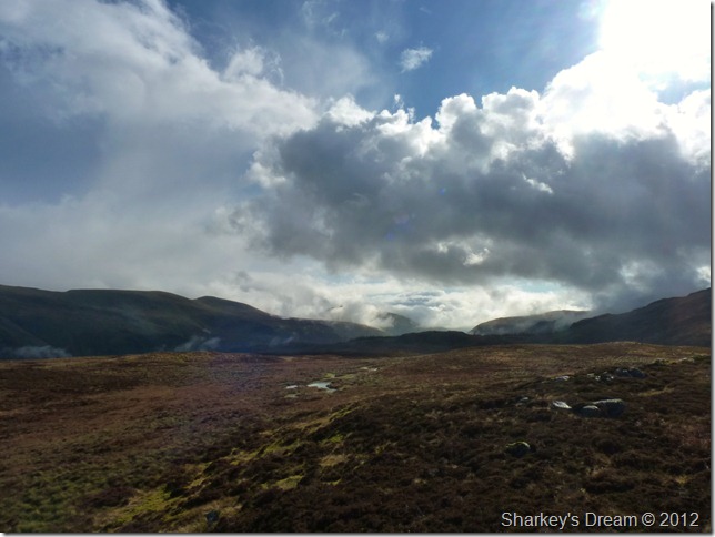
Open bog land.
The grasses rich in Autumn colour slightly took the squelch away, by this time both mine & Stuarts feet were swimming in water & despite this being a pretty secluded place, Stuarts cough was getting worse & made for some course reckoning, maybe we give High Tove a miss Stuart asked? I replied we both didn’t need the summit as it had been bagged individually before, you sure Paul Stuart asked? Stuarts cough needn’t make me second guess the notion, lets head for Armboth Fell? I’m with you mate.
We squelch on. |
 |
| |
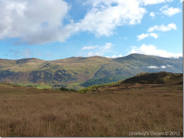
The Helvellyn range incorporating from (LtoR) Raise, White Side, Helvellyn Lower Man & Helvellyn. |
 |
| |
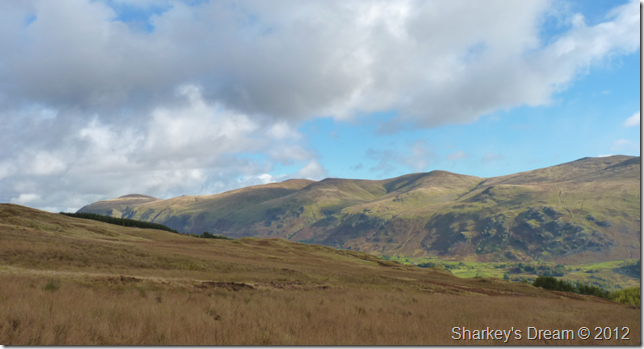
Clough Head & The Dodds. |
 |
| |
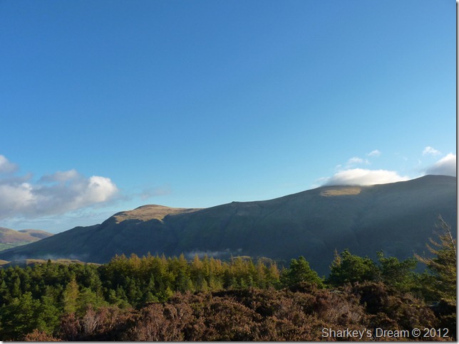
It wasn’t long before that ever increasing cloud cover from the north caught us up & opened up right over our heads, not a long shower as showers go, but enough for me to don the waterproof over trousers, here looking towards High Tove (L) & High Seat (R) |
 |
| |
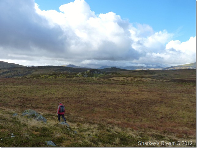
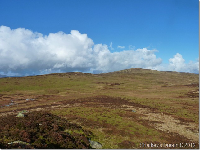
Armboth Fell lies in wait, the shower didn’t last too long & before we knew it blue skies were above our heads, here Stuart heading towards the summit of Armboth Fell. |
 |
| |
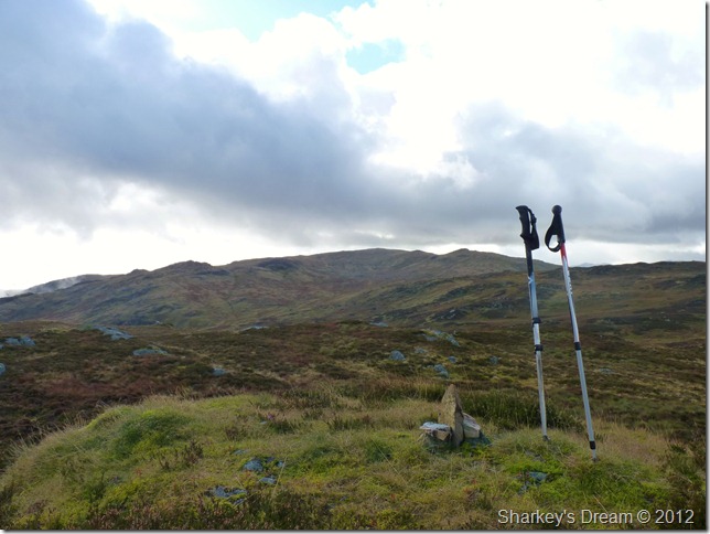
One of two of the highest points across Armboth Fell, east of here sits another which just confuses an already sometimes difficult summit to spot. |
 |
| |
We cross more bog to reach the second summit, again marked by tiny cairn. Cant we just build a beacon & make it easy for everyone! even AW claims that finding the summit is not easy & from memory Armboth Fell, was the only summit I struggled with whilst claiming all my Wainwrights. |
 |
| |
Standing Crags & the Ullscarf/Greenup Edge Ridge from the second summit. |
 |
| |
Looking south after the rain with Nethermost Pike & Dollywagon Pike over on the left of the picture. |
 |
| |
High Tove & High Seat under glorious sunshine again as we prepare to backtrack a little to the top of Fisher Gill – which can be seen as the depression over on the right of the photo. |
 |
| |
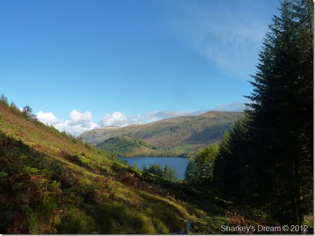
The descent via Fisher Gill offers fabulous views over Thirlmere & surrounding fells. |
 |
| |
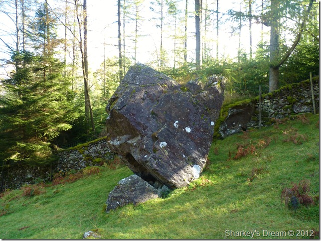
The perched boulder found just above Armboth. |
 |
| |
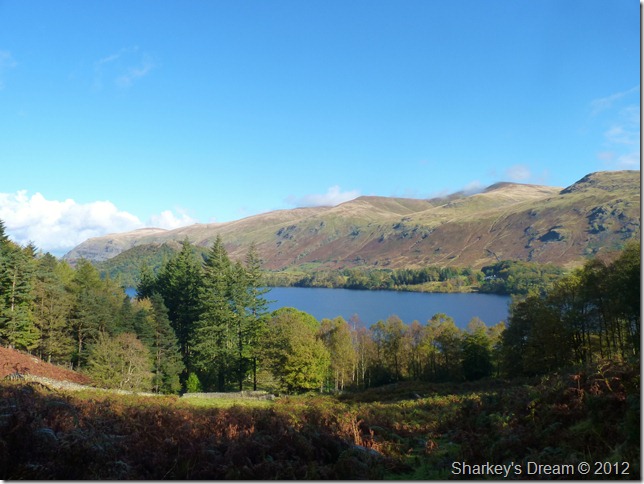
Thirlmere & The Dodds as we take our last steps down towards Armboth.
Okay, we didn’t reach our intended targets today & Stuart needn’t have apologised about cutting what should of been a seven summit walk into a two summiteer, In actual fact, I had to thank Stuart because the time not spent on the fells freed up some Paul time even if it was just for just a few hours. |
|
| |
| Back to top |
 |
|
